
The Coulterville Road was the first highway to Yosemite Valley which had been completed during June 1874. The Coulterville Road began at it's namesake town in Mariposa County traveling eastward through the Merced Grove and Big Meadow en route to Yosemite Valley. The Coulterville Road unlike the other highways to Yosemite has barely been modernized and remains a lightly traveled back road through Stanislaus National Forest. This blog will examine the history of the Coulterville Road and what can be visited while traveling on it.
Part 1; early travel to Yosemite Valley and the History of the Coulterville Road
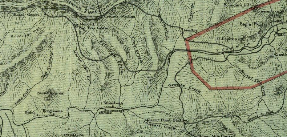
As noted above the Coulterville Road was the first Highway and Stage Route to reach Yosemite Valley. The Coulterville Road barely beat the Big Oak Flat Road to Yosemite Valley having been completed by the Coulterville & Yosemite Turnpike Company during June 1874. The Chinese Camp & Yosemite Turnpike Company completed the Big Oak Flat Road to Yosemite Valley during July 1874. While the Coulterville Road was soon surpassed in popularity by the Big Oak Flat Road it remains as the closest analog to the early era of stage travel on the highways to Yosemite Valley. The Coulterville Road can be seen in full scale on the 1897 Punnett Brothers Map of California.

The origins of the Coulterville Road can be traced back to the Joseph Walker Party of 1833. The Walker Party was likely the first group of Europeans to reach the Merced Grove of Redwood Sequoia Trees and Yosemite Valley. While the route of the Walker Party isn't completely certain it is likely that it largely followed a path that was a close analog to what would become the Coulterville Road.
By 1859 the Coulterville & Yosemite Turnpike Company was formed and would construct a tolled wagon road from the vicinity of Coulterville east to Crane Flat. Even though stages could reach the cliffs above the northern rim of Yosemite Valley it would be some time before the final descent could be made on anything other than by foot. Coulterville & Yosemite Turnpike Company President Dr. John T. McLean negotiated for exclusive Franchise Toll Road rights with the commissioners with the Yosemite Grant. The Coulterville Road can be seen meeting the Big Oak Flat Road near Crane Flat on the 1872 California Geological Survey Map. In 1872 the Big Oak Flat Road was under construction and ended near Tamarack Flat.

In 1870 a survey plotted a route for the Coulterville Road to reach Yosemite Valley was completed. This survey would also rediscover the Merced Grove. The Coulterville Road was completed in June of 1874 and was open to Stages by June 17th. The Big Oak Flat Road would complete the following month and would directly compete with the Coulterville Road. Ultimately the Chinese Camp & Yosemite Turnpike Company was able to petition the State Legislature to overrule the Yosemite Grant in allowing their Toll Road Franchise on the Big Oak Flat Road to stand.
Travel on the Coulterville Road despite not being quite as favorable as the Big Oak Flat Road was still popular. The route of the Coulterville Road to Yosemite Valley from locales as far as San Francisco are described in an 1888 article titled; "In the Heart of the Sierras, the Coulterville Routes." The mileage points on the Coulterville Road shown in the "In the Heart of the Sierras" article depict the way points between Coulterville east to Yosemite Valley. The high point of the Coulterville Road is shown to be at Hazel Green at 5,502 feet above sea level. The descent from Big Meadow to the Merced River Trail is noted to be particularly steep with a descent of 885 feet in 4.59 miles.


The route of the Coulterville Road became less favored upon the emergence of the Yosemite Valley Railroad in the Merced River Canyon. The Yosemite Valley Railroad operated from Merced to El Portal beginning in 1907 and offered a much more comfortable way to reach Yosemite Valley than following the Coulterville Road. Ironically Stages departing the Yosemite Valley Railroad terminus in El Portal still had to utilize the last leg of the Coulterville Road from the end of the Merced River Trail eastward along the Merced River into Yosemite Valley.
Yosemite Valley Railroad Timeline
By the summer of 1913 the Foresta Land Company completed the Davis Cutoff Road from Foresta to El Portal as a replacement for the Big Meadow Trail. The completion of the Davis Cutoff Road allowed cars to reach El Portal where drivers could take stages from the terminus of Yosemite Valley Railroad. At the time automobiles were still not allowed to enter the boundary of Yosemite National Park.
In 1914 automobile traffic to Yosemite Valley was authorized by Yosemite
National Park. By 1915 Tuolumne County purchased the 30-mile Big Oak Flat Road
and removed the tolls. Tuolumne County subsequently turned over the
portion of the Big Oak Flat Road east to the Yosemite National Park
Boundary to the California Division of Highways. The Division of
Highways in turn made the Big Oak Flat Road to the Yosemite National
Park boundary an extension of Legislative Route Number 40. The route of the Big Oak Flat Road within
Yosemite National Park was turned over by Tuolumne County to the Federal
Government.
Public access to the Davis Cutoff Road was banned by the Foresta Land Company during 1916 which was reported in the July 2, 1916, Modesto Morning Herald (courtesy Ephriham Dickson of the Yosemite History Facebook page). Notably the July 2, 1916, Modesto Morning Herald is one of first known references to the community of Foresta in place of McCauley Ranch. The prohibition of traffic diverging onto the Davis Cutoff Road added to the decline in popularity of the Coulterville Road.

In 1916 Legislative Route 18 was extended east from Mariposa to El Portal through the Merced River Canyon. Legislative Route 18 would be fully completed to El Portal by 1926 and offered an alignment on a gentle grade in the Merced River Canyon along with all-year access to Yosemite Valley. The prospects of traveling on the easy State Maintained grades via the Merced River Canyon to Yosemite was more attractive what was offered on the Coulterville Road. In time this new route of Legislative Route 18 would become California State Route 140 and El Portal Road within National Park.
In 1926 the National Park Service and Bureau of Public Roads drafted a new series of standards for access roads in National Parks. This led to a new routing of the Big Oak Flat Road being adopted to the south of the original route from Crane Flat to Yosemite Valley. The new alignment of Big Oak Flat Road was to be an all-year highway which would be built with gentler grades than the original alignment which had 16% descent into Yosemite Valley from Cascade Creek. Work on the New Big Oak Flat Road began in 1935 and was opened to traffic in 1940. The new Big Oak Flat Road utilized three tunnels and multiple bridges to descend to Yosemite Valley on a much lower grade.
The 1935 Division of Highways Map of Mariposa County shows how diminished the Coulterville Road was compared to Big Oak Flat Road and El Portal Road. The 1935 Division of Highways Map shows that Coulterville Road traffic was largely rerouted around Merced Grove via Crane Flat Road. Coulterville Road traffic shown to be largely connecting to the Big Oak Flat Road or Foresta Road to California State Route 140.

During modern times much of the Coulterville Road east of Bower's Cave was converted into Forest Service Road which is now part of Stanislaus National Forest. Beginning in 1956 a 14.7-mile section of the Coulterville Road was improved by the Northern California-Yosemite Highway Association to make travel easier for vehicles between Bower's Cave and Yosemite Valley. In the 1980s the route of the Coulterville Road east of Foresta to El Portal Road was destroyed by landslides. While much of the Coulterville Road is maintained enough for a high clearance vehicle to traverse it can no longer be driven fully as it opened in 1874. Segments of the Coulterville Road through Merced Grove, partially through Foresta and east of Foresta must be hiked as they are no longer accessible to vehicles.
Note; much of the information I've used over the years regarding early Highways to Yosemite comes from the 1947 article titled "One Hundred Years in Yosemite."
Part 2; making a modern map of the Old Coulterville Road
One of my goals of this blog is to illustrate the route of the Old Coulterville Road shown on the 1897 Punnett Brothers Map onto modern Google Imagery. Below the in the following eight illustrations the path of the Old Coulterville Road is projected onto the modern roadways of; Mariposa County, Stanislaus National Forest, the trails/roads of Yosemite National Park and other sections abandoned to time. My hope that is that if someone out there seeks to follow the Old Coulterville Road in full, they will have reliable information to use in their travels.


Part 3; driving from Coulterville east to Bower's Cave on the Old Coulterville Road
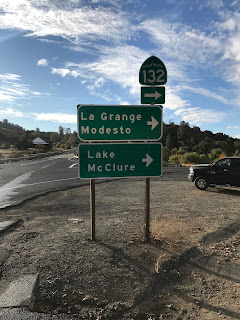
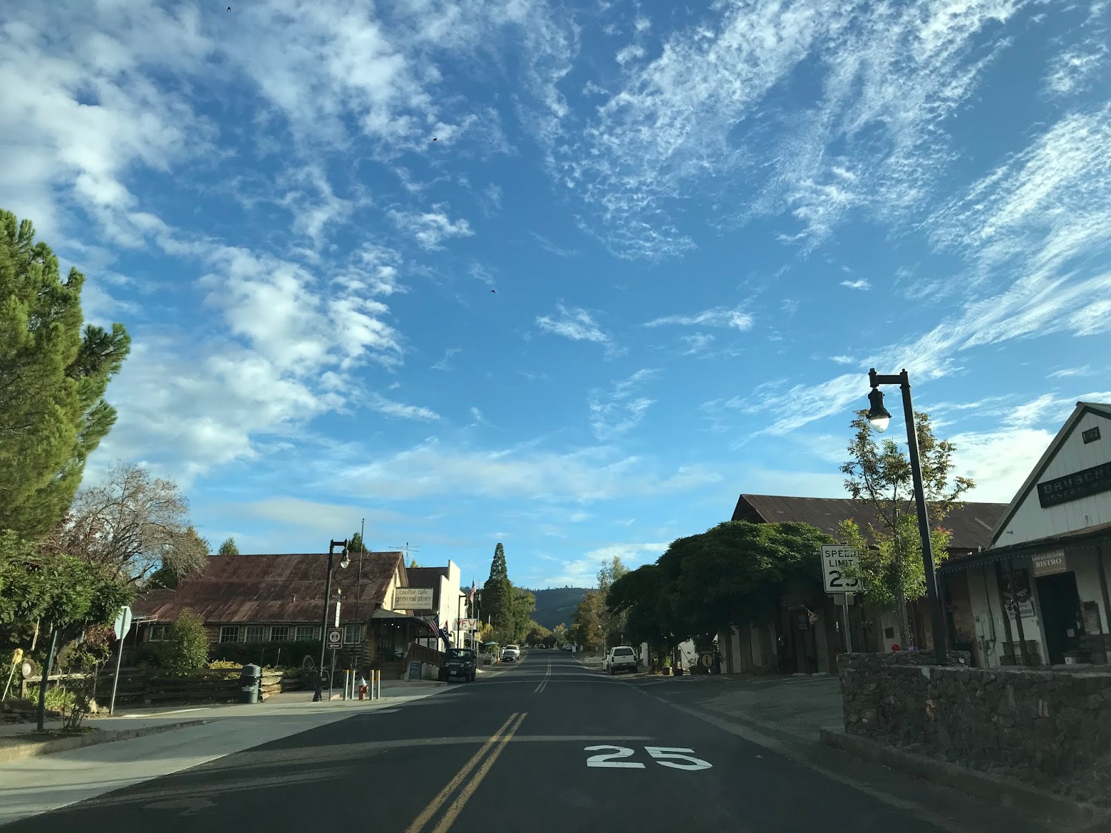
My journey on the Old Coulterville Road began in Coulterville at the junction of; California State Route 132, California State Route 49 and County Route J132. Coulterville is a classic California Gold Rush town. California State Route 132 has an implied continuation along County Route J132 which begins in Coulterville on Greeley Hill Road. The path of the Old Coulterville Road follows County Route J132 via Main Street and Greeley Hill Road eastward towards the intersection with Smith Station Road.


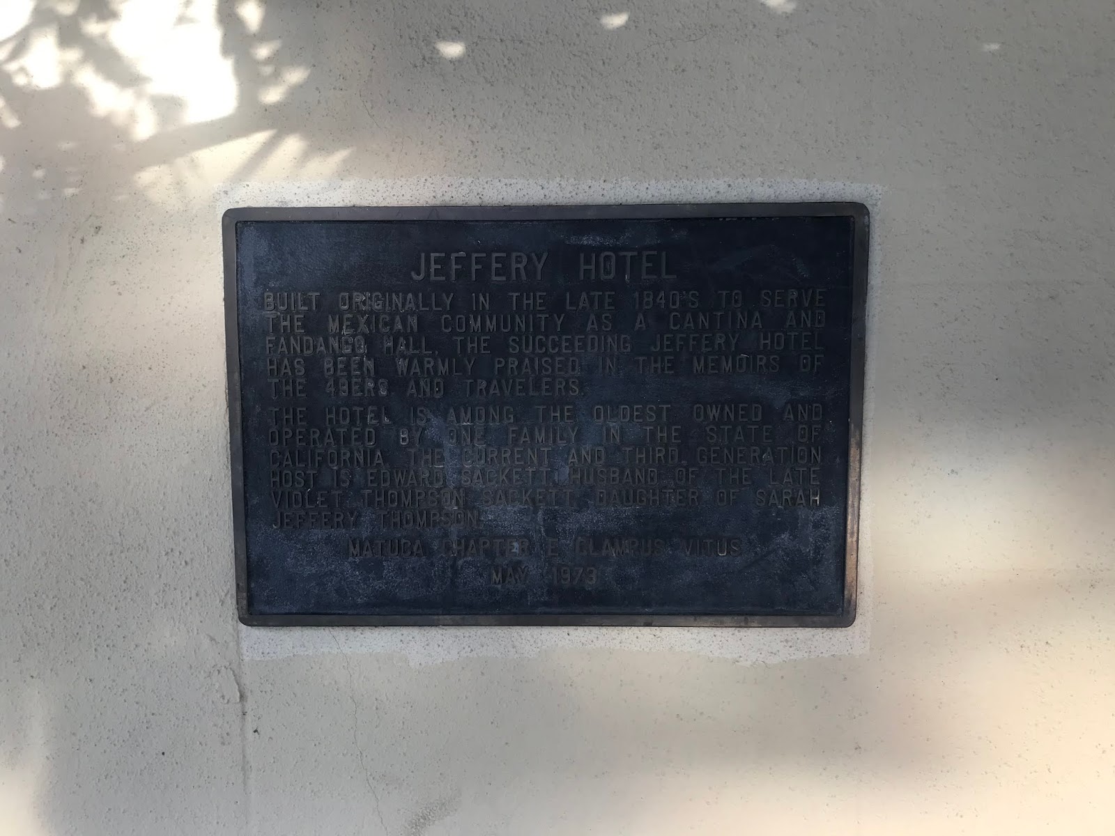
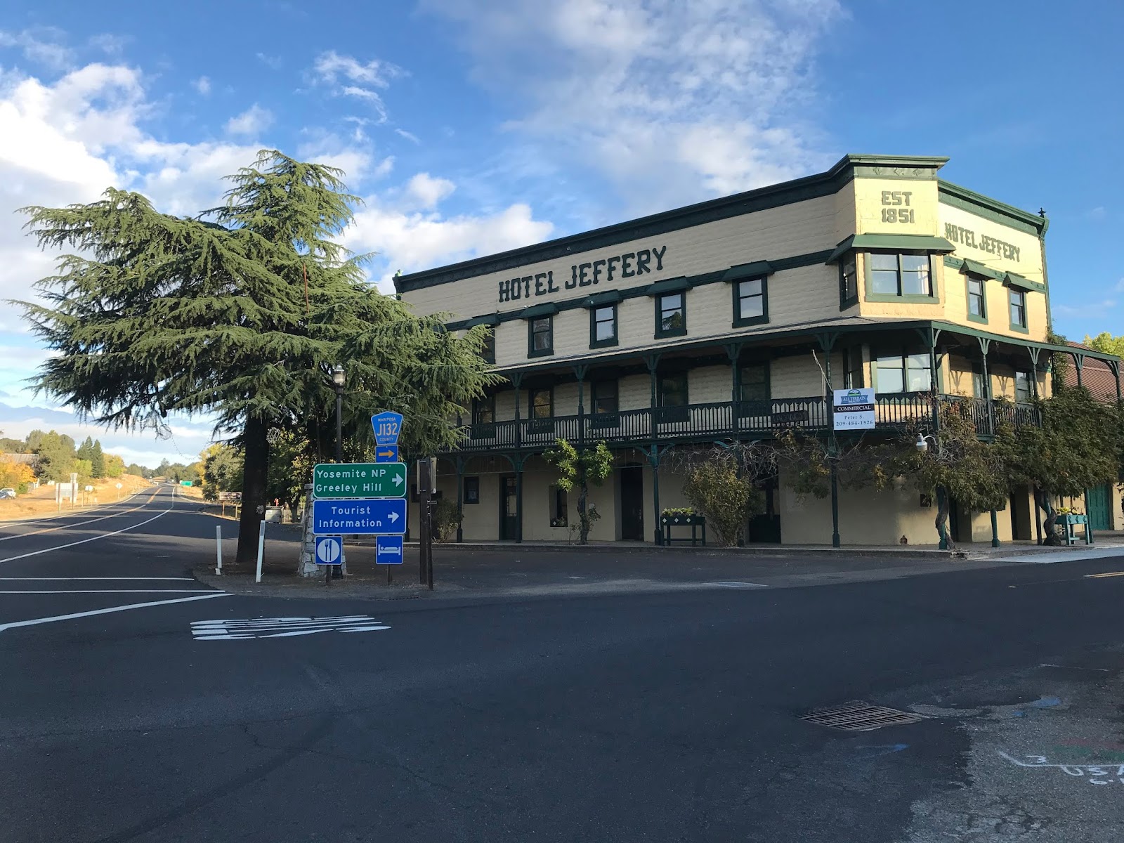
Coulterville was founded in 1850 along Maxwell Creek and is named after George Coulter. Originally Coulterville was called Maxwell Creek, but it was changed to the modern name by 1853. Coulterville has numerous buildings from the 1850s which remain in the community today. Some of the more notable buildings that I took photos of were the Hotel Jeffery, which was completed in 1851, the Barrett Blacksmith Shop which was built in the 1850s is now a Mini-Mart, and the Wells Fargo building from 1856 is now a museum.


According to CAhighways.org County Route J132 was defined in 1961. It seems likely the definition fell in line with the realigned California State Route 49 pulling California State Route 132 into downtown Coulterville with the completion of the 1963 Maxwell Creek Bridge. According CAhighways.org CR J132 was originally signed as County Route J20 and was shown with said designation on at least one commercial map as late as 1995.
County Route J132 is approximately 14.72-mile highway between California State Route 49/California State Route 132 in Coulterville northeast to California State Route 120. From California State 49/California State Route 132 the route of County Route J132 uses Main Street, Greeley Hill Road and Smith Station Road to reach California State Route 120.

County Route J132/Old Coulterville Road eastbound begins at California State Route 49/California State Route 132 on Main Street next to the Hotel Jeffery.


County Route J132/Old Coulterville Road on Main Street is co-signed as the Historic John Muir Route. Traffic on County Route J132 east is advised that Coulterville is considered a Historic Town.

County Route J132/Old Coulterville eastbound traverses downtown Coulterville and splits from Main Street onto Greeley Hill Road at Chinatown Main Street.


Main Street continues into the former Chinatown District of Coulterville. Coulterville much like many of the Gold Rush Era communities relied heavily on Chinese mining labor and was segregated. The Chinese Miners along with Mexican Miners apparently arrived just before George Coulterville in 1850. Today there is only one building in Coulterville's Chinatown which shows evidence of what it once was.

As County Route J132/Old Coulterville Road on Greeley Hill Road continues east of Coulterville it passes by Dogtown Road. Dogtown Road was part of an alternate route for stages on the Coulterville Road which passed by; the ghost town of Dogtown, Date Flat, and the Red Cloud Mine.

Traffic on County Route J132/Old Coulterville Road east on Greeley Hill Road is advised of 8 miles of curves ahead. The next major junction on County Route J132 eastbound is at Priest-Coulterville Road.


County Route J132/Old Coulterville Road east on Greeley Hill Road begins to ascend a series of switchbacks to the community of Greeley Hill.


County Route J132/Old Coulterville Road on Greeley Hill Road passes through Greeley Hill and enters the community of Redcloud Park. Redcloud Park is named for the nearby Redcloud Mine of the California Gold Rush era.


East of Redcould Park County Route J132 descends a series of hills and splits from Greeley Hill Road onto Smith Station Road. The path of the Old Coulterville Road remains on Greeley Hill Road east of the Smith Station Road intersection. The intersection of Greeley Hill Road and Smith Station Road marks the approximate location of Dudley Ranch.


Dudley's Ranch was one of the stage stops along the Coulterville Road. Dudley's Ranch was settled by Hosea Dudley during Christmas of 1856. By 1857 the lands of Dudley Ranch began to operate a sawmill. Ultimately Dudley Ranch would become far more successful as a Stage Station and lodge for travelers on the Coulterville Road. More regarding Dudley Ranch can be found on mariposaresearch.net's article titled "RAVES, DIARIES OF PIONEER KIN KEEP RANCHER CLOSE TO HIS PAST."
East of Dudley Ranch the route of Greeley Hill Road/Old Coulterville Road descends to the eastern terminus of Dogtown Road.


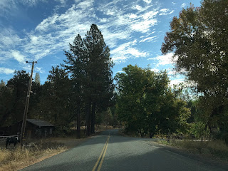
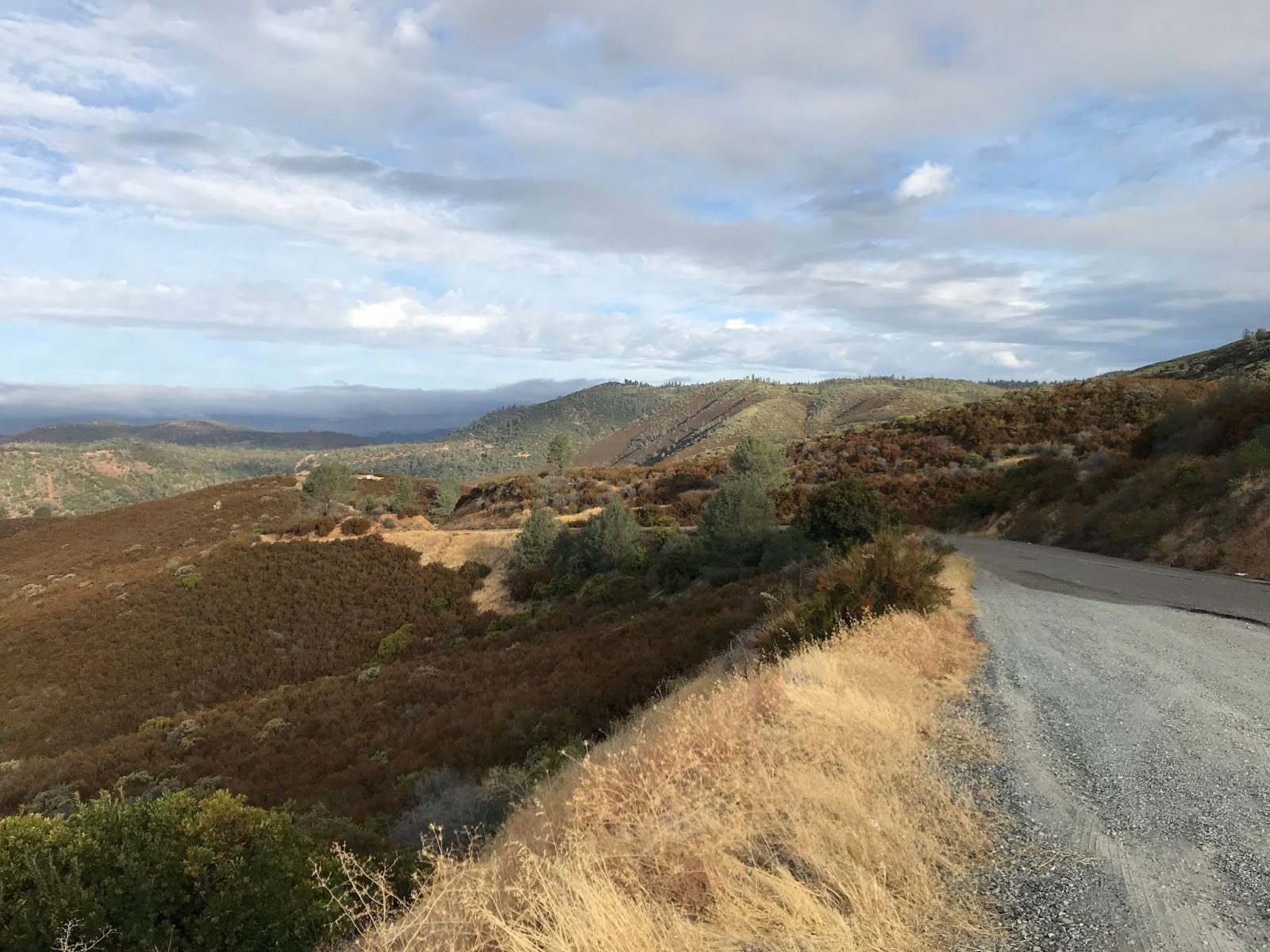
East of Dogtown Road the route of the Old Coulterville Road transitions onto Briceburg Road.

Briceburg Road/Old Coulterville Road eastbound crosses the North Fork Merced River via a single lane bridge.


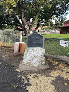
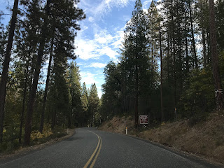
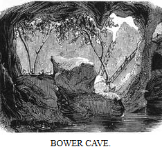
East of the North Fork Merced River the route of Briceburg Road/Old Coulterville Road passes by Bower's Cave. There is a historic monument to the Old Coulterville Road at the trail to Bower's Cave describing it's history.


There is a short trail from the historic monument to Bower's Cave along with warnings not to enter it.

Bower's Cave is described as follows in the "In the Heart of the Sierras Article:"
"This is a natural cleft in a great vein of limestone, of a singular grotto-like formation, one hundred and nine feet in depth and length, and ninety in width, which is entered by a passage between rocks, not more than three and a half feet wide, at the northern end of an opening in the roof, some seventy feet long by thirteen feet wide. The sides of this great cavity are draped with wild grape-vines, while through it peep the tops of tall maple trees that grow deep down in the cave. When the boughs of these are drawn aside, you look into the abyss below, where sleeps a small pool of water that is forty feet deep, made shadowy and mysterious by overhanging rocks. There is a boat upon the pool for the convenience of visitors. Side caverns opening into the main cave, unite to make this unique spot a very desirable one to visit. This is owned by Mr. Louis Pechart, a Frenchman, who is already the happy father of some thirteen living children"
Bower's Cave served as the start of the tolled portion of the Old Coulterville Road east to Yosemite Valley. East of Bower's Cave the pavement ends and route of the Old Coulterville Road transitions onto Old Yosemite Road/Forest Route 02S01. The route of the Old Coulterville Road from Bower's Cave to the junction with the Old Big Oak Flat Road is listed in the "In the Heart of the Sierras" as 31.55 miles away. The Merced Grove is listed as 15.9 miles from Bower's Cave.


Part 4; hiking the Old Coulterville Road in Merced Grove
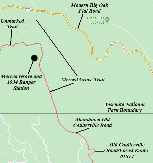
Uncertain of the road conditions on the Old Coulterville Road east of Bower's Cave I took the easy way to the Merced Grove and entered Yosemite National Park via California State Route 120 onto the modern Big Oak Flat Road. From the modern Big Oak Flat Road, I parked at the trailhead for the Merced Grove. The Merced Grove Trailhead has some historical information regarding the Old Coulterville Road and a Stage Route promotional flyer.


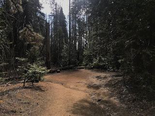
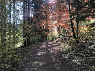
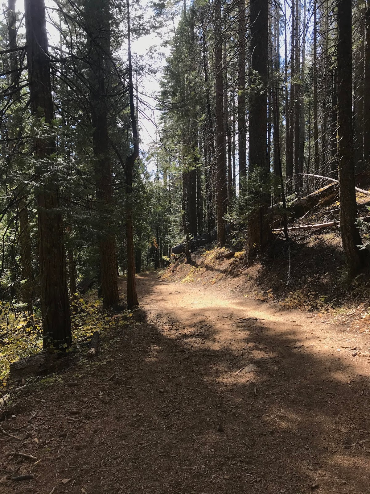
The Merced Grove Trail begins on what appears to be a fire route built by Yosemite National Park. The Merced Grove doesn't intersect the grade of the Old Coulterville Road until a gate with a sign stating "Merced Grove 1 Mile, Twin Bridges 2 Miles."


The Merced Grove Trail/Old Coulterville Road rapidly descends to the Merced Grove. While the grade is steep it is obvious that the wide cut in the terrain is meant for vehicles and not foot traffic. Nonetheless it is amusing to attempt to fathom a modern passenger vehicle trying to descend the final downhill grade to the Merced Grove.


The Merced Grove is the smallest Redwood Sequoia Grove in Yosemite National Park with approximately twenty trees. The Merced Grove while small offers a much quieter hiking experience over the more popular Mariposa and Tuolumne Groves.


The 1934 Ranger Station on the Old Coulterville Road still stands within the Merced Grove.


The Old Coulterville Road continues through Merced Grove to the boundary of Stanislaus National Forest where it merges onto Forest Route 01S12. In places approaching Stanislaus National Forest I did observe some evidence of an asphalt surface on the Old Coulterville Road. Upon reaching what was probably the Stanislaus National Forest boundary I turned around to head back up to the trailhead.


In 1926 the National Park Service and Bureau of Public Roads drafted a new series of standards for access roads in National Parks. This led to a new routing of the Big Oak Flat Road being adopted to the south of the original route from Crane Flat to Yosemite Valley. The new alignment of Big Oak Flat Road was to be an all-year highway which would be built with gentler grades than the original alignment which had 16% descent into Yosemite Valley from Cascade Creek. Work on the New Big Oak Flat Road began in 1935 and was opened to traffic in 1940. The new Big Oak Flat Road utilized three tunnels and multiple bridges to descend to Yosemite Valley on a much lower grade.
The 1935 Division of Highways Map of Mariposa County shows how diminished the Coulterville Road was compared to Big Oak Flat Road and El Portal Road. The 1935 Division of Highways Map shows that Coulterville Road traffic was largely rerouted around Merced Grove via Crane Flat Road. Coulterville Road traffic shown to be largely connecting to the Big Oak Flat Road or Foresta Road to California State Route 140.

Note: the 1934 Merced Grove Ranger Station is shown on the 1935 Division of Highways Map. The 1934 Merced Grove Ranger Station still exists today and was a replacement for the 1915 checking station on the Coulterville Road. Foresta Road had also been improved during the 1930s with the construction of modernized bridges. Subsequently Foresta Road became more favored over the final descent on the Coulterville Road east of Big Meadow and Foresta.
During modern times much of the Coulterville Road east of Bower's Cave was converted into Forest Service Road which is now part of Stanislaus National Forest. Beginning in 1956 a 14.7-mile section of the Coulterville Road was improved by the Northern California-Yosemite Highway Association to make travel easier for vehicles between Bower's Cave and Yosemite Valley. In the 1980s the route of the Coulterville Road east of Foresta to El Portal Road was destroyed by landslides. While much of the Coulterville Road is maintained enough for a high clearance vehicle to traverse it can no longer be driven fully as it opened in 1874. Segments of the Coulterville Road through Merced Grove, partially through Foresta and east of Foresta must be hiked as they are no longer accessible to vehicles.
Note; much of the information I've used over the years regarding early Highways to Yosemite comes from the 1947 article titled "One Hundred Years in Yosemite."
Part 2; making a modern map of the Old Coulterville Road
One of my goals of this blog is to illustrate the route of the Old Coulterville Road shown on the 1897 Punnett Brothers Map onto modern Google Imagery. Below the in the following eight illustrations the path of the Old Coulterville Road is projected onto the modern roadways of; Mariposa County, Stanislaus National Forest, the trails/roads of Yosemite National Park and other sections abandoned to time. My hope that is that if someone out there seeks to follow the Old Coulterville Road in full, they will have reliable information to use in their travels.


Part 3; driving from Coulterville east to Bower's Cave on the Old Coulterville Road
My journey on the Old Coulterville Road began in Coulterville at the junction of; California State Route 132, California State Route 49 and County Route J132. Coulterville is a classic California Gold Rush town. California State Route 132 has an implied continuation along County Route J132 which begins in Coulterville on Greeley Hill Road. The path of the Old Coulterville Road follows County Route J132 via Main Street and Greeley Hill Road eastward towards the intersection with Smith Station Road.


Coulterville was founded in 1850 along Maxwell Creek and is named after George Coulter. Originally Coulterville was called Maxwell Creek, but it was changed to the modern name by 1853. Coulterville has numerous buildings from the 1850s which remain in the community today. Some of the more notable buildings that I took photos of were the Hotel Jeffery, which was completed in 1851, the Barrett Blacksmith Shop which was built in the 1850s is now a Mini-Mart, and the Wells Fargo building from 1856 is now a museum.


According to CAhighways.org County Route J132 was defined in 1961. It seems likely the definition fell in line with the realigned California State Route 49 pulling California State Route 132 into downtown Coulterville with the completion of the 1963 Maxwell Creek Bridge. According CAhighways.org CR J132 was originally signed as County Route J20 and was shown with said designation on at least one commercial map as late as 1995.
County Route J132 is approximately 14.72-mile highway between California State Route 49/California State Route 132 in Coulterville northeast to California State Route 120. From California State 49/California State Route 132 the route of County Route J132 uses Main Street, Greeley Hill Road and Smith Station Road to reach California State Route 120.

County Route J132/Old Coulterville Road eastbound begins at California State Route 49/California State Route 132 on Main Street next to the Hotel Jeffery.

County Route J132/Old Coulterville Road on Main Street is co-signed as the Historic John Muir Route. Traffic on County Route J132 east is advised that Coulterville is considered a Historic Town.

County Route J132/Old Coulterville eastbound traverses downtown Coulterville and splits from Main Street onto Greeley Hill Road at Chinatown Main Street.

Main Street continues into the former Chinatown District of Coulterville. Coulterville much like many of the Gold Rush Era communities relied heavily on Chinese mining labor and was segregated. The Chinese Miners along with Mexican Miners apparently arrived just before George Coulterville in 1850. Today there is only one building in Coulterville's Chinatown which shows evidence of what it once was.

As County Route J132/Old Coulterville Road on Greeley Hill Road continues east of Coulterville it passes by Dogtown Road. Dogtown Road was part of an alternate route for stages on the Coulterville Road which passed by; the ghost town of Dogtown, Date Flat, and the Red Cloud Mine.

Traffic on County Route J132/Old Coulterville Road east on Greeley Hill Road is advised of 8 miles of curves ahead. The next major junction on County Route J132 eastbound is at Priest-Coulterville Road.


County Route J132/Old Coulterville Road east on Greeley Hill Road begins to ascend a series of switchbacks to the community of Greeley Hill.


County Route J132/Old Coulterville Road on Greeley Hill Road passes through Greeley Hill and enters the community of Redcloud Park. Redcloud Park is named for the nearby Redcloud Mine of the California Gold Rush era.


East of Redcould Park County Route J132 descends a series of hills and splits from Greeley Hill Road onto Smith Station Road. The path of the Old Coulterville Road remains on Greeley Hill Road east of the Smith Station Road intersection. The intersection of Greeley Hill Road and Smith Station Road marks the approximate location of Dudley Ranch.


Dudley's Ranch was one of the stage stops along the Coulterville Road. Dudley's Ranch was settled by Hosea Dudley during Christmas of 1856. By 1857 the lands of Dudley Ranch began to operate a sawmill. Ultimately Dudley Ranch would become far more successful as a Stage Station and lodge for travelers on the Coulterville Road. More regarding Dudley Ranch can be found on mariposaresearch.net's article titled "RAVES, DIARIES OF PIONEER KIN KEEP RANCHER CLOSE TO HIS PAST."
East of Dudley Ranch the route of Greeley Hill Road/Old Coulterville Road descends to the eastern terminus of Dogtown Road.


East of Dogtown Road the route of the Old Coulterville Road transitions onto Briceburg Road.

Briceburg Road/Old Coulterville Road eastbound crosses the North Fork Merced River via a single lane bridge.


East of the North Fork Merced River the route of Briceburg Road/Old Coulterville Road passes by Bower's Cave. There is a historic monument to the Old Coulterville Road at the trail to Bower's Cave describing it's history.

There is a short trail from the historic monument to Bower's Cave along with warnings not to enter it.

Bower's Cave is described as follows in the "In the Heart of the Sierras Article:"
"This is a natural cleft in a great vein of limestone, of a singular grotto-like formation, one hundred and nine feet in depth and length, and ninety in width, which is entered by a passage between rocks, not more than three and a half feet wide, at the northern end of an opening in the roof, some seventy feet long by thirteen feet wide. The sides of this great cavity are draped with wild grape-vines, while through it peep the tops of tall maple trees that grow deep down in the cave. When the boughs of these are drawn aside, you look into the abyss below, where sleeps a small pool of water that is forty feet deep, made shadowy and mysterious by overhanging rocks. There is a boat upon the pool for the convenience of visitors. Side caverns opening into the main cave, unite to make this unique spot a very desirable one to visit. This is owned by Mr. Louis Pechart, a Frenchman, who is already the happy father of some thirteen living children"
Bower's Cave served as the start of the tolled portion of the Old Coulterville Road east to Yosemite Valley. East of Bower's Cave the pavement ends and route of the Old Coulterville Road transitions onto Old Yosemite Road/Forest Route 02S01. The route of the Old Coulterville Road from Bower's Cave to the junction with the Old Big Oak Flat Road is listed in the "In the Heart of the Sierras" as 31.55 miles away. The Merced Grove is listed as 15.9 miles from Bower's Cave.


Part 4; hiking the Old Coulterville Road in Merced Grove
Uncertain of the road conditions on the Old Coulterville Road east of Bower's Cave I took the easy way to the Merced Grove and entered Yosemite National Park via California State Route 120 onto the modern Big Oak Flat Road. From the modern Big Oak Flat Road, I parked at the trailhead for the Merced Grove. The Merced Grove Trailhead has some historical information regarding the Old Coulterville Road and a Stage Route promotional flyer.


The Merced Grove Trail begins on what appears to be a fire route built by Yosemite National Park. The Merced Grove doesn't intersect the grade of the Old Coulterville Road until a gate with a sign stating "Merced Grove 1 Mile, Twin Bridges 2 Miles."


The Merced Grove Trail/Old Coulterville Road rapidly descends to the Merced Grove. While the grade is steep it is obvious that the wide cut in the terrain is meant for vehicles and not foot traffic. Nonetheless it is amusing to attempt to fathom a modern passenger vehicle trying to descend the final downhill grade to the Merced Grove.


The Merced Grove is the smallest Redwood Sequoia Grove in Yosemite National Park with approximately twenty trees. The Merced Grove while small offers a much quieter hiking experience over the more popular Mariposa and Tuolumne Groves.


The 1934 Ranger Station on the Old Coulterville Road still stands within the Merced Grove.


The Old Coulterville Road continues through Merced Grove to the boundary of Stanislaus National Forest where it merges onto Forest Route 01S12. In places approaching Stanislaus National Forest I did observe some evidence of an asphalt surface on the Old Coulterville Road. Upon reaching what was probably the Stanislaus National Forest boundary I turned around to head back up to the trailhead.


Part 5; the Old Coulterville Road in the Foresta Area
Foresta in modern times is accessed from the Big Oak Flat Road.


The Big Oak Flat Road is connected to the Old Coulterville by a short unnamed road which sometimes is displayed as part of Foresta Road on maps. The Old Coulterville Road is easily identified by the large number of Foresta community dumpsters present alongside it.


The dumpsters obscure what the final descent of the Old Coulterville Road from Big Meadow to Yosemite Valley. This segment of the Old Coulterville Road as noted in Part 1 was wiped out by landslides during the 1980s. Stray asphalt from the Old Coulterville Road can be found among the overgrowth.


From the dumpsters the Old Coulterville Road travels west into Foresta and reaches a Y junction with Foresta Road. A plaque regarding the history of Big Meadow, Coulterville Road and the Meyer's barns can be found.


Version History
- Published on December 6, 2019.
- First updated on October 14, 2022.
Comments