
Former US Route 101 on El Camino Real in Greenfield

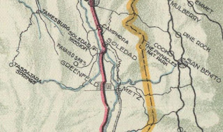
Greenfield is a city located in Salinas Valley of Monterey County, California.  Modern US Route 101 is aligned through Greenfield via a freeway bypass which opened during 1961.  The original alignment of US Route 101 in Greenfield was aligned directly through the community on El Camino Real.  Above the cover photo of this blog features a view of former US Route 101 in Greenfield facing north on El Camino Real.  Below Greenfield can be seen along US Route 101 on the 1935 Division of Highways Map of Monterey County


Part 1; the history of US Route 101 in Greenfield

During 1902 the California Home Extension Association purchased 4,000 acres of land about the Southern Pacific Railroad in Salinas Valley at what had been Rancho Arroyo Seco.  The land was put to sale in Los Angeles during 1905 which led to the plotting of a town which was originally to known as "Clark City" in honor of then California Home Extension Association founder John S. Clark.  Ultimately the town site was named "Greenfield" in honor of then California Home Extension Association President Edward Greenfield. 

Salinas Valley was ultimately part of the American El Camino Real which began being signed as an Auto Trail starting in 1906.  The era of State Highway Maintenance through Salinas Valley would ultimately begin with the 1909 First State Highway Bond Act which was approved by voters in 1910.  One of the highways approved through the 1909 First State Highway Bond Act was a 481.8-mile highway originating at the City Limits of San Francisco which terminated in San Diego.  This highway would ultimately come to be known in time as Legislative Route Number 2 ("LRN 2").  Within Salinas Valley much of LRN 2 would follow the existing corridor along the frontage roads of the Southern Pacific Railroad which included the community of Greenfield.  

The July 1914 California Highway Bulletin notes surveys for the location of LRN 2 from Greenfield to Camphora were complete.  LRN 2 between Greenfield and King City had been laid out as a 15-foot-wide highway during October 1912.  


Greenfield can be seen on the 
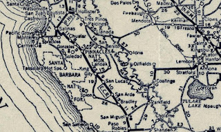
1917 California State Automobile Association Map along LRN 2.  LRN 2 is displayed to be aligned on what is now El Camino Real through the community.  


The 1920 Rand McNally Highway Map of California shows El Camino Real and the Pacific Highway following LRN 2 through Greenfield.  


The 1924 Rand McNally Map of California shows the California Banff Bee-Line Highway co-signed with the Pacific Highway through Greenfield. 


The initial draft of the US Route System was approved by the Secretary of Agriculture during November of 1925.  The US Route System within California was approved by California Highway Commission with no changes recommended by 
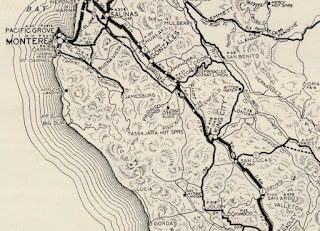
January 1926.  The initial alignment of US Route 101 ("US 101") was planned to follow LRN 2 from San Francisco to San Diego via Salinas Valley.  US 101 is shown on a map published in the 1926 California Highways & Public Works following LRN 2 south from San Francisco towards San Diego.


During November of 1926 the US Route System was approved by the ASSHO.  US Route 101 can be seen aligned through Greenfield on the 1926 Rand McNally Junior Map of California.  


The January/February 1929 California Highways & Public Works noted part of US Route 101/LRN 2 between Greenfield and King City was in the process of being widened to 30-feet.


The January/February 1933 California Highways & Public Works announced the full widening of US Route 101/LRN 2 between Greenfield and King City as part of the 1933-35 budget.  The existing 15-foot-wide surface between Greenfield and King City is noted to be failing.


The July 1934 California Highways & Public Works announced the widening of US Route 101/LRN 2 between Greenfield and King City to a 36-foot-wide roadbed as being complete.  

Below Greenfield can be seen along US Route 101/LRN 2 on the 1935 Division of Highways Map of Monterey County


The January 1940 California Highways & Public Works announced the resurfacing of US Route 101/LRN 2 through Greenfield had been awarded via contract.  


Greenfield would incorporate as a city on January 7, 1947.  The November/December 1956 California Highways & Public Works announced the widening of US Route 101/LRN 2 to four-lane expressway standards from 1.8 miles north of the Salinas River to 2 miles south of Greenfield as being budgeted for the 1957-58 Fiscal Year.  A second expressway project is listed as beginning 1 mile north of Greenfield to the Salinas River near Soledad.  


The May/June 1957 California Highways & Public Works notes the expressway expansion of US Route 101/LRN 2 between Greenfield and Soledad was underway.  The expressway expansion of US Route 101/LRN 2 between Greenfield and King City is noted to have been completed the previous February.  


The July/August 1958 California Highways & Public Works features the completed US Route 101/LRN 2 expressway between Greenfield and Soledad.  An attached project map notes a freeway agreement between the Division of Highways and the city of Greenfield had been reached.  


The October/November 1959 California Highways & Public Works announced the design and right-of-way acquisition of the US Route 101/LRN 2 freeway bypass of Greenfield were complete.  


The November/December 1959 California Highways & Public Works announced construction of the US Route 101/LRN 2 freeway bypass of Greenfield was budgeted for the 1960-61 Fiscal Year.  


The November/December 1961 California Highways & Public Works announced US Route 101/LRN 2 in Greenfield had been shifted to a new freeway bypass.  


The 1964 State Highway Renumbering all the Legislative Routes Numbers were dropped.  This measure left US Route 101 as the sole State Highway designation through Greenfield.  


Part 2; a drive on former US Route 101 in Greenfield on El Camino Real

From modern US Route 101 northbound traffic can access the original alignment through Greenfield on El Camino Real via Exit 297.


El Camino Real northbound enters downtown Greenfield and intersects Monterey County Route G16 at Elm Avenue.


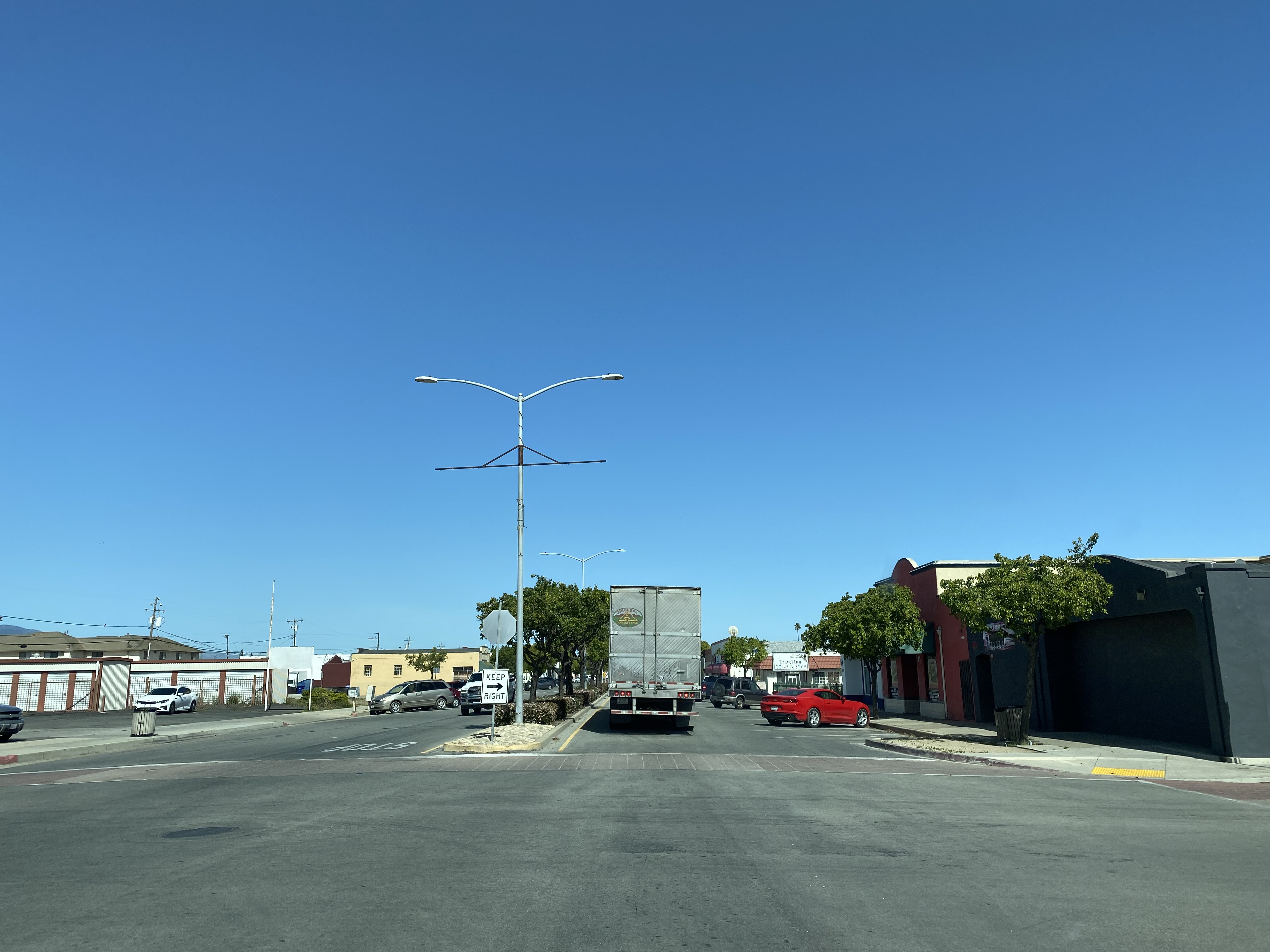
El Camino Real northbound passes through downtown Greenfield and loops back to modern US Route 101. 


Comments

Popular posts from this blog

North Carolina Continues to Move Forward with Rail

2023 and the first half of 2024 have seen continued growth in North Carolina's passenger rail system.  From increased daily trains from Raleigh to Charlotte, federal funds for studying additional corridors, and receiving a historic grant to begin the construction of high-speed rail between Raleigh and Richmond, the last 18 months have been a flurry of activity at NCDOT's Rail Division.  And that's just the tip of the iceberg. As ridership and routes increase - the engine of North Carolina passenger rail trains will become a more common sight. (Adam Prince) Increased Passenger Train Service: On July 10, 2023, a fourth Piedmont round-trip rail service between Raleigh and Charlotte commenced.  The four Piedmont trains plus the daily Carolinian (to Washington, DC, and New York) bring the total of trains serving the two cities daily to five. The current daily Piedmont and Carolinian schedule between Charlotte and Raleigh (NCDOT) The result was over 641,000 passengers utilized pa

US Route 101 in Benbow, Garberville and Redway

The communities of Benbow, Garberville and Redway can all be found along US Route 101 within southern Humboldt County.  The former surface alignment of US Route 101 in Garberville and Redway once crossed the Garberville Bluffs along what is now Redwood Drive via a corridor constructed as part of the Redwood Highway during the 1910s.  US Route 101 through Benbow, Garberville and Redway was modernized by 1935.  US Route 101 would eventually be upgraded to freeway standards in Benbow, Garberville and Redway by extension of the Redwood Freeway during 1966-68.  As the cover photo the original grade of US Route 101 and the Redwood Highway can be seen at the Garberville Bluffs during 1934.  US Route 101 can be seen in the communities of Benbow, Garberville and Redway on the 1935 Division of Highways Map of Humboldt County .   The history of US Route 101 in Benbow, Garberville and Redway Benbow, Garberville and Redway lie on the banks of the South Fork Eel River of southern Humboldt County.  D

The Midway Palm and Pine of US Route 99

Along modern day California State Route 99 south of Avenue 11 just outside the City limits of Madera one can find the Midway Palm and Pine in the center median of the freeway.  The Midway Palm and Pine denotes the halfway point between the Mexican Border and Oregon State Line on what was US Route 99.  The Midway Palm is intended to represent Southern California whereas the Midway Pine is intended to represent Northern California.  Pictured above the Midway Palm and Pine can be seen from the northbound lanes of the California State Route 99 Freeway.   This blog is part of the larger Gribblenation US Route 99 Page.  For more information pertaining to the other various segments of US Route 99 and it's three-digit child routes check out the link the below. Gribblenation US Route 99 Page The history of the Midway Palm and Pine The true timeframe for when the Midway Palm and Pine (originally a Deadora Cedar Tree) were planted is unknown.  In fact, the origin of the Midway Palm and Pine w