
Former California State Route 1 in Aptos

The community of Aptos is located in Santa Cruz County along the shores of Monterey Bay.  When California State Route 1 was commissioned during August 1934 it followed existing Legislative Route Number 56 through Aptos on Soquel Drive.  California State Route 1 was realigned onto the present freeway grade during November 1949.  Pictured below is a view of the 1928 Aptos Creek Bridge which was part of California State Route 1 on Soquel Drive in Aptos.  Pictured below is California State Route 1 in Aptos along Soquel Drive as depicted on the 1935 Division of Highways Map of Santa Cruz County.  


The history of California State Route 1 in Aptos

Modern Aptos traces its origin to Mexican Rancho Aptos.  Rancho Aptos was granted by the Mexican Government in 1833 Rafael Castro.  Rancho Aptos took its name from Aptos Creek which coursed through from the Santa Cruz Mountains to Monterey Bay.  Castro initially used Rancho Aptos to raise cattle for their hides.  Following California becoming an American State in 1850 the property ownership at Rancho Aptos was recognized and Castro began to lease his lands.  Soon a small town emerged on Rancho Aptos which included a wharf, general store and lumber mill.

During 1872 sugar magnate Charles Spreckels began purchasing large tracts of Castro's land holdings to make way for a Southern Pacific Railroad line.  Aptos came to further prominence when Loma Prieta Lumber Company opened operations and company town of the same name directly north of Aptos in 1883.  The Loma Prieta Lumber Company would actively log the Santa Cruz Mountains north of Aptos until 1923 on land which are now part of The Forest of Nisene Marks State Park.  Aptos can be seen along the locally maintained coastal highway in Santa Cruz County on the 1917 California State Automobile Association Map.  

During 1928 Santa Cruz County constructed a new bridge over Aptos Creek along Soquel Drive.  During 1933 Legislative Route Number 56 (LRN 56) was extended north from Carmel to Fernbridge.  The extension of LRN 56 brought it along the coast of Santa Cruz County which aligned it directly through Aptos on Soquel Drive.  The extension of LRN 56 through Aptos brought the 1928 Aptos Creek Bridge directly under Division of Highways maintenance.  

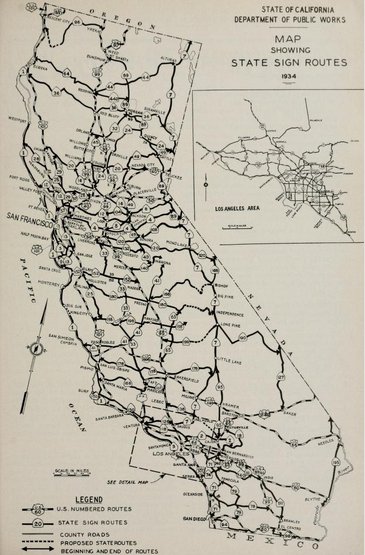
In the August 1934 California Highways and Public Works the Sign State Routes were announced.  California State Route 1 (CA 1) was applied to the entirety of LRN 56 from Las Cruces northward towards Fortuna which by proxy brought it through Aptos. 


As noted in the intro CA 1/LRN 56 can be seen aligned through Aptos along Soquel Drive on the 1935 Division of Highways Map of Santa Cruz County.  

The January/February 1944 California Highways & Public Works announced the expansion of CA 1/LRN 56 to a four-lane divided highway between Santa Cruz and Aptos was added to a list of approved post World War II projects by the California Highway Commission.  


The upcoming freeway alignment of CA 1/LRN 56 between Santa Cruz and Aptos is depicted in a sketch which was featured in May/June 1947 California Highways & Public Works.  The new freeway alignment of CA 1 in Aptos is stated to include two Southern Pacific Railroad underpass structures and a new bridge over Aptos Creek.  


The new Santa Cruz-Aptos freeway alignment of CA 1/LRN 56 is cited to be nearing completion in the November/December 1948 California Highways & Public Works.  The new Santa Cruz-Aptos freeway alignment is cited to span over a project zone originating from Morrissey Avenue in Santa Cruz to Rob Roy Junction south of Aptos.  The Santa Cruz-Aptos freeway is cited to have been constructed over three contracts and was expected to be open to traffic during summer 1949.  


The completed Santa Cruz-Aptos freeway alignment of CA 1/LRN 56 is featured in the November/December 1949 California Highways & Public Works.  The feature article notes the Santa Cruz-Aptos freeway was dedicated on November 4, 1949.  A future extension of the Santa Cruz-Aptos freeway is stated to be planned to connect to the Los Gatos Highway (CA 17).  An aerial photo features the new alignment of CA 1/LRN 56 bypassing Soquel Drive in Aptos.  


Since CA 1 was relocated in Aptos in 1949 it has changed very little in the community in the intervening decades.  During the 1964 State Highway Renumbering the Legislative Route Numbers were dropped which left CA 1 as the sole designation through Aptos.  

Comments

Popular posts from this blog

When did people begin to refer to the "Ridge Route" as "The Grapevine?" (former US Route 99 and Interstate 5)

The segment of US Route 99 from Los Angeles north to Bakersfield was traditionally known in State Highway documents as the "Ridge Route."  Even as the Ridge Route was transitioning from curvy mountain grade to the facility now occupied by Interstate 5nthe name largely persisted in California Highways & Public Works documents.  During modern times the name "Ridge Route" has be usurped in popular lexicon in favor to the nickname known as "The Grapevine."  This blog will attempt to decipher the origins of "The Grapevine" and how it came into popular use today.  Featured as the blog cover photo is a view of Interstate 5 in Grapevine Canyon and former US Route 99 at Deadman's Curve of the Ridge Route. This blog is part of the larger Gribblenation US Route 99 Page.  For more information pertaining to the other various segments of US Route 99 and it's three-digit child routes check out the link the below. Gribblenation US Route 99 Page Note:

US Route 101 in Benbow, Garberville and Redway

The communities of Benbow, Garberville and Redway can all be found along US Route 101 within southern Humboldt County.  The former surface alignment of US Route 101 in Garberville and Redway once crossed the Garberville Bluffs along what is now Redwood Drive via a corridor constructed as part of the Redwood Highway during the 1910s.  US Route 101 through Benbow, Garberville and Redway was modernized by 1935.  US Route 101 would eventually be upgraded to freeway standards in Benbow, Garberville and Redway by extension of the Redwood Freeway during 1966-68.  As the cover photo the original grade of US Route 101 and the Redwood Highway can be seen at the Garberville Bluffs during 1934.  US Route 101 can be seen in the communities of Benbow, Garberville and Redway on the 1935 Division of Highways Map of Humboldt County .   The history of US Route 101 in Benbow, Garberville and Redway Benbow, Garberville and Redway lie on the banks of the South Fork Eel River of southern Humboldt County.  D

Old Stage Road in Tulare County and Kern County

Old Stage Road is an approximately 30-mile rural highway comprised of Tulare County Mountain Road 1, Kern County Mountain Road 447 and Tulare County Mountain Road 109.  Old Stage originates at Jack Ranch Road near Posey and ends at the outskirts of Porterville at Deer Creek.  Old Stage Road notably is comprised of two 19th Century stage routes.  From White Mountain Road northwest to Fountain Springs, Old Stage Road overlays Thomas Baker's 1860s era stage road to Linn Valley (now Glennville) and the Kern River Gold Rush Claims.  From Fountain Springs to Deer Creek, Old Stage Road is comprised of the 1853 Stockton-Los Angeles Road. Featured as the blog cover is the northward descent on Old Stage Road along Arrastre Creek to the town site of White River.  What became White River was settled along a spur of the Stockton-Los Angeles Road as "Dog Town" when gold was discovered nearby.  By 1856 the community had been renamed Tailholt.  A stage road from Tailholt to Linn Valley w