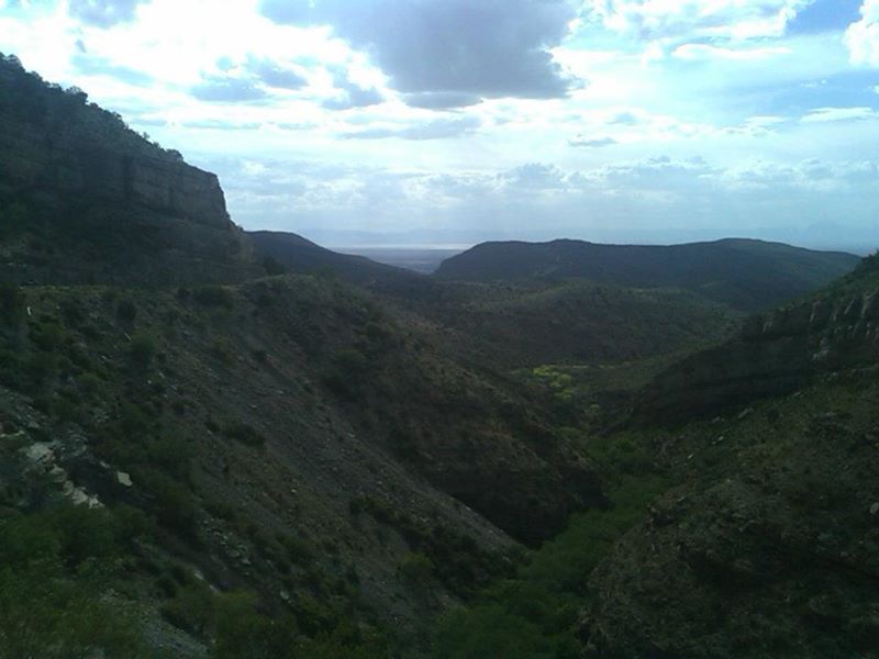
Throwback Thursday; Alamogordo and Sacramento Railroad (Cloud Climbing Railroad) on US 82

Back in 2012 I took a trip up US 82 from US 70/54 in Alamogordo which occupies much of the former right-of-way of the Alamogordo and Sacramento Railroad.


The A&S Railroad was a 32 mile spur of the El Paso and Northeast Railroad which was in operation from 1898 to 1947.  The A&S Railroad was primarily in service haul freight from the sawmills in Cloudcroft and Russia.  The A&S Railroad was known as the "Cloud Climber" due to it having a starting elevation at 4,320 feet above sea level and an ending elevation of 9,076 feet above sea level.  The A&S had grades as high as 6.4% and was generally considered to be an engineering marvel.  After freight service ended in 1947 the A&S rails were dismantled, only the Cloudcroft trestle remains in place to this day. 

Much of the former right-of-way of the A&S Railroad was used by US Route 82 when it was extended to Las Cruces in 1963.  The climb east into Cloudcroft from Alamogordo is fast but not as steep as might be suspect due to the low grades.  Cloudcroft at 8,600 feet above sea level is one of the highest all-year settlements in the United States.


Comments

Popular posts from this blog

Grand Loop Road of Yellowstone National Park

  Grand Loop Road is a 140 mile loop highway which traverses the interior of Yellowstone National Park.  Grand Loop Road connects all of the major attractions and geological features of Yellowstone National Park along with the entrance roads.  Grand Loop Road is a seasonal highway and despite some conjecture never has been part of the US Route System.   Part 1; the history of Grand Loop Road The majority of history pertaining to Grand Loop Road was taken from the below National Park Service article: Historic Roads - Yellowstone National Park (U.S. National Park Service) (nps.gov) Yellowstone was declared the first National Park of the United States on March 1st, 1872.  The first real highway to access Yellowstone National Park came in 1873 when a tolled facility was constructed from Bozeman, Montana via Yankee Jim Canyon to Mammoth Hot Springs.  Numerous attempts were made to fund construction of roadway infrastructure during the early years of Yellows...

The last 1956-63 era California Sign State Route Spade?

Along southbound California State Route 170 (the Hollywood Freeway Extension) approaching the Hollywood Freeway/Ventura Freeway interchange a white California State Route 134 Sign State Route Spade can be observed on guide sign.  These white spades were specifically used during the 1956-63 era and have become increasingly rare.  This blog is intended to serve as a brief history of the Sign State Route Spade.  We also ask you as the reader, is this last 1956-63 era Sign State Route Spade or do you know of others?  Part 1; the history of the California Sign State Route Spade Prior to the Sign State Route System, the US Route System and the Auto Trails were the only highways in California signed with reassurance markers.  The creation of the US Route System by the American Association of State Highway Officials during November 1926 brought a system of standardized reassurance shields to major highways in California.  Early efforts to create a Sign State Route ...

California State Route 156

Over the past couple years I've taken about every single conceivable noteworthy road in and out of the California Coast as far south as Malibu northward towards Point Reyes.  Generally I try to avoid the more popular routes due to the high traffic capacity which often overwhelms existing highways.  That being the case I've often found myself in need of getting to the Monterey Peninsula from San Joaquin Valley in a hurry which often means a trip on California State Route 156.   CA 156 is a 25 mile route from CA 152 in Santa Clara County west to CA 1 near the mouth of the Salinas River in Castroville of Monterey County. Part 1; the history of California State Route 156 All of modern CA 156 was part of Legislative Route 22 .   LRN 22 was defined during the 1909 First State Highway Bond Act between as a route between San Juan Bautista and Hollister.  During the 1919 Third State Highway Bond Act LRN 22 was extended east from Hollister to the Pachec...