After waking up somewhat early in Las Cruces I packed every back into the car and noticed there was a change of a snow storm to the west near the Arizona State Line. I had planned on following US 70 into Arizona to see the Old Queen Creek Tunnel on US 60 but my path ahead was uncertain given the weather. Either way, I was in familiar territory the rest of my trip west to California.

US 70 and US 180 multiplex I-10 west of Las Cruces but are generally silent in terms of signage. US 180 cuts away from I-10 in Deming while US 70 stays multiplexed west to Lordsburg. All seemed fine until I was west of Deming where I encountered the snow storm I was warned about on the news earlier in the morning. The storm was surprisingly heavy but I was able to settle in behind a line of trucks which were clearing the right lane. My Sonic was a Florida car which was very apparent by the complete lack of anti-freeze in my windshield wiper fluid. The storm cleared approaching Lordsburg but I pulled off at a travel center to purchase proper windshield wiper fluid. US 70 west closed west of Lordsburg due to the snow storm which required my continuing on I-10 west into Arizona.

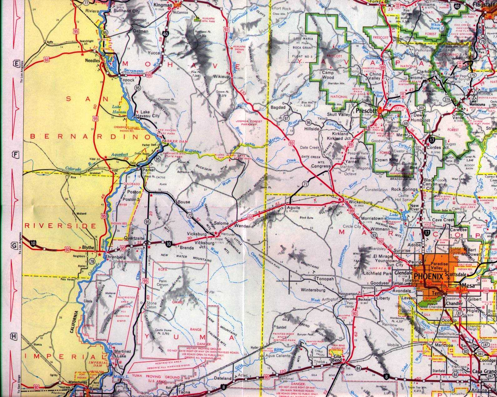
I-10 in Arizona is generally an uneventful affair. When I used to travel to New Mexico on business I would take I-10 from Phoenix probably about 75% of the time. The only thing that I found note worth enough to stop for was in Pichaco north of Tucson. When I lived in Phoenix there was talk about razing Camino Adelante Road which was a old alignment of AZ 84 to make way for an expanded I-10. The project seemed to be a non-starter before I left Arizona 2013 but upon my return almost all the buildings along Camino Adelante Road were long gone.

This February I encountered an ADOT Youtube Channel update on the I-10 widening project at the AZ 87 junction in Pichaco.
ADOT on I-10/AZ 87 junction project
After crossing the Gila River Reservation I made my way up the Phoenix area. My ultimate destination for the night was at a family member's house in Scottsdale which I reached by using AZ Loop 202 and AZ Loop 101.


I stayed in Scottsdale for a day to pick up my Challenger which I was keeping at my family's house due to my home in California not being ready. The Challenger would partake in it's own road trip of note in February. Considering how bad the weather was in New Mexico and even western Texas I'm glad in retrospect that I shipped the Challenger. The bad weather coupled with 245 tires on a car with 485 pound feet of torque would have not gone well.

The following morning I left the Phoenix Area on I-10 towards the California State Line. I had something special in mind for my return to California which required my turning off I-10 on Vicksburg Road. I took Vicksburg Road north to AZ 72 and continued westward.


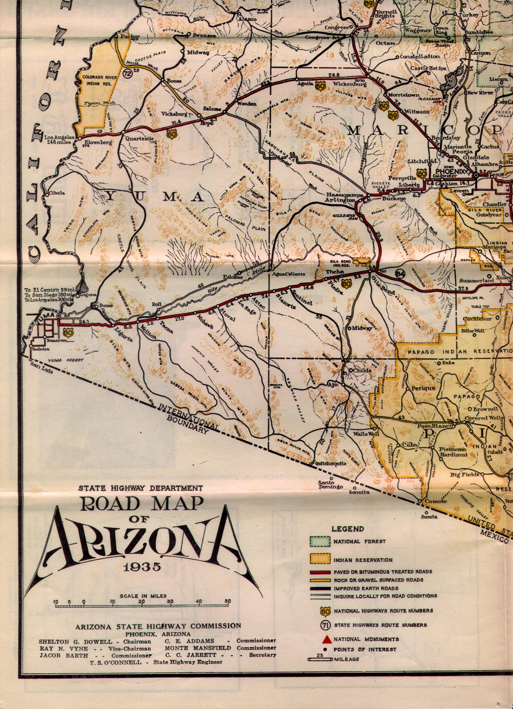
I used to take AZ 72 and CA 62 frequently as a quiet backdoor route from Phoenix to the Los Angeles area. AZ 72 is an approximately 37 mile state highway located in La Paz County between US 60 west to AZ 95 near Parker. AZ 72 for the most part is straight as an arrow but the roadway for whatever reason has always been badly worn every time I've ever driven it. The only community of note along AZ 72 is Bouse which is mostly known for the Desert Tank Training ground located Butler Valley in World War II. Bouse was founded in 1908 as a mining camp and was originally where AZ 95 met AZ 72 at Plomosa Road. AZ 72 was apparently adopted in 1930 but the earliest state highway map I can find showing it is from 1935. AZ 72 originally ended near the California State Line in Parker.
1935 Arizona Highway Map Sectional
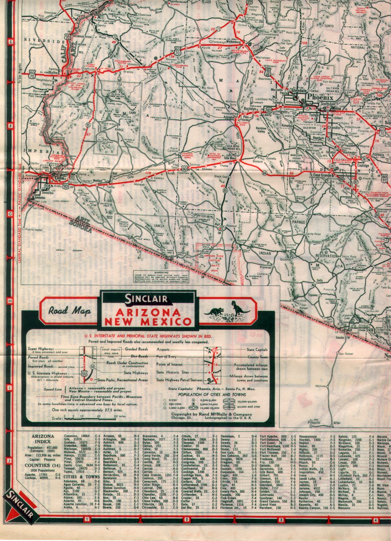
By the 1938 state highway AZ 95 can be seen running from Yuma to AZ 72 in Bouse. In addition the state highway map shows an obvious crossing over the California state line from Parker which I assume was terminus of AZ 72. US 95 wouldn't be extended into Arizona until 1961 according to USends but it appears that Arizona wanted the route much earlier.
1938 State Highway Map Sectional
USends on US 95
Sometime between 1951 and 1956 AZ 95 was realigned directly north from Quartzsite to AZ 72.
1951 Arizona Highway Map
1956 Arizona Highway Map
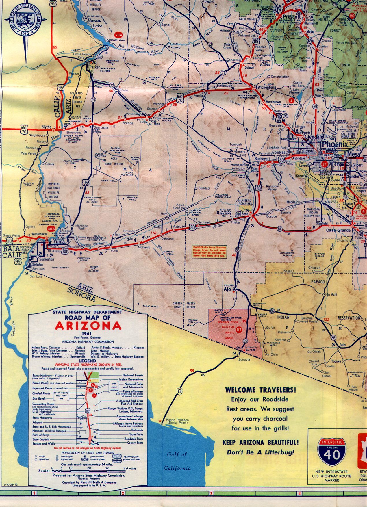
Sometime between 1961 (US 95 can be seen extended to the Mexican border on the 1961 map) and 1971 AZ 95 was extended all the way north to AZ 68, AZ 72 was truncated to AZ 72 outside of Parker. I find this move odd considering a Spur AZ 95 is technically what crosses the Colorado River to reach CA 62. It would to make more sense to multiplex AZ 72 into Parker and have it end at the state line.
1961 State Highway Map
1971 Arizona Highway Map
Speaking of AZ 95 I took it to Parker and used the Spur Route I mentioned above over the Colorado River to meet CA 62 in rural Riverside County.


US 70 and US 180 multiplex I-10 west of Las Cruces but are generally silent in terms of signage. US 180 cuts away from I-10 in Deming while US 70 stays multiplexed west to Lordsburg. All seemed fine until I was west of Deming where I encountered the snow storm I was warned about on the news earlier in the morning. The storm was surprisingly heavy but I was able to settle in behind a line of trucks which were clearing the right lane. My Sonic was a Florida car which was very apparent by the complete lack of anti-freeze in my windshield wiper fluid. The storm cleared approaching Lordsburg but I pulled off at a travel center to purchase proper windshield wiper fluid. US 70 west closed west of Lordsburg due to the snow storm which required my continuing on I-10 west into Arizona.

I-10 in Arizona is generally an uneventful affair. When I used to travel to New Mexico on business I would take I-10 from Phoenix probably about 75% of the time. The only thing that I found note worth enough to stop for was in Pichaco north of Tucson. When I lived in Phoenix there was talk about razing Camino Adelante Road which was a old alignment of AZ 84 to make way for an expanded I-10. The project seemed to be a non-starter before I left Arizona 2013 but upon my return almost all the buildings along Camino Adelante Road were long gone.

This February I encountered an ADOT Youtube Channel update on the I-10 widening project at the AZ 87 junction in Pichaco.
ADOT on I-10/AZ 87 junction project
After crossing the Gila River Reservation I made my way up the Phoenix area. My ultimate destination for the night was at a family member's house in Scottsdale which I reached by using AZ Loop 202 and AZ Loop 101.


I stayed in Scottsdale for a day to pick up my Challenger which I was keeping at my family's house due to my home in California not being ready. The Challenger would partake in it's own road trip of note in February. Considering how bad the weather was in New Mexico and even western Texas I'm glad in retrospect that I shipped the Challenger. The bad weather coupled with 245 tires on a car with 485 pound feet of torque would have not gone well.

The following morning I left the Phoenix Area on I-10 towards the California State Line. I had something special in mind for my return to California which required my turning off I-10 on Vicksburg Road. I took Vicksburg Road north to AZ 72 and continued westward.


I used to take AZ 72 and CA 62 frequently as a quiet backdoor route from Phoenix to the Los Angeles area. AZ 72 is an approximately 37 mile state highway located in La Paz County between US 60 west to AZ 95 near Parker. AZ 72 for the most part is straight as an arrow but the roadway for whatever reason has always been badly worn every time I've ever driven it. The only community of note along AZ 72 is Bouse which is mostly known for the Desert Tank Training ground located Butler Valley in World War II. Bouse was founded in 1908 as a mining camp and was originally where AZ 95 met AZ 72 at Plomosa Road. AZ 72 was apparently adopted in 1930 but the earliest state highway map I can find showing it is from 1935. AZ 72 originally ended near the California State Line in Parker.
1935 Arizona Highway Map Sectional
By the 1938 state highway AZ 95 can be seen running from Yuma to AZ 72 in Bouse. In addition the state highway map shows an obvious crossing over the California state line from Parker which I assume was terminus of AZ 72. US 95 wouldn't be extended into Arizona until 1961 according to USends but it appears that Arizona wanted the route much earlier.
1938 State Highway Map Sectional
USends on US 95
Sometime between 1951 and 1956 AZ 95 was realigned directly north from Quartzsite to AZ 72.
1951 Arizona Highway Map
1956 Arizona Highway Map
Sometime between 1961 (US 95 can be seen extended to the Mexican border on the 1961 map) and 1971 AZ 95 was extended all the way north to AZ 68, AZ 72 was truncated to AZ 72 outside of Parker. I find this move odd considering a Spur AZ 95 is technically what crosses the Colorado River to reach CA 62. It would to make more sense to multiplex AZ 72 into Parker and have it end at the state line.
1961 State Highway Map
1971 Arizona Highway Map
Speaking of AZ 95 I took it to Parker and used the Spur Route I mentioned above over the Colorado River to meet CA 62 in rural Riverside County.


Comments