
Former US Route 101 on the San Juan Grade and through San Juan Bautista

The San Juan Grade is a former segment of US Route 101 which once connected the community of Salinas north to San Juan Bautista over the Gabilan Range.  The San Juan Grade was completed as a First State Highway Bond Act project during 1915 and was a replacement for Old Stage Road.  The San Juan Grade was ultimately paved in Portland Cement which was common to the First through Third State Highway Bond Acts.  US Route 101 was shifted west to the Prunedale Cutoff during 1932 which led to the San Juan Grade being retained as a spur of Legislative Route Number 2.  The San Juan Grade was relinquished from the State Highway System during 1935 upon the completion of Legislative Route Number 22 west from San Juan Bautista to San Juan Bautista Y.  The San Juan Grade today remains one of the best examples left in California of a First State Highway Bond Act road. 


Part 1; the history of the San Juan Grade

The Gabilan Range between what is now San Juan Bautista and Salinas Valley was first explored during the second Juan Bautista De Anza Expedition of Las Californias.  The De Anza expedition likely crossed very close to the present alignment of Old Stage Road their exact path isn't clear.  Juan Bautista De Anza noted the following in his journal while passing near present-day San Juan Bautista on March 24, 1776:

"In the valley we saw many antelopes and white grey geese.  In the same valley we found an arroyo...and then came to a village in which I counted about twenty tule huts.  But the only two people we saw were two Indians who came out to the road and presented us with three fish more than a foot long."

In time the general route of the second De Anza Expedition became the path of El Camino Real ("The Royal Road").  The route of El Camino Real was intended to solidify a path of travel between the Catholic Missions of Las Californias.  In 1797 Mission San Juan Bautista was founded which led to a need for a spur of El Camino Real to be built from Salinas Valley over the Gabilan Range.  This spur of El Camino Real would become what is now Old Stage Road.  While the Spanish El Camino Real was largely just a general path between the Missions there are several paths such as Old Stage Road which can be identified conclusively as part of the highway.

In 1804 Alta California was formed out of the larger Las Californias.    El Camino Real would ultimately connect 21 Catholic Missions of Alta California ranging approximately 600 miles spanning from Mission San Diego de Alcala in San Diego north to Mission San Francisco Solano in Sonoma.  The Missions of El Camino Real were established from 1769 through 1823.  In the case of Mission San Francisco Solano, it was established two years after Mexico had won its independence from Spain in 1821.  Each Mission was meant to be approximately 30 miles apart from each other which would require a single day of travel by horseback.

Following the advent of Mexican independence from Spain the usage of the term "El Camino Real" largely fell into disuse.  Following the secularization of the Spanish Missions during August of 1833 the land holdings were split off into Ranchos.  Despite El Camino Real functionally no longer existing the route's path over what is now Old Stage Road remained a popular route of travel over the Gabilan Range.  What is now San Juan Bautista was founded as a town in 1834 known at the time as "San Juan de Castro."

Alta California was annexed by the United States in early 1848.  San Juan Bautista became an incorporated City in 1869 (citation; San Juan Bautista Historical Society).  San Juan Bautista was originally located in Monterey County but was among the land split into San Benito County in 1874.  Old Stage Road remained the primary route of travel between Salinas Valley and San Juan Bautista into the 20th Century.

Old Stage Road shows up numerous maps as a primitive road.  One such example is this 1857 Britton & Rey's Road Map of California.

Likewise Old Stage Road appears on the 1873 California Geological Survey Map of Central California as the road between Salinas Valley and San Juan Bautista.

In 1904 the American El Camino Real Association was formed with the goal to mark a modern highway that corresponded to the historical route between the Spanish Missions.  Ultimately the path of American El Camino Real was to be marked by the signature bells the corridor is known by today.  The first bell marking the American El Camino Real was placed in 1906 and it is estimated by 1915 that there may have been anywhere to 158 to 400 placed in-field.  The American El Camino Real was one of the earliest analogs of what would become the signed Auto Trails.  The American El Camino Real just as its Spanish predecessor crossed the Gabilan Range via Old Stage Road.  The background of the American El Camino Real is covered extensively on CAhighways.org.

CAhighyways.org on the American El Camino Real

The era of State Highway Maintenance through the Gablian Range would ultimately begin with the 1909 First State Highway Bond Act which was approved by voters in 1910.  One of the highways approved through the 1909 First State Highway Bond Act was a 481.8-mile highway originating at the City Limits of San Francisco which terminated in San Diego.  This highway would ultimately come to be known in time as Legislative Route Number 2 (LRN 2).

Old Stage Road even by the conventions of the 1910s was woefully inadequate for usage by automobiles.  The terrain of the Gabilan Range between San Juan Bautista and Salinas Valley was so rugged that an alternate route from Gilroy to Salinas by way of Watsonville and Castroville was considered.  The proposed highway routings of LRN 2 are featured in the January 1913 California Highway Bulletin.

The rationale for selecting the routing of the San Juan Grade through the Gabilan Range (referenced as San Juan Mountain) is noted to be three-fold in the January 1913 California Highway Bulletin.  The route through the Gabilan Range was the most direct and particle route between Salinas Valley-Santa Clara Valley, within seven miles of the San Benito County seat of Hollister and had an estimated gradient ranging from 2-6%.  The existing route of American El Camino Real over Old Stage Road is noted to be direct, and it would be desirable for LRN 2 to follow nearby over a better grade.  


The January 1913 California Highway Bulletin noted $75,000 in bonds had been sold which funded construction of the San Juan Grade.  

The July 1914 California Highway Bulletin noted surveys for the San Juan Grade were complete in San Benito County and in Monterey County.  LRN 2 from the Monterey County Line to San Juan Bautista is noted to be in the process of construction as an unpaved road.  A contract to construct LRN 2 in paved Portland Cement north of San Juan Bautista is noted to have been awarded on July 6, 1914.  


The January 1915 California Highway Bulletin noted LRN 2 had been completed over the San Juan Grade from the Monterey County Line north to San Jaun Bautista.  The San Juan Grade despite not yet being paved immediately saw service as a replacement for Old Stage Road.  LRN 2 north of San Juan Bautista north to the Santa Clara County is cited to have gone through the process of a rejected contract and was now being constructed via prison labor.  


The January 1915 California Highway Bulletin noted the San Juan Grade from Salinas to the San Benito County line had been completed as an unpaved highway. 


LRN 2 on the then new San Juan Grade can be seen in contrast to Old Stage Road through the Gabilan Range on the 1917 California State Automobile Association Map.  


LRN 2 over the San Juan Grade can be seen as the 1920 Denny's Pocket Map of San Benito County.  Note: Old Stage Road is shown on the 1920 Denny's Map as an abandoned road.


The initial draft of the US Route System was approved by the Secretary of Agriculture during November of 1925.  The US Route System within California was approved by California Highway Commission with no changes recommended by January 1926.  The initial alignment of US Route 101 was planned to follow LRN 2 from San Francisco to San Diego via the San Juan Grade.  US Route 101 is shown on a map published in the 1926 California Highways & Public Works following LRN 2 south from San Francisco towards San Diego.


During November of 1926 the US Route System was approved by the American Association of State Highway Officials.  US Route 101 can be seen aligned through over the San Juan Grade and through San Juan Bautista on the 1926 Rand McNally Junior Map of California.  


The November 1929 California Highways & Public Works noted that asphalt sealant was being applied to portions of the San Juan Grade which had cracked Portland Cement.  It isn't fully clear when the San Juan Grade was paved in Portland Cement. 


The October 1931 California Highways & Public Works featured the construction of the Prunedale Cutoff which would replace the San Juan Grade as the new alignment of US Route 101/LRN 2.  The Prunedale Cutoff alignment of US Route 101/LRN 2 is noted to bypass San Juan Bautista by way of the communities of Santa Rita, Prunedale and Dumbarton.  The Prunedale Cutoff is noted to have a planned crossing of the Gabilan Range at 550 feet above sea level versus the 1,050-foot elevation used by the San Juan Grade.  The article notes the Prunedale Cutoff was anticipated to be opened to traffic during the summer of 1932.  


The April 1932 California Highways & Public Works noted the new alignment of US Route 101/LRN 2 was scheduled to open to traffic on July 1.  The article stub notes that the San Juan Grade would be retained as part of the State Highway System.  The Prunedale Cutoff alignment of US Route 101/LRN 2 is noted to pass by the former bandit's lair known as the Pinecate Rocks.  


The opening of the Prunedale Cutoff as the new alignment of US Route 101/LRN 2 was featured in the August 1932 California Highways & Public Works.  The Prunedale Cutoff was opened to traffic on July 20, 1932, upon the completion of a dedication ceremony.  The Prunedale Cutoff is shown to have a terminal elevation of 473 feet in the Gabilan Range compared to the 1,016 feet on the San Juan Grade. 


The Pincate Rocks can be seen below in a modern photo along the Prunedale Cutoff compared to a photo dated to 1932.  The Pincate Rocks once had an accessible picnic area which has since been blocked off by expansion of US Route 101 in the Prunedale Cutoff corridor to four-lane expressway standards.  


The San Juan Grade is shown to be retained as a spur of LRN 2 east of US Route 101 on the Prunedale Cutoff on the 1935 Division of Highways Map of San Benito County.  


The September 1935 California Highways & Public Works discusses the new route of LRN 22 west of San Juan Bautista to US Route 101/LRN 2 at the Prunedale Cutoff and new Y junction (the San Juan Bautista Y).  The original route of LRN 22 on Rocks Road is referred to as "a winding county road" that was immediately improved temporarily with an oiled earth application upon being adopted in 1933.  The new routing of LRN 22 west of San Jaun Bautista is noted to negate the need for traffic to use the original routing of US Route 101 via the San Juan Grade.  The San Juan Bautista Y is noted to be in line for future beautification which would include mission style walls, a campanile and a cross.  


The completion of LRN 22 west of San Juan Bautista led to the relinquishment of the San Juan Grade from the State Highway System.  The San Juan Grade no longer appears on the 1936-37 Division of Highways Map.   


The 1938 Division of Highways Map displays California State Route 156 being applied over LRN 22 between Hollister and San Juan Bautista Y.  


The January 1938 California Highways & Public Works features the completion of the cross and campanile at San Juan Bautista Y.  


Part 2; mapping the San Juan Grade

For comparison's sake the below maps have been prepared to illustrate the alignment differences between Old Stage Road, the San Juan Grade and the Prunedale Cutoff.  The San Juan Grade is displayed on the maps below in red.


Part 3; a southbound drive on former US Route 101 through San Juan Bautista and the San Juan Grade

From modern US Route 101 traffic can access the original alignment of the highway southbound towards San Juan Bautista via Exit 347 and following Chittenden Road to San Juan Highway.  Note: the below photos were taken during Fall of 2017.  


The original alignment of US Route 101 southbound followed San Juan Highway into San Juan Bautista which becomes 1st Street upon entering the city.  


US Route 101 southbound followed 1st Street, Monterey Street, 3rd Street and The Alameda through the city of San Juan Bautista.  Note: 3rd Street is no longer accessible to southbound traffic due to a one-way configuration. 


The original alignment US Route 101 continued south of California State Route 156 along The Alameda to the start of the San Juan Grade which is known as Salinas Road in San Benito County.  The Alameda between California State Route 156 south to San Juan Canyon Road is now part of San Benito County Route G1.  


The asphalt quickly gives way to Portland Cement on the San Juan Grade upon passing Old Stage Road.  The Portland Cement present on the San Benito County side of the San Juan Grade is a very obvious indicator it was once part of US Route 101.  


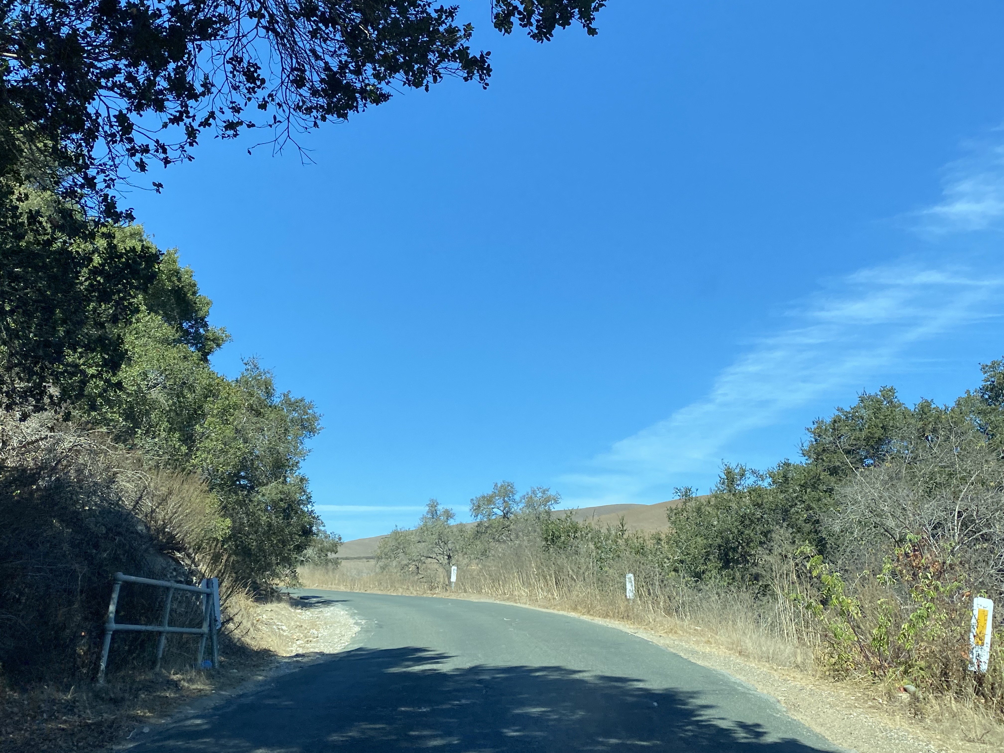
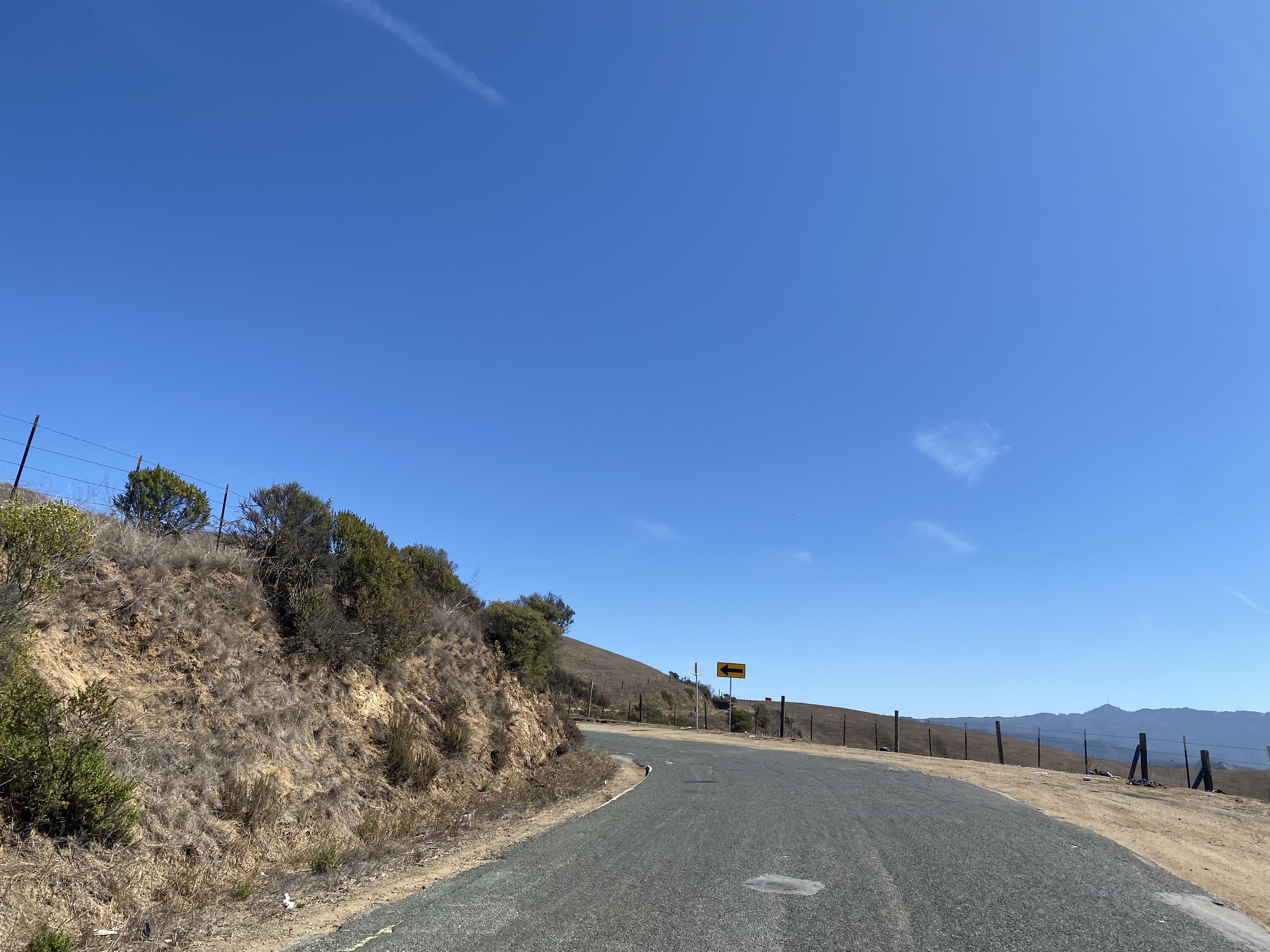
Former US Route 101 on the San Juan Grade begins to climb into the Gabilan Range. 


Despite lacking a center stripe the San Juan Grade southbound is wide enough for vehicles to pass each other.  As noted in Part 1 the gradient of the San Juan Grade averages 2-6%.  


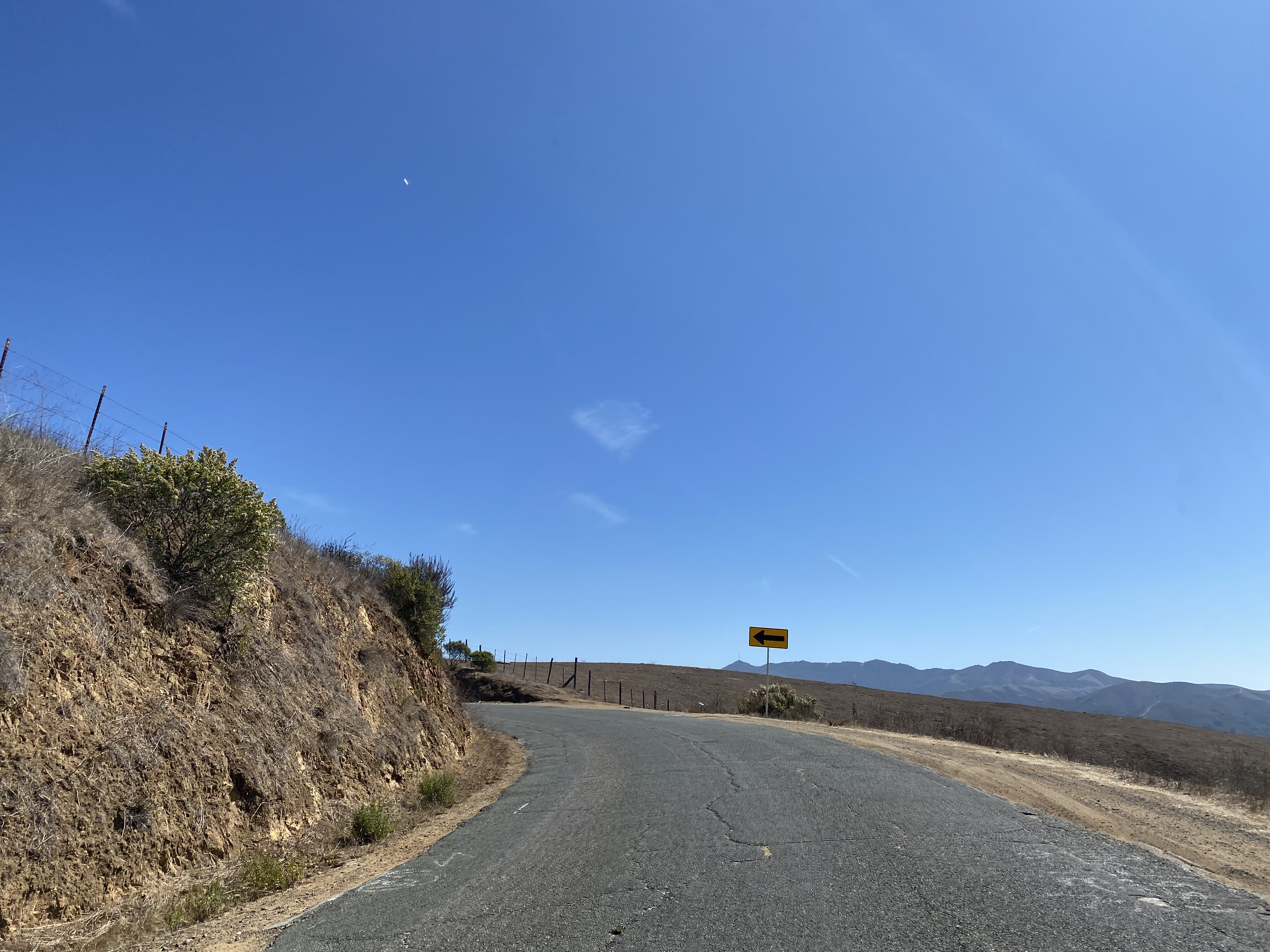
Former US Route 101 southbound on the San Juan Grade crosses an unnamed summit at 1,016 feet above sea level approaching the Monterey County Line.  


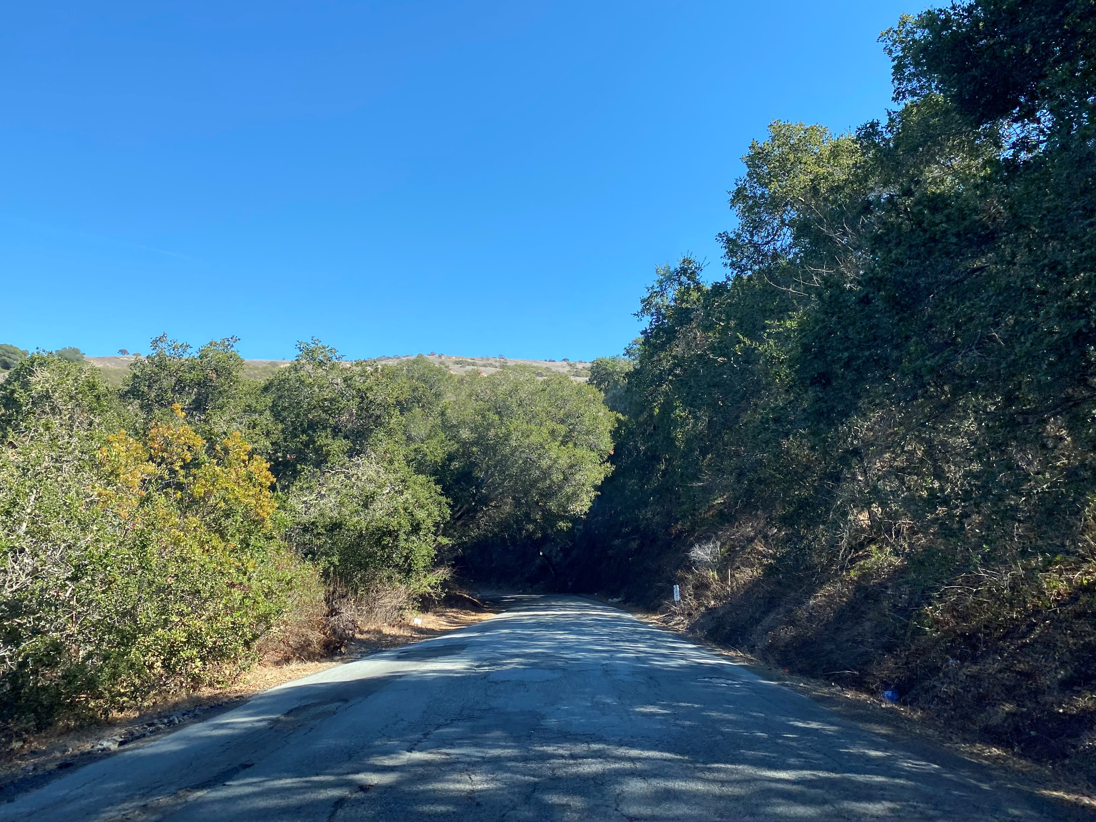
Upon crossing the Monterey County, the San Juan Grade has a top layer of asphalt covering the Portland Cement of the original alignment of US Route 101.  


The Monterey County side of the San Juan Grade begins to descend from the Gabilan Range towards Salinas.  


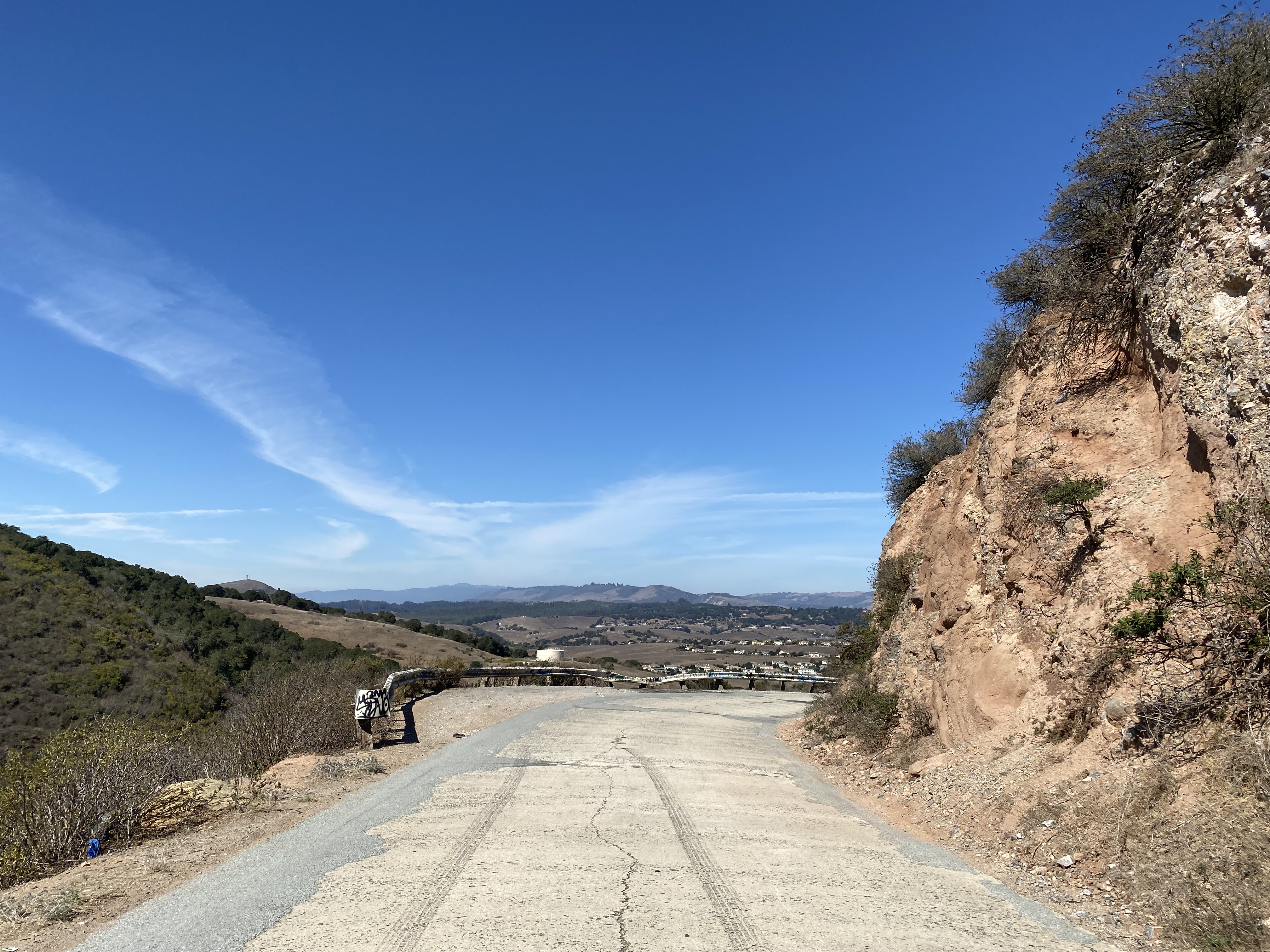
Approaching Crazy Horse Road, the grade of the San Juan Grade southbound flattens and jogs towards Main Street in Salinas.  


Part 4; a northbound drive on former US Route 101 over the San Juan Grade from Salinas through San Juan Bautista

From northbound North Main Street in the Salinas neighborhood of Santa Rita traffic can access the San Juan Grade via a right-hand turn.  North Main Street at San Juan Grade Road is where the 1932 Prunedale Cutoff alignment through Santa Rita once began.  North Main Street from downtown Salinas to Espinosa Road in Santa Rita were bypassed by the modern US Route 101 freeway during November 1965.  Note: most of the photos below were taken during 2021 and 2022. 


Former US Route 101 northbound on San Juan Grade Road jogs away from Salinas and narrows considerably at Crazy Horse Canyon Road.  


At the intersection of San Juan Grade Road and Crazy Horse Canyon Road a plaque pertaining to the Battle of Natividad can be found.  Natividad is a small community located to the south along Old Stage Road which is tied to Rancho La Natividad.  The Battle of Natividad was part of the Mexican-American War and took place on November 16, 1846, between the American militia and forces led by Jesus Castro.


The Monterey County side of the San Juan Grade climbs into the Gabilan Range where the asphalt gives way to Portland Cement at the San Benito County line.  Notably the Monterey County portion of the San Juan Grade has weathered considerably which has exposed portions of Portland Cement.  


From the San Benito County line Fremont Peak can be observed from the San Juan Grade.  Fremont Peak is located at 3,455 feet above sea level and is the highest peak in the Gabilan Range.  Fremont Peak is named in honor of John C. Fremont who scaled the mountain during 1846 during the Mexican-American War with a crew of 60 armed surveyors.  


From the Monterey County line northbound the San Juan Grade descends through the Gabilan Range as a concrete covered highway to the vicinity of Old Stage Road.  The San Juan Grade (Salinas Road) is inventoried as San Benito County Road 3.  


The original alignment of US Route 101 northbound transitions to The Alameda approaching San Juan Bautista.  At Mission Vineyards, The Alameda picks up Monterey County G1 within view of the remaining tracks of the San Juan Pacific Railway.  


The San Juan Pacific Railway (SJPR) incorporated in 1907.  The San Juan Pacific Railway was standard gauge line built to connect from the Southern Pacific Railroad in Chittenden of Santa Cruz County 7.94 miles southeast to a concrete processing facility in San Juan Canyon near San Juan Bautista.  Said Portland Cement processing facility in San Juan Canyon was originally owned by the San Juan Cement Company which began operations in 1907.

The San Juan Cement Company was not successful and shuttered operations in late November of 1907.  The assets of the San Juan Cement Company were eventually taken over by the Old Mission Cement Company in May of 1912.  The Old Mission Cement Company rebranded the SJPR into the Central California Railroad.  The Old Mission Cement Company built a narrow-gauge quarry line east of the processing facility deeper into San Juan Canyon.  The first cement shipments began rolling from San Juan Canyon in 1916 but it wasn't until 1918 that the Old Mission Cement Plant was complete.

The Old Mission Cement Plant extended its quarry line another 1.5 miles to two new quarries in 1921.  The Old Mission Cement Plant sold out to the Pacific Portland Cement Company in 1927.  The Pacific Portland Cement Company announced it intended to add three additional miles of quarry line in 1929.  The Pacific Portland Cement Company shuttered operations in 1930 due to the economic conditions of the Great Depression.  In 1937-1938 (sources conflict) the standard gauge rails of the Central California Railroad were removed.  The cement processing facility reopened in 1941 under the banner of Ideal Cement which operated to the 1970s when the cement plant was dismantled.


The original alignment of US Route 101 northbound follows The Alameda to the terminus of San Benito County Route G1 at California State Route 156.  Upon crossing California State Route 156, The Alameda enters San Juan Bautista and transitions to 3rd Street.  


The original alignment of US Route 101 followed 3rd Street through downtown San Juan Bautista and made a right-hand turn at Monterey Street.  As noted in Part 3, 3rd Street can only be accessed by vehicle traffic now in a northbound direction.  


The gas station Carl M. Luck can be found at the northeast corner of 3rd Street and Monterey Street.  Luck's gas station had been constructed during 1919 when the San Juan Grade carried traffic through San Juan Bautista.  Luck's gas station was gifted to the city of San Juan Bautista during 1974 and became the home of the San Juan Bautista Historical Society during 2000.  


Recently the San Juan Bautista Historical Society has begun to sign 3rd Street as historic US Route 101.  


The original alignment of US Route 101 from Monterey Street followed 1st Street and San Juan Highway to the ruins of the San Benito River Bridge.  The San Benito River Bridge once marked where US Route 101 entered Santa Clara County and can be easily identified by following San Juan Highway north from Chittenden Road where the road surface becomes Portland Cement.  


Update History

-  Published on October 19, 2017.
-  First updated during October 2019.
-  Updated for a second time on October 11, 2022. 

Comments

Jim Grey said…
I love to see original pavement, especially concrete! I get you totally on the ominous feel you can get on a remote patched-up concrete road. Fresh asphalt means civilization.
Challenger Tom said…
^^^

Really that was a pretty cool find that I honestly didn't know was there until this past week. I noticed the older alignment a couple months back on the 1935 San Benito County map but didn't realize that it was the original US 101 on the San Juan Grade. Either way it kind of makes me wonder if the Ridge Route really could be salvaged as a passable route if the slides were cleared off it. That concrete was in great shape for as old as it really is, totally bumpy, but totally passable still.
Unknown said…
Back in the early 1970s, several of us had to take a make-up class for driver's ed after school. The teacher chose me to drive to San Juan Bautista on that road. I was terrified! I still don't like to drive it.
Wonder Wanda said…
Thanks for visiting SJB again. The "very ancient concrete'' you refer to undoubtedly came from the Old Mission Portland Cement Company (which later became the Ideal Cement Plant), located at the mouth of San Juan Canyon (closed and dismantled in the 70s). This road is used more and more as a result of satellite navigation; I had to pull over once for an errant oncoming semi I saw approaching in the distance. ~ San Juan Bautista Historical Society.
Joel Klein said…
Thanks for this! We did a cycling loop last weekend starting in San Juan Bautista, went up to the top of Fremont Peak, and then did a loop up Salinas Road / San Juan Grade, across Crazy Horse Canyon Road, and back through Aromas. We were wondering about the provenance of the "very ancient concrete paving" of Salinas Road. It seemed odd for an ancient little country road, but makes total sense as a former major highway.
Paul Elliot said…
I have ridden over San Juan Grade a few times by motorcycle and find it to be quite interesting. Sadly, the original Old Stage Road is no longer drivable, but still exists as a hiking and biking trail.
Unknown said…
Great read, I traveled that road many times going to Hollister from Salinas. I love the back roads more. I'm glad to say I drove my girls thru this road growing up. I will be using this road again next week to attend my baby's High school graduation. Thanks for the good information👌

Popular posts from this blog

Old River Lock & Control Structure (Lettsworth, LA)

  The Old River Control Structure (ORCS) and its connecting satellite facilities combine to form one of the most impressive flood control complexes in North America. Located along the west bank of the Mississippi River near the confluence with the Red River and Atchafalaya River nearby, this structure system was fundamentally made possible by the Flood Control Act of 1928 that was passed by the United States Congress in the aftermath of the Great Mississippi River Flood of 1927 however a second, less obvious motivation influenced the construction here. The Mississippi River’s channel has gradually elongated and meandered in the area over the centuries, creating new oxbows and sandbars that made navigation of the river challenging and time-consuming through the steamboat era of the 1800s. This treacherous area of the river known as “Turnbull’s Bend” was where the mouth of the Red River was located that the upriver end of the bend and the Atchafalaya River, then effectively an outflow

Memphis & Arkansas Bridge (Memphis, TN)

  Like the expansion of the railroads the previous century, the modernization of the country’s highway infrastructure in the early and mid 20th Century required the construction of new landmark bridges along the lower Mississippi River (and nation-wide for that matter) that would facilitate the expected growth in overall traffic demand in ensuing decades. While this new movement had been anticipated to some extent in the Memphis area with the design of the Harahan Bridge, neither it nor its neighbor the older Frisco Bridge were capable of accommodating the sharp rise in the popularity and demand of the automobile as a mode of cross-river transportation during the Great Depression. As was the case 30 years prior, the solution in the 1940s was to construct a new bridge in the same general location as its predecessors, only this time the bridge would be the first built exclusively for vehicle traffic. This bridge, the Memphis & Arkansas Bridge, was completed in 1949 and was the third

California State Route 203 the proposed Minaret Summit Highway

California State Route 203 is an approximately nine-mile State Highway located near Mammoth Lakes in the Sierra Nevada Mountains of Mono County.  California State Route 203 as presently configured begins at US Route 395, passes through Mammoth Lakes and terminates at the Madera County line at Minaret Summit.  What is now California State Route 203 was added to the State Highway System in 1933 as Legislative Route Number 112.  The original Mammoth Lakes State Highway ended at Lake Mary near the site of Old Mammoth and was renumbered to California State Route 203 in 1964.  The modern alignment of the highway to Minaret Summit was adopted during 1967.   The corridor of Minaret Summit and Mammoth Pass have been subject to numerous proposed Trans-Sierra Highways.  The first corridor was proposed over Mammoth Pass following a Southern Pacific Railroad survey in 1901.  In 1931 a corridor between the Minarets Wilderness and High Sierra Peaks Wilderness was reserved by the Forest Service for po