
Eustis Covered Bridge - Quebec


Located near the former mining town of Eustis, the 90 foot long Eustis Covered Bridge is one of three covered bridges located in Quebec's Eastern Townships region that features a multiple Kingpost truss design. Built in 1908 over the Massawippi River at a scenic spot along Rue Stafford, the Eustis Covered Bridge is one of the last remaining remnants of the once thriving copper mining town of the same name. A century ago, the village of Eustis hosted a large mining complex, a number of company houses, general store, church, train station, and a baseball team. The covered bridge is open seasonally, from around April 15 to November 15 of any given year.

Like many covered bridges, the Eustis Covered Bridge has had a tumultuous history, having been saved from demolition during the 1990s and then later restored. After being improperly restored in 1998, the bridge was closed to traffic in 2008. Restoration to the covered bridge took place from June 2011 to November 2011, and then reopened to traffic in April 2012. The work for restoring the bridge to prime condition was completed by Hamlet Heavy Timberwork, Ltd. of Rigaud, Quebec at a cost of $596,000.

During the restoration, the bridge was hoisted off of its abutments, dismantled, and transported in pieces to an off site location. With exception of the original corner braces and some of the rafters, however, most of the truss work for the bridge was been replaced with new timber. The trusses were replaced because of a previous, poorly executed repair job some years ago which involved “cutting sections of the trusses, rendering the trusses ineffective. As a result of the restoration, the trusses were returned to their actual load bearing role, and the proper camber arch was restored to the lower chords of the structure.

I had the opportunity to visit the Eustis Covered Bridge and found a pull-off along the road near the bridge. From the pull-off, there is a short walk to the bridge and it is an easy bridge to explore.


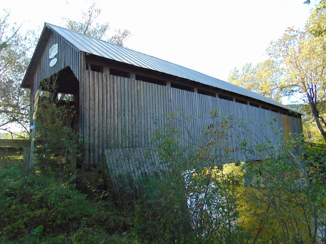
Side profile of the Eustis Covered Bridge. There is a short trail off the bridge to get photos from the side.

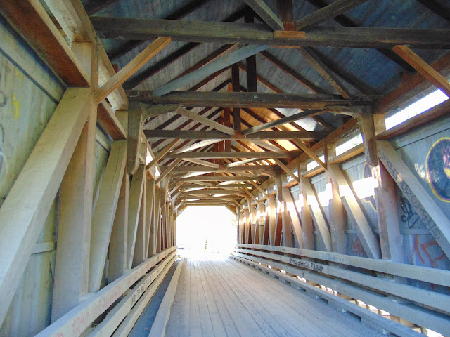
Inside the covered bridge.

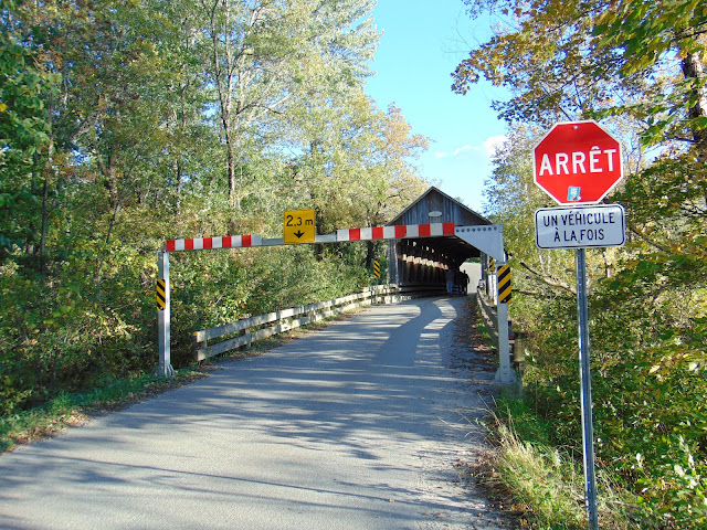
A headache bar has been installed to keep overheight vehicles from striking the portals of the covered bridge.

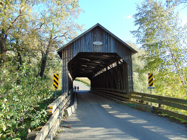
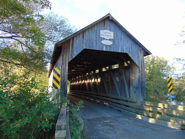
View of the north portal of the Eustis Covered Bridge.

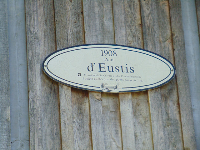
Bridge plaque on the covered bridge, indicating the year the bridge was originally constructed.

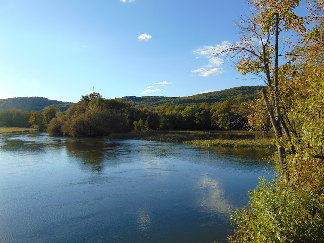
View of the Massawippi River on a pleasant late September afternoon.


How to Get There:


Sources and Links:
Townships Heritage WebMagazine - The Return of the Eustis Bridge
Covered Bridges in Quebec - Eustis Bridge
Chemin des Cantons - Round Barns and Covered Bridges Route

Comments

Popular posts from this blog

Paper Highways: The Unbuilt New Orleans Bypass (Proposed I-410)

  There are many examples around the United States of proposed freeway corridors in urban areas that never saw the light of day for one reason or another. They all fall somewhere in between the little-known and the infamous and from the mundane to the spectacular. One of the more obscure and interesting examples of such a project is the short-lived idea to construct a southern beltway for the New Orleans metropolitan area in the 1960s and 70s. Greater New Orleans and its surrounding area grew rapidly in the years after World War II, as suburban sprawl encroached on the historically rural downriver parishes around the city. In response to the development of the region’s Westbank and the emergence of communities in St. Charles and St. John the Baptist Parishes as viable suburban communities during this period, regional planners began to consider concepts for new infrastructure projects to serve this growing population.  The idea for a circular freeway around the southern perimeter of t

Hernando de Soto Bridge (Memphis, TN)

The newest of the bridges that span the lower Mississippi River at Memphis, the Hernando de Soto Bridge was completed in 1973 and carries Interstate 40 between downtown Memphis and West Memphis, AR. The bridge’s signature M-shaped superstructure makes it an instantly recognizable landmark in the city and one of the most visually unique bridges on the Mississippi River. As early as 1953, Memphis city planners recommended the construction of a second highway bridge across the Mississippi River to connect the city with West Memphis, AR. The Memphis & Arkansas Bridge had been completed only four years earlier a couple miles downriver from downtown, however it was expected that long-term growth in the metro area would warrant the construction of an additional bridge, the fourth crossing of the Mississippi River to be built at Memphis, in the not-too-distant future. Unlike the previous three Mississippi River bridges to be built the city, the location chosen for this bridge was about two

Memphis & Arkansas Bridge (Memphis, TN)

  Like the expansion of the railroads the previous century, the modernization of the country’s highway infrastructure in the early and mid 20th Century required the construction of new landmark bridges along the lower Mississippi River (and nation-wide for that matter) that would facilitate the expected growth in overall traffic demand in ensuing decades. While this new movement had been anticipated to some extent in the Memphis area with the design of the Harahan Bridge, neither it nor its neighbor the older Frisco Bridge were capable of accommodating the sharp rise in the popularity and demand of the automobile as a mode of cross-river transportation during the Great Depression. As was the case 30 years prior, the solution in the 1940s was to construct a new bridge in the same general location as its predecessors, only this time the bridge would be the first built exclusively for vehicle traffic. This bridge, the Memphis & Arkansas Bridge, was completed in 1949 and was the third