Despite looping back to the Tampa Area my road trip was not over as I still had much of Southern Florida to explore. Not wanting to take any I-75 after the previous two days I decided on an inland route south to US 41 on the Tamiami Trail east of Naples.

Leaving Hernando County I took the back roads to CR 541 and went south into Pasco County where it becomes CR 41.

As I mentioned much earlier in the trip blog series CR 41 was part of FL 41 and is probably the hilliest road in Florida. The dips down the Brooksville Ridge approaching Dade City are gigantic.


I took US 301 to CR 35A the Old Lakeland Highway in Dade City. US 301 didn't make it down to Florida until 1947 but I'm fairly certain it is an older alignment along with Chancey Road. US 98 would likely have used the Old Lakeland Highway as well when it was shifted east to Palm Beach in 1952. When I reached the overpass with US 98 I took a ramp up to it to continue towards Lakeland.


On US 98 at the boundary of Polk County is one of the old County Monoliths which served as entry markers. The Monoliths were put in place in 1930 alongside well traveled roads that entered Polk County. The Monoliths proclaim Polk County to be the "Citrus Center" which is odd considering it is mostly known for phosphate mining. Early US 98 likely followed CR 54 east from Old Lakeland Highway given that Old Dade City Road is just to the south.


I'm fairly certain US 98 once entered Lakeland on Kathleen Road. The alignment matches up to US 92 and the Old Dade City Highway. For whatever reason I can't seem to find a reliable highway map from the World War II era of either Pasco or Polk Counties.
Entering Lakeland I passed the "infamous" I-4 (probably the most miserable freeway in the country in my opinion) and followed US 98 through town. Exiting Lakeland to the south I passed under the FL 570 Toll Road.


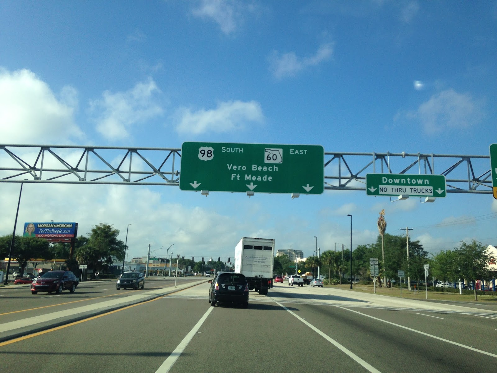
I followed US 98 south to Bartow which I took onto a brief multiplex of FL 60 to US 17. I followed US 17/98 out of Bartow.


US 98 splits away from US 17 in Fort Meade. The alignment of US 98 east of Fort Meade is interesting in that it takes several graded 90 degree turns through the farm lands. I continued south on US 17 since it is a quiet route and I wanted to try something a little off-beat from the norm.

I took US 17 south to Arcadia in DeSoto County. I turned east briefly on FL 70 to the northern terminus of FL 31 where I turned south.

FL 31 is only 36 miles long and terminates at FL 80 to the south in Fort Myers Shores. Major junctions like FL 31 include; CR 760, CR 760A, CR 763, CR 74, CR 78, and FL 78.


Having really no other practical route south I took FL 80 west to I-75. I took I-75 south to CR 951 in Collier County. I used CR 951 south to reach US 41 where the Tamiami Trail opens up in the Big Cypress Reserve and Everglades.


Leaving Hernando County I took the back roads to CR 541 and went south into Pasco County where it becomes CR 41.

As I mentioned much earlier in the trip blog series CR 41 was part of FL 41 and is probably the hilliest road in Florida. The dips down the Brooksville Ridge approaching Dade City are gigantic.


I took US 301 to CR 35A the Old Lakeland Highway in Dade City. US 301 didn't make it down to Florida until 1947 but I'm fairly certain it is an older alignment along with Chancey Road. US 98 would likely have used the Old Lakeland Highway as well when it was shifted east to Palm Beach in 1952. When I reached the overpass with US 98 I took a ramp up to it to continue towards Lakeland.


On US 98 at the boundary of Polk County is one of the old County Monoliths which served as entry markers. The Monoliths were put in place in 1930 alongside well traveled roads that entered Polk County. The Monoliths proclaim Polk County to be the "Citrus Center" which is odd considering it is mostly known for phosphate mining. Early US 98 likely followed CR 54 east from Old Lakeland Highway given that Old Dade City Road is just to the south.


I'm fairly certain US 98 once entered Lakeland on Kathleen Road. The alignment matches up to US 92 and the Old Dade City Highway. For whatever reason I can't seem to find a reliable highway map from the World War II era of either Pasco or Polk Counties.
Entering Lakeland I passed the "infamous" I-4 (probably the most miserable freeway in the country in my opinion) and followed US 98 through town. Exiting Lakeland to the south I passed under the FL 570 Toll Road.


I followed US 98 south to Bartow which I took onto a brief multiplex of FL 60 to US 17. I followed US 17/98 out of Bartow.

US 98 splits away from US 17 in Fort Meade. The alignment of US 98 east of Fort Meade is interesting in that it takes several graded 90 degree turns through the farm lands. I continued south on US 17 since it is a quiet route and I wanted to try something a little off-beat from the norm.

I took US 17 south to Arcadia in DeSoto County. I turned east briefly on FL 70 to the northern terminus of FL 31 where I turned south.

FL 31 is only 36 miles long and terminates at FL 80 to the south in Fort Myers Shores. Major junctions like FL 31 include; CR 760, CR 760A, CR 763, CR 74, CR 78, and FL 78.


Having really no other practical route south I took FL 80 west to I-75. I took I-75 south to CR 951 in Collier County. I used CR 951 south to reach US 41 where the Tamiami Trail opens up in the Big Cypress Reserve and Everglades.


Comments