2017 Southeast Trip Part 13; US Route 1 the Overseas Highway and the legacy of Florida State Road 4a
My final major destination of my 2017 Southeast trip was on a road I've driven hundreds of times; US Route 1 on the Overseas Highway from Florida City to Key West.
First a little background; back in 2012 was the first time I drove the Overseas Highway during a family trip to Florida when I was living in Florida. Less than a year later I was offered a job ironically in Key West which was a once in a lifetime opportunity. That being the case I was able to pretty much able to drive the Overseas Highway hundreds of times and find pretty much all it's secrets. I don't intend this to be a short blog because there is so much history that is barely remembered that I thought was worth bringing to light. One such topic will be the history of the 1928 Overseas Highway which was known as Florida State Road 4a. But for now I'll continue forward with my usual highway guide format and interject with important historical points of interest.
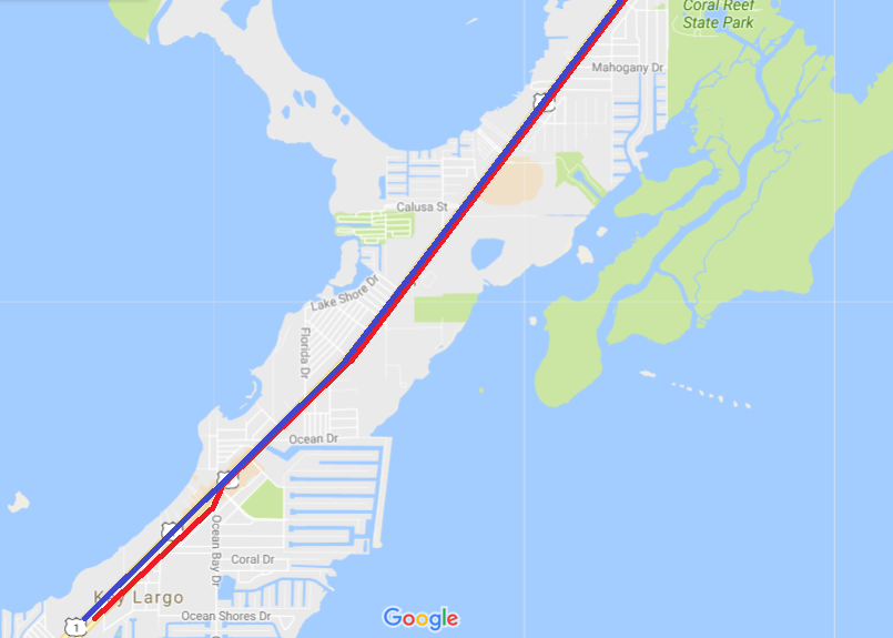
From Florida City is about 127 miles to downtown Key West and the southern terminus of US 1. I hit the road early in the morning from Florida City. The Overseas Highway begins at the junction of Card Sound Road/County Route 905A and US 1.

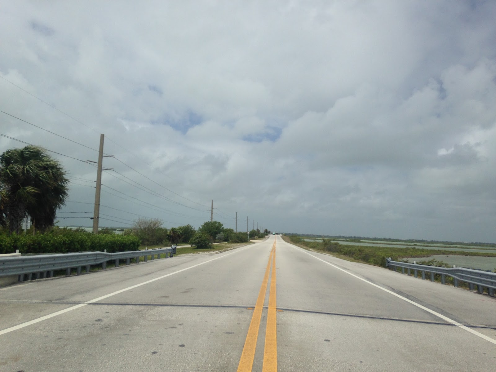
US 1 between Florida City and Key Largo is generally known locally as the "18 Mile Stretch" which is named after the distance between the two locations. The 18 Mile Stretch straddles the Florida Everglades in Miami-Dade County before entering Monroe County as the waters open up in Manatee Bay. The 18 Mile Stretch is on the Overseas Railroad Grade and is a two-lane expressway with passing zones. The passing zones generally get pretty hazardous with drivers speeding up to 70-90 miles per hour to attempt to pass RVs, truckers, and vehicles hauling boats.


I did manage to catch sunrise over Barnes Sound.

Approaching Jewfish Creek Key West is listed as 105 miles to the south.

The previous crossing of Jewfish Creek was replaced by a larger structure that has clearance for sail boats. Much of the current bridges along the Overseas Highway were completed in the 1980s and were largely replacements of Overseas Railroad bridges. The Jewfish Creek crossing is sectioned off into frontage roads of modern US 1 which allow access to Gilbert's Resort and the Anchorage Resort.


The modern elevated crossing over Jewfish Creek on to Key Largo has a wide view of the Upper Keys.


As US 1 lands on Key Largo it junctions the opposite half of Card Sound Road which is signed as CR 905. Card Sound Road was not only the original alignment of US 1 in the Florida Keys but was also part of Florida State Road 4a. Florida State Road 4a was a highway which was completed in 1928 between Florida City and Key West. FL 4a was very different than US 1 and took a ferry route in the Middle Keys from Lower Matecumbe Key to No Name Key. Aside from the ferry link FL 4a largely ran along side of the Overseas Railroad which is mostly apparent in the Upper Keys. The northbound lanes of US 1 on Key Largo was the roadway grade of FL 4a whereas the southbound lane was the Overseas Railroad. I'll be discussing the circumstances that led to US 1 being routed through the Keys and what happened to the alignments of FL 4a further in this blog.

US 1 is initially signed as 45 MPH on Key Largo.

US 1 passes John Pennekamp Coral Reef State Park on Key Largo. Coral Reef State Park encompasses waters above a living coral reef which is viewed from glass floor boats or by snorkeling. Coral Reef State Park is the most popular State Park in Florida by visitor count and was established in 1963.

US 1 is signed as 50 MPH briefly on Key Largo but drops to 45 MPH approaching Tavernier and Tavernier Creek. The speed limit remains at 45 MPH for the next 14 miles southbound.


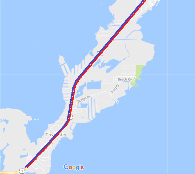
US 1 crosses Tavernier Creek to Plantation Key which is the beginning of the limits of the City of Islamorda.


US 1 drops down to two lanes on Plantation Key. US 1 remains on the Overseas Railroad grade while the alignment of FL 4a largely on the neighborhood frontage roads on the Atlantic side of the highway.


Approaching Snake Creek there is a weigh station for commercial trucks. The bridge over Snake Creek has the only draw span left on the Overseas Highway.


On Windley Key along the Gulf Side of the Highway is Windley Key Fossil Reef Geological State Park. The State Park is the site of a quarry that was used in the construction of the Overseas Railroad between 1905 to 1912.

Downtown Islamorada is located on Upper Matecumbe Key. At North Hammock Road CR 905 is actually signed and indicates a well maintained portion of FL 4a.

The Overseas Railroad was in operation until sections of it were destroyed in 1935 Labor Hurricane. At mile marker 82 on Upper Matecumbe Key in Islamorada is the site where the former Post Office for the city once stood. The Labor Day Hurricane is what ultimately led to US 1 being routed to Key West but events were already in motion to remove the ferry gap in FL 4a.


On the south side of Lower Matecumbe Key FL 4a would have crossed over the Overseas Railroad onto the Gulf side approaching the Tea Table Key Fill. FL 4a remained on the north side of the Overseas Railroad to the ferry docks on Lower Matecumbe Key.
On the Atlantic side of the Overseas Highway a small island known as Indian Key can be seen from the Tea Table Key Fill and Indian Key Fill. Indian Key is site of a ghost town of the same name which was once the County Seat of Dade County. Indian Key was first settled in 1824 and became the Dade County seat temporarily when the Middle in addition to Upper Keys were split from Monroe County. Indian Key was burned in 1840 during a raid in the second Seminole War. The population of Indian Key was likely less than 100 during the Second Seminole War and the settlement never really recovered. Apparently Indian Key was inhabited until the 1880s but I haven't seen a ton of clear evidence to support that. Indian Key is now a state park which can be accessed by boat from Lower Matecumbe Key.


The grade of the Overseas Highway and by extension Overseas Railroad approaches the waters of the Atlantic on Lower Matecumbe Key. On the south end of Lower Matecumbe Key FL 4a would have turned towards the ferry docks for No Name Key approximately at the location of modern Toll Gate Boulevard.

At the bridge crossing for Lower Matecumbe and Craig Key at mile marker 73 a couple concrete pilings can be seen in the waters on the Gulf side of the Overseas Highway. When the 1935 Labor Day Hurricane struck the Middle Keys were affected the most as it took the burnt of the storm. A short distance south of the FL 4a ferry docks World War I Veterans were constructing a new highway bridge which would have spanned from Lower Matecumbe Key to Fiesta Key via what is now known as Veterans Key. At the time there was enough interest in Florida to close the ferry gap in FL 4a by building a new highway alongside the Overseas Railroad.
When the Hurricane struck the workers on Veterans Key were killed, in total there is 423 known victims of the 1935 Labor Day Hurricane. The 1935 Labor Day Hurricane was a Category 5 storm that had sustained winds of 185 MPH. The Overseas Railroad grade was ruined in the Middle Keys and the right-of-way was sold to the state of Florida. The Florida East Coast Railway had intended the Overseas Railroad to a be a major freight route with shipments coming from Key West. Improvements in diesel technology allowed ships to largely bypass Key West which negated the intended purpose of the Overseas Railroad. Initially the right-of-way of the Overseas Railroad was used to complete the ferry gap in FL 4a leading to US 1 being extended to Key West. Much of early US 1 in the Florida Keys continued to use the right-of-way of FL 4a in the Upper and Lower Keys for a time.
There is a small monument facing the Veterans Key highway bridge piers detailing the events that occurred there.


Looking south along the Overseas Railroad grade towards Craig Key with the modern Overseas Highway Channel 5 to Fiesta Key in the background.


A quick glance back at Veterans Key where the crews working on the new highway bridge were housed.

US 1 on the Overseas Highway has some really nice scenic placard designs. The Overseas Highway is one of the thirty one All-American Roads recognized by the U.S. Department of Transportation.


Continuing southbound Fiesta Key and Long Key can be seen southbound from the top of the Channel 5 bridge.

Long Key has a small city at mile marker 68 known as Layton. Layton has less than 200 residents and has been incorporated since 1963. There is a Monroe County Sheriff Sub-Station in Layton with a amusingly placed older Panther platform Ford Crown Victoria staged to deter speeders. If you're wondering why I keep referring to mile markers so much it is simply how locations and addresses are generally identified on the Overseas Highway. The first two digits of addresses on US 1 indicate the mile with the third digit indicating the tenth of a mile. Hypothetically an address of "20122" would indicate that a location is on Mile Marker 20.1.


Long Key State Park is located immediately south of Layton. Much of Long Key is within State Park lands which gives the island a different feel than the more heavily populated Keys of similar size.

The Middle Keys host some of the longest bridges on the Overseas Highway and by extension the previous Overseas Railroad. The 2.3 mile Long Key Viaduct stretching from Long Key to Conch Key is one of the longer bridges on the Overseas Highway.


Duck Key can be seen from the original Long Key Viaduct south of Conch Key. The Overseas Highway junctions Duck Key Drive before landing on Grassy Key in the Vaca Keys of the City of Marathon.

On Long Point Key at mile marker 56.2 the Overseas Highway junctions Curry Hammock State Park.

As Marathon becomes more urbanized the Overseas Highway junctions Sadwoski Causeway which leads to the City of Key Colony Beach on Shelter Key. Key Colony Beach essentially was created in the 1950s to block annexation by the City of Marathon.


Sombrero Beach Road was once part of State Road 931 which was a loop of US 1 in the City of Marathon.

At Sombrero Beach FL 931 crossed to Boot Key and looped back up to US 1 via the 20th Street and the Boot Key Bridge. The Boot Key Bridge was completed in 1960 and closed in 2008 after it was deemed deficient. The Boot Key Bridge used to have a draw span that was removed I believe back in 2009? I seem to recall being able to walk towards the bridge in the past but there was some pretty heavy duty barriers blocking access down 20th Street. My understanding is that Boot Key was intended to be converted to a nature preserve but is littered with debris and remains from radio towers.


I would have loved to stop at the northern end of Seven Mile Bridge but the parking area was undergoing some renovations.

The modern Seven Mile Bridge is actually only 6.79 miles and was completed by 1982. Pigeon Key can be seen on the Old Seven Mile Bridge while crossing the new span along with trees growing on the former roadway.


I did stop on the south end of the Seven Mile Bridge which is at mile marker 40.


Back in 2013 when I was living in the Keys I would run the northern portion of the Old Seven Mile Bridge to Pigeon Key. 2.2 miles of the Old Seven Mile Bridge from Marathon can be used by foot to reach Pigeon Key. These photos date from 2013 before any renovations to the parking lot facility on the northern end of the Old Seven Mile Bridge began.


There was a toll facility on the Old Seven Mile Bridge when it was converted to road use by 1938 which remained in effect until 1954. The Old Seven Mile Bridge is has a gap near the old toll facility and draw span. Pigeon Key is accessible from the Old Seven Mile Bridge via a wooden ramp.


Pigeon Key had housing for Florida East Coast Railway workers who built the Old Seven Mile Bridge from 1908 to 1912. After the completion of the Old Seven Mile Bridge the facilities at Pigeon Key were converted for maintenance of the bridge. During World War II Pigeon Key was converted to barracks housing for the Coast Guard. Today Pigeon Key is a Historic District and maintained by the Pigeon Key Foundation. Boats can be taken from mile marker 47.5 from Marathon if you don't feel inclined to walk the Old Seven Mile Bridge.


The Overseas Highway crosses Little Duck Key, Missouri Key, and Ohio Key before crossing onto Bahia Key. Bahia Key is the location of Bahia Honda State Park.


The main park road in Bahia Honda State Park leads up to the Old Bahia Honda Bridge. The Old Bahia Honda Bridge is a truss span that was designed to aid the Overseas Railroad cross the unusually 24 foot deep channel to Spanish Harbor Key. All of the old Overseas Railroad bridges that were used to bring US 1 down to Key West needed to be converted for road use. Most of the bridges just had a road deck placed on them but Bahia Honda was unique. The road deck over the Old Bahia Honda Bridge was placed on top of the truss span and the former through route used by trains was beefed up as extra support.
The Old Bahia Honda Bridge can be viewed from Bahia Honda State Park along side the newer dual span. According to conjecture I've heard over the years the dual span in the newer Bahia Honda Bridges was due to a far larger plan to create an expressway from Florida City to Key West. I can't corroborate the information about an expressway but it is nonetheless intriguing to consider how it would have been constructed. Regardless, the white sandy beaches of Bahia Honda Key are a nice place to take a break from driving on the Overseas Highway.


For some reason the gap in the northern part of the Bahia Honda Bridge can't be approached anymore.

But it could be approached back in 2013.


The view from the Spanish Harbor Key side is particularly interesting to see.

Approaching Big Pine Key the speed limit lowers due to the endangered Key Deer being present. Big Pine Key is the only section of the Overseas Highway that has a night time speed limit which is 35 MPH. The Key Deer is a subspecies of White Tail Deer and is the smallest in North America. The Key Deer range extended from No Name Key south to Sugarloaf Key. Key Deer generally are about the size a medium-large dog and tend to be unafraid of humans due to frequent interactions.


I took a detour on Key Deer Boulevard towards No Name Key. Key Deer Boulevard used to be part of FL 940.


I made my way up to Watson Boulevard and took it over Bogie Channel to No Name Key. The very end of Watson Boulevard was the landing location for the ferry carrying FL 4a traffic from Lower Matecumbe Key. There isn't a memorial or anything other than a cut in the water to indicate a ferry dock was once present.

I took Watson Boulevard back towards Big Pine Key on the old alignment of FL 4a. I'm not sure when the Bogie Channel Bridge was built but it isn't the original span. Most of the bridges on the alignment of FL 4a were wooden and haven't left much of a trace aside from approach spans.


I really like the look of this sign for No Name Key in front of the Bogie Channel Bridge.


I'm not sure when the Bogie Channel Bridge was built but it isn't the original span. Most of the bridges on the alignment of FL 4a were wooden and haven't left much of a trace aside from approach spans.


The No Name Pub is ironically located on Big Pine Key. The No Name Pub dates back to 1931 and was located alongside FL 4a near the ferry landing on No Name Key. The No Name Pub was originally a general store with the namesake pub added in 1936. At some point in the 1930s a brothel was added to the No Name Pub which lasted into the early 1940s. Today the No Name Pub is more known for it's remote location, dollar bills adorning the walls of the bar, and a pretty decent pizza.

The No Name Pub is a great location to spot a roaming Key Deer.

Watson Boulevard snakes around Big Pine Key and the old bridge to Little Torch Key would have been where the road ends.


Oddly on Little Torch Key FL 4a is an actual street name and has plenty of signage. FL 4a rejoined the Overseas Railroad on Little Torch and followed it to Sugarloaf Key on the Gulf side.


A small series of bridge approaches that were FL 4acan be seen on the Gulf side of the Overseas Highway from Little Torch crossing over to Ramrod Key. FL 4a is the name of the street on the Gulf side of the Overseas Highway on Ramrod Key.

FL 4a was on Center Street on Summerland Key. Parts of Center Street are paved while the remainder is largely washed out dirt or is part of the Overseas Heritage Trail.


At the end of Niles Road on the very northern tip of Summerland Key is a derelict wooded car bridge.

There used to be a boat pressed against this bridge and no ladder present. Niles Road in general has a ton of apparent hurricane damage.

On Cudjoe Key FL 4a has been converted into part of the Overseas Heritage Trail. The Overseas Heritage Trail is 106 miles long and utilizes parts of FL 4a in addition to the Overseas Railroad. The trail is somewhat dubious due to it being necessary to use the modern Overseas Highway bridges due to gaps in the old Overseas Railroad bridges. The Overseas Railroad bridges were gapped to allow sailboats to cross under. The Overseas Heritage Trail was designated back in 2004 and is part of US Bike Route 1.


Back in 2013 I used to run FL 4a on Cudjoe Key every morning. The old roadway was largely still an overgrown dirt road on the side of a lagoon.


Interestingly Cudjoe Key is the location of a Cudjoe Key Air Force Station which has a tethered radar balloon known locally as "Fat Albert." Supposedly the installation was put in during during the late 1950s to track Missiles over the Elgin Gulf Test Range. Popular rumor has it that Fat Albert actually broadcasts pirate TV and radio signals into nearby Communist Cuba. Apparently there used to be two balloons but one flew away and crashed.
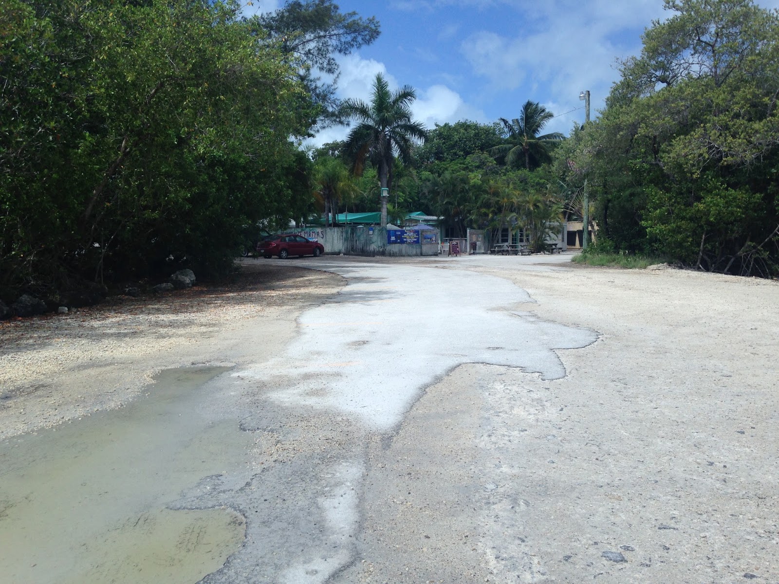
On Sugarloaf Key FL 4a crossed the Overseas Railroad again towards the Atlantic side of the island near the present location of Mangrove Mama's. My understanding is that Mangrove Mama's was built on the site of a Overseas Railroad depot.

South of Mangrove Mama's FL 4a would have run past Pirate's Cove. FL 4a and early US 1 followed the Atlantic Coast to a crossing to Geiger Key. Today the road is signed as dead end south of Pirate's Cove and the road can be walked to the location of a small burned out wooden highway bridge.


I tried running down to the burned out wooden bridge but it wasn't happening with how much left leg hurt. I was also rained on pretty badly which wasn't fun out in the overgrown stretch of FL 4a. This photo is from 2014 when I ran down to the burnt bridge.

The section of FL 4a south of Mangrove Mama's is signed as FL 939A but it actually isn't state maintained. Old sections of FL 4a were sectioned up into individual state highways. I can't find a ton of documentation as to what was actually signed on Sugarloaf Key but I believe FL 939 was Sugarloaf Boulevard, FL 939A was on FL 4a south of Sugarloaf Boulevard, and FL 939B was signed north of Sugarloaf Boulevard.

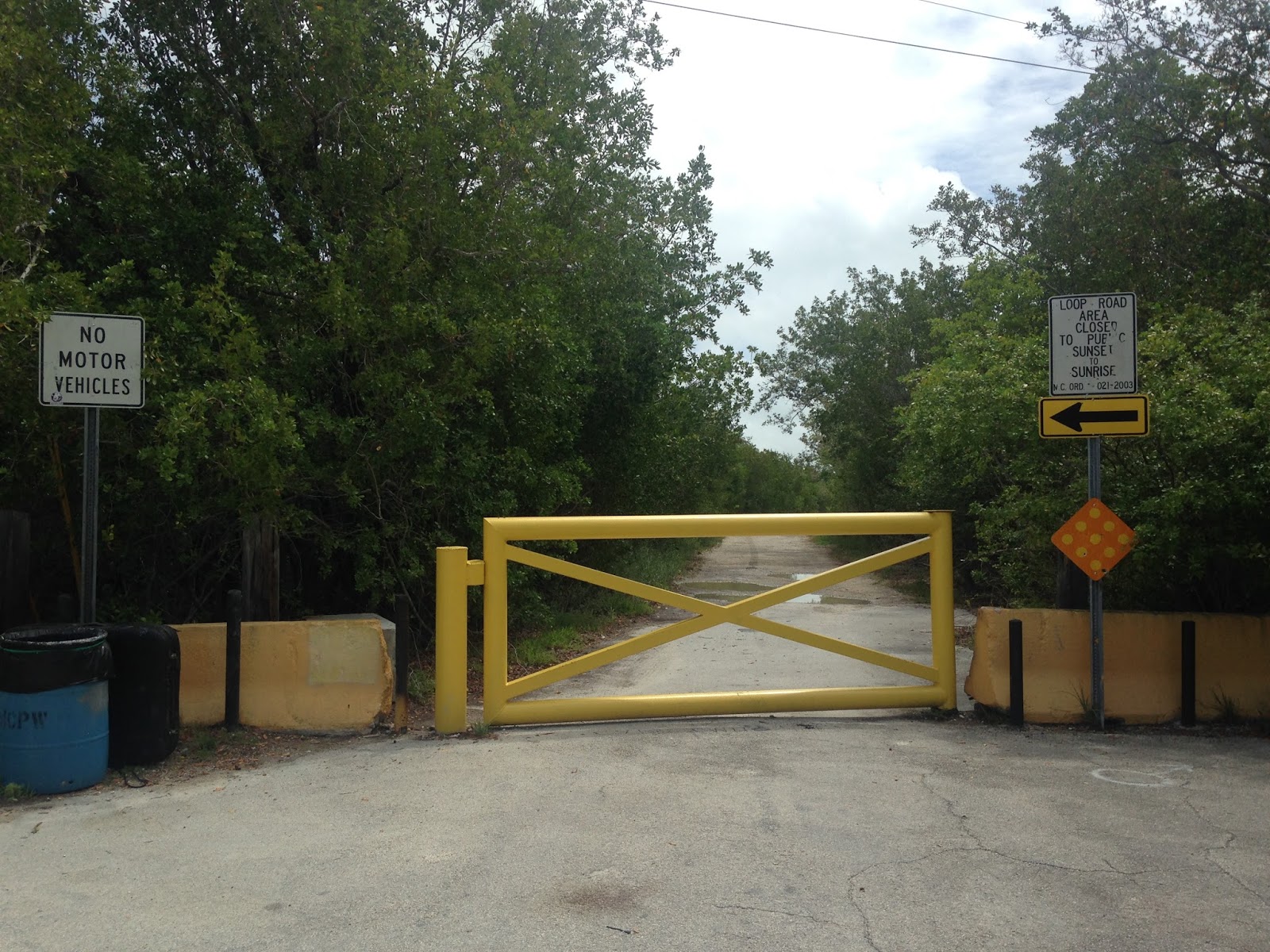
At the end of Sugarloaf Boulevard the side opposite of the burnt out bridge is behind a locked gate for the Loop Road. The area is signed with no parking signs all over the place but the Loop Road is a circuit just north of FL 4a that is used for annual time trail events.

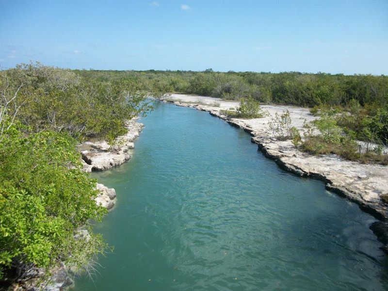
Back in 2013 I explored this section of FL 4a on foot during a run. There a bridge over a large channel cut which apparently is locally known as the "Jumping Bridge." I'm to understand that the bridge is popular to dive from due to the deep water.


Sections of FL 4a west of Sugarloaf Boulevard are locally maintained on the Atlantic Shore. There is a short bridge before maintenance ends in the Key Deer National Wildlife Refuge. FL 4a would have continued through the brush to a bridge crossing to Geiger Key.


Sugarloaf Key used to have a historic site on the Gulf side behind the Sugarloaf Lodge known as the Perky Bat Tower which was blown over during Hurricane Irma. The Perky Bat Tower was built in 1929 for a resort owned Richter Clyde Perky. Supposed the bats would eat the mosquitos near the resort but apparently flew away once the tower was opened.

The Overseas Railroad and by extension modern Overseas Highway takes a direct course through the Saddlebunch Keys to Big Coppit Key. A small community known as Bay Point is located at Mile Marker 15. Bay Point used to be an Army encampment during the days of Cuban Missile Crisis and the old building on the Gulf side of of the Overseas Highway is still signed as Federal property.

On Big Coppit Key FL 941 used to be signed on Boca Chica Road all the way south to Boca Chica Beach. FL 4a would have crossed over from Sugarloaf Key onto Geiger Key and continued south on Boca Chica Road on the Atlantic side of Boca Chica Key to a bridge crossing at Boca Chica Beach to Stock Island. The old highway is still located south of Naval Air Station Key West but it is being eroded away into the ocean. Some sections are overgrown with plants while others have just power lines indicating that infrastructure was actually present. The Sheriff's department was actually making an arrest while I was at Boca Chica Road, apparently the shanty town that was constructed a half decade ago was still present.


Approaching Geiger Key on Boca Chica Road is an old Nike Missile Site. There was four Nike Missile Sites that were put in during the 1960s near the city of Key West. Another battery was located at the Gulf side of Boca Chica Key, one on Trumbo Point was converted to a US Army Dive School, and the final location is in a lagoon behind Key West International Airport.

FL 4a northbound would have continued north onto Geiger Road through this locked gate.

Returning to the modern Overseas Highway it actually widens out into an expressway on Rockland Key and continues as such to FL A1A in Key West. Today the Overseas Highway bypasses Naval Air Station Key West on the Atlantic side. The Overseas Railroad actually used what is now Midway Avenue through the Air Station.


FL 4a after crossing from Boca Chica Key used Malooney Avenue and MacDonald Avenue on Stock Island to reach the Overseas Railroad one last time. Both alignments continued south into Key West.

Upon entering Key West I took A1A on Roosevelt Boulevard to Bertha Street via Flagler Avenue/CR 5a. I wanted to take the southern most segment of A1A for old times sake before continuing on the Overseas Highway to downtown Key West. I'm fairly certain A1A actually begins at Roosevelt Boulevard but the signage is incredibly vague. Smathers Beach and East Martello Fort are along the Key West segment of A1A. East Martello Fort was completed in 1862 and now houses the infamous Robert the Doll. Apparently if you take a picture of Robert without thanking him you become cursed...that is if you believe that sort of thing.


Heading back north to US 1 and the Overseas Highway on Roosevelt there is an abnormally large amount of parking along Cow Key Channel. Apparently there used to be house boats in Cow Key Channel until the previous decade.

Surprisingly there is actual signage for CR 5a on which is on A1A near the junction with Flagler Avenue.

The Overseas Highway loops the Gulf Side of Key West on Roosevelt Boulevard. Back in 2012-2014 Roosevelt was routed southbound only with the northbound detour on Flagler Avenue while a new sea wall was being built. Business owners eventually successfully petitioned FDOT to route Roosevelt as one-lane north/south due to the damage it had caused local businesses. The new sea wall was adorned with palm trees to Palm Avenue.


The Overseas Railroad took a turn up ahead on Palm Avenue towards Trumbo Point whereas the Overseas Highway continues into downtown Key West.

Entering downtown Key West the Overseas Highway follows Truman Avenue to Whitehead Street. My hotel was on Duval Street so I took a northward turn and parked at the hotel.


From Duval Street I followed the Overseas Highway on foot from Truman Avenue to Whitehead Street.


Whitehead Street is full of notable historical locations like the 1849 Key West Lighthouse. This is actually the second Lighthouse and replaced the one that was destroyed in a hurricane in 1846. The Key West Lighthouse is 73 feet tall and has one of the worst rickety staircases I've ever been on.

A look up Whitehead Street.

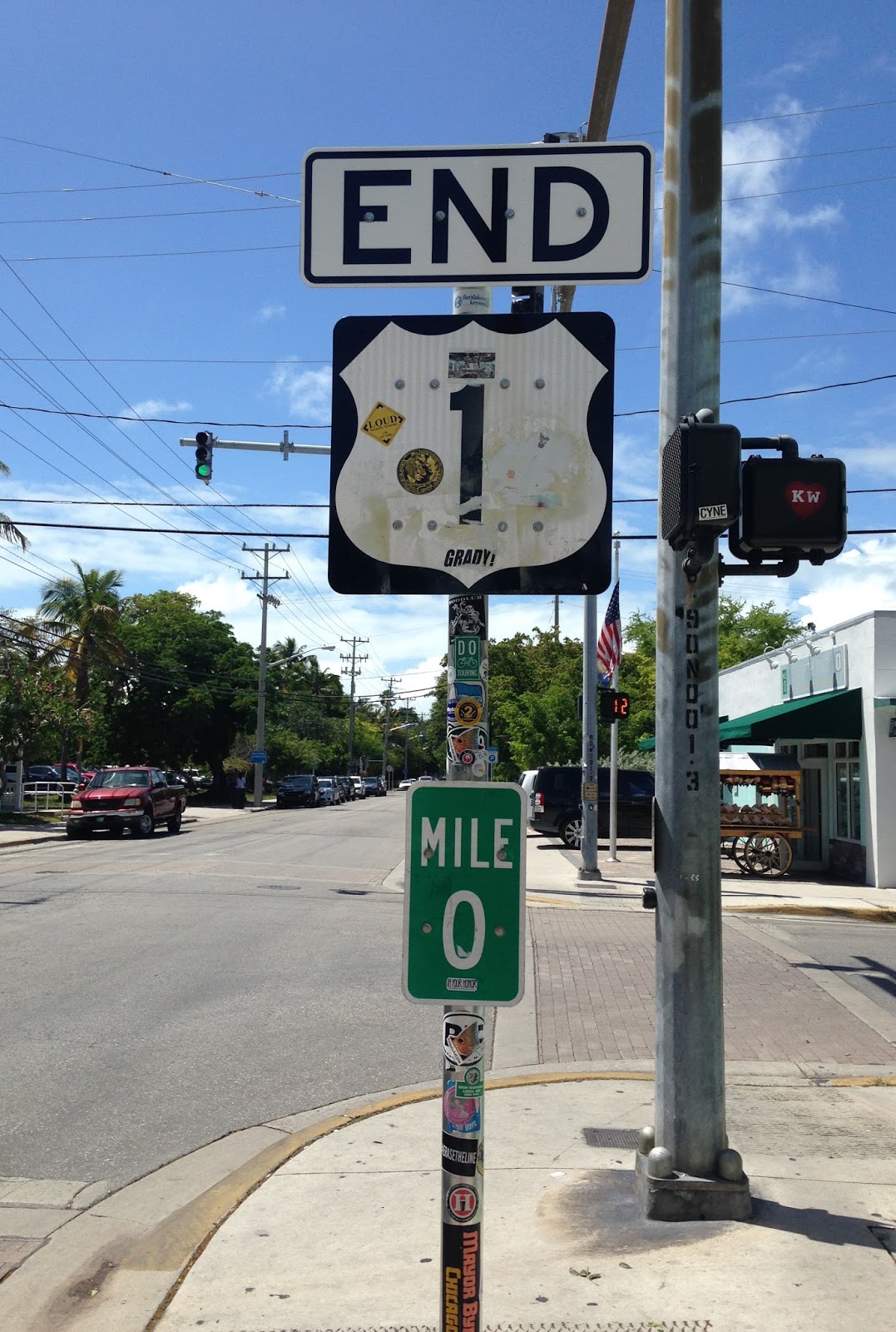
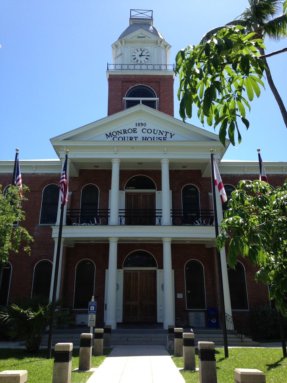
The Overseas Highway and US 1 end at mile marker 0 at the intersection of Whitehead Street and Flemming Street.

This is probably the tenth END, US 1, MM 0 assembly I've seen. The signage is stolen with alarming frequency.

The terminus for the Overseas Highway and US 1 makes sense considering it is located on the Monroe County Courthouse.

The beginning point for US 1 is signed way more ornately which I find oddly amusing.

I spent the rest of the afternoon walking through downtown Key West. I started out at Mallory Square to get some ice cream and walk the red brick streets.


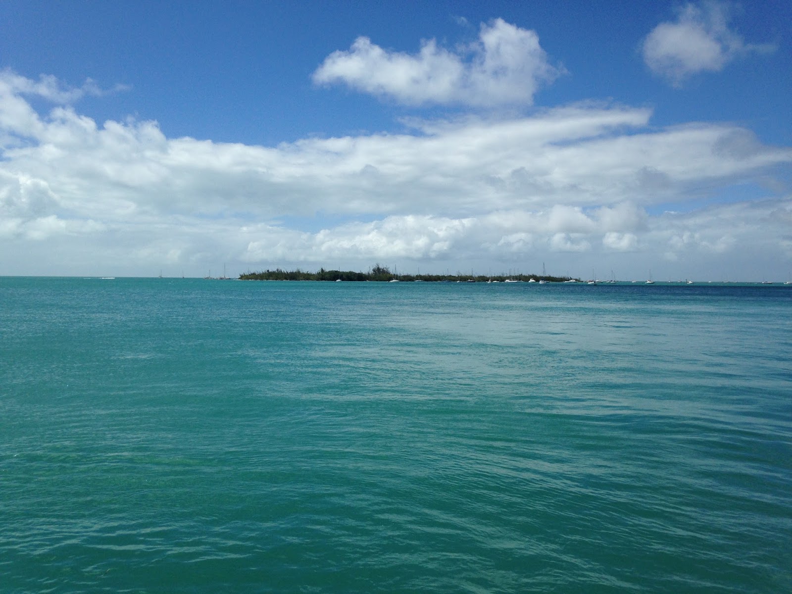
I ended up sitting over the waters looking over Tank Island which I suppose is technically now called Sunset Key. Tank Island was the location of Naval fuel tanks when diesel submarines used to be stationed in Naval Air Station Key West in Truman Annex. The submarines base was decomissioned in 1974 which led to most of Truman Annex and many other Naval properties in Key West being turned over to city control.


Wisteria Island has a bunch of house boats still surrounding it just to the north of Tank Island.
More scenery around Mallory Square.


I next looped through the city owned portion of Truman Annex to check out some of the former military housing.


I stopped at the Winter White House which became infamous due to it being frequently used by President Truman in 1946 and 1947. The Winter White House was originally constructed back in 1890 and was intended to First Officer's Quarters for Naval Station Key West. The Winter White House continued to be used by future presidents until the submarine base was decomissioned as stated previously.


I continued through Truman Annex and made my way down to the Southernmost Point on Whitehead Street. The buoy technically is slightly north of the radar station in Truman Annex over in Naval Station Key west but I'm not sure if that counts since the latter is on dredged land. Most of Truman Annex was constructed using landfill.


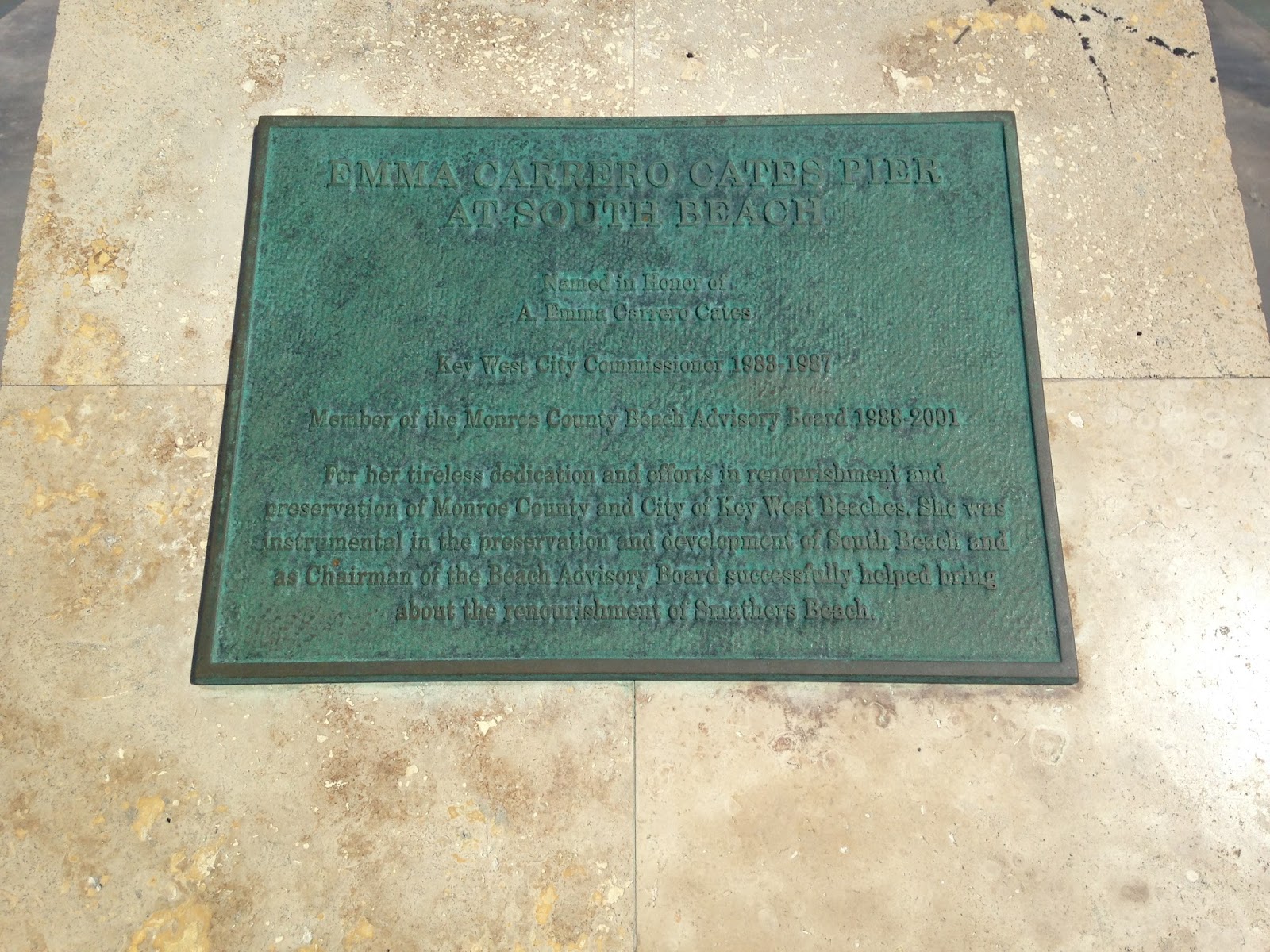
The rest of the afternoon was spent walking from the south end of Duval Street at the South Beach Pier north to Mallory Square. Duval Street is where the bulk of tourists stop in Key West as it hosts the majority of the bars and places to eat. Really it isn't my kind of place but I was staying at the La Concha which is the noted historical hotel on Duval Street which opened in 1926.


The following morning I made my way back up the Keys to Key Largo and pulled off on the alignment of FL 4a which was on Card Sound Road/CR 905. There was initially a heavy rain storm on Key Largo which isn't uncommon in the morning in the Florida Keys.


There is a Nike Missile Site somewhere on Card Sound Road but I've never been able to find it. As I mentioned near the beginning of the blog FL 4a and early US 1 used Card Sound Road. Card Sound Road apparently was used as the alignment of US 1 until a pipeline project in 1941 which was built on top of the Overseas Railroad right-of-way on the 18 Mile Stretch. Following the completion of the pipeline project US 1 was shifted onto the 18 Mile Stretch.
Oddly Card Sound Road is designated as CR 905 and CR 905A. CR 905 continues north to the tip of Key Largo, I find it odd that the 905A designation is the one that returns to the mainland.


The current Card Sound Bridge was apparently completed in 1969. The original Card Sound bridge was slated to open in 1926 but was delayed until 1928 due to hurricane damage. The original Card Sound Bridge was a wooden swing span which would be it's ultimate undoing. After US 1 was shifted onto the 18 Mile Stretch the Old Card Sound Bridge caught on fire in 1944 and was further damaged in a 1947 hurricane. Subsequently the Old Card Sound Bridge was removed and Card Sound Road largely became abandoned. It wasn't until the Islandia development in the 1960s that north Key Largo became to develop and the state became interested in building the current Card Sound Bridge. My understanding is that FL 905A was turned over to Monroe County some time in the 1980s.


The Card Sound Bridge Toll Booth is maintained by Monroe County and is currently $1 dollar to cross.

Card Sound Road ends at US 1 in Florida City. Suffice to say the weather going to Key West was much better than leaving. Either way I think that I really got the photo album of both the 1928 and 1938 Overseas Highways that I wanted.

I prepared a series of maps showing the difference in the alignment of the 1928 FL 4a Overseas Highway versus the Overseas Railroad. The maps start at Key West and progress northward to the mainland. I added notes regarding items of interest that have been discussed in this blog.


I found some maps of interest regarding US 1, FL 4a, and the Overseas Railroad. The 1914 map of Monroe County shows the recently completed Overseas Railroad.
1914 Monroe County Map
Most of the Overseas Railroad was completed by 1911 which is reflected on the Monroe County Map of the same year.
1911 Monroe County Map
Interestingly one of the routes the Florida East Coast Railroad considered for the Overseas Railroad was roughly along what became the Ingraham Highway in the Florida Everglades. Apparently the Overseas Railway would have crossed from Cape Sable to No Name Key. The 1907 map of Monroe County seems to be reflective of the Cape Sable plan.
1907 Monroe County Map
These maps from 1937 show FL 4a essentially with a complete route through the Middle Keys via the Overseas Railroad right-of-way.
1937 Road Map of the Lower Keys
1937 Road Map of the Middle and Upper Keys
The 1956 Florida State Highway Map shows the modern Overseas Highway alignment. Some interesting observations would include FL 939 being signed on Sugarloaf Key and an incomplete Card Sound Road being signed as FL 905.
1956 Florida State Highway Map
Keyshistory.org has been invaluable over the years in terms of helping me find information that helped me track down the original Overseas Highway. The website is a wonderful read that is full of historic photos. I would recommend the following pages regarding the history of the Overseas Highway.
History of the Overseas Highway
Construction of the 1928 Overseas Highway
Construction of the 1938 Overseas Highway
This page goes over the entire history of the Overseas Railroad. I don't think that I've really mentioned the railroad enough in this blog or the people involved in the construction of it. Suffice to say that Keyshistory can offer much more detail but one fact that I find amazing is that really that the Overseas Railroad was the dream of Henry Flagler. I don't think in modern times a single individual can have as much impact on an infrastructure project as Henry Flagler did with the Overseas Railroad. Construction of this scale would largely be impossible in the post 1972 EPA Act World.
Keyshistory on the Overseas Railroad
Updade 1/25/19: I did manage to find a 1931 Florida State Road map on David Rumsey which shows the full route of FL 4a.
1931 Florida State Road Map
Comments