My ultimate destination for the Washington trip was on the Kitsap Peninsula.

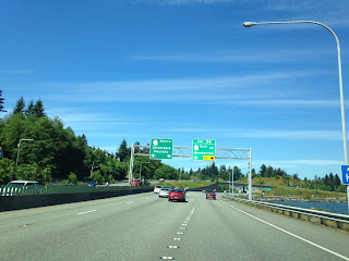
My hotel was WA 310 which I reached via WA 304 through downtown Bremerton. WA 310 is only 1.8 miles long and loops from WA 304 west to WA 3.

WA 310 was part of Primary State Highway 21 until it was renumbered in 1964. The entire highway is either on Kitsap Way or Callow Avenue. Oddly WA 310 is one of the few state highways I've completely clinched as I decided a run the following morning. My leg from still healing up from the tendon injury I mentioned during the Southeast trip but I felt good enough to try a solid 7-8 miles. After reaching WA 304 I took it east Burwell Street towards the Seattle-Bremerton Ferry. Instead of stopping at the Ferry I made my way up to the new Manette Bridge which opened in 2011. The new Manette Bridge replaced a steel truss span which was opened in 1930. The new bridge oddly only had one pedestrian lane but had some really nice views of the Olympic Range to the northwest.

The bridge in the background in the above picture is the Port Washington Narrows bridge on WA 303. The Port Washington Narrows Bridge dates back to 1958 and has a generally weathered appearance. Mount Rainier could be seen over the new Manette Bridge looking south and the Olympic Range over the Port Washington Narrows to the north.


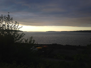
I didn't have a ton of time on the visit to Washington. Later in the day I drove north on WA 3 towards the northern part of the Kitsap Peninsula. Fortunately sundown is late in the day in Washington which allowed me a chance to check out the Hood Canal Floating Bridge and Port Gamble on WA 104.

The Hood Canal Bridge is the largest floating bridge in the world at a length of 7,869 feet and connects the Kitsap and Olympic Peninsulas. The Hood Canal Bridge was completed in 1961 and actually partially sunk in a hurricane force windstorm in 1979. Apparently the Hood Canal Bridge carries about 15,000-20,000 vehicles a day which obviously means there are substantial traffic problems when it closes to allow submarines pass. There was actually a small monument I found out on the Olympic side of the Hood Canal Bridge out in the weeds.


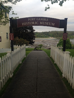
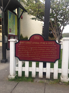
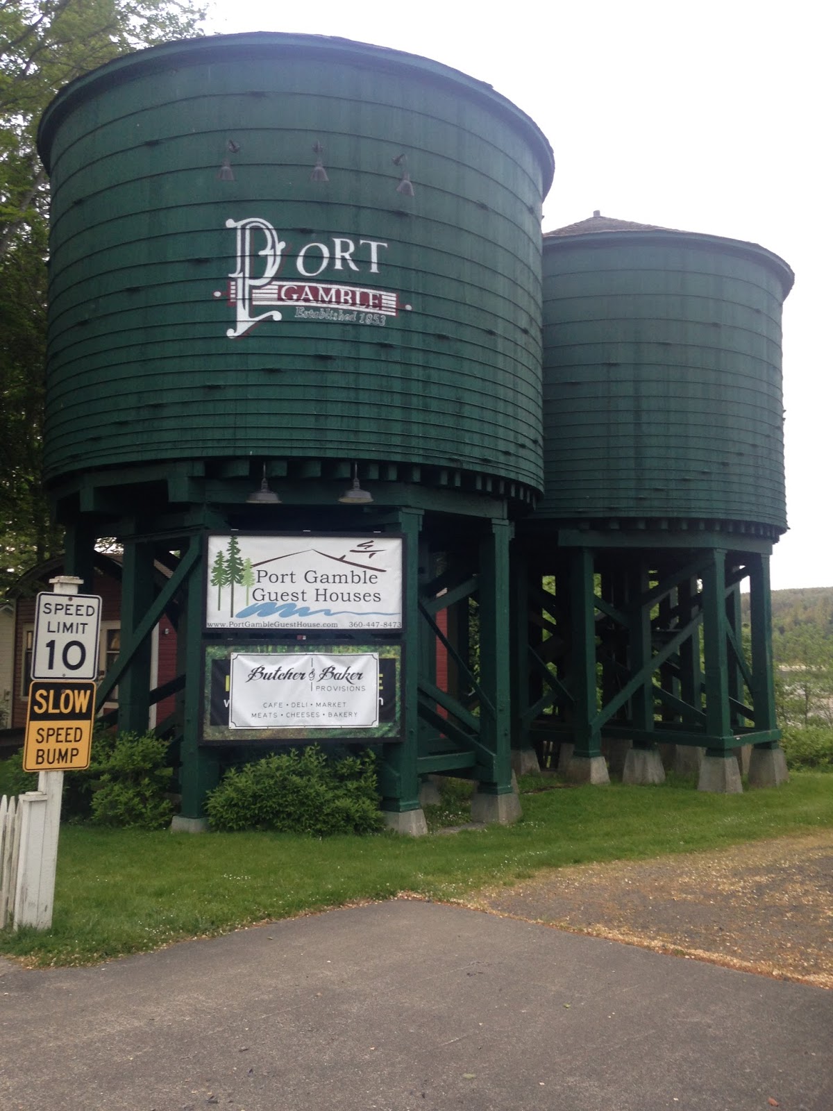
After returning to the Kitsap Peninsula I stayed on WA 104 east to Port Gamble. Port Gamble is a preserved lumber town which was founded in 1853. Port Gamble has a ton of historic buildings on Rainier Avenue along with placards which detail the history of the town and the lumbering industry. Logging actually operated continuously in Port Gamble until 1995 which the longest anywhere in the United States at the time.


Traveling back to my hotel I took WA 307 and WA 305 to get back to WA 3. I clinched WA 307 which is entirely on Bond Road and is only 5.25 miles long. Unlike many highways in the area WA 307 dates back to 1991 which obviously is well past the 1964 Washington State Highway renumbering.

The next morning I made my way back to SeaTac and departed back to California. Obviously I would have liked to traveled more in Washington State but the trip had come together fast and it was immediately after the 3,000 mile Southeast Trip. Back in 2015 I explored the state much more through, to that end I will touch on that trip some time this year if time permits.

My hotel was WA 310 which I reached via WA 304 through downtown Bremerton. WA 310 is only 1.8 miles long and loops from WA 304 west to WA 3.


WA 310 was part of Primary State Highway 21 until it was renumbered in 1964. The entire highway is either on Kitsap Way or Callow Avenue. Oddly WA 310 is one of the few state highways I've completely clinched as I decided a run the following morning. My leg from still healing up from the tendon injury I mentioned during the Southeast trip but I felt good enough to try a solid 7-8 miles. After reaching WA 304 I took it east Burwell Street towards the Seattle-Bremerton Ferry. Instead of stopping at the Ferry I made my way up to the new Manette Bridge which opened in 2011. The new Manette Bridge replaced a steel truss span which was opened in 1930. The new bridge oddly only had one pedestrian lane but had some really nice views of the Olympic Range to the northwest.

The bridge in the background in the above picture is the Port Washington Narrows bridge on WA 303. The Port Washington Narrows Bridge dates back to 1958 and has a generally weathered appearance. Mount Rainier could be seen over the new Manette Bridge looking south and the Olympic Range over the Port Washington Narrows to the north.


I didn't have a ton of time on the visit to Washington. Later in the day I drove north on WA 3 towards the northern part of the Kitsap Peninsula. Fortunately sundown is late in the day in Washington which allowed me a chance to check out the Hood Canal Floating Bridge and Port Gamble on WA 104.

The Hood Canal Bridge is the largest floating bridge in the world at a length of 7,869 feet and connects the Kitsap and Olympic Peninsulas. The Hood Canal Bridge was completed in 1961 and actually partially sunk in a hurricane force windstorm in 1979. Apparently the Hood Canal Bridge carries about 15,000-20,000 vehicles a day which obviously means there are substantial traffic problems when it closes to allow submarines pass. There was actually a small monument I found out on the Olympic side of the Hood Canal Bridge out in the weeds.


After returning to the Kitsap Peninsula I stayed on WA 104 east to Port Gamble. Port Gamble is a preserved lumber town which was founded in 1853. Port Gamble has a ton of historic buildings on Rainier Avenue along with placards which detail the history of the town and the lumbering industry. Logging actually operated continuously in Port Gamble until 1995 which the longest anywhere in the United States at the time.


Traveling back to my hotel I took WA 307 and WA 305 to get back to WA 3. I clinched WA 307 which is entirely on Bond Road and is only 5.25 miles long. Unlike many highways in the area WA 307 dates back to 1991 which obviously is well past the 1964 Washington State Highway renumbering.

The next morning I made my way back to SeaTac and departed back to California. Obviously I would have liked to traveled more in Washington State but the trip had come together fast and it was immediately after the 3,000 mile Southeast Trip. Back in 2015 I explored the state much more through, to that end I will touch on that trip some time this year if time permits.
Comments