
Back in January of 2017 I was looking to make a day trip out to Yosemite for the winter but California State Route 41 and the Wawona Road were under R2 chain restrictions. Given that I was driving a two wheel drive car at the time I headed out from the Central Valley early in the morning and took California State Route 140 through the Merced River Canyon to Yosemite Valley via the El Portal Road.
Present California State Route 140 ("CA 140") is a 102 mile east/west State Highway which originates at Interstate 5 near Gustine. CA 140 east of Merced enters the Sierra Nevada Mountains where it terminates at the El Portal Entrance to Yosemite National Park. Yosemite National Park presently signs CA 140 on the El Portal Road to the junction with the Big Oak Flat Road in Yosemite Valley.

Part 1; the history of El Portal Road and the Yosemite All-Year Highway
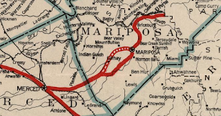
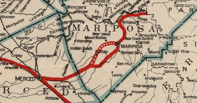
El Portal Road from El Portal east into Yosemite Valley partially follows a portion of the Old Coulterville Road. The Coulterville Road was one of the original franchise toll roads into Yosemite Valley which opened just before the Big Oak Flat Road in 1874. The Coulterville Road traversed the rugged terrain north of Merced River from Coulterville eastward before dropping to El Portal along the river itself. From El Portal the Coulterville Road ascended into Yosemite Valley. Given the alignment and haggard terrain the Coulterville Road traversed it quickly lost it's popularity to the Big Oak Flat Road which had a much more even decline grade into Yosemite Valley to the north. This 1883 Yosemite Area Topographical Map shows the Coulterville Road following the Merced River west out of Yosemite Valley.

The full route between Coulterville and El Portal can be seen on the 1935 California Division of Highways Map of Mariposa County. By 1935 the majority of traffic on the Coulterville Road appears to have been detouring via Foresta Road to El Portal.

Franchise toll roads were the order of the day in mid-19th Century California and the dispute of routes to Yosemite Valley is an intriguing one. On the blog below I touched on the disputes between the organizers of the Coulterville Road and Big Oak Flat Road.
History of the Big Oak Flat Road
On the article linked below I touched on more of the history of the Coulterville Road and explored much of what can be found today.
The Old Coulterville Road; the first road to Yosemite
The US Department of the Interior touched on the Coulterville Road substantially on a report about the Big Oak Flat Road.
US Department of the Interior Report on the Big Oak Flat Road
In time the north bank of the Merced River was used as part of the Yosemite Valley Railroad. The Yosemite Valley Railroad ran from Merced to El Portal from 1907 to 1945. A detailed history of the Yosemite Valley Railroad can be found at yosemitevalleyrailroad.com. From El Portal passengers arriving via the Yosemite Valley Railroad would take a stage into Yosemite Valley via El Portal Road and the Coulterville Road. The genesis of El Portal Road was the Yosemite Valley Railroad needed to construct a connecting road from their station in El Portal to the Coulterville Road. A detailed map of the Yosemite Valley Railroad route can be found on the link below.
Yosemite Valley Railroad Map
The below photos are sourced as a reference from a public post from Stan McQuown of the Yosemite History Facebook page. The photos are cited to be from a family trip via the Yosemite Valley Railroad and Coulterville Road in June of 1908. Note; the images below are intentionally snipped and reduced, I would encourage viewing the originals on the Yosemite History Facebook page.
The El Portal entrance of Yosemite National Park marque can be seen below. Yosemite Valley Railroad stages would begin their ascent towards the Coulterville Road from this marque.


Below The Gateway formation or "El Portal" on El Portal Road can be seen.

According to CAhighways the State Legislature during 1895 added a new State Highway from "the town of Mariposa in Mariposa County to Yosemite Valley." This new route was intended as a free wagon road which was to utilize the low elevations of the Merced River Canyon to reach Yosemite Valley. The 1895 act was intended as a survey and did not fund any construction endeavors. In 1909 a new State Highway between Merced and Mariposa was included in the 1909 First State Highway Bond Act and would in time become Legislative Route 18. Legislative Route 18 ("LRN 18") was extended during the 1916 Second State Highway Bond east from Mariposa to Yosemite incorporating the previous 1895 Legislatively defined highway. LRN 18 appears for the first time on the 1918 Division of Highways State Map as constructed from the Mariposa County Line east to Mariposa and with all other segments being shown as "proposed."

The July 1926 California Highways & Public Works declared the completion of the Yosemite All-Year Highway segment of LRN 18 along with a publicized opening to motorist travel on July 31st.


The completed LRN 18 between Merced and El Portal is seen on the 1928 Division of Highways State Map. Reportedly the opening of the Yosemite All-Year Highway led to a massive decline in ridership on the Yosemite Valley Railroad.

The November 1929 California Highways & Public Works noted oil mixing on the Yosemite All-Year Highway had been completed which rendered LRN 18 in good condition for winter travel. According to CAhighways.org LRN 18 was amended in 1929 to include the Big Oak Flat Road from the Yosemite National Park boundary near Crane Flat to LRN 40.

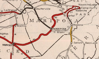
By 1932 a new alignment of LRN 18 north of what is now Old Highway in Mariposa County appears on the Division of Highways State Map. It appears the new route of LRN 18 was still under construction as Old Highway was clearly still under State Maintenance.
Old Highway is no longer shown as part of LRN 18 on the 1934 Division of Highways State Map nor the 1935 California Division of Highways Map of Mariposa County seen above. Note; according to CAhighways.org 1935 also saw the Legislative cancellation of the 1895 Mariposa-Yosemite Highway survey.
More regarding Old Highway in Mariposa County can be found on this article below:
Old Highway; Mariposa County
In the August 1934 California Highways & Public Works the Sign State Routes were announced. California State Route 140 ("CA 140") was assigned to LRN 18 from Merced to CA 120 by way of Yosemite National Park via the Big Oak Flat Road.


Originally in 1934 CA 140 had an implied route through Yosemite that exited the park to the Northwest via the Old Big Oak Flat Road. In 1940 part of new Big Oak Flat Road opened to traffic but the implied route of CA 140 continued to CA 120 northwest out of Yosemite National Park. The implied route of CA 140 on the Old Big Oak Flat Road can be observed on these maps below.


The 1935 Division of Highways Map of Tuolumne County shows in detail State Highway maintenance approaching the boundary of Yosemite National Park. The lower path is the route of CA 140 on the Big Oak Flat Road whereas the top path is CA 120 on the Tioga Pass Road. State maintenance of CA 140 on the Big Oak Flat Road is shown ending at the Crane Flat Ranger Station whereas CA 120 maintenance ends at the Aspen Valley Ranger Station. I marked the paths of CA 120 and CA 140 with shields for graphical clarity.

The below graphic illustrates the original alignments of CA 120/CA 140 on the Big Oak Flat and Tioga Pass Road. Red denotes the path of the Big Oak Flat Road whereas blue denotes the Tioga Pass Road.

Zooming in on the above graphic the original crossing over the South Fork Tuolumne River where CA 120 split from the Big Oak Flat Road onto the Tioga Pass Road can be seen.

In 1940 the current route of the Big Oak Flat Road in Yosemite National Park was opened between Crane Flat and Yosemite Valley. The Old Big Oak Flat Road from Tuolumne Grove to Yosemite Valley was largely converted into a one-way scenic alternate. In 1943 a large rock slide made the Old Big Oak Flat Road inaccessible to cars and a subsequent slide in 1945 took out the 16% grade descending into Yosemite Valley. Given that the newer and much better Big Oak Flat Road was unaffected Yosemite National Park decided to abandoned much of the Big Oak Flat Road. Notably 1943 also saw the Tioga Pass Road realigned which led to CA 140/LRN 18 from near Crane Flat along the Big Oak Flat Road to be annexed into CA 120/LRN 40. This action truncated to CA 140 to the El Portal Entrance of Yosemite National Park.
By 1938 CA 140 had been extended west via LRN 122 to CA 33 in Gustine which can be seen on the Division of Highways State Map.

LRN 122 had been adopted into the State Highway System during 1933 along what was known as River Road. LRN 122 moved off of River Road during 1937 when it definitively became a westward extension of CA 140. River Road in time would be become Sign County Route J18. A drive on Sign County Route J18 can be found on the article linked below.
Sign County Route J18 and possible pre-1937 California State Route 140
1943 saw the Tioga Pass Road realigned which led to CA 140/LRN 18 from near Crane Flat along the Big Oak Flat Road to be annexed into CA 120/LRN 40. This action truncated to CA 140 to the El Portal Entrance of Yosemite National Park. These changes can be seen on the 1944 Division of Highways State Map.

CA 140 first appears extended west of Gustine to Interstate 5 on the 1969 Division of Highways State Map.

Part 2; Yosemite National Park and El Portal Road in the winter of 2017
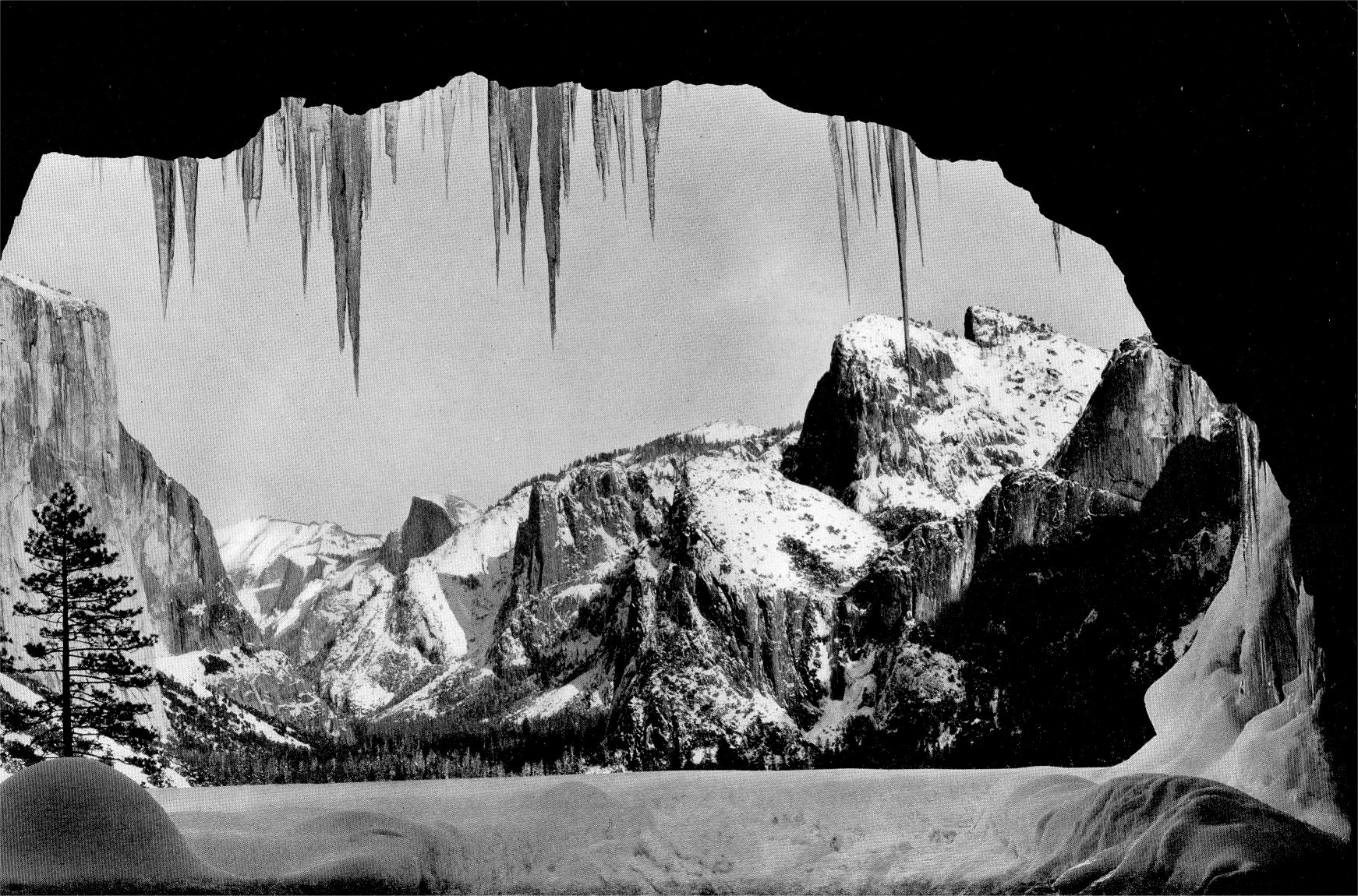
Returning to my winter trip to Yosemite during 2017 I oddly found Yosemite Valley wasn't under chain restrictions despite recent heavy snow. After having my fill of Yosemite Valley I tried my hand at replicating Ansel Adam's Wawona Tunnel View monochrome.

Ansel Adam's Wawona Tunnel View
Personally I think the Wawona Tunnel looks great covered in snow and ice.

Yosemite National Park has a weird interpretation of the California Highway Spade. I followed the signage leading to CA 140 and via El Portal Road.


Yosemite Valley is truly something to behold in a snowy winter.


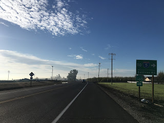
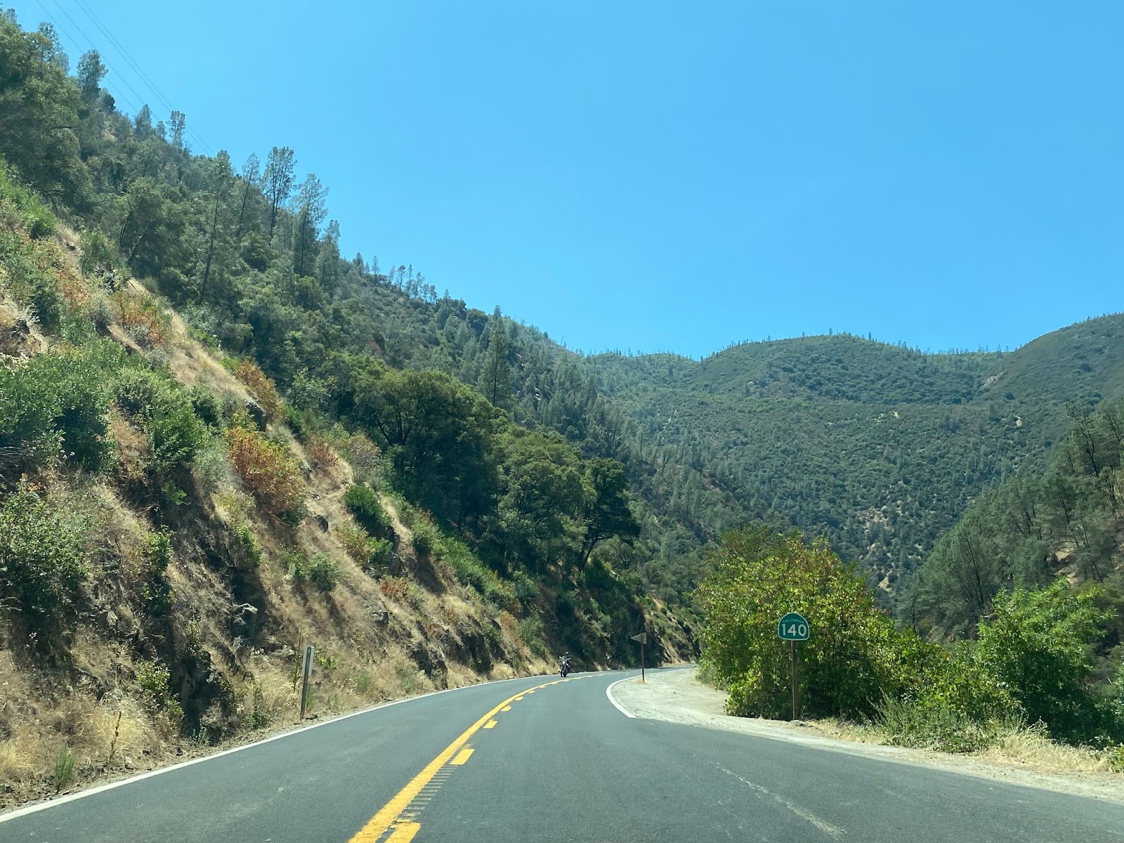
As the 9 mile long El Portal Road begins there is a CA 140 reassurance shield directing traffic west towards El Portal. Similarly CA 120 traffic is directed to take the Big Oak Flat Road towards Crane Flat.

El Portal Road carries a sustained 8% grade descending from Yosemite Valley. El Portal Road descends from approximately 4,000 feet above sea level in Yosemite Valley to approximately 1,950 feet above sea approaching El Portal in the Merced River Canyon.

The El Portal Road ends at CA 140 in El Portal where State Maintenance begins.

Part 3; a drive on California State Route 140
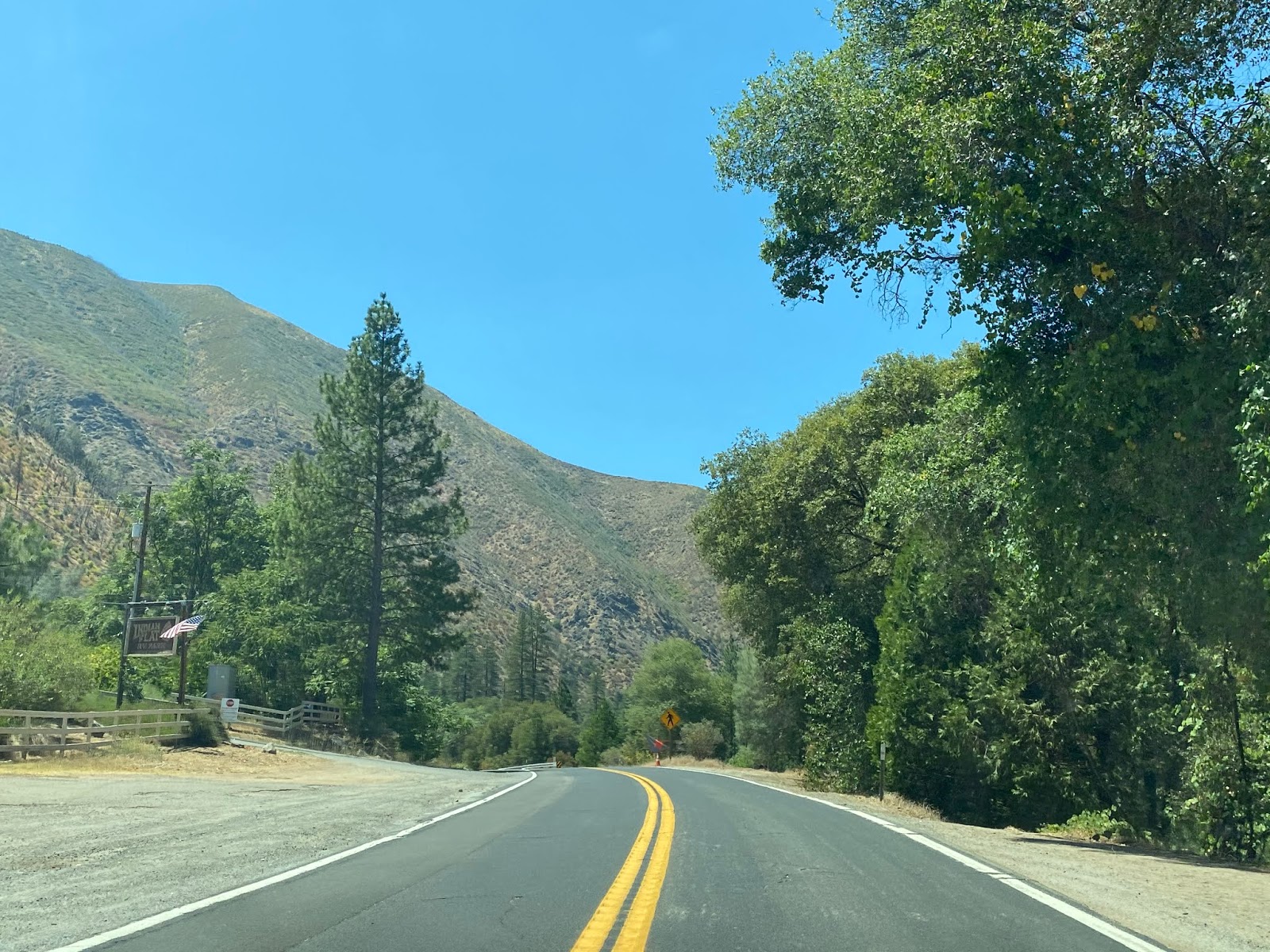
CA 140 westbound begins in El Portal and is signed with Scenic Highway placards. The start of CA 140 westbound is located within the boundary of Stanislaus National Forest.

CA 140 westbound in El Portal is signed as 30 miles from Mariposa.

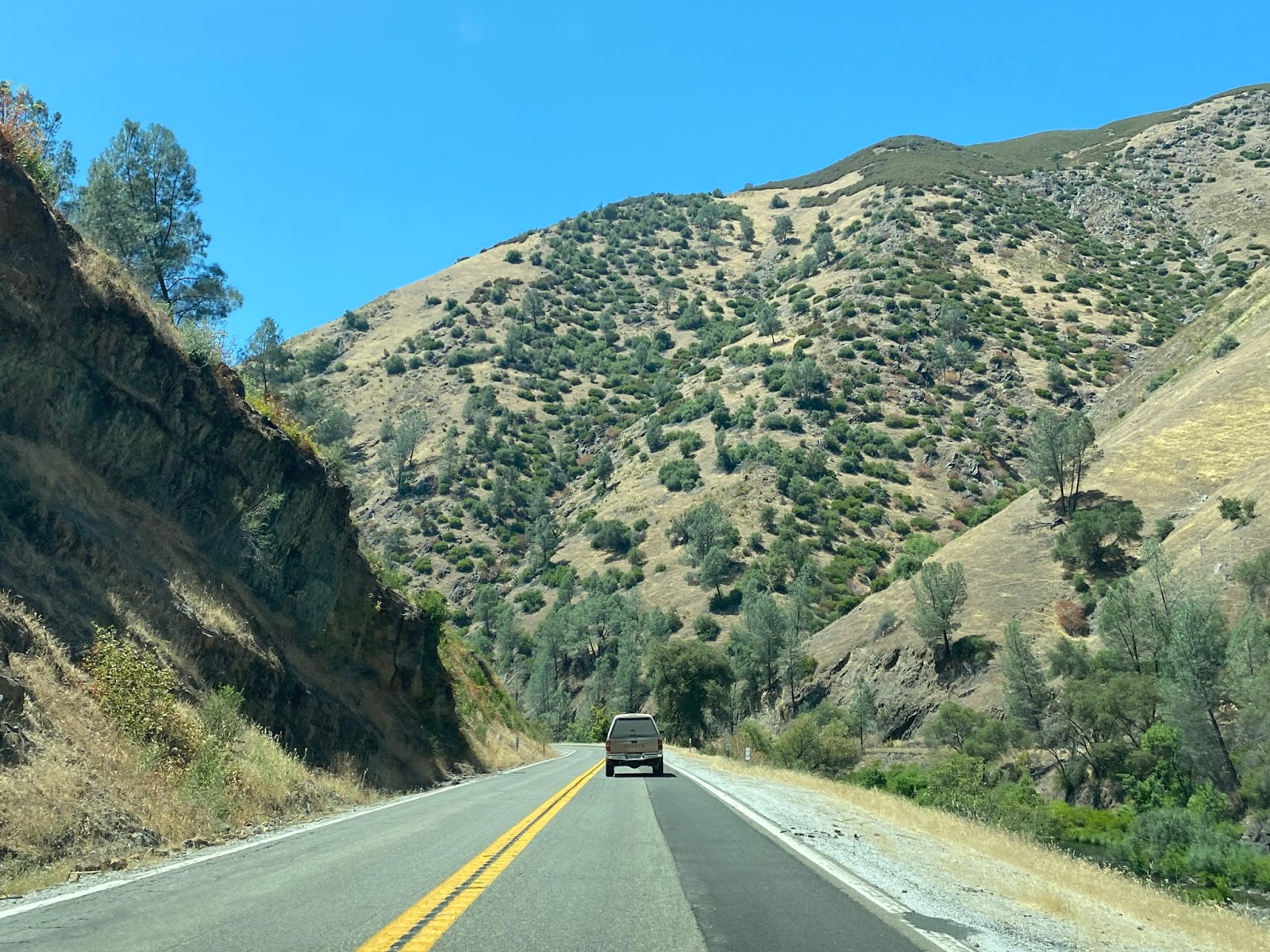
CA 140 westbound initially follows the north bank of the Merced River. The first point of interest in El Portal can be found at El Portal Road.


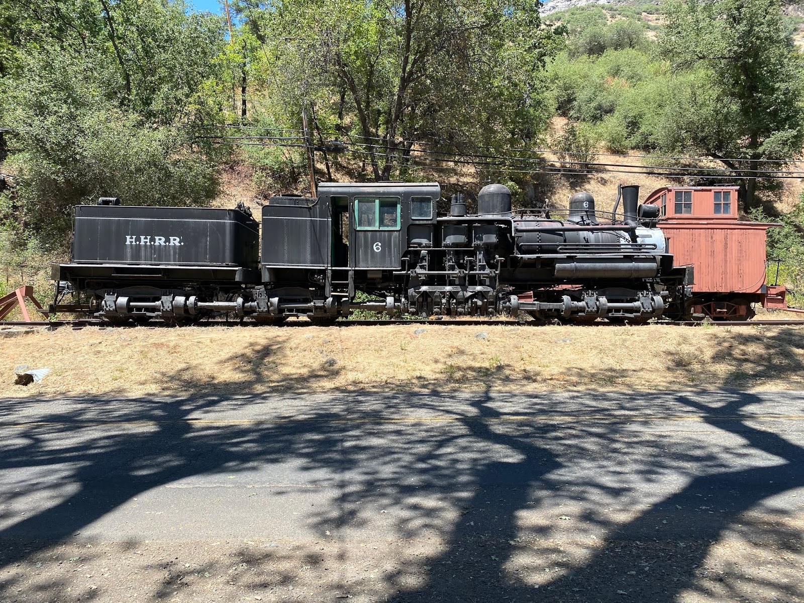
The Yosemite Conservancy has a railroad display at the end of El Portal Road. The display includes Hetch Hetchy Railroad Locomotive #6, Yosemite Valley Railroad Caboose #15, a Yosemite Railroad Valley Railroad turntable, and several of the siding building from the ghost town of Bagby. Bagby was a siding of the Yosemite Valley Railroad which is now located under the waters of Lake McClure.


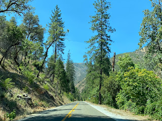
At Post Mile MPA 49.85 CA 140 westbound crosses over the Merced River Bridge to the south bank of the Merced River. The south bank of the Merced River is located within Sierra National Forest.


From El Portal CA 140 west traffic is advised there is 38 miles of curves ahead.


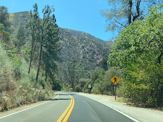
At the intersection of Foresta Road CA 140 west passes by the Red Bud Picnic Grounds.


Traffic west of the Red Bud Picnic Ground is advised that a traffic detour on CA 140 lies approximately 4 miles ahead.


Occasional Yosemite Valley Railroad trestles can be seen on the north bank of the Merced River on CA 140 west of El Portal. The one in the third photo below was incorporated into what is now Incline Road.


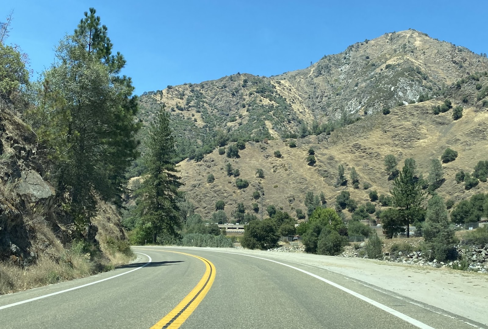
CA 140 west passes by the Indian Flat Day Use Area.


The weight limits of the Ferguson Slide Bridges can be seen on CA 140 west of Indian Flat.

CA 140 west passes by the Cedar Lodge.


West of the Cedar Lodge the ruins of the Clearinghouse Mine can be seen on the north bank of the Merced River. The Clearinghouse Mine had a Post Office apparently from 1913 through 1933.


CA 140 westbound crosses the South Fork Merced River at Post Mile MPA 43.24.


Immediately west of the South Fork Merced River along a bend is the location of the Ferguson Slide. The Ferguson Slide took out a large portion of CA 140 back in 2006. Temporary bridges put up in 2006 but those were replaced in 2008 by the current dual single lane Bailey spans. CA 140 temporarily is rerouted onto the Yosemite Valley Railroad Grade utilizing a one-way timed traffic light. Repairs on the Ferguson will apparently incorporate a rock shed and slated to begin during April of 2022.


CA 140 west of the Ferguson Slide crossings the Sweetwater Creek Bridge at Post Mile MER 37.84.


CA 140 west crosses the Slate Creek Bridge at Post Mile MPA 37.05.


CA 140 west continues along the Merced River to the Bear Creek Bridge where the Merced River Center can be found in Briceburg.


Briceburg was a siding of the Yosemite Valley Railroad and is where the 1926 Briceburg Bridge can be found. The Briceburg Bridge crosses the Merced River to the former grade of the Yosemite Valley Railroad.

The current Briceburg Bridge is a wooded suspension structure which replaced an earlier foot bridge in the same location circa 1926. The Briceburg Bridge was built to connect the Yosemite Valley Railroad siding facility of Briceburg on the north bank of the Merced River to the Yosemite All Year Highway on the south bank..


The Burma Grade offers an excellent vista of Briceburg Bridge, Merced River, Bear Creek Bridge, and the southward swing of CA 140 towards Mariposa. The Burma Grade itself is a high clearance road which climbs out of the Merced River Canyon to the Old Coulterville Road in Stanislaus National Forest. The Burma Grade is also known as Briceburg Road.


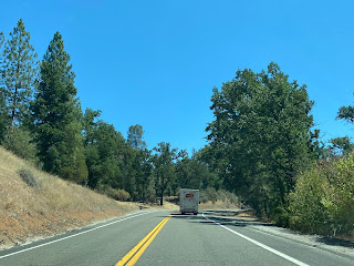
CA 140 westbound from Briceburg begins a steep climb out of the Merced River Canyon to Midpines.


CA 140 west from Midpines climbs to Midpines Summit located at 2,962 feet above sea level.


Approaching Mariposa CA 140 west begins a descent and intersects Old Highway (Old Legislative Route 18).


CA 140 west enters Mariposa and meets CA 49.


Mariposa was settled during the 1849 California Gold Rush and was located originally approximately 6 miles to the west along Aqua Fria Creek. Following floods and fires in the winter of 1849/50 the town site of Mariposa was moved east to Mariposa Creek where it presently stands. Mariposa County was one of the original counties in California created in 1850 and Mariposa was selected as the county seat in 1851. Originally Mariposa County was by far the largest county in California with it's jurisdiction stretching at least partially into modern day; Merced, Madera, Fresno, Tulare, Kings, Kern, San Benito, Inyo, Mono, San Bernardino, and Los Angeles Counties.
CA 140 west and CA 49 south multiplex through downtown Mariposa before breaking away at Mariposa Creek.


As noted above south of downtown Mariposa the original alignment of LRN 18 was on Old Highway. This map below shows the original alignment of LRN 18 over Old Highway compared to modern CA 140.


CA 140 continues west out of Merced on the 1937 LRN 122 alignment. There is a guide sign which shows Gustine 30 miles away and I-5 an additional 5 miles west from there. The guide sign is obstructed by local yard growth.


CA 140 westward has an almost straight grade 20 miles westward to a junction with CA 165.


Traffic on CA 140 westbound is notified at the CA 165 junction that the truck route ends 10 miles away in Gustine.

CA 140 westbound begins to wind through the terrain as it approaches the grass lands of the San Joaquin River. CA 140 enters Great Valley Grasslands State Park at the San Joaquin River.

At Los Banos Creek CA 140 westbound intersects the Kesterson Unit of the San Luis National Wildlife Refuge.

As CA 140 westbound progresses out of the San Joaquin River grasslands it approaches Santa Fe Grade Road which was intended to be used as a railroad line. The Santa Fe Grade Road traverses almost entirely unbroken largely as a dirt road southeast to South Dos Palos near CA 33.

CA 140 westbound emerges from the San Joaquin River grasslands at Gustine Municipal Airport and takes a direct westward swing crossing a set of rails where it meets CA 33. Oddly there is a CA 140 "Junction" shield which should display CA 33.


CA 140 westbound multiplexes CA 33 southbound through downtown Gustine on 4th Street, 6th Avenue, and South Avenue to Sullivan Road.


CA 140 westbound follows Sullivan Road five miles where it terminates at I-5.


Part 1; the history of El Portal Road and the Yosemite All-Year Highway
El Portal Road from El Portal east into Yosemite Valley partially follows a portion of the Old Coulterville Road. The Coulterville Road was one of the original franchise toll roads into Yosemite Valley which opened just before the Big Oak Flat Road in 1874. The Coulterville Road traversed the rugged terrain north of Merced River from Coulterville eastward before dropping to El Portal along the river itself. From El Portal the Coulterville Road ascended into Yosemite Valley. Given the alignment and haggard terrain the Coulterville Road traversed it quickly lost it's popularity to the Big Oak Flat Road which had a much more even decline grade into Yosemite Valley to the north. This 1883 Yosemite Area Topographical Map shows the Coulterville Road following the Merced River west out of Yosemite Valley.

The full route between Coulterville and El Portal can be seen on the 1935 California Division of Highways Map of Mariposa County. By 1935 the majority of traffic on the Coulterville Road appears to have been detouring via Foresta Road to El Portal.

Franchise toll roads were the order of the day in mid-19th Century California and the dispute of routes to Yosemite Valley is an intriguing one. On the blog below I touched on the disputes between the organizers of the Coulterville Road and Big Oak Flat Road.
History of the Big Oak Flat Road
On the article linked below I touched on more of the history of the Coulterville Road and explored much of what can be found today.
The Old Coulterville Road; the first road to Yosemite
The US Department of the Interior touched on the Coulterville Road substantially on a report about the Big Oak Flat Road.
US Department of the Interior Report on the Big Oak Flat Road
In time the north bank of the Merced River was used as part of the Yosemite Valley Railroad. The Yosemite Valley Railroad ran from Merced to El Portal from 1907 to 1945. A detailed history of the Yosemite Valley Railroad can be found at yosemitevalleyrailroad.com. From El Portal passengers arriving via the Yosemite Valley Railroad would take a stage into Yosemite Valley via El Portal Road and the Coulterville Road. The genesis of El Portal Road was the Yosemite Valley Railroad needed to construct a connecting road from their station in El Portal to the Coulterville Road. A detailed map of the Yosemite Valley Railroad route can be found on the link below.
Yosemite Valley Railroad Map
The below photos are sourced as a reference from a public post from Stan McQuown of the Yosemite History Facebook page. The photos are cited to be from a family trip via the Yosemite Valley Railroad and Coulterville Road in June of 1908. Note; the images below are intentionally snipped and reduced, I would encourage viewing the originals on the Yosemite History Facebook page.
The El Portal entrance of Yosemite National Park marque can be seen below. Yosemite Valley Railroad stages would begin their ascent towards the Coulterville Road from this marque.

The Yosemite Valley Railroad Depot in El Portal can be seen below.


According to CAhighways the State Legislature during 1895 added a new State Highway from "the town of Mariposa in Mariposa County to Yosemite Valley." This new route was intended as a free wagon road which was to utilize the low elevations of the Merced River Canyon to reach Yosemite Valley. The 1895 act was intended as a survey and did not fund any construction endeavors. In 1909 a new State Highway between Merced and Mariposa was included in the 1909 First State Highway Bond Act and would in time become Legislative Route 18. Legislative Route 18 ("LRN 18") was extended during the 1916 Second State Highway Bond east from Mariposa to Yosemite incorporating the previous 1895 Legislatively defined highway. LRN 18 appears for the first time on the 1918 Division of Highways State Map as constructed from the Mariposa County Line east to Mariposa and with all other segments being shown as "proposed."

The July 1926 California Highways & Public Works declared the completion of the Yosemite All-Year Highway segment of LRN 18 along with a publicized opening to motorist travel on July 31st.


The completed LRN 18 between Merced and El Portal is seen on the 1928 Division of Highways State Map. Reportedly the opening of the Yosemite All-Year Highway led to a massive decline in ridership on the Yosemite Valley Railroad.

The November 1929 California Highways & Public Works noted oil mixing on the Yosemite All-Year Highway had been completed which rendered LRN 18 in good condition for winter travel. According to CAhighways.org LRN 18 was amended in 1929 to include the Big Oak Flat Road from the Yosemite National Park boundary near Crane Flat to LRN 40.
By 1932 a new alignment of LRN 18 north of what is now Old Highway in Mariposa County appears on the Division of Highways State Map. It appears the new route of LRN 18 was still under construction as Old Highway was clearly still under State Maintenance.
Old Highway is no longer shown as part of LRN 18 on the 1934 Division of Highways State Map nor the 1935 California Division of Highways Map of Mariposa County seen above. Note; according to CAhighways.org 1935 also saw the Legislative cancellation of the 1895 Mariposa-Yosemite Highway survey.

More regarding Old Highway in Mariposa County can be found on this article below:
Old Highway; Mariposa County
In the August 1934 California Highways & Public Works the Sign State Routes were announced. California State Route 140 ("CA 140") was assigned to LRN 18 from Merced to CA 120 by way of Yosemite National Park via the Big Oak Flat Road.
Originally in 1934 CA 140 had an implied route through Yosemite that exited the park to the Northwest via the Old Big Oak Flat Road. In 1940 part of new Big Oak Flat Road opened to traffic but the implied route of CA 140 continued to CA 120 northwest out of Yosemite National Park. The implied route of CA 140 on the Old Big Oak Flat Road can be observed on these maps below.


The 1935 Division of Highways Map of Tuolumne County shows in detail State Highway maintenance approaching the boundary of Yosemite National Park. The lower path is the route of CA 140 on the Big Oak Flat Road whereas the top path is CA 120 on the Tioga Pass Road. State maintenance of CA 140 on the Big Oak Flat Road is shown ending at the Crane Flat Ranger Station whereas CA 120 maintenance ends at the Aspen Valley Ranger Station. I marked the paths of CA 120 and CA 140 with shields for graphical clarity.

The below graphic illustrates the original alignments of CA 120/CA 140 on the Big Oak Flat and Tioga Pass Road. Red denotes the path of the Big Oak Flat Road whereas blue denotes the Tioga Pass Road.

Zooming in on the above graphic the original crossing over the South Fork Tuolumne River where CA 120 split from the Big Oak Flat Road onto the Tioga Pass Road can be seen.

In 1940 the current route of the Big Oak Flat Road in Yosemite National Park was opened between Crane Flat and Yosemite Valley. The Old Big Oak Flat Road from Tuolumne Grove to Yosemite Valley was largely converted into a one-way scenic alternate. In 1943 a large rock slide made the Old Big Oak Flat Road inaccessible to cars and a subsequent slide in 1945 took out the 16% grade descending into Yosemite Valley. Given that the newer and much better Big Oak Flat Road was unaffected Yosemite National Park decided to abandoned much of the Big Oak Flat Road. Notably 1943 also saw the Tioga Pass Road realigned which led to CA 140/LRN 18 from near Crane Flat along the Big Oak Flat Road to be annexed into CA 120/LRN 40. This action truncated to CA 140 to the El Portal Entrance of Yosemite National Park.
By 1938 CA 140 had been extended west via LRN 122 to CA 33 in Gustine which can be seen on the Division of Highways State Map.

LRN 122 had been adopted into the State Highway System during 1933 along what was known as River Road. LRN 122 moved off of River Road during 1937 when it definitively became a westward extension of CA 140. River Road in time would be become Sign County Route J18. A drive on Sign County Route J18 can be found on the article linked below.
Sign County Route J18 and possible pre-1937 California State Route 140
1943 saw the Tioga Pass Road realigned which led to CA 140/LRN 18 from near Crane Flat along the Big Oak Flat Road to be annexed into CA 120/LRN 40. This action truncated to CA 140 to the El Portal Entrance of Yosemite National Park. These changes can be seen on the 1944 Division of Highways State Map.

CA 140 first appears extended west of Gustine to Interstate 5 on the 1969 Division of Highways State Map.

Part 2; Yosemite National Park and El Portal Road in the winter of 2017
Returning to my winter trip to Yosemite during 2017 I oddly found Yosemite Valley wasn't under chain restrictions despite recent heavy snow. After having my fill of Yosemite Valley I tried my hand at replicating Ansel Adam's Wawona Tunnel View monochrome.

Ansel Adam's Wawona Tunnel View
Personally I think the Wawona Tunnel looks great covered in snow and ice.

Yosemite National Park has a weird interpretation of the California Highway Spade. I followed the signage leading to CA 140 and via El Portal Road.


Yosemite Valley is truly something to behold in a snowy winter.


As the 9 mile long El Portal Road begins there is a CA 140 reassurance shield directing traffic west towards El Portal. Similarly CA 120 traffic is directed to take the Big Oak Flat Road towards Crane Flat.

El Portal Road carries a sustained 8% grade descending from Yosemite Valley. El Portal Road descends from approximately 4,000 feet above sea level in Yosemite Valley to approximately 1,950 feet above sea approaching El Portal in the Merced River Canyon.


The El Portal Road ends at CA 140 in El Portal where State Maintenance begins.

Part 3; a drive on California State Route 140
CA 140 westbound begins in El Portal and is signed with Scenic Highway placards. The start of CA 140 westbound is located within the boundary of Stanislaus National Forest.

CA 140 westbound in El Portal is signed as 30 miles from Mariposa.

CA 140 westbound initially follows the north bank of the Merced River. The first point of interest in El Portal can be found at El Portal Road.


The Yosemite Conservancy has a railroad display at the end of El Portal Road. The display includes Hetch Hetchy Railroad Locomotive #6, Yosemite Valley Railroad Caboose #15, a Yosemite Railroad Valley Railroad turntable, and several of the siding building from the ghost town of Bagby. Bagby was a siding of the Yosemite Valley Railroad which is now located under the waters of Lake McClure.


At Post Mile MPA 49.85 CA 140 westbound crosses over the Merced River Bridge to the south bank of the Merced River. The south bank of the Merced River is located within Sierra National Forest.


From El Portal CA 140 west traffic is advised there is 38 miles of curves ahead.


At the intersection of Foresta Road CA 140 west passes by the Red Bud Picnic Grounds.


Traffic west of the Red Bud Picnic Ground is advised that a traffic detour on CA 140 lies approximately 4 miles ahead.


Occasional Yosemite Valley Railroad trestles can be seen on the north bank of the Merced River on CA 140 west of El Portal. The one in the third photo below was incorporated into what is now Incline Road.


CA 140 west passes by the Indian Flat Day Use Area.


The weight limits of the Ferguson Slide Bridges can be seen on CA 140 west of Indian Flat.

CA 140 west passes by the Cedar Lodge.


West of the Cedar Lodge the ruins of the Clearinghouse Mine can be seen on the north bank of the Merced River. The Clearinghouse Mine had a Post Office apparently from 1913 through 1933.


CA 140 westbound crosses the South Fork Merced River at Post Mile MPA 43.24.


Immediately west of the South Fork Merced River along a bend is the location of the Ferguson Slide. The Ferguson Slide took out a large portion of CA 140 back in 2006. Temporary bridges put up in 2006 but those were replaced in 2008 by the current dual single lane Bailey spans. CA 140 temporarily is rerouted onto the Yosemite Valley Railroad Grade utilizing a one-way timed traffic light. Repairs on the Ferguson will apparently incorporate a rock shed and slated to begin during April of 2022.


CA 140 west of the Ferguson Slide crossings the Sweetwater Creek Bridge at Post Mile MER 37.84.


CA 140 west crosses the Slate Creek Bridge at Post Mile MPA 37.05.


CA 140 west continues along the Merced River to the Bear Creek Bridge where the Merced River Center can be found in Briceburg.


Briceburg was a siding of the Yosemite Valley Railroad and is where the 1926 Briceburg Bridge can be found. The Briceburg Bridge crosses the Merced River to the former grade of the Yosemite Valley Railroad.

The current Briceburg Bridge is a wooded suspension structure which replaced an earlier foot bridge in the same location circa 1926. The Briceburg Bridge was built to connect the Yosemite Valley Railroad siding facility of Briceburg on the north bank of the Merced River to the Yosemite All Year Highway on the south bank..


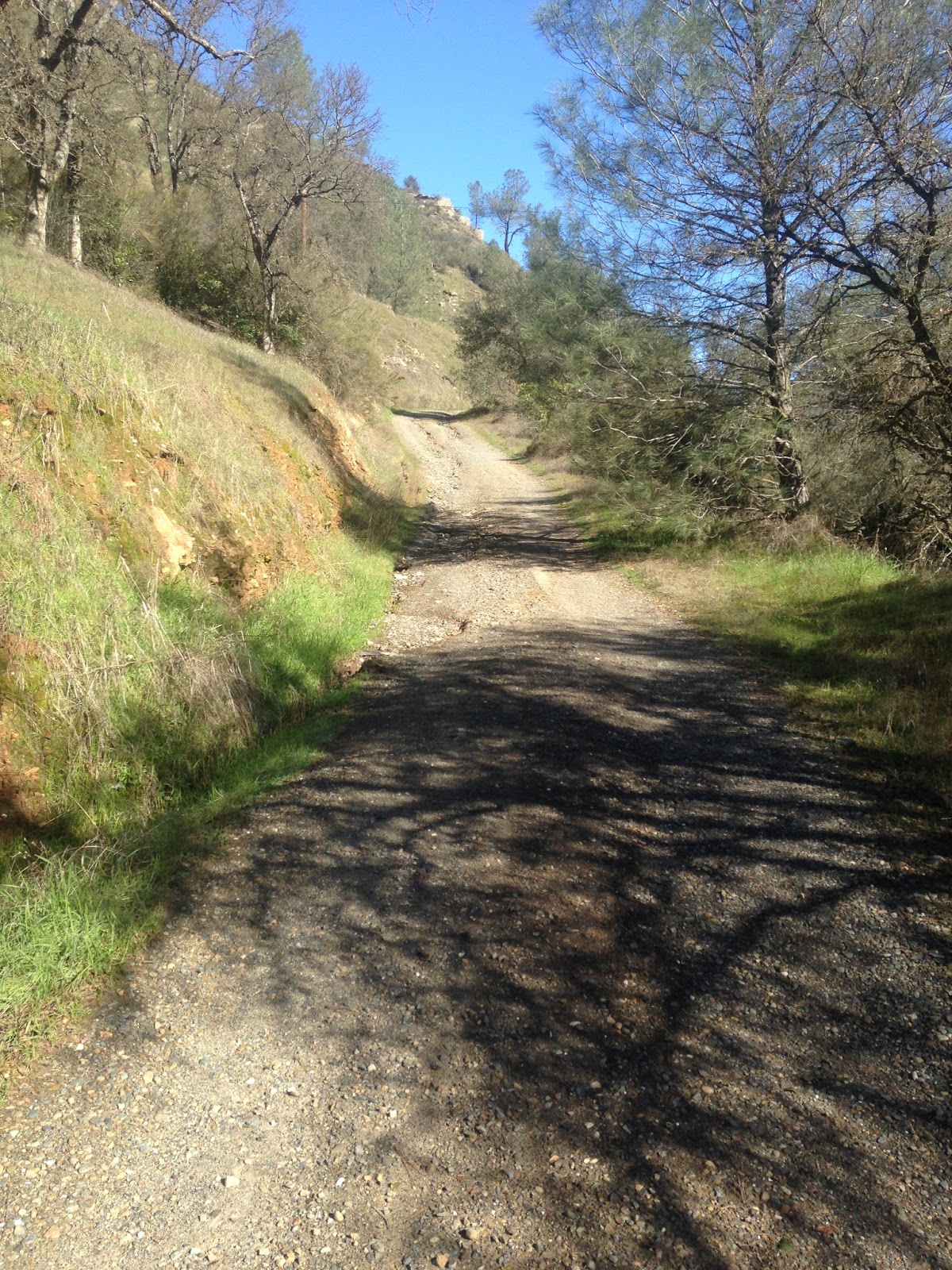
The Burma Grade offers an excellent vista of Briceburg Bridge, Merced River, Bear Creek Bridge, and the southward swing of CA 140 towards Mariposa. The Burma Grade itself is a high clearance road which climbs out of the Merced River Canyon to the Old Coulterville Road in Stanislaus National Forest. The Burma Grade is also known as Briceburg Road.


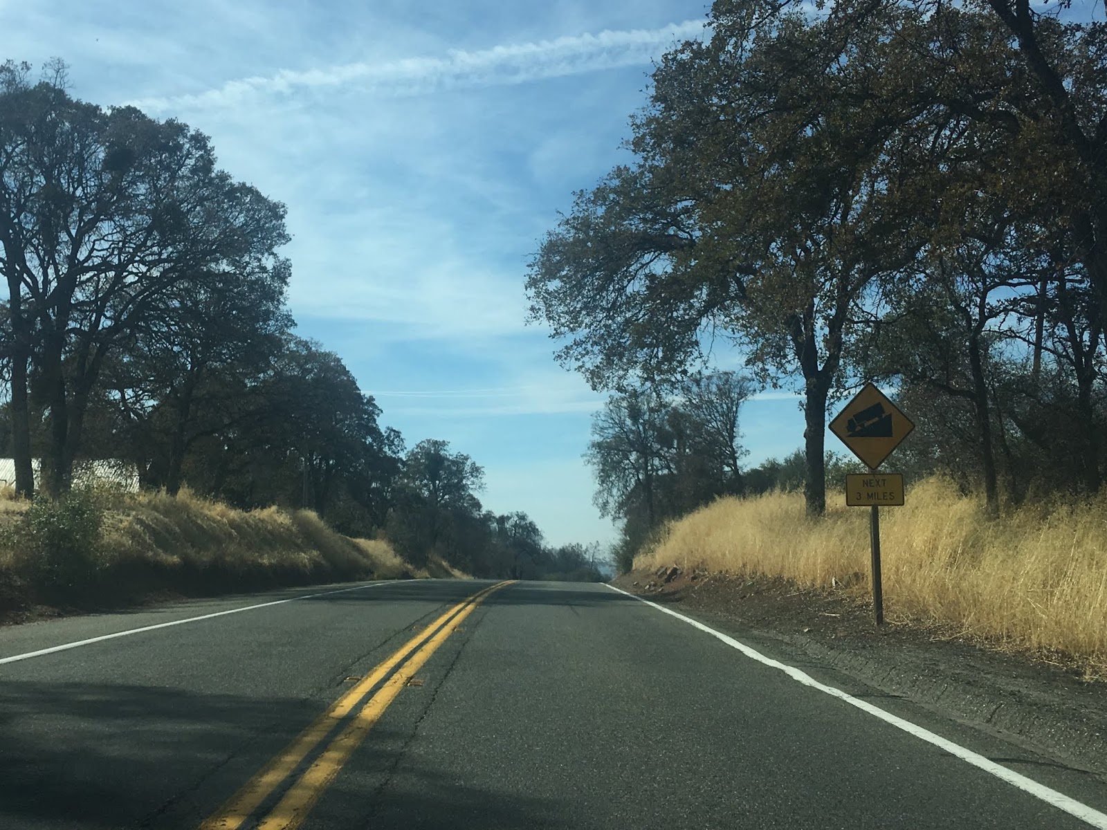
CA 140 westbound from Briceburg begins a steep climb out of the Merced River Canyon to Midpines.


CA 140 west from Midpines climbs to Midpines Summit located at 2,962 feet above sea level.


Approaching Mariposa CA 140 west begins a descent and intersects Old Highway (Old Legislative Route 18).


CA 140 west enters Mariposa and meets CA 49.


Mariposa was settled during the 1849 California Gold Rush and was located originally approximately 6 miles to the west along Aqua Fria Creek. Following floods and fires in the winter of 1849/50 the town site of Mariposa was moved east to Mariposa Creek where it presently stands. Mariposa County was one of the original counties in California created in 1850 and Mariposa was selected as the county seat in 1851. Originally Mariposa County was by far the largest county in California with it's jurisdiction stretching at least partially into modern day; Merced, Madera, Fresno, Tulare, Kings, Kern, San Benito, Inyo, Mono, San Bernardino, and Los Angeles Counties.
CA 140 west and CA 49 south multiplex through downtown Mariposa before breaking away at Mariposa Creek.


As noted above south of downtown Mariposa the original alignment of LRN 18 was on Old Highway. This map below shows the original alignment of LRN 18 over Old Highway compared to modern CA 140.

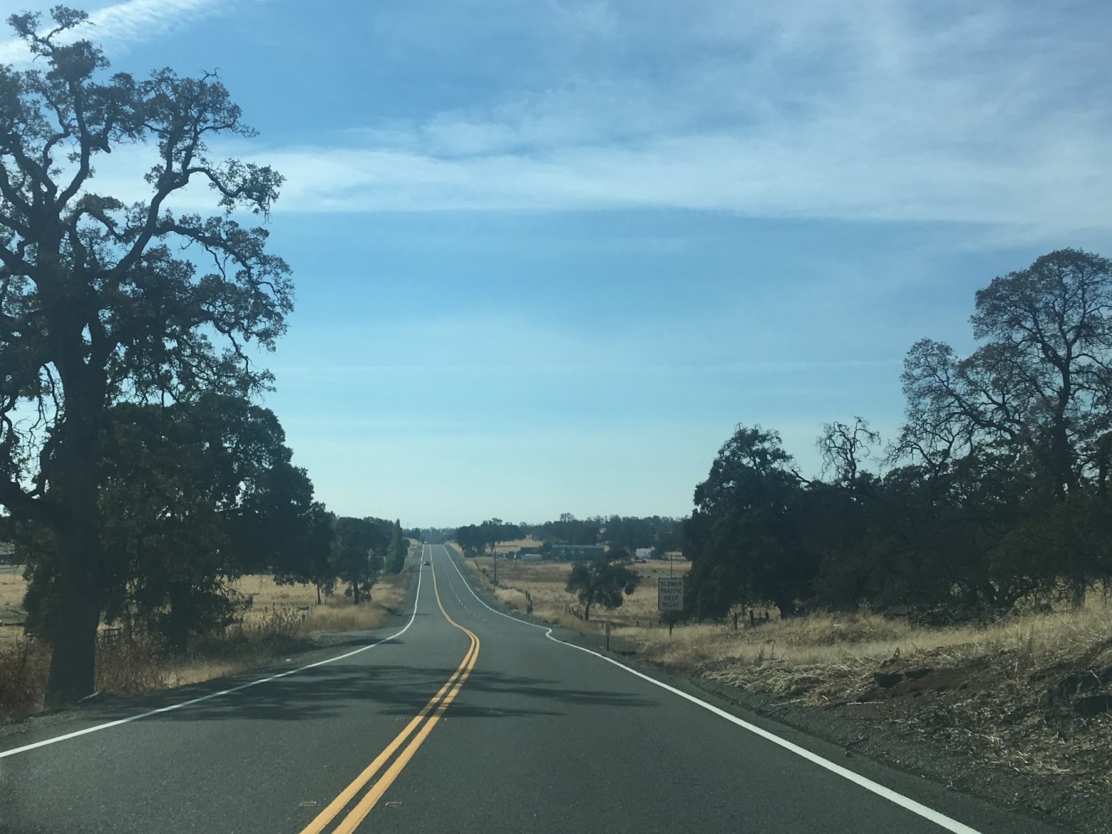
Catheys Valley is signed as 10 miles west of Mariposa on CA 140 and Merced is shown as 37 miles west.


CA 140 ascends a small summit with a passing lane before descending into McBrides Gulch.


In McBridges Gulch there is two historic markers for the Agua Fria ghost town on the westbound lane of CA 140.


Agua Fria was located just north of modern CA 140 along Agua Fria Road
in Mariposa County. Agua Fria is significant in that it was the first
County Seat of Mariposa County between 1850 to 1851 before it was moved
to Mariposa. Agua Fria apparently had two sections called "Upper" and
"Lower" Agua Fria which were centered around two springs. Apparently
the gold claims in Agua Fria quickly exhausted and frequent fires in the
1850s did the town in. Agua Fria apparently had Post Office Service
until 1862.
Agua Fria Road is located immediately west of the above monuments on CA 140 west.

At Postmile MPA 15.5 there is another passing zone on CA 140 westbound.


CA 140 westbound next intersects Mount Bullion Cut-Off Road which provides quick access to CA 49 to the north.

West of Mount Bullion Cut-Off Road CA 140 westbound begins to descend the Sierra Foothills into Catheys Valley. Catheys Valley is located at 1,325 feet above sea level.


In Catheys Valley CA 140 westbound passes by Catheys Valley County Park and intersects Hornitos Road. Hornitos Road continues north the village of Hornitos and Signed County Route J16.


CA 140 west of Hornitos Road opens up into another passing zone before intersecting the western end of Old Highway.

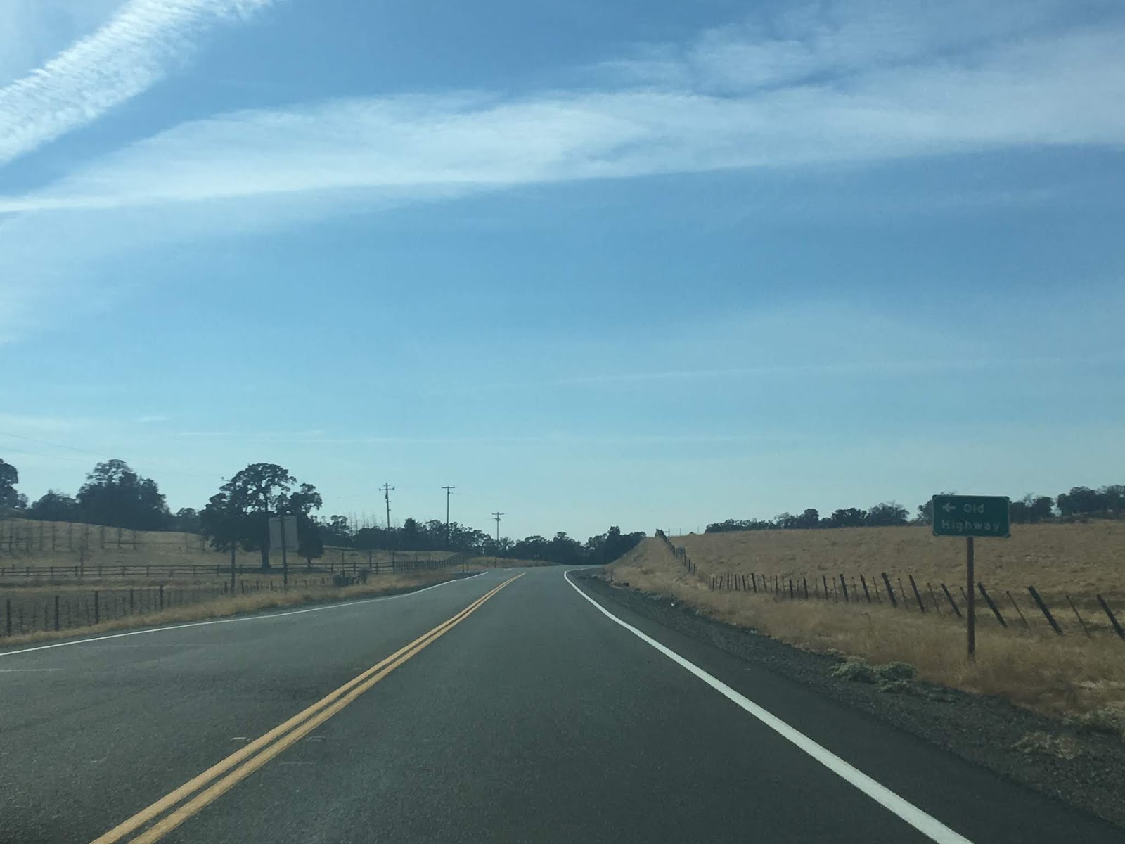
CA 140 westbound continues to snake through the terrain of the Sierra Foothills and crosses two small bridges from the 1920s. There is an obvious older alignment of LRN 18 which can be seen snaking the terrain next to modern CA 140.


CA 140 westbound opens up into another passing zone before reaching the Merced County Line.


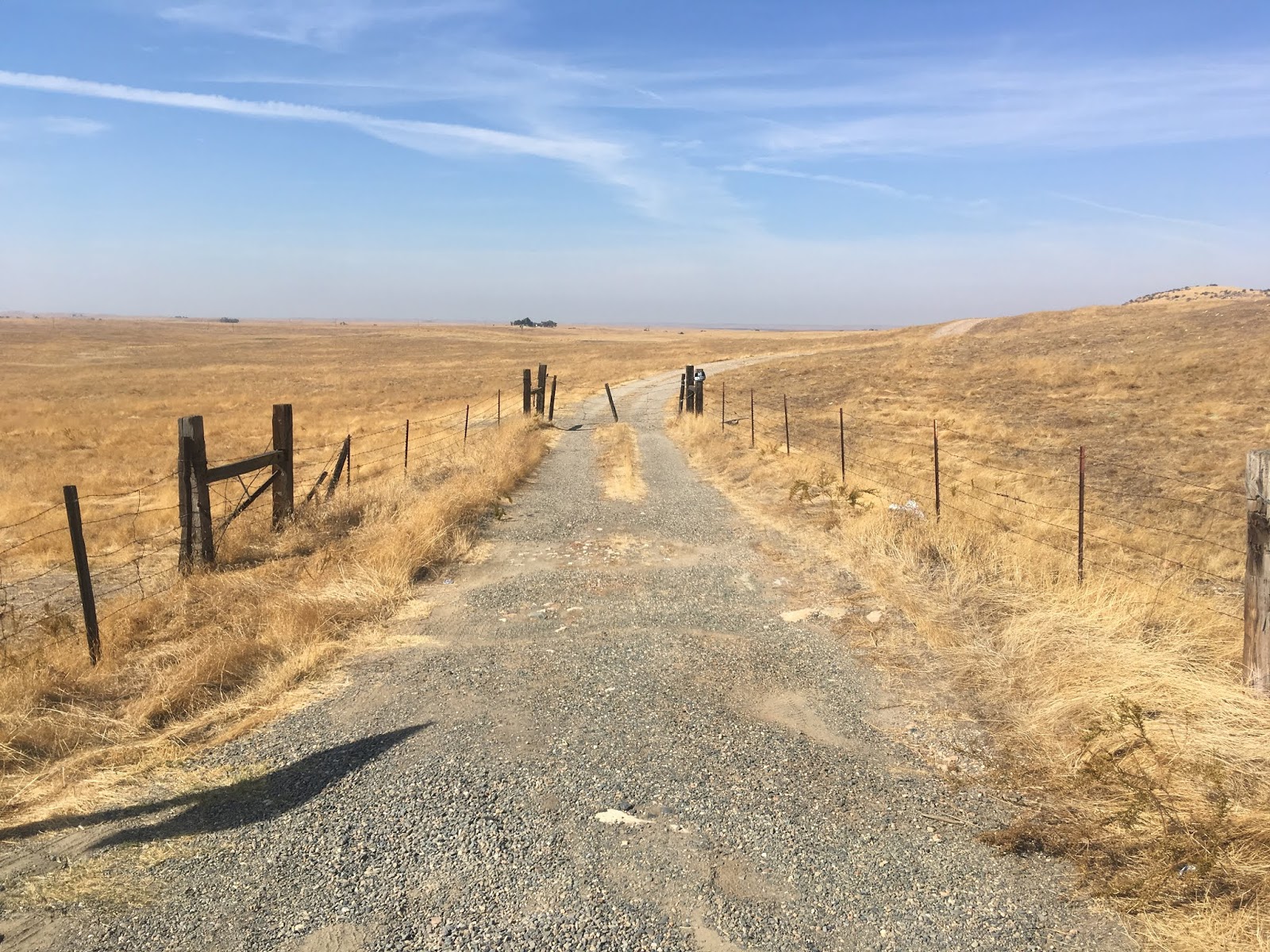
The Mariposa/Merced County line on CA 140 is notable due to it crossing over the former Stockton-Los Angeles Road. The Stockton-Los Angeles Road is at times called the Millerton Road and was created in 1853 during the Kern River Gold Rush to replace the El Camino Viejo. The Stockton-Los Angeles Road mostly stuck to the Sierra Foothills east of San Joaquin Valley whereas the El Camino Viejo stayed near the foothills of the Diablo Range roughly along modern CA 33. Looking north onto a ranch road on the former Stockton-Los Angeles Road alignment it isn't difficult to envision wagons traversing the landscape on the way to new gold claims.


West of the Stockton-Los Angeles Road CA 140 enters San Joaquin Valley and Planada. Planada dates back to the 1890s as a railroad siding originally under the name of Whitton.


CA 140 west of Planada is signed as the "Special Agent Richard Oules Memorial Highway." Merced is shown as 9 miles to the west and Gustine 40 miles west.


CA 140 westbound enters the City of Merced and crosses over the railroad at Santa Fe Avenue. Merced is the County Seat of Merced County and is one of the fastest growing cities in California.


CA 140 continues as a surface highway until meeting CA 99. CA 140 westbound jumps onto the CA 99 freeway and bypasses downtown Merced.

At exit 187B CA 99 north/CA 140 pick up CA 59 northbound CA 140 west and CA 59 north quickly exit the CA 99 freeway at Exit 188. CA 59 north turns right on V Street whereas CA 140 west turns left towards Gustine.


CA 140 continues west out of Merced on the 1937 LRN 122 alignment. There is a guide sign which shows Gustine 30 miles away and I-5 an additional 5 miles west from there. The guide sign is obstructed by local yard growth.


CA 140 westward has an almost straight grade 20 miles westward to a junction with CA 165.


Traffic on CA 140 westbound is notified at the CA 165 junction that the truck route ends 10 miles away in Gustine.

CA 140 westbound begins to wind through the terrain as it approaches the grass lands of the San Joaquin River. CA 140 enters Great Valley Grasslands State Park at the San Joaquin River.

At Los Banos Creek CA 140 westbound intersects the Kesterson Unit of the San Luis National Wildlife Refuge.

As CA 140 westbound progresses out of the San Joaquin River grasslands it approaches Santa Fe Grade Road which was intended to be used as a railroad line. The Santa Fe Grade Road traverses almost entirely unbroken largely as a dirt road southeast to South Dos Palos near CA 33.

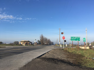
CA 140 westbound emerges from the San Joaquin River grasslands at Gustine Municipal Airport and takes a direct westward swing crossing a set of rails where it meets CA 33. Oddly there is a CA 140 "Junction" shield which should display CA 33.


CA 140 westbound multiplexes CA 33 southbound through downtown Gustine on 4th Street, 6th Avenue, and South Avenue to Sullivan Road.


CA 140 westbound follows Sullivan Road five miles where it terminates at I-5.


Comments
Thank you,
Darol