

Deep in the heart of New York State's Hudson Valley region, a landmark rehabilitation contract is now well underway that will help bring an aging and landmark suspension bridge back to life so it may continue to serve the residents of Kingston, NY and the surrounding area.
Built in 1921, the Wurts Street Suspension Bridge (sometimes also referred to as the Rondout Creek Bridge or the Kingston-Port Ewen Suspension Bridge) was the first major suspension bridge built in the Hudson Valley for automobile traffic. 100 years of wear & tear on the structure have taken their toll and after about 10 years of delay and negotiation, a comprehensive $45 million contract was awarded in 2021 that will see the structure restored and reopened to all modes of traffic. This contract, awarded by the New York State Department of Transportation (Region 8) and being executed by a contracting team led by A. Servidone/B. Anthony Construction Corp., is intended to accomplish a number of critical to-do list items for the structure.
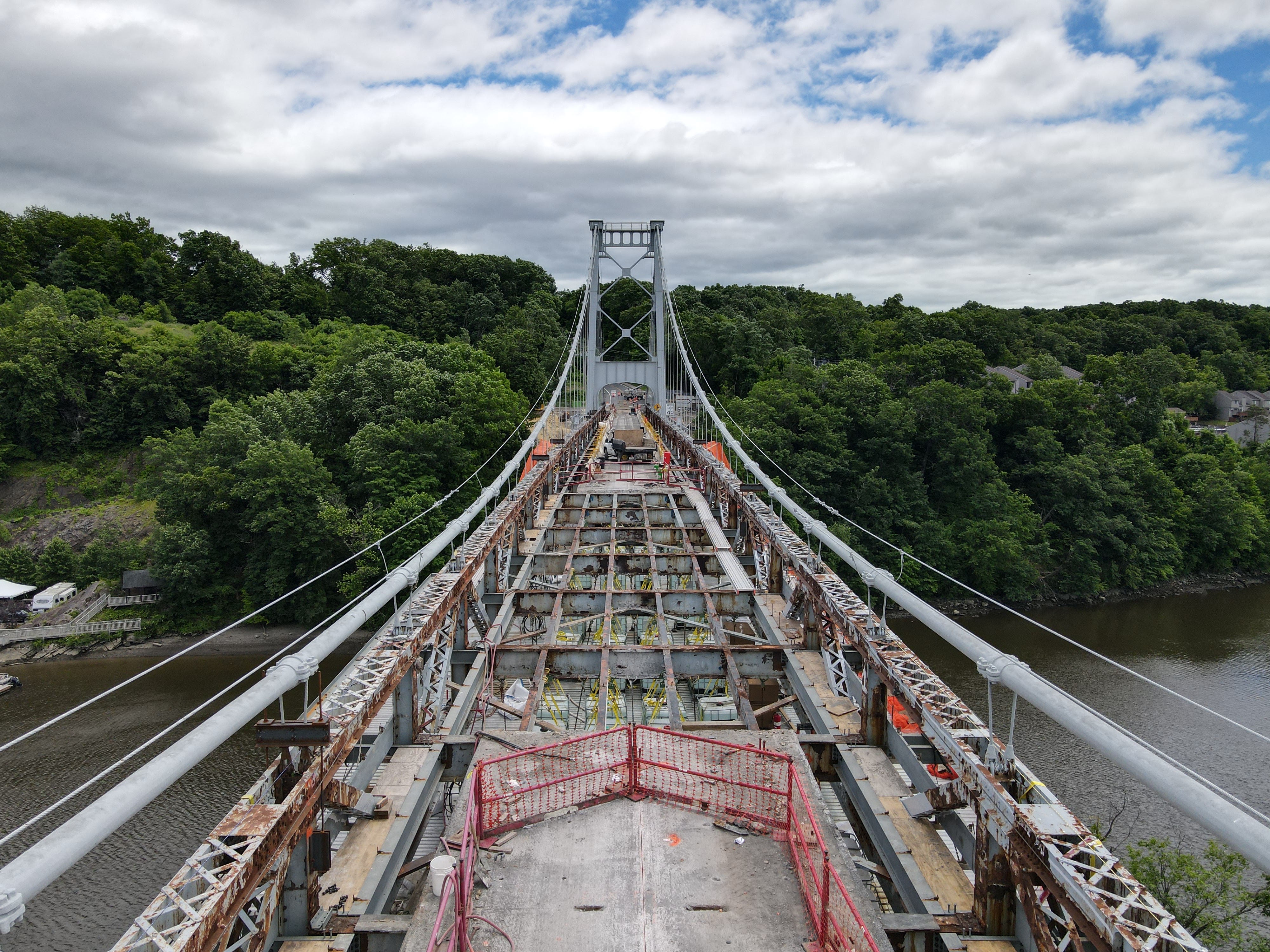
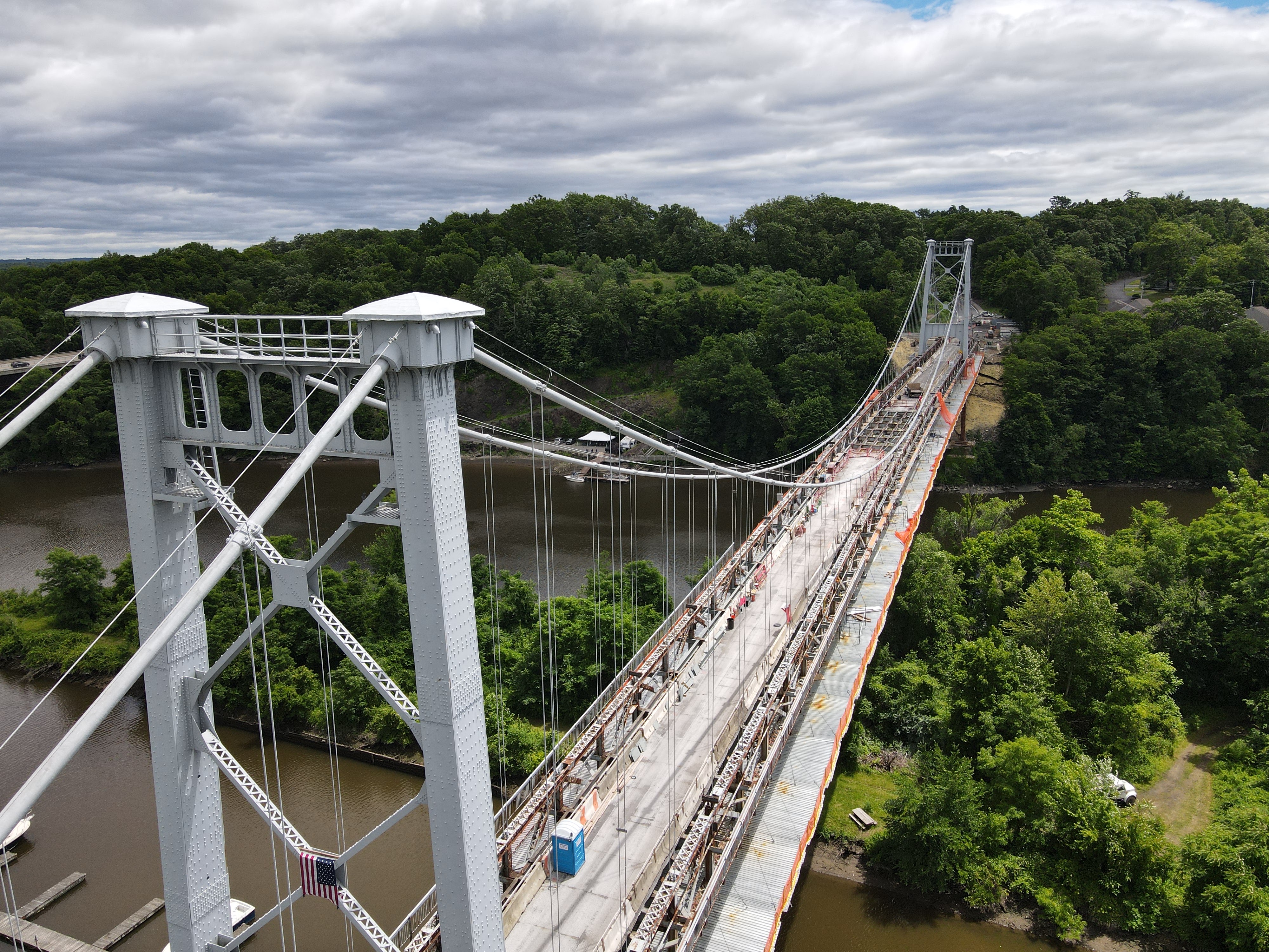
In what will be a first for a suspension bridge in the Hudson Valley, a dehumidification & monitoring system will be installed for the bridge's main cables. This system is designed to slow the introduction of moisture into the cable strands and delay/prevent the onset of corrosion into the cables in order to extend their lifespan. All structural steel components are to be refurbished with the removal of the original lead-based paint, the performance of select structural repairs to connections and other components, and the repainting of the entire superstructure from the roadway down to the foundations. New precast concrete "lightweight" deck panels are to be installed upon completion of steel repairs and this will result in a much lighter deck capable of being supported far easier by the bridge's cable system. Aside from the new dehumidification system, the bridge's cable support system will be further enhanced by the full replacement of all suspender ropes that link the main cables vertically with the roadway. All of the above-described work is planned for this contract, which has a deadline of late 2023 for full completion.
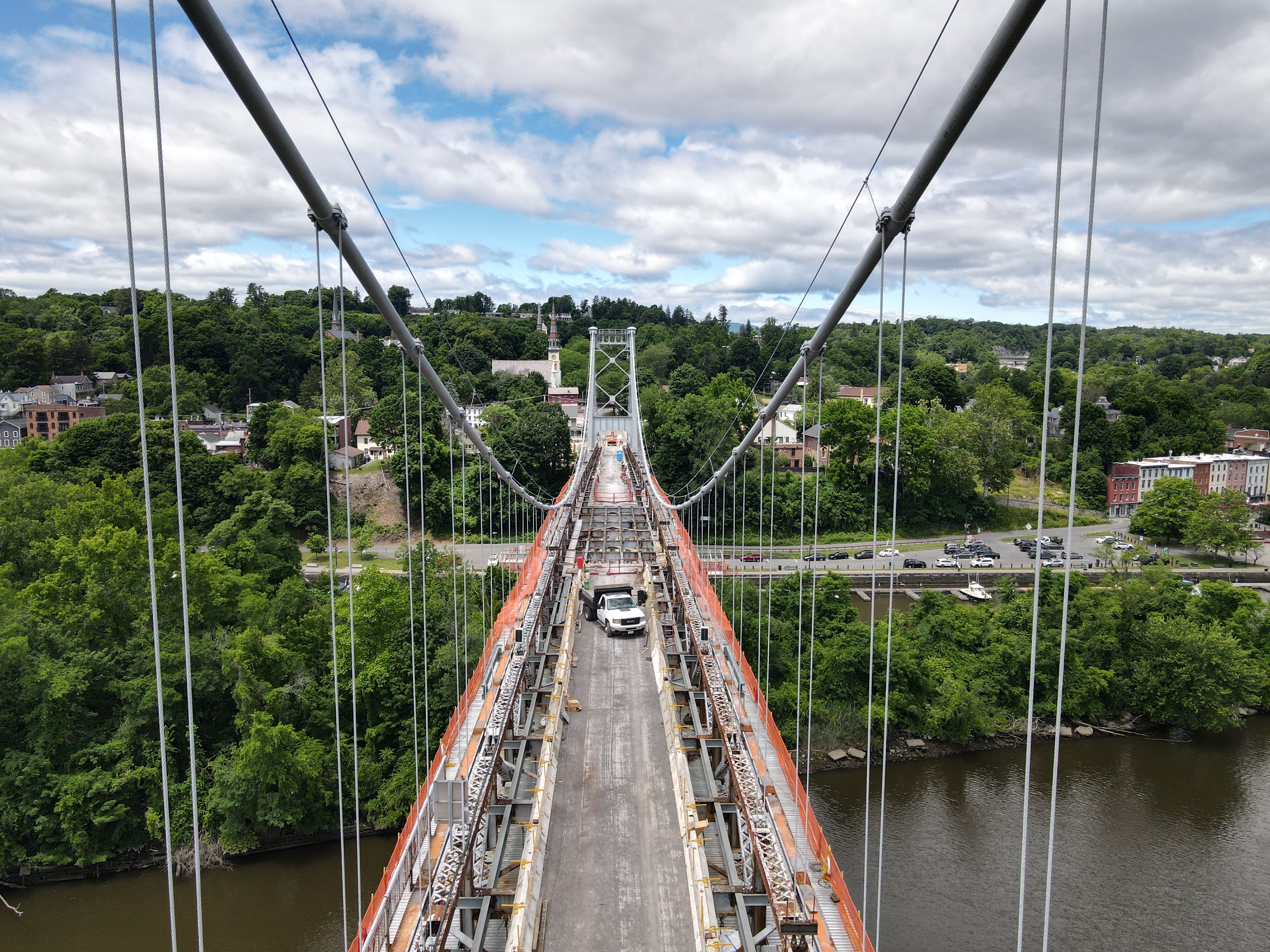

Above: The Wurts Street Suspension Bridge spans the Rondout Creek between Kingston and Port Ewen, NY. The bridge was once part of the original alignment for US Route 9W through Ulster County.
The clusure of the Wurts Street Bridge to all traffic for upwards of three years has not been without its concerns and issues among local residents. The bridge has always been a popular pedestrian route for residents on both sides of Rondout Creek. Furthermore, partial street closures on the Kingston side of the bridge have made travel in the immediate area of the bridge challenging, especially on weekends with folks flocking to the Rondout Creek waterfront for recreation & tourism purposes. Nevertheless, this investment in this historic bridge has been many years in the making and it is hoped that the project will be executed and completed satisfactorily so that bridge enthusiasts everywhere many once again enjoy this old classic.
The following pictures were taken by the author of this post using a DJI quadcopter drone. Always use proper judgment and situational awareness when flying in areas such as this. Click on each photo to see a larger version.


Comments