
Sunday River Covered Bridge - Newry, Maine


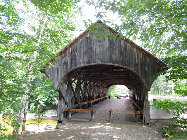
Located alongside the Sunday River Road in Newry, Maine, the Sunday River Covered Bridge spans 87 feet over the Sunday River. Also known as the Artist's Bridge, the Sunday River Covered Bridge was built by Hiram York in 1872 and a Paddleford through truss design was used for its construction. Now only open for pedestrian access, the last vehicle to cross the bridge was in 1958 when a parallel modern span was built alongside the covered bridge. While the bridge no longer serves traffic, it is still a good place for recreation, artistry and curiosity.

The Sunday River Covered Bridge is not the first bridge to be located at this spot in Newry. The first Sunday River Bridge was built in 1811, but was subject to frequent washouts, including a major one in 1869. When that bridge was rebuilt the following year, a windstorm destroyed the bridge again eight months later. Finding it was necessary to replace the bridge, the town of Newry voted on the construction of a covered bridge and selected Hiram York as its builder. With attention to the bridge's stability, York built the covered bridge using the Paddleford Truss construction that had become common among covered bridges in northern New England. The bridge was restored at the same time it was bypassed by the new bridge just downstream. The truss work of the bridge remains largely original, while the floorboards have been replaced over time.

So you may be wondering why the Sunday River Covered Bridge is also known as the Artist's Bridge. The covered bridge maintains a reputation as being the most photographed and painted of the historic covered bridges found across Maine. It has also been suggested that the name of Artist's Bridge came about because the artist John Enneking was observed working by the bridge on many days, painting in plein air. Enneking was an early American impressionist painter and he maintained a home in Newry. Many of his works featured landscape scenes of northern New England.

Today, the Sunday River Covered Bridge provides a scenic spot to peacefully enjoy the mountains of western Maine. After all, the Sunday River makes its way downstream from the Mahoosuc Range on its way to the Androscoggin River. You may find someone fishing in the river during your visit, or you may opt to detour to the bridge after a day of skiing at the nearby Sunday River ski resort. In all, I rather enjoyed my visit to this bridge.

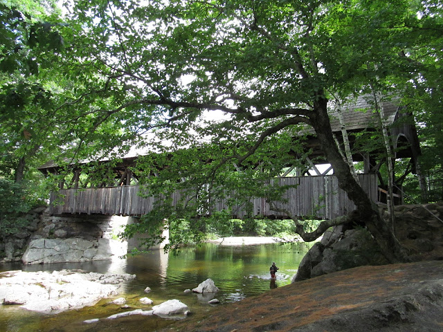
The Sunday River Covered Bridge makes for a good fishing spot.

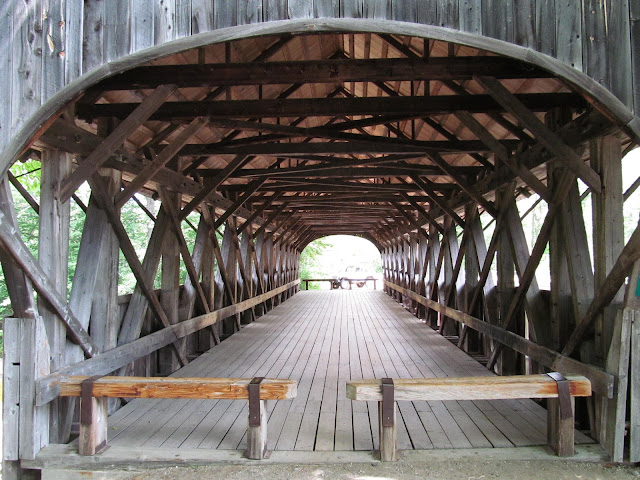
A look inside the covered bridge.
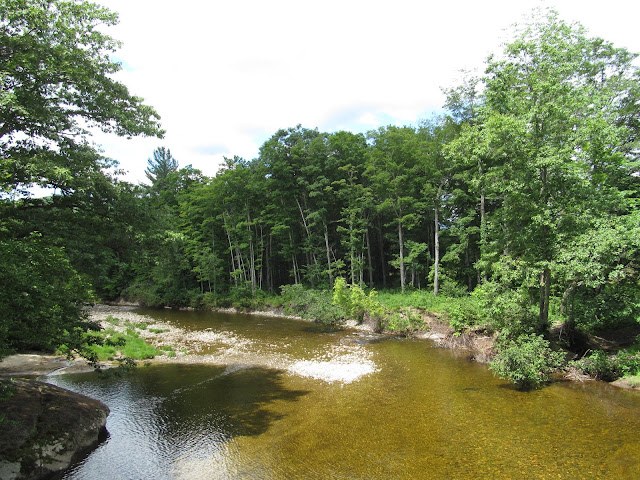
Sunday River.


How to Get There:


Sources and Links:
Maine Department of Transportation - Sunday River Bridge (Artist's Covered Bridge), Newry, Maine
Society of Architectural Historians - Sunday River Covered Bridge
Bridgehunter.com - Artist's Bridge 19-09-04
Atlas Obscura - Artist's Bridge
Scenic USA - Maine - Sunday River Bridge
Maine Magazine - Beloved by Artists

Comments

Popular posts from this blog

North Carolina Continues to Move Forward with Rail

2023 and the first half of 2024 have seen continued growth in North Carolina's passenger rail system.  From increased daily trains from Raleigh to Charlotte, federal funds for studying additional corridors, and receiving a historic grant to begin the construction of high-speed rail between Raleigh and Richmond, the last 18 months have been a flurry of activity at NCDOT's Rail Division.  And that's just the tip of the iceberg. As ridership and routes increase - the engine of North Carolina passenger rail trains will become a more common sight. (Adam Prince) Increased Passenger Train Service: On July 10, 2023, a fourth Piedmont round-trip rail service between Raleigh and Charlotte commenced.  The four Piedmont trains plus the daily Carolinian (to Washington, DC, and New York) bring the total of trains serving the two cities daily to five. The current daily Piedmont and Carolinian schedule between Charlotte and Raleigh (NCDOT) The result was over 641,000 passengers utilized pa

US Route 101 in Benbow, Garberville and Redway

The communities of Benbow, Garberville and Redway can all be found along US Route 101 within southern Humboldt County.  The former surface alignment of US Route 101 in Garberville and Redway once crossed the Garberville Bluffs along what is now Redwood Drive via a corridor constructed as part of the Redwood Highway during the 1910s.  US Route 101 through Benbow, Garberville and Redway was modernized by 1935.  US Route 101 would eventually be upgraded to freeway standards in Benbow, Garberville and Redway by extension of the Redwood Freeway during 1966-68.  As the cover photo the original grade of US Route 101 and the Redwood Highway can be seen at the Garberville Bluffs during 1934.  US Route 101 can be seen in the communities of Benbow, Garberville and Redway on the 1935 Division of Highways Map of Humboldt County .   The history of US Route 101 in Benbow, Garberville and Redway Benbow, Garberville and Redway lie on the banks of the South Fork Eel River of southern Humboldt County.  D

The Midway Palm and Pine of US Route 99

Along modern day California State Route 99 south of Avenue 11 just outside the City limits of Madera one can find the Midway Palm and Pine in the center median of the freeway.  The Midway Palm and Pine denotes the halfway point between the Mexican Border and Oregon State Line on what was US Route 99.  The Midway Palm is intended to represent Southern California whereas the Midway Pine is intended to represent Northern California.  Pictured above the Midway Palm and Pine can be seen from the northbound lanes of the California State Route 99 Freeway.   This blog is part of the larger Gribblenation US Route 99 Page.  For more information pertaining to the other various segments of US Route 99 and it's three-digit child routes check out the link the below. Gribblenation US Route 99 Page The history of the Midway Palm and Pine The true timeframe for when the Midway Palm and Pine (originally a Deadora Cedar Tree) were planted is unknown.  In fact, the origin of the Midway Palm and Pine w