Through my travels this past decade one of the more frequent highways I've driven in Northern California has been California State Route 36.

California State Route 36 ("CA 36") is a lengthy 250 mile east/west State Highway. CA 36 begins at US Route 101 in Alton of Humboldt County and crosses the Coast Ranges to Red Bluff in Sacramento Valley. From Sacramento Valley CA 36 continues east via the dividing line of the Sierra Nevada Mountains and Cascade Mountains to US Route 395 near Susanville. CA 36 passes through the Counties of; Humboldt, Trinity, Shasta, Tehama, Plumas, and Lassen over it's 250 mile alignment.

Part 1; the history of California State Route 36
The origins of CA 36 date back to the era of the California Gold Rush. Specifically what is now CA 36 between Red Bluff east to Susanville was constructed during the 1860s as a part of two wagon routes according to the September 1950 California Highways & Public Works article titled "Crossing the Sierra." In particular the Humboldt Road was the wagon road that blazed a path over Fredoyner Pass.


In chronological order the first segment of State Highway that would be adopted as part of Future CA 36 was a route between the communities of Kuntz (now Mad River) and Peanut (approximately) by way of 1907 Legislative Chapter 117. In time this segment of highway between Kuntz and Peanut would come to be known as Legislative Route 35 ("LRN 35"). The original Legislative language of the Kuntz-Peanut State Highway was as follows:
"Locating, surveying, and constructing a state highway connecting the present county road systems of any one or all of the counties of Trinity, Tehama, and Shasta with the road system of Humboldt County."
No known State Highway Maps from 1907 have been published online, further the above description is vague beyond that it was clear that described "present county roads." For graphic fidelity purposes this is approximately what the Peanut-Red Bluff Highway would have looked like.

The 1918 Division of Highways State Map reveals LRN 29 as a proposed highway from Red Bluff east to Coppervale and under construction east to Susanville.

LRN 35 is shown as a special appropriations road between Mad River and Peanut.

The 1919 Third State Highway Bond Act extended LRN 29 east to the Nevada State Line. Future CA 36 would utilize LRN 29 from Susanville to future CA 7/US 395. The extension of LRN 29 first appears on the 1920 Division of Highways State Map.

In 1933 LRN 35 west extended west from Mad River to LRN 1/US 101 in Alton along with LRN 29 being was extended west from Red Bluff LRN 35. Thusly, all the highways that would become the initial CA 36 were finally brought into State Inventory. These changes to LRN 29 and LRN 35 can be seen on the 1934 Division of Highways State Map.

Notably LRN 86 from Lassen Volcanic National Park-Mineral Road to Mineral along with LRN 83 (which ended at LRN 29) to Morgan were also added to the State Highway System. These Legislative Routes would later hold significance when CA 36 was realigned over Morgan Summit.

The Sign State Routes were announced in the August 1934 California Highways & Public Works. CA 36 was announced as a Sign Route originating from US 101 near Scotia to Route 7 near Susanville by way of Red Bluff.


CA 36 can be seen for detail for the first time on the 1935 Gousha Highway Map of California. Note; CA 36 is shown traversing LRN 29 by way of what is presently CA 172 over Mineral Summit.

It is unclear when CA 36 moved off of LRN 29 over Mineral Summit. One of the few maps I can find showing in fully clear detail CA 36 over LRN 29 via Mineral Summit is the 1935 USGS Map of Payne's Creek. USGS Maps from the 1950s show CA 36 realigned via LRN 86 and LRN 83 over Morgan Summit.

A May 1935 Division of Highways Map shows the progress of signing the US Routes and Sign State Routes in California. CA 36 is shown to have been fully signed over Mineral Summit via LRN 29.


The September/October 1964 California Highways & Public Works discusses the relocation of CA 36 from Johnstonville Road to a new expressway between Susanville and Johnstonville. The new 4.75 mile expressway between Susanville and Johnstonville is cited to have been opened to traffic on July 13th, 1964. Parts of Old CA 36 on Johnstonville Road would be later added to Sign County Route A27 in 1971.


A planned realignment of CA 36 between Dales and Paynes Creek first appears on the 1975 Caltrans State Map.

Portions of CA 36 between Dales and Mineral are shown to have been upgraded to two-lane expressway standards on the 1977 Caltrans State Map. Ultimately the expressway upgrade of CA 36 between Dales and Paynes Creek was never constructed.

Part 2; a drive on California State Route 36
Our drive on CA 36 eastbound begins at US 101 southbound Exit 685 in Alton of Humboldt County. Note; the images below are sourced from photos I took in 2017 and 2020 combined with Google Street View to fill in gaps.


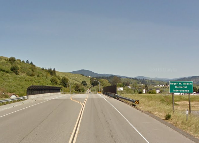
CA 36 east crosses over US 101 and passes through Alton. Traffic on CA 36 eastbound is advised that long vehicles are not recommended beyond Bridgeville. Alton was settled as a railroad in 1887 siding of the Pacific Lumber Company which established a spur line from Scotia to the Eel River & Eureka Railroad. Alton was originally known as Hansen but the changed to it's modern name in 1889.

From Alton CA 36 is signed as 3 miles from Hydesville and 24 miles from Bridgeville.


At Postmile HUM 17.028 CA 36 east passes through Grizzly Creek Redwoods State Park.


At Postmile HUM 17.94 CA 36 east passes the Van Duzen River. An older truss span can be seen alongside modern CA 36.

CA 36 east crosses the Van Duzen River again at Postmile HUM 20.205.

CA 36 east enters Bridgeville and crosses the Van Duzen River at Postmile R23.82. Kneeland Road and was the original alignment of CA 36 through Bridgeville and an older crossing the Van Duzen River can be found at Postmile HUM R23.923. Bridgeville was originally known as Robinson's Ferry but obtained it's modern name in 1875 when a bridge over the Van Duzen River was constructed. Dinsmore is signed as 19 miles from Bridgeville on CA 36 east whereas Red Bluff is signed as 116 miles away.


Pictured below is an image of the 1925 Van Duzen River Bridge in Bridgeville as seen on Wikipedia.

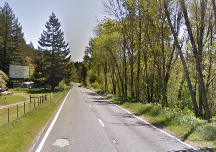
CA 36 east of Bridgeville splits from the Van Duzen River and begins to gain elevation.


At Postmile HUM 35.39 CA 36 east crosses the Little Van Duzen River.
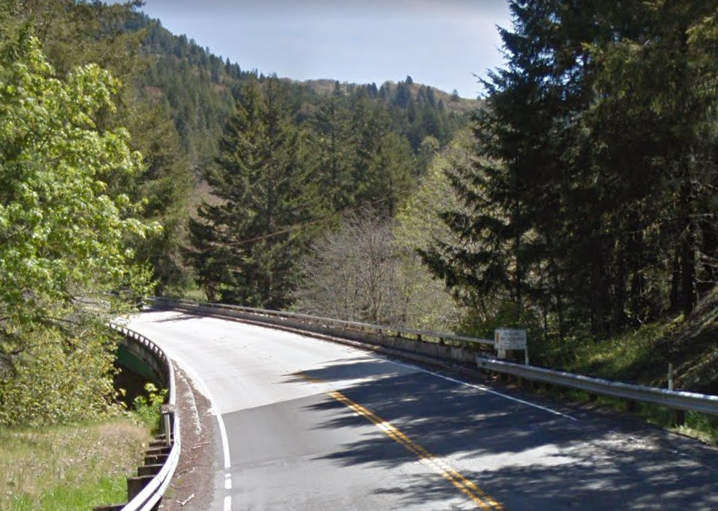
At approximately Postmile HUM 35.91 CA 36 east becomes a one lane highway and makes another ascent. The two lane portions of CA 36 east resume at approximately Postmile HUM 40.459 near another bridge over the Van Duzen River.


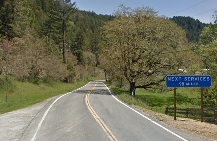
CA 36 east begins to closely follow the course of the Van Duzen River again. At Postmile HUM 41.588 CA 36 east enters the community of Dinsmore which is 2,415 feet above sea level. Traffic on CA 36 east in Dinsmore is advised there are no services for 98 miles.


At approximately Postmile HUM 42.74 CA 36 east enters Six Rivers National Forest.
CA 36 east follows the Van Duzen River into Trinity County.

Approaching Van Duzen Road at Postmile TRI R0.647 CA 36 east is signed as 95 miles from Red Bluff.

CA 36 enters the community of Mad River and crosses the namesake river at approximately Postmile TRI R2.65. Mad River lies at an elevation of 2,484 feet above sea level.


CA 36 east of Mad River begins an uphill ascent. Forest Glen is signed as 14 miles to the east on CA 36 whereas Red Bluff is signed as 90 miles away.


At Postmile TRI 10.111 CA 36 east enters Trinity-Shasta National Forest approaching South Fork Mountain Road.

CA 36 east crosses the South Fork Trinity River and enters Forest Glen at Postmile TRI 17.078. Forest Glen was settled in 1913 as an automotive way station on early LRN 35.


CA 36 east of Forest Glen beings to follow the course of Rattlesnake Creek before splitting away at approximately TRI 24.000. At Postmile TRI 27.17 CA 36 east intersects CA 3. Red Bluff is signed as 67 miles east on CA 36 at the junction of CA 3.


CA 36 east continues to wind through the terrain and intersects western Wildwood Road at Postmile TRI R40.742. An older alignment of CA 36 can be found on Old Cold Creek and western Wildwood Road.


CA 36 east splits from Beegum Creek and begins to straighten.

CA 36 east at Postmile TEH 10.32 crosses Dry Creek.

CA 36 east begins to follow the course of Dry Creek. At Postmile TEH 19.11 CA 36 east crosses Salt Creek and enters the community of Rosewood.


CA 36 east splits from Dry Creek near Bowman Road lat Postmile TEH R23.209.


CA 36 east of Bowman Road is signed as 19 miles from Red Bluff.

CA 36 east follows Beegum Road and picks up the course of Dibble Creek approaching Red Bluff. At Postmile TEH 40.20 CA 36 east enters Red Bluff on Beegum Road.

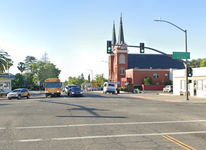
CA 36 east crosses the Union Pacific Railroad and makes a right hand turn onto Main Street at Postmile TEH R41.205. Main Street with in Red Bluff serves as the I-5 Business Loop and was US 99 north of downtown.


CA 36 east follows Main Street south into downtown Red Bluff. At Postmile TEH L41.283 CA 36 east makes a left hand turn onto Antelope Boulevard towards the Sacramento River. Notably US 99 West once began on Main Street south of Oak Street in downtown Red Bluff. US 99 East began at Antelope Boulevard and was co-signed with CA 36.


Red Bluff is the Tehama County Seat and lies at an elevation of 305 feet above sea level due to it being located on the floor of Sacramento Valley. When gold was discovered in Yreka in 1851 it led to a rush which took travelers through Sacramento Valley. The rush to Yreka led to a small community developing at the confluence of Reeds Creek and the Sacramento River. The community was originally known as Leodocia and Covertsburg before Post Office Service opened as "Red Bluff" in October 1853. The name "Red Bluff" comes from formations near the community which were once apparent on the Sacramento River. When Tehama County was created in 1856 the community of Tehama was selected as the County Seat. Red Bluff was selected by county voters as the new County Seat in 1857. The Southern Pacific Railroad reached Red Bluff in 1872 and the community incorporated as a City in March of 1876.
CA 36 east crosses the Sacramento River and intersects Interstate 5.


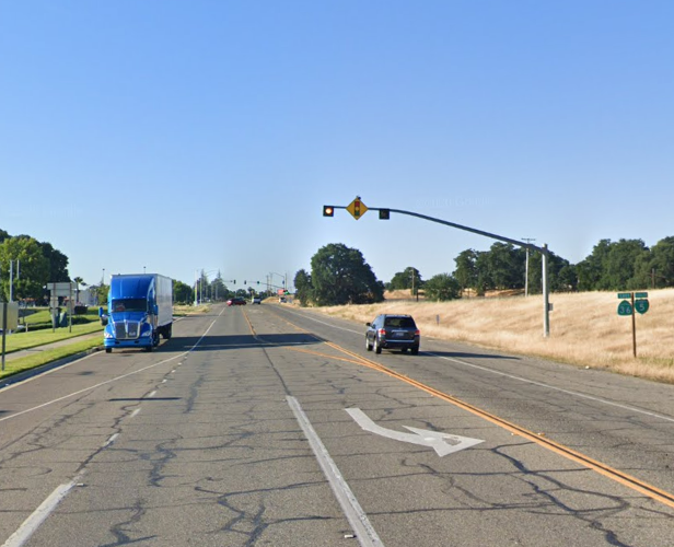
CA 36 east of I-5 is co-signed as "TO CA 99" on Antelope Boulevard. At Postmile TEH 44.000 CA 36 east intersects CA 99. US 99E once split from CA 36 where CA 99 now is signed.


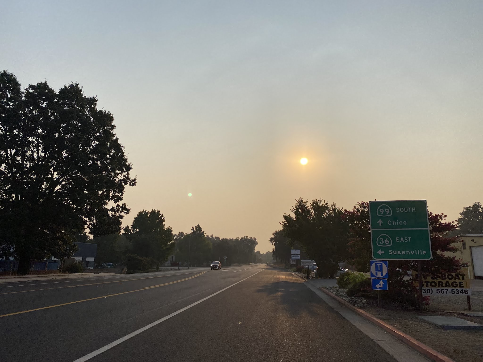
CA 36 east makes a left hand turn from CA 99 and traffic is notified that Susanville is 102 miles ahead.


Leaving Red Bluff CA 36 east traffic is advised the next gas is 68 miles ahead in Chester. A rest area is also signed as 71 miles ahead on CA 36 east.


Lassen Volcanic National Park is signed as 47 miles ahead on CA 36 east whereas Lake Almanor is signed as 65 miles ahead.

CA 36 follows the course of Paynes Creek northeast into the Sierra Nevada Foothills. CA 36 east enters Dales where it intersects Sign County Route A6/Long Road at Postmile TEH 55.261.


Dales gets it's name from Dale's Station which was located on Legislative Route 29. Dales Station once had a gas station which was wiped out by floods on Payne's Creek in 1937.

CA 36 begins to climb east of Dales and quickly approaches the 2,000 foot elevation level. At Postmile TEH 64.000 CA 36 east intersects it's former alignment on Paynes Creek Loop in the the community of Paynes Creek. A Post Office in Paynes Creek operated from 1890 to 1973.


CA 36 east of Paynes Creek is signed as 84 miles from Susanville.

CA 36 east climbs rapidly following the course of South Fork Butte Creek to the Lassen National Forest Boundary at Postmile TEH 80.21. Lassen Peak can be seen eastward in the distance.


CA 36 east enters Mineral and intersects it's original alignment at CA 172 at Postmile TEH 81.13. Post Office service in Mineral was established in 1894. The community takes it's name from a nearby Mineral Spring. Mineral is located at 4,918 feet above sea level.


CA 172 is a 9 mile loop to/from CA 36 from Mineral to near Mill Creek. Much of CA 172 is a one-lane state highway over the
5,266 foot high Mineral Summit. Mineral Summit by some definitions is where the Sierra Nevada Mountains transitions into the volcanic Cascade Mountains.

CA 36 east climbs from Mineral over what was Legislative Route 86 to an intersection with CA 89 at Morgan Summit. Morgan Summit is located at 5,768 feet above sea level and is also often cited as the dividing point of the Sierra Nevada Mountains from the Cascade Mountains.


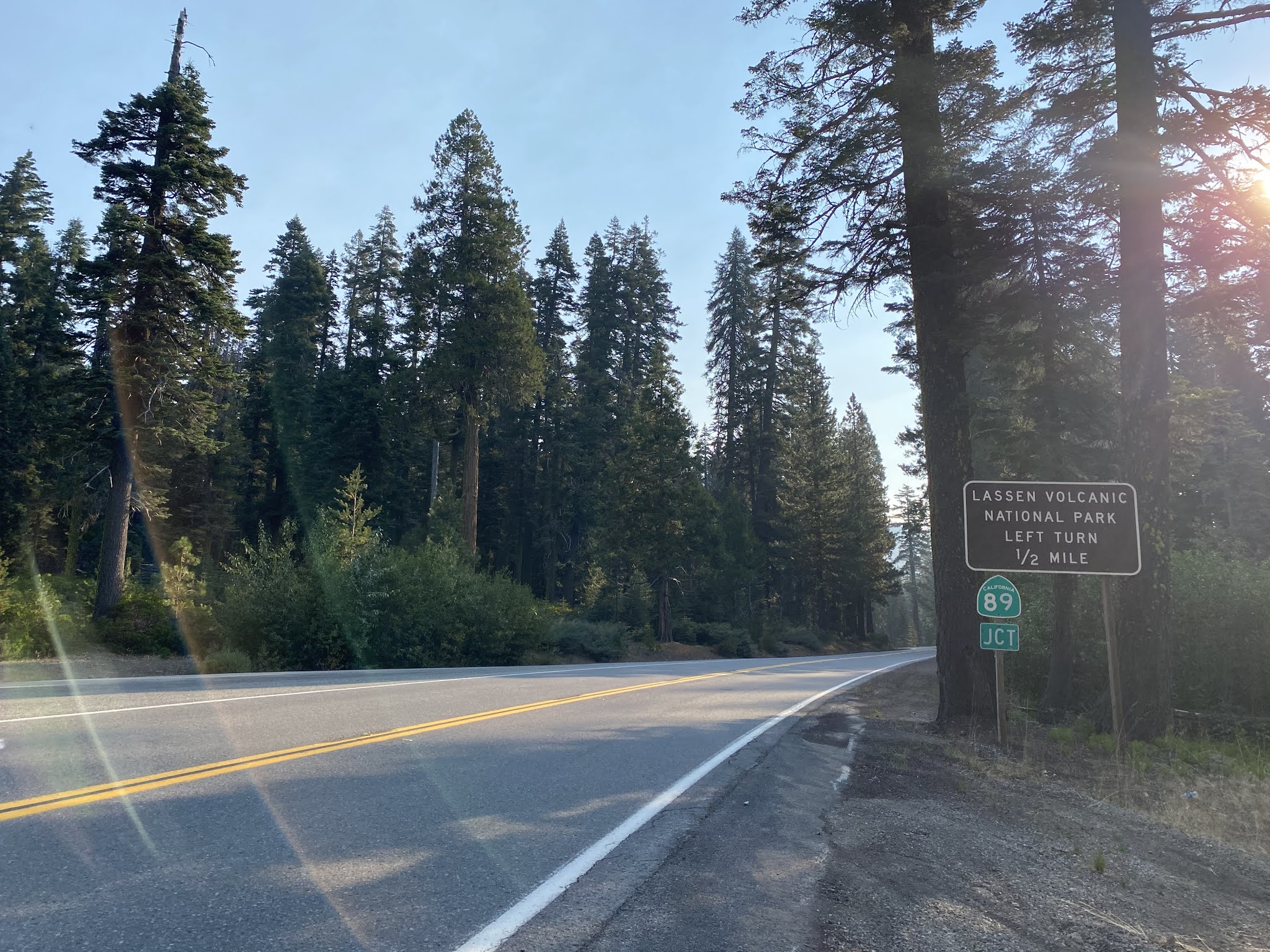


A turn north from CA 36 at Morgan Summit on CA 89 north takes traffic to Lassen Park Highway of Lassen Volcanic National Park.

Lassen Volcanic National Park lies with the southern part of the Cascade
Range and is named for Lassen Peak. Lassen Peak is a Lava Dome volcano
which lies at an elevation of 10,457 feet above sea level. Lassen Peak
takes it's name from Peter Lassen who was a well renown pioneer during
the 1840s on through the early California Gold Rush. Peter Lassen is
most known for establishing a cut-off route to the California Trail by
way of Goose Lake and the Pit River.
Lassen Peak arose approximately 27,000 years ago from the shattered
northern flank of Brokeoff Volcano. Lassen Peak is documented to have
been witnessed by Jedediah Smith during 1821. Lassen Peak's first
recorded ascent was made by the Grover K. Godfrey expedition during
1851. During May of 1907 Lassen Peak National Monument was created by
then sitting President Theodore Roosevelt.
Below Lassen Peak along with Lassen Park Highway can be seen from a flight I took to Portland during 2019.

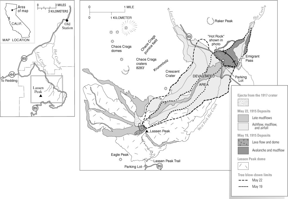
On May 30th 1914 Lassen Peak suddenly became active when it began to erupt by way of a steam explosion. On May 14, 1915 Lassen Peak began to erupt lava blocks which spread as far as 20 miles away. The eruptions culminated on May 22, 1915 at 4 PM during the "Great Eruption" which could be seen as far as 150 miles away in Eureka. The Great Eruption formed a large crater atop Lassen Peak, a pyroclastic flow which destroyed 3 square miles (now the Devastated Area), and a large lahar which reached Hat Valley. The column from the Great Eruption of Lassen Peak can be seen in this photo below from Loomis Rock.

The scene in downtown Red Bluff on May 22, 1915.

A USGS Map showing the Devastated Area.
In a somewhat interesting response to the Great Eruption of 1915 U.S. Congress approved Lassen Volcanic National Park on August 9, 1916. Another large eruption on Lassen Peak occurred during May of 1917, with large scale releases of steam occurring afterwards to 1920. The last steam release on Lassen Peak occurred during 1921 before the volcano went dormant again. Visitation to Lassen Volcanic National Park was made easier with the completion of Lassen Park Highway in 1931.
From Morgan Summit CA 36 east multiplexes CA 89 south towards CA 172 near Mill Creek. CA 36 east/CA 89 south intersect CA 172 near Mill Creek at Postmile TEH 91.257. CA 36 east/CA 89 south from Mineral Summit is part of the Volcanic Legacy Scenic Byway.

A look at the CA 172 junction from CA 36 west/CA 89 north.

A view northward towards Lassen Peak from CA 36 east/CA 89 south at Gurnsey Creek roughly near Postmile TEH 97.53.

CA 36 east/CA 89 south intersect CA 32 at Postmile TEH 99.936.


Near Lost Creek Road CA 36 east/CA 89 south enter Plumas County.

At approximately Postmile PLU 2.58 CA 36 east/CA 89 south leave the boundaries of Lassen National Forest. CA 36 east and CA 89 south split at the north shore of Lake Almanor.at Postmile PLU 6.28.


Lake Almanor is a large reservoir impounding the North Fork Feather
River via use of Canyon Dam. Canyon Dam was originally completed in
1914 and influenced the alignment of what became CA 89. Canyon Dam was expanded in the 1920s and
1960s to enlarge it's water storage capacity to about 1,300,000 acre
feet.

CA 36 east of CA 89 is signed as 3 miles from Chester and 37 miles from Susanville. CA 36 east of CA 89 is also part of the Volcanic Legacy Scenic Byway.

At Postmile PLU 6.47 CA 36 east crosses the Chester Flood Control Channel.

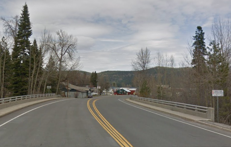
CA 36 east passes through Chester and crosses the North Fork Feather River at Postmile PLU 8.48. Chester was settled by two individuals; one from Chester, Vermont and the other from Chester, Missouri. Post Office service opened in Chester in 1894 but the community has never incorporated. Chester lies at an elevation of 4,534 feet above sea level.


CA 36 east of Chester crosses Lake Almanor via a causeway.

The CA 36 causeway over Lake Almanor as it appears from the air.

At Postmile PLU R13.93 CA 36 east intersects Sign County Route A13.


CA 36 east of Sign County Route A13 enters Lassen County.

At Postmile LAS 0.76 CA 36 east intersects CA 147. CA 147 is signed as access to the community of Clear Creek.


CA 36 east of CA 147 is signed 24 miles from Susanville.

CA 36 east passes through Westwood and intersects Sign County Route A21/Mooney Road at Postmile LAS 3.70. Westwood was plotted in 1913 as the head of the Red River Lumber Company.


CA 36 east reenters Lassen National Forest and passes through what was Coppervale at Postmilie LAS 9.31. Coppervale was the sight of copper mining claims during the 1860s. Post Office Service in Coppervale operated sporadically from 1864 until it finally shuttered in 1914.

From Coppervlae CA 36 east ascends to Frednoyer Pass which lies at elevation of 5,751 feet above sea level. Frednoyer Pass serves as part of the Great Basin Divide between the Feather River River watershed to the west and Susan River watershed to the east. Frednoyer Pass is often also cited as part of the transition zone between the Sierra Nevada Mountains and Cascade Mountains. Frednoyer Pass gets it's name from Dr. Atlas Frednoyer Pass whom discovered it in 1850.


CA 36 east descends from Frednoyer Pass following the course Willard Creek to the Lassen National Forest boundary at Postmile LAS 16.19.


CA 36 east picks up the course of the Susan River and intersects CA 44 at Postmile LAS R19.19.


CA 36 east of CA 44 is signed 5 miles from Susanville.

CA 36 east descends along the course of the Susan River where it becomes Main Street in the City of Susanville. CA 36 east intersects CA 139 in downtown Susanville at Postmile LAS 25.35. Susanville is the Lassen County Seat and lies at an elevation of 4,186 feet above sea level. Susanville was settled in the 1850s and was originally known as Rooptown. The modern community name of Susanville was adopted in 1857. Lassen County was formed in 1864 and Susanville was selected as the County Seat. Susanville incorporated as a City in 1900.


At Postmile LAS R26.28 CA 36 intersects it's original alignment at Sign County Rout A27/Johnstonville Road.

At Postmile LAS 26.73 CA 36 east crosses the Susan River.

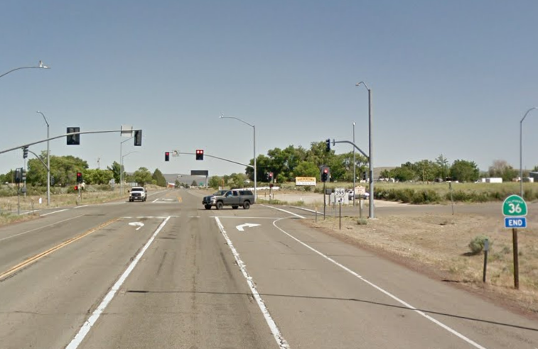
CA 36 east terminates at US 395 in Johnstonville at Postmile LAS R29.39.


Comments