A recent trip to California State Route 1 in Malibu spurred my interest in revisiting a trip I did in 2014 which included following the highway from Interstate 10 in Santa Monica northward to California State Route 68 in Monterey. Since I have covered the segment of CA 1 through Big Sur northward to Monterey County so many times I thought it was time to tell the tale of the rest of the highway southward.

This article specifically will cover two segments of CA 1:
- What was formerly the first CA 3 and later US 101A from San Juan Capistrano north to Oxnard.
- CA 1 between Oxnard northward to San Luis Obispo.
As stated above the route of CA 1 has been extensively covered on Gribblenation previously. The previous articles pertaining to CA 1 can be found below. Suffice to say that CA 1 is highly intertwined with the history of US 101 and has a ton of roadside lore.
California State Route 1/Big Sur Slide Special Part 3; Ragged Point Closure south to US 101 in San Luis Obispo
California State Route 1/Big Sur Slide Special Part 4; Prelude to Pfeiffer Canyon reopening
California State Route 1/Big Sur Slide Special Part 5; Pfeiffer Canyon reopens
November Bay Area Trip Part 7; Califoria State Route 1 from I-280 south to CA 17
Challenger Adventures in the Coast Range Part 2; California State Route 1 from County Route G16 south to the Nacimiento-Fergusson Road
California State Route 1; exploring Point Lobos and Pfeiffer-Big Sur State Park
California State Route 1 in Big Sur; the Mud Creek Slide reopens
To Big Sur and California State Route 1 via the Nacimiento-Fergusson Road
Disaster Tourism Trip Park 4; San Francisco
Disaster Tourism Trip Part 5; Muir Woods Road and the Panoramic Highway
Disaster Tourism Part 6; Point Reyes National Seashore and Sir Francis Drake Boulevard
Hyde Street Pier and the original surface alignment of US 101 in San Francisco
November Bay trip Part 5; Marin Headlands
California State Route 1 Tom Lantos Tunnels and the Devil's Slide
As originally defined in 1934 CA 1 had a southern terminus at US 101 in Las Cruces near Gaviota Pass. The north terminus of CA 1 was intended from the very start to be at US 101 near Fortuna. The original definition of CA 1 from Las Cruces to Fortuna can be seen on the below Department of Public Works guide from 1934 announcing the Signed State Highways on Page 22 and Page 23.
August 1934 Department of Public Works guide announcing the Signed State Highways
CA 1 would not ultimately be extended southward from Las Cruces to San Juan Capistrano until the 1964 State Highway Renumbering. At the time CA 1 was extended over US 101/Legislative Route Number 2 on a multiplex from Las Cruces to Oxnard where it annexed the route of US 101A along the coast to San Juan Capistrano. US 101A between Oxnard and San Juan Capistrano was part of LRN 60 which had been adopted in 1919 during the Third State Highway Bond Act. According to CAhighways.org legislative action wasn't taken until 1925 to acquire the existing roadways along the path of LRN 60 as a State Highway.
CAhighways.org on LRN 60
In 1934 the entirety of LRN 60 was selected to be signed as part of the first CA 3. The original definition of CA 3 can be seen on the 1934 Department of Public Works Guide above. CA 3 between San Juan Capistrano and El Rio (modern Oxnard) can be seen on this 1935 Goshua Highway Map of California.
1935 Goshua Highway Map of California
The original alignment of CA 3 in the Los Angeles Area can be viewed in detail on the 1935 Goshua Los Angeles Area Highway Map.
1935 Goshua Los Angeles Area Highway Map
For reference the early alignments of CA 3 and US 101 between Oxnard to Las Cruces can be seen on the following 1935 County Maps from the Division of Highways.
Orange County Highway Map
Los Angeles County Highway Map
Ventura County Highway Map
For further reference the early alignments of CA 1 and US 101 from Oxnard north to San Luis Obispo can be seen by viewing the two additional maps below.
Santa Barbra County Highway Map
San Luis Obispo County Highway Map
In October of 1935 the Department of Public Works announced that CA 3 would be replaced by US 101A on Page 21.
October 1935 Department of Public Works guide announcing CA 3 being replaced by US 101A
US 101A first appears on the 1938 State Highway Map.
1938 State Highway Map
As stated above CA 1 was extended over US 101 from Las Cruces to Oxnard and replaced US 101A from Oxnard to San Juan Capistrano during the 1964 State Highway Renumbering. These changes can be observed by comparing the 1963 State Highway Map to the 1964 Edition.
1963 State Highway Map
1964 State Highway Map
CA 1 north of Las Cruces to San Luis Obispo was originally defined as part of LRN 56. LRN 56 and the original 1934 definition of CA 1 shared a common route from Las Cruces north to Fortuna. LRN 56 had been first defined as a State Highway during the 1919 Third State Highway Bond Act between Carmel and San Simeon. In 1921 LRN 56 had been extended southward from San Simeon to Cambria. In 1931 LRN 56 was extended southward again from Cambria to LRN 2 in San Luis Obispo. By 1933 LRN 56 was extended southward to Las Cruces and northward to LRN 1 near Fortuna. The legislative history of LRN 56 can be found on CAhighways.org.
CAhighways.org on LRN 56
Of note CA 1 between Oxnard and Las Cruces was originally defined as part of the State Highway System as LRN 2 in 1909 during the First State Highway Bond Act.
CAhighways.org on LRN 2
As noted above my approach to CA 1 in Santa Monica back in 2014 was during an early morning headed west to the terminus of I-10. I-10 west on the Santa Monica Freeway officially terminates at Exit 1B for CA 1/Lincoln Boulevard in Santa Monica. CA 1 northwest continues towards the coast line via the 1936 McClure Tunnel where it becomes an expressway on Pacific Coast Highway. From the Santa Monica Pier the route of CA 1 heading northwest towards Malibu is easily observed.


CA 3 before the McClure Tunnel had an unclear alignment which can be seen on a 1935 Division of Highways Map of western Los Angeles. There is a possibility the early alignment of CA 3/LRN 60 was on Ocean Avenue and Channel Road.
1935 Western Los Angeles Highway Map
CA 1 north from Santa Monica passes through the Pacific Palisades neighborhood of Los Angeles before meeting CA 27 on the outskirts of Malibu. Upon entering Malibu CA 1 northbound has a junction with Signed County Route N1 at Malibu Canyon Road. Near the junction with N1 the route of CA 1 overlooks former CA 3 which was on Malibu Road.


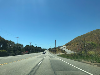
West of downtown Malibu the route of CA 1 north has a junction with Signed County Route N9 on Kanan Dume Road. The photo below was taken in 2019 (on an infinitely less gloomy day) when I drove through Malibu on northbound CA 1.

As CA 1 north continues through Malibu it meets CA 23 at Decker Canyon Road. Again the photos below are from 2019.

Past the junction with CA 23 the route of CA 1 north exits Malibu near Mulholland Highway at the boundary of Leo Carrillo State Park. Past the western boundary of Leo Carrillo State Park the route of CA 1 enters Ventura County. CA 1 north through past the Ventura County Line runs along the coastline skirting the beach line and peaks of the Santa Monica Mountains.

CA 1 north follows the coast through Ventura County and passes by Point Mugu Rock. Point Mugu Rock is actually a road cut that was built for the route of US 101A between 1937 and 1940. The original route of CA 3 and US 101A actually skirted the rock face above the ocean over along what would become the south face Point Mugu Rock.


The old road grade around Point Mugu Rock is obvious upon close inspection. The original cut around Point Mugu Rock was constructed circa 1923-24. I took this photo of CA 1 southbound from the original road grade of CA 3 and US 101A.

Approaching Oxnard CA 1 north passes by Naval Air Station Point Mugu on a short freeway.

CA 1 north presently follows Rice Avenue through Oxnard passing by CA 34 before jumping onto US 101 on the Ventura Freeway. Originally CA 3 and US 101A followed Oxnard Boulevard and Saviers Road to mainline US 101.
Present CA 1 north multiplexed onto US 101 north meets CA 232 at Vineyard Avenue/Exit 62A before crossing the Santa Clara River into Ventura. At Exit 66A CA 1/US 101 north on the Ventura Freeway meet CA 126 on the Santa Paula Freeway. Beyond downtown Ventura CA 1/US 101 north on the Ventura Freeway meet CA 33 at Exit 70B.
At Exit 72 CA 1 north briefly splits from US 101 north onto Pacific Coast Highway. CA 1 north passes through the communities of Dulah and Faria Beach before rejoining US 101 at Exit 78. West of Exit 78 the route of CA 1/US 101 north enters Santa Barbra County and runs along the coastline. The next significant junction is at CA 150 via CA 1/US 101 north Exit 84 in Carpinteria.


CA 1/US 101 north continue to multiplex through to Santa Barbra. CA 1/US 101 north in Santa Barbra has several significant junctions:
- Exit 96A access a former segment of CA 144 via Milpas Street.
- Exit 97 accesses CA 225 via Bath Street towards Castillo Street.
- Exit 100 accesses a former segment of CA 225 at Los Positas Road.
- Exit 101B accesses CA 154 via San Marcos Pass Road.
CA 1/US 101 north continue through to Goleta where CA 217 is met at Exit 104B. West of Goleta the route of CA 1/US 101 north passes through relatively open country along bluffs above the ocean.
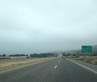
Near Gaviota State Park the route of CA 1/US 101 north takes a sudden northward turn towards the Santa Ynez Mountains. CA 1/US 101 north passes through the Santa Ynez Mountains via Gaviota Pass. The northbound lanes of CA 1/US 101 utilize the Gaviotta Tunnel which was completed in 1953. The southbound lanes of CA 1/US 101 are carried by the 1931 Gaviota Creek Bridge through Gaviota Pass.


CA 1 north splits from US 101 north just past the Gaviota Tunnel at Exit 132. This would have been the origin point of CA 1 prior to the 1964 State Highway Renumbering.


CA 1 north continues northwest along Cabrillo Highway towards CA 246 in Lompoc.


CA 1 follows Ocean Avenue through Lompoc and makes a northward turn on H Street. Between 1964 to 1984 the route of CA 246 multiplexed CA 1 through Lompoc on Ocean Avenue headed west towards Surf.
North of Lompoc CA 1 follows Cabrillo Highway towards Vandenburg Air Force Base.


From Vandenburg Air Force Base CA 1 north continues to CA 135 (former US 101) and multiplexes it for a couple miles before splitting away near Orcutt.


The link to the CA 135 article above notates the original alignment of CA 1 over the Harris Grade. The Harris Grade alignment began just north of Lompoc and reached CA 135 (Old US 101) in Harris Canyon. The switch to the modern alignment of CA 1 towards Vandenburg Air Force base can be seen appearing the 1988 State Highway Map.
1988 State Highway Map
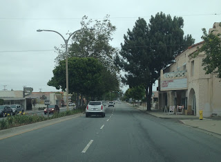
CA 1 north drops to a two-lane highway and eventually enters Guadalupe. At Main Street in Guadalupe CA 1 north meets the western terminus of CA 166.


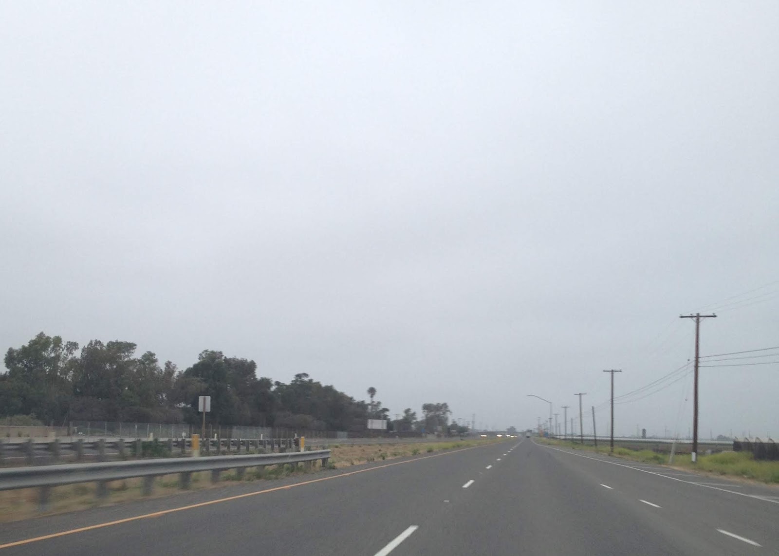
North of Guadalupe CA 1 enters San Luis Obispo County. CA 1 snakes through the farmlands near the coastline before entering Pismo Beach and meeting US 101 north once again.


CA 1/US 101 north multiplex through much of San Luis Obispo County. At Exit 201 CA 1/US 101 meet CA 227 in San Luis Obispo.


At Exit 203B in San Luis Obispo the route of CA 1 splits away from US 101 towards Morro Bay and Big Sur. CA 1 doesn't meet US 101 again until the approach for the Golden Gate Bridge in San Francisco.


This article specifically will cover two segments of CA 1:
- What was formerly the first CA 3 and later US 101A from San Juan Capistrano north to Oxnard.
- CA 1 between Oxnard northward to San Luis Obispo.
As stated above the route of CA 1 has been extensively covered on Gribblenation previously. The previous articles pertaining to CA 1 can be found below. Suffice to say that CA 1 is highly intertwined with the history of US 101 and has a ton of roadside lore.
California State Route 1/Big Sur Slide Special Part 3; Ragged Point Closure south to US 101 in San Luis Obispo
California State Route 1/Big Sur Slide Special Part 4; Prelude to Pfeiffer Canyon reopening
California State Route 1/Big Sur Slide Special Part 5; Pfeiffer Canyon reopens
November Bay Area Trip Part 7; Califoria State Route 1 from I-280 south to CA 17
Challenger Adventures in the Coast Range Part 2; California State Route 1 from County Route G16 south to the Nacimiento-Fergusson Road
California State Route 1; exploring Point Lobos and Pfeiffer-Big Sur State Park
California State Route 1 in Big Sur; the Mud Creek Slide reopens
To Big Sur and California State Route 1 via the Nacimiento-Fergusson Road
Disaster Tourism Trip Park 4; San Francisco
Disaster Tourism Trip Part 5; Muir Woods Road and the Panoramic Highway
Disaster Tourism Part 6; Point Reyes National Seashore and Sir Francis Drake Boulevard
Hyde Street Pier and the original surface alignment of US 101 in San Francisco
November Bay trip Part 5; Marin Headlands
California State Route 1 Tom Lantos Tunnels and the Devil's Slide
As originally defined in 1934 CA 1 had a southern terminus at US 101 in Las Cruces near Gaviota Pass. The north terminus of CA 1 was intended from the very start to be at US 101 near Fortuna. The original definition of CA 1 from Las Cruces to Fortuna can be seen on the below Department of Public Works guide from 1934 announcing the Signed State Highways on Page 22 and Page 23.
August 1934 Department of Public Works guide announcing the Signed State Highways
CA 1 would not ultimately be extended southward from Las Cruces to San Juan Capistrano until the 1964 State Highway Renumbering. At the time CA 1 was extended over US 101/Legislative Route Number 2 on a multiplex from Las Cruces to Oxnard where it annexed the route of US 101A along the coast to San Juan Capistrano. US 101A between Oxnard and San Juan Capistrano was part of LRN 60 which had been adopted in 1919 during the Third State Highway Bond Act. According to CAhighways.org legislative action wasn't taken until 1925 to acquire the existing roadways along the path of LRN 60 as a State Highway.
CAhighways.org on LRN 60
In 1934 the entirety of LRN 60 was selected to be signed as part of the first CA 3. The original definition of CA 3 can be seen on the 1934 Department of Public Works Guide above. CA 3 between San Juan Capistrano and El Rio (modern Oxnard) can be seen on this 1935 Goshua Highway Map of California.
1935 Goshua Highway Map of California
The original alignment of CA 3 in the Los Angeles Area can be viewed in detail on the 1935 Goshua Los Angeles Area Highway Map.
1935 Goshua Los Angeles Area Highway Map
For reference the early alignments of CA 3 and US 101 between Oxnard to Las Cruces can be seen on the following 1935 County Maps from the Division of Highways.
Orange County Highway Map
Los Angeles County Highway Map
Ventura County Highway Map
For further reference the early alignments of CA 1 and US 101 from Oxnard north to San Luis Obispo can be seen by viewing the two additional maps below.
Santa Barbra County Highway Map
San Luis Obispo County Highway Map
In October of 1935 the Department of Public Works announced that CA 3 would be replaced by US 101A on Page 21.
October 1935 Department of Public Works guide announcing CA 3 being replaced by US 101A
US 101A first appears on the 1938 State Highway Map.
1938 State Highway Map
As stated above CA 1 was extended over US 101 from Las Cruces to Oxnard and replaced US 101A from Oxnard to San Juan Capistrano during the 1964 State Highway Renumbering. These changes can be observed by comparing the 1963 State Highway Map to the 1964 Edition.
1963 State Highway Map
1964 State Highway Map
CA 1 north of Las Cruces to San Luis Obispo was originally defined as part of LRN 56. LRN 56 and the original 1934 definition of CA 1 shared a common route from Las Cruces north to Fortuna. LRN 56 had been first defined as a State Highway during the 1919 Third State Highway Bond Act between Carmel and San Simeon. In 1921 LRN 56 had been extended southward from San Simeon to Cambria. In 1931 LRN 56 was extended southward again from Cambria to LRN 2 in San Luis Obispo. By 1933 LRN 56 was extended southward to Las Cruces and northward to LRN 1 near Fortuna. The legislative history of LRN 56 can be found on CAhighways.org.
CAhighways.org on LRN 56
Of note CA 1 between Oxnard and Las Cruces was originally defined as part of the State Highway System as LRN 2 in 1909 during the First State Highway Bond Act.
CAhighways.org on LRN 2
As noted above my approach to CA 1 in Santa Monica back in 2014 was during an early morning headed west to the terminus of I-10. I-10 west on the Santa Monica Freeway officially terminates at Exit 1B for CA 1/Lincoln Boulevard in Santa Monica. CA 1 northwest continues towards the coast line via the 1936 McClure Tunnel where it becomes an expressway on Pacific Coast Highway. From the Santa Monica Pier the route of CA 1 heading northwest towards Malibu is easily observed.


CA 3 before the McClure Tunnel had an unclear alignment which can be seen on a 1935 Division of Highways Map of western Los Angeles. There is a possibility the early alignment of CA 3/LRN 60 was on Ocean Avenue and Channel Road.
1935 Western Los Angeles Highway Map
CA 1 north from Santa Monica passes through the Pacific Palisades neighborhood of Los Angeles before meeting CA 27 on the outskirts of Malibu. Upon entering Malibu CA 1 northbound has a junction with Signed County Route N1 at Malibu Canyon Road. Near the junction with N1 the route of CA 1 overlooks former CA 3 which was on Malibu Road.


West of downtown Malibu the route of CA 1 north has a junction with Signed County Route N9 on Kanan Dume Road. The photo below was taken in 2019 (on an infinitely less gloomy day) when I drove through Malibu on northbound CA 1.

As CA 1 north continues through Malibu it meets CA 23 at Decker Canyon Road. Again the photos below are from 2019.


Past the junction with CA 23 the route of CA 1 north exits Malibu near Mulholland Highway at the boundary of Leo Carrillo State Park. Past the western boundary of Leo Carrillo State Park the route of CA 1 enters Ventura County. CA 1 north through past the Ventura County Line runs along the coastline skirting the beach line and peaks of the Santa Monica Mountains.

CA 1 north follows the coast through Ventura County and passes by Point Mugu Rock. Point Mugu Rock is actually a road cut that was built for the route of US 101A between 1937 and 1940. The original route of CA 3 and US 101A actually skirted the rock face above the ocean over along what would become the south face Point Mugu Rock.


The old road grade around Point Mugu Rock is obvious upon close inspection. The original cut around Point Mugu Rock was constructed circa 1923-24. I took this photo of CA 1 southbound from the original road grade of CA 3 and US 101A.

Approaching Oxnard CA 1 north passes by Naval Air Station Point Mugu on a short freeway.
CA 1 north presently follows Rice Avenue through Oxnard passing by CA 34 before jumping onto US 101 on the Ventura Freeway. Originally CA 3 and US 101A followed Oxnard Boulevard and Saviers Road to mainline US 101.
Present CA 1 north multiplexed onto US 101 north meets CA 232 at Vineyard Avenue/Exit 62A before crossing the Santa Clara River into Ventura. At Exit 66A CA 1/US 101 north on the Ventura Freeway meet CA 126 on the Santa Paula Freeway. Beyond downtown Ventura CA 1/US 101 north on the Ventura Freeway meet CA 33 at Exit 70B.
At Exit 72 CA 1 north briefly splits from US 101 north onto Pacific Coast Highway. CA 1 north passes through the communities of Dulah and Faria Beach before rejoining US 101 at Exit 78. West of Exit 78 the route of CA 1/US 101 north enters Santa Barbra County and runs along the coastline. The next significant junction is at CA 150 via CA 1/US 101 north Exit 84 in Carpinteria.


CA 1/US 101 north continue to multiplex through to Santa Barbra. CA 1/US 101 north in Santa Barbra has several significant junctions:
- Exit 96A access a former segment of CA 144 via Milpas Street.
- Exit 97 accesses CA 225 via Bath Street towards Castillo Street.
- Exit 100 accesses a former segment of CA 225 at Los Positas Road.
- Exit 101B accesses CA 154 via San Marcos Pass Road.
CA 1/US 101 north continue through to Goleta where CA 217 is met at Exit 104B. West of Goleta the route of CA 1/US 101 north passes through relatively open country along bluffs above the ocean.

Near Gaviota State Park the route of CA 1/US 101 north takes a sudden northward turn towards the Santa Ynez Mountains. CA 1/US 101 north passes through the Santa Ynez Mountains via Gaviota Pass. The northbound lanes of CA 1/US 101 utilize the Gaviotta Tunnel which was completed in 1953. The southbound lanes of CA 1/US 101 are carried by the 1931 Gaviota Creek Bridge through Gaviota Pass.


CA 1 north splits from US 101 north just past the Gaviota Tunnel at Exit 132. This would have been the origin point of CA 1 prior to the 1964 State Highway Renumbering.


CA 1 north continues northwest along Cabrillo Highway towards CA 246 in Lompoc.


CA 1 follows Ocean Avenue through Lompoc and makes a northward turn on H Street. Between 1964 to 1984 the route of CA 246 multiplexed CA 1 through Lompoc on Ocean Avenue headed west towards Surf.

North of Lompoc CA 1 follows Cabrillo Highway towards Vandenburg Air Force Base.


From Vandenburg Air Force Base CA 1 north continues to CA 135 (former US 101) and multiplexes it for a couple miles before splitting away near Orcutt.


The link to the CA 135 article above notates the original alignment of CA 1 over the Harris Grade. The Harris Grade alignment began just north of Lompoc and reached CA 135 (Old US 101) in Harris Canyon. The switch to the modern alignment of CA 1 towards Vandenburg Air Force base can be seen appearing the 1988 State Highway Map.
1988 State Highway Map
CA 1 north drops to a two-lane highway and eventually enters Guadalupe. At Main Street in Guadalupe CA 1 north meets the western terminus of CA 166.


North of Guadalupe CA 1 enters San Luis Obispo County. CA 1 snakes through the farmlands near the coastline before entering Pismo Beach and meeting US 101 north once again.


CA 1/US 101 north multiplex through much of San Luis Obispo County. At Exit 201 CA 1/US 101 meet CA 227 in San Luis Obispo.


At Exit 203B in San Luis Obispo the route of CA 1 splits away from US 101 towards Morro Bay and Big Sur. CA 1 doesn't meet US 101 again until the approach for the Golden Gate Bridge in San Francisco.

Comments