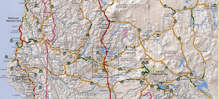
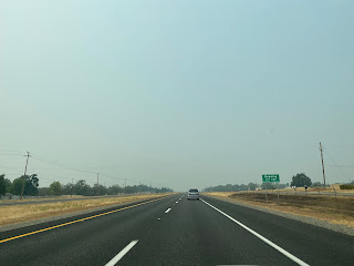
US Route 299 connected US Route 101 near Arcata of Humboldt County east across the northern mountain ranges of California to US Route 395 in Alturas of Modoc County. US Route 299 was the longest child route of US Route 99 and is the only major east/west highway across the northern counties of California. US Route 299 was conceptualized as the earliest iteration of what is known as the Winnemucca-to-the-Sea Highway. The legacy of US Route 299 lives on today in the form of the 307 mile long California State Route 299. Featured as the cover of this blog is the interchange of US Route 101 and US Route 299 north of Arcata which was completed as a segment of the Burns Freeway during 1956.
This blog is part of the larger Gribblenation US Route 99 Page. For more information pertaining to the other various segments of US Route 99 and it's three-digit child routes check out the link the below.
Part 1; the history of US Route 299 and California State Route 299
The development of the State Highways which comprised US Route 299 ("US 299") and later California State Route 299 ("CA 299") began with 1903 Legislative Chapter 366 which defined the general corridor of the Trinity-Humboldt State Highway:
"for the purposes of locating and surveying a proposed highway from a point on the Trinity River near the town of North Fork (also known as Helena), thences W-ly down said river to connect with the existing road in Humboldt County."
The 1909 First State Highway Bond Act was approved by California voters during 1910. The 1909 First State Highway Bond Act defined a significant number of State Highways which largely were plotted through well established corridors of travel or were projected to become as such. The 1909 First State Highway Bond Act defined
Legislative Route Number 20 ("LRN 20") as a new State Highway between Redding and Weaverville. The 1909 First State Highway Bond Act also defined
LRN 28 as a new State Highway between Redding and Alturas.
1911 Legislative Chapter 498 defined much of LRN 28 as part of the Lassen State Highway:
"That certain highway known as the county road and beginning on the boundary line between Shasta and Lassen Counties in the NE corner of T37N R6E and running and extending through T38N R6E, T38N R7E, T38N R8E, to the Modoc County Line...shall be designated and known as the Lassen State Highway."
The
January 1915 California Highway Bulletin lists the entire 47.9 miles of LRN 20 between Weaverville and Redding as having been surveyed.

LRN 20 was extended as part of the 1915 Second State Highway Bond Act (Legislative Chapter 404) which added a segment originating at LRN 1/Redwood Highway in Arcata east to Douglas City via Weaverville. 1915 Legislative Chapter 765 authorized a survey to extend LRN 28 from Surprise Valley in Modoc County to the Nevada State Line.
The California Highway Bulletin publication ended during July 1916 and would not be followed upon until the California Highway & Public Works publication began in 1924. The
1917 California State Automobile Association Map shows the progress of construction of LRN 20. A functional road can be seen existing along the planned route of LRN 20 from Arcata east to China Flat (Willow Creek). A projected route of LRN 20 can be seen east of China Flat via North Fork Trinity River towards an existing highway at North Fork/Helena. LRN 20 can be shown having a functional alignment from North Fork/Helena east to Redding via Weaverville and Shasta.


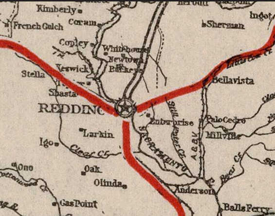
Within Sacramento Valley much of LRN 3 incorporated what was the Southern Pacific Railroad frontage roads. Within Redding the implied route of LRN 3 bypassed downtown as it crossed the Sacramento River from what is now Henderson Open Space Park via the
1908 Redding Free Bridge to Smile Place. From Smile Place LRN 3 continued west on Parkview Avenue and turned south on Market Street. At the time LRN 20 traversed downtown Redding north on Market Street and west on Eureka Way towards Weaverville. LRN 28 can be seen originating from LRN 3 at the intersection of what was Canby Road and Dana Drive. LRN 28 can be seen following Old Alturas Road east from Redding towards Bella Vista Junction.
East of Bella Vista Junction LRN 28 can seen following much of the existing highway to Bieber. From Bieber east to Adin a new cutoff highway is shown as a planned replacement for Susanville Road (future Lassen County Route A2) and Adin-Susanville Highway (future CA 139). From Adin LRN 28 is shown following the existing highway east over Adin Pass to Alturas via Canby.

The
1918 Division of Highways Map shows LRN 3 crossing the Sacramento River over the 1915 Diestelhorst Bridge. The shift in LRN 3 truncated LRN 20 out of downtown Redding to Eureka Way. LRN 28 was shifted west via the Redding Free Bridge to a new terminus at LRN 3 in downtown Redding.
LRN 28 was formally funded east of Alturas to the Nevada State Line via 1921 Legislative Chapter 888:
"for the survey, plans and estimates and for the construction of the highway from the town of Alturas in Modoc County to the Nevada-California state line by the most direct and practical route via Cedarville in connecting with the proposed Nevada state highway (Nevada State Route 8A)..."
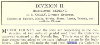
The
November 1925 California Highways & Public Works notes a project was underway to build a new segment of LRN 28 from the Cedarville Causeway east to the Nevada State Line. The new segment of LRN 28 is stated to be two miles in length and was anticipated to be completed during the winter of 1925-26. Once the new segment of LRN 28 was completed it would permit all-year access from Alturas east via Cedarville to the Nevada State Line.
During November of 1926 the US Route System was approved by the AASHO. US 99 was aligned over the entirety of LRN 3 between the Oregon State Line south to Red Bluff via Redding. US Route 99 can be seen aligned on LRN 3 through Redding and acting as the central junction of LRN 20/LRN 28 on the
1926 Rand McNally Highway Map of California.
The
April 1927 California Highways & Public Works features snow removal on LRN 28 near Burney.

The same July/August 1928 California Highways & Public Works references construction of three bridges on LRN 28 in Adin were put up for bid and may be completed by year end.
The
1930 Division of Highways Map shows LRN 20 had a planned bypass route of Weaverville along the Trinity River via Junction City-Douglas City. It appears that LRN 20 was intended to a have a spur route between Douglas City and Weaverville but this is never reflected in the Legislative Route description.
The
January 1932 California Highways & Public Works announced 18.5 miles of LRN 28 east from Burney to Fall River Mills was slated to be surfaced. The LRN 28 between Burney and Fall River Mills was stated to be planned to be partially realigned onto more favorable grades.

The
July 1932 California Highways & Public Works discusses the opening of a new alignment of LRN 20 between Valdor and Weaverville via Junction City. The Valdor-Weaverville corridor of LRN 20 is stated to have been historically of a low character and incorporated much of the elements of the original road adopted as a State Highway during 1915. The article states reconstruction of the Valdor-Weaverville corridor was pushed back due to the work completing LRN 20 west of Helena being prioritized. The older alignment of LRN 20 is stated to have followed Canon Creek west from Junction City via high grades towards Valdor. The new alignment of LRN 20 west from Junction City to Valdor was brought to a lower grade blasted out along the Trinity River.


The
March 1933 California Highways & Public Works notes a new alignment of LRN 20 opening east of Arcata over the Mad River. The new alignment of LRN 20 over the Mad River eliminated at-grade crossings of the Northwestern Pacific Railroad and Arcata & Mad River Railroad.


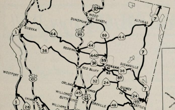
In the August 1934 California Highways & Public Works the Sign State Routes were announced. CA 44 was announced as a new State Highway running from US 101 near Arcata east via LRN 20 to US 99 in Redding and via LRN 28 to CA 7 in Alturas. CA 440 was announced as a new State Highway running from Redding east via the 1933 extension of LRN 20 to Lassen Volcanic National Park.
On August 11th, 1934 the California State Highway Engineer petitioned the AASHO for a new US Route designation between Arcata and Alturas via the corridor of CA 44.
The first route description of US 299 can be observed in a September 1934 letter by the California State Highway Engineer to the AASHO. US 299 along with numerous other US Route designations in California were approved by the AASHO Executive Committee Meeting during November of 1934.


The original CA 44 was swapped to US Route 299 by 1935. The approval of US 299 was concurrent with that of US 395 which replaced most of CA 7. CA 440 appears to have been a placeholder designation pending the approval by the AASHO of US 299. Nonetheless CA 440 appears alongside US 299 on the 1935 Gousha Map of California.
The 1935 Division of Highways Map of Humboldt County provides a detailed look into the original alignment of US 299 on LRN 20. US 299 can be seen originating at US 101/LRN 1 north of Arcata via what is now West End Road. US 299/LRN 20 eastbound is seen crossing the Mad River and intersecting LRN 85 at North Bank Road. US 299/LRN 20 east of LRN 85 is seen entering Blue Lake via Blue Lake Boulevard. East of Blue Lake US 299/LRN 20 is seen crossing the North Fork Mad River towards CA 96/LRN 84 at Willow Creek via Lord Ellis Summit and Redwood Creek. East of Willow Creek US 299/LRN 20 can be seen following the Trinity River into Sayler of Trinity County.
The
1935 Division of Highways Map of Trinity County shows US 299/LRN 20 eastbound following the Trinity River through the communities of; Sayler, Burnt Ranch, Del Loma, Big Bar, Helena/North Fork and Junction City. From Junction City US 299/LRN 20 cut over Oregon Mountain to Main Street in Weaverville. From Weaverville US 299/LRN 20 eastbound jogged southward crossing the Trinity River into Douglas City where it intersected LRN 35. US 299/LRN 20 east of Douglas City passed through the community of Fawn Lodge and entered Shasta County.


The original alignment of US 299 within Redding followed LRN 20 via Eureka Way to US 99/LRN 3 at Market Street. US 299 multiplexed US 99 south on Market Street towards Parkview Avenue onto LRN 28. From Parkview Avenue US 299 followed Parkview Avenue and Smile Place over the 1908 Redding Free Bridge over the Sacramento River. Upon crossing the Sacramento River US 299/LRN 28 followed Canby Road, Dana Drive and Old Alturas Road east toward Bella Vista. For illustrative purposes highway shields were placed over the 1935 Division of Highways Map of Shasta County below to highlight the highway grid around Redding more clearly.

US 299/LRN 28 eastbound from Bella Vista can be seen on the 1935 Division of Highways Map of Shasta County passing the communities of; Ignot, Round Mountain and Montgomery Creek before passing through Burney on Main Street. East of Burney US 299/LRN 28 can be seen briefly multiplexing CA 89/LRN 83. CA 89/LRN 83 southbound is seen following modern Black Ranch Road to US 299/LRN 28 westbound and branching away at modern Mountain View Road.
The 1935 Division of Highways Map of Shasta County shows US 299/LRN 28 picking up the course of the Pit River. US 299/LRN 28 is seen following the Pit River through Fall River Mills and McArthur to the Lassen County Line.

The
1935 Division of Highways Map of Lassen County shows US 299/LRN 28 splitting from the Pit River towards Big Valley Summit. US 299/LRN 28 east of Big Valley Summit is seen entering Big Valley where it passed through the communities of Nubieber and Bieber towards the Modoc County Line near Adin.
The
1935 Division of Highways Map of Modoc County shows US 299/LRN 28 passing through Adin and ascending to Adin Summit. From Adin Summit US 299/LRN 28 can be seen crossing the Pit River and entering the community of Canby. US 299/LRN 28 can be seen following the Pit River eastward from Canby to a terminus at US 395/LRN 73 via 12th Street.
LRN 28 can be seen continuing east of US 395/LRN 73 Alturas via Cedar Pass towards Cedarville. From Cedarville LRN 28 eastbound can be seen crossing Middle Alkali Lake via the Cedarville Causeway to the Nevada State Line and Nevada State Route 8A.

The January 1936 California Highways & Public Works details of the opening of the 1935 Sacramento River Bridge and the new alignment of US 99/US 299/LRN 3. The new Sacramento River Bridge is opening ceremony is cited to be held on December 18th, 1935. US 299 eastbound was realigned over the new Sacramento River Bridge north on Market Street via a multiplex of US 99/LRN 3. US 299 split from US 99/LRN 3 eastward onto LRN 28 at Lake Boulevard.
At some point between 1935-1937 CA 440 was reassigned as CA 44. The current CA 44 first appears on the 1937 Gousha Highway Map of California.
The March 1938 California Highways & Public Works details the three phase project to improve US 99/US 299/LRN 3 north of downtown Redding and the Sacramento River. Phase 1 included the completion of the 795 foot long plate girder 1935 Sacramento River Bridge. The 1935 Sacramento River Bridge likely played a huge factor in why the original CA 44 was reassigned as US Route 299 during 1935. Phase 2 included a new direct alignment of US 99/US 299/LRN 3 on Market Street from the north bank of the Sacramento River to Sulpur Creek which was completed in December 1935. Phase 3 was completed during July 1937 between Sulpur Creek and Boulder Hill. The Phase 3 project included a new interchange where US 299/LRN 28 split towards Alturas.


The August 1939 California Highways & Public Works features a recently completed hydraulic cut through Oregon Mountain which was to serve as a realignment of US 299/LRN 20 between Junction City-Weaverville. The hydraulic excavation is stated to have been planned in 1933 and would culminate with the new alignment of US 299/LRN 28 being paved by early 1940.

The
May/June 1947 California Highways & Public Works features the ongoing improvement of US 299/LRN 20 between Arcata 44 miles east to Willow Creek. The importance of the lumber industry during World War II saw US 299/LRN 20 receive a 5.1 mile resurfacing between the Mad River Bridge and Blue Lake during 1944. Log truck traffic during World War II required a detour around the existing Mad River Bridge onto LRN 85 (future CA 200). The existing substandard Mad River Bridge is stated to be the process of being replaced by a new span. The 1915 extension of LRN 20 west to Arcata is stated to have been largely built by Humboldt County at the conclusion of World War I along the established path of the Lord Ellis Trail. The article goes on to state that the only prior automotive highway from the coastline to Willow Creek was via Bald Mountain Road.
A 16.4 mile segment of US 299/LRN 20 from Blue Lake east to Redwood Creek is started to have been heavily weathered during World War II. The Post-War housing boom saw an increase in lumber demand which required US 299/LRN 20 be rebuilt between Blue Lake and Redwood Creek. The Federal Housing Administration released funds during August of 1946 to aid the Division of Highways in rebuilding US 299/LRN 20 in the Blue Lake-Redwood Creek corridor to a standard width of 26 feet. The first widening project on US 299/LRN 20 began in a 4.7 mile corridor between Redwood Creek and Redwood Summit during August of 1946 and was completed by February 1947. Work on the remaining 11.7 mile segment of US 299/LRN 20 from Redwood Summit west to Blue Lake is stated to have begun during April 1947. The entire 16.4 mile segment of US 299/LRN 20 in the Blue Lake-Redwood Creek corridor is stated to have an anticipated completion culminating in paving likely by September 1947. The existing substandard North Form Mad River Bridge east of Blue Lake on US 299/LRN 20 is featured.


The
July/August 1947 California Highways & Public Works features the ongoing reconstruction of US 299/LRN 20 between Sayler and Cedar Flat along the Trinity River. A segment of US 299/LRN 20 is cited to have been completed between Weaverville and Prairie Creek during 1942 before work camps were transferred to Burnt Ranch in the middle of the Sayler-Cedar Flat corridor. The importance of the US 299/LRN 20 to the ongoing efforts during World War II allowed road work to continue which culminated in 2.7 miles of grading being completed between Burnt Ranch-Cedar Flat by April 1945. The Sayler-Cedar Flat corridor is stated to be 12 miles in length and have anticipated completion target date sometime during fall of 1948.
The
March 1951 California Highways & Public Works details the improvements to the Bonner Grade (Cedar Pass) of the Warner Range on LRN 28 between Alturas and Cedarville. The Warner Range is described as being used extensively by emigrant groups during the 1849 California Gold Rush with nearby Surprise Valley being settled in the 1860s. An early photo from 1906 during the initial Modoc County/State cooperative in constructing a modern road over the Bonner Grade is shown. The Bonner Grade is described as being improved as part of LRN 28 in; 1921, 1924 and 1936. The Bonner Grade is described as being one of the weakest links in the
Winnemucca-to-the-Sea Highway (possibly the first reference seen in a publication) which seemingly included Nevada State Route 8A through Vya, LRN 28 to Alturas and the entirety of US 299 to Eureka. Surveys in 1947-1948 sought to lower the Bonner Grade from the existing 7% grade to 6% over the course of a 5,500 foot shorter alignment. Grading of the new Bonner Grade is described as being completed in 1950 with the final surfacing coming in 1951.


The
November/December 1951 California Highways & Public Works details the progress of first unit of the realignment of US 299/LRN 28 over Hatchet Mountain Pass in Shasta County. The first unit of the Hatchet Mountain realignment began work in October 1950 over a 1.6 mile segment which included a crossing of Hatchet Creek. Construction of LRN 28 within the vicinity of Hatchet Creek is stated to have originally taken place from 1918-24.
The
September/October 1953 California Highways & Public Works features the ongoing construction of the first phase of the US 101/LRN 1 Arcata Bypass Freeway ("Burns Freeway"). The articles states a later portion of the project would include a interchange for US 101/US 299 along with a new bridge over the Mad River.


The
November/December 1953 California Highways & Public Works features the rebuilding of US 299/LRN 20 between Weaverville and Douglas City. The Weaverville-Douglas City project area is stated to be four miles in length and featured a new bridge over Weaver Creek which had been completed during November. Grading and surfacing of the new Weaverville-Douglas City corridor is stated to have an anticipated completion during 1954. The early history of the US 299/LRN 20 corridor between Weaverville-Shasta is discussed via the formation of the Weaverville & Shasta Wagon Road Company in 1857. The Weaverville & Shasta Wagon Road Company completed the Grass Valley Toll Road by 1858 from Weaverville to Shasta. The Grass Valley Toll Road would later be incorporated as a spur of the larger California-Oregon Trail via Scott Mountain and Yreka.


The
September/October 1955 California Highways & Public Works features the opening of the second phase of the US 101/Burns Freeway. The completed project zones along the Burns Freeway are stated to now span from the northern City of Limit of Eureka to the northern City Limit of Arcata. The project scale of the Burns Freeway is stated to be planned to extend via a US 101/LRN 1 bypass of Eureka along with a planned US 101/US 299 interchange at the Mad River.
The
September/October 1955 California Highways & Public Works references a three mile project zone which would eliminate numerous curves on US 299/LRN 20 along the Trinity River. A second article stub references US 299/LRN 28 being in the process of improvement via a realignment at Montgomery Creek and ongoing work at Hatchet Summit.

The
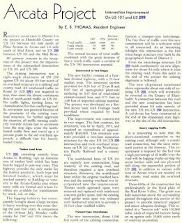
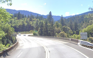
November/December 1956 California Highways & Public Works feature the opening of the new US 101/US 299 Burns Freeway interchange north of Arcata. The US 101/US 299 interchange utilized a single two lane bridge over the Mad River which rejoined the existing alignment of US 299/LRN 20 approaching Blue Lake. The original intersection of US 101/US 299 north of Arcata can be found where West End Road crosses under the Burns Freeway.
The
May/June 1957 California Highways & Public Works notes updates to numerous projects along US 299. A major 20 mile segment of US 299/LRN 20 west of Weaverville is described as being rebuilt along with a 8.5 mile corridor between Oregon Mountain-Prairie Creek. A 10.5 mile segment of US 299/LRN 20 between Willow Creek-Berry Summit is stated to be in process of reconstruction via Bureau of Public Roads contracts. US 299/LRN 28 over Hatchett Mountain is described as having a completed realignment project along with a 9 mile rebuild from Adin over Adin Summit to the Pit River Bridge.
US 299/LRN 28 over Adin Summit appears in the
May/June 1958 California Highways & Public Works. A second photo depicts US 299/LRN 20 under construction in Trinity County. A third photo depicts the new alignment of US 299/LRN 20 east of Weaverville.
The US 101/US 299 interchange appears in the
July/August 1958 California Highways & Public Works. A small article stub notes that US 299/LRN 20 was in the early phases of freeway conversion east 0.3 miles across the Mad River. The freeway conversion of US 299 over the Mad River required a parallel bridge be built.
The
November/December 1959 California Highways & Public Works notes US 299/LRN 20 on Eureka Way west of downtown Redding was upgraded via construction of a four lane overhead of the Southern Pacific Railroad. The new Southern Pacific Railroad overhead on Eureka Way is described as being completed during November 1958.
The
May/June 1961 California Highways & Public Works details the progress of US 299/LRN 20 being realigned around the future site of the Whiskeytown Reservoir. Construction of the Whiskeytown Reservoir realignment is stated to have begun during January 1960 and consisted of a 5 mile span of US 299/LRN 20. Large earthen fills are described as being utilized extensively as part of the realignment of US 299/LRN 20.
The
March/April 1962 California Highways & Public Works features the completed realignment of US 299/LRN 20 around the site of the Whiskeytown Reservoir. The new alignment of US 299/LRN 20 around the Whiskeytown Reservoir is stated to be built to two lane expressway standards which could be expanded four lanes. Construction and design of the Whiskey Creek Bridge is detailed extensively. The realignment of US 299/LRN 20 at the Whiskeytown Reservoir site is stated to have opened on November 6th, 1961.
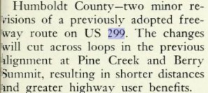
The elimination of US 299 was approved by the AASHO Executive Committee on 6/19/1963 and would become effective on New Year's Day 1964. The elimination of US 299 was requested by the State of California due to the highway not meeting the 1959 AASHO 300 mile intra-state standard for a single State US Routes. The State of California intended to replace the entire 295 miles of US 299 with CA 299.


During the 1964 California Highway Renumbering all the Legislative Route Numbers were eliminated in favor of field of signage. The new designation of
CA 299 was extended from Alturas via a multiplex of US 395 and former LRN 28 through Cedarville towards Nevada State Route 8A at the Nevada State Line. CA 299 was given a new definition which implied it would soon multiplex the incomplete Interstate 5 in Redding. CA 299 first appears on the
1964 Division of Highways Map.


The
November/December 1965 California Highways & Public Works references a 1.9 mile freeway segment of CA 299 east of Market Street to Interstate 5 as having opened during August 1965. CA 299 shifted to a new alignment entering Redding eastbound via Eureka Way, multiplexing US 99 south on Market Street and east onto Tehama Streets towards a stub freeway connection with Interstate 5. CA 299/Interstate 5 multiplexed north towards Lake Boulevard.
The
November/December 1965 California Highways & Public Works notes CA 299 had been completed to freeway standards between the Mad River and Blue Lake. The new freeway tied in with existing CA 299 on Blue Lake Boulevard. A new bridge over Redwood Creek is cited as opening as also opening during 1965.
The California Highways & Public Works publication ended during 1967. CA 299 can be seen with a realignment between Blue Lake and Lord Ellis Summit under construction on the
1970 Division of Highways Map.
CA 299 is shown bypassing Blue Lake and on a new alignment to Lord Ellis Summit on the
1975 Caltrans Map. The new bypass and alignment of CA 299 replaced what had been US 299 on Blue Lake Boulevard between Blue Lake-Lord Ellis Summit.
The 1975 Caltrans Map also shows CA 299 east of Interstate 5 in Redding to Old Oregon Trail having been upgraded to freeway standards.

1998 Legislative Chapter 828 shifted the alignment of CA 299 back onto Market Street in Redding via a multiplex of CA 273 (former US 99) north from Eureka Way to Lake Boulevard. This measure eliminated CA 299's multiplex of Interstate 5 and extended CA 44 into downtown Redding via Tehama Street. The present alignment of CA 44 in downtown Redding appears on the
2005 Caltrans State Map.
Part 2; the corridor of US Route 299/California State Route 299 prior to the State Highway System
Numerous trails and stage roads which existed in the corridor of US 299/CA 299 are referenced in the California Highways & Public Works during Part 1 above. The great majority of these trails and stage routes can be observed on the 1882 Bancroft's Map of California.
The May/June 1947 California Highways & Public Works references the path of US 299/CA 299 west of Helena to Arcata was largely built over the corridor of the Lord Ellis Trail. The 1882 Bancroft's Map of California depicts the Lord Ellis Trail as a stage road originating at Eureka in Humboldt County. The Lord Ellis Trail can be seen traveling eastward as a stage road to Arcata where it crossed the Mad River towards Blue Lake. From Blue Lake the Lord Ellis Trail is shown as a stage road traveling east to China Flat (Willow Creek) where it ended at a crossing of the Trinity River. No stage road east of China Flat to Helena in Trinity County can be observed implying the Lord Ellis Trail was nothing more than a foot path. From Helena a stage road can be seen traveling east to Weaverville via Junction City.


The
November/December 1953 California Highways & Public Works discusses the Weaverville & Shasta Road Company being founded in 1857 which culminated in Grass Valley Toll Road being completed by 1858. As stated in Part 1 the Grass Valley Toll Road became a spur of the larger California-Oregon Trail. The California-Oregon Trail was an alternative route to the Siskiyou Trail (along the Sacramento River) which was capable of handling stage travel. The California-Oregon Trail became favored over the Siskiyou Trail since it connected the mining claims of Yreka, Scott Valley and Shasta directly via Scott Mountain. The 1882 Bancroft's Map of California shows Weaverville & Shasta Wagon Road (the Grass Valley Toll Road) and Lewiston Turnpike connecting Weaverville-Shasta (Shasta County) in the future corridor of US 299/CA 299. A wagon road east of Shasta to the Southern Pacific Railroad in Redding and Dersch Ferry over the Sacramento River can also be observed.

The 1882 Bancroft's Map of California displays a stage road hearing directly east from Dersch Ferry in Redding to Millville via the future corridor of modern CA 44. Two stage roads between Millville east to Burney Valley can be seen. The northern route is seen following Oak Run Creek towards the future corridor of US 299/CA 299 via Montgomery. The southern route is shown as the "Tamarock Toll Road" following the general course of modern Whitmore Road through the communities of; Sharine, Tamarock and Kentucky.
The 1882 Bancroft's Map of California shows several stage roads from Burney Valley to Fall River Mills over the general future corridor of US 299/CA 299. From Fall River Mills a stage road can be seen crossing the Fall River via Burgetville to Pitville. From Pitville a stage road can seen following the general course of the Pit River towards Canby and Alturas via a community called Argusvillle.
The 1882 Bancroft's Map does not show an established stage road from Alturas over Cedar Pass, The Applegate Trail is only shown as a stage road as far north as Willow Ranch on the shores of Goose Lake at Lassen's Creek. The Applegate Trail was a spur of the larger California Trail which crossed the Klamath Basin westward to the mines of the Siskiyou Mountains. The
March 1951 California Highways & Public Works notes the first modern road over Cedar Pass via the Bonner Grade wasn't built as a direct connection between Alturas-Cedarville until a Modoc County/State cooperative project during 1906.
Part 3; a drive on California State Route 299/former US Route 299
CA 299 beings at the the terminus of Nevada State Route 8A at the California State Line/Modoc County Line at Postmile MOD 66.632 (overall mileage 305.625). As CA 299 westbound begins Surprise Valley and Middle Alkali Lake can be seen. Note; Google images were used to fill photo gaps along CA 299 I haven't been to in several years.
Despite having State Highway shields Nevada State Route 8A essentially is a Washoe County Route and hasn't been part of the Nevada State Highway System since the 1976 Highway Renumbering. Nevada State Route 8A carries a pre-1976 Nevada State Highway number which was assigned during 1929. As noted in Part 1 much of the original length Nevada State Route 8A has since become Nevada State Route 140 and part of the Winnemucca-to-the-Sea Highway. Nevada State Route 8A can be seen terminating at LRN 28 at the California State Line for the first time on the
1929 Nevada Department of Highways Map.
Nevada State Route 8A was signed which can be seen in a
2007 photo by Jake Bear (hosted on the AAroads shield gallery) at the eastern terminus of CA 299 at the Nevada State Line. When I drove Nevada State Route 8A in 2008 this shield was still present.
CA 299 westbound begins to cross the Cedarville Causeway over Middle Alkali Lake at approximately Postmile MOD 61.000.

CA 299 westbound enters Cedarville and intersects Main Street at Postmile MOD 57.345. As noted in Part 1 the March 1951 California Highways & Public Works stated Surprise Valley was used extensively by emigrant groups during the California Gold Rush. Surprise Valley was settled in the 1860s and a small community known as "Deep Creek" was plotted in 1864 as a stopping point for emigrant wagon trains. A primitive route over Cedar Pass and the Warner Range was plotted by William Cressler and John Bonner which connected Surprise Valley the lands of then Siskiyou County west of the Warner Range. Deep Creek received Post Office Service in 1869 under the name of "Cedarville." The name of Cedarville was derived from a community of the same name in Ohio. Cedarville surpassed Lake City as the largest community of Surprise Valley in 1880 and has remained as such ever since. Cedarville lies at an elevation of 4,652 feet above sea level and never has incorporated.

CA 299 westbound departing Cedarville begins to climb into the Warner Range.
CA 299 westbound crosses the approximately 5,600 foot high Cedar Pass at Postmile MOD 51.358.
Upon crossing the Warner Range CA 299 westbound intersects US 395 at Postmile MOD 40.647. CA 299 westbound begins a multiplex of US 395 southbound to Alturas.

CA 299 westbound/US 395 southbound enter the City of Alturas via Main Street. CA 299 westbound splits from US 395 at 12th Street north of downtown Alturas at Postmile MOD 40.623. Alturas is the only incorporated City in Modoc County as well as the County Seat. What is now Alturas was founded in 1871 as "Dorris Bridge." The community changed it's name to "Dorrisville" in 1874 and was assigned the Modoc County Seat when it split away from Siskiyou County the same year. Dorrisville became "Alturas" in 1880 and the community would incorporate as a City during September of 1901. Alturas lies at an elevation of 4,370 feet above sea level and likely never lost the Modoc County Seat due to it being on the course of the Pit River. The junction of US 395 and CA 299 at Main Street/12th Street in Alturas is the original starting point of US 299.

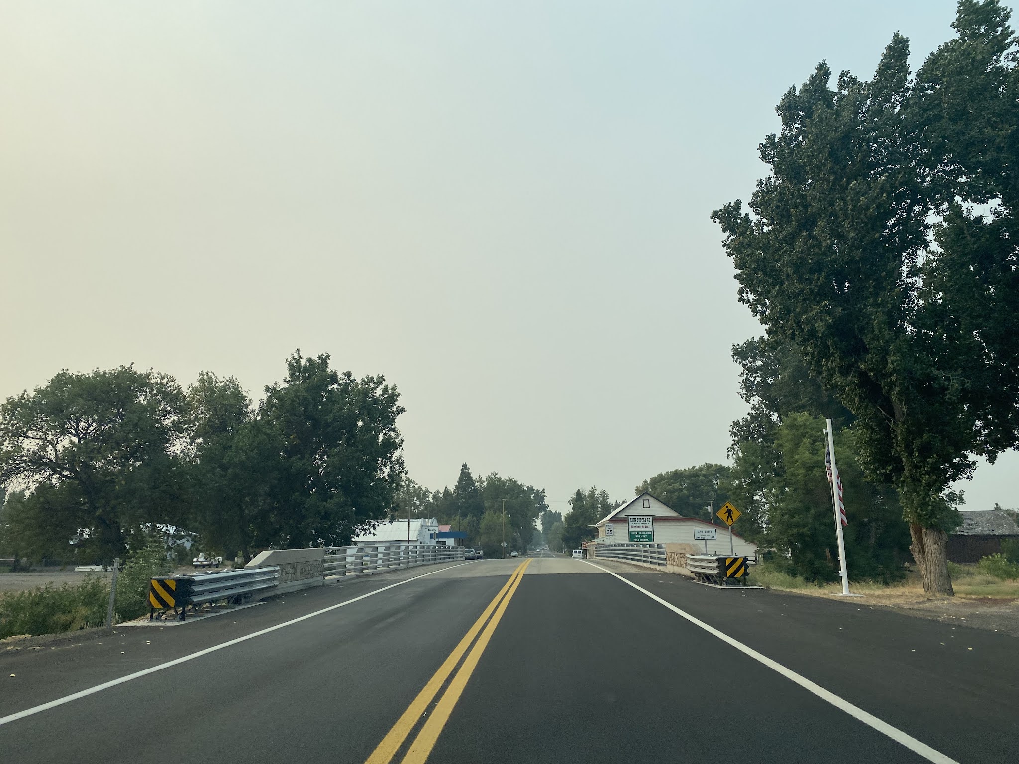
CA 299 westbound follows the Pit River and enters the community of Canby at approximately Postmile MOD 22.345. Canby began as a stage stop and received Post Office Service beginning 1874. Canby takes it's name in honor of General Edward Canby who was shot and killed during the 1872-73 Modoc War. Canby would stay relevant during the early 20th Century when a Southern Pacific Railroad line was built from the Klamath Basin.
At Postmile MOD 21.750 CA 299 westbound intersects CA 139. CA 299 westbound begins a multiplex of CA 139 southbound towards Adin. CA 299 west/CA 139 south is signed as 21 miles from Adin at the beginning of the multiplex.
At Route 299 Postmile MD 18.000 CA 299 west/CA 139 south cross the Pit River.
CA 299 west/CA 139 south enter Modoc National Forest and climb to Adin Pass at 5,173 feet above sea level.
From Adin Pass CA 299 west/CA 139 south is signed as 10 miles from Adin.
At Route 299 Postmile 8.32 CA 299 west/CA 139 south intersect Modoc County Route 198. As noted in Part 1 Modoc County Route 198 is the original alignment of US 299 in the vicinity of Rush Creek.
CA 299 west/CA 139 south cross Rush Creek and intersect the opposite end of County Route 198 at Route 299 Postmile MD 7.35.
CA 299 west/CA 139 south exit Modoc National Forest and emerge into Big Valley. CA 299 west/CA 139 south intersect County Route 86 at Route 299 Postmile MD 4.29.
CA 299 west/CA 139 south enter the community of Adin at approximately Route 299 Postmile MD 1.36.
Adin was founded as the first community west of the Warner Mountains of Modoc County in 1869 by Adin McDowell. Adin was largely founded a supplying locale for travelers to the mines of Hayden Hill in Lassen County. The Aidenville Post Office opened in 1871 and the community took it's modern name by 1876. Adin briefly saw a lumber boom during the Great Depression but never incorporated as a City.
CA 299 west/CA 139 south cross Ash Creek and Butte Creek while traversing the center of Adin. South of Adin CA 139 southbound splits from CA 299 westbound.
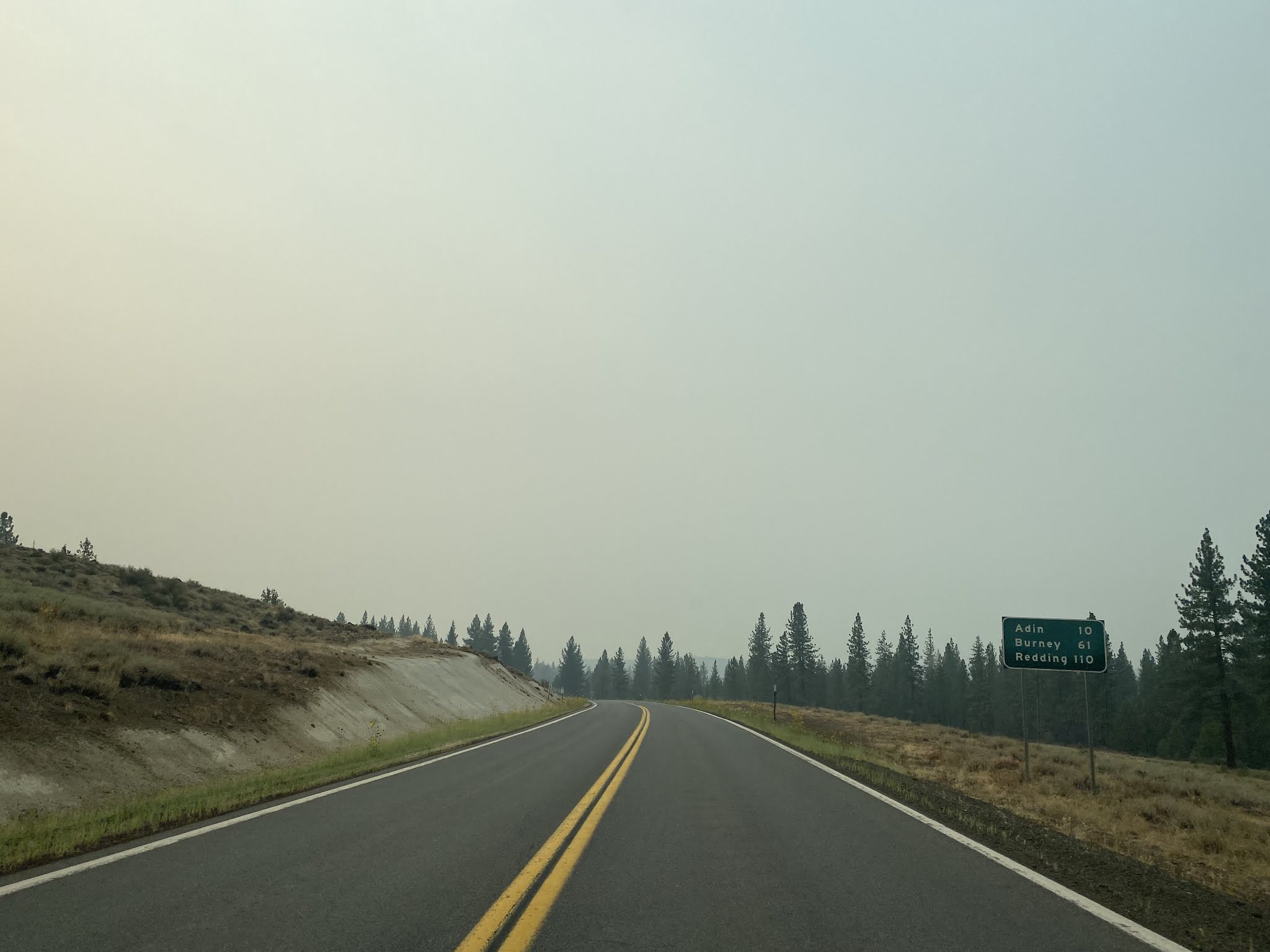
CA 299 west of CA 139 is signed as 10 miles from Bieber, 51 miles from Burney and 104 miles from Redding.
CA 299 west of Adin enters Lassen County.
CA 299 westbound passes through the landscape of Big Valley and intersects Lassen County Route A2/Susanville Road at Postmile LAS 14.92.
CA 299 westbound passes through the community of Bieber and crosses the Pit River at approximately Postmile LAS 14.00. Bieber was settled and received Post Office Service in 1877 along the Pit River. A historic plaque pertaining to the
Lassen Emigrant Trail can be found in Bieber which reads:
"Peter Lassen opened the Lassen Emigrant Trail in 1848 when he led a 12-wagon emigrant train from Missouri to California. The route, which passed near this place, was extensively traveled during the years 1848-53 by emigrants seeking gold, adventure, and a new life in the west - but because of the hardships of the route and the hostility of the indians, the trail was little used after 1853."
West of Bieber CA 299 is signed as 2 miles from Nubieber, 22 miles from Fall River Mills and 92 miles from Redding.
At Postmile LAS 11.92 CA 299 westbound crosses over the Nubieber Overhead. The Nubieber Overhead is located near the former junction point of the Great Northern Railway and Western Pacific Railroad. Presently both lines are consolidated as part of the Burlington North & Santa Fe Railroad.
At Postmile LAS 11.50 CA 299 westbound passes through Nubieber. Nubieber was set up as the mutual terminus siding of the Great Northern Railway and Northern Pacific Railroad in 1931. The community name of "Nubieber" is a play on "New Bieber." Nubieber is located at an elevation of 4,121 feet above sea level.
CA 299 west of Nubieber ascends to Big Valley Summit at Postmile LAS 8.575. Big Valley Summit is located at an elevation of 4,603 feet above sea level.
CA 299 westbound descends from Big Valley Summit and intersects Lassen County Route 407/Old Highway Road at Postmile LAS 3.912.
CA 299 westbound descends through the terrain into Fall River Valley and enters Shasta County near Pittville Road at Postmile SHA 96.853.
A historic plaque pertaining to the first Fall River Valley School can be found on CA 299 west of Pittville Road. The historic plaque describes the first school in Fall River Valley being built nearby in 1868. The schoolhouse didn't have a floor until the sawmill community of Dana was established in 1870.
CA 299 westbound enters the community of McArthur and intersects Shasta County Route A19/McArthur Road at Postmile SHA 95.219.
CA 299 west of McArthur is signed as 4 miles from Fall River Mills, 74 miles from Redding and 220 miles from Eureka.
CA 299 westbound enters the community of Fall River Mills and crosses the Fall River at Postmile SHA 91.40. Fall River Mills was plotted out around the former site of Fort Crook. Fort Crook was plotted by the U.S. Army in 1857 as Camp Hollenbrush. Fort Crook was maintained through the Civil War until 1869 when it was abandoned by the U.S. Army. The land holdings of Fort Crook were eventually turned over to public use by 1881. Upon crossing the Fall River a plaque pertaining to the
Lockhart Ferry can be found on CA 299 which reads:
"Established by Samuel Lockhart in 1856 as a link in the first wagon road from Yreka to Red Bluff, the Lockhart Ferry crossed below the confluence of the Fall and Pitt Rivers near this spot. After a massacre in December 1856, the ferry was re-established in 1857 below Fall River Falls."
CA 299 westbound intersects Shasta County Route A20/Glenburn Road west of the Fall River.
West of Fall River Mills CA 299 westbound ascends to a canyon above the Pit River.
CA 299 westbound descends through the terrain and crosses the Pit River at Postmile SHA 84.61.


West of the Pit River CA 299 intersects CA 89 at Postmile SHA 80.01. CA 89 is signed as access to Lassen Volcanic National Park and McArthur Burney Memorial Falls State Park.
McArthur Burney Falls Memorial State Park can be found on CA 89 approximately 5 miles north of CA 299. McArthur Burney Falls Memorial State Park is the second oldest unit in the California State Park system having been created in 1926. McArthur Burney Falls Memorial State Park features the signature Burney Falls of Burney Creek. Burney Creek is a tributary of the Pit River and it's namesake falls are 114 feet high. Burney Falls was deeded to the State of California during 1920 by Frank and Scott McArthur over concerns Pacific Gas & Electricity would attempt impound the waters for potential future hydroelectric projects.
Returning to CA 299 the highway west of CA 89 is signed as 5 miles from Burney and 59 miles from Redding.
At Postmile SHA 78.3 CA 299 westbound passes through the community of Johnson Park.
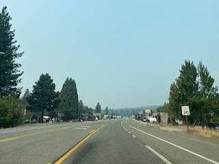
CA 299 westbound enters the community of
Burney at approximately Postmile SHA 75.306. Burney is named after settler Samuel Burney who was discovered murdered at the location of the present community during the winter of 1859. Subsequent the death of Samuel Burney the valley which his body was discovered came to be known as "Burney Valley." Burney Valley was largely granted to William L. Clayton during 1871 who in turn sold his 320 acre holdings in 1872. Burney Valley was significant enough to warrant Post Office service beginning in 1872. Burney Valley would continue to subdivide and evolve into a modern community through the 1880s.
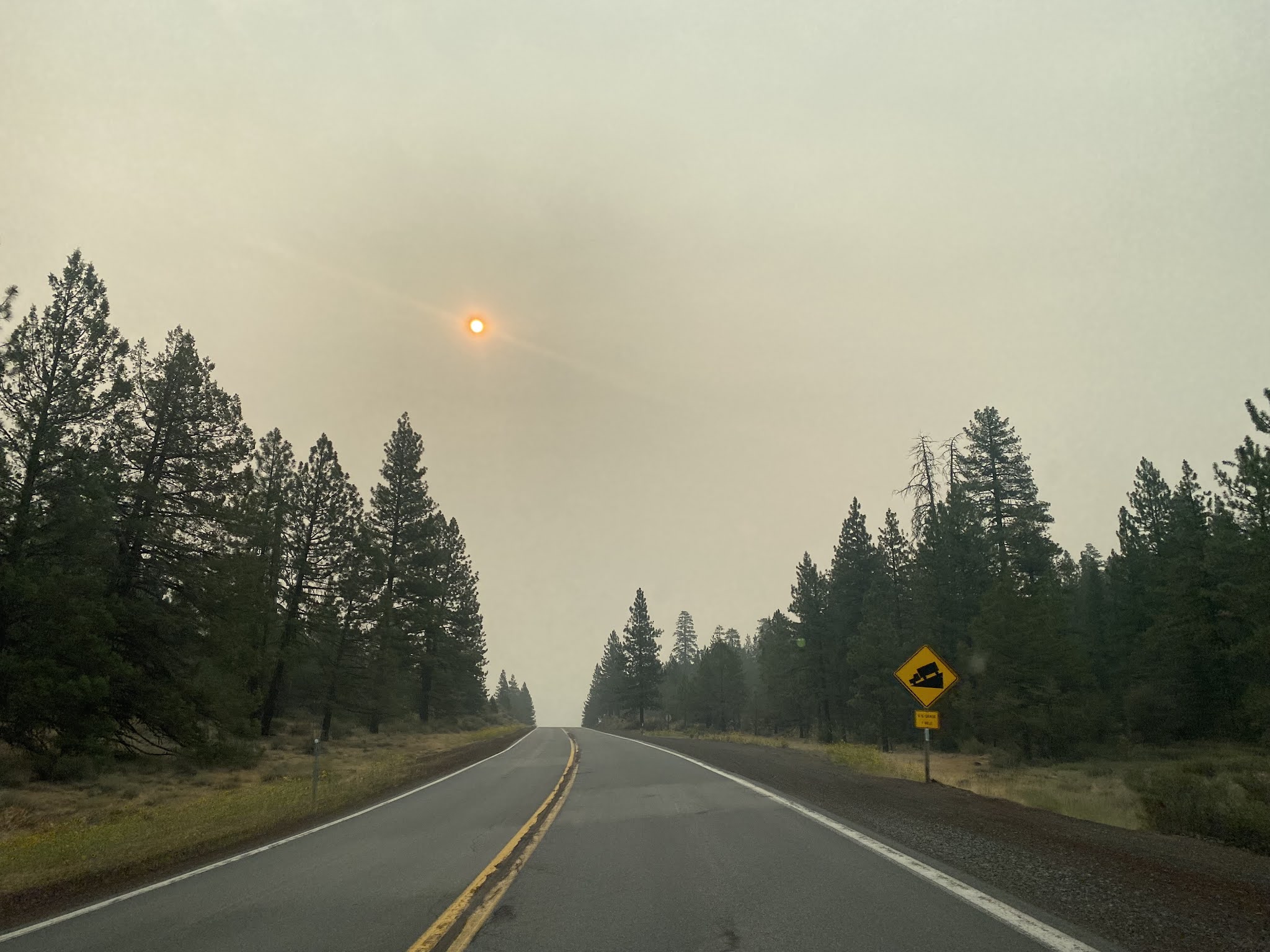
CA 299 west of Redding is signed as 18 miles from Montgomery Creek, 54 miles from Redding and 196 miles from Eureka.
CA 299 westbound ascends to the 4,368 Hatchet Mountain Summit at Postmile SHA 64.097.
CA 299 westbound descends from Hatchet Mountain Summit passing by a rest area before entering Montgomery Creek at Postmile SHA 56.766.
CA 299 west of Montgomery Creek is signed as 3 miles from Round Mountain, 24 miles from Bella Vista and 33 miles from Redding.
CA 299 westbound passes through Round Mountain at Postmile SHA 53.246.
CA 299 westbound drops below 2,000 feet above sea level and follows Little Cow Creek to Ignot at Postmile SHA 42.933. The ruins of a mine head frame can be observed in Ignot across Little Cow Creek opposite CA 299.
CA 299 westbound departing Ignot is signed as 21 miles from Redding, 67 miles from Weaverville and 175 miles from Eureka.
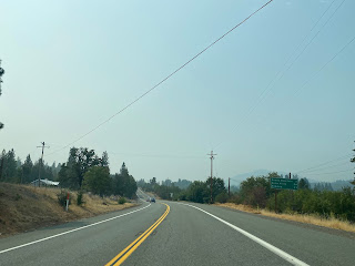
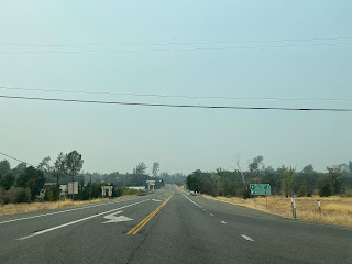
CA 299 westbound descends below 1,000 feet above sea level and enters Sacramento Valley. At Postmile SHA 29.97 CA 299 westbound enters Bella Vista. Bella Vista was once a large lumber community which was at the end of the Shasta Lumber Company logging flume. The Shasta Lumber Company flume was completed between Bella Vista and Hatchet Mountain by 1888. Bella Vista was also the eastern terminus of the 15 mile Bella Vista Railway. The Bella Vista Railroad had a western terminus at the Southern Pacific Railroad in Anderson. The Bella Vista Railway was constructed during the 1890s and wasn't abandoned until the 1930s.
CA 299 westbound passes through Bella Vista and is signed as 9 miles from Redding.
CA 299 west of Bella Vista expands to a freeway approaching Old Oregon Trail. CA 299 Exit 143 accesses Old Oregon Trail and Shasta College.
CA 299 westbound enters the City of Redding approaching Exit 141. CA 299 Exit 141 accesses Churn Creek Road and Hawley Road.
CA 299 westbound transitions onto Lake Boulevard and intersects Interstate 5. CA 299 westbound follows Lake Boulevard to a junction with CA 273/Old US 99 At Market Street at Postmile SHA 24.00. Lake Boulevard continues westerly as Shasta County Route A18 whereas CA 299 westbound transitions onto a multiplex CA 273 southbound on Market Street.


CA 273 south multiplexes CA 299 west on Market Street over the 1935 Sacramento River Bridge to Eureka Way at Route 273 Postmile SHA 16.836. CA 299 west departs CA 273 south via Eureka Way towards Shasta.
The first European settlement in modern day Redding was in 1844 when Pierson B. Redding received a Mexican land grant of Rancho Buena Ventura. During the American California Gold Rush mining claims were made near Shasta. These mining claims near Shasta led to the formation of a community known as Poverty Flats. In 1868 the Central Pacific Railroad purchased land in Poverty Flats which it intended to be the northern terminus of it's line to the gold claims of Northern California. By 1872 the Central Pacific Railroad reached Redding and the community began surpass nearby Shasta in importance. Redding was incorporated in 1887 and won the Shasta County Seat from Shasta in 1888. Redding can be seen along the Central Pacific Railroad on the
1873 Oregon, California, & Nevada Railroad Map.
CA 299 westbound on Eureka Way crosses the Union Pacific Railroad overhead at Postmile SHA 23.90.
CA 299 westbound follows Eureka Way out of the City of Redding. Departing Redding CA 299 is signed as 2 miles from Shasta, 42 miles from Weaverville and 143 miles from Eureka.
At approximately Postmile SHA 18.494 CA 299 westbound enters Shasta. While the community of Shasta is not a ghost town much of the older district resembles one along CA 299 and is part of Shasta State Historic Park. Shasta was founded in 1848 when Gold Claims were discovered nearby in the Klamath Mountains. Shasta was mainly used as stopping point for expeditions westward towards Weaverville, Whiskeytown, French Gulch, and Helena. Shasta had a population as high as 3,500 residents before declining in the 1880s when the Central Pacific Railroad made Redding a more desirable location. Much of CA 299 in Shasta consists of crumbling Gold Rush era buildings.
CA 299 westbound departing Shasta is signed as 5 miles from Whiskeytown, 39 miles from Weaverville and 140 miles from Eureka.
At Postmile SHA 14.3 CA 299 westbound crosses the Whiskey Creek Bridge over the Whiskeytown Reservoir. The extra wide frame members of the Whiskey Creek Bridge noted in Part 1 was never utilized to expand CA 299 to four lanes.
Upon crossing the Whiskey Creek Bridge CA 299 westbound intersects Whiskey Creek Road where the Whiskeytown General could be found. Prior the formation of the Whiskeytown Reservoir the site of Whiskeytown was located on Whiskey Creek. Whiskeytown was settled in 1849 and had a peak population of about 1,000 residents by 1855. The photos of the Whiskeytown General Store below were taken during 2016.
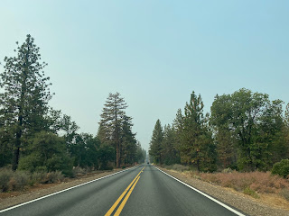
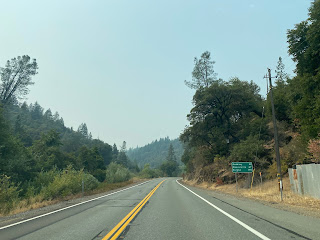
CA 299 west of the Whiskeytown Reservoir climbs to the 3,213 foot Buckhorn Summit and enters Trinity County.
CA 299 west of Buckhorn Summit descends to the Trinity River and intersects CA 3 in Douglas City at Postmile TRI R58.1. CA 299 is signed as 7 miles from Weaverville and 107 miles from Eureka at the CA 3 junction Douglas City. Gold was discovered in the Trinity River at the current site of Douglas City in 1848. Douglas City was settled in 1850 as a mining community and was named for Stephen Douglas.
CA 299 westbound begins a multiplex of CA 3 northbound in Douglas City. CA 299 west/CA 3 north cross the Trinity River at Postmile TRI R58.1 in Douglas City.
CA 299 west/CA 3 north follow Weaver Creek onto Main Street in Weaverville and split at Postmile TRI 51.575 at Trinity Lake Boulevard.
Weaverville is the Trinity County seat and by far it's largest community with a population approaching 3,600. Weaverville and the Klamath Mountains were part of the epicenter of the Gold Rush era in northern California. Weaverville was founded in 1850 and incredibly remote for the time and was only accessible by foot trail. The first stage to arrive in Weaverville came in 1853 which was followed by the Grass Valley Toll Road opening in 1858.
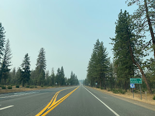
CA 299 westbound departing Weaverville is signed as 5 miles from Junction City, 57 miles from Willow Creek and 101 miles from Eureka.
CA 299 westbound climbs over the 2,888 foot high Oregon Mountain Summit at Postmile TRI 48.59. Oregon Mountain was the site of the La Grange Mine. A historic marker regarding the
La Grange Mine on CA 299 reads as follows:
"This mine was originally known as the Oregon Mountain group of claims, first operated about 1862. In 1892 the mine was purchased by the La Grange Hydraulic Gold Mining Company which brought water from Stuart's Fork through 29 miles of ditch tunnels and flume and delivered it to the mine pit under a 650 food head. Over 100,000,000 yards of gravel were moved and $3,500,000 in gold produced. Large scale operations ceased in 1918."
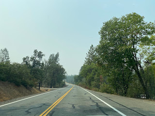
CA 299 westbound descends from Oregon Mountain Summit to the Trinity River near the outskirts of Junction City.
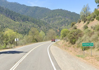
CA 299 westbound enters Junction City at approximately Postmile TRI 43.51. CA 299 westbound traffic is notified of a lack of services for 48 miles in front of Shasta-Trinity National Forest Junction City Station. Junction City was settled in the 1850s and came to be known as Milltown. The modern name of Junction City was taken in 1861 in reference to Canon Creek (also known as Canyon Creek) and the Trinity River. Canyon Creek Road in Junction City is the original alignment of LRN 20 referenced in Part 1.
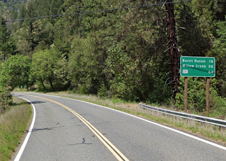
Departing Junction City CA 299 westbound crosses Canyon Creek. CA 299 is signed as 15 miles from Big Bar, 48 miles from Willow Creek and 93 miles from Eureka.
At Postmile TRI 36.91 westbound CA 299 crosses the North Fork Trinity River and intersects East Fork Road. East Fork Road can be used to access the town site of Helena.
Helena was settled in 1851 at the confluence of the main branch of the Trinity River and it's North Fork. Helena was known as; Bagdad, North Fork and The Cove before it's present name was adopted in 1891 upon the community receiving Post Office Service. The name "Helena" was taken from the first Post Master's wife and was used to avoid confusion with North Fork of Madera County. Helena was the western end of LRN 20 until 1923 when the connecting road was completed to Willow Creek along the Trinity River. During the 1930s Helena was impacted heavily by the Great Depression and declined to a ghost town. Much of the ruins of Helena are surprisingly intact and can be located just off CA 299 on East Fork Road in the Helena Historic District.
CA 299 west from Helena to Willow Creek follows the Trinity River through a series of canyons. The Trinity River can be observed from the Pigeon Point Campground near Helena in the photos below taken during 2016.
At Postmile TRI 31.2 CA 299 westbound passes through the community of Big Flat.
CA 299 westbound passes through Big Bar at Postmile TRI 28.57. Big Bar was settled in 1849 and has had continuous Post Office Service since 1850. A Shasta-Trinity National Forest Ranger Station can be found in Big Bar.
At Postmile TRI 21.72 CA 299 westbound passes through the community of Del Loma.
Departing Del Loma CA 299 westbound is signed as 10 miles from Burnt Ranch, 26 miles from Willow Creek and 64 miles from US 101.
CA 299 westbound crosses the Trinity River at Postmile TRI 14.1 and enters Cedar Flat.
At Postmile TRI 11.65 CA 299 westbound passes through Burnt Ranch. The name "Burnt Ranch" references a group of Canadian miners burning a Native American ranch in the area to forcefully make way for their settlement in 1849.
Upon passing by a rest area CA 299 westbound crosses the Trinity River twice beginning at Postmile TRI R3.5.
At Postmile TRI 1.23 CA 299 westbound passes through the community of Sayler. Sayler was established during 1918 as a mining community during the construction of LRN 20 along the Trinity River. Sayler and named after notable miner Charles Marshall Sayler.
West of Sayler CA 299 crosses the South Fork Trinity River and enters Humboldt County.
CA 299 westbound enters Willow Creek and intersects CA 96 at Postmile HUM 38.82. As Willow Creek was being settled off of mining and lumber claims during the 1870s it had a large number of Chinese immigrants which led to the community being called China Flat. The China Flat Post Office opened in 1878 which was changed to Willow Creek in 1915. Willow Creek sits at the confluence of the Trinity River and namesake Willow Creek.
CA 299 westbound departing Willow Creek is signed as 33 miles from Blue Lake and 40 miles from Arcata.
CA 299 west of Willow Creek splits away from the course of the Trinity River. CA 299 westbound ascends over the 2,803 foot high Berry Summit at Postmile R28.99. West of Berry Summit CA 299 begins a 7 mile long descent carried via 7% grades.

CA 299 descends westward to the Redwood Creek Bridge at Postmile HUM R22.41.
From Redwood Creek CA 299 climbs westward to Lord Ellis Summit at Postmile HUM R17.18. Lord Ellis Summit is located at 2,263 feet above sea level. The original alignment of US 299/LRN 20 can be found behind a closed gate south of Lord Ellis Summit. Traffic on CA 299 is advised of a 6% descent over the next 7 westward miles from Lord Ellis Summit.
At Postmile HUM R11.00 CA 299 westbound crosses the North Fork Mad River and intersects another stub of the former US 299/LRN 20.
CA 299 westbound intersects the original alignment of US 299/LRN 20 via Blue Lake Boulevard at Postmile HUM R7.12.
At Postmile HUM R5.84 CA 299 westbound expands to a freeway. At Exit 5 CA 299 westbound intersects the opposite end of former US 299/LRN 20 on Blue Lake Boulevard.


Modern Blue Lake is made up of several consolidated town sites; Old Blue Lake, Powersville, and Scottsville. Blue Lake is named after a small lake that formed from flooding from the Mad River which disappeared for final time during the 1920s. Scottsville was founded 1866, Powersville in 1869 and Mad River in 1870. Mad River in time would become what now known as Old Blue Lake. In 1910 all three towns were consolidated into what is modern Blue Lake.
Blue Lake was located along the Arcata & Mad River Railroad which ran from Arcata to Korbel. The Arcata & Mad River Railroad was a narrow gauge line which was first constructed in 1853 to transport lumber from the Klamath Mountains to shipping yards on the Pacific Ocean. The Arcata & Mad River Railroad was converted to standard gauge in 1925 and was in continuous service until 1983 making it one of the longest lived railroads in U.S. history. Service on the Arcata & Mad River Railroad permanently shuttered in 1992 which led to the tracks being removed in 1997. When the Arcata & Mad River Railroad was shuttered it was the longest active railroad in California.
The photos below were taken in 2016 in Blue Lake along the corridor of the Arcata & Mad River Railroad along Railroad Avenue.
CA 299 Exit 4 accesses Glendale Drive west of Blue Lake.
CA 299 westbound Exit 3B accesses Essex Lane.
CA 299 Exit 2 accesses CA 200/North Bank Road. Directly west of CA 200 the route of CA 299 crosses the Mad River.
CA 299 westbound terminates at US 101 in Arcata.
Version History
- Originally published on 11/5/18 as "Adventure US Route 299 from US Route 101 to Interstate 5."
- Updated and republished on 10/17/21 as "US Route 299 and modern California State Route 299."


Comments