One of the shorter US highways at 63 miles in length, US 197 entered the US Highway System in 1952, after approval by the American Association of State Highway Officials (AASHO) in November of 1951. The timing of the creation of US 197 was due to a new bridge being built over the Columbia River at The Dalles, Oregon, as US 97 to the east was still being served by a
ferry crossing across the Columbia River between Maryhill, Washington and Biggs, Oregon until 1962. At the time of the highway's inclusion into the US Highway System, there were a number of dams being built along the Columbia River, including a dam at the Dalles just east of the US 197 bridge, which led to US 197's timeliness in being included in the US Highway System.
Replacing what was OR 23 between US 97 at Shaniko Junction (south of Maupin, Oregon) and The Dalles, plus a route mostly along what was when part of US 830 in Washington State east to Maryhill, US 197 travels through a few towns, high desert terrain and closer to the Columbia River, some farms as well. US 197 is part of The Dalles-California Highway, with US 97 and US 197 taking on the role of serving traffic needs along the eastern front of the Oregon Cascades and beyond. In Washington State, US 197 is currently a short connector highway of about 3 miles between WA 14 at Dallesport and the Columbia River, but went east along WA 14 to Maryhill technically until 2006, even though US 197 was not signed along this stretch of WA 14 for decades. I am not sure if that was an oversight from when US 830 was decommissioned. So currently, US 197 just goes from US 97 in Shaniko Junction, Oregon to WA 14 in Dallesport, Washington. US 197 was lightly traveled on the day I drove it and seems like a good way to get to Central Oregon from The Dalles, Hood River or even as an alternative way to travel from Portland.
 |
| From the AASHTO Route Numbering Archive, correspondence from the AASHO Executive Secretary Hale H. Hale regarding the approval of US 197's inclusion into the US Highway System. |
We'll take modern day US 197 from north to south on this photographic journey. Let's go!
 |
| US 197 begins just after this sign on WA 14 eastbound in Dallesport. |
 |
| Looking towards The Dalles in the distance on US 197 in Dallesport. |
 |
| Mount Hood is a prominent companion on a drive along US 197. There was plenty of snow on the mountain on the day I drove this highway. |
 |
| View of The Dalles Bridge over the Columbia River. The bridge officially opened in 1954. Before the bridge opened, a ferry service ran across the Columbia River at The Dalles. |
 |
| Going northbound for a bit to take a better look at The Dalles Dam, which separates the Lake Bonneville and Lake Celilo portions of the Columbia River. |
 |
| Plus a nice sweeping view of The Dalles Bridge. |
 |
| Oregon welcomes you. US 197 bypasses the heart of The Dalles, which was a major point along the Oregon Trail as settlers determined whether to take the Barlow Road or take their chances with the Columbia River on their way to the Willamette Valley. At least that's what the computer game taught me. Today, The Dalles has recreational activities, lots of cherries that are grown plus a healthy share of historic murals in the downtown district for all to see. |
 |
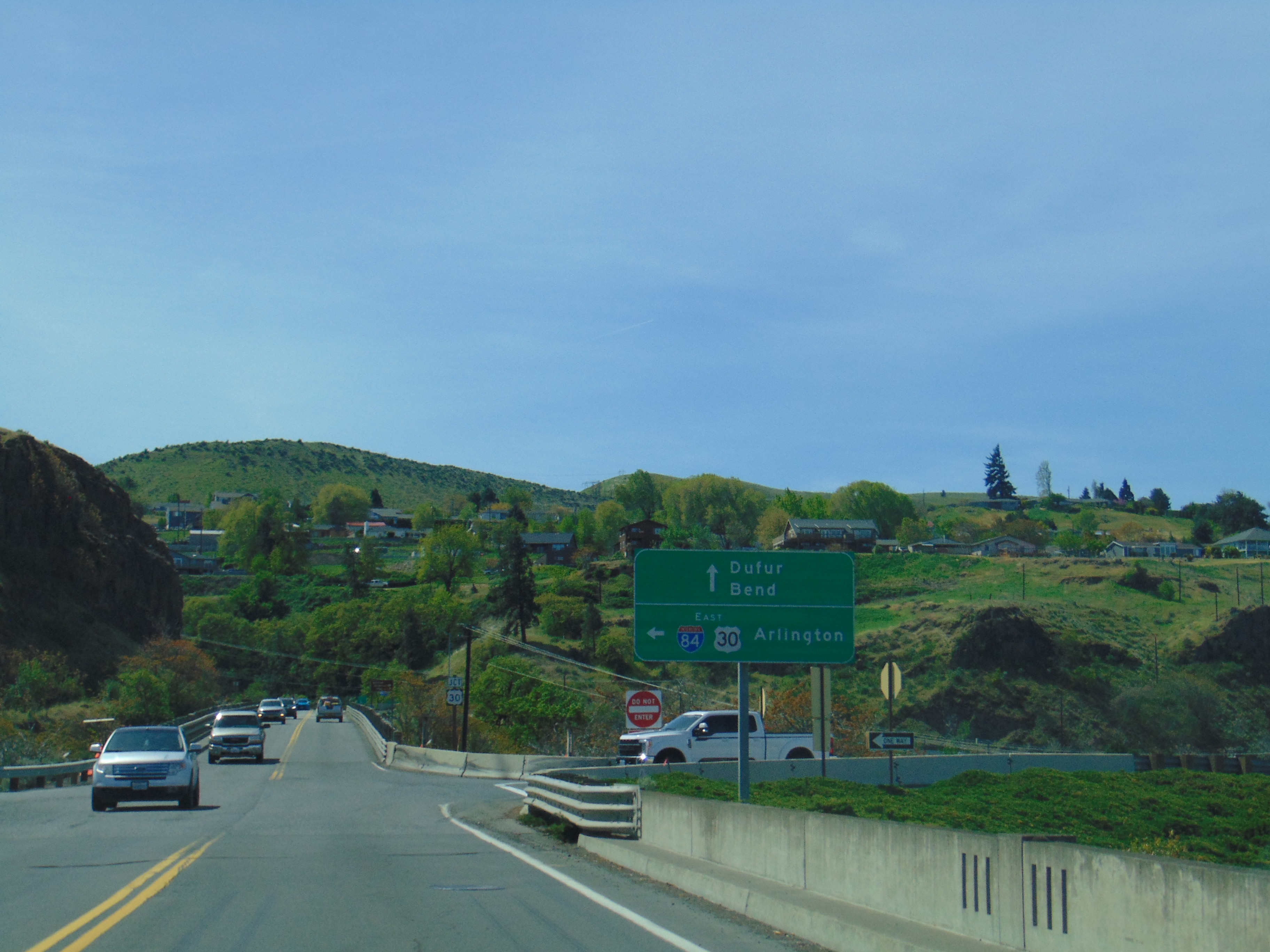
| US 197 crosses I-84 here. |
 |
| If you want to go to The Dalles, you can drive a couple of miles down US 30. But for the intents and purposes of this article, we'll continue uphill along US 197. |
 |
| US 197 follows part of the route of the Barlow Road, part of the historic Oregon Trail. |
 |
| Wheat fields and farms are on prominent display in the distance along US 197 between The Dalles and Dufur. I drove US 197 at the end of April, so the hills look lush and green. |
 |
| Mount Hood is poking out in the distance. |
 |
| To the right is the small town of Dufur, home of the historic Balch Hotel. The curiously named Dufur was named after two brothers who first settled in this area. |
 |
| High desert terrain becomes more prominent south of Dufur, as seen on what looks like an old alignment of US 197. |
 |
| Cutting through the hills on US 197 southbound. |
 |
| Going to take a short detour to White River Falls, which is in a state park 4 miles to the east. |
 |
| Meanwhile, the Barlow Road veers off of US 197 and heads west towards the Cascades. |
 |
| The upper part of the 90 foot tall White River Falls. I just stuck around the viewing area at the upper end of the waterfall due to trying to make time, but there is a hike you can take to see the whole waterfall along with a power generator. |
 |
| Back on US 197 southbound in Tygh Valley. |
 |
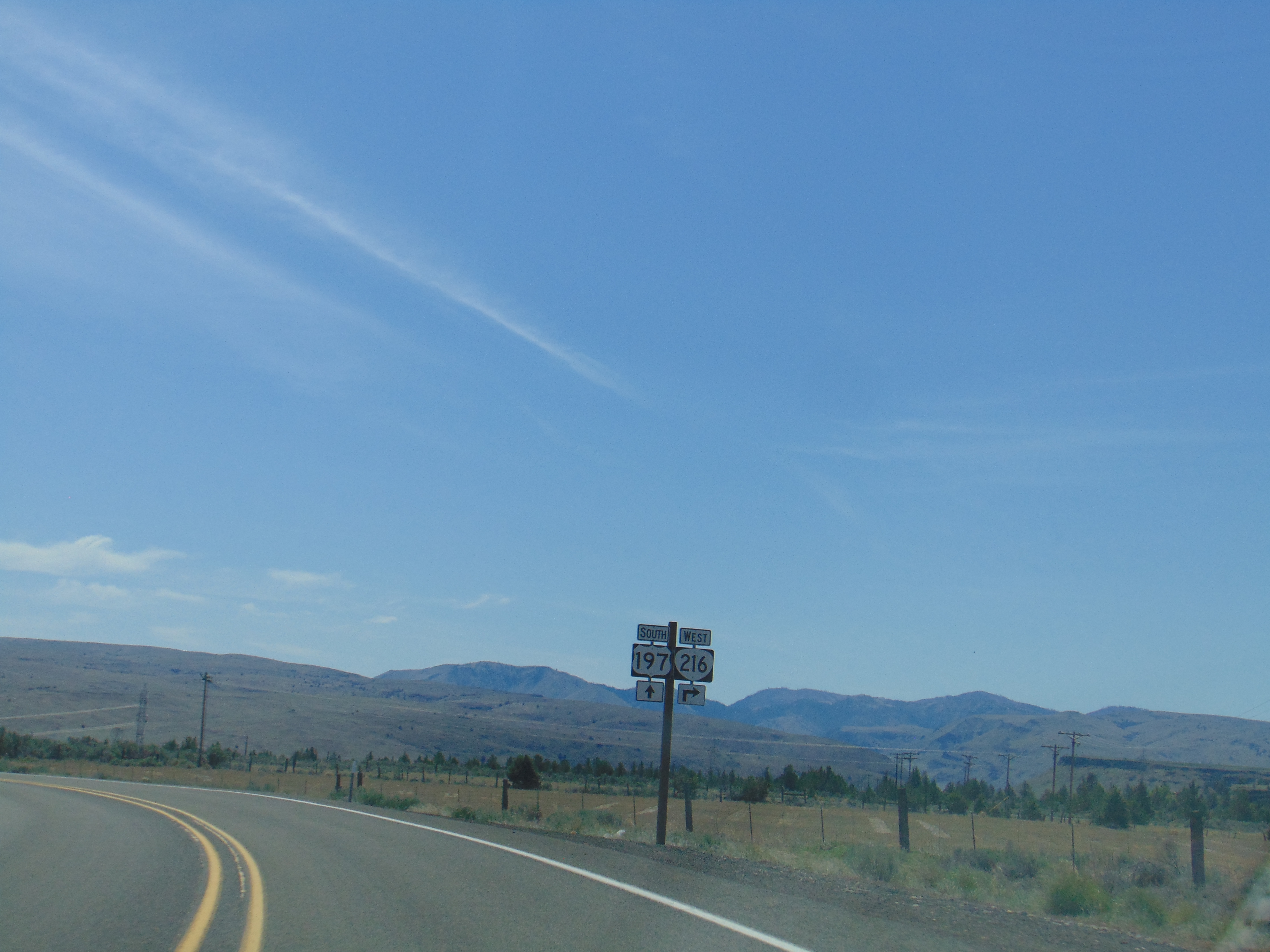
| OR 216 leaves US 197 as it continues west to US 26 and Mount Hood. |
 |
| Entering Maupin, the one town that US 197 goes through rather than bypasses. Incorporated in 1922, Maupin is located on the Deschutes River and is known for its whitewater rafting and fishing opportunities. |
 |
| A look north at the high desert terrain as we enter Maupin. |
 |
| Downtown Maupin. |
 |
| The Deschutes River Bridge in Maupin, which opened in 1929. US 197 descends down the gorge of the Deschutes River after going through downtown Maupin, then back up the gorge on the other side of the river, leading to viewpoints like this one. |
 |
| But it's otherwise pretty much all high desert terrain on US 197 south of Maupin. |
 |
| But there are mountains to see in the distance, especially at the 3,363 foot high Criterion Summit. |
 |
| There is a viewing area that was built at Criterion Summit for people wanting to get a good glimpse at the mountains beyond. |
 |
| South of Criterion Summit, US 197 goes through some rolling hills and ranch lands. |
 |
| US 197 ends at US 97 in Shaniko Junction. |
How to Get There:
Sources and Links:
USEnds.com -
End of US Highway 197AASHTO Route Numbering Archive -
Route Numbering Archive1859 Oregon's Magazine -
Highway 197 from The Dalles to MaupinRoad Trip Planning -
Oregon United States #197 Highway GuideA.F. Litt -
The Dalles-California Highway


Comments