Given I was out in Monterey I was very close to the northern section of Big Sur that is still cut off by the Pfeiffer Canyon Bridge closure. Originally the new Pfeiffer Bridge was slated to open on October the 1st but now seems to be pushed back to October the 24th. I woke up early on the 19th and didn't have much better to do until Mid-Day, it seemed like a waste of a fog free coast not to head down CA 1 to see what progress has been made. Of course as I stated in Part 1, Big Sur technically begins at the Carmel River or the intersection of CA 1 and County Route G16.
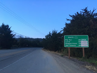
There wasn't a single trace of fog the entire 26 miles south to Pfeiffer Big Sur State Park which offered much more clear views of the coastline. Back in June the weather was still dreary and had heavy rain in places.

Of course I couldn't resist getting some unobstructed historic bridge pictures, this one is the Malpaso Creek Bridge.

Not a cloud in the sky, even Point Sur could be seen far to the south.

The Granite Canyon Bridge.

The Garrapata Creek Bridge and a quick look back to the north.


The coastline south of the Garrapata Bridge.

The terrain along CA 1 starts to get more elevated around the Rocky Creek Bridge. Aside from the Bixby Bridge I find the Rocky Creek Bridge to be the most visually appealing along CA 1.


Not everyday you get the entire Bixby Bridge to yourself, but really with the Pfeiffer Canyon and Mud Creek closures there isn't much in the way of tourism on CA 1 in Big Sur this year. There was a huge glut of work vehicles and Caltrans trucks heading south to the Pfeiffer Canyon Bridge project but nothing that really impeded getting some clear photos. There was a work truck on Coast Road which blocked me from taking some photos of the road deck on my way south.


I stopped at Hurricane Point to get a clear look to the north of Bixby Creek and south at Point Sur. Really the views here are impressive, I still love to look at the coast even after being here so many times over the years.


The Little Sur River Bridge.

Point Sur rises 361 feet above the Pacific Ocean and is the location of the Point Sur Lighthouse. The Point Sur Lighthouse was built in 1889 and was at one time extremely isolated until CA 1 was built by it in 1937. My understanding is that the coastline around Point Sur was extremely prone to shipwrecks prior to a Lighthouse being established.


South of Point Sur CA 1 treks inland towards Pfeiffer Big State Park and the bridge closure. Not much here has changed since June other than the roadway being much more clean and I think a new VMS sign? I'm to understand that there is far more hiking routes available now than back in June, I'm hoping to try some of them next month. Regardless I flipped a U-turn at the Pfeiffer Canyon Bridge closure and headed back north to Monterey.


On the way back north I did stop at Hurricane Point and the Bixby Bridge for some extra photos. The work truck from earlier was long gone which opened up access to Coast Road. For some reason the road closure sign to anyone other than locals is still present on Coast Road.


Just for kicks I stopped at Jacks Peak County Park on the way back into Monterey since I had some extra time to kill. I figured that an overlook of Monterey, Monterey Bay, and even the Santa Cruz mountains would be worth stopping for a couple minutes.

Comments