Spreckels Avenue


Spreckels Avenue is an approximately 1.5-mile roadway located south of Salinas in Monterey County.  Spreckels Avenue is named after the community of Spreckels which is one of the best-preserved company towns in California.  Spreckels was founded in in 1898 by the Spreckels Sugar Company who operated a mill in the community from 1899-1982.  Spreckels Avenue begins at the grade of the former Spreckels Branch Railroad and terminates to the west at California State Route 68.  


Part 1; the history of Spreckels Avenue

Spreckels and the Spreckels Sugar Company were named after Claus Spreckels.  The Spreckels Sugar Company was founded in August 1896 after Claus Spreckels and began construction of a mill south of the city of Salinas.  Much of Salinas Valley during the 1890s had been undeveloped for agricultural purposes.  

The community bearing Claus Spreckels' name was constructed near the new mill and was connected to the Southern Pacific Railroad via the so-called Spreckels Branch Railroad.  Both the community of Spreckels and the Spreckels Branch Railroad would be complete by 1898.  The Spreckels Branch Railroad split from the Southern Pacific Railroad via what is known as Spreckels Junction.  The Spreckels Sugar Company mill would open to operations during 1899.  

Spreckels was connected to the Salinas-Monterey Highway via what came to be known as Spreckels Avenue.  The 1910 United States Geological Survey Map of Salinas displays Spreckels Avenue ending at the Old Hilltown near the 1889 Salinas River Bridge.  Old Hilltown was once the site of a ferry operation at the Salinas River along the highway between Salinas and Monterey.   The site of Old Hilltown was located along what is now Spreckels Lane.  

Private home sales began in Spreckels during 1925 but much of the community would remain in the hands of the Spreckels Sugar Company.  The Salinas-Monterey Highway was added to the State Highway System as part of Legislative Route Number 117 during 1933.  Spreckels Avenue can be seen connecting Spreckels to Legislative Route Number 117 on the 1935 Division of Highways Map of Monterey County.  Legislative Route Number 117 would begin to be signed as California State Route 68 in 1961.  

The Spreckels Sugar Company mill in Spreckels shuttered during 1982.  Following the shuttering of the mill the Spreckels Branch Railroad was withdrawn to the city limits of Salinas.  The remaining homes in the community of Spreckels were sold to the public.  


Part 2; a drive on Spreckels Avenue

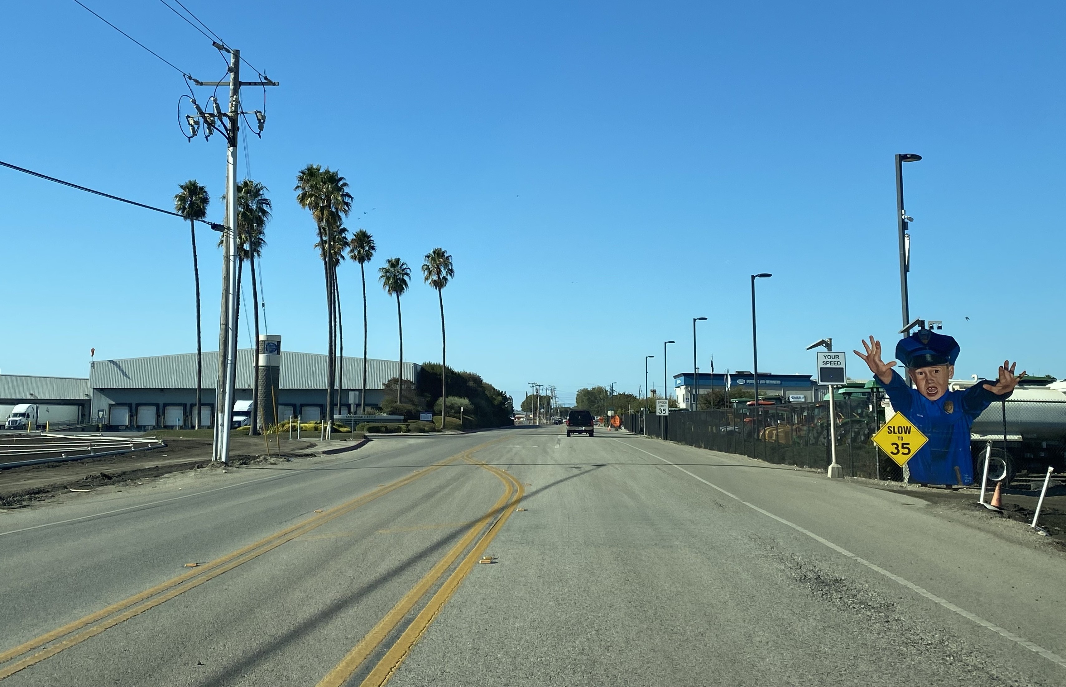
As noted in the introduction Spreckels Avenue begins at the former grade of the Spreckels Branch Railroad.  Spreckels Avenue acts as a continuation of the Harris Road.  The transition of Harris Road to Spreckels Avenue is easy to spot due to the non-Manual of Traffic Control Devices advisory speed signage.  

Spreckels Avenue westbound passes through the downtown area of the community.  The Spreckels Volunteer Fire Department building boasts being active since 1899. 


Westbound Spreckels Avenue departs the community of Spreckels through a tunnel of trees.  As the tree tunnel ends the roadway intersects with Spreckels Lane which as noted in Part 1 once connected to Old Hilltown.  


Westbound Spreckels Avenue terminates at California State Route 68.  


Comments

Popular posts from this blog

Cajon Pass; Cajon Pass Toll Road, National Old Trails Road, US Route 66/91/395 and Interstate 15

This past weekend I spent some time in Cajon Pass traversing the many historic road alignments. Cajon Pass is located in San Bernardino County, California along the San Andreas Fault.  Cajon Pass  serves the boundary line between the Mojave Desert, the San Gabriel Mountains, San Bernardino Mountains and San Bernardino Valley.  Cajon Pass is historically one of the most traveled transportation corridors in American California and presently is served by four rail lines, Interstate 15 and California State Route 138. While Cajon Pass is known mostly for carrying US Route 66 it has carried numerous other signed highways that have had a significant impact on regional and national road travel.  While this is my best attempt to compile everything from the best sources I could find into one single transportation history blog regarding road travel in Cajon Pass I suspect as time goes on this article will be frequently updated.  If you have any information that you ...

Pardee Dam Road

Pardee Dam is a 358-foot-high concrete structure located near Campo Seco at the Calaveras County and Amador County Line.  Pardee Dam impounds the Mokelumne River which forms the namesake Pardee Reservoir.  Pardee Dam was completed during 1929 and is part of the East Bay Municipal Utility District.  Pardee Dam is accessed by the namesake Pardee Dam Road which crosses the structure via the one-lane road seen as the blog cover photo.   Part 1; the history of Pardee Dam Road The closest community to Pardee Dam is that of Campo Seco on the Calaveras County side of the Mokelumne River.  Campo Seco was founded in 1850 by Mexican Miners who worked placer claims in Oregon Gulch during the height of the California Gold Rush.  Campo Seco would reach a population of about three hundred by 1860 spurred by the numerous mining claims in the area.  Main Street of Campo Seco flowed directly into the Campo Seco Turnpike which had been authorized by the California L...

The last 1956-63 era California Sign State Route Spade?

Along southbound California State Route 170 (the Hollywood Freeway Extension) approaching the Hollywood Freeway/Ventura Freeway interchange a white California State Route 134 Sign State Route Spade can be observed on guide sign.  These white spades were specifically used during the 1956-63 era and have become increasingly rare.  This blog is intended to serve as a brief history of the Sign State Route Spade.  We also ask you as the reader, is this last 1956-63 era Sign State Route Spade or do you know of others?  Part 1; the history of the California Sign State Route Spade Prior to the Sign State Route System, the US Route System and the Auto Trails were the only highways in California signed with reassurance markers.  The creation of the US Route System by the American Association of State Highway Officials during November 1926 brought a system of standardized reassurance shields to major highways in California.  Early efforts to create a Sign State Route ...