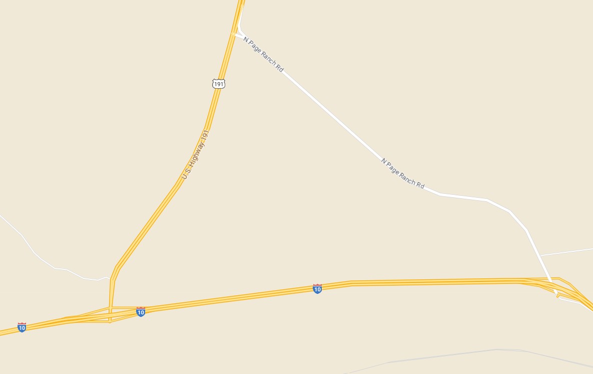
US Roure 191Y is a hidden State Highway designation on Page Ranch Road in Cochise County, Arizona. US Route 191Y is a 3.5-mile spur of US Route 191 which originates at Interstate 10 Exit 355 and terminates to the northwest via Page Ranch Road at mainline US Route 191. US Route 191Y is not a signed highway but nonetheless has Arizona Department of Transportation mile markers reflecting mileage from mainline US Route 191. Page Ranch Road was added to the Arizona State Highway system as US Route 666Y during 1958. During 1992 US Route 191 was extended south to the Mexican border which led to Page Ranch Road being reassigned as US Route 191Y.
Part 1; the history of US Route 191Y
What is now US Route 191Y and Page Ranch Road was added to the Arizona State Highway System during September 9, 1927, as Arizona State Route 81. Arizona State Route 81 originated at US Route 80 near Douglas and terminated at the US Route 180 in Safford. Arizona State Route 81 can be seen aligned past Bowie Junction and modern Page Ranch Road on the 1927 Arizona State Highway Commission Map.
Arizona State Route 81 was one of the original Arizona State Routes to be defined.
During the December 8, 1938, American Association of State Highway Officials (AASHO) meeting the Executive Commitee approved an Arizona Highway Commission request to extend US Route 666 to US Route 80. The extension of US Route 666 subsumed the entirety of Arizona State Route 81.
US Route 666 appears co-assigned with Arizona State Route 81 on the corridor of Page Ranch Road towards Bowie Junction on the 1939 Rand McNally Map of Arizona.
One of the earliest highway maps to display Page Ranch Road split from US Route 666 is the 1948 Rand McNally Map of Arizona. Page Ranch Road is displayed as a locally maintained roadway connecting from Arizona State Route 86 at Bowie Junction northwest to US Route 666.
According to the
2013 Arizona Department of Transportation mileage log, Page Ranch Road was built to state standards during 1961. The mileage log notes Page Ranch Road to currently be part of US Route 191Y. The US Route 191Y designation for Page Ranch Road during 1961 would have been US Route 666Y. State maintenance of Page Ranch Road is noted to have been 3.11 miles during 1961.
The first half mile of US Route 666Y appears to have been realigned at some point during the 1960s during the construction of the Luzena Interchange (Exit 355) of Interstate 10 at Bowie Junction. The construction of Luzena Interchange extended US Route 666Y to a length of 3.5 miles. The razed older grade of Page Ranch Road and US Route 666Y can be seen on Google satellite images.
On May 8, 1992, the Arizona Department of Transportation submitted an application to AASHTO eliminate US Route 666 in the state. The application came with a secondary request to extend US Route 191 from Chambers south to the Mexican border in Douglas over the existing routing of US Route 666. Both requests were approved by the AASHTO Executive Committee on June 15, 1992.
The extension of US Route 191 led to the redesignation US Route 666Y on Arizona Department of Transportation logbooks as US Route 191Y on
September 18, 1992. US Route 191Y is not an officially recognized US Route by AASHTO.
Part 2; a drive on US Route 191Y
From southbound US Route 191 intersects US Route 191Y at Page Ranch Road approaching Mile Marker 90. US Route 191Y/Page Ranch Road is simply signed as "3 miles to Interstate 10" from southbound mainline US Route 191. Note: all photos in this section in addition to the blog cover were taken by Adam Prince.
The view from the north terminus of US Route 191Y facing towards Mount Graham.
The view south on US Route 191Y/Page Ranch Road towards Interstate 10 Exit 355.


Comments