
Cross Plains, Tennessee

The small Robertson County town of Cross Plains in Middle Tennessee is a charming example of the numerous small towns in the state.

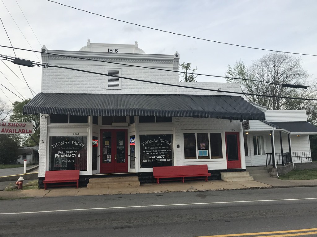
Thomas Drugs - Cross Plains, Tennessee
The town was settled by Thomas Kilgore in the late 1700s.  His settlement was originally named Kilgore Station, but the name would later be changed to Cross Plains.


Cross Plains is home to over 1700 residents and is a quiet town with only a flashing four way stop.  The heart and soul of the town is Thomas Drugs - a 90 year old pharmacy with a still running grill and soda fountain.  Thomas Drugs resides in a 1915 storefront and has been owned by the Green family since 1976.


Cross Plains is one of the numerous stops and attractions along the 334 mile Ring of Fire Driving Trail.  The town hosts the annual Kilgore Station Bluegrass Festival every April.  The town also hosts a two day community wide yard sale called "Trash and Treasures" every June.

All photos taken by post author - April 2019

How To Get There:

Comments

Popular posts from this blog

Cajon Pass; Cajon Pass Toll Road, National Old Trails Road, US Route 66/91/395 and Interstate 15

This past weekend I spent some time in Cajon Pass traversing the many historic road alignments. Cajon Pass is located in San Bernardino County, California along the San Andreas Fault.  Cajon Pass  serves the boundary line between the Mojave Desert, the San Gabriel Mountains, San Bernardino Mountains and San Bernardino Valley.  Cajon Pass is historically one of the most traveled transportation corridors in American California and presently is served by four rail lines, Interstate 15 and California State Route 138. While Cajon Pass is known mostly for carrying US Route 66 it has carried numerous other signed highways that have had a significant impact on regional and national road travel.  While this is my best attempt to compile everything from the best sources I could find into one single transportation history blog regarding road travel in Cajon Pass I suspect as time goes on this article will be frequently updated.  If you have any information that you ...

Pardee Dam Road

Pardee Dam is a 358-foot-high concrete structure located near Campo Seco at the Calaveras County and Amador County Line.  Pardee Dam impounds the Mokelumne River which forms the namesake Pardee Reservoir.  Pardee Dam was completed during 1929 and is part of the East Bay Municipal Utility District.  Pardee Dam is accessed by the namesake Pardee Dam Road which crosses the structure via the one-lane road seen as the blog cover photo.   Part 1; the history of Pardee Dam Road The closest community to Pardee Dam is that of Campo Seco on the Calaveras County side of the Mokelumne River.  Campo Seco was founded in 1850 by Mexican Miners who worked placer claims in Oregon Gulch during the height of the California Gold Rush.  Campo Seco would reach a population of about three hundred by 1860 spurred by the numerous mining claims in the area.  Main Street of Campo Seco flowed directly into the Campo Seco Turnpike which had been authorized by the California L...

California State Route 82/Old US Route 101 on the El Camino Real from San Francisco to Interstate 380

After completing Interstate 380 I made my way northward into the City Limits of San Francisco to drive the northernmost portion of California State Route 82. CA 82 is 52 mile State Route between I-280 in San Francisco southward to Interstate 880 in San Jose.  CA 82 is significant due to it being part of the historical surface alignment of US Route 101 and the El Camino Real. The "El Camino Real" was a Spanish Highway in Las Californias and Alta California which connected the 21 Catholic Missions along the coast.  Essentially the route of the El Camino Real was plotted out in the late 1700s from two Spanish survey expeditions.  The Missions were plotted approximately 30 miles apart along the 600 mile route so that they would be a single day journey by horse.  The El Camino Real name fell into disuse after the Mexican Revolution of 1821 but was revived by American highway promoters in the 1890s and 1900s.  Today the El Camino Real is mostly associated...