This past February I visited the Mexican State of Jalisco. My trip through Jalisco included a tour of; numerous towns, drives on the Federal Highway System, a drive on an Autopista, and visits to other unique pieces of infrastructure.

Part 1; what are the differences between roads in Mexico versus the United States?
Being primarily a highway blog site the elephant in the room for many readers of Gribblenation probably is "what are the differences with driving in Mexico versus the United States?" To that end while there are some similarities with the United States there many unique facets of Mexican roadways:
- Road maintenance on the whole lags far behind the U.S. on every level. Your drive to work on a beat up Interstate that is constantly under construction doesn't compare to a drive on a critically weathered Federal Highway 15 in Guadalajara. If I was to draw an analog I would compare the state of most Federal Highways to a remotely paved National Forest Service Road.
- Signage is more in line with what one might see on a European Highway, obviously speed is measured in Kilometers Per Hour.
- Federal Highways don't carry multiplex reassurance signage. Federal Highways tend to be barely signed at all and can be very difficult to follow. Following a Federal Highway requires a driver to pay very close attention to guide signage. Federal Highway 15 seemed to be an exception as it had reassurance shields on Kilometer Markers in 5 Kilometer intervals south of Guadalajara.
- Most Jalisco State Highways were better signed than the Federal Highways.
- Traffic in Guadalajara was far more intense and difficult to get through than any major U.S. city I've traveled in. Limited access roadways are rare and most major roadways in Guadalajara were engineered to the fullest extent they can be to fit as many vehicles as possible.
- On local levels almost nobody wants to use the Autopistas ("D Routes") given that they have a huge toll cost relative to the value to Pesos. When I drove Autopista 54D south of Federal Highway 80 it cost $84 Pesos which was about $4.75 dollars US. It seems that at least in the case of my own family road trips are more enjoyable when it includes driving through a town rather than some limited access bypass.
- Riding in the back of the truck, SUV, or wagon is still a thing. Road travel kind of reminded me of how travel in the U.S. once was in the 1980s before there was a crack down on back seat belt laws. Safety really isn't at the forefront of using the road pretty much in any capacity.
- Filling up with gas is just like Oregon and New Jersey, an attendant pumps it for you. The average gas cost was about $20.00 Pesos a liter which came out close to $4 dollars a gallon U.S. I suppose being from California that steep price didn't sting all that much...
- There is almost no traffic lights on Federal Highways or even on the Jalisco State Highways that I drove. The Federal Highways often featured huge reductions in speed coupled with speed bumps at major at-grade intersections.
- Every traffic light I saw was horizontal in configuration.
- There seems to be virtually no traffic enforcement in cities or even highways. I don't recall even seeing any police presence on a Federal Highway.
- Driving tendencies are all over the place. Some drivers go way over the speed limit whereas others go way under. With the slow drivers I noticed that they tend to pull over to the shoulder or side of the lane to allow traffic to pass. Almost nobody follows the lane markings and passes pretty much are open season.
- Local level street signage on the whole is extremely poor. Most towns and Municipalities I visited were only loosely signed with traffic control devices. Most street blades can be found on the corners of buildings at an intersection along with directional markers indicating if a road is one-way or two-way. I found the stop signs tend to be placed on the opposite side of intersections and are rarely actually followed by drivers. I found a lot of local roadways didn't feature any traffic control information at all. A lot two-lane roads locally have no center line and are narrow enough for only one vehicle at a time.
- Pedestrians and cyclists are far more aggressive than their U.S. counterparts. The cyclists in particular tend to ignore all traffic control signage. Cyclists often pass vehicles left, right, or even going the wrong way. Pedestrians tend to jump into the roadway and expect vehicles to stop for them even when it isn't possible. Intersections with large amounts of pedestrians tended to be managed with speed bumps in rural towns and municipalities.
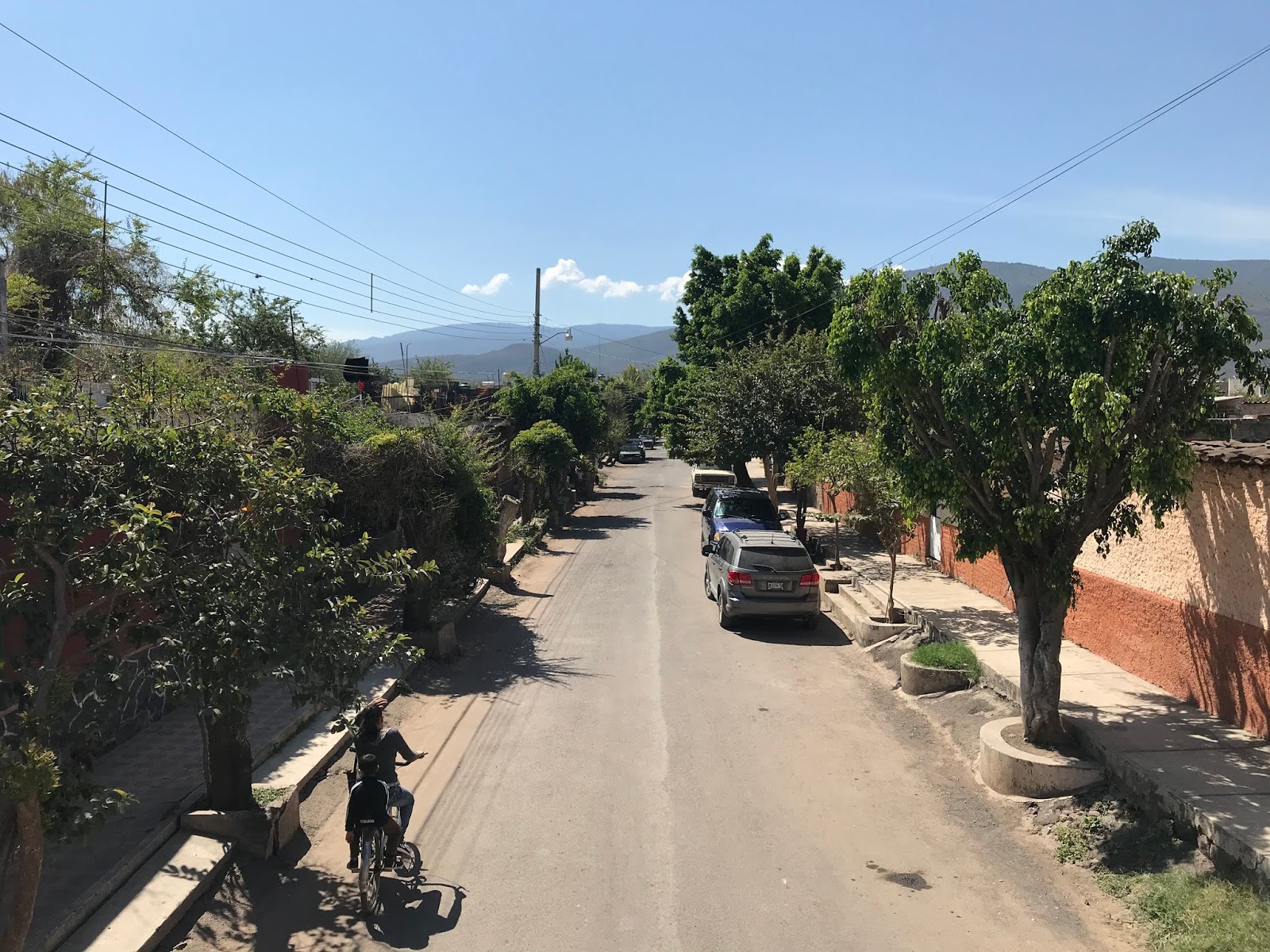
- Cobblestone road surfaces were probably the most common road type in the smaller communities. Some of the cobblestone roads were actually pretty good and featured some flat bricks to flow traffic. Most cobblestone roads were extremely old and had some serious issues with subsiding.
- Most local roads I drove in smaller communities were located at the bottom of the drainage grade. Most of these roadways flood severely in wet weather. Pedestrian traffic generally stays on elevated sidewalks.
- Autopistas in rural areas have a ton of surface level intersections that access remote roadways. I actually had to use two of these surface intersections on Autopista 54D while visiting a family ranch. I would compare these intersections to what can be seen on rural Interstates like; I-17, I-10, and I-40.
- Dirt roads usually have almost no grading and are covered in loose debris. Surprisingly low clearance traffic tends to still utilize even the most haggard dirt roads.
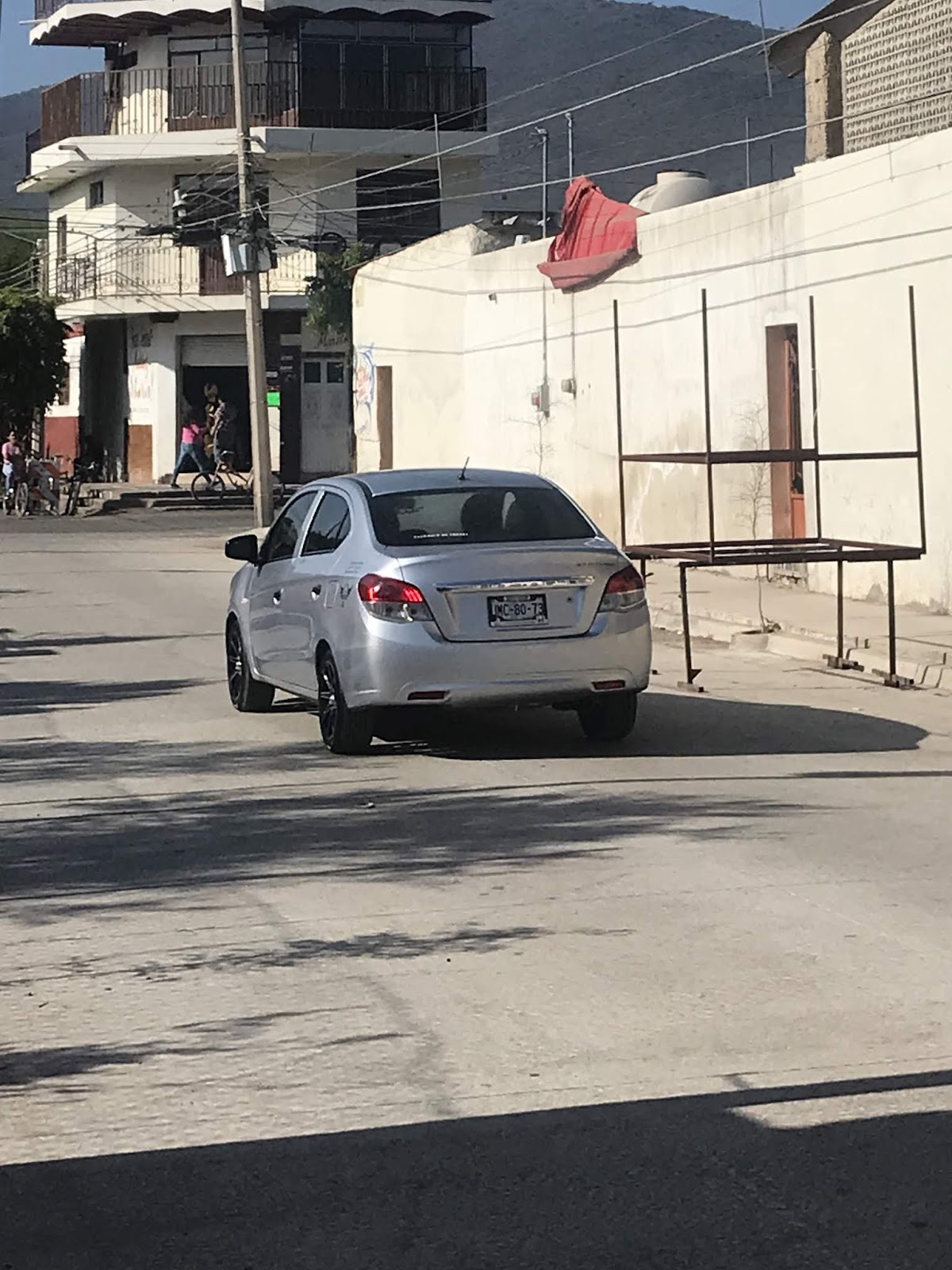
- Most vehicles in Mexico are older trucks, body-on-frame SUVs, or small compact cars. There are numerous new vehicles that are exclusive to South America and Mexico. I will be detailing the numerous Mexican market cars I observed in Part 3.
- Mopeds are very common on all roadways and are often used by two or more riders.
- All highways have very narrow shoulders or no shoulder at all.
- Four lane Federal Highways tend to have a solid concrete divider.
- Rail crossings are very rarely controlled.
Part 2; the streets of Zacoalco de Torres
My trip to Jalisco was largely based out of the town of Zacoalco de Torres.

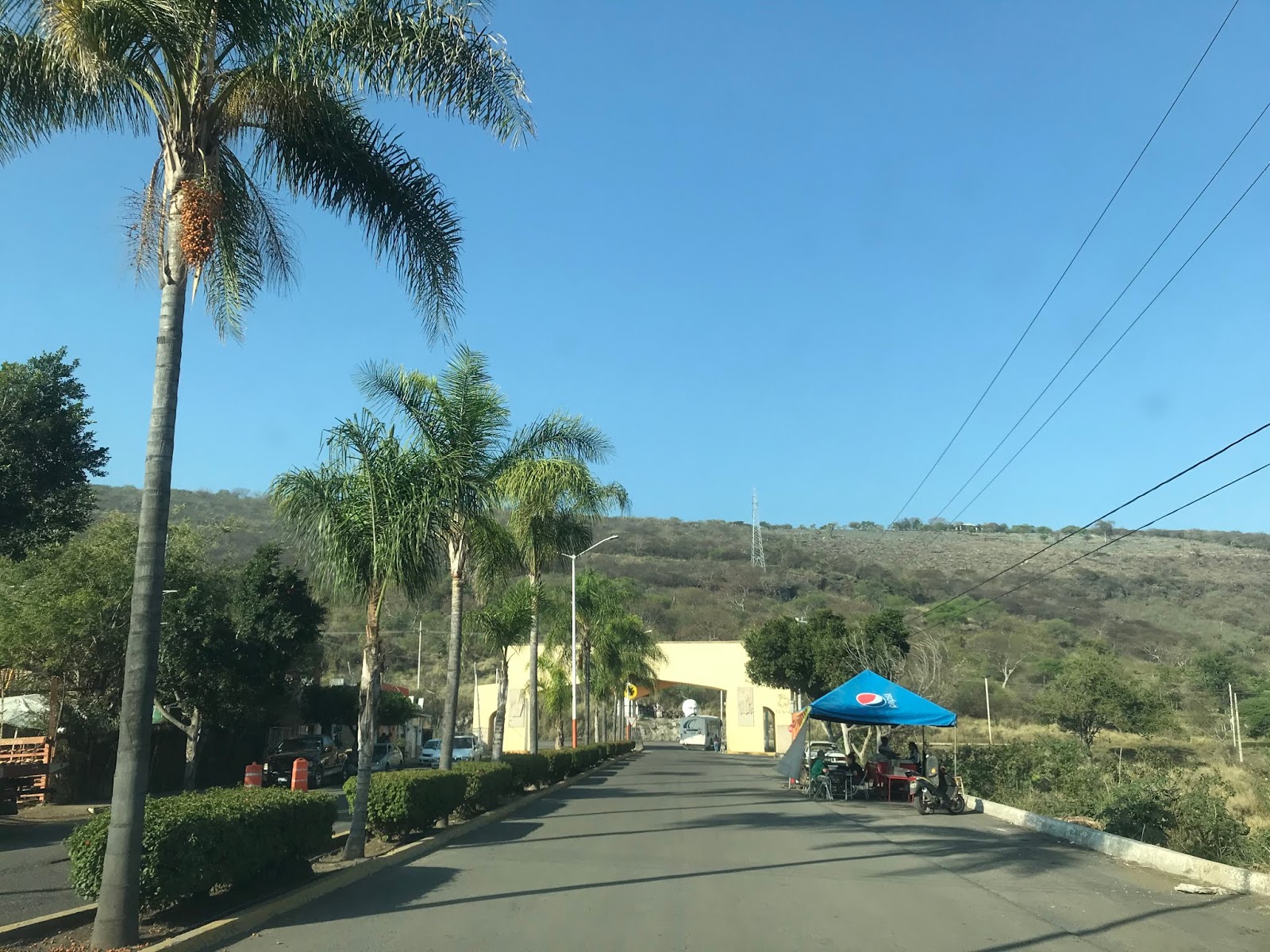
Zacoalco de Torres is a Town and one of one hundred twenty five Municipalities of Jalisco. Zacoalco de Torres is located off of Federal Highway 54 on the shores of Laguna de Zacoalco. Zacoalco de Torres as a Municipality covers approximately 189 square miles and has a population of approximately 30,000. Zacoalco de Torres is located about an hour and half south of downtown Guadalajara.

Part 2A; the history of Zacoalco de Torres
The entomology of "Zacoalco" comes from the word "Tzacoalco" which is thought to have meant "place of confinement," "in the pyramind," or "place where eagles perch." The area that is now Zacoalco de Torres was settled by the Aztecs in 1264. The Aztecs settled upon Chiquihuitillo Hill which rests between Laguna de Zacoalco and Laguna de San Marcos. In 1524 the Spanish arrived in the Aztec lands surrounding Laguna de Zacoalco. Most Aztecs fled to the south towards Laguna de Sayula in response to Spanish Conquistador Francisco Cortes de San Buenaventura attempting to subdue them by force. The Spanish invasion prompted the commissioning of the Town of Zacoalco.
In 1810 during the Mexican War of Independence the Town of Zacoalco was taken by revolutionary Jose Antonio Torres during the Battle of Zacoalco. The Town of Zacoalco was renamed to Zacoalco de Torres in 1829 in memory of Jose Antonio Torres and the Battle of Zacoalco. During Mexican rule Zacoalco de Torres mostly came to be known for the numerous home made wood furniture stores which are located in the town.

Part 2B; cityscape and streets of Zacoalco de Torres
I arrived in Zacoalco de Torres after an overnight red eye flight to Guadalajara. This view was at sun rise looking west on the cobblestone Calle Rayon.

After gathering my bearings and a nap I took a late morning walk to the Municipal Mercado. Lunch included a half dozen tacos and a glass bottled Fanta at the Area Gastronomica. Food in rural Jalisco is a bargain by American standards as I was able to feed five people for $100 Pesos (about $5.64 dollars U.S.).


The Municipal Mercado in Zacoalco de Torres has numerous store fronts. The real advantage of going to the Mercado in my opinion was the meat and produce stands.

Zacoalco de Torres lies within the Region of Sur. There is Sur Regional bus transportation located at the Municipal Mercado along Calle 5 de Mayo.

The intersection of Calle 16 de Septiembre and Calle 5 de Mayo demonstrates the lack of adherence to traffic control I described above. Almost nobody paid the hand painted stop sign any attention.


As noted above "street blades" are often located on the corners of buildings such as these Calle 16 de Septiembre signs.

Suffice to say some stop signs have seen much better days.

Mini-Marts in Mexico are usually easy to identify due to the brightly painted soda logos adorning the structures. Most soda in Mexico is still made with sugar cane which led to something of a soda binge during the entire trip.

The low point in the drainage grade of Zacoalco de Torres is located along Calle Libertad. Calle Libertad has numerous pedestrian bridges such as this one located at the intersection of Calle Progreso.


The drainage grade of Calle Libertad empties into a large ditch next to the Ferromex Freight Line.

This church is located at the intersection of Calle Progreso and Calle Pino Suarez. I kind of dig the older designs of the structures in Mexican towns. The buildings remind me of Gold Rush era towns in California with the brick and adobe construction.


I noticed that the domestic dogs in Zacoalco de Torres tended to run more feral than the actual feral dogs. This particular pooch took to a roof top on Calle Galeana to have an overlook point of the people passing by.

Most mornings in Zacolaco de Torres included a walk to a local taco shop along the railroad tracks of the Ferromex Freight Line. As noted above the railroad overpasses tend to not be controlled such as this one at the intersection of Calle Matamoros and Calle Jesus Carranza.

A look east on Calle Jesus Carranza. In the U.S. this would barely qualify as a rail frontage facility. The best tacos on the trip were to be had on a small shop off to the right.


On my last day in Zacoalco de Torres a Ferromex Train made a stop at the Calle Jesus Carranza overpass while I was walking to get tacos.

Zacoalco de Torres includes some areas in the fringe reaches north of the Ferromex Freight Line that appear to have once been their own town sites. This view below is from the cobblestone Calle Aldema headed north into Las Cebollas. Las Cebollas is one of the central hubs where a good percentage of the wooden furniture in Zacoalco de Torres is made.


Part 2C; the Plaza
Most nights in Zacoalco de Torres included a visit to the food stands located at the Plaza. The Plaza is bounded by; Calle Jose Antonio Torres, Calle Leandro Valle, Calle Hidalgo, and Calle Arista. The town sign proudly displaying "Zacoalco" can be found in the Plaza facing westward towards Templo de San Francisco de Asis.

A giant wooden chair can be found in the Plaza. This kind of stool is known as a Equipale and is commonly found in the United States in communities near the Mexican border.

The Municipal Offices are located at the northern end of the Plaza.


A statue of Jose Antonio Torres can be found in the center of the Plaza.

The Plaza includes a gazebo which I'm to understand frequently hosts bands.

A look east from the Plaza towards Calle Jose Antonio Torres.

Templo de San Francisco de Asis during the day and lit up at night.


A quick look inside Templo de San Francisco de Asis.


Part 2D; crossing Laguna de Zacoalco via Calle Jose Antonio Torres
One of the earlier days in the trip included a drive over Laguna de Zacoalco via Calle Jose Antonio Torres. North of downtown Zacoalco de Torres the route of Calle Jose Antonio Torres becomes a dirt road and crosses the Ferromex freight line. An abandoned rail depot can be found along Calle Jose Antonio Torres.


Laguna de Zacoalco mostly is dry lake which makes traversing it via a slightly elevated road grade on Calle Jose Antonio Torres pretty straight forward. Calle Jose Antonio Torres is a multi-use path which includes an exercise lane. Being an avid distance runner I would have liked to partook in the running path but I never found the time.

Calle Jose Antonio Torres branches off into two paths at Chiquihuitillo Hill. There is a small religious monument at the foot Chiquihuitillo Hill but I'm not certain what significance it has.

Part 2E; out into the boons north of Zacoalco de Torres
On the third day of the trip my Wife's Aunt had received word that there was some deceased cattle found on her ranch north of Zacoalco de Torres in the receding water pond. We took the family F-150 out during the morning hours to go investigate if the cattle in question belonged to my Wife's Aunt. My route out of Zacoalco de Torres was northeast via; Calle Galena, Calle Rayon, and Calle Ocampo to Camino Real in Las Cebollas.


Camino Real continues northeast mostly on a cobblestone grade to Autopista 54D.


Getting to the family ranch required pulling onto the southbound lanes of Autopista 54D for about a half mile. The turn onto the family ranch road required a left hand turn from Autopista 54D. Suffice to say any notion of the Autopistas being anywhere near the same standards as the Interstates wa shattered once the presence of frequent at-grade intersections was apparent.


The road to the family ranch is unnamed, the off the cuff name we came up with Camino Monstruo (named after one of our dogs). Camino Monstruo is an unimproved road which ascends eastward into the mountain side passing by numerous ranch plots along the way. At the family ranch there is a large gate on Camino Monstruo to deter entry.


Upon closing the gate the route of Camino Monstruo swings south towards the watering pond (which apparently is known as El Rincon). I turned off onto our ranch plot by making a right hand turn at a feeding house.


I pulled off onto our ranch plot, the bovine pedestrians seemed surprised to see a truck.


A walk to the watering pond revealed three dead cattle (not pictured) but none of them had family tags on them.


The backtrack on Camino Monstruo included a detour to see some family horses.


Part 2F; a hike to El Cerrito and drive back down
One of the final days in Zacoalco de Torres included a trip up to the church on El Cerrito. The church on El Cerrito is atop a mountain road which overlooks Zacoalco de Torres. From most rooftops the church on El Cerrito can be easily been seen looking south.

My approach to the unnamed road up El Cerrito was from Federal Highway 54 northbound. At Calle Ramon Corona traffic was stopped to allow a Sunday parade to cross Federal Highway 54. I pulled to the side of the highway and decided to walk up to El Cerrito while a family member took a turn driving the truck.


The unnamed road up to El Cerrito is a cobblestone grade. The roadway winds up a somewhat gentle incline to the church overlooking Zacoalco de Torres. All of Zacoalco de Torres along with Laguna de Zacoalco and Laguna de San Marcos can be seen from the road up to El Cerrito. About half the parade crowd elected to take a bypass hiking route which was considerably more steep.


The final climb up to the church on El Cerrito includes a series of steps in front of an active festival. The Rosca Bread Pizza was surprisingly good and offered some unique add-ons like hot dogs.


The church atop El Cerrito had some historic photos but they had a copyright disclaimer. I would have liked to know more about the history of the church but my Spanish is below basic and I couldn't translate any viable information on the fly.

The drive back down from the family F-150 from El Cerrito wasn't too bad given the somewhat gentle grade. I did discover that the F-150 wouldn't shift into 1st gear as the column shifter was misaligned.

The road up El Cerrito is lit up at night.


Part 3; the unique Mexican Market cars and other interesting automotive sightings
I noted above that the Mexican Market has numerous unique cars and they tend to be compact. Throughout my trip I spent some time documenting the Mexican Market cars I noticed along with other unique automobiles.
First up is the current generation Chevy Tornado. The Chevy Tornado is known as the "Montana" in most South American Markets but was sold alongside the Chevy Montana Mini-Van in Mexico. The Tornado is a Front Wheel Drive Ute which is based off the Chevy Agile. The Montana is sold with gas and diesel four cylinder engines which makes it popular as an affordable work truck.

The Dodge Vision is a rebadged Fiat Siena which was sold in Mexico from 2015-2018. The Vision has the exact same appearance as the Siena aside from some Dodge badges. The Dodge Vision was available with optional; 1.0L, 1.4L, and 1.6L four cylinder engines. The Dodge Vision is fairly rare as it sold only 3,274 units in it's peak volume year of 2016. The Vision is a small car at 169 inches in length and has a 99 inch wheelbase.

The Chevy Celebrity was sold through the 1982-1989 model years as a mid-size A-Body car. While the Celebrity was common in the United States (often selling more than 300,000 units a year) it is now rarely seen.

French vehicles are common in Mexico as evidenced by this black first generation Renault Duster SUV. The Duster is primarily Front Wheel Drive but some had a Nissan sourced All Wheel Drive system as an option.

From 1995 to 2011 General Motors sold the Chevrolet Chevy (yes, a Chevy Chevy) as a sub-compact offering in Mexico. The Chevy Chevy was a rebadged Opel Corsa and this particular model is the 3-door which was available with a 78hp 1.6L four cylinder.

The Atos was a City Car which was produced from 1997 through 2014. The Atos was badged as a Dodge in Mexico and this is a second generation variant. Impressively the Atos weighed just under 1,900 pounds.

A Chevy Corsa (Opel Corsa) sedan.

Another Chevy Chevy; note the "Chevy" badge.

A first generation Chevy Tornado.

The find of the trip was a 1973 Chevy Chevelle Laguna. The Chevelle Laguna (later Laguna S3) was the replacement of the Chevelle SS and was mostly known for the "Colonade" styling which was common on Mid-1970s A Body Cars. The Laguna and Laguna S3 was available with a 350ci or 400 Chevy Small Block V8, the 454 Big Block V8 was available throught the 1975 model year. I can't recall the last time I've seen a Colonade car State Side much less a Laguna/Laguna S3.

A old Chevy S-10 Tahoe.

The Volkswagen Beetle is incredibly common in Mexico as it was produced until 2003.

A first generation Ford Ka (sounds like a person from Boston or a crow making noise) in front of a grocery store. The Ford Ka is a city car that is mostly known from the European Market. The Ford Ka produced between 53hp and 60hp during it's first generation run from 1996 through 2008.

An older Chevy C/K truck with Silverado trim. The Silverado didn't become it's own line of truck until 1999.

A firth generation Ford F-Series truck.

An Isuzu Pickup and Oldsmobile Bravada parked across the street from each other.

The Nissan Tsuru is essentially just a Nissan Sentra.

The Ford Fiesta Ikon was sold in Mexico from 1999 through 2015.

As noted above the Chevy Beat is a refreshed first generation Chevy Spark. I wish that we had this available for $8,800 dollars in the United States.


The Dodge Attitude is a rebadged current generation Mitsubishi Mirage. At minimum the front nose
at least has a Dodge shaped grill unlike the Vision.

Second generation Renault Logans are a fairly common sight. The Logan is technically a compact with the sedan measuring 171.1 inches in lenght.

The Nissan Platina is a rebaded first generation Renault Symbol.

The Renault Duster Oroch is a presently produced Front Wheel Drive pickup truck.

Part 4; Federal Highways 54, 80, 15, and 23 to Chapala
The longest drive on the trip was from Zacoalco de Torres to Chapala. My route to Chapala followed Federal Highways; 54, 80, 15, and 23.

My approach to Federal Highway 54 out of Zacoalco de Torres was via Avenida Ruben Ramirez Flores.


I pulled out of Zacoalco de Torres onto Federal Highway 54 northbound.


Federal Highway 54 isn't signed north of Zacoalco de Torres but rather as Jalisco State Highway 401. North of Zacoalco de Torres Federal Highway 54 passes by La Cruz.


Federal Highway 54 north of La Cruz crosses over the Ferromex Freight Line and enters Santa Catarina.


A stop was made for breakfast in Santa Catarina. Despite the home made sign it is hard to miss the painted "Gorditas."

North of Santa Catarina Federal Highway 54 intersects Jalisco State Highway 437.


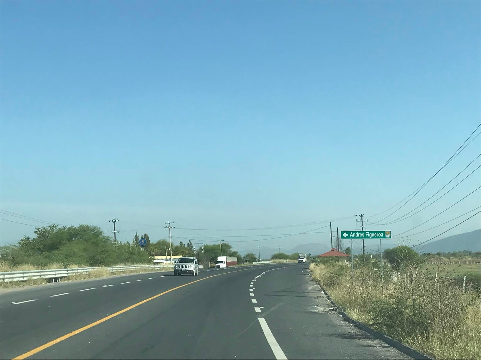
Federal Highway 54 north of Jalisco State Highway 437 passes by the community of Andres Figueroa.


Federal Highway 54 continues north towards Federal Highway 80 and crosses over the entranceway of Centro Logistico Jalisco.


Federal Highway 54 north intersects Jalisco State Highway 402.

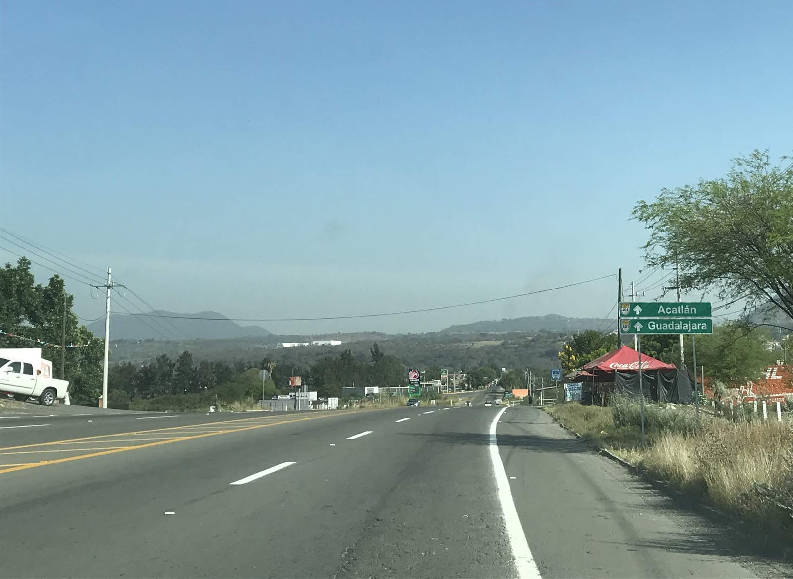
North of Jalisco State Highway 402 the route of Federal Highway 54 is signed as 8 Kilometers from Acatlan and 40 Kilometers from Guadalajara.


Federal Highway 54 north enters Acatlan. Federal Highway 54 swings east of Acatlan onto a bypass route.


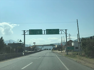
Federal Highway 54 north ascends up a ridge to Federal Highway 80. Multiplexes are generally not signed on Federal Highways thus there is no reference to Federal Highway 54 at the turn for Federal Highway 80 east. Note; Federal Highways generally aren't signed with directional placards.


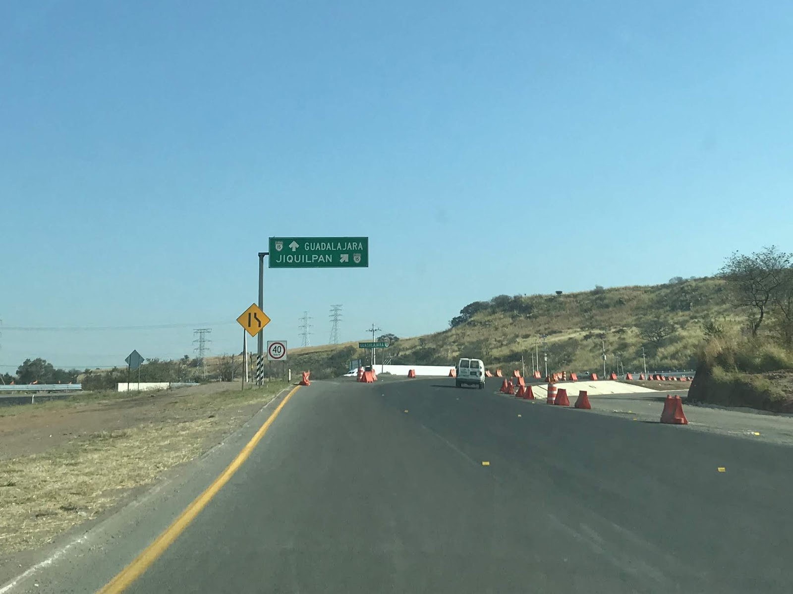
Federal Highway 80/54 eastbound is a divided highway all the way to the at-grade junction with Federal Highway 15 and Autopista 54D.


I made a left hand turn towards Guadalajara. The turn onto Federal Highway 15 south was closed due to construction and normally would have been a right hand exit from Federal Highway 80/54. The construction required a U-Turn on Federal Highway 15 north but was not a major detour.

Federal Highway 15 southbound quickly enters the Municipality of Jocotepec.


Federal Highway 15 south briefly expands to four lanes climbing over a ridge. Lake Chapala can be seen at the top of the ridge off in the distance to the southeast.


Federal Highway 15 south passes through the community of El Molino. El Molino has a massive pedestrian overpass of Federal Highway 15.


Federal Highway 15 south expands to four lanes. Major intersections are primarily controlled with speed reductions and usage of speed bumps. Federal Highway 15 southbound intersects Libramiento Jocotepec (which is oddly signed as Federal Highway 110 despite the actual highway being aligned east of Lake Chapala) which serves as a bypass of downtown Jocotepec.


Federal Highway 15 southbound intersects Federal Highway 23 in Jocotepec. I turned eastbound towards downtown Jocotepec on the loosely signed Federal Highway 23.


The alignment of Federal Highway 23 through Jocotepec is incredibly hard to track as it has no reassurance shields. The general alignment of Federal Highway 23 through Jocotepec can be tracked via overhead guide signs on; Calle Vicente Guerrero Ote, Gonzalez Ortega Sur, and Calle Miguel Arana. My route through through Jocotepec began on Federal Highway 23 eastbound on Calle Vicente Guerrro Ote which enters a somewhat amusing roundabout that has a crucified Jesus on the display in the center.


My route through downtown Jocotepec diverged slightly from Federal Highway 23 as I swung north on Calle Hidalgo Eje Sur. Note; the first traffic lights of the trip were encountered in Jocotepec.


I stayed north on Calle Hidalgo Eje Sur and made a right hand turn onto Calle Miguel Arana.


Calle Miguel Arana eastbound heads out of downtown Jocotepec and picks up Federal Highway 23 at Gonzalez Ortega Sur.


Federal Highway 23 east splits onto Calle de Chante towards Chapala. Calle Miguel Arana continues straight to Lake Chapala and Malecon de Jocotepec.

On the way back from Chapala I made the detour to Malecon de Jocotepec. Malecon de Jocotepec is where the Jocotepec community sign can be located. Jocotepec and the west shore of Lake Chapala is thought to have been inhabited first by tribes as early as 100 BC. The Nahua Tribe began permanent settlement of the west shore of Lake Chapala beginning approximately 1361. Upon the arrival of the Spanish the land on the west shore of Lake Chapala was given as a grant in 1520. The town of Jocotepec was founded in 1529.

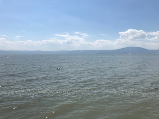
Lake Chapala is the largest fresh water lake in Mexico by surface area at approximately 420 square miles. Lake Chapala is shallow at a maximum depth of 34 feet which leads to seasonal variations of the lake level. Lake Chapala is located approximately 5,000 feet above sea level and is fed by; Rio Lerma, Rio Zula, Rio Huaracha, and Rio Duero. Lake Chapala is the headwaters of Rio Grande de Santiago.


The varying levels of Lake Chapala are easily seen from a crumbling pier (which I'm to assume is probably Malecon de Jocotepec)

Federal Highway 23 eastbound leaves Jocotepec and enters Chantepec where it meets the opposite end of the Federal Highway 110 bypass route.


Federal Highway 23 eastbound passes through Chantepec and enters the community of Jaltepec. Jaltepec is where the first real Federal Highway 23 sign can be found which is near the entrance to Villa Tres Marias.


Federal Highway 23 eastbound passes through Jaltepec and San Juan Cosala where it exits the Municipality of Jocotepec.


Federal Highway 23 enters the community of Ajijic which was founded on the north shore of Lake Chapala in 1533. I began to encounter severe road construction and traffic backups headed east through downtown Ajijic.


Federal Highway 23 eastbound enters San Antonio Tlayacapan and splits northeast onto a bypass route of Chapala. I continued straight on Hidalgo eastbound towards Chapala.

I'd make a joke about the Coronavirus and Corona Beer but to be honest I didn't hear a single about the former the almost two weeks I was in Mexico. That said, Corona by far was the most common beer I saw being sold in Jalisco. Hidalgo approaching Chapala has a Corona distribution center right off the road.

I'm fairly certain Hidalgo is the former alignment of Federal Highway 23 as it has numerous worn out Federal Highway signs on it. Hidalgo eastbound closely follows the shore of Lake Chapala and ends in downtown Chapala at Avenida Francisco Ignacio Madero.


I made a right hand turn south on Avenida Francisco Ignacio Madero to Chapala Malecon.

The current site of the City of Chapala was home to Nahautl Tribes before Spanish contact. The Spanish first contacted the tribes in Chapala during 1524. Many of church facilities in Chapala were built in 1531 leading to the formation of the Town. Chapala was the locale of a battle during the Mexican Revolution in 1812 in which the occupying Spanish forces were defeated by revolutionaries. Tourism in Chapala began to develop during the 1880s in the form of mostly Americans and Canadians who were attracted by the temperate climate. Modern Chapala today has one of the largest American and Canadian populations within Central Mexico.

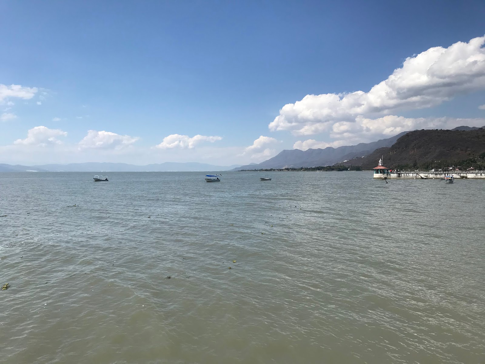
From the Chapala Malecon there is a fantastic view of Lake Chapala looking eastward and the Sierra de San Juan Cosala.


Chapala Malecon has a small mercado which seemed to be fairly popular with the tourist crowd.


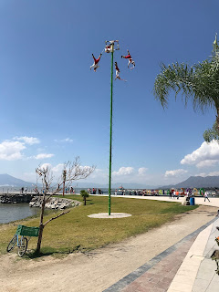
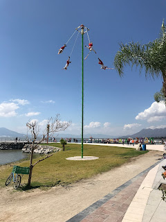
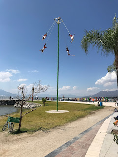
Local tribal members conduct a rope swinging show several times a day in front of Chapala Malecon.


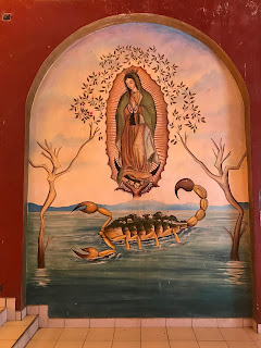
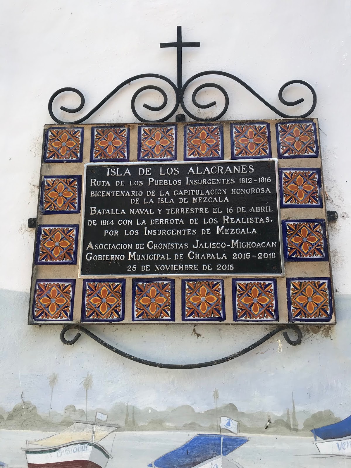
The visit to Chapala included a short boat ride to Isla de los Alacranes (Scorpion Island).


Isla de los Alacranes essentially a tourist trap but it was probably worth the detour just to throw one of these up in the garage.

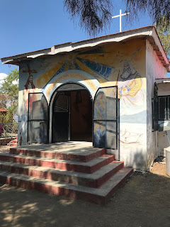
Isla de los Alacranes was once the locale of a Spanish fort and prison. There are a couple of small chapels on Isla de los Alacranes along with numerous ruins of the fortification.


Since this blog has gotten extremely long I've decided to split it into two parts. Part 2 mostly covers the City of Guadalajara and numerous roads I traveled throughout it's urban landscape.
2020 Jalisco, Mexico Road Trip Part 2

Part 1; what are the differences between roads in Mexico versus the United States?
Being primarily a highway blog site the elephant in the room for many readers of Gribblenation probably is "what are the differences with driving in Mexico versus the United States?" To that end while there are some similarities with the United States there many unique facets of Mexican roadways:
- Road maintenance on the whole lags far behind the U.S. on every level. Your drive to work on a beat up Interstate that is constantly under construction doesn't compare to a drive on a critically weathered Federal Highway 15 in Guadalajara. If I was to draw an analog I would compare the state of most Federal Highways to a remotely paved National Forest Service Road.
- Signage is more in line with what one might see on a European Highway, obviously speed is measured in Kilometers Per Hour.
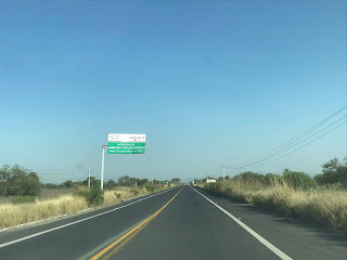
- Federal Highways don't carry multiplex reassurance signage. Federal Highways tend to be barely signed at all and can be very difficult to follow. Following a Federal Highway requires a driver to pay very close attention to guide signage. Federal Highway 15 seemed to be an exception as it had reassurance shields on Kilometer Markers in 5 Kilometer intervals south of Guadalajara.
- Most Jalisco State Highways were better signed than the Federal Highways.
- Traffic in Guadalajara was far more intense and difficult to get through than any major U.S. city I've traveled in. Limited access roadways are rare and most major roadways in Guadalajara were engineered to the fullest extent they can be to fit as many vehicles as possible.
- On local levels almost nobody wants to use the Autopistas ("D Routes") given that they have a huge toll cost relative to the value to Pesos. When I drove Autopista 54D south of Federal Highway 80 it cost $84 Pesos which was about $4.75 dollars US. It seems that at least in the case of my own family road trips are more enjoyable when it includes driving through a town rather than some limited access bypass.
- Riding in the back of the truck, SUV, or wagon is still a thing. Road travel kind of reminded me of how travel in the U.S. once was in the 1980s before there was a crack down on back seat belt laws. Safety really isn't at the forefront of using the road pretty much in any capacity.
- Filling up with gas is just like Oregon and New Jersey, an attendant pumps it for you. The average gas cost was about $20.00 Pesos a liter which came out close to $4 dollars a gallon U.S. I suppose being from California that steep price didn't sting all that much...
- There is almost no traffic lights on Federal Highways or even on the Jalisco State Highways that I drove. The Federal Highways often featured huge reductions in speed coupled with speed bumps at major at-grade intersections.
- Every traffic light I saw was horizontal in configuration.
- There seems to be virtually no traffic enforcement in cities or even highways. I don't recall even seeing any police presence on a Federal Highway.
- Driving tendencies are all over the place. Some drivers go way over the speed limit whereas others go way under. With the slow drivers I noticed that they tend to pull over to the shoulder or side of the lane to allow traffic to pass. Almost nobody follows the lane markings and passes pretty much are open season.
- Local level street signage on the whole is extremely poor. Most towns and Municipalities I visited were only loosely signed with traffic control devices. Most street blades can be found on the corners of buildings at an intersection along with directional markers indicating if a road is one-way or two-way. I found the stop signs tend to be placed on the opposite side of intersections and are rarely actually followed by drivers. I found a lot of local roadways didn't feature any traffic control information at all. A lot two-lane roads locally have no center line and are narrow enough for only one vehicle at a time.
- Pedestrians and cyclists are far more aggressive than their U.S. counterparts. The cyclists in particular tend to ignore all traffic control signage. Cyclists often pass vehicles left, right, or even going the wrong way. Pedestrians tend to jump into the roadway and expect vehicles to stop for them even when it isn't possible. Intersections with large amounts of pedestrians tended to be managed with speed bumps in rural towns and municipalities.
- Cobblestone road surfaces were probably the most common road type in the smaller communities. Some of the cobblestone roads were actually pretty good and featured some flat bricks to flow traffic. Most cobblestone roads were extremely old and had some serious issues with subsiding.
- Most local roads I drove in smaller communities were located at the bottom of the drainage grade. Most of these roadways flood severely in wet weather. Pedestrian traffic generally stays on elevated sidewalks.
- Autopistas in rural areas have a ton of surface level intersections that access remote roadways. I actually had to use two of these surface intersections on Autopista 54D while visiting a family ranch. I would compare these intersections to what can be seen on rural Interstates like; I-17, I-10, and I-40.
- Dirt roads usually have almost no grading and are covered in loose debris. Surprisingly low clearance traffic tends to still utilize even the most haggard dirt roads.
- Most vehicles in Mexico are older trucks, body-on-frame SUVs, or small compact cars. There are numerous new vehicles that are exclusive to South America and Mexico. I will be detailing the numerous Mexican market cars I observed in Part 3.
- Mopeds are very common on all roadways and are often used by two or more riders.
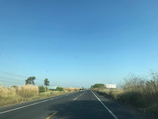
- All highways have very narrow shoulders or no shoulder at all.
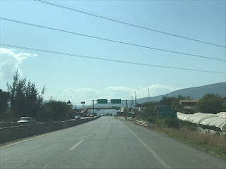
- Four lane Federal Highways tend to have a solid concrete divider.
- Rail crossings are very rarely controlled.
Part 2; the streets of Zacoalco de Torres
My trip to Jalisco was largely based out of the town of Zacoalco de Torres.

Zacoalco de Torres is a Town and one of one hundred twenty five Municipalities of Jalisco. Zacoalco de Torres is located off of Federal Highway 54 on the shores of Laguna de Zacoalco. Zacoalco de Torres as a Municipality covers approximately 189 square miles and has a population of approximately 30,000. Zacoalco de Torres is located about an hour and half south of downtown Guadalajara.

Part 2A; the history of Zacoalco de Torres
The entomology of "Zacoalco" comes from the word "Tzacoalco" which is thought to have meant "place of confinement," "in the pyramind," or "place where eagles perch." The area that is now Zacoalco de Torres was settled by the Aztecs in 1264. The Aztecs settled upon Chiquihuitillo Hill which rests between Laguna de Zacoalco and Laguna de San Marcos. In 1524 the Spanish arrived in the Aztec lands surrounding Laguna de Zacoalco. Most Aztecs fled to the south towards Laguna de Sayula in response to Spanish Conquistador Francisco Cortes de San Buenaventura attempting to subdue them by force. The Spanish invasion prompted the commissioning of the Town of Zacoalco.
In 1810 during the Mexican War of Independence the Town of Zacoalco was taken by revolutionary Jose Antonio Torres during the Battle of Zacoalco. The Town of Zacoalco was renamed to Zacoalco de Torres in 1829 in memory of Jose Antonio Torres and the Battle of Zacoalco. During Mexican rule Zacoalco de Torres mostly came to be known for the numerous home made wood furniture stores which are located in the town.

Part 2B; cityscape and streets of Zacoalco de Torres
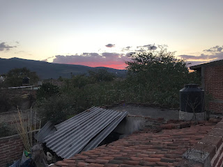
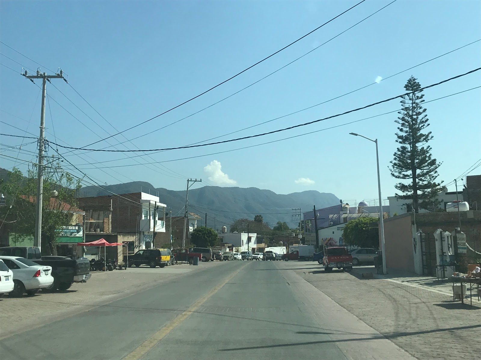
I arrived in Zacoalco de Torres after an overnight red eye flight to Guadalajara. This view was at sun rise looking west on the cobblestone Calle Rayon.

After gathering my bearings and a nap I took a late morning walk to the Municipal Mercado. Lunch included a half dozen tacos and a glass bottled Fanta at the Area Gastronomica. Food in rural Jalisco is a bargain by American standards as I was able to feed five people for $100 Pesos (about $5.64 dollars U.S.).


The Municipal Mercado in Zacoalco de Torres has numerous store fronts. The real advantage of going to the Mercado in my opinion was the meat and produce stands.

Zacoalco de Torres lies within the Region of Sur. There is Sur Regional bus transportation located at the Municipal Mercado along Calle 5 de Mayo.

The intersection of Calle 16 de Septiembre and Calle 5 de Mayo demonstrates the lack of adherence to traffic control I described above. Almost nobody paid the hand painted stop sign any attention.


As noted above "street blades" are often located on the corners of buildings such as these Calle 16 de Septiembre signs.

Suffice to say some stop signs have seen much better days.

Mini-Marts in Mexico are usually easy to identify due to the brightly painted soda logos adorning the structures. Most soda in Mexico is still made with sugar cane which led to something of a soda binge during the entire trip.

The low point in the drainage grade of Zacoalco de Torres is located along Calle Libertad. Calle Libertad has numerous pedestrian bridges such as this one located at the intersection of Calle Progreso.


The drainage grade of Calle Libertad empties into a large ditch next to the Ferromex Freight Line.

This church is located at the intersection of Calle Progreso and Calle Pino Suarez. I kind of dig the older designs of the structures in Mexican towns. The buildings remind me of Gold Rush era towns in California with the brick and adobe construction.


I noticed that the domestic dogs in Zacoalco de Torres tended to run more feral than the actual feral dogs. This particular pooch took to a roof top on Calle Galeana to have an overlook point of the people passing by.

Most mornings in Zacolaco de Torres included a walk to a local taco shop along the railroad tracks of the Ferromex Freight Line. As noted above the railroad overpasses tend to not be controlled such as this one at the intersection of Calle Matamoros and Calle Jesus Carranza.

A look east on Calle Jesus Carranza. In the U.S. this would barely qualify as a rail frontage facility. The best tacos on the trip were to be had on a small shop off to the right.


On my last day in Zacoalco de Torres a Ferromex Train made a stop at the Calle Jesus Carranza overpass while I was walking to get tacos.

Zacoalco de Torres includes some areas in the fringe reaches north of the Ferromex Freight Line that appear to have once been their own town sites. This view below is from the cobblestone Calle Aldema headed north into Las Cebollas. Las Cebollas is one of the central hubs where a good percentage of the wooden furniture in Zacoalco de Torres is made.


Part 2C; the Plaza
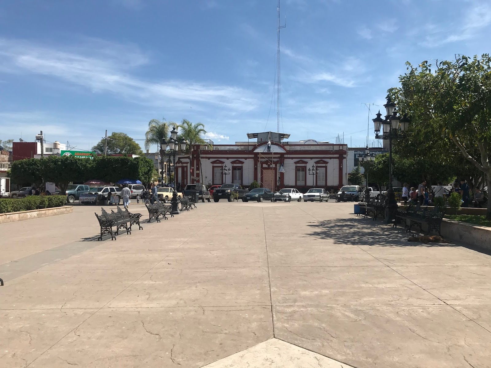
Most nights in Zacoalco de Torres included a visit to the food stands located at the Plaza. The Plaza is bounded by; Calle Jose Antonio Torres, Calle Leandro Valle, Calle Hidalgo, and Calle Arista. The town sign proudly displaying "Zacoalco" can be found in the Plaza facing westward towards Templo de San Francisco de Asis.

A giant wooden chair can be found in the Plaza. This kind of stool is known as a Equipale and is commonly found in the United States in communities near the Mexican border.

The Municipal Offices are located at the northern end of the Plaza.


A statue of Jose Antonio Torres can be found in the center of the Plaza.

The Plaza includes a gazebo which I'm to understand frequently hosts bands.

A look east from the Plaza towards Calle Jose Antonio Torres.
Templo de San Francisco de Asis during the day and lit up at night.


A quick look inside Templo de San Francisco de Asis.


Part 2D; crossing Laguna de Zacoalco via Calle Jose Antonio Torres
One of the earlier days in the trip included a drive over Laguna de Zacoalco via Calle Jose Antonio Torres. North of downtown Zacoalco de Torres the route of Calle Jose Antonio Torres becomes a dirt road and crosses the Ferromex freight line. An abandoned rail depot can be found along Calle Jose Antonio Torres.


Laguna de Zacoalco mostly is dry lake which makes traversing it via a slightly elevated road grade on Calle Jose Antonio Torres pretty straight forward. Calle Jose Antonio Torres is a multi-use path which includes an exercise lane. Being an avid distance runner I would have liked to partook in the running path but I never found the time.


Calle Jose Antonio Torres branches off into two paths at Chiquihuitillo Hill. There is a small religious monument at the foot Chiquihuitillo Hill but I'm not certain what significance it has.

Part 2E; out into the boons north of Zacoalco de Torres
On the third day of the trip my Wife's Aunt had received word that there was some deceased cattle found on her ranch north of Zacoalco de Torres in the receding water pond. We took the family F-150 out during the morning hours to go investigate if the cattle in question belonged to my Wife's Aunt. My route out of Zacoalco de Torres was northeast via; Calle Galena, Calle Rayon, and Calle Ocampo to Camino Real in Las Cebollas.


Camino Real continues northeast mostly on a cobblestone grade to Autopista 54D.


Getting to the family ranch required pulling onto the southbound lanes of Autopista 54D for about a half mile. The turn onto the family ranch road required a left hand turn from Autopista 54D. Suffice to say any notion of the Autopistas being anywhere near the same standards as the Interstates wa shattered once the presence of frequent at-grade intersections was apparent.


The road to the family ranch is unnamed, the off the cuff name we came up with Camino Monstruo (named after one of our dogs). Camino Monstruo is an unimproved road which ascends eastward into the mountain side passing by numerous ranch plots along the way. At the family ranch there is a large gate on Camino Monstruo to deter entry.


Upon closing the gate the route of Camino Monstruo swings south towards the watering pond (which apparently is known as El Rincon). I turned off onto our ranch plot by making a right hand turn at a feeding house.


I pulled off onto our ranch plot, the bovine pedestrians seemed surprised to see a truck.


A walk to the watering pond revealed three dead cattle (not pictured) but none of them had family tags on them.


The backtrack on Camino Monstruo included a detour to see some family horses.


Part 2F; a hike to El Cerrito and drive back down
One of the final days in Zacoalco de Torres included a trip up to the church on El Cerrito. The church on El Cerrito is atop a mountain road which overlooks Zacoalco de Torres. From most rooftops the church on El Cerrito can be easily been seen looking south.

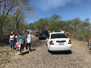
My approach to the unnamed road up El Cerrito was from Federal Highway 54 northbound. At Calle Ramon Corona traffic was stopped to allow a Sunday parade to cross Federal Highway 54. I pulled to the side of the highway and decided to walk up to El Cerrito while a family member took a turn driving the truck.


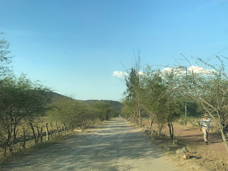
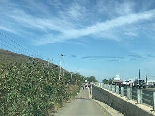
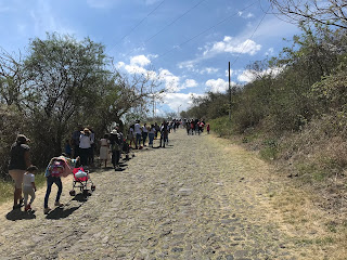
The unnamed road up to El Cerrito is a cobblestone grade. The roadway winds up a somewhat gentle incline to the church overlooking Zacoalco de Torres. All of Zacoalco de Torres along with Laguna de Zacoalco and Laguna de San Marcos can be seen from the road up to El Cerrito. About half the parade crowd elected to take a bypass hiking route which was considerably more steep.


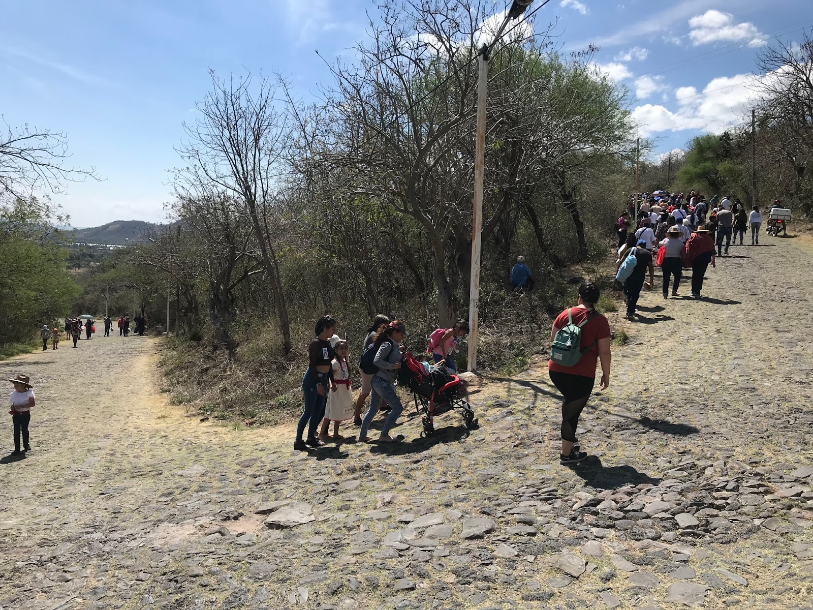


The final climb up to the church on El Cerrito includes a series of steps in front of an active festival. The Rosca Bread Pizza was surprisingly good and offered some unique add-ons like hot dogs.


The church atop El Cerrito had some historic photos but they had a copyright disclaimer. I would have liked to know more about the history of the church but my Spanish is below basic and I couldn't translate any viable information on the fly.

The drive back down from the family F-150 from El Cerrito wasn't too bad given the somewhat gentle grade. I did discover that the F-150 wouldn't shift into 1st gear as the column shifter was misaligned.

The road up El Cerrito is lit up at night.


Part 3; the unique Mexican Market cars and other interesting automotive sightings
I noted above that the Mexican Market has numerous unique cars and they tend to be compact. Throughout my trip I spent some time documenting the Mexican Market cars I noticed along with other unique automobiles.
First up is the current generation Chevy Tornado. The Chevy Tornado is known as the "Montana" in most South American Markets but was sold alongside the Chevy Montana Mini-Van in Mexico. The Tornado is a Front Wheel Drive Ute which is based off the Chevy Agile. The Montana is sold with gas and diesel four cylinder engines which makes it popular as an affordable work truck.

The Dodge Vision is a rebadged Fiat Siena which was sold in Mexico from 2015-2018. The Vision has the exact same appearance as the Siena aside from some Dodge badges. The Dodge Vision was available with optional; 1.0L, 1.4L, and 1.6L four cylinder engines. The Dodge Vision is fairly rare as it sold only 3,274 units in it's peak volume year of 2016. The Vision is a small car at 169 inches in length and has a 99 inch wheelbase.

The Chevy Celebrity was sold through the 1982-1989 model years as a mid-size A-Body car. While the Celebrity was common in the United States (often selling more than 300,000 units a year) it is now rarely seen.

French vehicles are common in Mexico as evidenced by this black first generation Renault Duster SUV. The Duster is primarily Front Wheel Drive but some had a Nissan sourced All Wheel Drive system as an option.

From 1995 to 2011 General Motors sold the Chevrolet Chevy (yes, a Chevy Chevy) as a sub-compact offering in Mexico. The Chevy Chevy was a rebadged Opel Corsa and this particular model is the 3-door which was available with a 78hp 1.6L four cylinder.

The Atos was a City Car which was produced from 1997 through 2014. The Atos was badged as a Dodge in Mexico and this is a second generation variant. Impressively the Atos weighed just under 1,900 pounds.

A Chevy Corsa (Opel Corsa) sedan.

Another Chevy Chevy; note the "Chevy" badge.

A first generation Chevy Tornado.

The find of the trip was a 1973 Chevy Chevelle Laguna. The Chevelle Laguna (later Laguna S3) was the replacement of the Chevelle SS and was mostly known for the "Colonade" styling which was common on Mid-1970s A Body Cars. The Laguna and Laguna S3 was available with a 350ci or 400 Chevy Small Block V8, the 454 Big Block V8 was available throught the 1975 model year. I can't recall the last time I've seen a Colonade car State Side much less a Laguna/Laguna S3.

A old Chevy S-10 Tahoe.

The Volkswagen Beetle is incredibly common in Mexico as it was produced until 2003.

A first generation Ford Ka (sounds like a person from Boston or a crow making noise) in front of a grocery store. The Ford Ka is a city car that is mostly known from the European Market. The Ford Ka produced between 53hp and 60hp during it's first generation run from 1996 through 2008.

An older Chevy C/K truck with Silverado trim. The Silverado didn't become it's own line of truck until 1999.

A firth generation Ford F-Series truck.

An Isuzu Pickup and Oldsmobile Bravada parked across the street from each other.

The Nissan Tsuru is essentially just a Nissan Sentra.

The Ford Fiesta Ikon was sold in Mexico from 1999 through 2015.

As noted above the Chevy Beat is a refreshed first generation Chevy Spark. I wish that we had this available for $8,800 dollars in the United States.


The Dodge Attitude is a rebadged current generation Mitsubishi Mirage. At minimum the front nose
at least has a Dodge shaped grill unlike the Vision.
Second generation Renault Logans are a fairly common sight. The Logan is technically a compact with the sedan measuring 171.1 inches in lenght.

The Nissan Platina is a rebaded first generation Renault Symbol.

The Renault Duster Oroch is a presently produced Front Wheel Drive pickup truck.

Part 4; Federal Highways 54, 80, 15, and 23 to Chapala
The longest drive on the trip was from Zacoalco de Torres to Chapala. My route to Chapala followed Federal Highways; 54, 80, 15, and 23.

My approach to Federal Highway 54 out of Zacoalco de Torres was via Avenida Ruben Ramirez Flores.


I pulled out of Zacoalco de Torres onto Federal Highway 54 northbound.


Federal Highway 54 isn't signed north of Zacoalco de Torres but rather as Jalisco State Highway 401. North of Zacoalco de Torres Federal Highway 54 passes by La Cruz.


Federal Highway 54 north of La Cruz crosses over the Ferromex Freight Line and enters Santa Catarina.


A stop was made for breakfast in Santa Catarina. Despite the home made sign it is hard to miss the painted "Gorditas."

North of Santa Catarina Federal Highway 54 intersects Jalisco State Highway 437.


Federal Highway 54 north of Jalisco State Highway 437 passes by the community of Andres Figueroa.

Federal Highway 54 continues north towards Federal Highway 80 and crosses over the entranceway of Centro Logistico Jalisco.


Federal Highway 54 north intersects Jalisco State Highway 402.

North of Jalisco State Highway 402 the route of Federal Highway 54 is signed as 8 Kilometers from Acatlan and 40 Kilometers from Guadalajara.


Federal Highway 54 north enters Acatlan. Federal Highway 54 swings east of Acatlan onto a bypass route.


Federal Highway 54 north ascends up a ridge to Federal Highway 80. Multiplexes are generally not signed on Federal Highways thus there is no reference to Federal Highway 54 at the turn for Federal Highway 80 east. Note; Federal Highways generally aren't signed with directional placards.


Federal Highway 80/54 eastbound is a divided highway all the way to the at-grade junction with Federal Highway 15 and Autopista 54D.


I made a left hand turn towards Guadalajara. The turn onto Federal Highway 15 south was closed due to construction and normally would have been a right hand exit from Federal Highway 80/54. The construction required a U-Turn on Federal Highway 15 north but was not a major detour.
Federal Highway 15 southbound quickly enters the Municipality of Jocotepec.


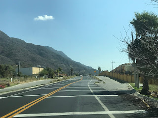
Federal Highway 15 south briefly expands to four lanes climbing over a ridge. Lake Chapala can be seen at the top of the ridge off in the distance to the southeast.


Federal Highway 15 south passes through the community of El Molino. El Molino has a massive pedestrian overpass of Federal Highway 15.


Federal Highway 15 south expands to four lanes. Major intersections are primarily controlled with speed reductions and usage of speed bumps. Federal Highway 15 southbound intersects Libramiento Jocotepec (which is oddly signed as Federal Highway 110 despite the actual highway being aligned east of Lake Chapala) which serves as a bypass of downtown Jocotepec.


Federal Highway 15 southbound intersects Federal Highway 23 in Jocotepec. I turned eastbound towards downtown Jocotepec on the loosely signed Federal Highway 23.


The alignment of Federal Highway 23 through Jocotepec is incredibly hard to track as it has no reassurance shields. The general alignment of Federal Highway 23 through Jocotepec can be tracked via overhead guide signs on; Calle Vicente Guerrero Ote, Gonzalez Ortega Sur, and Calle Miguel Arana. My route through through Jocotepec began on Federal Highway 23 eastbound on Calle Vicente Guerrro Ote which enters a somewhat amusing roundabout that has a crucified Jesus on the display in the center.


My route through downtown Jocotepec diverged slightly from Federal Highway 23 as I swung north on Calle Hidalgo Eje Sur. Note; the first traffic lights of the trip were encountered in Jocotepec.


I stayed north on Calle Hidalgo Eje Sur and made a right hand turn onto Calle Miguel Arana.


Calle Miguel Arana eastbound heads out of downtown Jocotepec and picks up Federal Highway 23 at Gonzalez Ortega Sur.


Federal Highway 23 east splits onto Calle de Chante towards Chapala. Calle Miguel Arana continues straight to Lake Chapala and Malecon de Jocotepec.

On the way back from Chapala I made the detour to Malecon de Jocotepec. Malecon de Jocotepec is where the Jocotepec community sign can be located. Jocotepec and the west shore of Lake Chapala is thought to have been inhabited first by tribes as early as 100 BC. The Nahua Tribe began permanent settlement of the west shore of Lake Chapala beginning approximately 1361. Upon the arrival of the Spanish the land on the west shore of Lake Chapala was given as a grant in 1520. The town of Jocotepec was founded in 1529.

Lake Chapala is the largest fresh water lake in Mexico by surface area at approximately 420 square miles. Lake Chapala is shallow at a maximum depth of 34 feet which leads to seasonal variations of the lake level. Lake Chapala is located approximately 5,000 feet above sea level and is fed by; Rio Lerma, Rio Zula, Rio Huaracha, and Rio Duero. Lake Chapala is the headwaters of Rio Grande de Santiago.


The varying levels of Lake Chapala are easily seen from a crumbling pier (which I'm to assume is probably Malecon de Jocotepec)

Federal Highway 23 eastbound leaves Jocotepec and enters Chantepec where it meets the opposite end of the Federal Highway 110 bypass route.


Federal Highway 23 eastbound passes through Chantepec and enters the community of Jaltepec. Jaltepec is where the first real Federal Highway 23 sign can be found which is near the entrance to Villa Tres Marias.


Federal Highway 23 eastbound passes through Jaltepec and San Juan Cosala where it exits the Municipality of Jocotepec.


Federal Highway 23 enters the community of Ajijic which was founded on the north shore of Lake Chapala in 1533. I began to encounter severe road construction and traffic backups headed east through downtown Ajijic.


Federal Highway 23 eastbound enters San Antonio Tlayacapan and splits northeast onto a bypass route of Chapala. I continued straight on Hidalgo eastbound towards Chapala.

I'd make a joke about the Coronavirus and Corona Beer but to be honest I didn't hear a single about the former the almost two weeks I was in Mexico. That said, Corona by far was the most common beer I saw being sold in Jalisco. Hidalgo approaching Chapala has a Corona distribution center right off the road.

I'm fairly certain Hidalgo is the former alignment of Federal Highway 23 as it has numerous worn out Federal Highway signs on it. Hidalgo eastbound closely follows the shore of Lake Chapala and ends in downtown Chapala at Avenida Francisco Ignacio Madero.


I made a right hand turn south on Avenida Francisco Ignacio Madero to Chapala Malecon.

The current site of the City of Chapala was home to Nahautl Tribes before Spanish contact. The Spanish first contacted the tribes in Chapala during 1524. Many of church facilities in Chapala were built in 1531 leading to the formation of the Town. Chapala was the locale of a battle during the Mexican Revolution in 1812 in which the occupying Spanish forces were defeated by revolutionaries. Tourism in Chapala began to develop during the 1880s in the form of mostly Americans and Canadians who were attracted by the temperate climate. Modern Chapala today has one of the largest American and Canadian populations within Central Mexico.

From the Chapala Malecon there is a fantastic view of Lake Chapala looking eastward and the Sierra de San Juan Cosala.


Chapala Malecon has a small mercado which seemed to be fairly popular with the tourist crowd.


Local tribal members conduct a rope swinging show several times a day in front of Chapala Malecon.


The visit to Chapala included a short boat ride to Isla de los Alacranes (Scorpion Island).


Isla de los Alacranes essentially a tourist trap but it was probably worth the detour just to throw one of these up in the garage.

Isla de los Alacranes was once the locale of a Spanish fort and prison. There are a couple of small chapels on Isla de los Alacranes along with numerous ruins of the fortification.


Since this blog has gotten extremely long I've decided to split it into two parts. Part 2 mostly covers the City of Guadalajara and numerous roads I traveled throughout it's urban landscape.
2020 Jalisco, Mexico Road Trip Part 2
Comments