
Day 3 included sites in and around Albuquerque and Santa Fe.
For the entire day set - head to flickr - over 200 photos!
The first stop was Sandia Peak. I took a journey to the top of the mountain in October 2007, and was excited to take the trip to over 10,000 feet again. Unfortunately, this time the skies were overcast and gloomy but it was still home to many great views!
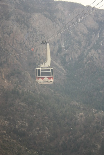
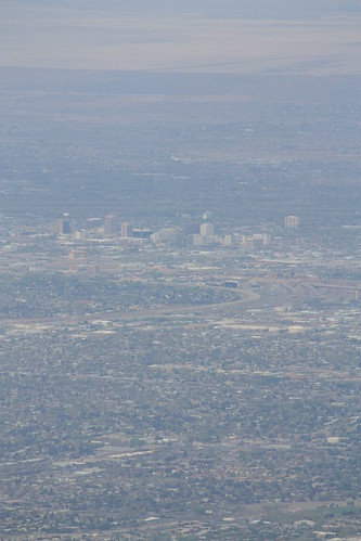
The tram ride is about 15 minutes to the top and costs $17 to ride. You begin at the base of the mountain at around 6500 feet and the journey ends at an elevation of 10,378 feet! Usually the surrounding mountains and valley below are in clearer view, but the Albuquerque skyline can be seen rather clearly from here.
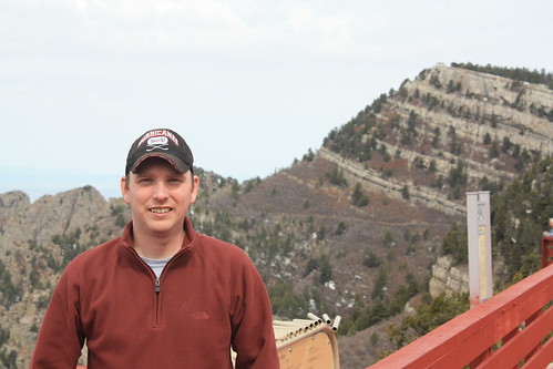
Here I am at Sandia Peak. It's pretty much the top location for out-of-towners to visit while in Albuquerque.
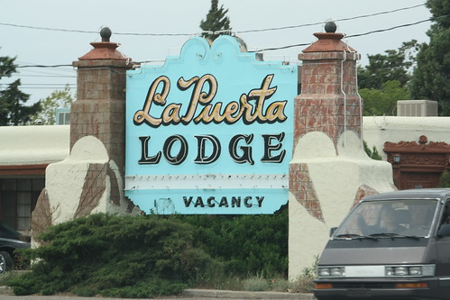
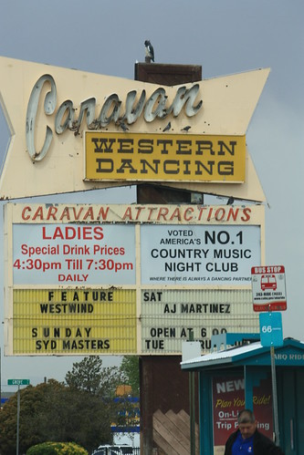
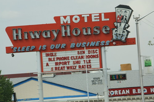
Next, we headed down to Central Ave. towards Downtown Albuquerque. Central Ave. was the main drag through town during the Route 66 era. Though it's now bypass by I-40 to the North, there are many remnants of the highway's heyday to be found. Mostly in the form of neon signs of old motor lodges, restaurants, liquor stores, and night clubs.

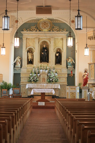
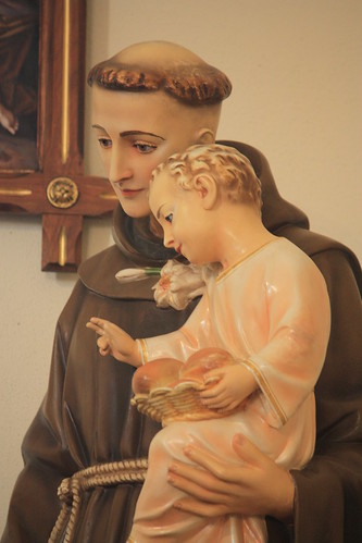
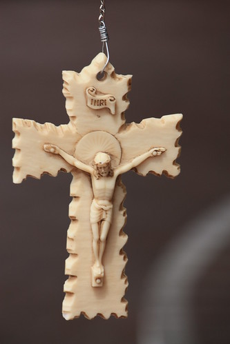
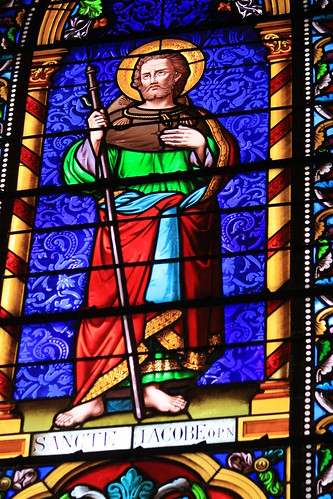
From Central Ave. was a visit to Old Town Albuquerque. I also had visited their previously in 2007. Sadly, the overcast conditions took away from photographing the exterior of the beautiful San Felipe de Neri Catholic Church. But with a better camera, I was able to take better photos of the interior.
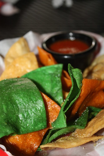
Lunch was in Old Town at the Quesadilla Grille. I don't take a lot of food photography, but had to take a shot of the colorful chips and salsa.
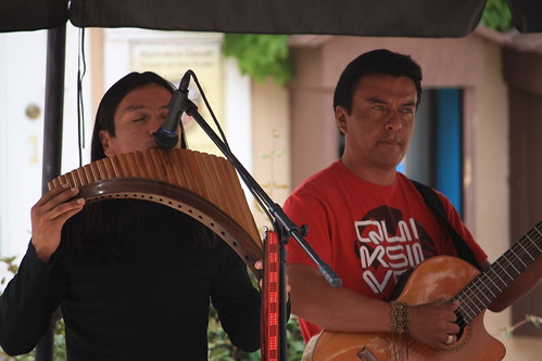
There always seems to be live music playing somewhere in Old Town during the day, and this day was no exception.
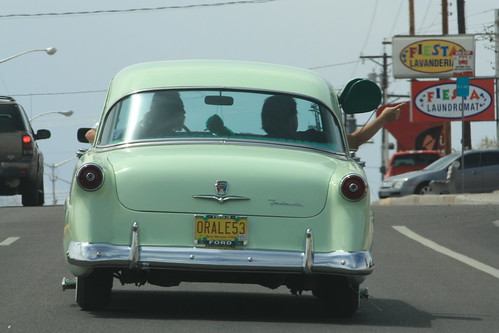
From Old Town, it was back on Central Ave. towards the Rio Puerco Bridge. However, what wouldn't be a ride on Old 66 without seeing a classic car! This is what we believe is a 1953 Ford Customline four door sedan.
I was hoping to come across this sign that I found in 2007.
Unfortunately, an entire rebuild of the western end of Central Ave. interchange (Exit 149) cause the button copy classic to be removed. Now it was on to the Rio Puerco bridge which is located a few miles west of here at Exit 140.
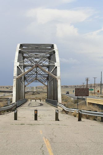
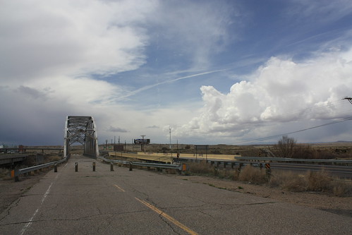
The Rio Puerco Bridge is a Parker Through Truss that was built in 1933. It remained in service until 1999. Since then, it has been preserved as part of Route 66 heritage by NMDOT. Nearby rain and storms gave a great backdrop for this historic bridge.
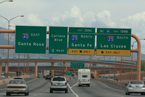
From there it was on to Santa Fe via the Big I and I-25.
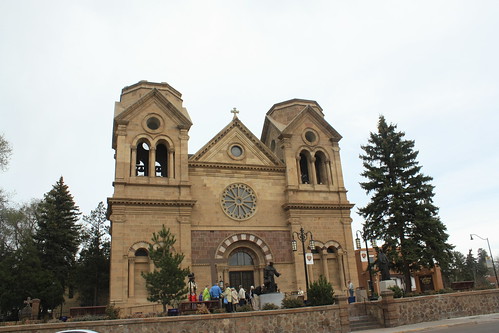
The highlight of Santa Fe - which was more overcast and a lot chillier than Sandia or Albuquerque - was the Cathedral Basilica of Saint Francis of Assisi.
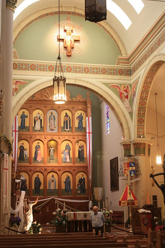
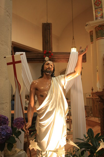
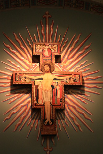
The inside is absolutely amazing.
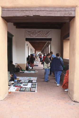
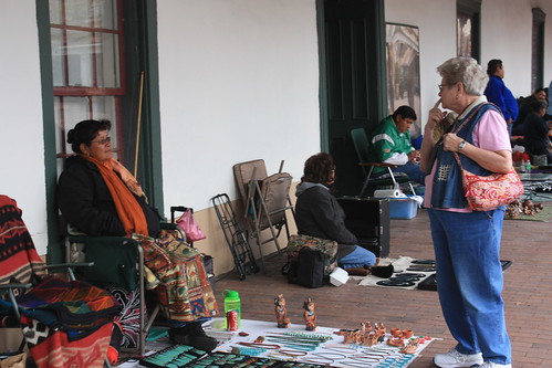
Also worth checking out in Santa Fe is the Native American vendors at the Palace of Governors.
The cool and overcast afternoon took away from Santa Fe. I've heard great things about it, and I would have to go back again and spend more time there to really decide on it.
From there it was I-25 North for a few miles to US 285 South and eventually NM 41 towards Moriarty. The nearby storms and heavy rain made for impressive open road shots.


NM 41 runs to Moriarty where I picked up old US 66. Moriarty has a few goodies - from an old button copy sign.
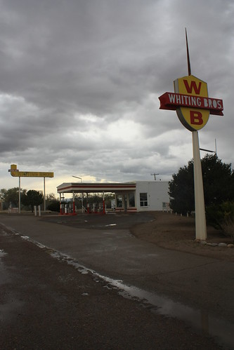
- to an old Whiting Brothers service station.
Took NM 333 back towards Albuquerque in hopes to find more goodies, but nothing really caught my eye. The other hope was to get sunset photos, but the cloud cover was too thick and no luck there either.
So Day 4 is west into Arizona...will better skies appear? The day will be broken into two parts - Old 66 in Arizona and Painted Desert/Petrified Forest National Park. Til next time!
Enjoy!
For the entire day set - head to flickr - over 200 photos!
The first stop was Sandia Peak. I took a journey to the top of the mountain in October 2007, and was excited to take the trip to over 10,000 feet again. Unfortunately, this time the skies were overcast and gloomy but it was still home to many great views!
The tram ride is about 15 minutes to the top and costs $17 to ride. You begin at the base of the mountain at around 6500 feet and the journey ends at an elevation of 10,378 feet! Usually the surrounding mountains and valley below are in clearer view, but the Albuquerque skyline can be seen rather clearly from here.
Here I am at Sandia Peak. It's pretty much the top location for out-of-towners to visit while in Albuquerque.
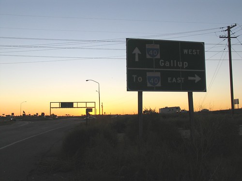
Next, we headed down to Central Ave. towards Downtown Albuquerque. Central Ave. was the main drag through town during the Route 66 era. Though it's now bypass by I-40 to the North, there are many remnants of the highway's heyday to be found. Mostly in the form of neon signs of old motor lodges, restaurants, liquor stores, and night clubs.
From Central Ave. was a visit to Old Town Albuquerque. I also had visited their previously in 2007. Sadly, the overcast conditions took away from photographing the exterior of the beautiful San Felipe de Neri Catholic Church. But with a better camera, I was able to take better photos of the interior.
Lunch was in Old Town at the Quesadilla Grille. I don't take a lot of food photography, but had to take a shot of the colorful chips and salsa.
There always seems to be live music playing somewhere in Old Town during the day, and this day was no exception.
From Old Town, it was back on Central Ave. towards the Rio Puerco Bridge. However, what wouldn't be a ride on Old 66 without seeing a classic car! This is what we believe is a 1953 Ford Customline four door sedan.
I was hoping to come across this sign that I found in 2007.
Unfortunately, an entire rebuild of the western end of Central Ave. interchange (Exit 149) cause the button copy classic to be removed. Now it was on to the Rio Puerco bridge which is located a few miles west of here at Exit 140.
The Rio Puerco Bridge is a Parker Through Truss that was built in 1933. It remained in service until 1999. Since then, it has been preserved as part of Route 66 heritage by NMDOT. Nearby rain and storms gave a great backdrop for this historic bridge.
From there it was on to Santa Fe via the Big I and I-25.
The highlight of Santa Fe - which was more overcast and a lot chillier than Sandia or Albuquerque - was the Cathedral Basilica of Saint Francis of Assisi.
The inside is absolutely amazing.
Also worth checking out in Santa Fe is the Native American vendors at the Palace of Governors.
The cool and overcast afternoon took away from Santa Fe. I've heard great things about it, and I would have to go back again and spend more time there to really decide on it.
From there it was I-25 North for a few miles to US 285 South and eventually NM 41 towards Moriarty. The nearby storms and heavy rain made for impressive open road shots.
NM 41 runs to Moriarty where I picked up old US 66. Moriarty has a few goodies - from an old button copy sign.
- to an old Whiting Brothers service station.
Took NM 333 back towards Albuquerque in hopes to find more goodies, but nothing really caught my eye. The other hope was to get sunset photos, but the cloud cover was too thick and no luck there either.
So Day 4 is west into Arizona...will better skies appear? The day will be broken into two parts - Old 66 in Arizona and Painted Desert/Petrified Forest National Park. Til next time!
Enjoy!


Comments