
Within the City of Chowchilla and much of the immediate area much of what was former US Route 99 can be found in the multiple alignments. Chowchilla is located in western Madera County, California near the Chowchilla River.


Part 1; the history of US Route 99 in Chowchilla
Minturn and Berenada were both founded in 1872 as sidings of the Southern Pacific Railroad. The Southern Pacific Railroad laid the groundwork for development of San Joaquin Valley. Previous to the Southern Pacific Railroad travel via wagon or foot in Central California tended to avoid San Joaquin Valley in favor of the Stockton-Los Angeles Road. The Stockton Los Angeles Road lied to the east of San Joaquin Valley in the Sierra Nevada Foothills and was less subject flooding. Before the Southern Pacific Railroad most of San Joaquin Valley was a sparsely inhabited wetland which made travel by road difficult. Minturn and Berenda can along the Southern Pacific Railroad on the 1873 Oregon, California, & Nevada Railroad Map.

In 1910 Orlando Alison Robertson who was a Land Developer from Minnesota became interested in acquiring lands south of Minturn held by Chowchilla Ranch. On May 22nd, 1912 Robertson purchased Chowchilla Ranch from the Agricultural Pastoral & Agricultural Company. Half of what had been Chowchilla Ranch was sub-divided and put up for sale to farmers. The northeast corner of Robertson's property would soon development into the community of Chowchilla. The development of Chowchilla saw the current street grid develop which played a large part in the decline of the Southern Pacific siding of Minturn. The growth of Chowchilla was considerably quick as the community incorporated as a City in February of 1923.
The emergence of the automobile in the early 20th Century in California led to the 1909 First State Highway Bond Act which was approved by voters during 1910. The majority of the highways approved as part of the First State Highway Bond Act were largely well established routes of travel. One such highway was Legislative Route Number 4 ("LRN 4") which was defined as a highway from "Sacramento to Los Angeles."
A very early LRN 4 in the Chowchilla Area can be seen on the 1917 California State Automobile Association Map. LRN 4 can be seen following Chowchilla Boulevard south through the communities of; Minturn, Chowchilla, and Califa before transitioning onto Fairmead Boulevard. LRN 4 is seen crossing the Southern Pacific Railroad in the community of Berenda at what is now Road 21. From Berenda LRN 4 can be seen following west of the Southern Pacific Railroad into Madera.


The 1924 Rand McNally Highway Map of California provides more detail on the alignment LRN 4, the Inland Route, and National Park-to-Park Highway near Chowchilla. Just as with the 1917 CSAA Highway Map LRN 4 can be seen following Chowchilla Boulevard through Chowchilla and transitioning onto Fairmead Boulevard towards a crossing of the Southern Pacific in Berenada.


Thusly US 99 appears on the 1925 Rand McNally Map of California as being plotted on the LRN 4 through Chowchilla (note; only Califa is shown).

During November of 1926 the US Route System was approved by the AASHO. US 99 can be seen aligned through Chowchilla via Chowchilla Boulevard 1927 National Map Company Sectional Map.

The July/August 1929 California Highways & Public Works discusses a new planned alignment of US 99/LRN 4 from Berenda Crossing to Califa. This planned new segment of US 99/LRN 4 is described as 4.1 miles and a replacement for the 15 foot wide Fairmead Boulevard on the eastern side of the Southern Pacific Railroad. The new road is described as crossing following the western side of Southern Pacific Railroad and crossing at Califa to Chowchilla Boulevard. This new planned alignment of US 99/LRN 4 would provide a new junction with LRN 32/Pacheco Pass Highway (future California State Route 152). The surface material noted to be used in the realignment of US 99/LRN 4 is Portland Cement.

The September 1929 California Highways & Public Works expounds more on the Berenda-Califa realignment of US 99/LRN 4. The new alignment of US 99/LRN 4 is described to include a rail subway on US 99/LRN 4 in Califa which was slated to be constructed by the Southern Pacific Railroad.

The realignment of US 99/LRN 4 along with the Southern Pacific Railroad Subway are described as being complete in the April 1930 California Highways & Public Works.

The Southern Pacific Railroad subway in Califa and the US 99/CA 152 junction can be seen on the 1935 Division of Highways Map of Madera County.

The Chowchilla Freeway upgrade of US 99 is discussed in the March/April 1957 California Highways & Public Works. The Chowchilla Freeway is described as being aligned east of Chowchilla Boulevard on a new bypass route for US 99/LRN 4. The 1930 Southern Pacific Railroad subway is discussed as being converted from two-way traffic to use exclusively for northbound US 99 traffic. The US 99/CA 152 junction upgrade is described as being converted from being at-grade to a series of ramps. Work on the Chowchilla Freeway is described as having broken ground on March 23rd, 1956 with an anticipated completion coming in July 1957.


Part 2; exploring the alignments of US Route 99 in the Chowchilla area
Our visit to the relic alignments of US 99 in the Chowchilla Area begins from present CA 99 northbound approaching CA 152. From northbound CA 99 the junction with CA 152 westbound can be found via a left hand ramp signed as Exit 166. The left Exit ramp on CA 99 is one of the many relics of 1950s era freeway upgrades to US 99.


As noted in Part 1 the 1930 Southern Pacific Railroad Subway was incorporated into northbound lanes of the Chowchilla Freeway in 1957. Califa would have been located on the eastern side of the 1930 Southern Pacific Railroad Subway. The Pre-1930 alignment of US 99 would have been just east of the Southern Pacific Railroad Subway via what is now Fairmead Boulevard. The Post-1930 alignment of US 99 would have veered left onto Chowchilla Boulevard east of the Southern Pacific Railroad Subway.


Most of the Chowchilla Freeway overpass structures feature Arc Deco designs which were still in vogue in the 1950s. This overpass of the Chowchilla Freeway can be seen carrying Avenue 24 over CA 99.

A southbound look from the end of Chowchilla Boulevard reveals the split from the Pre-1930/Post-1930 alignments of US 99. The left hand asphalt alignment is the Post-1930 Southern Pacific Railroad Subway route. The right hand concrete alignment is the Pre-1930 Fairmead Boulevard route.

A walk along the Pre-1930 concrete alignment reveals how narrow the 15 foot road deck carrying US 99 really was. This design was common of First State Highway Bond Act era roads.


A look north on the Pre-1930 concrete alignment of US 99.


A look north on former US 99 on Chowchilla Boulevard from the north end of the Pre-1930/Post-1930 alignment split.

From the Pre-1930/Post-1930 alignment split former US 99 on Chowchilla Boulevard heads northward towards Chowchilla. There is a major intersection which can be found at Avenue 24 which accesses CA 99 on the Chowchilla Freeway.


Former US 99/Chowchilla Boulevard crosses a ditch near Avenue 24 1/2 and enters the City of Chowchilla.


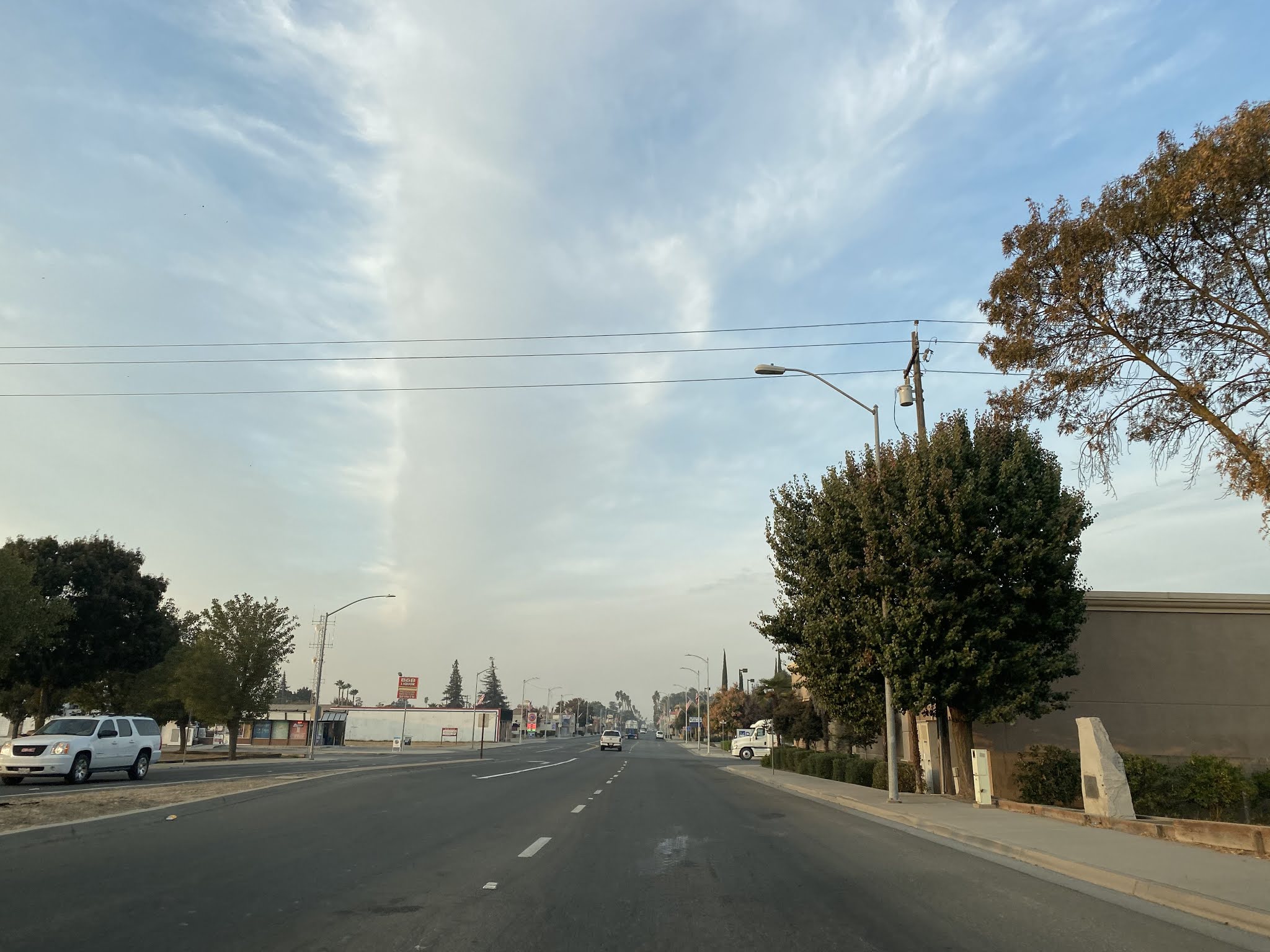
Former US 99/Chowchilla Boulevard continues north into downtown Chowchilla. Chowchilla Bouelvard is now bisected by numerous businesses which forces traffic onto; CA 223/Robertson Boulevard, Front Street, and Kings Avenue to get between the disconnected segments.


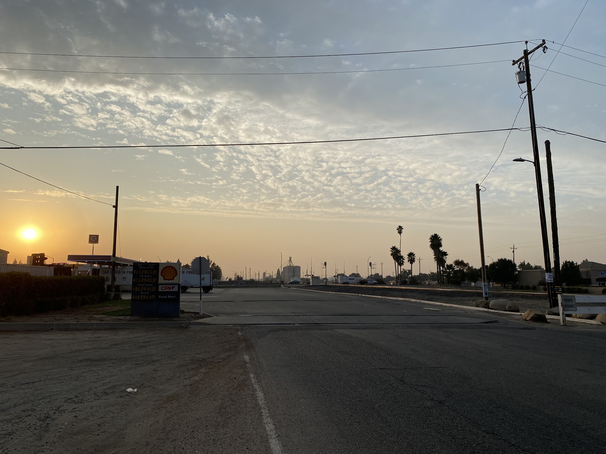
A look south through the Shell gas station parking lot which was once US 99/Chowchilla Boulevard.
Former US 99/Chowchilla Boulevard north crosses another ditch and leaves the limits of the City of Chowchilla.


Former US 99/Chowchilla Boulevard becomes a expressway approaching Road 15 in Minturn and terminates at the Chowchilla Freeway.


Comments