Federal Highway GUA 10D is tolled Autopista located near the Guadalajara metropolitan area in the Mexican state of Jalisco. Federal Highway GUA 10D is 111 kilometers in length spanning from Federal Highway 80D/90D near Zapotlanejo west to Federal Highway 15D at El Arenal. Federal Highway GUA 10D does not follow the established numbering conventions of the Federal Highway System and is one of the newer facilities in Mexico as it was fully dedicated during January 2018. Federal Highway GUA 10D is known as "Macrolibramiento Sur de Guadalajara" which translates into English as "Southern Super Bypass of Guadalajara.
Part 1; the history of Federal Highway GUA 10DThe purpose of Federal Highway GUA 10D is to permit freight traffic to bypass the city of Guadalajara as a component of the Nogales highway corridor. As presently configured Federal Highway GUA 10D functions as a true bypass Guadalajara metro area and has only seven junctions. Federal Highway GUA 10D only serves approximately 6,000 vehicles a day which is largely comprised of freight vehicles.
The first 25-kilometer segment of Federal Highway GUA 10D was announced as having opened in a Secretariat of Communications and Transportation press release dated August 1, 2016. The August 1, 2016 pressed release noted 1.5 billion Pesos went into funding construction of the initial segment of Federal Highway GUA 10D. Federal Highway GUA 10D does not fall within the established numbering convention of the Federal Highway System aside from the "D" suffix denoting it as a tolled Autopista.
The full 111-kilometers of Federal Highway GUA 10D were announced as having opened in a
January 8, 2018, Secretariat of Communications and Transportation press release. Upon fully opening during 2018 the toll rate for traveling the entire 111-kilometers of Federal Highway GUA 10D was 299 Pesos.
Part 2; a drive on Federal Highway GUA 10D from Federal Highway 23 west to Federal Highway 15
From Federal Highway 23 south of Guadalajara and Miguel Hidalgo y Costilla International Airport traffic can access Federal Highway GUA 10D. Tepic is listed as the westbound control city transitioning from Federal Highway 23 southbound Federal Highway GUA 10D. Traffic entering Federal Highway 10D is required to pass through a toll booth (Plaza de Cobro Chapala) with a current rate of 111 Pesos for automobiles.
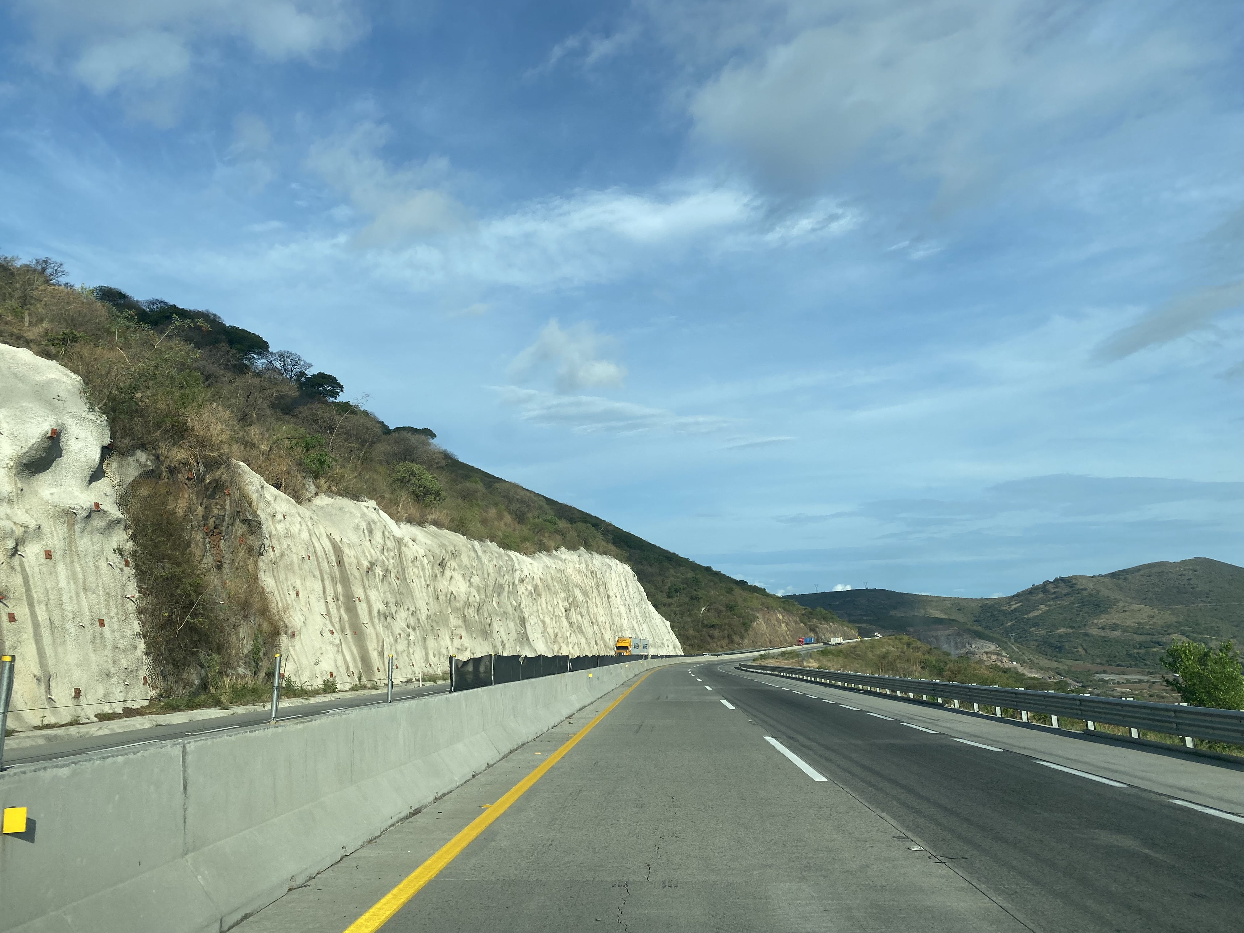
Despite having been completed in 2018 the difference between Autopista standards to that of American Interstates is almost instantly apparent. Federal Highway GUA 10D essentially has no interior shoulder which is coupled with a narrow exterior shoulder.
Federal Highway GUA 10D between Federal Highway 23 west to Federal Highway 15 is approximately 35-kilometers. The segment bypasses far to the south of Guadalajara among the hills above Laguna de Cajititlán.
Part 3; a drive on Federal Highway GUA 10D from Federal Highway 23 to Federal Highway 80D
Federal Highway GUA 10D east from Federal Highway 23 descends to a crossing of Río Grande de Santiago. Río Grande de Santiago begins at nearby Lake Chapala and follows a 433-kilometer course to the Pacific Ocean in Nayarit.
Federal Highway GUA 10D rises east from Río Grande de Santiago to a toll facility known as "Caseta de Cobro La Laja Macrolibramiento" approaching Federal Highway 15D. The current toll rate for automobiles at Caseta de Cobro La Laja Macrolibramiento is $88 Pesos.
Eastbound Federal Highway GUA 10D crosses over an interchange with Federal Highway 15D. Federal Highway 15D is aligned north of Lake Chapala whereas the toll-free mainline is aligned south of the basin.
Federal Highway GUA 10D eastbound terminates at Federal Highway 80D near Zapotlanejo. Traffic cannot access Federal Highway 90D from the eastbound lanes but can exit onto Federal Highway 90 into Zapotlanejo.
Version History
- Originally published on 8/16/2022.
- Updated on 3/4/2024.


Comments