US Route 101 near the village of Klamath in Del Norte County has a notable roadside attraction in the form of Trees of Mystery.

Trees of Mystery is a park noted for being a significant roadside attraction on US Route 101 ("US 101") in Northern California. Trees of Mystery can be found approximately five miles north of the Klamath River and the Village of Klamath.

Part 1; history of the Trees of Mystery
Trees of Mystery largely is surrounded by the much more preservationist minded Redwood National Park and California State Parks. Trees of Mystery offers a slightly different experience given it's trails are located on private land. What eventually became Trees of Mystery opened in 1931 by Carl Bruno as a fishing camp known as "Wonderland Redwood Park." Under Bruno's ownership the name Wonderland Redwood Park was changed to "Kingdom of Trees." Bruno's business partner Carl Lewin which rebranded the park to "Trees of Mystery" in 1946.
Trees of Mystery is easily identified from US 101 by the statues of Paul Bunyan and Babe the Ox which are located in the park parking lot.

The original Paul Bunyan statue was constructed in 1946 but was destroyed by rains during the following winter. The Babe the Ox statue was constructed in 1950 and the current Paul Bunyan was built in 1961. Both statues are constructed from wooden roards, chicken wire, and stucco. In what has to be the most 2020 thing ever both statues as of late are featuring face masks.


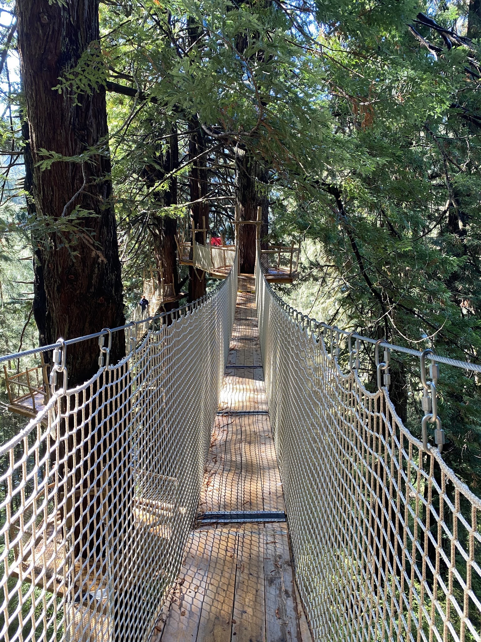
Trees of Mystery has been expanding almost continuously upon opening in it's current form in 1946. In 2001 a aerial tramway known as the "Sky Trail" was constructed from the Brotherhood Tree to the canopy atop Trees of Mystery. As of June 2020 Trees of Mystery opened the Redwood Canopy Trail via a network of wooden netted suspension bridges.
Part 2; the trails of Trees of Mystery
The primary trailhead at Trees of Mystery begins at the Visitor Center. A guide sign indicates the distance to each of the major trails via the Kingdom of Trees Trail.

The Elephant Tree can be found near the trailhead of the Kingdom of Trees Trailhead.

The Upside Down Tree is two trees that have grown together.


The Octopus Tree features a hollow underneath it's trunk.


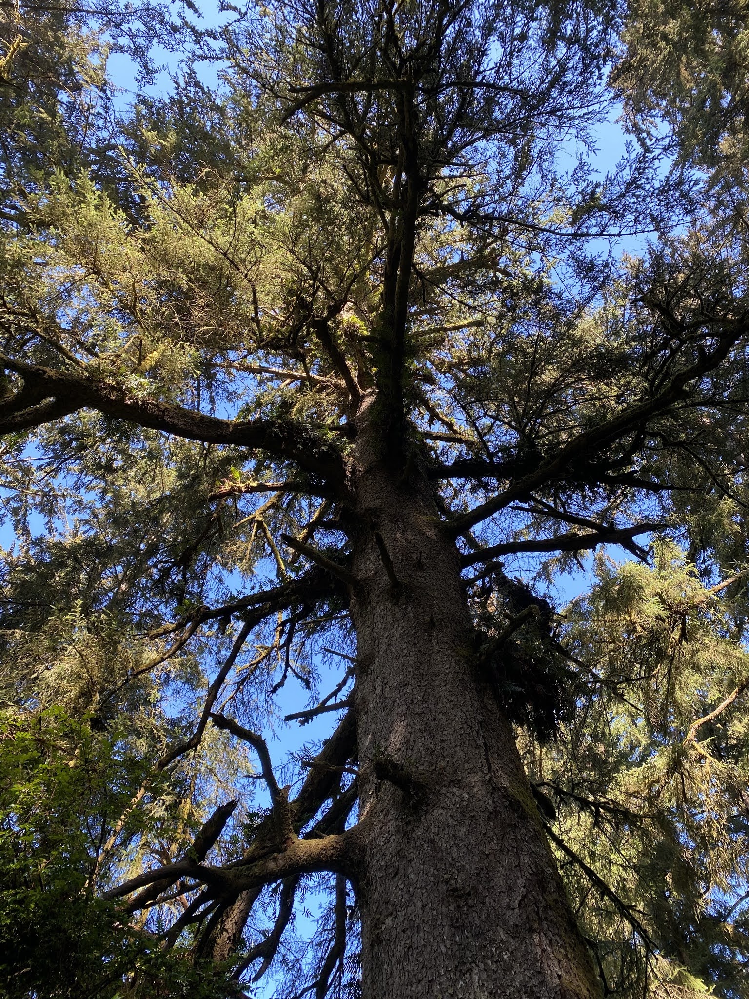
Some of the Coastal Redwoods which serve as the primary attraction at Trees of Mystery.


More Coastal Redwoods.


The 3 in 1 Tree.


The 297 foot tall Trinity Tree.


The Redwood Canopy Trail as noted above is the newest feature at Trees of Mystery and probably the best emulation of Return of Jedi (a Ewok free version) I've encountered.


The Cathedral Trees upon returning to the Kingdom of Trees trail.


The turn towards the Skytrail offers a view of the substructure of the Redwood Canopy Trail.


The Forest Experience Trail connects the Kingdom of Trees Trail to the Skytrail. The Brotherhood Tree can found on the Forest Experience Trail. The Brotherhood Tree once stood at a height of 297 feet but has been reduced by lighting.


The Skytrail ascends from the vicinity of the Brotherhood Tree to Teds Ridge. From Teds Ridge the Pacific Ocean can be viewed to the west and Rattlesnake Ridge to east. The Wilderness Trail can be taken as an alternate to the tramway borne Skytrail.


The Tower Inferno Tree.


Trees of Mystery also featured numerous wood carved sculpture displays and art.


Comments