California State Route 99/Old US Route 99 Freeway Part 1; Interstate 5 north to California State Route 145

Over the past three years I've had the opportunity to drive the entirety of the California State Route 99 Freeway from Interstate 5 north to Sacramento several times but rarely took many photos until this past month. The saga of US Route 99 in California being dropped to a State Highway no later 1967 is well established at this point. The point of this blog series is to focus on the actual active CA 99 freeway itself rather than the history of US Route 99.
This blog is the first of a two-part series regarding the CA 99 Freeway. The segment part of this blog series covers the CA 99 Freeway south from US 50/CA 51 in Sacramento to CA 145 in Madera.
California State Route 99/Old US Route 99 Freeway Part 2; US Route 50/California State Route 51 south to California State Route 145
This blog is part of the larger Gribblenation US Route 99 Page. For more information pertaining to the other various segments of US Route 99 and it's three-digit child routes check out the link the below.

California State Route 99 from Interstate 5 north to California State Route 145
CAhighways.org on US 99/CA 99
The route of CA 99 from I-5 north to Sacramento is tied back to Legislative Route Number 4. A 359 mile section of LRN 4 between Los Angeles and Sacramento was approved by voters in 1910 via the 1909 First State Highway Bond Act. By the Third State Highway Bond Act this section of State Highway was assigned to LRN 4. LRN 4 would become part of US Route 99 but was not likely signed as such until 1928. South of the I-5 junction US 99/LRN 4 would have traversed the many alignments of the Ridge Route to Los Angeles. I just did a Ridge Route Historic blog which covers the topic here:
Legend of the Ridge Route; a history of crossing the mountains between the Los Angeles Basin to San Joaquin Valley from wagon trails to Interstates
US 99 was one of the many US Routes which was decomissioned following the 1964 California State Highway Renumbering. Specifically US 99 was heavily truncated in 1964 to downtown Los Angeles following by a complete removal by 1967. The progression of the demise of US Route 99 can be observed by comparing each year of the State Highway Map during said time frame.
1964 State Highway Map
1964 State Highway Map City Insert
1965 State Highway Map
1965 State Highway Map City Insert
1966 State Highway Map
1966 State Highway Map City Insert
1967 State Highway Map
1967 State Highway Map City Insert
With the essential historical brief out of the way I began my journey on the CA 99 Freeway northbound from I-5 Exit 221 in Kern County. The CA 99 Freeway is typically known in board terms as "The Golden State Highway and/or Freeway."


From I-5 northbound CA 99 is signed as the "Kern County Korean War Veterans Memorial Highway." Bakersfield is signed as 25 miles away Fresno 131 miles away, and downtown Sacramento 301 miles away on northbound CA 99.


CA 99 northbound meets a junction for CA 166 at Exit 3 in Mettler.


Previously I wrote a blog post about the entirety of CA 166 which can be found here.
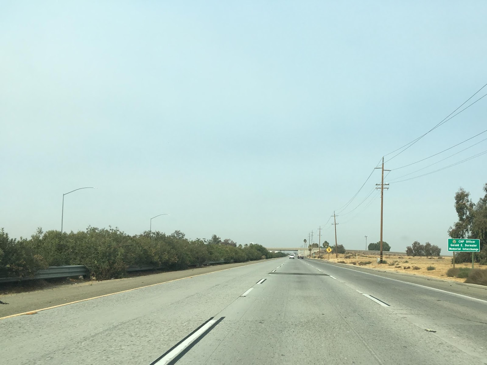
North of CA 166 the route of CA 99 northbound is signed as the "CHP Officer Gerald E. Dormaier Memorial Highway."
CA 99 northbound Exit 11 is for Union Avenue which is previous route of US 99 through Bakersfield along the CA 99 Business Route and CA 204.


My previous blog entry on CA 204 and the former alignments of US 99 in Bakersfield can be found here:
North of the Union Avenue Exit the route of CA 99 is signed as 15 miles from Bakersfield.

At Exit 13 CA 99 northbound has a junction with CA 223 on Bear Mountain Boulevard. CA 223 eastbound is the most direct access to Bakersfield National Cemetery.


My previous blog post on CA 223 can be found here:
At Exit 18 on the outskirts of Bakersfield CA 99 northbound meets CA 119 on Taft Highway which is a previous portion of US Route 399.


My previous blog post on CA 119 and said portion of US Route 399 can be found here:
Within the City of Bakersfield at Exit 24 CA 99 northbound meets the CA 58 freeway.


The CA 58 freeway east of Bakersfield is along the former-right-of-way once occupied by US Route 466. US Route 466 from Bakersfield to Tehachapi was something I covered in the past which can be viewed here:
CA 58 westbound multiplexes CA 99 northbound over the Kern River to Exit 26A where it branches off on the Rosedale Highway. Although it isn't signed well 24th Street eastbound is CA 178 through downtown Bakersfield.

CA 58 will soon have a new freeway interchange with CA 99 as part of the Centennial Corridor which will connect the Westside Parkway. I previous covered the Westside Parkway which can be found here:
Before the 1964 State Highway Renumber CA 178 continued west from Bakersfield to US 101. Last year I went out searching for the early alignments of CA 178 west of Bakersfield.
Eastbound CA 178 along the Kern River to CA 14 is one of the best scenic drives in the Southern Sierras in my opinion. My previous blog post on CA 178 in the Kern River Canyon can be found here:
From CA 58/CA 178 McFarland is signed 22 miles away and Fresno 104 miles away on northbound CA 99. CA 99 northbound meets CA 204 but there is no direct access other than a merge lane from the latter.

At Exit 30 CA 99 meets the southern terminus of CA 65 on the Porterville Highway.


My previous blog regarding the south segment of CA 65 can be found here:
At Exit 44 in Famoso CA 99 northbound crosses over a rail overpass to the west side of the tracks and meets CA 46 on the Paso Robles Highway. Exit 44 also accesses Famoso-Porterville Highway which was the original south terminus of CA 65.


CA 46 largely is another former segment of of US Route 466, my previous blog post on the highway can be found here:
McFarland is signed as 5 miles away and Tulare 42 miles away on CA 99 northbound past the CA 46 Exit.

North of McFarland at Exit 52 northbound CA 99 traffic is advised there is access to Colonel Allensworth State Historic Park and Lake Woollomes.


At the outskirts of the City of Delano CA 99 northbound is signed as the "Veterans of Foreign Wars Memorial Highway."

At Exit 56 in downtown Delano CA 99 northbound meets a junction with CA 155 at Garces Highway.


CA 155 continues east to Lake Isabella and CA 178, my blog post on the highway can be found here:
CA 99 northbound crosses back over to the east side of the nearby railroad tracks. At Exit 58 for County Line Road CA 99 northbound drops to a sub-standard four-lane section entering Tulare County. From Delano northward to CA 198 there are various right-on/right-off ramps and sub-standard shoulder widths that don't meet Interstate standards. One of the most common questions about the CA 99 freeway is why it isn't an Interstate given it's length? The answer is that lengthy sections are not Interstate standard and would require expensive rebuilding.


Entering Tulare County Earlimart is 7 miles away and Fresno 75 miles away on CA 99 northbound.

At Exit 65 in Earlimart CA 99 northbound traffic is advised that Colonel Allensworth State Historic Park can be accessed by Avenue 56. Although it is no longer "signed" Avenue 56 is part of Signed County Route J22.


J22/Avenue 56 continues eastward to Mountain Road 56 which is a directly line to access Sherman Pass Road in Sequoia National Forest. Sherman Pass Road is significant giving it is the only Trans-Sierra Highway not maintained by Caltrans. My previous blog post for the climb over Sherman Pass can be found here:
Past Avenue 56/J22 Pixley is signed 4 miles away and Fresno 67 miles away on CA 99 northbound.

In Pixley at Exit 70A CA 99 northbound meets Signed County Route J24 (again this route is no longer signed) on Avenue 96. I didn't have a solid list for the all the Signed County Routes since only one of them is presently signed in Tulare County and missed capturing an Exit 70A photo.
At Exit 76 in Tipton CA 99 northbound meets the western segment of CA 190.

Over the past couple years I've accumulated photos from the entire completed sections of CA 190. I complied documents regarding the history of the unbuilt Trans-Sierra segment, said blog can be found here:
Oddly Exit 77 in Tipton at Avenue 152 accesses Signed County Route J26 on CA 99 northbound. I find it strange that a Signed County Route was plotted out so close to a State Highway.

North of Tipton at Avenue 152 Tulare is signed 10 miles away and Fresno 55 miles away on CA 99 northbound.

CA 99 northbound crosses the Tule River and meets the Phillip S. Rayne Rest Area a couple miles from Tulare. The rest area was recently adorned with historic informational placards. I found the placards regarding US 99, steam ship, and Tulare Lake to be the most interesting.


As CA 99 northbound enters the City of Tulare it enters several exits for the International Agriculture Center.

At Exit 87/Tulare Avenue in Tulare CA 99 northbound encounters CA 137.


My previous blog post regarding CA 137 can be found here:
Directly past CA 137 on northbound CA 99 Visalia is signed 8 miles away and Fresno is shown 44 miles away.

At Exit 96 CA 99 northbound encounters CA 198 east and at Exit 97 it encounters CA 198 west. CA 99 northbound expands back to a six lane freeway at the CA 198 junction.


CA 198 has wildly varying terrain from the Coast Ranges east to Sequoia National Park, it is one of the better driving roads in the state in my opinion. To that end I've written several blogs covering the entirety of the highway.
At Exit 98/Betty Drive in Goshen CA 99 northbound enters Signed County Route J36.

North of Goshen CA 99 northbound encounters Signed County Route J34 at Avenue 328. Oddly J34 and Avenue 328 doesn't have an access ramp to CA 99.
A couple miles north of Traver at the Kings River CA 99 northbound encounters Signed County Route J38/Avenue 384 at Exit 109. J38/Avenue 384 also has an off-highway Caltrans Rest Area.


At Exit 112 CA 99 northbound enters the City of Kings, enters Fresno County, and encounters the west terminus of CA 201.


Just
before CA 201 the route of CA 99 northbound is signed as the "CHP
Officers Brian M. Law and Juan J. Gonzalez Memorial Highway."


Previously I wrote a blog entry about CA 201 which can be found here:
Previously I used Kingsburg as my starting point to track the original alignment of US Route 99 along Golden State Boulevard through Fresno. I mapped out the alignment history of US Route 99 in Fresno before it was shifted to the modern freeway, said blog can be found here:
Past CA 201 Selma is signed as 4 miles away while Fresno is shown 19 miles away on CA 99 northbound.

At Exit 115/Mountain View Avenue CA 99 northbound encounters Signed County Route J40.

Past Mountain View Avenue/J40 CA 99 northbound is signed as the "William Lehn Fresno Police Department Memorial Highway."

At Exit 118 CA 99 northbound encounters the north terminus of CA 43 on Highland Avenue in the City of Selma.

Previously I drove the entirety of CA 43 in a thick Tule Fog, said blog can be found here:
Past Exit 118 the City of Fowler is signed 4 miles away while Fresno is 13 miles away on CA 99 northbound.

Entering the City of Fresno northbound CA 99 traffic is notified that there are eleven exits in the community.


At Exit 130 CA 99 northbounds encounters Jensen Avenue which is signed as the "TO" route for CA 41 southbound. Before the CA 41 expressway south of Fresno was built CA 41 was actually on Jensen Avenue, the signage along the surface street was never changed.


At Exit 131 CA 99 northbound encounters CA 41 northbound which traverses downtown Fresno.

Given CA 41 is in close proximity to me I've traversed the entirety of the highway. In turn I've written numerous blogs pertaining to the route and former alignments.
Past CA 41 the route of CA 99 northbound encounters CA 180 at Exit 133.


Again given CA 180 is one of my home routes I have several blog posts pertaining to the route and unbuilt section west of CA 33.
Past CA 180 northbound CA 99 in Fresno enters the California High Speed Rail corridor. The first segment of the High Speed Rail has been under construction from Fresno north to Madera since early 2015.

CA 99 northbound Exit 135A onto Belmont Avenue provides access to; Fresno Chaffee Zoo, Roeding Park, and the Tower District of Fresno.

At Exit 135B on northbound CA 99 traffic advised there is access to Fresno City College.


Part of the CA 99 freeway recently was relocated between Exit 136 at Clinton Avenue and Exit 138A at North Golden State Boulevard. The northbound lanes were shifted westward towards the southbound to make room for the High Speed Railroad grade. The grade replaced by the High Speed Rail was part of the original route of US Route 99 even before it was a freeway. The new overpasses require enough clearance and grade separation to ensure that the High Speed trains can maintain speeds. North Golden State Boulevard which happens to be part of the historic US 99 corridor will also require a large degree of alterations due to the High Speed Rail.


At Exit 138B the route of northbound CA 99 shifts westward away from North Golden State Boulevard and the High Speed Rail Corridor.


The Forestiere Underground Gardens are located at Exit 140 along Shaw Avenue on CA 99 northbound.


Past Shaw Avenue the City of Madera is signed 13 miles away and Sacramento is signed 161 on CA 99 northbound.

CA 99 northbound past Herndon Avenue is signed as the "100th Infantry Battalion Memorial Highway." At the San Joaquin River CA 99 northbound crosses into Madera County and approaches a large new bridge new High Speed Rail bridge known as the San Joaquin River Viaduct under construction. The San Joaquin River Viaduct is the second High Speed Rail Bridge to begin construction after the Fresno River Viaduct. The San Joaquin River Viaduct is slated to 4,740 feet long upon completion.


At Exit 144 on Avenue 7 there is direct access to the High Speed Rail Project San Joaquin River Viaduct grade. Avenue 7 continues westwards towards the City of Firebaugh and serves as an alternate to CA 180. From the Exit overpass the new High Speed Rail grade to the San Joaquin River Viaduct can be viewed.


Legislation for the High Speed Rail was approved through Proposition 1A in 2008 which called for $9,000,000,000 in bonds to be issued. Various Federal Funds were obtained for the High Speed Rail Project in 2010-2011. The High Speed Rail is set to open between San Francisco and Los Angeles in Phase 1 of the project in 2029. Phase 2 calls for future extensions of the High Speed Rail to Sacramento and San Diego. The primary stipulations of the High Speed Rail was that it obtain minimum speeds of 200 MPH and a travel time between San Francisco to Los Angeles in 2 hour and 40 minutes. From Avenue 7 it is hard to envision the High Speed Rail and the San Joaquin River Viaduct project being completed so far into the future. The subject is part of local conjecture with positive and negative opinions across California.


For comparison sake I did take a picture of the Fresno River Viaduct last year while driving CA 145 northbound. The Fresno River Viaduct is slated to be only 1,600 feet long and has far less obstructions being east of Madera than the San Joaquin River Viaduct.

At CA 99 northbound Exit 151 there is access to for Avenue 12 and Road 29. Exit 151 is signed as access for the Madera Community Center.


The City of Madera has four exits on CA 99 northbound. CA 145 meets CA 99 northbound at Exit 153B. Exit 153A provides access to Gateway Drive which was the former surface route of US 99 through Madera.


My previous blog entry on CA 145 can be found here:
In the second part of this blog series I'll be covering the segment of CA 99 freeway north from CA 145 to US 50/CA 51. Once the next entry is posted I will link it below.
Comments