
Butler, PA Walkabout

 1113

Over the Christmas holiday, I was able to explore parts of Southwestern Pennsylvania.  On December 23rd, we took a drive up to and walked around the town of Butler.

To visit the entire photo set on flickr, head here.

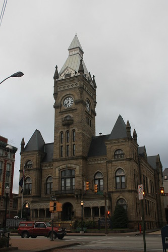
Butler is a unique town of 15,000 located about 35 miles north of Pittsburgh.  It is the county seat of Butler County.  The County Courthouse (shown below) was built in 1885 and is still in use today.

1070

One of more unique buildings in Bulter is the Butler County Motor Company Ford Dealership.

1079

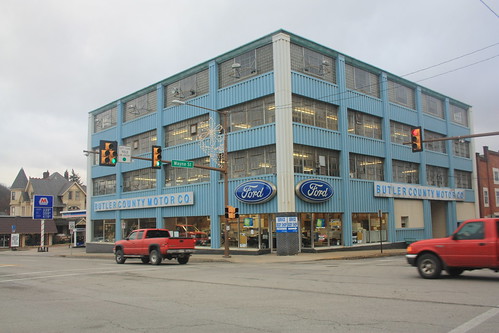
This is the first time I had seen an automotive dealer be housed in a multi-story building like this.  The Butler County Motor Company (aka Butler County Ford) has been around since 1918 and was one of the first Ford automotive dealerships authorized by Henry Ford.

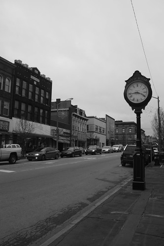
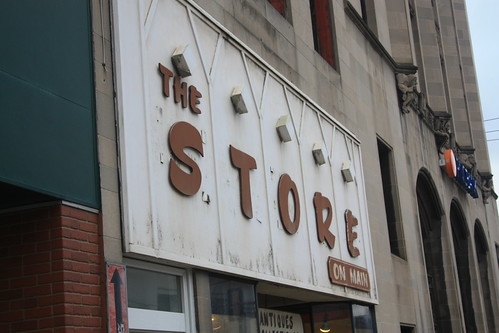
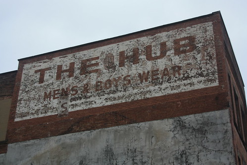
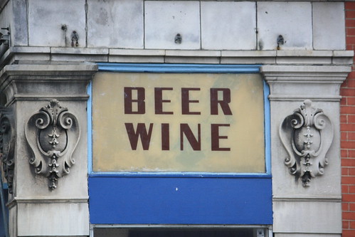
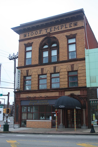
Walking down Main Street in Butler - there are a number of great older building, storefronts, and ghost signs.

1091

1087

Beer? Wine? Your choice

1086

One of the buildings that caught my eye at the end was the home of the Penn Theatre.  Even though looking up the theatre online says that it is being renovated, it looks in pretty bad shape, and most of those articles date to 2005 and the theatre looks a lot better then.

The Penn Theatre will see better days

1104

1106

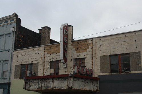
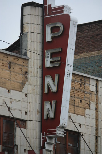
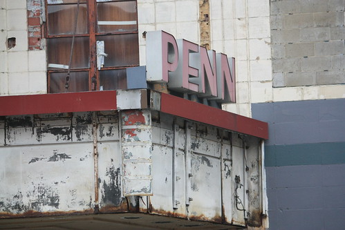
The theatre was built in 1938 and was sold in 2001.  Currently, the Butler Penn Theatre Community Trust hopes to renovate the Penn Theatre but the last information I found was a presentation from 2009.  I certainly hope that this theatre can be renovated and that various events small, large, local, and otherwise can occur there.

Finally, it was a cold day and even some snow flurries briefly fell through the air.  Maggie and I stopped at a Downtown Butler tradition, Cummings Candy and Coffee Shop to warm up and get something to eat.

1099

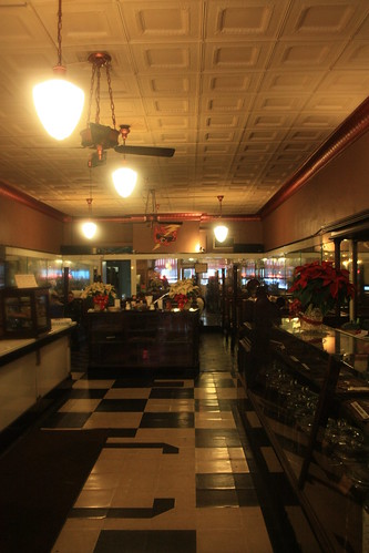
The Cummings family have owned and operated the shop since 1905 - making it the oldest family owned business in Butler!  Inside definitely has an old fashioned soda shop feel, and it's a great place to have some coffee or tea or a quick snack.

There's a lot more to Butler than the quick 30 or so minute walk that Friday before Christmas.  It was certainly worth the drive to check out for the first time.

Comments

Popular posts from this blog

Dillon Road

Dillon Road is a 34.2-mile highway located in northern Coachella Valley of Riverside County, California.  Dillon Road begins at Avenue 48 on the outskirts of Indio and ends to the west at California State Route 62 near San Gorgonio Pass.  Dillon Road was developed the 1930s as a construction road for the Colorado River Aqueduct.  Dillon Road serves as a northern bypass to much of the development of Coachella Valley.  Dillon Road is known for it's frequent dips and spectacular views of San Gorgonio Pass.   Part 1; the history of Dillon Road Dillon Road was constructed as a haul road for the Colorado River Aqueduct through Coachella Valley.  The Colorado River Aqueduct spans 242 miles from Parker Dam on the Colorado River west to Lake Mathews near Corona.  Construction of the Colorado River Aqueduct began during January 1933 near Thousand Palms and was made functional on January 7, 1939.  West of Berdoo Canyon Road the alignment of Dillon Road is largely concurrent with the Colorado

Oldtown Toll Bridge - Maryland and West Virginia

  The Oldtown Toll Bridge linking Oldtown, Maryland over the Potomac River with neighboring Green Spring, West Virginia is only one of a few truly privately owned toll bridges located in the United States. It's a simple bridge by design, as the 318 foot long Oldtown Toll Bridge is a low water bridge. Low water bridges are designed to allow water to safely and efficiently flow over the bridge deck. Additionally, a dozen concrete pedestals have been secured in the Potomac River in order to support the bridge and wooden deck. The bridge was constructed in 1937 when a gentleman by the name of Mr. Carpenter obtained the proper permits to build the Bridge through an Act of Congress. This was a blessing for residents, especially on the West Virginia side of the Potomac River, as it saved motorists commuting to Cumberland an hour in travel time. Using Mr. Carpenter's blueprints, the Army Corp of Engineers and a number of local laborers constructed the bridge and it remained under the

Tehachapi-Willow Springs Road

Tehachapi-Willow Springs Road is an approximately 21-mile highway located in southeast Kern County.  Tehachapi-Willow Springs Road begins at Tehachapi Boulevard (former US Route 466) in Tehachapi and crosses the Tehachapi Mountains via the 4,820-foot-high Oak Creek Pass.  Tehachapi-Willow Springs Road enters Antelope Valley of the wider Mojave Desert and passes by the historic stage station of Willow Springs to a southern terminus at Rosamond Boulevard.  Tehachapi-Willow Springs Road has historic ties to the Havilah-Los Angeles Road and Stockton-Los Angeles Road due to the once reliable presence of water at Willow Springs. Part 1; the history of Tehachapi-Willow Springs Road Oak Creek Pass and Willow Springs were known to the local tribes of the Tehachapi Mountains for generations.  The first documented European crossing of Oak Creek Pass was during 1776 as part of an expedition by Francisco Garces.  Oak Creek Pass is as used again by John C. Fremont during an 1844-1845 expedition to e