
California State Route 4 ("CA 4") contains probably most infamous Trans-Sierra State Highway in Caltrans Inventory. CA 4 from CA 207 in Bear Valley east over Pacific Grade Summit and Ebbetts Pass includes approximately 30 miles of one-lane highway which reaches gradients as steep as 24%.

CA 4 is a 192 mile State Highway which originates at I-80 near Hercules of the San Francisco Bay Area and terminates at CA 89 in the remote Sierra Nevada Mountains of Alpine County. CA 4 is probably the most diverse State Highway in California as it has; several freeway segments, traverses the San Joaquin/Sacramento River Delta, and becomes a remote mountain pass in the Sierra Nevada Mountains.

The focus of this article pertains primarily to CA 4 east of Angel's Camp over Pacific Grade Summit and Ebbetts Pass. The other articles pertaining the remaining segments of CA 4 can be found on Gribblenation at the links below:
California State Route 4; Stockton Crosstown Freeway
Part 1; the history of transportation over Pacific Grade Summit and Ebbetts Pass
Ebbetts Pass is suspected to have been possibly regularly used by the Miwok and Washoe tribes as a foot path over the Sierra Nevada Mountains. The 1827 Jedediah Smith Expedition possibly used Ebbetts Pass to leave California. Major John Ebbetts claimed to have traversed Ebbetts Pass during April of 1851 with pack mules during the height of the California Gold Rush. John Ebbetts initially believed that the route he had located would be suitable for a transcontinental railroad but later found it unsuitable when he later returned to survey it. John Ebbetts intended to return to survey his namesake pass for a wagon road but was killed during the explosion of the steamboat Secretary in San Pablo Bay in 1854. For the outset the pass discovered by John Ebbetts was referred to by his name although it would not be formally adopted by the U.S. Geological Survey until 1893.
Ebbetts Pass can be seen on the 1857 Britton & Rey's Road Map of California in what was what Amador County. Note; the road over Carson Pass can be seen north of Ebbetts Pass in El Dorado County.

In 1856 an immigrant road was constructed from Murphy's east to Ebbetts Pass. This early immigrant road diverged from modern CA 4 in Hermit Valley and cut north towards the Carson Pass Road in Hope Valley. This early route over Ebbetts Pass is depicted in the September 1950 California Highways & Public Works article titled "Crossing the Sierra."


In 1858 Konigsberg was founded by Norwegian Miners near potential silver claims east of Ebbetts Pass along Silver Creek. The growth of Konigsberg was spurred by the Comstock Lode Rush out of Nevada by 1859. Konigsberg’s outward growth spawned nearby communities eastward on Silver Creek and the East Fork Carson River such as; Centerville, Mount Bullion, Monitor (technically on Monitor Creek), and Markleeville. The growth around Konigsberg led to a franchise toll road company known as the “Big Tree & Carson Valley Turnpike Company being formed in the winter of 1861-62. Construction of the "Big Trees Roads" (named after the Calaveras Grove of Redwood Sequoias) over Ebbetts Pass began in June of 1862. Substantial detail on the construction of the Big Trees Road can be found on Scenic4.org sourced from the Alpine County Museum.
The Big Tree & Carson Valley Turnpike entered into a financial agreement with Harvey Blood and Jonathan Curtis of Grizzly Bear Valley in 1864 to pay back taxes which continued to fund construction of the Big Trees Road. The Big Trees Road was completed to Silver Mountain City by 1864 and largely followed the course of modern CA 4 from what is now Calaveras Big Trees State Park east to Markleeville. During 1863 the Konigsberg Post Office opened for service and in 1864 the community was renamed to Silver Mountain City. In 1864 Alpine County was formed and Silver Mountain City was selected as the first Alpine County Seat. Some sources claim Silver Mountain City reached a population of 3,000 residents by 1866. In 1868 Blood and Curtis were deeded the Big Trees Road as the Big Tree & Carson Valley Turnpike Company was not generating expected profits. Silver Mountain City would retain the Alpine County Seat until 1874 when it was moved to Markleeville. The Big Trees Road can be seen traversing Alpine County by way of Ebbetts Pass on the 1873 Bancroft's Map of California, Arizona, and Nevada.

At it's peak Alpine County boasted a population of approximately 11,000 residents which was made accessible by way of the Big Trees Road over Ebbetts Pass. The Mines of Silver Mountain City began to decline in the 1870s and shuttered by 1883. By 1886 Silver Mountain City had become a ghost town but the franchise rights to the Big Trees Road remained. Notably the Big Trees Road differed slightly from modern CA 4 from Ebbetts Pass east to the confluence of Silver Creek of Noble Creek. The Big Trees Road can be seen following the north bank of Silver Creek from Ebbetts Pass the vicinity of Silver Mountain City at the confluence with Noble Creek on the 1889 USGS Map of Alpine County.

"The certain road commencing at the Calaveras big tree grove located in Calaveras County thence running to Dorrington in said county, thence E-ly following what is known as the Big Tree and Carson Valley Turnpike to Mt. Bullion in Alpine Cty, thence along county road to Markleeville in Alpine Cty, thence along that certain road via Kirkwood, Silver Lake, Pine Grove and Irishtown to Jackson in Amador Cty, including therewith the road from Picketts in Hope Valley connecting with the Lake Tahoe Wagon Road, a state highway, at Osgood's Place in El Dorado Cty, and the road from Mt Bullion via Loupe in Alpine Cty to Junction in Mono County connecting with the Sonora and Mono State Highway is hereby declared and established a state highway and shall be designated and known as "Alpine State Highway"
The description above essentially made the Alpine State Highway a discontinuous segment of the already existing Legislative Route 24 ("LRN 24") between Lodi and San Andreas. This same legislation effectively extended LRN 23 north from Bridgeport over what would come to be known as Monitor Pass to the Lake Tahoe Wagon Road (LRN 11 and the future South Lincoln Highway) in Meyers. LRN 24 on the Alpine State Highway can be seen under State Maintenance on the 1917 California State Automobile Association Map.

An image sourced from Scenic4.org showing what is claimed to be the first automobile on the Big Trees Road. The location is cited to be at Cold Springs Ranch (modern Dorrington).

The gap in LRN 24 was filled by 1924 Legislative Chapter 375 which added a new segment from Calaveras Big Trees west to Angel's Camp. The gap in LRN 24 can be seen filled between Angel's Camp and Calaveras Big Trees on the 1926 Division of Highways State Map. According to Scenic4.org LRN 24 between Angel's Camp east to LRN 23 near Markleeville was built to State Standards by 1926.

In the August 1934 California Highways & Public Works the Sign State Routes were announced. CA 4 was announced as the highway crossing Ebbetts Pass via LRN 24 and terminating at CA 89 (near the unbuilt segment of LRN 23) near Markleeville.


CA 4 near Ebbetts Pass facing Silver Mountain is featured in a photograph seen in the July/August 1944 California Highways & Public Works.

By 1948 CA 4 can be seen extended to the Nevada State Line on a multiplex with CA 88. This extension of CA 4 to the Nevada State Line can be seen on the 1948 Division of Highways Map.

CA 4 near Ebbetts Pass wasn't connected to US 395 until 1954 when the new extension of CA 89/LRN 23 over Monitor Pass opened to traffic. The dedication ceremony for the new highway over Monitor Pass is cited to have taken place on September 12th in the September/October 1954 California Highways & Public Works. The new route over Monitor Pass established the direction connection between the Alpine County Seat of Markleeville and Mono County Seat of Bridgeport that was sought in 1911.


CA 4 in Bear Valley can be seen in this image from snowbrains.com during 1954.

CA 4 at Pacific Grade Summit; date unknown image sourced from hmbd.org.

CA 4 at Ebbetts Pass; date unknown image sourced from hmbd.org.

The Louis Chalmers Smelter site on CA 4 just east of the site of Silver Mountain City. This structure was built in 1862 and is still intact.

CA 4 at the East Fork Carson River in 1952.

CA 4 at Upper Cascade Creek; date unknown.

CA 4 was cut back to it's current eastern terminus at CA 89 during the 1964 Highway Renumbering which can be seen on the 1964 Division of Highways Map.

Part 2; a drive on California State Route 4 over Pacific Grade Summit and Ebbetts Pass
Our drive on CA 4 east towards Pacific Grade Summit and Ebbetts Pass begins from CA 99 southbound in Stockton of San Joaquin County. CA 4 eastbound merges onto CA 99 south from the Cross Town Freeway and utilizes Exit 252B to split onto Golden Gate Avenue.


At Postmile SJ 19.98 CA 4 east merges onto Farmington Road. Note; CA 4 east of Stockton to Angel's Camp was added to the State Highway System as an extension of Legislative Route 75 in 1933.


CA 4 follows Farmington Road east from Stockton and becomes a two lane highway. At Postmile SJ 24.864 CA 4 east intersects Sign County Route J5 at Jack Tone Road.


At Postmile SJ 33.079 CA 4 east enters the community of Farmington and intersects Sign County Route J6 at Escalon-Bellota Road.

At Postmile SJ 38.059 CA 4 east enters Stanislaus County.

At Postmile STA 4.541 CA 4 east intersects Sign County Road J14 at Milton Road.


CA 4 eastbound begins to climb into the Sierra Nevada Foothills and enters Calaveras County at Post Mile STA R8.883.

At Postmile CAL R0.98 CA 4 east intersects it's original alignment at Telegraph Court and Telegraph Road.

The ruins of Telegraph City are located on former CA 4 on Telegraph Road. Telegraph City originally was known as Grasshopper City but became more known for it's telegraph line which connected Stockton and Sonora. Telegraph City had Post Office service from 1862 to 1894. Telegraph City was mostly known for cattle grazing but also had a small scale copper mining industry. Numerous foundations from Telegraph City can be found on former CA 4 on Telegraph Road.


At Postmile CAL R7.337 CA 4 east intersects Town Square Road in Copperopolis. Town Square Road connects with former CA 4 which was located on Reed's Turnpike and Main Street in Copperopolis.

CA 4 east intersects it's older alignment at Postmile CAL R8.143 at Main Street/Sign County Route E15 in Copperopolis.


Downtown Copperopolis can be found on former CA 4 on Main Street. Copperopolis was founded in 1860 and was the second major copper strike
in Calaveras County after Telegraph City. During the Civil
War the copper mines in Copperopolis closed but they reopened in the
1880s ensuring the community survived. The Copperopolis Armory dates back to 1864
and saw use in during the Civil War. Reed's Store dates back to 1861
and was once the headquarters of the Union Mining Company in 1906.


Truck traffic on CA 4 east of Sign County Route E15 has a 30 foot truck advisory. Angel's Camp is signed as 12 miles from Copperopolis.


CA 4 begins to twist through the Sierra Nevada Foothills. At Postmile CAL R14.713 intersects Pool Station Road.


CA 4 east continues wind through the terrain of the Sierra Nevada Foothills and enters Angel's Camp. CA 4 east intersects CA 49/CA 4 Business at Main Street in Angel's Camp.


CA 4 Business is aligned on Main Street and Vallecito Road. These photos were taken from CA 49 north on Main Street approaching CA 4 Business.


Originally CA 4 used to multiplex CA 49 through downtown Angels Camp and exit east via Vallecito Road. Today CA 4 bypasses downtown Angels Camp to the northeast. The bypass route CA 4 takes is fairly modern and shows on historicaerials by comparing the 2005 and 2009 photos.


Reportedly Angles Camp was named after Henry Angell and originally
established as a mining camp in 1848 but quickly grew to a substantial
town site. By the peak of the Gold Rush mining boom Angels Camp
apparently had close to 15,000 people living in the community. Angels
Camp is largely known for the 1865 Mark Twain short story called "The
Celebrated Jumping Frog of Calaveras County" which has led to the
community nickname of "Frogtown."


The neighborhood of Altaville can be found on CA 49 in Angel's Camp just north of modern CA 4. Altaville used to be a separate community to Angels Camp and was
established in 1852. The Altaville Grammar School still stands on the
west side of CA 49 and was built in 1858 and was apparently in use until
the early 1950s.


CA 4 east of CA 49 is signed as 9 miles from Murphys, 20 miles from Arnold, and 84 miles from Markleeville.

CA 4 east uses the Angel's Camp Bypass which crosses Murphy's Grade Road and Angel's Creek. At Postmile CAL R22.999 CA 4 east intersects CA 4 Business at Vallecito Road.


Traffic on CA 4 east of Vallecito Road is notified if Ebbetts Pass is open or closed.

CA 4 east enters Vallecito and meets Sign County Route E18 at Parrot's Ferry Road located at Postmile CAL 26.085. Originally CA 4 was aligned through Vallecito on Angel's Road and Main Street. Vallecito was founded in 1849 when the Murphy's Brothers located gold near the community. Vallecito was originally known as Murphy's Diggins but the name changed to Vallicita in 1854 when Post Office service began. The modern name of Vallecito was adopted in 1950.


At Postmile CAL 27.722 CA 4 east enters Douglas Flat. Douglas Flat was founded in the 1850s as a gold mining community and is most know for the 1857 Harper & Lone Star Claims which were valued at approximately $130,000 dollars. The original alignment of CA 4 through Douglas Flat was on Main Street.


At Postmile CAL 28.500 CA 4 east enters Murphys.

Murphys is located at an elevation of 2,172 feet above sea level. Murphys was settled also by the Murphy's Brothers after Vallecito during the height of the California Gold Rush and was originally known as Murphy's New Diggins." In time the community was renamed to "Murphy's Camp" before it was shortened to "Murphys" in 1935. The mines around Murphys is said to have produced as much as $20,000,000 dollars in gold. CA 4 originally utilized Main Street and Big Trees Road through Murphys.


From Murphys the route of CA 4 east is signed as 8 miles from Avery, 14 miles from Big Trees, and 36 miles to Bear Valley.


CA 4 climbs to over 3,000 feet above sea level east of Murphys.


CA 4 east bound enters Stanislaus National Forest at Postmile CAL 35.341.


At Postmile CAL 37.443 CA 4 east enters the community of Avery. Avery is the home of the Avery Hotel Restaurant & Saloon which opened in 1853.


CA 4 east of Avery is signed as 4 miles from Arnold, 7 miles from Big Trees, and 33 miles from Lake Alpine.

CA 4 east enters Arnold at Postmile CAL 41.414.


Arnold is named after Bob and Bernice Arnold who opened the Ebbetts Pass Inn during 1927. Arnold is located near what had been a collection of logging cabins and ranches.


Big Trees is located 4 miles east of Arnold on CA 4. CA 4 east of Arnold is designated as the Ebbetts Pass Scenic Byway.


CA 4 enters Calaveras Big Tree State Park and intersects Big Trees Parkway at Postmile CAL 44.497.


The Calaveras Big Trees Grove is located at approximately 4,800 feet above sea level. The first European reference to the Big Trees Grove dates to 1833 when it was cited in the diary of explorer J.K. Leonard. The initial European discovery of the Big Trees Grove was not publicly announced and isn't suspected to have been visited again until 1850. Augustus T. Dowd explored the northern and southern Big Trees Groves in 1852. The explorations by Dowd have largely are stated to have been often what is cited as the European discovery of the Redwood Sequoia Trees.
In 1853 the Discovery Tree was felled and it was determined it was approximately 1,244 years old. In 1854 the Mother of the Forest Tree was stripped of it's bark so it could be studied, it died by 1861. The Pioneer Cabin Tree was noted during early exploration of the North Grove due to a small tunnel which had been burned into it's trunk. The Pioneer Cabin Tree was noted to have been hollow up to a height of 150 feet.
Below is a depiction of the Discovery Tree after it was felled.

The image below depicts the Pioneer Cabin Tree as it was likely in the 1860s.

In the 1880s the trunk of the Pioneer Cabin Tree was cut into a tunnel which allowed wagons to pass through. This photo is cited to have been taken before 1899.

By the early 20th Century most of the Big Trees Grove was under the ownership of logging companies. Plans to cut the remainder of the Big Tree Grove spurred public outcry which led to the North Grove being purchased added to the California State Park System in 1931 as Calaveras Big Trees State Park. The South Grove (which has ten times as many mature Sequoias) was added to Calaveras Big Trees State Park in 1954.
The Discovery Tree as it exists now on the North Grove Trail.


The head of the North Grove trail.

A strand of Redwood Sequoias growing together.


The fallen Father of the Forest Tree.


The remains of the Mother of the Forest Tree which burned in 1908.


The early pioneer trails and Big Trees Road went directly the North Grove near the Mother of the Forest Tree. This early path is presently being rehabilitated to a natural state.

The remains of the Pioneer Cabin Tree which fell during the winter of 2017.


The Pioneer Cabin Tree when it was still opened to vehicle traffic.

Dorrington is signed 2 miles from Calaveras Big Trees State Park. CA 4 east of Calaveras Big Tree State Park has scenic placards.


CA 4 east rises above 5,000 feet above sea level and enters Dorrington at Postmile CAL 47.024. Dorrington was founded as Cold Springs Ranch along the Big Trees Road and historically was a stage stop. Dorrington was adopted as the community name in 1902 when it named after the first Post Master's wife; Dora Connell.


CA 4 east passes through Camp Connell at Postmile CAL R47.739.

From Camp Connell CA 4 east is signed as 18 miles from Bear Valley and 22 miles from Lake Alpine.

CA 4 east continues to climb and passes by a vista of the North Fork Stanislaus River.


CA 4 east climbs to the Hell's Kitchen Vista at Postmile CAL 59.527 and intersects Spicer Reservoir Road.


CA 4 east enters Tamarack at Postmile CAL R64.038. Tamarack is located at 6,913 feet above sea level.


CA 4 east climbs above 7,000 feet above sea level and enters Alpine County and Bear Valley. Reassurance shields for CA 207 and the Bear Valley Ski Area begin appear overhead in Bear Valley.


The Bear Valley Ski Area traces it's history to Harvey Blood's Toll Station on the Big Trees Road. The first written documentation referring to the area as "Bear Valley" (instead of Grizzly Bear Valley) is first cited in 1869 according to bearvalley.com. Following Harvey Blood's death Blood's Station continued to operate until 1920 when it was sold to the Bishop Mining and Cattle Company.
In 1952 the Orvis Family purchased 480 acres of land from the Bishop Mining and Cattle Company. The Orvis Family later purchased 400 additional acres of Stanislaus National Forest parcels north of Bear Valley towards Mount Reba in 1963 with the intentions of building a ski resort. The Mount Reba Ski Area opened in 1967 (along with what would become CA 207 II) for the winter ski season. In June of 1991 the Mount Reba Ski Area was purchased and renamed to the Bear Valley Ski Area.
CA 4 eastbound intersects CA 207 at Postmile ALP R2.906.


The 24% gradient warning for CA 4 eastbound over Ebbetts Pass can be found at the junction with modern CA 207. The 24% grades ahead mostly apply in reality to Pacific Grade Summit but nonetheless are very real.


CA 4 east passes by the Lake Alpine Reservoir. Lake Alpine is located at 7,303 feet above sea level and is fed by Silver Creek.


Trucks and RVs are given a final warning about the grades ahead on CA 4 approaching the east shore of Alpine Lake.


CA 4 east exits Stanislaus National Forest.


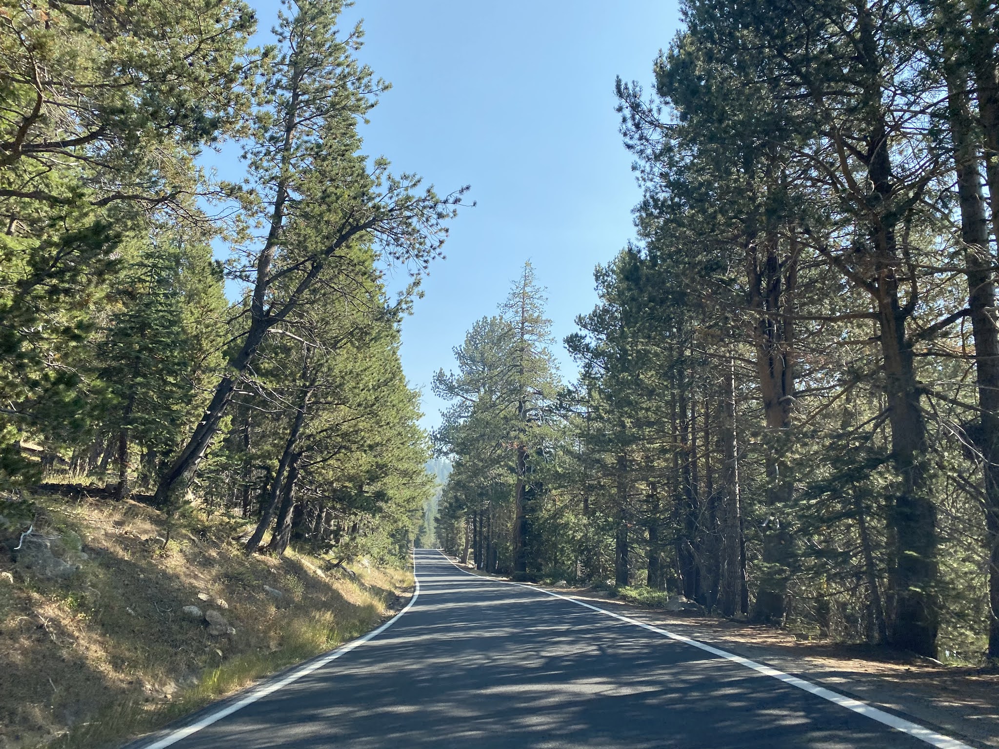
CA 4 east briefly expands back to four lanes approaching Mosquito Lakes.


CA 4 east passes by Mosquito Lakes.


Fall cattle drives between Bear Valley and Hermit Valley are common on CA 4. Back in 2016 I had to park at Mosquito Lakes Campground due to one such cattle drive.

CA 4 east ascends the 8,050 foot Pacific Grade Summit.


CA 4 east begins a very steep descent to Hermit Valley via a series of four switchbacks. The third switchback is known as "Cadillac Curve" due to the fact that wreckage of one can be found at the bottom of the hill. CA 4 east crosses the North Fork Mokelumne River at Postmile ALP 12.924 and enters Hermit Valley. Hermit Valley is located at 7,060 feet above sea level. The historic marker in the background in the last photo below marks where the original immigrant road departed north towards Carson Pass.


CA 4 east begins to climb from Hermit Valley and intersects Highland Lakes Road at Postmile ALP 17.198.


CA 4 east enters Toiyabe National Forest.


At Postmile ALP 18.676 CA 4 east crosses the 8,730 foot high Ebbetts Pass.

Ebbetts Pass sans Miata/Fiat guy in front of it.

CA 4 east crosses the Pacific Crest Trail and passes the Kinney Reservoir at Postmile ALP 19.469. The Kinney Reservoir impounds Kinney Creek and was built in 1912. Ebbetts Peak can be seen behind the Kinney Reservoir.


CA 4 east begins to descend and crosses North Cascade Creek at Postmile ALP 21.79.


Near the Upper Cascade Creek Bridge the original Big Trees Road can be seen north across Silver Creek.


CA 4 east descends through another set of switchbacks and hairpins. At Postmile ALP 24.258 CA 4 passes by Silver Creek Campground which is roughly where Silver Mountain City was located.


CA 4 becomes a two lane highway again east of Raymond Meadow Creek.


The Louis Chalmers Smelter can be found on CA 4 easst approaching Silver Creek. This smelter is one of the last obvious remains from the large scale silver mining operations along Silver Creek.


At Postmile Mile ALP 27.98 CA 4 east crosses Silver Creek.


At Postmile ALP 29.236 CA 4 east passes Wolf Creek Road. Centerville Flat Campground can be found on Wolf Creek Road upon the town site of Centerville.


CA 4 east crosses the East Fork Carson River at Postmile ALP 29.78.

CA 4 east terminates at CA 89 at Monitor Creek. The confluence of the East Fork Carson River and Monitor Creek was the approximate site of the town of Mount Bullion. Monitor was located eastward a couple miles up modern CA 89.


Comments
My mother's mother attended San Jose Normal School where she met one of the Stevenot daughters of Murphys.
The two maintained a long friendship, which led to my mother spending some of her summers in the late 19-teens through the late 20s helping drive the Zumwalt (and others) cattle from Altaville/Angels to the summer ranges at and near Highland Lakes (above Bear Valley nee Bloods). As the "girl" in the drive team, she would close the cattle gates which meant she'd be covered head to toe in dust and detritus. But, this meant she got to bathe first, eat first and otherwise be the "belle of the ball" among the teamsters and attendant drovers.
The former Chief of Naval Operations, Elmo Zumwalt, Jr. is related to the cattle family from the Tulare area.
My mother was a good friend of Walter "Wat" Tryon, and Charlie lived just on the hill above the Sierra Railroad line into Angels Camp. Charlie referred to the morning train from Angels to Jamestown as the "Tri-Daily" as it left in the AM and "tried all day" to return. The railroad grade consisted of many steep switchbacks which limited the trains to no more than 5-6 cars. "Wat" got his name from when he was a lad and would usually respond to a question with, "wat?" I believe he had a career with Armour Meats located in Chicago.
My mother would often tell tales of the city dudes from San Francisco being escorted to Highland Lakes to fish for the renowned Rainbow and Native trout located, there. Typically, the dudes would have the latest dry/wet flies and all of the attendant gear.....they'd usually come up bust with nothing caught while the locals would use a Royal Coachman or Helgramites and would what would today be considered a "limit out" for the day.