Ever sleep in a Wigwam? To my knowledge, none of us at Gribblenation have......yet. However, Holbrook, Arizona is one of a few places in the United States where you can.
 |
| The Wigwam Motel - Holbrook, Arizona (Adam Prince - April 2010). |
Holbrook is home to the Wigwam Motel - one of three remaining unique Native American-themed motor courts in the country. The tipi-inspired rooms were part of a small national chain of motor courts that opened in the 1930s and 40s.
The first two Wigwam Motels operated near Mammoth Cave National Park in Kentucky. Both opened in the late 1930s. During the 1940s, Wigwam Motels headed south into Alabama, Florida, and Louisiana. By the late 1940s, two more locations opened - Holbrook, Arizona and San Bernandino, California.
 |
| The Holbrook Wigwam Motel advertises the novelty of sleeping in a "Wigwam". (Adam Prince - April 2010). |
The novelty of "Eat and Sleep in a Wigwam" attracted numerous travelers to lodge overnight while visiting or driving through the area.
 |
| The simple tipi-inspired design guest room. Holbrook's rooms are a throwback to an earlier time - modern amenities like internet access are non-existent. (Adam Prince - April 2010) |
Individual guest cabins were designed by Frank Redford. He patented the design in 1936 and again in 1957. Most complexes were home to around 15 structures - each made of steel, concrete, and stucco. Some locations had a small filling station, restaurant, and pool.
Opened in 1950, the Holbrook location was owned and operated by Chester Lewis. After a visit to Redford's Cave City, Kentucky location in the 1930s, Lewis would later purchase the design plans and the right to use the Wigwam Village name. In a unique royalty agreement, Lewis agreed to send the proceeds from the dime-operated room radios to Redford. A dime allowed guests to listen to 30 minutes of the radio.
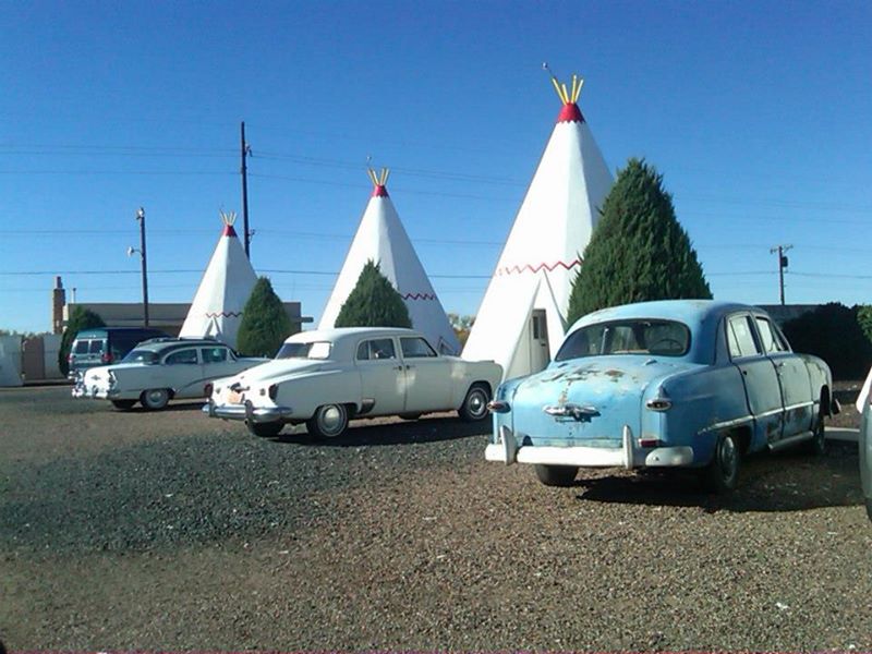 |
| Classic cars are on permanent display at the Holbrook Wigwam Motel. (Tom Fearer - 2011) |
In the late 70s, Interstate 40 was built and bypassed Holbrook to the North. As a result of a downturn in business, Lewis sold the property. The motor court closed, but the gas station operation remained. A few years later, in the mid-80s, Lewis' descendants repurchased the property. They closed the gas station, converted part of the main office into a museum, and reopened the motel.
Outside the Wigwam Motel is a collection of classic cars mixed in with the signature tipi guest rooms. Overnight reservations can still be made for this piece of American automobile nostalgia.
 |
| Adam Prince - April 2010. |
Today, three Wigwam Motels remain - Cave City, Kentucky, Holbrook, and San Bernandino. All three are listed in the National Register of Historic Places.

Site Navigation:
- East - Petrified Forest National Park
- West - Jack Rabbit Trading Post
- Return to Gribblenation's Route 66 Homepage
Sources & Links:
- Wigwam Motel #6 - Motel's Website
- Route 66 Wigwam Motel in Holbrook, Arizona ---Inspired Imperfection
- Wigwam Village Motel #6 ---National Park Service
How To Get There:
- Original publish date - August 15, 2018
- Article rewritten by and included photos from Adam Prince - December 24, 2022
Comments