This past week I decided to take a small scale road trip on California State Route 190 from CA 99 east to the unbuilt section over the Sierra Nevada Range. While I was in for what turned out to be a fun drive following the course of the Tule River watershed what I found researching the back story of CA 190 was one of the most complex and unusual stories of any California State Highway. Given that I had a ton of older photos of the eastern segment of CA 190 in the Mojave Desert of Inyo County I thought it was time to put something together for the entire route.

The simplified story of CA 190 is that it is a 231 mile state highway that has a 43 mile unbuilt gap in the Sierra Nevada Range. CA 190 is an east/west State Highway running from CA 99 in Tulare County at Tipton east to CA 127 located in Death Valley Junction near the Nevada State Line in rural Inyo County. The routing CA 190 was adopted into the State Highway system as Legislative Route 127 which was adopted in 1933 according to CAhighways.org.
CAhighways.org on CA 190
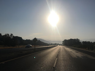
My course of the western segment of CA 99 was headed eastbound. CA 190 begins from CA 99 at Exit 76 in Tipton.

CA 190 traffic is directed south on Burnett Road to the start of CA 190 on Avenue 144/Poplar Avenue.


CA 190 eastbound quickly rises over the CA 99 freeway.

East of Tipton a guide sign shows Poplar as 9 miles to the east and Porterville 17 away on CA 190.

Interestingly CA 190 is actually presently closed east of Road 152/Signed County Route J15 to Poplar. My understanding is that the road bed was in such bad shape that it required detouring traffic one mile to the north onto Avenue 152/Olive Street.


Part of the recent construction was a new roundabout at CA 190/Signed County Route J15. Signed County Route J15 north from CA 190 and isn't actually signed in the field anymore. In fact, the overwhelming majority of Signed County Routes in Tulare County are no longer signed.


I followed J15 one mile north on the detour CA 190 route. From J15 the detour CA 190 route runs on Avenue 152 and Oettle Grade back the mainline CA 190 in Poplar at Avenue 144.


East of Poplar CA 190 crosses the Kern-Friant Canal.

CA 190 meets CA 65 at the City Limit of Porterville and expands to an expressway. CA 190 crosses CA 65 on an overpass configuration.


Oddly the guide sign on CA 190 east of CA 65 is located within the City Limits of Porterville. The guide sign shows Springville 17 miles to the east and the end of western segment of CA 190 as 44 miles away.

At Main Street CA 190 meets it's former alignment through downtown Porterville.

CA 190 was originally routed through downtown Porterville from Poplar Avenue on a multiplex of CA 65 on Main Street. CA 190 continued east through Porterville on Orange Avenue, Date Avenue, and Springville Avenue. CA 190 was realigned onto the modern expressway alignment in sections from 1960 to 1964 as part of the Lake Success Project. This illustration below describes the original routing of CA 190 from downtown Porterville to the Success Dam.

Previously I wrote about the southern section of CA 65 which includes the alignment history of the highway:
California State Route 65; South Segment
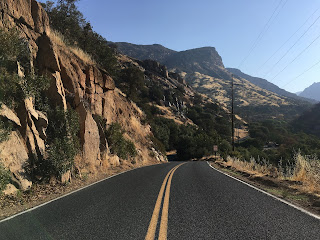
Today CA 190 east of downtown Porterville drops back down from an expressway to a two-lane highway and enters a roundabout.


CA 190 begins to ascend a bluff and the Success Dam quickly comes into view.

There is an overlook of Lake Success east on CA 190 above the Success Dam. The Success Dam impounds the Tule River and was built from 1958 to 1961. The primary purpose of the Success Dam was flood control down river in Porterville. The Tule River is one of many watersheds that used to flow into Tulare Lake to the west in San Joaquin Valley. Since the early 1850s the Tule River was an important crossing on the Stockton-Los Angeles Road. Porterville itself traces it's origins back to stage stop located on the Tulare River in 1854.

CA 190 used to be routed through the northern half of Lake Success. There was a small community known as Success which was a rail siding of the Southern Pacific Line between Porterville and Springville. Success also had a small rock quarry which is located immediately east of Lake Success.

The Southern Pacific Line between Porterville and Springville can be observed on this 1935 California Division of Highways Map of Tulare County.
1935 Tulare County Highway Map
CA 190 originally would have emerged from Lake Success where Holdridge Drive now dips into the waters. CA 190 ran eastward on Avenue 176 and Road 320 on what is now modern Signed County Route J28 to modern CA 190. The original route of CA 190 prior to Lake Success can be seen on the illustration below.

CA 190 crosses the South Fork Tule River on this bridge.

The view of the Sierras on CA 190 eastbound from Lake Success is surprisingly nice.

East of the Success Quarry CA 190 crosses the Middle Fork Tule River and remains on the north bank all the way to Quaking Aspen.

At Road 320 CA 190 meets Signed County Route J28. Much like J15 the route of J28 is no longer signed.


Springville dates back to 1860 when it was known as Daunt. The name Daunt apparently comes from the first store owner who opened for business in 1860. Oddly Springville probably is mostly known for it's Tuberculosis Sanitarium which opened 1918. The Sanitarium closed but is now used as a apartment complex (weird).


By 1935 the Division of Highways assumed control of the road from Keeler and Darwin in addition to some of the Eichbalm Toll Road. The Eichbalm Toll Road is still seen as being locally controlled through Panamint Valley over Towne Pass. While LRN 127 was signed on the Eichbalm Toll Road I am uncertain if CA 190 through Darwin or on the Eichbalm Toll Road at any point.


CA 190 continues east into Death Valley and enters Stovepipe Wells. Stovepipe Wells is the location where the Lost Death Valley 49ers had to burn their wagons.


The simplified story of CA 190 is that it is a 231 mile state highway that has a 43 mile unbuilt gap in the Sierra Nevada Range. CA 190 is an east/west State Highway running from CA 99 in Tulare County at Tipton east to CA 127 located in Death Valley Junction near the Nevada State Line in rural Inyo County. The routing CA 190 was adopted into the State Highway system as Legislative Route 127 which was adopted in 1933 according to CAhighways.org.
CAhighways.org on CA 190
My course of the western segment of CA 99 was headed eastbound. CA 190 begins from CA 99 at Exit 76 in Tipton.

CA 190 traffic is directed south on Burnett Road to the start of CA 190 on Avenue 144/Poplar Avenue.


CA 190 eastbound quickly rises over the CA 99 freeway.

East of Tipton a guide sign shows Poplar as 9 miles to the east and Porterville 17 away on CA 190.

Interestingly CA 190 is actually presently closed east of Road 152/Signed County Route J15 to Poplar. My understanding is that the road bed was in such bad shape that it required detouring traffic one mile to the north onto Avenue 152/Olive Street.


Part of the recent construction was a new roundabout at CA 190/Signed County Route J15. Signed County Route J15 north from CA 190 and isn't actually signed in the field anymore. In fact, the overwhelming majority of Signed County Routes in Tulare County are no longer signed.


I followed J15 one mile north on the detour CA 190 route. From J15 the detour CA 190 route runs on Avenue 152 and Oettle Grade back the mainline CA 190 in Poplar at Avenue 144.


East of Poplar CA 190 crosses the Kern-Friant Canal.

CA 190 meets CA 65 at the City Limit of Porterville and expands to an expressway. CA 190 crosses CA 65 on an overpass configuration.


Oddly the guide sign on CA 190 east of CA 65 is located within the City Limits of Porterville. The guide sign shows Springville 17 miles to the east and the end of western segment of CA 190 as 44 miles away.

At Main Street CA 190 meets it's former alignment through downtown Porterville.

CA 190 was originally routed through downtown Porterville from Poplar Avenue on a multiplex of CA 65 on Main Street. CA 190 continued east through Porterville on Orange Avenue, Date Avenue, and Springville Avenue. CA 190 was realigned onto the modern expressway alignment in sections from 1960 to 1964 as part of the Lake Success Project. This illustration below describes the original routing of CA 190 from downtown Porterville to the Success Dam.

Previously I wrote about the southern section of CA 65 which includes the alignment history of the highway:
California State Route 65; South Segment
Today CA 190 east of downtown Porterville drops back down from an expressway to a two-lane highway and enters a roundabout.


CA 190 begins to ascend a bluff and the Success Dam quickly comes into view.

There is an overlook of Lake Success east on CA 190 above the Success Dam. The Success Dam impounds the Tule River and was built from 1958 to 1961. The primary purpose of the Success Dam was flood control down river in Porterville. The Tule River is one of many watersheds that used to flow into Tulare Lake to the west in San Joaquin Valley. Since the early 1850s the Tule River was an important crossing on the Stockton-Los Angeles Road. Porterville itself traces it's origins back to stage stop located on the Tulare River in 1854.

CA 190 used to be routed through the northern half of Lake Success. There was a small community known as Success which was a rail siding of the Southern Pacific Line between Porterville and Springville. Success also had a small rock quarry which is located immediately east of Lake Success.

The Southern Pacific Line between Porterville and Springville can be observed on this 1935 California Division of Highways Map of Tulare County.
1935 Tulare County Highway Map
CA 190 originally would have emerged from Lake Success where Holdridge Drive now dips into the waters. CA 190 ran eastward on Avenue 176 and Road 320 on what is now modern Signed County Route J28 to modern CA 190. The original route of CA 190 prior to Lake Success can be seen on the illustration below.

CA 190 crosses the South Fork Tule River on this bridge.

The view of the Sierras on CA 190 eastbound from Lake Success is surprisingly nice.

East of the Success Quarry CA 190 crosses the Middle Fork Tule River and remains on the north bank all the way to Quaking Aspen.

At Road 320 CA 190 meets Signed County Route J28. Much like J15 the route of J28 is no longer signed.

I made a detour on J28 to Holdridge Drive to check out the original segment of CA 190. Holdridge Drive ends near the waters of Lake Success where it becomes a hiking trail of the Lake Success Wildlife Management Area.


East of J28 the route of CA 190 begins to ascend and crosses the 1,000 foot elevation mark entering Springville.


The Springville Chamber of Commerce has an old photo located roughly looking the opposite way of the first photo above which shows CA 190 during the mid-20th century.
East of Springville CA 190 meets Signed County Route J37/Balch Park Road.

Signed County Route J37 is probably the only Signed County Route left with actually signage in Tulare County. I covered the topic previously which can be found here:
Balch Camp Road has a significant role in the story of the CA 190 crossing of the Sierra Range. I was linked a 1926 Los Angeles Times article by Dan Jensen on the Facebook California History Page detailing a plan by; Inyo County, Tulare County, the Division of Highways, and City of Los Angeles to build a Trans-Sierra Highway.
Apparently plans had been floated since 1923 to build a Trans-Sierra Highway via a route of Carroll Creek in Inyo County over the 11,300 foot high Mulkey Pass. The road was to extend westward into Tulare County over the Kern Canyon Fault and emerge on what is now Signed County Route J37 on Balch Park Road. After crossing the North Fork Tule River the route would have split northwest on Yokohl Valley Drive to Visalia and on the route that became CA 190 southwest to Porterville. A map in the 1926 Los Angeles Times Article depicts a drawing of said Trans-Sierra Highway.
Apparently $1,000,000 dollars was set aside to build the Trans-Sierra Highway. What became Horseshoe Meadows Road from Carroll Creek was on land owned by the City of Los Angeles and the city was apparently going to use $170,000 dollars to build a road to Mulkey Pass. I'm not certain how Inyo and Tulare Counties spent their money but the latter probably used it to build Balch Park Road. My evidence that Balch Park Road is fruit of the $1,000,000 dollars set aside for a Trans-Sierra Highway is that the North Fork Tule River Bridge on Balch Park Road has a date stamp of 1927.


Camp Nelson is signed as 16 miles away and Quaking Aspen is signed 25 miles to the east on CA 190 as it crosses the North Fork Tule River. Traffic is advised at the North Fork Tule River Bridge that snow is not plowed at night on CA 190.


East of the North Fork Tule River CA 190 traffic is advised that the next gas is 16 miles away. The grade ahead on CA 190 in the Middle Fork Tule River Canyon is extremely slow and feels more like 30 miles with the slow speeds.

The truck portion of CA 190 soon ends just east of the "Next Gas" sign.

CA 190 soon enters the Giant Sequoia National Monument which is part of Sequoia National Forest. Giant Sequoia National Monument was created out of Federal Legislation in 2000 to enhance protection of Sequoia Groves in Sequoia National Forest. Giant Sequoia National Monument remains under the jurisdiction of Sequoia National Forest which was created in 1908.

CA 190 quickly begins to gain elevation through curves and switchbacks before rising over 2,000 feet. The route of CA 190 actually runs underneath a flume which dates back to 1959.


At the flume there is a small trail leading down the Middle Fork Tule River. When I last drove CA 190 in 2016 I didn't stop to see what was at the bottom so I decided a quick hike.


CA 190 crosses the North Middle Fork Tule River (yes that's really a thing) where it meets a small power station. Camp Nelson is signed as being 9 miles to the east.


CA 190 climbs above the power station on a series of several sharp switch backs to the first overlook of the Middle Fork Tule River Canyon.


Immediately to the east there is another overlook of the Middle Fork Tule River Canyon which I used as the cover photo for this blog.

The grade on CA 190 is very shallow and pretty tame. That said the ascent is almost constant and much of CA 190 to 4,000 feet in elevation is along the cliff-face of the Middle Fork Tule River Canyon.


Near the 4,000 foot elevation marker there is a map road side which provides an overlook of the Middle Fork Tule River Canyon and Great Western Divide.

Some of the cuts in the mountain side are fairly sharp leading to situations like this where netting was installed on the side of CA 190 to curtail rock slides.

CA 190 enters Pierpoint Springs at approximately 4,600 feet. Pierpoint Springs is presently signed as only having 50 residents.

Camp Nelson is located directly east of Pierpoint Springs.

Camp Nelson apparently dates back to the 1890s when the Camp Nelson Lodge was opened. I haven't been able to confirm but I believe that the route of CA 190 to Camp Nelson was plotted out for the Lodge. Apparently the rest of CA 190 to Quaking Aspen was opened in 1931 as part of the larger goal by Tulare County to create a Trans-Sierra Route to Lone Pine referenced above. For unknown reasons Tulare County seemed to abandoned extending Balch Park Road as a Trans-Sierra Highway. The Division of Highways assumed control of a portion the roadway in the Middle Tule River Canyon as part of LRN 127 in 1933 as described above.
Quaking Aspen is signed as 9 miles away on CA 190. Johnsondale and Kernville are actually accessible via Mountain Routes 107, 50, and 99.

Immediately past the guide sign CA 190 crosses 5,000 feet in elevation.

I encountered an older building which had a faded name of "Wellsville Saloon" in Cedar Slope at approximately 5,600 feet above sea level. I couldn't find any history or backstory on Cedar Slope or Wellsville but the Saloon appears to be fairly old.


CA 190 rises above 6,000 feet and enters another large set of switch-backs.


Above 6,000 feet above sea level the granite rocks of the Sierras are very apparent. CA 190 ends at Postmile 56.56 near Quaking Aspen where the 43 Trans-Sierra gap in the highway begins.


Interestingly the CA 190 shield above the "end" placard has been stolen. The Postmile marker looking back westbound on CA 190 is peeling heavily.


Although CA 190 ends, Mountain Route 107/Great Western Divide Highway continues southward as described above.

From the end of the western segment of CA 190 I headed westward back down to Signed County Route J28. Suffice to say though the route east to Death Valley Junction is pretty far away to the east only made longer by the 43 mile gap in CA 190 through the Sierras.
Historically there has been three proposed routes of CA 190 through the Sierras, all involving traversing the Kern Canyon Fault. The Kern Canyon Fault is a massive faulting in the middle of the Sierras which the Kern River flows southward through. All proposed routes of CA 190 would have had to dip into the Kern Canyon Fault and ascend to the Kern Plateau before descending to the Mojave Desert.
The first proposed CA 190/LRN 127 routing through the Sierras was from Quaking Aspen northeast to Lone Point and is the one that came the closest to actually being built. This proposed route first appears on the 1934 State Highway Map, at the time the road east out of Camp Nelson was not state maintained as was Tuttle Creek Road west out of Lone Pine through the Alabama Hills.

By 1935 CA 190/LRN 127 was under state maintenance to Quaking Aspen. At the same time the Division of Highways assumed maintenance of Tuttle Creek Road west out of Lone Pine to Carroll Creek.


By 1938 State Highways Shields start to appear on the State Highway Map. CA 190 is clearly shown on Tuttle Creek Road heading southwest out of Lone Pine.

By 1940 CA 190 was extended from Tuttle Creek Road westward up what is now the first bend in Horseshoe Meadows Road into the Sierras.

On the eastern side of the Sierras CA 190 used Horseshoe Meadows Road, Tuttle Creek Road, and Whitney Portal Road to reach US 395 in Lone Pine. CA 190 would have multiplexed US 395 to the current alignment of CA 136 where it split east on the north bank of Owens Lake to Death Valley. Today part of Tuttle Creek Road is abandoned and has been replaced by extended Horseshoe Meadows Road. These illustrations below show the original alignment of CA 190 descending the eastern Sierras and Alabama Hills through Lone Pine.


By 1960 the Horseshoe Meadows Road and Tuttle Creek alignment of CA 190 was relinquished and a new proposed routing over Olanch Pass appears on the State Highway Map. LRN 127 is shown a new proposed route south of Owens Lake.

By 1966 the third and final proposed routing of CA 190 over Haiwee Pass appears on the State Highway Map. The old routing of CA 190 to Lone Pine is shown as LRN 136.

By 1967 the new alignment of CA 190 south of Owens Lake appears on the State Highway Map and the old route to Lone Pine on the north shore became CA 136.

From the west terminus of CA 136 the Alabama Hills can be seen in the background in the photo below. CA 190 would have turned right onto northbound US 395 into Lone Pine and would have taken a 180 degree swing back across the photo on Tuttle Creek Road to Horseshoe Meadows Road. Interestingly Mount Whitney can also been seen in the Sierras about 2/3rds of the way to the left in the photo.

I previously wrote about CA 136 and it's status as the original alignment of CA 190 which can be found here:
Interestingly CA 190 is still signed along CA 136 eastward. Death Valley destinations Stovepipe Wells in addition to Furnace Creek are shown as 77 and 102 miles away respectively.

In the first photo below CA 136 meets CA 190 looking southward. The second photo shows the current route of CA 190 on the left, Owens Lake in the middle, and CA 136 on the right. With the large geographic prospective it is easy to see how difficult a Trans-Sierra Route of CA 190 would have been to build.


The original routing of CA 190 on modern CA 136 went through the community of Keeler. East of Keeler there wasn't many roadways to get across the Mojave Desert to Death Valley. The only community between Keeler and Stovepipe Wells that was substantial at the time LRN 127 was adopted in 1933 was Darwin. Darwin was founded on silver and lead claims in 1874 but later became part the western terminus of the Eichbalm Toll Road in 1926. The Eichbalm Toll Road connected Darwin to Stovepipe Wells 35.5 miles to the east via Towne Pass.
Caltrans District 9 actually has an article on the history of the Eichbalm Toll Road. I should note that the Eichbalm Toll Road article shows unique signage I've never seen from the Division of Highways showing a signed LRN 127 east of Darwin.
According to the article above the Division of Highways had been in negotiations to purchase the Eichbalm Toll Road for part of LRN 127 by early 1933. On the 1934 State Highway Map a local road from Lone Pine via Keeler and Darwin is shown connecting the Eichbalm Toll Road. It seems that at the time the Division of Highways might have planned an entirely new route to Furnace Creek which would have bypassed Towne Pass. What is certain is that the Division of Highways initially planned to bypass Darwin to the north.


By 1936 it seems that the Division of Highways abandoned plans to route CA 190/LRN 127 through Darwin as much of the route is seen returned to local maintenance. The path of the Eichbalm Toll Road through Panamint Valley over Towne Pass is shown under state maintenance.

By 1938 the current route of CA 190 north of Darwin is shown being completed. From Lone Pine east to Death Valley Junction CA 190 had become a completed route through the Mojave and Death Valley.

CA 190 in Panamint Valley follows the path of the Eichbalm Toll Road up to Towne Pass. From Panamint Valley Road Stovepipe Wells is shown as 28 miles to the east, Furnace Creek 53 miles to the east, and CA 127 at Death Valley Junction is 83 miles to the east.

Previously I have written about Panamint Valley and the roads that cross it from Trona north to CA 190.
The grade up from the floor of Panamint Valley at approximately 2,000 feet above sea level to Towne Pass at 4,956 feet above sea level on CA 190 is massive. Back in 2016 I was traveling west on CA 190 and warped my brake rotors under estimating the grades on Towne Pass which I believe were signed at 8%.

Towne Pass is where the Lost Death Valley 49ers made their escape over the Panamint Range. The Death Valley 49ers were looking for a shortcut through then uncharted Mojave Desert to Walker Pass when they accidentally discovered Death Valley. The Lost Death Valley 49ers became trapped in Death Valley which was ironic considering they were trying to avoid the same fate of the Donner Party which had become trapped at Donner Pass just a couple years prior. From Towne Pass the Lost Death Valley 49ers followed the path of Emigrant Canyon Road into Panamint Valley. The Lost Death Valley 49ers continued through the Mojave southwest and passed by Walker Pass but missed it. Ultimately the Lost Death Valley 49ers ended up in Santa Clarita Valley. This photo below is from Towne Pass looking eastward on CA 190 into Death Valley National Park.


East of Stovepipe Wells is the Mesquite Dunes. The Mesquite Dunes were used in filming several Star Wars movies and can be as high was 140 feet.

CA 190 has a junction with Scotty's Castle Road at what is known as Hell's Gate. Hell's Gate overlooks Badwater Basin which is located to the south.

Scotty's Castle Road splits northwest from Hell's Gate at CA 190 whereas Daylight Pass splits northeast towards Nevada State Route 374 and Rhyolite. Previously I wrote about NV 374 and Rhyolite which can be found here:
Approaching Furnace Creek on CA 190 there is ruins of the Harmony Borax
Works off the side of the highway. Although Borax was discovered by
evacuees of Panamint City in the 1870s it wasn't until 1881 when the
mineral was found at the location of the Harmony Borax Works. The
Harmony Borax were built in 1882 Works and were mostly known for the
Twenty-Mule teams which would all Borax to the rail depots in Mojave
during the cool seasons from until 1889.


East of the Harmony Borax Works on CA 190 is Furnace Creek. Furnace Creek dates back 1883 when it was known as Greenland Ranch and was constructed by the William Tell Borax Company. By 1891 Greenland Ranch became a weather station and was renamed to Furnace Creek by 1933 when Death Valley National Monument was created. Death Valley National Monument became a National Park in 1994 and Furnace Creek is the primary visitor center.

Gas in Furnace Creek is typically over $4 dollars a gallon which is to be expected given the remote location.

The next gas on eastbound CA 190 isn't even located on the highway but 57 miles away in Pahrump, NV.

At Badwater Basin Road CA 190 dips to Sea Level elevation. Suffice to say things are far different on CA 190 then they were at the unbuilt section in the Sierras at about 7,000 feet above sea level.

The climb from Furnace Creek to at CA 127 in Death Valley Junction is approximately 30 miles. As CA 190 begins to ascend east about of Death Valley is passes Zabriskie Point.

Climbing eastward out of Death Valley CA 190 passes Furnace Creek Wash Road. Furnace Creek Wash Road passes by the ghost town Ryan and is the road used to access Dante's View Road. I wrote about both topics previous which can be found here:
The eastern segment of CA 190 ends at CA 127 in Death Valley Junction. There isn't much fan fare for CA 190 despite the epic trek across the Mojave Desert which feels odd considering the western segment has all the correct signage.

I even wrote about CA 127 previous which can be found here:
In closing I've often heard that the gap in CA 190 probably won't be built due to environmental red tape. While I don't think there is much need for a Trans-Sierra crossing along CA 190 the assertion that the hold up is due to Sequoia National Forest is absurd. Sequoia National Forest went out of it's way to construct the newest Trans-Sierra Pass on Sherman Pass Road in the 1970s. The true issue at hand simply seems to be a lack of will and budgetary constraints on the state level to build the Haiwee Pass alignment of CA 190. Either way CA 190 probably is one of the more fascinating State Route given the large gaps and efforts it took to build in the desert.
And yes I even went over Sherman Pass, my previous article can be found here:
Comments