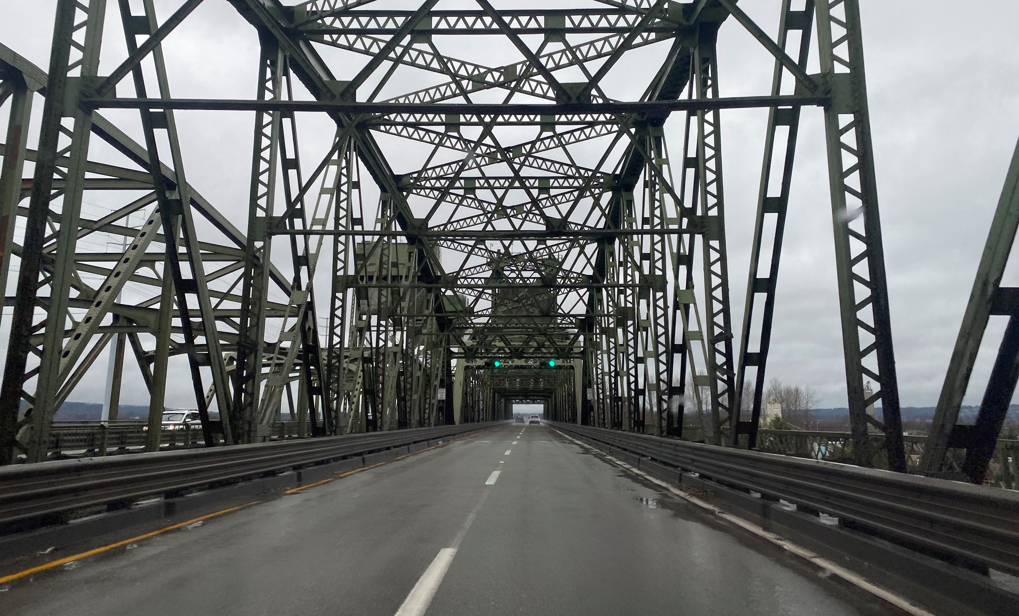
US Route 99 was aligned through the Snohomish County cities of Everett and Marysville when the US Route System was created during November 1926. Early US Route 99 inherited the alignment of the Pacific Highway which was simplified during 1927 between Everett to Marysville way of Smith Island and Spenser Island. US Route 99 was heavily modernized by way of the Broadway cutoff in Everett and Maryville bypass during 1954. US Route 99 would be replaced by Interstate 5 when the freeway between Everett and Marysville opened to traffic during May 1965. Featured as the blog cover is a view on former northbound US Route 99 atop the 1927 Snohomish River Bridge between Everett and Marysville. US Route 99 can be seen on the
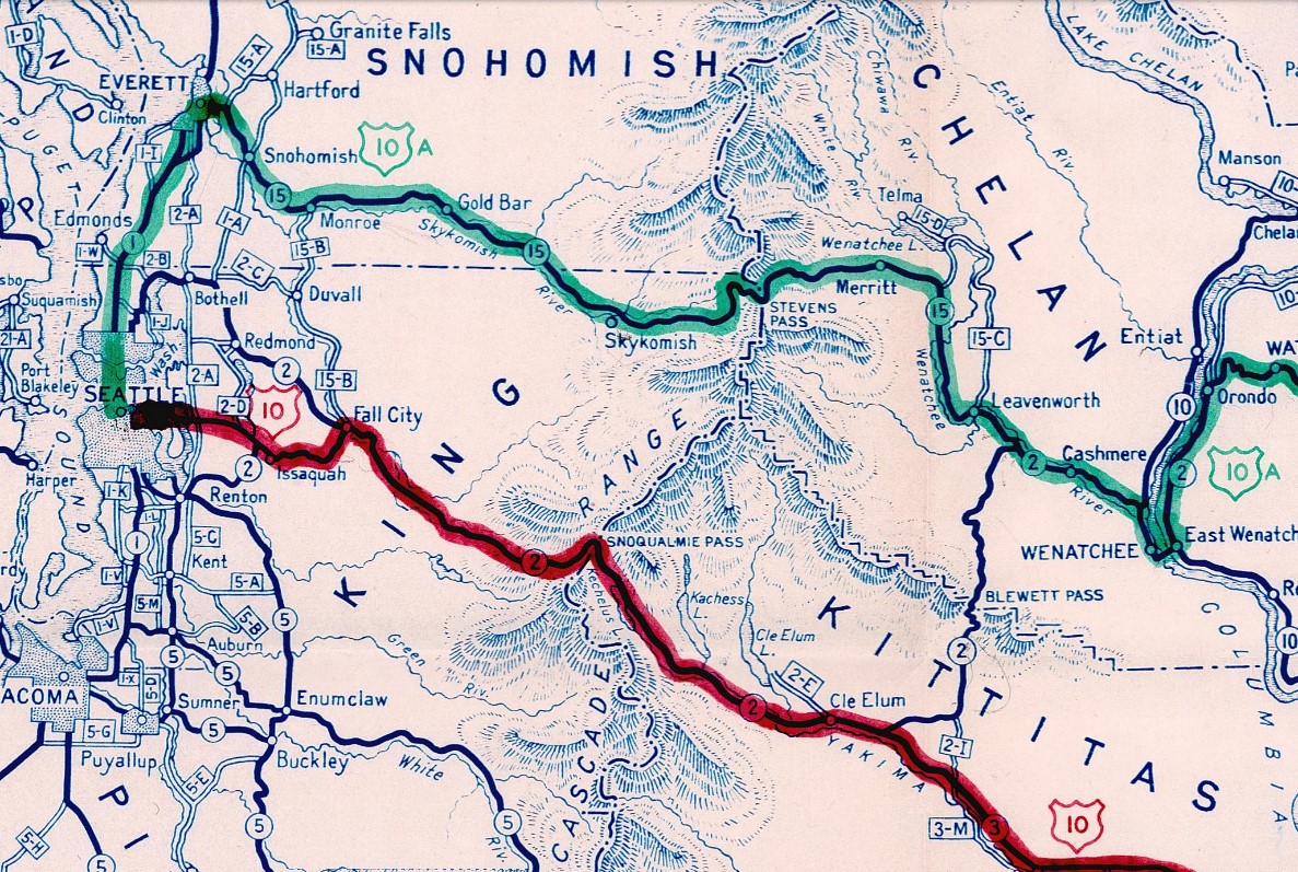
1965 Official Highway Map of the State of Washington passing through Everett on Broadway and the Marysville bypass.

This blog is part of the larger Gribblenation US Route 99 Page. For more information pertaining to the other various segments of US Route 99 and it's three-digit child routes check out the link the below.
Part 1; the history of US Route 99 in Everett and Marysville
Marysville was founded north of the Snohomish River during 1872 by government-appointed Indian Affairs agent James P. Comeford. Early Marysville was sustained by lumber interests north of the Snohomish River and the town was formally plotted during 1885. Marysville would incorporate as a city on March 20, 1891. A major driving force for the incorporation of Marysville was the completion of the Great Northern Railway through the community. The community's name "Marysville" is disputed and has several cited origins.
Everett is the largest city in Snohomish County and the County Seat. Everett lies on Port Gardner Peninsula. What was to become Everett was surveyed during July 1890 by lumberman Henry Hewitt Jr. and railroad executive Charles L Colby as a port for the Great Northern Railway. During August 1890 the Rucker Brothers of Tacoma purchased 50-acres of land to plot the Everett town site. The community of Everett was named after the son of Charles L. Colby. Everett would incorporate as a city on May 4, 1893. Following a Supreme Court decision following a controversial election Everett was awarded the Snohomish County Seat during October 1895.
During the 1913 the Pacific Highway was established as an organized Auto Trail Association borne out of the Good Roads movement. The Pacific Highway was applied over the through highway between Everett and Marysville. The Pacific Highway (4) and Evergreen National Highway (20) can be seen passing through Everett and Marysville on the 1924 Rand McNally Map of Washington. The alignment of the Pacific Highway northbound from Everett followed Evergreen Way, Rucker Avenue, Everett Avenue, Broadway, Hewitt Avenue over the Snohomish River, 20th Street Southeast, Sunnyside Boulevard, 61st Street Northeast and 3rd Street in Marysville. From 3rd Street in Marysville the Pacific Highway continued north towards Smokey Point via State Avenue.


The US Route System was formally approved by the American Association of State Highway Engineers (AASHO) on November 11, 1926. which formally brought US Route 99 into existence. US Route 99 overlaid the existing Pacific Highway in Washington State. The description of US Route 99 can be seen on the November 11, 1926, AASHO descriptions of the US Routes in Washington State.
US Route 99 was realigned onto a new direct highway connecting Everett-Marysville via Smith Island and Spenser Island during October 1927 (
Wikipedia references 38, 39 and 40). The new alignment of US Route 99 turned north on Broadway at Everett Avenue in downtown Everett. US Route 99 crossed the Snohomish River onto Smith Island via a then new lift bridge. From Smith Island US Route 99 crossed Union Slough onto Spenser Island via a then new concrete tee bridge, a lift bridge over Steamboat Slough and another lift bridge over Ebey Slough onto State Avenue in Marysville.
The new direct alignment of US Route between Everett and Marysville can be seen on
the 1931 Clason's Map of Washington. During 1937 the entirety of US Route 99 was dual assigned as Primary State Route 1
At the June 1940 AASHO Meeting the committee approved a northern alternate alignment for US Route 10. The northern alternate for US Route 10 crossed the Cascade Mountains via what was Washington State Road 15 over Stevens Pass to Everett. From Everett US Route 10 Alternate followed Hewitt Avenue, Broadway to US Route 99 at Everett Avenue. US Route 10 Alternate followed US Route 99 southbound out of Everett via Everett Avenue, Rucker Avenue and Evergreen Way towards Seattle.
During the December 1946 AASHO Meeting the committee approved a request to extend US Route 2 from Bonners Ferry, Idaho to Everett. The extension of US Route 2 would replace US Route 10 Alternate over Stevens Pass and terminate at US Route 99 in Everett. US Route 10 Alternate was subsequently deleted following the extension of US Route 2.
During 1954 US Route 99 in Everett and Marysville were streamlined. US Route 99 in Everett was realigned onto the Broadway cutoff which rerouted the highway off Evergreen Way, Rucker Avenue and Everett Avenue. The bridges carrying US Route 99 over the Snohomish River, Union Slough and Steamboat Slough were twinned to become a freeway. In Marysville US Route 99 was realigned off State Avenue onto a new freeway which extended to
136th Street Northeast.
The realignment of US Route 99 onto the Broadway cutoff seems to have led to a business route in Everett being created without AASHO approval. The US Route 99 Business Route in Everett appears on the 1955 United States Geological Survey Map (courtesy of historicaerials.com) following Evergreen Way, Rucker Avenue and 41st Street.
US Route 99 appears on the
1955 State Highway Map of Washington following the Broadway cutoff in Everett and Marysville bypass of State Avenue. US Route 2 is shown to terminate at US Route 99/Broadway via Hewitt Avenue.
On June 29, 1956, the Federal Highway Aid Act of 1956 was signed into law on the Federal Level. The Federal Highway Aid Act of 1956 was the genesis point of the Interstate Highway System which would in the coming decade sew the demise via of US Route 99 in Washington via replacement by Interstate 5.
Interstate 5 from North Seattle to Everett opened to traffic on February 3, 1965 (
Wikipedia reference 95). Part of Interstate 5 in Everett absorbed the Broadway cutoff into southbound lanes and multiplexed US Route 99. Interstate 5 and US Route 99 both appear on the
1965 Official Highway Map of the State of Washington. The planned extension of Interstate 5 north of Everett to Marysville also appears on the 1965 Official Highway Map of the State of Washington.
On June 24, 1969, the AASHO Executive Commitee approved a request by the Washington State Highway Commission to eliminate US Route 99 in Washington. The Washington State Highway Commission approved a motion to eliminate US Route 99 on April 22, 1969. The justification to eliminate US Route 99 in Washington State was to avoid confusion and cost associated with signing the highway concurrent on much of Interstate 5.
Following the deletion of US Route 99 in Washington the former routing from Everett to Marysville became
Washington State Route 529 during 1971. Washington State Route 529 initially began at Interstate 5 in Everett on Broadway and terminated at Washington State Route 528 via State Avenue in Marysville.
Washington State Route 529 in Everett was realigned off Broadway during 1991 to better serve Naval Station Everett (
Wikipedia reference 19). The new alignment of Washington State Route 529 through Everett followed Everett Avenue from Interstate 5 west to Marine View Drive. Washington State Route 529 followed Marine View Drive north to the 1927 and 1954 Snohomish River Lift Bridges. During July 2013 the 1927 Ebey Slough Lift Bridge was replaced by a modern four lane fixed span (
Wikipedia reference 43).
Part 2; a drive on former US Route 99 in Everett and Marysville
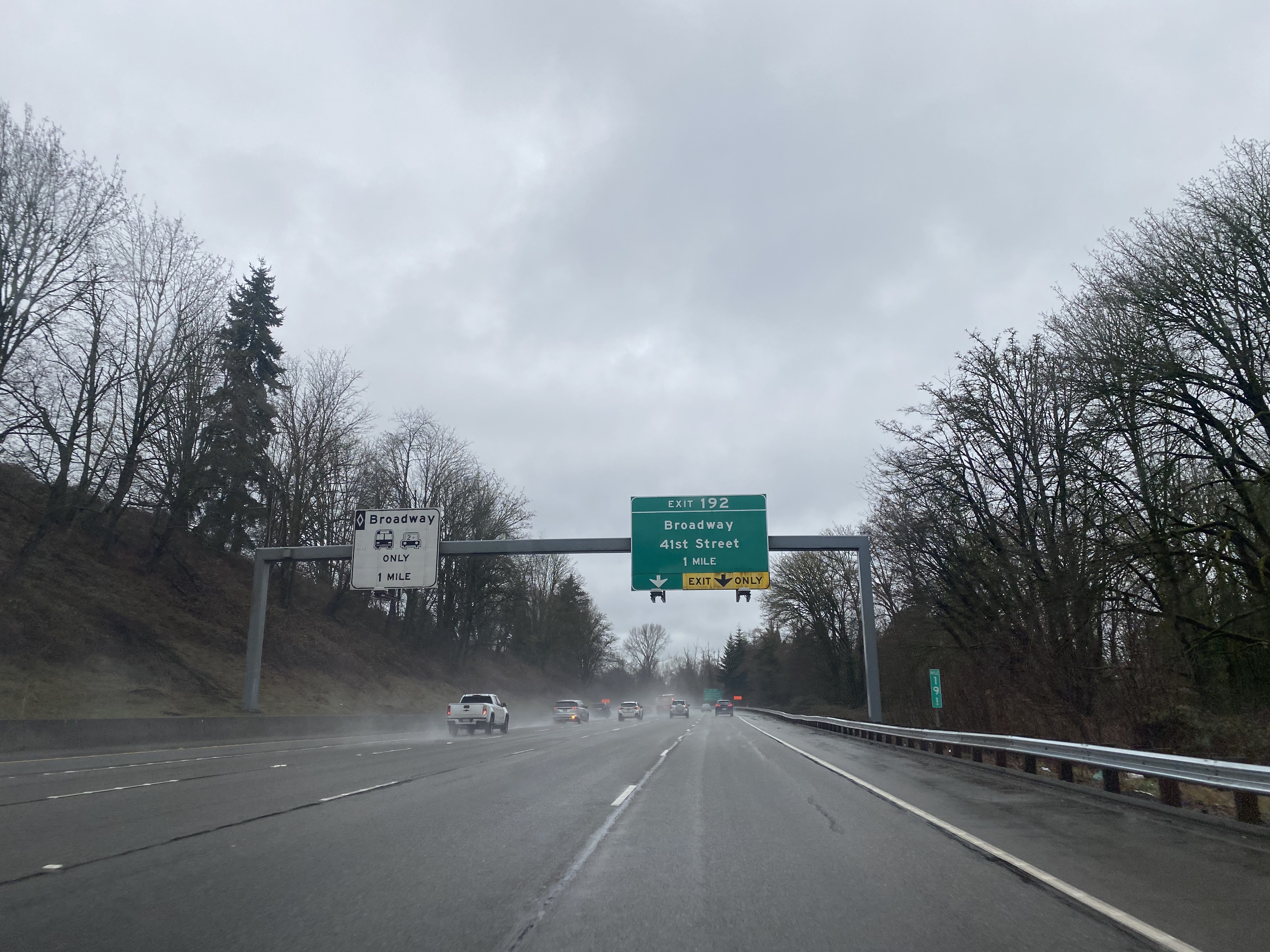
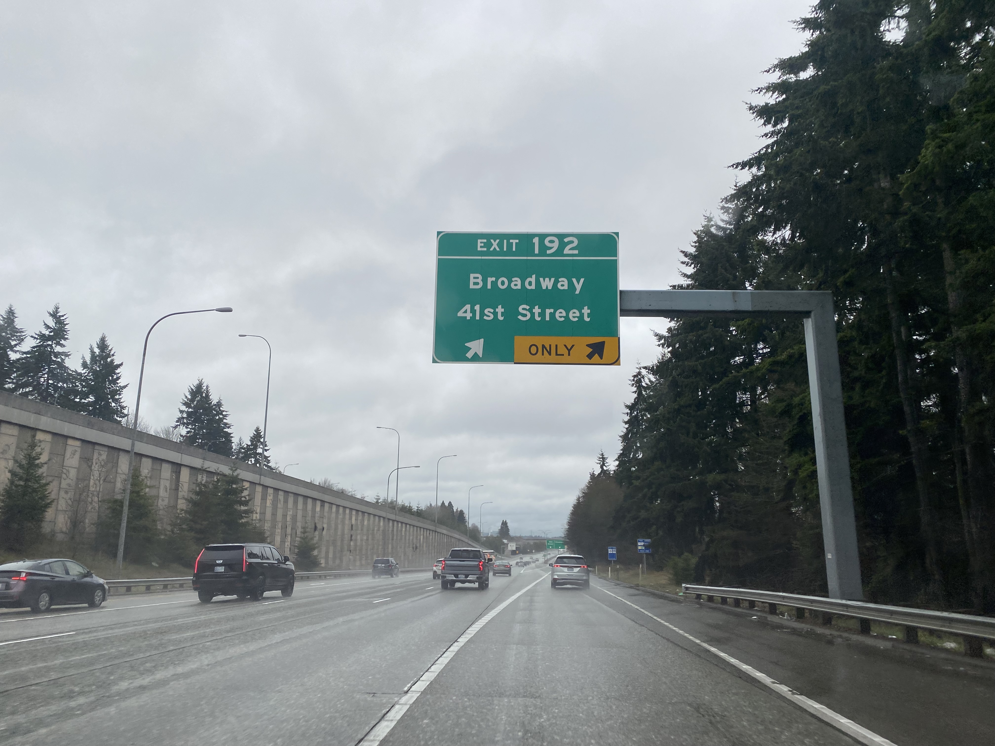
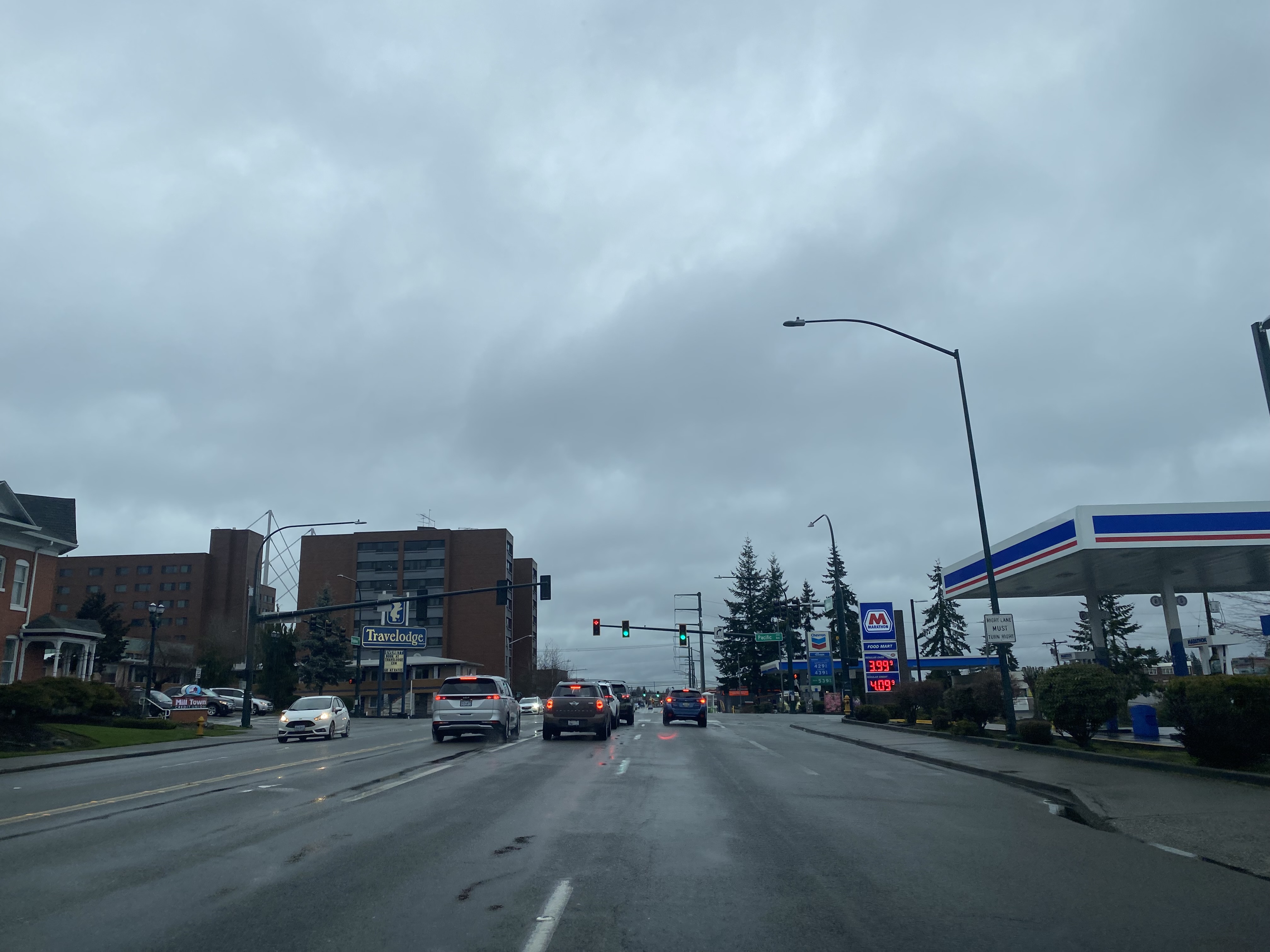
Former US Route 99 along Broadway in Everett can be accessed from Interstate 5 northbound Exit 192.
Broadway continues north into downtown Everett and intersects Hewitt Avenue where US Route 2 once terminated at US Route 99. It isn't fully clear when US Route 2 was truncated to Interstate 5 given end control city of Everett never changed. US Route 2 from Interstate 5 east to Cavaleros Corner opened as a freeway on
April 8, 1969.
Broadway continues over a railroad overpass which was constructed during 2015 and intersects Washington State Route 529 at Everett Avenue. The intersection of Broadway and Everett Avenue is where US Route 2 originally terminated in Everett and where US Route 99 would originally reach Broadway.
The former alignment of Broadway continues north through Everett and merges into Washington State Route 529 at Marine View Drive.


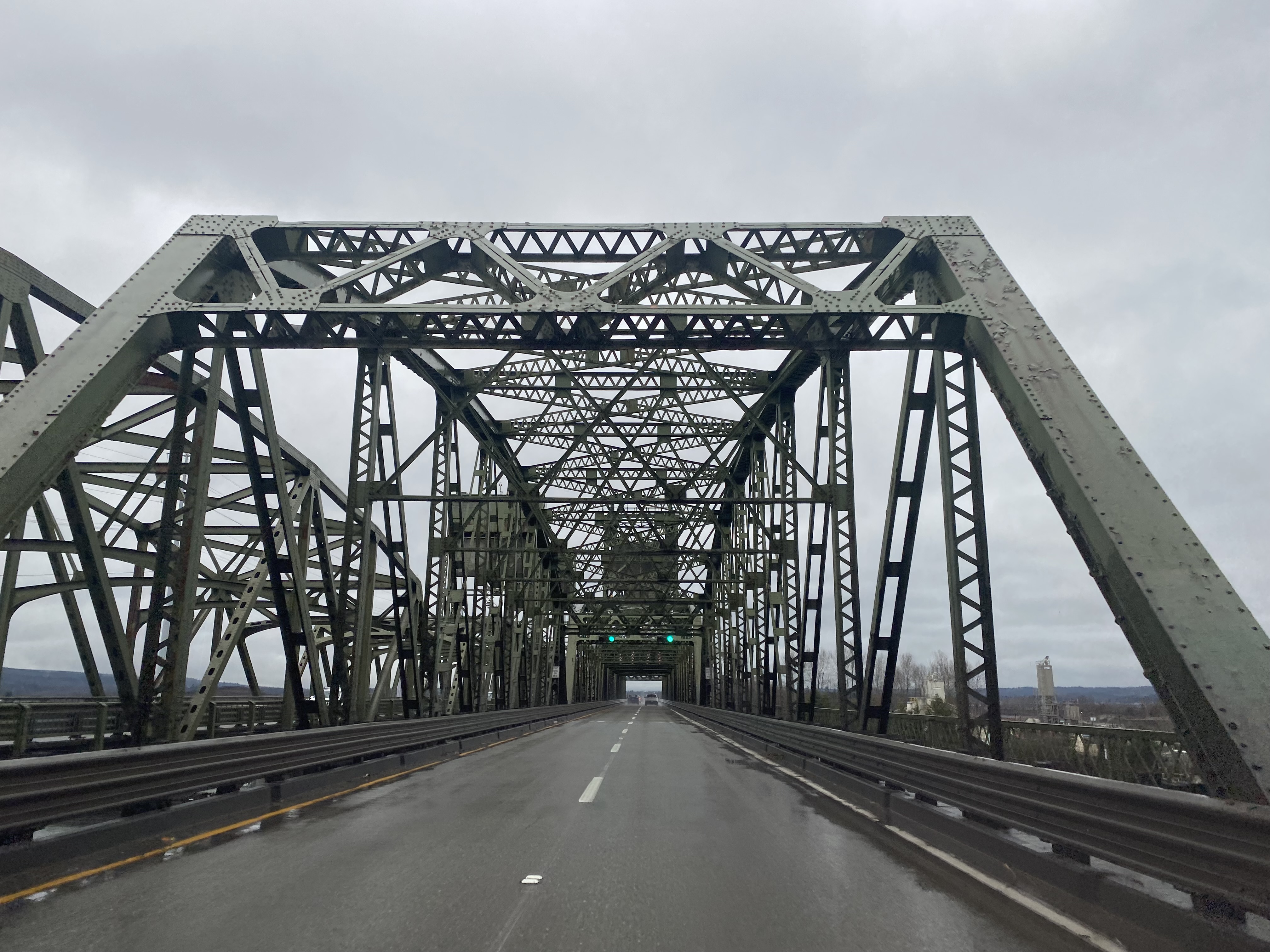
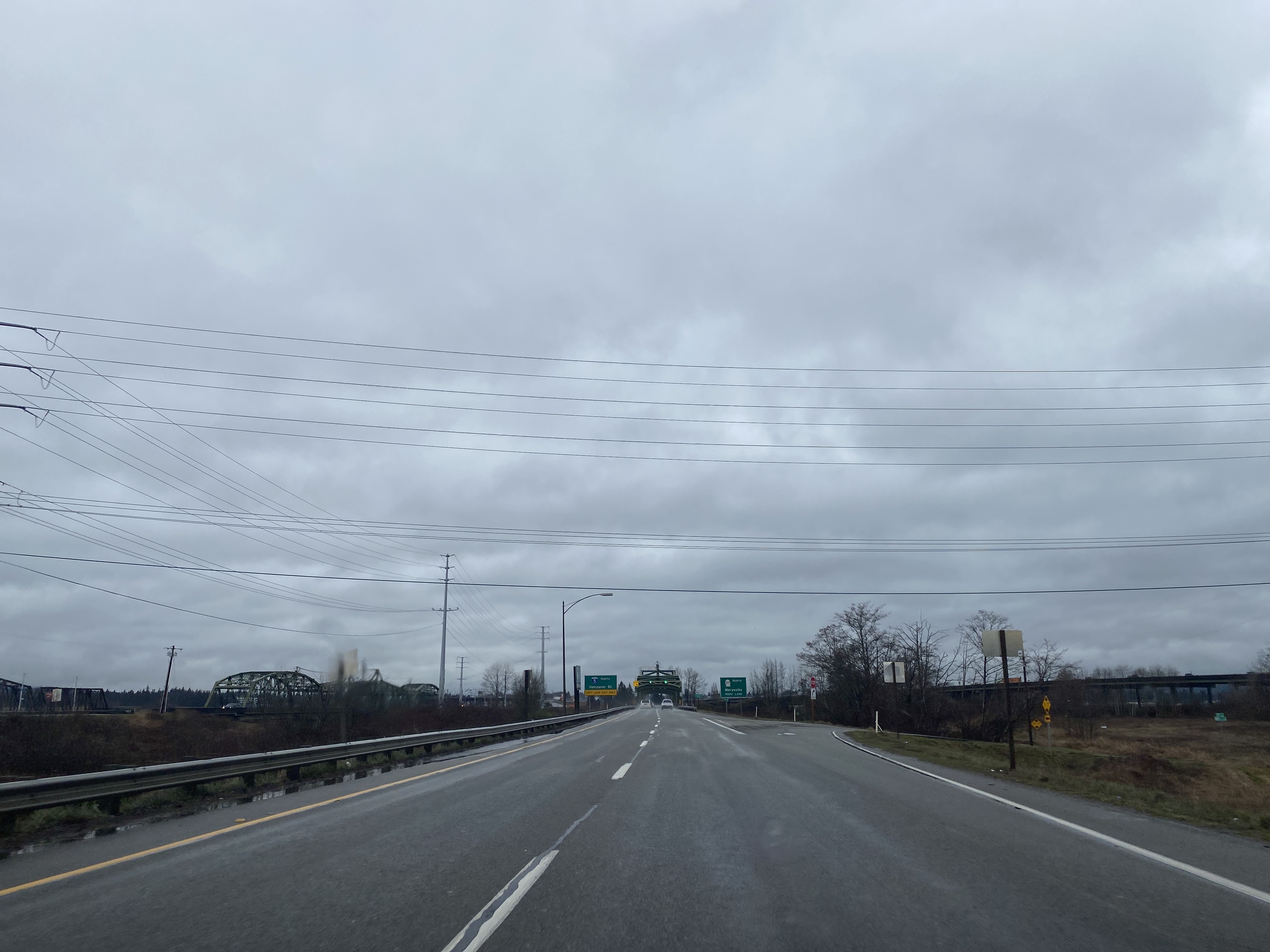
Washington State Route 529 becomes a primitive freeway approaching the Snohomish River. Northbound Washington State Route 529 crosses the Snohomish River via the
1927 Snohomish River Lift Bridge whereas the southbound lanes cross the
1954 Lift Bridge.
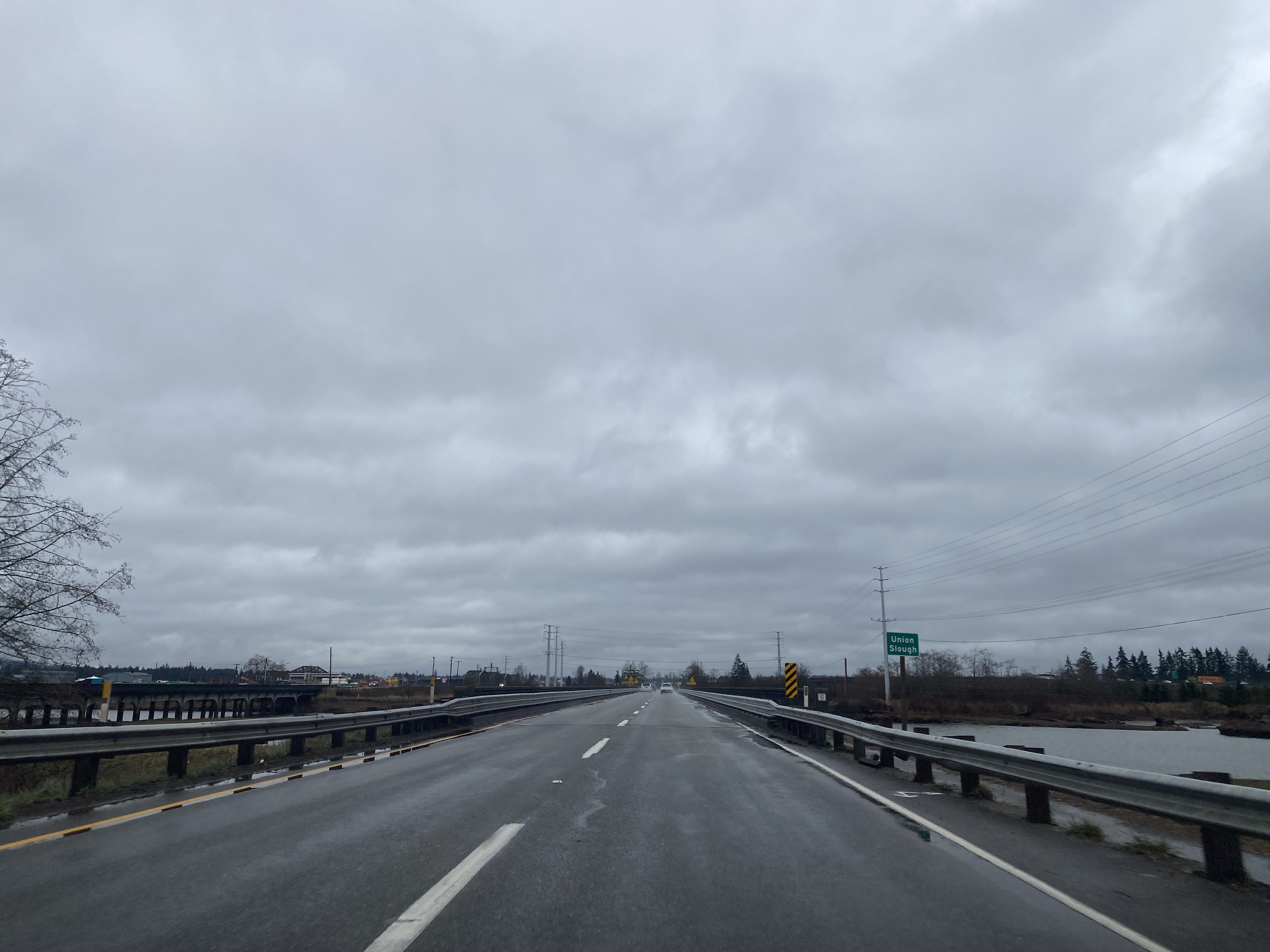
Northbound Washington State Route 529 passes over Smith Island and crosses the
1954 Union Slough Bridge. The southbound lanes of Washington State Route 529 cross Union Slough via the
1927 Bridge.
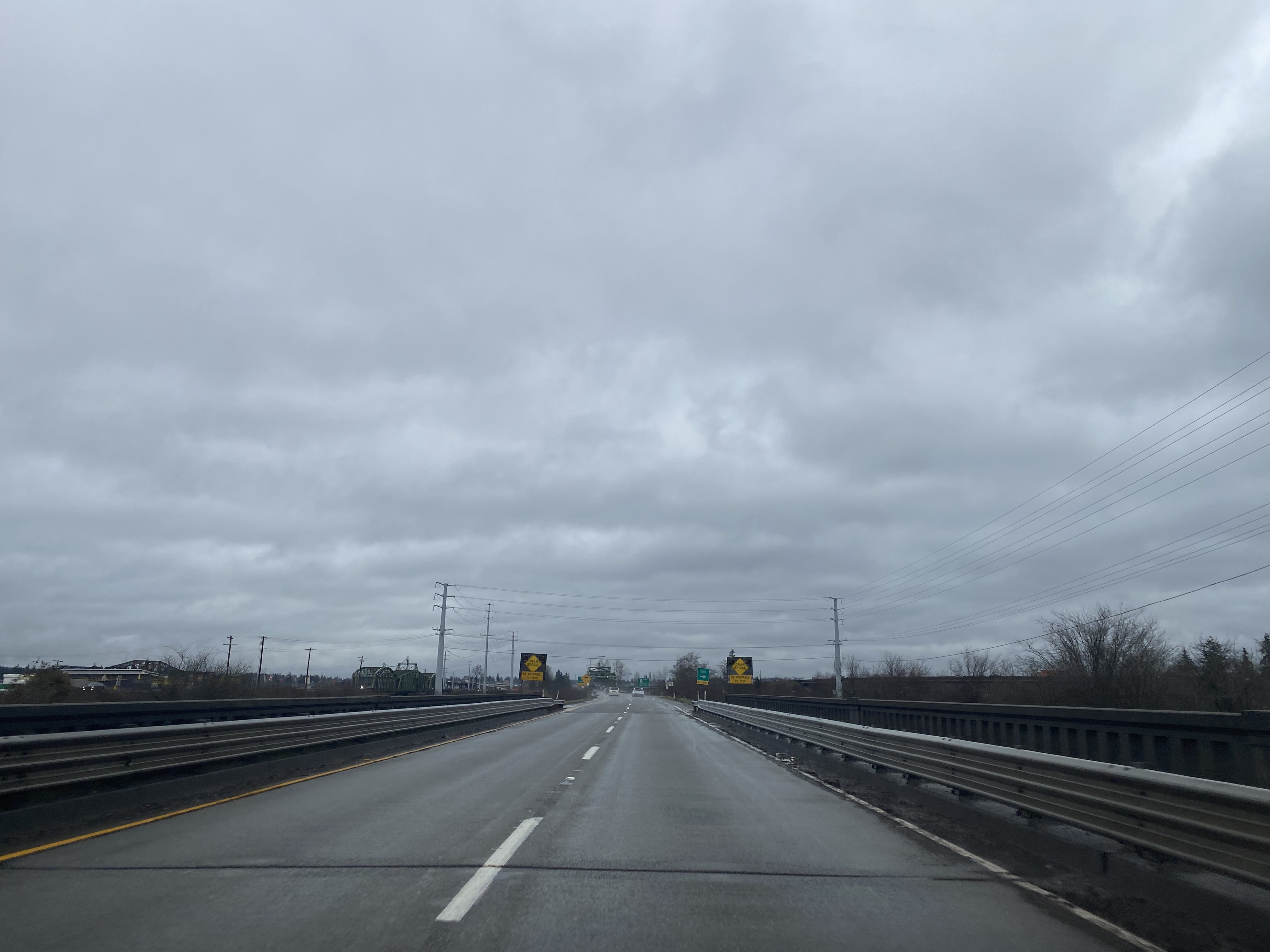
Northbound Washington State Route 529 passes over Spenser Island and crosses the 1954 Steamboat Slough Bridge. The southbound lanes of Washington State Route 529 cross Steamboat Slough via the 1927 Bridge.
Northbound Washington State Route 529 intersects Interstate 5.
Northbound Washington State Route 529 merges in with the southbound lanes of highway and crosses the 2013 Ebey Slough Bridge onto State Avenue in Marysville.
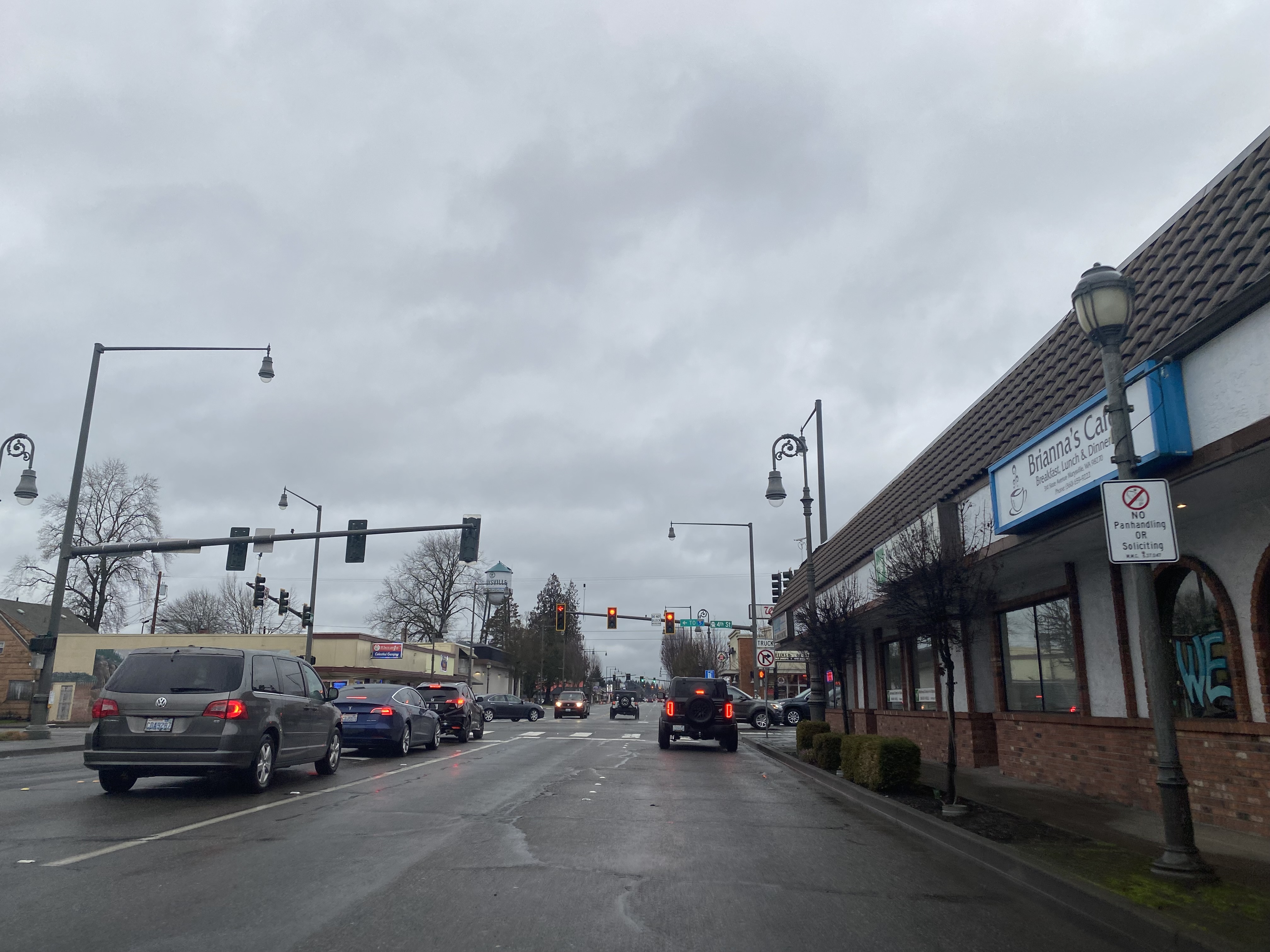
Washington State Route 529 northbound on State Avenue intersects the original alignment of US Route 99 at 3rd Street in downtown Marysville.
Washington State Route 529 northbound terminates as State Avenue intersects Washington State Route 528 at 4th Street in downtown Marysville.
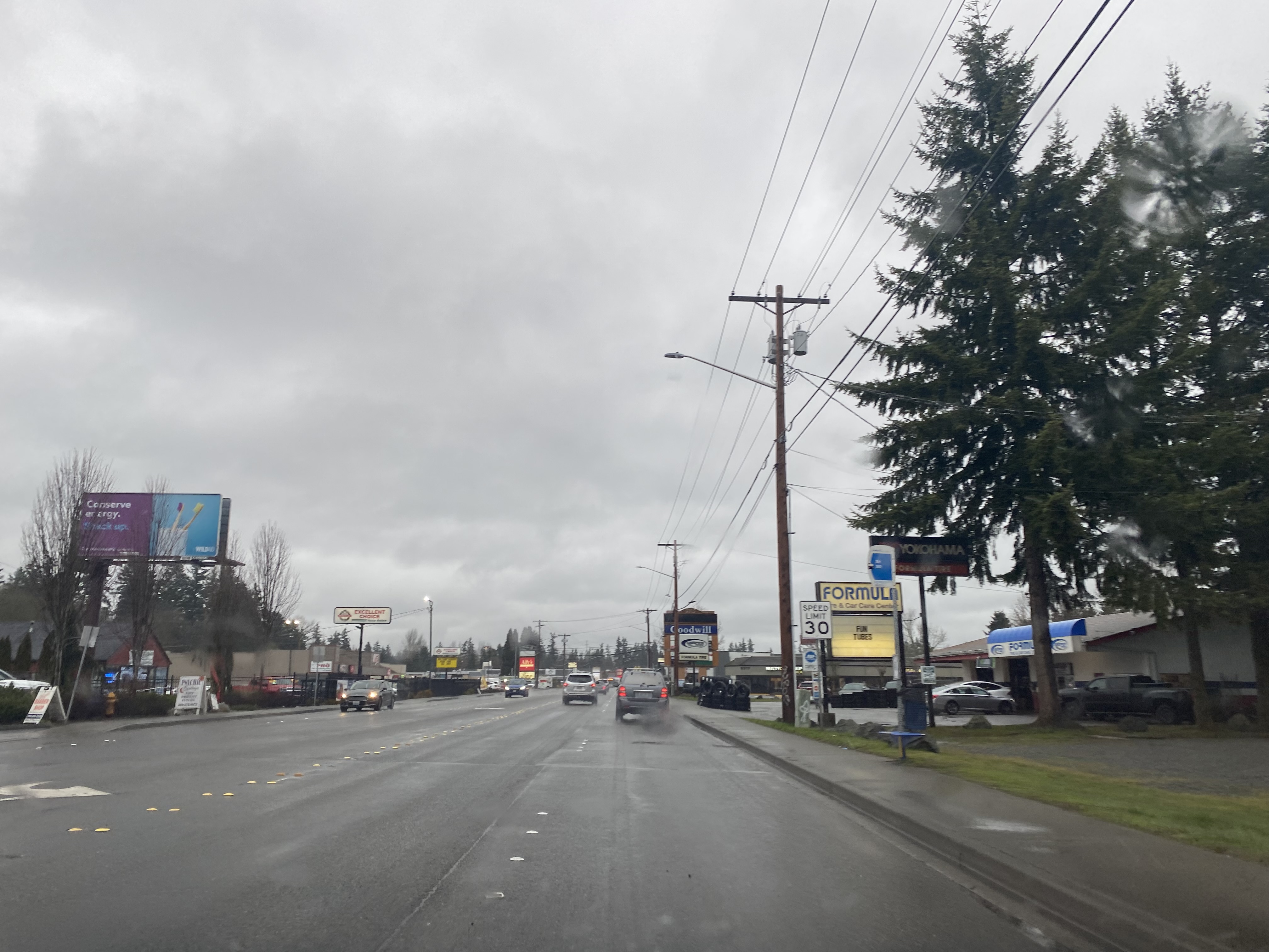
Former US Route 99 northbound followed State Avenue out of Marysville towards Smokey Point. State Avenue becomes Smokey Point Boulevard at 116th Street Northeast.


Comments