
Former US Route 101 through Pismo Beach and Arroyo Grande

The Cities of Pismo Beach and Arroyo Grande are both located on US Route 101 in southern San Luis Obispo County.  Within the City of Pismo Beach the original alignment of US Route 101 can be found on Price Street.  The City of Arroyo Grande has two historic alignments of US Route 101; one that follows Branch Street and Bridge Street over the 1908 Arroyo Grande Creek Bridge and the other which follows Traffic Way.  Pictured above is the  then new US Route 101 freeway in Pismo Beach as it was in 1961.  Depicted below is the alignment of US Route 101 through Pismo Beach and Arroyo Grande on the 1935 Division of Highways Map of San Luis Obispo County. 


Part 1; the history of US Route 101 through Pismo Beach and Arroyo Grande

The area that is now Arroyo Grande Valley was surveyed on September 4th, 1769 during the Portola Expedition.  Arroyo Grande Valley was found to have soils which would lead to being an established locale on what would become El Camino Real when Mission San Luis Obispo de Tolosa was founded in 1772.  

The route of El Camino Real was intended to solidify a path of travel between the Catholic Missions of Las Californias.  In 1804 Alta California was formed out of the larger Las Californias.  El Camino Real would ultimately connect 21 Catholic Missions of Alta California ranging approximately 600 miles spanning from Mission San Diego de Alcala in San Diego north to Mission San Francisco Solano in Sonoma.  The Missions of El Camino Real were established from 1769 through 1823.  In the case of Mission San Francisco Solano it was established two years after Mexico had won it's independence from Spain in 1821.  Each Mission was meant to be approximately 30 miles apart from each other which would require a single day of travel by horseback.

Following the secularization of the Spanish Missions during period of Mexican Alta California the lands of Arroyo Grande Valley were granted to Francis Ziba Branch as Rancho Santa Manuela during 1836.  Branch attempted to graze the lands of Arroyo Grande Valley but ultimately sold off much of his holdings as California became an American State.  In 1862 the San Luis Obispo County Board of Supervisors established Arroyo Grande Township.  The formation of Arroyo Grande Township led directly to the development of a town site on what is now Branch Street.  Arroyo Grande received a railroad depot in 1882 and the community would incorporate as a City on July 10th, 1911.  

The City of Pismo Beach is located on land which was part of Rancho Pismo of Mexican Alta California.  Rancho Pismo was granted to Jose Ortega in 1840 who in turn sold it to Issac Sparks in 1846.  Sparks later sold the lands of Rancho Pismo to John Michael Price after California had become an American State.  Price would subsequently go on to plot the town site of Pismo along the Southern Pacific Railroad during 1891.  Pismo Beach would later incorporate as a City on April 25th, 1946.    

In 1904 the American El Camino Real Association was formed with the goal to mark a modern highway that corresponded to the historical route between the Spanish Missions.  Ultimately the path of American El Camino Real was to be marked by the signature bells the corridor is known by today.  The first bell marking the American El Camino Real was placed in 1906 and it is estimated by 1915 that there may have been anywhere from 158 to 400 placed in-field.  Pismo Beach and Arroyo Grande being along the main highway at the time were signed as part of the American El Camino Real.  The American El Camino Real was one of the earliest analogs of what would become the signed Auto Trails.  The background of the American El Camino Real is covered extensively on CAhighways.org.

CAhighyways.org on the American El Camino Real

The era of State Highway Maintenance through Pismo Beach and Arroyo Grande would begin with the 1909 First State Highway Bond Act which was approved by voters in 1910.  One of the highways approved through the 1909 First State Highway Bond Act was a 481.8 mile highway originating at the City Limits of San Francisco which terminated in San Diego.  This highway would ultimately come to be known in time as Legislative Route Number 2 ("LRN 2").  In 1913 the Pacific Highway was plotted as a major Auto Trail which had Pismo Beach and Arroyo Grande along it's planned route.

Early LRN 2 in Pismo Beach can be seen in the October 1912 California Highway Bulletin.  

The January 1915 California Highway Bulletin notes LRN 2 between Arroyo Grande to Pismo Beach was constructed to State Standards during 1914.  LRN 2 between Arroyo Grande and Pismo Beach is stated to have been paved in 15 foot wide concrete slabs. 

Early LRN 2/American El Camino Real/Pacific Highway can be seen passing through Pismo Beach and Arroyo Grande on the 1917 California State Automobile Association Map.


The 1920 Rand McNally Highway Map of California shows El Camino Real and the Pacific Highway following LRN 2 through Pismo Beach and Arroyo Grande.  

The 1924 Rand McNally Map of California shows the California Banff Bee-Line Highway co-signed with the Pacific Highway on LRN 2 through Pismo Beach and Arroyo Grande. 


The January 1925 California Highways & Public Works discusses a cooperative plan between the California Highway Commission and California Railroad Commission to eliminate an at-grade crossing of the Southern Pacific Railroad on LRN 2 in Pismo Beach.  The short approach to the Southern Pacific Railroad overpass in Pismo Beach is cited to be the only remaining unpaved segment of LRN 2 between San Francisco and Los Angeles.  


The March 1925 California Highways & Public Works depicts the planned Southern Pacific Railroad overpass realignment compared to the existing LRN 2 in Pismo Beach.  A new bridging structure can be seen crossing Villa Creek towards Hinds Avenue.  


Note; the original alignment of LRN 2 over Villa Creek as depicted above is carried via the now closed Bello Street Bridge.  According to bridgehunter.com the Bello Street Bridge was constructed in 1913 as a through truss span.  The Bellow Street Bridge is 125 feet in length and can be seen in this photo courtesy Jann Mayer of bridgehunter.com.


The July 1925 California Highways & Public Works announced construction of the realignment of LRN 2 over the Southern Pacific Railroad and Villa Creek had recently begun.  


Construction of a bridge on the new alignment of LRN 2 in Pismo Beach can be seen on the 1925 California Highways & Public Works.  


The initial draft of the US Route System was approved by the Secretary of Agriculture during November of 1925.  The US Route System within California was approved by California Highway Commission with no changes recommended by January 1926.  The initial alignment of US Route 101 ("US 101") was planned to follow LRN 2 from San Francisco to San Diego via San Luis Obispo County.  US 101 is shown on a map published in the 1926 California Highways & Public Works following LRN 2 south from San Francisco towards San Diego.


The March 1926 California Highways & Public Works states that the two bridges on the new alignment of LRN 2 in Pismo Beach were nearing completion. 


The July 1926 California Highways & Public Works announced the Southern Pacific Railroad overhead and bridge over to Villa Creek had been opened as new alignment of LRN 2.  


During November of 1926 the US Route System was approved by the AASHO.  US 101 can be seen aligned through Pismo Beach and Arroyo Grande on the 1927 National Map Company Sectional Map.

The December 1927 California Highways & Public Works announced US 101/LRN 2 between Pismo Beach and San Luis Obispo was in the process of being reconstructed.  


The September/October 1928 California Highways & Public Works notes the reconstruction of US 101/LRN 2 between Pismo Beach and San Luis Obispo was nearing completion.  


The January/February 1929 California Highways & Public Works notes US 101/LRN 2 between Pismo Beach and Arroyo Grande was in the process of being reconstructed.  Reconstruction of US 101/LRN 2 from Pismo Beach north to San Luis Obispo is stated to have been completed. 


The July/August 1929 California Highways & Public Works announced the reconstruction of US 101/LRN 2 from Pismo Beach to Arroyo Grande had been completed.  The new concrete road deck between Pismo Beach and Arroyo Grande is stated to be paved in 20-30 foot wide concrete slabs.  


The August 1931 California Highways & Public Works announced US 101/LRN 2 between Arroyo Grande and Berros Creek was slated to be reconstructed.  The scope of the project would realign US 101/LRN 2 off of Branch Street and Bridge Street in downtown Arroyo Grande.  The new alignment of US 101/LRN 2 in Arroyo Grande was slated to be shifted to a new bridge over Arroyo Grande Creek via what is now Traffic Way.   


The June 1932 California Highways & Public Works announced reconstruction of US 101/LRN 2 in Arroyo Grande towards Berros Creek had been completed.  US 101/LRN 2 in Arroyo Grande had been shifted to a new alignment along Traffic Way.  In total 32 curves between Arroyo Grande and Los Berros Creek had been eliminated along US 101/LRN 2.  Former US 101 on Branch Street east of Traffic Way to Bridge Street was incorporated into LRN 147 during 1933 according to cahighways.org.  


The August 1934 California Highways & Public Works announced initial run of Sign State Routes.  California State Route 1 ("CA 1") was announced as a highway which followed the entire planned route of LRN 56 from from US 101 in Fortuna back to US 101 at Las Cruces.  CA 1 as originally defined followed LRN 56 into San Luis Obispo via Santa Rosa Street southbound where it picked US 101/LRN 2 at Monterey Street.  US 101/CA 1 as originally defined multiplexed southward via Santa Rosa Street and Higuera Street on LRN 2 through downtown San Luis Obispo towards Pismo Beach.  CA 1/LRN 56 departed US 101/LRN 2 from Price Street via Dolliver Street.  LRN 56 had been extended from San Luis Obispo south to Las Cruces during 1933 according to cahighways.org.  

As noted in the intro the 1935 Division of Highways Map of San Luis Obispo County depicts US 101/LRN 2 in Pismo Beach and Arroyo Grande. 

US 101/LRN 2 south of Pismo Beach as depicted in the October 1938 California Highways & Public Works.  

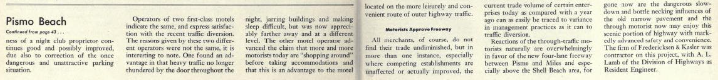
The November/December 1949 California Highways & Public Works announced the opening of a four lane segment of US 101/CA 1/LRN 2 from Pismo Beach north to Miles Station.  The upgrade of US 101/CA 1/LRN 2 one mile north of downtown Pismo Beach incorporated the existing highway into the southbound lanes towards the Shell Beach area.  Through Shell Beach US 101/CA 1/LRN 2 had been moved to a bypass of Price Street/Shell Beach Road.  


The November/December 1951 California Highways & Public Works details the growth of the Shell Beach area following US 101/CA 1/LRN 2 being moved to a bypass.  


US 101/LRN 2 through Arroyo Grande on Traffic Way can been seen in this aerial view depicted in the November/December 1951 California Highways & Public Works.


The November/December 1953 California Highways & Public Works notes a freeway conversion of US 101/LRN 2 between Pismo Beach-Arroyo Grande was budgeted for the 1954-55 Fiscal Year.  


The July/August 1954 California Highways & Public Works notes a freeway upgrade between Pismo Beach and Arroyo Grande was in the process of construction.  


US 101/CA 1/LRN 2 facing southbound at Shell Beach towards Pismo Beach is featured as the cover of the January/February 1957 California Highways & Public Works.  


The January/February 1957 California Highways & Public Works depicts the recently opened new freeway alignment of US 101/LRN 2 between Pismo Beach and Arroyo Grande.  The Pismo Beach-Arroyo Grande Freeway segment of US 101/LRN 2 is cited to have been completed during September 1956.  Both Pismo Beach and Arroyo Grande are shown to have active freeway resolutions.  


The September/October 1958 California Highways & Public Works notes right-of-way acquisition for the freeway realignment of US 101/LRN 2 in Pismo Beach was underway.  Construction of the US 101/LRN 2 freeway through Arroyo Grande is noted to be in progress.  


Grading for the US 101/LRN 2 freeway can be seen on an aerial photo in the September/October 1958 California Highways & Public Works.  


The September/October 1959 California Highways & Public Works notes US 101/LRN 2 had moved to the new freeway alignment which had been completed during June 1959.  


The US 101/LRN 2 freeway through Arroyo Grande as seen in the January/February 1960 California Highways & Public Works.  


The July/August 1961 California Highways & Public Works details the opening of the US 101/LRN 2 freeway through Pismo Beach.  The freeway upgrade of US 101/LRN 2 is cited to have been completed during May 1961.  Price Street in downtown Pismo Beach is noted to have been the last surface street alignment of US 101/LRN 2 to have been bypassed in San Luis Obispo County. 


The back cover of the July/August 1961 California Highways & Public Works displays the newly completed US 101/LRN 2 freeway through Pismo Beach.  


The November/December 1963 California Highways & Public Works notes a segment of the US 101/CA 1/LRN 2 south of San Luis Obispo expressway had been recently converted to freeway standards.  The conversion of existing expressway to freeway standards is stated to be continuing southward towards the Shell Beach area in Pismo Beach. 


During the 1964 California State Highway Renumbering the Legislative Route Numbers were dropped.  LRN 2 was subsequently reassigned legislatively as part of Route 101 to match the field signed US 101.  US 101/CA 1 north of downtown Pismo Beach is cited to have been converted freeway standards through Shell Beach during June 1965 according to the November/December 1965 California Highways & Public Works.  


Part 2; a drive on former US Route 101 on Price Street in Pismo Beach

From modern US 101/CA 1 southbound in Pismo Beach the original alignment of US 101 can be accessed via Exit 191A and following it to Price Street.  Note; these photos are from Google Street View. 


Former US 101 on Price Street continues southbound and loops back to the modern freeway.


Part 3; a drive on former US Route 101 in Arroyo Grande

The two former alignments of US 101 in Arroyo Grande can be accessed from the modern highway via Exit 187A to CA 227/Grand Avenue.   CA 227 was assigned over what had been LRN 147 during the 1964 State Highway Renumbering.  


Former US 101 southbound in Arroyo Grande follows Grand Avenue to Branch Street.  The pre-1932 alignment of US 101 can be followed by staying on CA 227/Branch Street into downtown Arroyo Grande.  The post-1932 alignment of US 101 can be followed by turning right on Traffic Way.  


The pre-1932 alignment of US 101 southbound followed CA 227/Branch Street and turned right onto Bridge Street. 


From Bridge Street traffic can access Olohan Alley and Arroyo Grande Creek Swinging Bridge.  The Arroyo Grande Creek Swinging Bridge was constructed by Newton Short in 1875 to connect his properties.  The Arroyo Grande Creek Swinging Bridge was originally strung with rope and lacked sides.  Sides were added to the Arroyo Grande Swinging Bridge around 1902 and the structure was given to the City of Arroyo Grande in 1911.  The Arroyo Grande Creek Swing Bridge was later rebuilt with steel cabling after it was damaged by a storm in 1995.   Presently the Arroyo Grande Creek Swing Bridge is claimed by some to be the last swing bridge in California.  


The pre-1932 alignment of US 101 on Bridge Street crosses the 1908 Arroyo Grande Creek Bridge.  The 1908 Arroyo Grande Creek Bridge is a Pratt Pony Truss design which is 129.9 feet in length.  The 1908 Arroyo Grande Creek Bridge was recently renovated by the City of Arroyo Grande and just reopened to traffic in early 2021.  


Bridge Street southbound merges in with the post-1932 alignment of US 101 on Traffic Way.  Traffic Way continues southward to an on ramp to modern US 101 .  


Comments

Effie McDermott said…
Wow, you put a lot of work and research into this article! I can help you with some natty little details about the historic route of El Camino Real and the Mexican Land Grants, but overall any suggestions would be minor, thank you for posting!! I enjoyed it very much.
Unknown said…
Very interesting details. I walked around near the Old alignment by Pismo Creek and saw existing concrete road bed from a century ago. It is still there under a lot of vegetation. Fascinating history.

Popular posts from this blog

Old River Lock & Control Structure (Lettsworth, LA)

  The Old River Control Structure (ORCS) and its connecting satellite facilities combine to form one of the most impressive flood control complexes in North America. Located along the west bank of the Mississippi River near the confluence with the Red River and Atchafalaya River nearby, this structure system was fundamentally made possible by the Flood Control Act of 1928 that was passed by the United States Congress in the aftermath of the Great Mississippi River Flood of 1927 however a second, less obvious motivation influenced the construction here. The Mississippi River’s channel has gradually elongated and meandered in the area over the centuries, creating new oxbows and sandbars that made navigation of the river challenging and time-consuming through the steamboat era of the 1800s. This treacherous area of the river known as “Turnbull’s Bend” was where the mouth of the Red River was located that the upriver end of the bend and the Atchafalaya River, then effectively an outflow

Memphis & Arkansas Bridge (Memphis, TN)

  Like the expansion of the railroads the previous century, the modernization of the country’s highway infrastructure in the early and mid 20th Century required the construction of new landmark bridges along the lower Mississippi River (and nation-wide for that matter) that would facilitate the expected growth in overall traffic demand in ensuing decades. While this new movement had been anticipated to some extent in the Memphis area with the design of the Harahan Bridge, neither it nor its neighbor the older Frisco Bridge were capable of accommodating the sharp rise in the popularity and demand of the automobile as a mode of cross-river transportation during the Great Depression. As was the case 30 years prior, the solution in the 1940s was to construct a new bridge in the same general location as its predecessors, only this time the bridge would be the first built exclusively for vehicle traffic. This bridge, the Memphis & Arkansas Bridge, was completed in 1949 and was the third

California State Route 203 the proposed Minaret Summit Highway

California State Route 203 is an approximately nine-mile State Highway located near Mammoth Lakes in the Sierra Nevada Mountains of Mono County.  California State Route 203 as presently configured begins at US Route 395, passes through Mammoth Lakes and terminates at the Madera County line at Minaret Summit.  What is now California State Route 203 was added to the State Highway System in 1933 as Legislative Route Number 112.  The original Mammoth Lakes State Highway ended at Lake Mary near the site of Old Mammoth and was renumbered to California State Route 203 in 1964.  The modern alignment of the highway to Minaret Summit was adopted during 1967.   The corridor of Minaret Summit and Mammoth Pass have been subject to numerous proposed Trans-Sierra Highways.  The first corridor was proposed over Mammoth Pass following a Southern Pacific Railroad survey in 1901.  In 1931 a corridor between the Minarets Wilderness and High Sierra Peaks Wilderness was reserved by the Forest Service for po