
As noted above Lassen Volcanic Highway serves as a continuation of CA 89. From the Southwest Entrance of Lassen Volcanic National Park in Tehama County the route of Lassen Park Highway ascends from a starting elevation of 6,646 feet above sea level to 8,511 feet above sea level at the foot of Lassen Peak. Lassen Park Highway terminates near Manzanita Lake at an elevation of 5,808 feet above sea level within Shasta County. Lassen Park Highway in total is 29.86 miles in length.

Part 1; the history of Lassen Park Highway
Lassen Volcanic National Park lies with the southern part of the Cascade Range and is named for Lassen Peak. Lassen Peak is a Lava Dome volcano which lies at an elevation of 10,457 feet above sea level. Lassen Peak takes it's name from Peter Lassen who was a well renown pioneer during the 1840s on through the early California Gold Rush. Peter Lassen is most known for establishing a cut-off route to the California Trail by way of Goose Lake and the Pit River.
Lassen Peak arose approximately 27,000 years ago from the shattered northern flank of Brokeoff Volcano. Lassen Peak is documented to have been witnessed by Jedediah Smith during 1821. Lassen Peak's first recorded ascent was made by the Grover K. Godfrey expedition during 1851. During May of 1907 Lassen Peak National Monument was created by then sitting President Theodore Roosevelt.
Below Lassen Peak along with Lassen Park Highway can be seen from a flight I took to Portland during 2019.

On May 30th 1914 Lassen Peak suddenly became active when it began to erupt by way of a steam explosion. On May 14, 1915 Lassen Peak began to erupt lava blocks which spread as far as 20 miles away. The eruptions culminated on May 22, 1915 at 4 PM during the "Great Eruption" which could be seen as far as 150 miles away in Eureka. The Great Eruption formed a large crater atop Lassen Peak, a pyroclastic flow which destroyed 3 square miles (now the Devastated Area), and a large lahar which reached Hat Valley. The column from the Great Eruption of Lassen Peak can be seen in this photo below from Loomis Rock.

The scene in downtown Red Bluff on May 22, 1915.

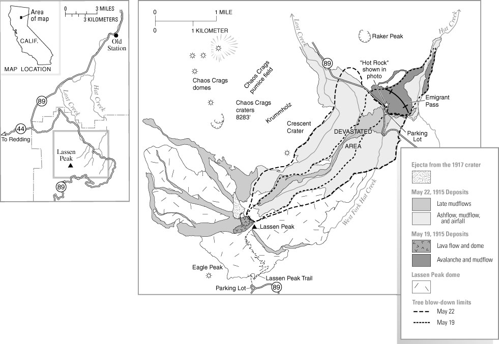
A USGS Map showing the Devastated Area.
In a somewhat interesting response to the Great Eruption of 1915 U.S. Congress approved Lassen Volcanic National Park on August 9, 1916. Another large eruption on Lassen Peak occurred during May of 1917, with large scale releases of steam occurring afterwards to 1920. The last steam release on Lassen Peak occurred during 1921 before the volcano went dormant again.
So what does one do with a recently activated National Park and recently dormant volcano? Given that answer came during the 1920s it was simple; build a road so people can see it! During 1924 and 1925 the route of Lassen Park Highway was surveyed by National Park Service engineers. This culminated in the construction of the first two miles of Lassen Park Highway from the Southwest Entrance to the Sulphur Works during 1925. The early Lassen Park Highway can be seen stretching from Mineral northward to the Sulphur Works on the 1930 California Division of Highways Map.

During 1926 the Park Service entered into an agreement with the Bureau of Public Roads to construct Lassen Park Highway. The Bureau of Public Roads made some alterations of the original surveyed route of Lassen Park Highway but they were not drastic. The original alignment of Lassen Park Highway was to be 16 feet wide and closely followed the Forest Service Road standards of the time. Lassen Park Highway was completed during 1931 and a dedication ceremony was held during July of said year.
During 1933 Legislative Route 83 was added to the State Highway System. The first route segments of LRN 83 were intended to connect to Lassen Park Highway from both terminus points according to CAhighways.org:
- From LRN 3 (US 99) near Mount Shasta to Lassen Volcanic National Park.
- Lassen Volcanic National Park to LRN 29 near Morgan.
In the August 1934 California Highways & Public Works Guide the Sign State Routes were announced. CA 89 was added as a new highway which utilized LRN 83 from US 99 southeast towards Truckee. CA 89 continued beyond Truckee via the west shore Lake Tahoe to CA 7 over Monitor Pass (at the time unbuilt). The 1934 CHPW article even provides an illustration which shows CA 89 was intended to be routed via Lassen Park Highway through Lassen Volcanic National Park.


CA 89 can be seen routed through Lassen Park Highway on the 1935 Goshua Highway Map of California.

Between 1948 and 1953 Lassen Park Highway was widened to a minimum standard of 20 feet and culminated in the road being completely paved. During 2006 Lassen Park Highway was added to the National Register of Historic Places on June 23rd. The National Park Service entry on the addition of Lassen Park Highway to the National Register of Historic Places can be read below:
Lassen Volcanic National Park Highway Historic District
Regarding the signing of CA 89 it is very apparent that the California State Automobile Association did place reassurance shields on Lassen Park Highway. This photo below is of the Southwest Entrance to Lassen Volcanic National Park with it's original 16 foot width roadway.


Of note; the blocks on the entrance sign to the right are still in use on Lassen Park Highway to display "Lassen Volcanic National Park." This photo below was taken during May of 2017 from the same location as the two photos above. The wider modern road cut is most apparent to the left of the photo.

Part 2; a drive southbound on Lassen Park Highway
My approach to Lassen Park Highway during 2014 was from CA 89 south from I-5. I pulled into the north entrance of Lassen Volcanic National Park from CA 89 south/CA 44 west in Shasta County. Signage indicates that CA 89 has an implied continuation through Lassen Volcanic National Park via Lassen Park Highway which can be seen on the first of two Google Images below. Caltrans maintenance ends at the National Park Boundary at Post Mile R49.343.


Lassen Park Highway is part of the Volcanic Legacy Scenic Byway. The Volcanic Legacy Scenic Byway consists of 500 miles of roads with the Cascade Range.


My first stop on Lassen Park Highway was at Manzanita Lake I stopped for a look at the namesake creek and southward view of Lassen Peak.


Lassen Park Highway from Manzanita Lake generally is aligned in a southeastern direction. Below is a look southwest from Lassen Peak Highway towards Lassen Peak through the Devastated Area.

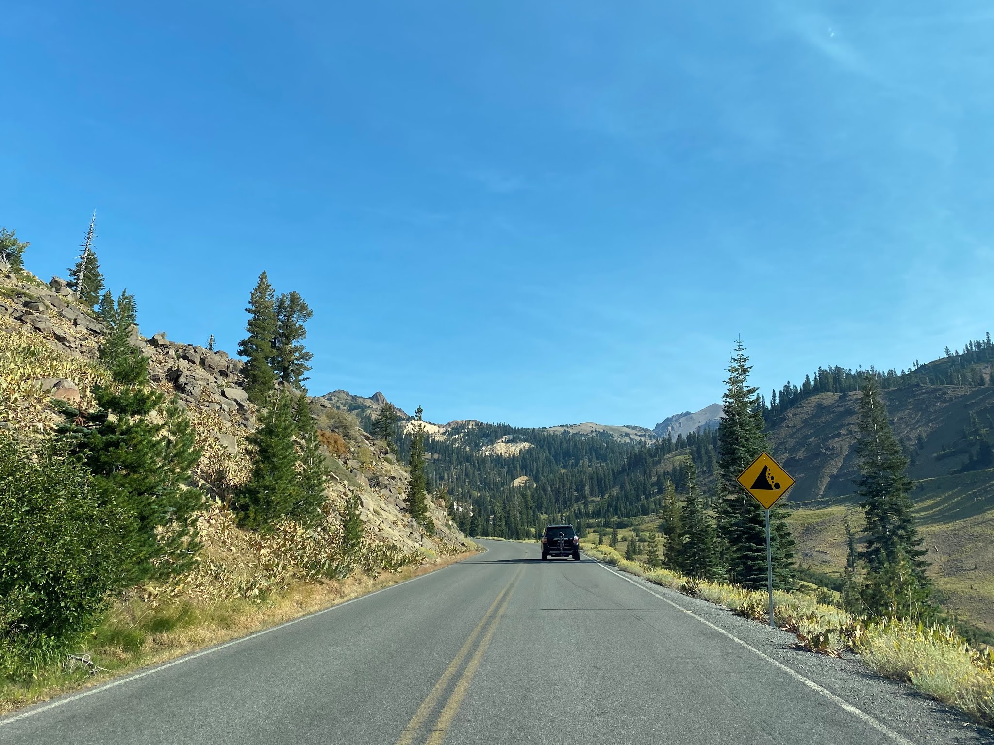
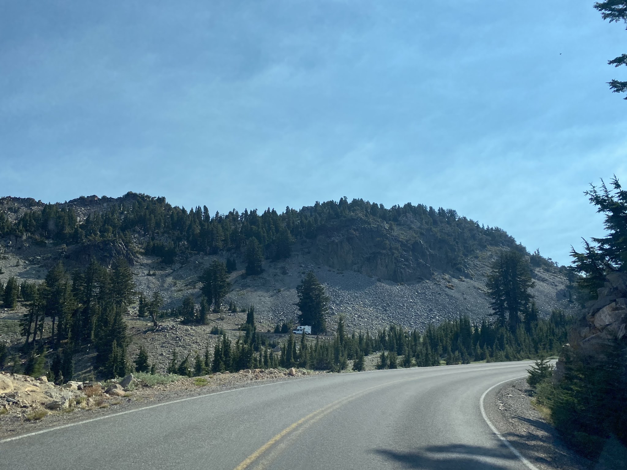
Lassen Park Highway southbound winds around the eastern flank of Lassen Peak towards Summit Lake. Below is a view of Lassen Peak looking west over Lassen Park Highway near Summit Lake.

As Lassen Park Highway continues south there are a couple places to pull out which open onto a vista where Lake Alamanor can be viewed to the Southeast.

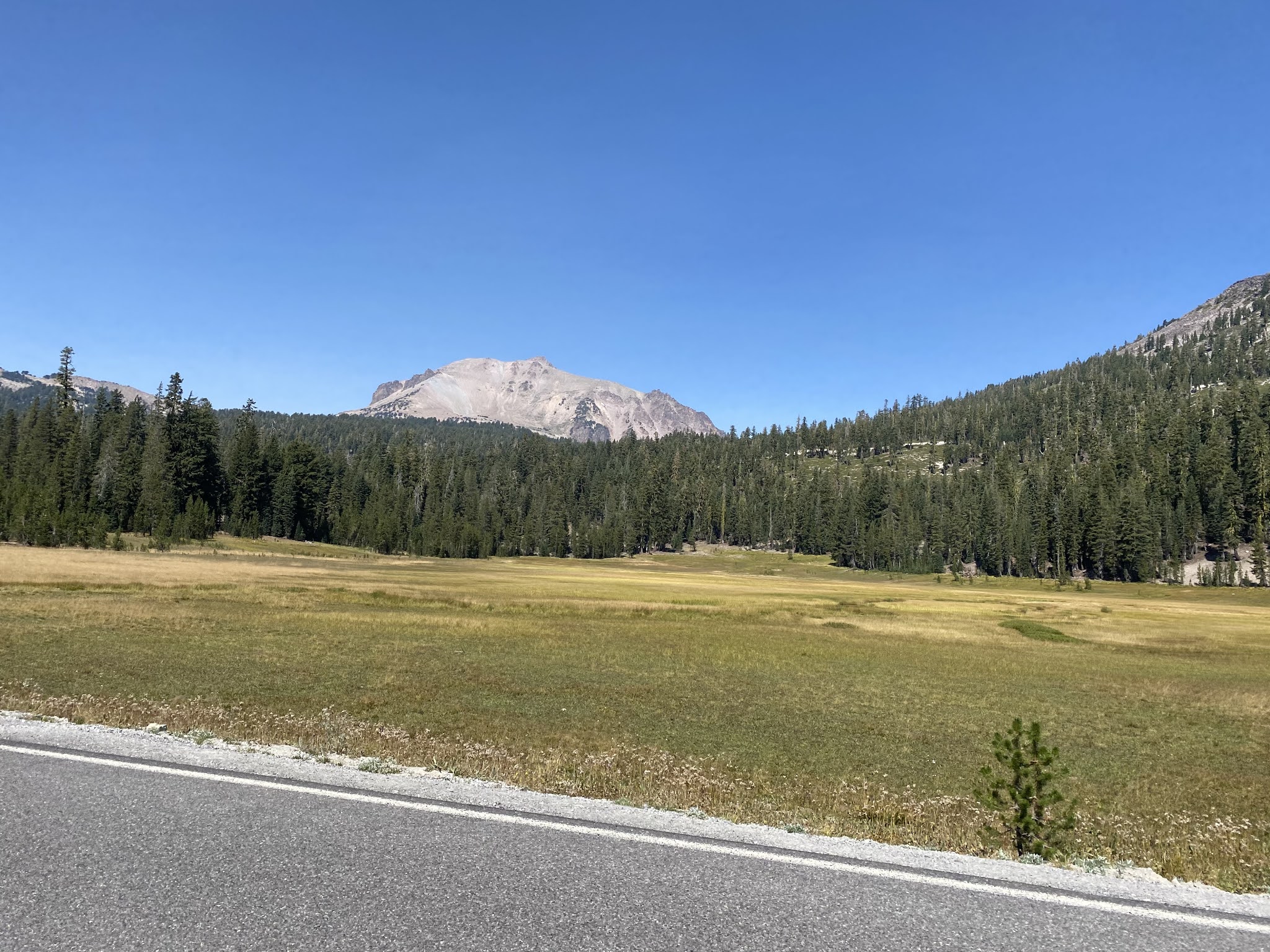
Lassen Park Highway southbound swings westward along Kings Creek which has a northward view through a meadow of Lassen Peak.

From Kings Creek Lassen Park Highway begins to ascend towards the Lassen Peak Trailhead by way of switchbacks. Through the switchbacks Lake Almanor can be seen to the southeast.

Lassen Park Highway tops out at 8,512 feet above sea level near the Lassen Peak Trailhead. The trail up Lassen Peak is 2.5 miles one-way and follows a generally northward path from Lassen Park Highway.

From the Lassen Peak Trailhead the route of Lassen Park Highway swings southward towards Lake Helen. Below Brokeoff Volcano (also known as Mount Tehama) can be seen in the distance to the southwest over Lake Helen. Brokeoff Volcano lies at an elevation of 9,239 feet above sea level. Brokeoff Volcano was active from 590,000-387,000 years ago before the volcanic hot spot began moving northeast towards Lassen Peak. Brokeoff Volcano is thought to have been at one point higher than 11,000 feet above sea level.

A look northward from Lake Helen at Lassen Park Highway and Lassen Peak.

Lake Helen lies at an elevation of 8,200 feet above sea level and is named for Helen Tanner Brodt. Brodt was the first woman to ascend Lassen Peak during 1864. Lake Helen is frozen the majority of the year and typically receives approximately 180 inches of snow fall.


Emerald Lake is located immediately west of Helen Lake on Lassen Peak Highway at 8,100 feet above sea level.

Lassen Peak Highway from Emerald Lake swings southwest over the Tehama County Line to the Sulphur Works. My photos below of the Sulphur Works were from 2016 when Lassen Park Highway was mostly closed.

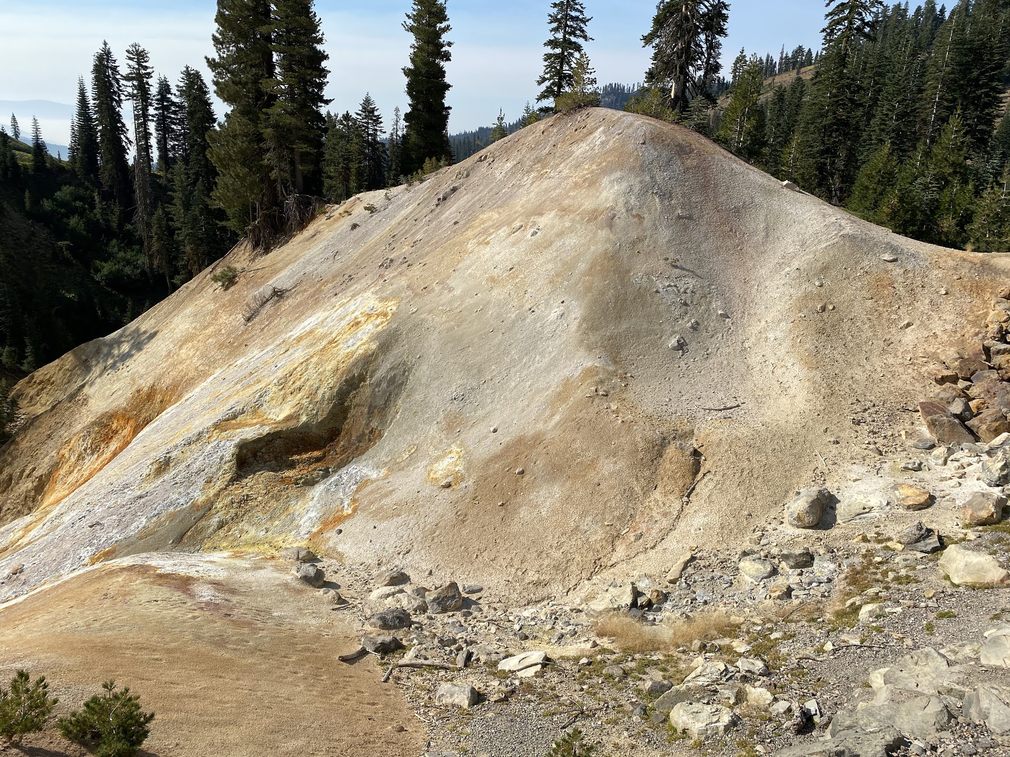
The Sulphur Works area is well signed to deter people from walking off into areas that have boiling water underneath.


Lassen Park Highway swings south from the Sulphur Works to the Kohn Yah-mah-nee Visitor Center. From the Kohn Yah-mah-nee Visitor Center the peaks of Brokeoff Volcano, Mount Diller (9,087 feet above sea level), and Pilot Pinnacle (8,886 feet above sea level) looking west-to-east.

From the Kohn Yah-mah-nee Visitor Center I descended to the Southwest Entrance of Lassen Volcanic National Park where CA 89 resumes at Post Mile TEH 4.403.
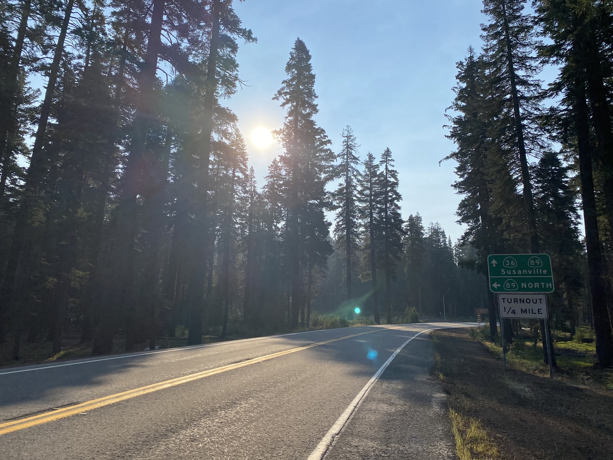
CA 89 south of Lassen Volcanic National Park meets CA 36 at Morgan Summit and begins a multiplex eastward towards Lake Almanor. Morgan Summit is generally considered to be the geological divide of the Cascade Range and Sierra Nevada Mountains to the south.

Part 3; a drive northbound on Lassen Park Highway
During Labor Weekend of 2020 I made a return trip to Lassen Volcanic National Park. After departing Red Bluff during the morning hours I made my way east on CA 36 to Morgan Summit. Upon reaching Morgan Summit I turned north on CA 89 towards the south entrance of Lassen Volcanic National Park.


The Lassen Volcanic National Park Visitor Center is located just beyond the south entrance station on Lassen Park Highway.


Notably the Lassen Volcanic National Park Visitor Center has an address of; 21820 Lassen National Park Highway.

The Lassen Volcanic National Park Visitor Center has an outdoor geological timeline display.


A display in the Lassen Volcanic National Park Visitor Center that will horribly date Part 3 of this article

From the Visitor Center the first major stop on Lassen Park Highway is the Sulphur Works.


Interestingly the Sulphur Works wasn't owned by the Park Service until 1952. Mathias Supan began extracting sulfur in 1865 and the land he purchased managed to remain in private hands for almost a century. The Supan Sulphur Works included a Inn and bathhouse.


Lassen Park Highway northbound snakes through the terrain and ascends to Emerald Lake.


Lassen Park Highway passes the Bumpass Hell Trailhead approaching Lake Helen.


The view of Lassen Peak from Lake Helen.

For all the foot track heading to Bumpass Hell the picnic ground at Lake Helen was essentially empty.


Lassen Park Highway climbs above Lake Helen to the Lassen Peak Trailhead.


The Lassen Park Highway high point of 8,511 feet comes just after the Lassen Peak Trail.

Lassen Park Highway begins to descend through a series of a switchbacks. A plaque containing historical information pertaining to the construction of Lassen Park Highway can be found .


Lassen Park Highway descends to the King Creek Picnic Ground.


I hiked out to Cold Boiling Lake and Crumbaugh Lake from King Creek Picnic Ground. Cold Boiling Lake is a small body of water which has occasional bubbling methane which can be seen on the surface. Bumpass Hell can be accessed via a short connecting trail from Crumbaugh Lake.


Lassen Park Highway swings eastward towards the King Creek Falls Trailhead.


Lassen Park Highway swings northward towards Summit Lake.


From Summit Lake Lassen Park Highway turns northwest and passes the Devastated Area en route to Manzanita Lake.


Lassen Park Highway passes through the north entrance station. Approaching CA 89/CA 44 there is oddly a junction sign (with missing Volcanic Legacy shield) for CA 89.


Comments