
This past Saturday (10/6), I started my vacation by going hiking at Vroman's Nose in Middleburgh, NY and also exploring some backroads I haven't been down.
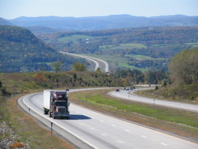
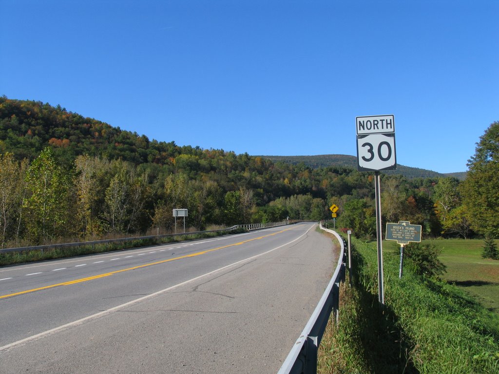
I started the trip on I-90 to I-88 and got off at the NY 30A interchange (exit 23) . I backtracked up NY 7 a little bit and headed south on NY 30 to take some shots of I-88 from the NY 30 overpass. (I commented on this view in one of my first entries). The views didn't disappoint this nearly perfect autumn day!
I took a few photos along NY 30 and the Schoharie Covered Bridge. There was a History Fair at the old fort, and the ticket gate was at the end of the bridge. I would have loved to stopped but I really wanted to hike the nose. Speaking of the nose, here it is...
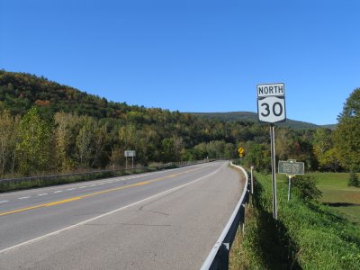
 Vroman's Nose is just outside of Middleburgh and less than a mile south of the NY 30/145 crossroads. The nose was formed by the Wisconsin Glaciers over 25,000 years ago. Signs along NY 30 easily point you down a side road to the trail access. Also, there is a nearly 25 year old (posted 9/82) NY 30 shield on this side road at the intersection. (Yes, I got a photo of that.) The Vroman's Nose loop consists of three trails, Green, Blue, and Yellow. The total hike is about 1.5 miles and is relatively easy with the exception as you approach the pinnacle. Vroman's Nose is named after Dutch Settler, Adam Vroman, who settled in the area in the early 1700s. Today, the ninth generation of Vroman's still live closeby.
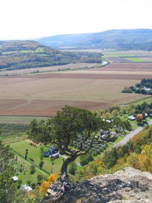
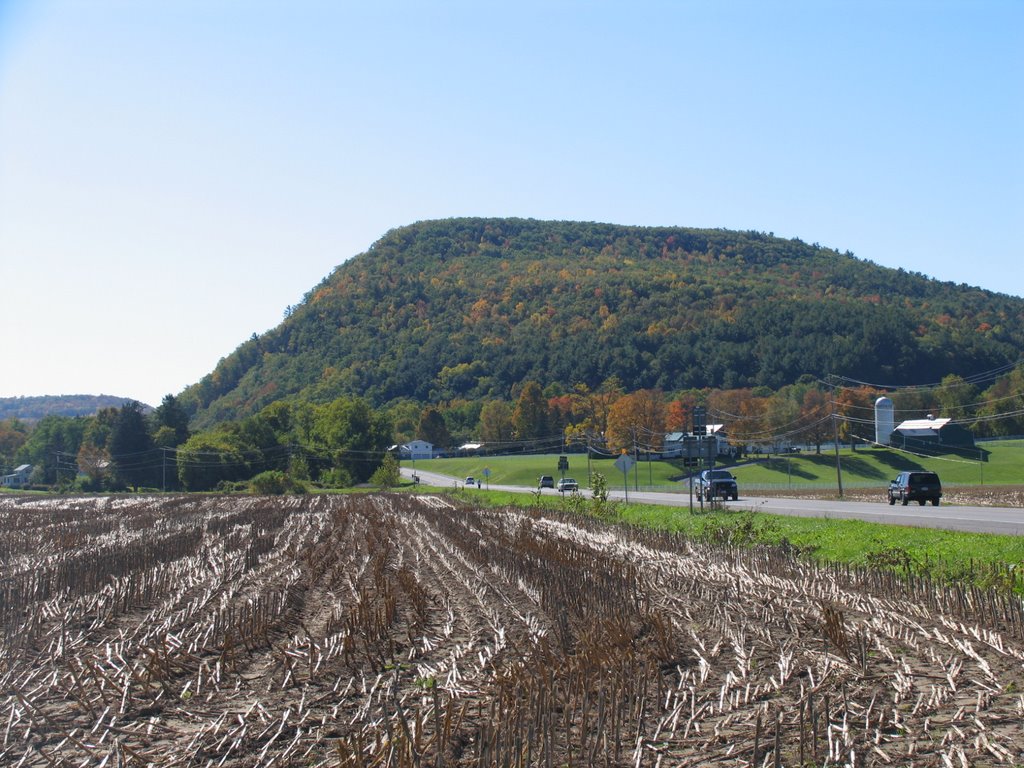
 Vroman's Nose towers nearly 700' over the vast Schoharie Creek Valley and NY 30. With a good zoom lens you are able to get some great shots of the farmland below.
 Doug Kerr's been to Vroman's Nose once before..maybe more...and he's got some more photos here. I took a great plenty of shots and one of these days, I'll have it up on my homepage.
Next, I headed down NY 30 in hope to see Mine Kill Falls but the park was closed. But I did stop and got a few shots of NY 30 and also explored the town of Breakabeen. They have a nice general store there.
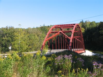
 From Breakabeen, I continued south to NY 990V (which is posted btw) and then headed east towards the town of Gilboa. Much to my surprise was a tied-arch bridge carrying NY 990V over the Schoharie.
 From there I headed east on 990V, Schoharie County 3, Albany County 35, NY 145, NY 23, NY 32, NY 81, US 9W, I-87, I-787, I-90 to home. I took around 100 photos on Saturday. And at the rate I'm going, you may get to see them next year.
I started the trip on I-90 to I-88 and got off at the NY 30A interchange (exit 23) . I backtracked up NY 7 a little bit and headed south on NY 30 to take some shots of I-88 from the NY 30 overpass. (I commented on this view in one of my first entries). The views didn't disappoint this nearly perfect autumn day!

I took a few photos along NY 30 and the Schoharie Covered Bridge. There was a History Fair at the old fort, and the ticket gate was at the end of the bridge. I would have loved to stopped but I really wanted to hike the nose. Speaking of the nose, here it is...
 Vroman's Nose is just outside of Middleburgh and less than a mile south of the NY 30/145 crossroads. The nose was formed by the Wisconsin Glaciers over 25,000 years ago. Signs along NY 30 easily point you down a side road to the trail access. Also, there is a nearly 25 year old (posted 9/82) NY 30 shield on this side road at the intersection. (Yes, I got a photo of that.) The Vroman's Nose loop consists of three trails, Green, Blue, and Yellow. The total hike is about 1.5 miles and is relatively easy with the exception as you approach the pinnacle. Vroman's Nose is named after Dutch Settler, Adam Vroman, who settled in the area in the early 1700s. Today, the ninth generation of Vroman's still live closeby.
 Vroman's Nose towers nearly 700' over the vast Schoharie Creek Valley and NY 30. With a good zoom lens you are able to get some great shots of the farmland below.
 Doug Kerr's been to Vroman's Nose once before..maybe more...and he's got some more photos here. I took a great plenty of shots and one of these days, I'll have it up on my homepage.
Next, I headed down NY 30 in hope to see Mine Kill Falls but the park was closed. But I did stop and got a few shots of NY 30 and also explored the town of Breakabeen. They have a nice general store there.
 From Breakabeen, I continued south to NY 990V (which is posted btw) and then headed east towards the town of Gilboa. Much to my surprise was a tied-arch bridge carrying NY 990V over the Schoharie.
 From there I headed east on 990V, Schoharie County 3, Albany County 35, NY 145, NY 23, NY 32, NY 81, US 9W, I-87, I-787, I-90 to home. I took around 100 photos on Saturday. And at the rate I'm going, you may get to see them next year.
Comments
airpleinblog.blogspot.com