
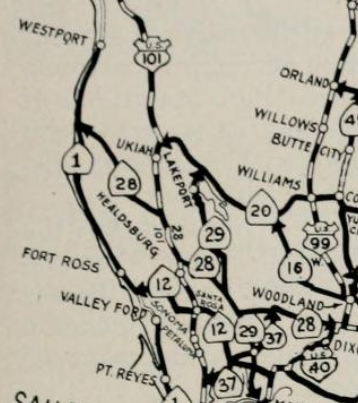
Prior to the construction of the modern alignment of US Route 101 and Redwood Highway getting from Hopland of Mendocino County south to Cloverdale of Sonoma County was far more difficult. Modern US Route 101 and the Redwood Highway follow the courses of the Russian River from Hopland south to Cloverdale. The original alignment of US Route 101 and the Redwood Highway can be found west of the modern highway via; Mountain House Road, California State Route 128 and Cloverdale Boulevard.

Part 1; the history of US Route 101 and the Redwood Highway between Hopland-Cloverdale
Cloverdale of Sonoma County was originally settled by R.B. Markle and
W.J. Miller in 1856 who established the stage stop known as Markleville on the
Russian River. In 1859 Markle's property interests were sold to James
Abram Kleiser who in turn plotted out the town site of Cloverdale.
Cloverdale would incorporate as a City on February 28th, 1872 when the San Francisco &
Northern Pacific Railroad reached the community. Cloverdale can be seen as the north terminus of the San Francisco & North Pacific Railroad and head of a stage route to Mendocino County on the 1873 Brancroft's Map of California. Note; this stage road north of Cloverdale is now part of California State Route 128 ("CA 128") and Mountain House Road towards Hopland.

Hopland is located in southern Mendocino County on the banks of the Russian River. Hopland was originally settled as "Sanel" on the western bank of the Russian River in 1859. The Sanel Post Office opened in 1860 when the community grew to a large enough size. Sanel would move to the eastern bank of the Russian River in 1874 so it could be centrally located on the new Franchise Toll Road to Clear Lake. Sanel's community name would change to Hopland in 1879 in reference to the local hops harvesting. The bulk of Hopland would relocate back to the western bank of the Russian River in the late 1880s when the San Francisco & North Pacific Railroad was completed from Cloverdale north to Ukiah.
For a time the community on the western bank of the Russian River was known as Sanel whereas the community on the eastern bank was known as Hopland. Today the community on the western bank of the Russian River is known as Hopland whereas the community on the eastern bank is known as Old Hopland. Sanel can be seen on the San Francisco & North Pacific Railroad on the western bank of the Russian River whereas Hopland can be seen to the east on the 1896 George Blum Map of Sonoma, Marin, Lake and Napa Counties. Note; what is now Mountain House Road and CA 128 can be seen connecting Hopland south to Cloverdale as a stage road on the George Blum map.

The history of what would become US Route 101 ("US 101") from Hopland to Cloverdale began with the approval of the 1909 First State Highway Bond Act.
The First State Highway Bond Act was approved by voters during 1910 and
was the genesis point of some of the most notable highways in
California. Legislative Route Number 1 ("LRN 1") as originally plotted
was a new State Highway which was designated between San Francisco north
to Crescent City. The route of LRN 1 would be extended to the Oregon
State Line during the 1919 Third State Highway Bond Act and was came be
known as the Redwood Highway.
LRN 1 between Hopland-Clover can be seen in the October 1912 California Highway Bulletin.

LRN 1 can be seen aligned on what is now Mountain House Road and CA 128 from Hopland-Cloverdale on the 1917 California State Automobile Association Map.

In November 1926 the US Route System was created. US Route 101 from San
Francisco north to Crescent City was aligned over the Redwood Highway. US 101 can be seen aligned from Hopland-Cloverdale on what is now Mountain House Road and CA 128
on the 1927 Rand McNally Highway Map of California.

The January 1928 California Highways & Public Works cited that the Redwood Empire Association requested comment from the California Highway Commission regarding a potential realignment of US 101/LRN 1 from Hopland-Cloverdale east of the Russian River. The California Highway Commission responded by advising the Redwood Empire Association that a survey for the realignment of US 101/LRN had already been conducted.

The November 1929 California Highways & Public Works contains an extensive article about the planned realignment of US 101/LRN 1 between Hopland-Cloverdale which had been approved by the California Highway Commission. The planned realignment of US 101/LRN 1 which would track largely east of the Russian River and shorten the highway by approximately three miles. The article notes that no funding for the Hopland-Cloverdale realignment of US 101/LRN 1 was earmarked for the 1929-1931 Fiscal Years.

The March 1934 California Highways & Public Works discusses the nearly completed new alignment of US 101/LRN 1 along the Russian River between Hopland-Cloverdale. The original alignment of US 101/LRN between Hopland-Cloverdale (referred to the as the Hopland Grade) is described as "tortuous" and ridge lined with two summits peaking over 1,200 feet above sea level. The Hopland-Cloverdale realignment of US 101 is cited to have begun during February of 1932 and would cost approximately $1,225,000 dollars. Five bridge structures along new alignment of US 101/LRN 1 are described in great detail.


The August 1934 California Highways & Public Works discusses the opening ceremony for two new alignments of US 101/LRN 1 on the Redwood Highway; Hopland-Cloverdale and Waldo-Sausalito. The opening ceremony for the newly realigned segments US 101/LRN 1 is cited to have taken place on August 5th which included a large caravan attended by the Governor.


Ultimately US 101 was moved to a freeway bypass of Cloverdale which opened to traffic during February of 1994 according to CAhighways.org. The new freeway alignment of US 101 shifted CA 128 onto a multiplex which departed westbound onto North Cloverdale Boulevard at Exit 522. From Cloverdale Boulevard CA 128 westward is still aligned over the original Hopland-Cloverdale alignment of US 101.
Part 2; touring the original alignment of US Route 101 from Hopland south to Cloverdale
Our tour of the original alignment of US 101 from Hopland south to Cloverdale begins in downtown Hopland at the US 101/CA 175 junction.


US 101 south of CA 175 intersects it's original alignment at Mountain House Road at Postmile MEN 10.81.


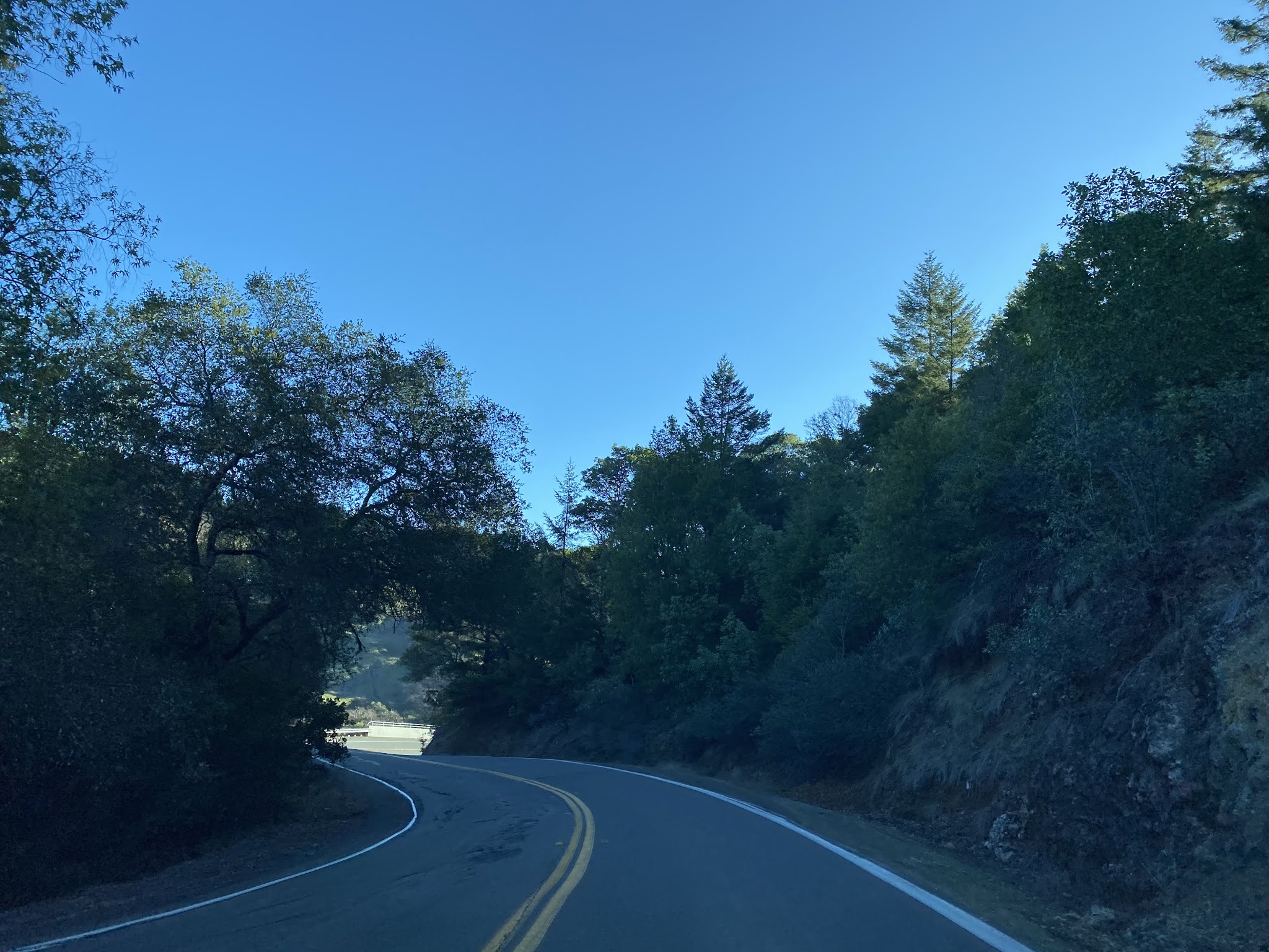
Mountain House Road southbound traverses through some winery fields departing Hopland.

Traffic on Mountain House Road southbound is advised approaching the Duncan Springs Road intersection of a curvy alignment ahead. Mountain House Road is signed with Mendocino County Route 111 Postmiles (8.26 at Duncan Springs Road).

Mountain House Road southbound begins to gain elevation.


At County Route 111 Postmile 6.44 Mountain House Road southbound crosses a stream in front of Red Barn Ranch.

Mountain House Road continues southward following the hills west of the Russian River before breaking towards the mountains.


Mountain House Road southbound passes through a series of ridges.


Mountain House Road southbound continues to wind through the terrain and picks up the course of McDonald Creek.


Mountain House Road southbound terminates at CA 128 in what was once the community of McDonald. The original alignment of US 101 would have turned left onto modern CA 128 towards Cloverdale. Cloverdale is signed as 8 miles from Mountain House Road via CA 128 eastbound.


CA 128 eastbound enters the watershed of Edwards Creek and ascends to the Sonoma County Line.


CA 128 eastbound winds through narrow terrain as it begins to split away from Edwards Creek towards Cloverdale. CA 128 descends a series of hairpins before leveling out at Alderglen Springs at Route 128 Postmile SON 2.7.


CA 128 continues east and reaches Cloverdale Boulevard at Route 128 SON L4.04. The original alignment of US 101 would have split right towards downtown Cloverdale via Cloverdale Boulevard.


Comments