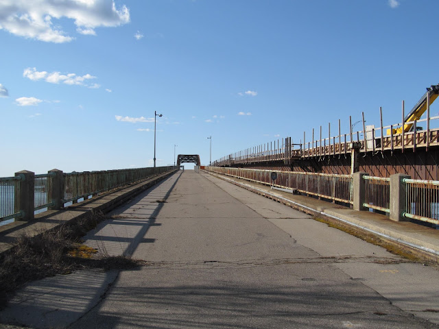
Named for famed Revolutionary War General John Sullivan, the General Sullivan Bridge is a grand old bridge which graces the Great Bay of the Piscataqua River between Dover and Newington in New Hampshire's Seacoast region, not far from Portsmouth. Built in 1934, the 1,585 foot long continuous truss bridge is the longest existing pre-1940 bridge in New Hampshire and was similar in design to the old Lake Champlain Bridge between Vermont and New York State. The General Sullivan Bridge was a trailblazer. Designed by Fay, Spofford and Thorndike, a nationally recognized bridge engineering firms of the time, the continuous truss form advanced the design and construction methods of its day and it is attributed to the influence of future highway bridges that use similar structural principles and configuration.
In the vicinity of the General Sullivan Bridge was one of the earliest water crossings in New Hampshire. Over time, and as automobile traffic increased, the roads approaching the crossing became part of the first set of state highways in New Hampshire, which now follow the US 4 and NH 16 corridors. The General Sullivan Bridge carried traffic across Little Bay for more than 30 years until traffic demands along the Spaulding Turnpike required more capacity and the Little Bay Bridge was constructed and opened in 1966. The General Sullivan Bridge continued to carry southbound traffic until 1984 when the Little Bay Bridge was widened and all turnpike traffic was routed on to the newer bridges. Since that time, the General Sullivan Bridge has been a bicycle and pedestrian crossing and a location for anglers who enjoy fishing in the Great Bay below.
However, the General Sullivan Bridge may not be long for this world. In 2010 and 2015, fencing was installed along the deck to limit access to the middle part of the deck based on the bridge's deterioration. In 2017, the New Hampshire Department of Transportation determined the General Sullivan “was not rehab safe,” and in 2018 it was closed to even pedestrian and bike travel. NHDOT had planned to rehabilitate the General Sullivan Bridge as part of the Spaulding Turnpike expansion project, but in 2018, NHDOT officials acknowledged it would be much cheaper to replace the bridge than rehabilitate it. Officials estimated it would save $16.3 million to take down and rebuild the bridge rather than repairing it, while also saving $44.3 million in maintenance costs over the expected 75 year life of the bridge. There is an historic nature to the old bridge, as in 1988, the bridge was deemed eligible for National Register of Historic Places consideration. So if the bridge is torn down, some historic artifacts related to the old bridge may be kept and displayed.
In 2013, I made a couple of trips to the New Hampshire Seacoast region to explore the General Sullivan Bridge. This was in preparation for the Portsmouth road meet that I hosted during 2013. Naturally, I took a number of photos for your enjoyment.
Starting to walk up the bridge from the Newington shore of the Great Bay.
Fencing that was put up in 2010 to help protect the bridge.
Looking back towards the Newington side of the bridge. There was construction taking place on the adjacent Little Bay Bridge at the time I visited.
Walking towards the Dover side of the bridge. There is a small park called Hilton Park on the Dover side of the General Sullivan Bridge.
Looking out into the Great Bay.
Walking towards Dover's Hilton Park.
Walking back to Newington.
How to Get There:
Sources and Links:
Last call to save Gen. Sullivan Bridge unlikely to be heard - Foster's Daily Democrat (01/09/2020)
About the General Sullivan Bridge - New Hampshire Department of Transportation
General Sullivan Bridge - HistoricBridges.org
General Sullivan Bridge - Bridgehunter.com


Comments
Thank you