This June I took a trip out to Yosemite National Park upon receiving my COVID-19 Day Use Reservation. My destination in Yosemite National Park was out in Hetch Hetchy Valley. I sought to hike to the Wapama Fall Bridge which took me through some of the path of the former Hetch Hetchy Valley Railroad and abandoned Lake Eleanor Road.
Part 1; Hetch Hetchy Valley, the Hetch Hetchy Railroad, and reservoir roads
Hetch Hetchy is glacially carved valley similar to Yosemite Valley which is located on the Tuolumne River of Tuolumne County. Hetch Hetchy Valley presently is impounded by the O'Shaughnessy Dam which was completed during 1923 as part of a project to deliver water and hydroelectric power to the City of San Francisco. Before being impounded Hetch Hetchy Valley had an average depth of approximately 1,800 feet with a maximum depth of approximately 3,000 feet. Hetch Hetchy Valley is approximately three miles long and as much as a half mile wide. Hetch Hetchy Valley is located downstream from the Grand Canyon of the Tuolumne along the course of the Tuolumne River. Hetch Hetchy Valley can be seen below in the image during the early 20th Century before being impounded. From left to right the following can be seen; Tueeulala Fall, Wapama Fall, Hetch Hetchy Dome, and part of Kolana Rock.
Hetchy Hetchy Valley has been inhabited for more than 6,000 years. During the California Gold Rush era Hetch Valley was disputed by the Miwok and Paiute Tribes. Hetch Hetchy Valley made for an ideal summer home for tribes looking to escape the oppressive heat of San Joaquin Valley. Hetch Hetchy Valley was kept clear of tree cover by controlled burns conducted by the inhabiting tribes. The name of Hetch Hetch Valley comes from it's Miwok name "Hatchhatchie" which means 'edible grass." Numerous features of Hetch Hetchy Valley such Tueeulala Fall, Wapama Fall, Kolona Rock, and the Tuolumne River still use their Miwok names.
Nathan Screech was first non-native to explore Hetch Hetchy Valley during the 1850s. By 1853 a trail between Big Oak Flat through 38 miles of wilderness to Hetch Hetchy Valley had been established by Joseph Screech. After the establishment of Joseph Screech's trail the native settlers were pushed out by ranchers seeking to use Hetch Hetchy for cattle grazing. During 1867 Charles F. Hoffman of the California Geological Survey conducted the first major survey of Hetch Hetchy. Hetch Hetchy began to draw attention due to it's ease of access and milder climate compared to nearby Yosemite Valley. Hetch Hetchy Valley along with the Joseph Screech Trail can be seen on a 1874 California Geological Survey sketch map:
Hetch Hetchy Valley, the Joseph Screech Trail, and even Lake Eleanor can be seen on the 1874 Whitney Map of the Sierra Nevada Mountains adjacent to Yosemite Valley.
Yosemite Valley and the Mariposa Grove by 1864 had been granted to the State of California to establish places of recreation. The original "Yosemite Grant" did not include Hetch Hetchy Valley which was continued to be used by ranchers. Naturalist John Muir began to petition for Hetch Hetchy Valley to be protected like Yosemite Valley. The first serious proposal to build a reservoir in Hetch Hetchy Valley came during 1882 which was strongly contested by Muir. Muir's efforts are largely credited with Hetch Hetchy Valley being included into boundary of Yosemite National Park when it was established on October 1st, 1890. Hetch Hetchy Valley, Lake Eleanor, and the early Yosemite National Park boundary can be seen on the 1906 USGS Map of Yosemite National Park.
The City of San Francisco would attempt to obtain rights to build a reservoir in Hetch Hetchy Valley during 1901, 1903, and 1905. These proposals were rejected each time due to Hetch Hetchy Valley lying within the boundary of Yosemite National Park. On April 18th 1906 the City of San Francisco was struck by a 7.9 magnitude earthquake. During the shaking much of the water supply within San Francisco was destroyed which rendered the City unable to respond to the ensuing fires that arose from gas main breaks.
Following the 1906 San Francisco Earthquake the City applied to the U.S. Secretary of the Interior to obtain water rights in Hetch Hetchy Valley. Said water development rights to Hetch Hetchy and the Tuolumne River watershed were granted to San Francisco during 1908. The water rights of Hetch Hetchy Valley were contested by the Sierra Club and John Muir for several years. During December 1913 U.S. Congress along with President Woodrow Wilson signed the Raker Act which authorized Hetch Hetchy and Lake Eleanor as water sources for the City of San Francisco.
Construction of the reservoirs at Hetch Hetchy Valley and Lake Eleanor required that a new railroad line be constructed to haul materials to the dam sites. The Hetch Hetchy Railroad began construction during 1914 and would quickly build with the first 9 miles of the 68 mile line by 1915. The remaining 59 miles of the Hetch Hetchy Railroad were completed by October 1917. The Hetch Hetchy Railroad began to operate as a common carrier during February of 1918. The Hetch Hetchy Railroad can be seen originating at the Sierra Railroad at Hetch Hetchy Junction and ascending eastward to the Hetch Hetchy Valley on the 1924 Rand McNally Railroad Map of California.
The most notable section of the Hetch Hetchy Railroad was located at Moccasin. The Hetch Hetchy Railroad ascended above Moccasin on a series of switchbacks which are presently occupied by Moccasin Switchback Road and Priest Street. The grade can be seen as a cut in the ridge near the descending Hetch Hetchy Aqueduct in the photo below.
Moccasin is a company town which is operated by the city of San Francisco. The original Moccasin Powerhouse was completed in 1925 and was replaced by the present powerhouse in 1969. The Moccasin Dam was which impounds the reservoir of the same name was completed in 1930. The Moccasin Reservoir began to leak in March of 2018 due to heavy rains causing it plug with debris. Ultimately the reservoir did not fail but is presently undergoing repairs as when I took the below picture during 2018.
The wreckage of Hetch Hetchy Railroad #4 during September 1922 can be seen near Six Bit Gulch near at the modern Don Pedro Reservoir site.
A tourism train on the Hetch Hetchy Railroad.
Hetch Hetchy Railroad #1.
The Hetch Hetchy Railroad near the O'Shaughnessy Dam site in Mather.
The Hetch Hetchy Railroad crossing the Tuolumne River at what is now the Don Pedro Reservoir.
Current Lake Eleanor was created when Lake Eleanor Dam raised the water levels upon it's completion during 1918. Lake Eleanor is located on Eleanor Creek and can be found at an elevation of 4,657 feet above sea level. Construction of the O'Shaughnessy Dam at Hetch Hetchy Valley began on August 1st, 1919 and concluded May 24th, 1923. The original height of the O'Shaughnessy Dam was 226 feet above the Tuolumne River and 344 feet above it's foundation. The O'Shaughnessy Dam can be seen below during construction in 1922.
The completed O'Shaughnessy Dam and Hetch Hetchy Reservoir in their original forms can be seen below. Lake Eleanor Road can be seen atop the O'Shaughnessy Dam before a tunnel was blasted out.
The Hetch Hetchy Railroad, Lake Eleanor Road, and incompleted O'Shaughnessy Dam can be seen on the 1923 USGS Map of Yosemite National Park.
The Hetch Hetchy Railroad continued to operate and haul materials to Hetch Hetchy until February 1925. The Hetch Hetchy Railroad was reactivated during 1934 when O'Shaughnessy Dam was being raised. The Hetch Hetchy Railroad was repaired and began to be operated by the Sierra Railroad beginning on May 13th, 1935. The height of the O'Shaughnessy Dam was raised to it's current height of 430 above it's foundation and 312 above the Tuolumne River by 1938. The raised O'Shaughnessy Dam required a new tunnel for Lake Eleanor Road be blasted out. The raised O'Shaughnessy Dam, Lake Eleanor Road, and Hetch Hetchy Aqueduct can be seen on the 1935 Division of Highways Map of Tuolumne County.
During 1938 the station at Hetch Hetchy Junction was removed and most of the sidings were sold for scrap during the early years of World War II. By 1944 the rail siding facilities in Groveland were removed and the rest of the Hetch Hetchy Railroad was dismanteled during 1949.
The O'Shaughnessy Dam and Lake Eleanor Road can be seen on the 1938 USGS Map of Yosemite National Park.
At some point during the Mid-20th Century Lake Eleanor Road was closed for public use which can be seen on the 1956 Shell Highway Map of California. Since the 1950s Lake Eleanor Road has fallen into a state of disrepair and has degraded to a simple trail.
The O'Shaughnessy Dam was been highly controversial since it was completed and has been subject to proposed removals in decent decades. At present time there no legislative propositions in the works that would even attempt to conduct a true study on the removal of the O'Shaughnessy Dam from Hetch Hetchy Valley. Much of the current argument for removing the O'Shaughnessy Dam stems from the provision in the Riker Act which prohibited power and water rights from being sold to a private entity. During 1925 the City of San Francisco entered into an agreement with Pacific Gas & Electricity to carry power temporarily out of Hetch Hetchy via it's transmission lines. This measure was meant to be temporary since the City of San Fransisco ran out of funding to complete it's own transmission line.
Part 2; Hetch Hetchy, abandoned Lake Eleanor Road, and Wapama Fall
My approach to Hetch Hetchy was through Stanislaus National Forest via Evergreen Road. Approaching it's north terminus Evergreen Road passes through a marque for Camp Mather.
Evergreen is notable in the context of the history Yosemite National Park as it's southern segment is part of the original route of the Big Oak Flat Road and California State Route 120:
Old California State Route 140 California State Route 120 entrances into Yosemite National Park
Evergreen Road ends at Camp Mather. A left hand turn takes traffic onto Forest Route 12/Mather Road westbound. A right hand turn takes traffic onto Hetch Hetchy Road northeast towards Hetch Hetchy Valley.
Traffic on Hetch Hetchy Road is advised Day Use hours are 8 AM to 5 PM.
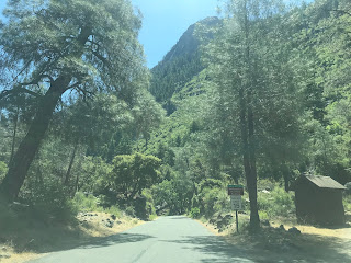
Hetch Hetchy Road has a small entrance station at the boundary of Yosemite National Park.
Hetchy Hetchy Road within Yosemite National Park essentially follows the grade of the Hetch Hetchy Valley Railroad. Hetch Hetch Road begins with a slow descent towards Hetch Hetchy. A couple miles within Yosemite National Park Hetch Hetchy Road intersects the Poopenaut Valley Trail. Poopenaut Valley is located just downstream on the Tuolumne River from Hetch Hetchy Valley.
Hetch Hetchy Road passes by some stone retaining walls that possibly were part of the Hetch Hetchy Railroad grade. Hetch Hetchy Road also passes by the Smith Meadow Trail.
Hetch Hetchy Road descends to the upper flank of Hetch Hetchy Valley and passes by the Hetch Hetchy Backpacker Campground.
Hetch Hetchy Road follows a one-way alignment on the Hetch Hetchy Railroad grade to the O'Shaughnessy Dam and former Lake Eleanor Road.
My hike towards Wapama Falls began at the top of the O'Shaughnessy Dam.
From the O'Shaughnessy Dam spillway it isn't too hard to envision Lake Eleanor Road as it was during the late 1930s.
A look at the face of the O'Shaughnessy Dam.
Hikers are advised of the numerous restrictions of the Hetch Hetch Reservoir. Given Hetch Hetchy is part of a municipal water supply activities in the waters aside from fishing are prohibited.
A look at the top of the O'Shaughnessy Dam spillway.
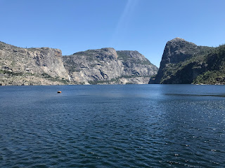
The O'Shaughnessy Dam has numerous historic plaques and a hell of a view of Hetch Hetchy Valley. Wapama Fall could be seen off in the distance to the north but unfortunately Tueeulala Fall was dry.
A look downstream from atop the O'Shaughnessy Dam.
A historic plaque regarding the Hetch Hetchy Railroad can be found atop the O'Shaughnessy Dam.
Lake Eleanor Road once passed through the tunnel located at the western abutment of O'Shaughnessy Dam. The tunnel leads the west shore of the Hetch Hetchy Reservoir.
The end of the tunnel is the start point for the Hetch Hetchy Trail. Wapama Falls is shown as 2.7 miles away.
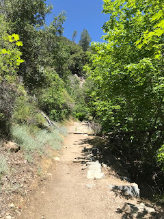
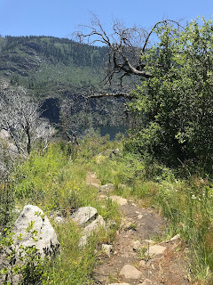
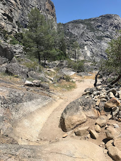
The Hetch Hetchy Trail follows the west shore of the Reservoir and begins to climb in elevation. Long washed out asphalt from Lake Eleanor Road can be found on the Hetch Hetchy Trail amid fallen rocks.
A trail fork is found on the Hetch Hetchy Trail at 0.9 miles. The left fork follows the grade of Lake Eleanor Road to Lake Eleanor. The path to Wapama Falls splits right and is signed as 1.8 miles away.
The Hetch Hetchy Trail swings eastward towards Wapama Falls. The Hetch Hetchy Trail descends from the grade of Lake Eleanor Road to a grassy area near Tueeulala Fall.
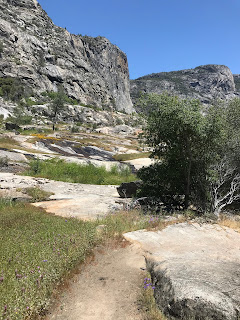
The Hetch Hetchy Trail opens onto a granite rock face which crosses the path of Tueeulala Fall. Tueeulala Fall is fed by Falls Creek much like Wapama Fall but as noted above the former was dry during my hike. Tueelula Fall when flowing has a 880 foot fall over two drops.
The Hetch Hetchy Trail begins to make another ascent towards Wapama Fall within view of Kolana Rock.
Upon reaching a small foot bridge the Hetch Hetchy Trail makes a descent down a stairwell to the reservoir. Approaching the bottom of the stairwell Wapama Fall comes into view.
The Hetch Hetchy Trail crosses the bottom of Wapama Fall via a stone/wooden foot bridge. Wapama Fall has an 1,100 foot three tier drop and carries the main flow of Falls Creek into Hetch Hetchy Valley.
My hike ended overlooking Kolona Rock which towers 2,000 feet over Hetch Hetchy Valley.














Comments