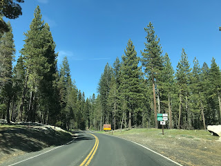
While recently revisiting Yosemite National Park I took a couple minutes to capture some of the California Sign State Route shields posted by the National Park Service ("NPS"). None of the NPS shields were actually posted on roadways maintained by Caltrans but were clearly intended to create route continuity with the Sign State Highways. This phenomenon is not exclusive to Yosemite National Park and can be found on numerous roads not maintained by Caltrans throughout California.

Part 1; Route continuity over who maintains the route
In the very early era of State Highways in California the Division of Highways didn't actually field sign the Auto Trails or even US Routes. The responsibility of Highway signage fell to the California State Automobile Association ("CSAA") and Automobile Club of Southern California ("ACSC"). The Auto Clubs simply signed Highways on roadways that best served navigational purposes. These navigational purposes often didn't include roadways that were maintained by the Division of Highways. In fact it wasn't until 1933 that the State Legislature decided that the Division of Highways could even maintained roadways in Cities during Legislative Chapter 767. Legislative Chapter 767 also added 6,700 miles of existing roads to the State Highway network as Secondary Highways.


The Sign State Routes were announced in a California Highway & Public Works Guide ("CHWP") during August of 1934. In said publication it was clear that the Sign State Routes were meant to supplement the existing US Routes towards enhancing navigation through the State rather than to show Division of Highways maintenance.


Some early Sign State Routes were definitely signed along locally maintained roadways. Below is a summary of examples which can be observed on the 1938 Division of Highways State Map:
- CA 49 between CA 89 in Sierraville to CA 24. This segment of CA 49 was eventually added to the State Highway System:

- CA 28 between Winters and the vicinity of Davis. This segment of CA 28 was eventually added to the State Highway System and in time became CA 128.

- CA 180 between Paicines and Mendota in addition to CA 33 between Mendota and the vicinity of Coalinga. CA 180 between Paicines and Mendota was never added to the State Highway System whereas CA 33 was.

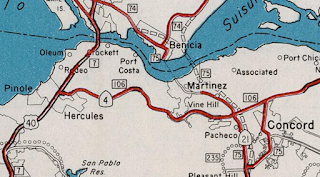
There are numerous additional examples of Sign State Routes on locally controlled roadways which can be found before the 1940s by way of vintage photos. During 1947 the Division of Highways took over signing State Highways. The ACSC continued to sign local roadways until 1956 whereas the CSAA signed local roadways until 1969. The last known example of a Sign State Route being authorized to be signed on a local roadway was CA 21 in Martinez. CA 21 was signed on local roads in Martinz approaching the Benicia-Martinez Ferry before the Benicia-Martinez Bridge opened during 1962. The image below is from the 1961 Division of Highways State Map.
Part 2; the current known "rogue" Sign State Route shields
During the 1964 Highway Renumbering a Sign State Route number was assigned to every State maintained roadway. This system replaced the previous Legislative Route designations to match what said highways were actually field signed as. While on paper this made for an administratively more simple system it had the unintended consequence of Sign State Routes becoming an analog for State maintenance.
Through the Legislative process of relinquishment there is a vehicle by way a local authority may be ordered by the State to continue to sign a Sign State Route. Generally said agreements stipulate that Sign State Routes must continue to be signed on former State Highway segments until the entire State Highway is relinquished. That said, in practice the State has no means to actually force a local authority to continue to sign a Sign State Route on a relinquished State Highway segment. A present example of this would be San Jose not signing CA 130 on Alum Rock Avenue in San Jose.
Some local authorities continue to sign Sign State Routes on non-Caltrans/State maintained roadways. As stated above this is especially prevalent in Yosemite National Park. Below CA 140 is signed on El Portal Road beginning at the intersection of Big Oak Flat Road. The Big Oak Flat Road is signed with "TO" CA 120 signage along with "TO" US 395 from El Portal Road.


Historically the CSAA signed CA 89 through Lassen Volcanic National Park on Lassen Park Highway.


Although there isn't much in the way of overt CA 89 shields on Lassen Park Highway today Caltrans does makes sure that traffic knows it is considered to be a continuation of the highway. This CA 89 shield can be found at the north entrance of Lassen Volcanic National Park at the beginning of Lassen Park Highway.


Part 1; Route continuity over who maintains the route
In the very early era of State Highways in California the Division of Highways didn't actually field sign the Auto Trails or even US Routes. The responsibility of Highway signage fell to the California State Automobile Association ("CSAA") and Automobile Club of Southern California ("ACSC"). The Auto Clubs simply signed Highways on roadways that best served navigational purposes. These navigational purposes often didn't include roadways that were maintained by the Division of Highways. In fact it wasn't until 1933 that the State Legislature decided that the Division of Highways could even maintained roadways in Cities during Legislative Chapter 767. Legislative Chapter 767 also added 6,700 miles of existing roads to the State Highway network as Secondary Highways.


The Sign State Routes were announced in a California Highway & Public Works Guide ("CHWP") during August of 1934. In said publication it was clear that the Sign State Routes were meant to supplement the existing US Routes towards enhancing navigation through the State rather than to show Division of Highways maintenance.


Some early Sign State Routes were definitely signed along locally maintained roadways. Below is a summary of examples which can be observed on the 1938 Division of Highways State Map:
- CA 49 between CA 89 in Sierraville to CA 24. This segment of CA 49 was eventually added to the State Highway System:

- CA 28 between Winters and the vicinity of Davis. This segment of CA 28 was eventually added to the State Highway System and in time became CA 128.

- CA 180 between Paicines and Mendota in addition to CA 33 between Mendota and the vicinity of Coalinga. CA 180 between Paicines and Mendota was never added to the State Highway System whereas CA 33 was.

There are numerous additional examples of Sign State Routes on locally controlled roadways which can be found before the 1940s by way of vintage photos. During 1947 the Division of Highways took over signing State Highways. The ACSC continued to sign local roadways until 1956 whereas the CSAA signed local roadways until 1969. The last known example of a Sign State Route being authorized to be signed on a local roadway was CA 21 in Martinez. CA 21 was signed on local roads in Martinz approaching the Benicia-Martinez Ferry before the Benicia-Martinez Bridge opened during 1962. The image below is from the 1961 Division of Highways State Map.

Part 2; the current known "rogue" Sign State Route shields
During the 1964 Highway Renumbering a Sign State Route number was assigned to every State maintained roadway. This system replaced the previous Legislative Route designations to match what said highways were actually field signed as. While on paper this made for an administratively more simple system it had the unintended consequence of Sign State Routes becoming an analog for State maintenance.
Through the Legislative process of relinquishment there is a vehicle by way a local authority may be ordered by the State to continue to sign a Sign State Route. Generally said agreements stipulate that Sign State Routes must continue to be signed on former State Highway segments until the entire State Highway is relinquished. That said, in practice the State has no means to actually force a local authority to continue to sign a Sign State Route on a relinquished State Highway segment. A present example of this would be San Jose not signing CA 130 on Alum Rock Avenue in San Jose.
Some local authorities continue to sign Sign State Routes on non-Caltrans/State maintained roadways. As stated above this is especially prevalent in Yosemite National Park. Below CA 140 is signed on El Portal Road beginning at the intersection of Big Oak Flat Road. The Big Oak Flat Road is signed with "TO" CA 120 signage along with "TO" US 395 from El Portal Road.

From the Big Oak Flat side of intersection with El Portal Road CA 140 is clearly signed as though it was an active highway in Yosemite National Park. Oddly CA 41 is implied to begin from the Big Oak Flat Road/El Portal Road junction.

At Crane Flat Yosemite National Park signs CA 120 as though it transitions from the Big Oak Flat Road east onto the Tioga Pass Road.


From the Crane Flat gas station the NPS sourced CA 120 shields are very apparent.

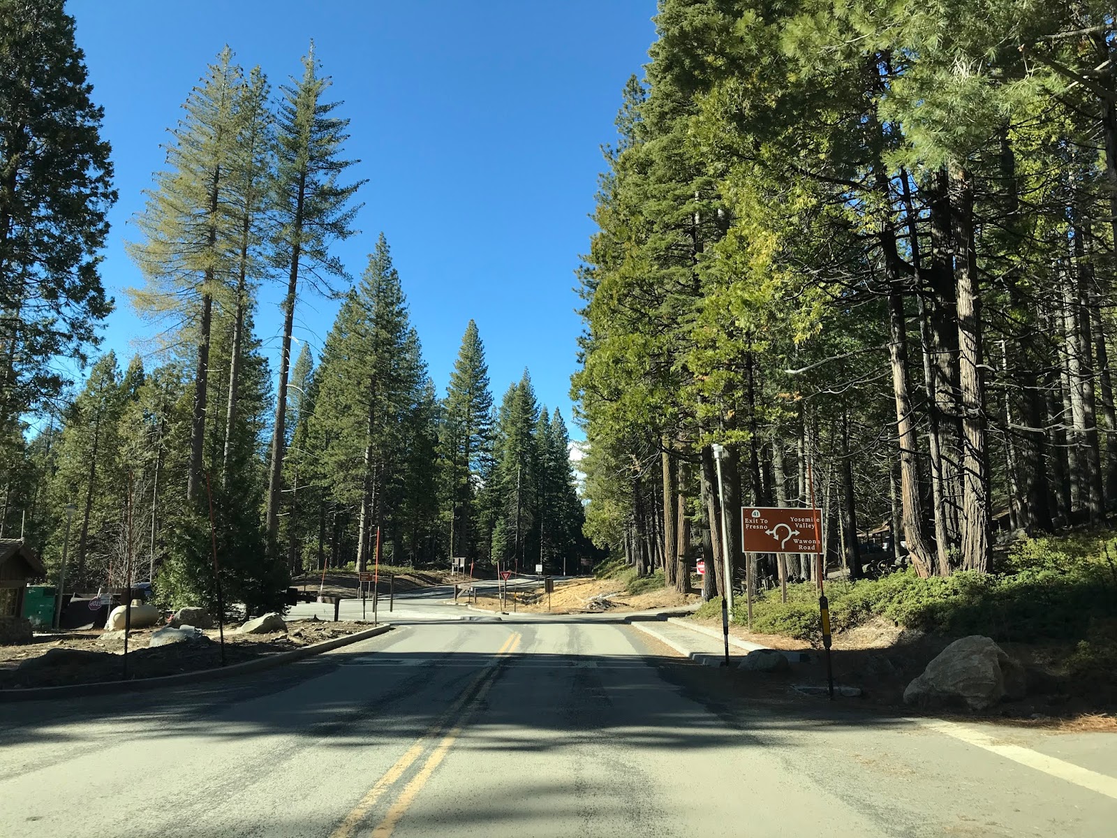
Part of South Side Drive and the Wawona Road are signed as though they are part of CA 41.


CA 41 isn't signed with "TO" signage as the Glacier Point Road ends at the Wawona Road.

Even the Mariposa Grove Roads implies that the Wawona Road is part of CA 41.
A highway advisory sign in Yosemite Valley lists CA 41, CA 140, and CA 120 instead of the Wawona Road, El Portal Road, Big Oak Flat Road, and Tioga Pass Road.

Not all rogue Sign State Route shields are found in National Parks. Presently CA 130 ends at the Lick Observatory atop Mount Hamilton.

But Santa Clara County has crafted their own CA 130 shields which continue the highway from Lick Observatory east via San Antonio Valley Road and Del Puerto Road to the Stanislaus County Line.


CA 180 has a gap in State maintenance within Grant Grove of Kings Canyon National Park, but you wouldn't known it from the NPS sourced signage. Interestingly Kings Canyon National Park even uses a Caltrans spec CA 180 shield headed eastbound.

This CA 180 shield can be found on a guide sign heading west through Grant Grove.

Kings Canyon does make an effort to sign the Generals Highway as "TO" CA 198.

Oddly parts of the Generals Highway are implied by Sequoia National Park to be part of CA 198.


Although there isn't much in the way of overt CA 89 shields on Lassen Park Highway today Caltrans does makes sure that traffic knows it is considered to be a continuation of the highway. This CA 89 shield can be found at the north entrance of Lassen Volcanic National Park at the beginning of Lassen Park Highway.

Comments