
California State Route 200

During 2016 while visiting Northern California I ended up taking California State Route 200 as a cut-off from US Route 101 east to California State Route 299.


CA 200 is a small 3 mile State Highway signed on North Bank Road within Humboldt County near the community of Arcata.  CA 200 follows the north bank of the Mad River and serves as a connector route between US 101 east to CA 299.


Part 1; the history of California State Route 200

North Bank Road along the Mad River existed before it was added to the State Highway System.  North Bank Road can be seen as a connecting road in the vicinity of Arcata between Legislative Route 1 (future US 101) east to Legislative Route 20 (future US 299/CA 299) on the 1917 California State Automobile Association Map of California.


North Bank Road was added to the State Highway System during 1933 as Legislative Route 85.  Legislative Route 85 can be seen aligned between US 101/Legislative Route 1 and US 299/Legislative Route 20 on the 1935 California Division of Highways Map of Humboldt County.


During the 1964 State Highway Renumbering Legislative Route 85 was assigned CA 200.  The change from Legislative Route 85 to CA 200 can be seen on the 1964 Division of Highways State Map.


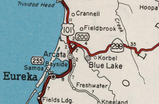
CA 200 appears to have been field signed by 1969 as indicated by the Division of Highways State Map from said year.  Since 1969 there has been virtually no changes to CA 200 and the highway has appeared to have always followed the same general alignment on North Bank Road. 


Part 2; a virtual drive on California State Route 200 westbound

Our virtual drive on CA 200 begins on CA 299 westbound.  CA 299 westbound junctions CA 200 westbound at Exit 2.  Note; all below images are take from Google Street View as I didn't have the presence in mind to take a photo log of CA 200 back during 2016.  


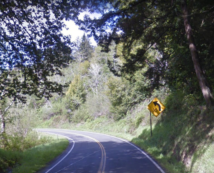
CA 200 west is signed as a bicycle route due to the present expressway status of US 101 and CA 299.  CA 200 initially is wide enough shoulder to accommodate bicycle traffic but quickly narrows. 


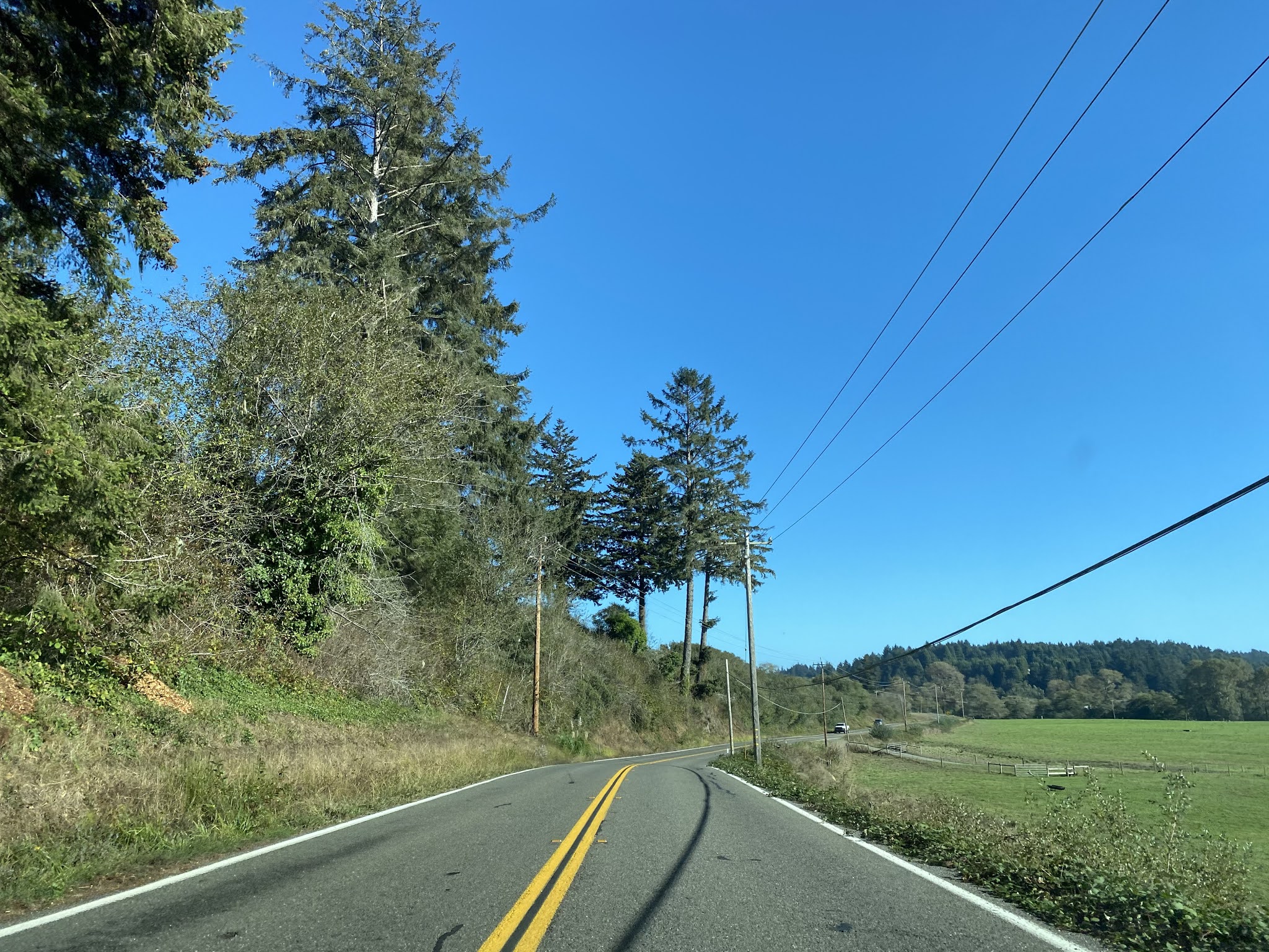
CA 200 upon narrowing approaches a bluff on the north bank of the Mad River.


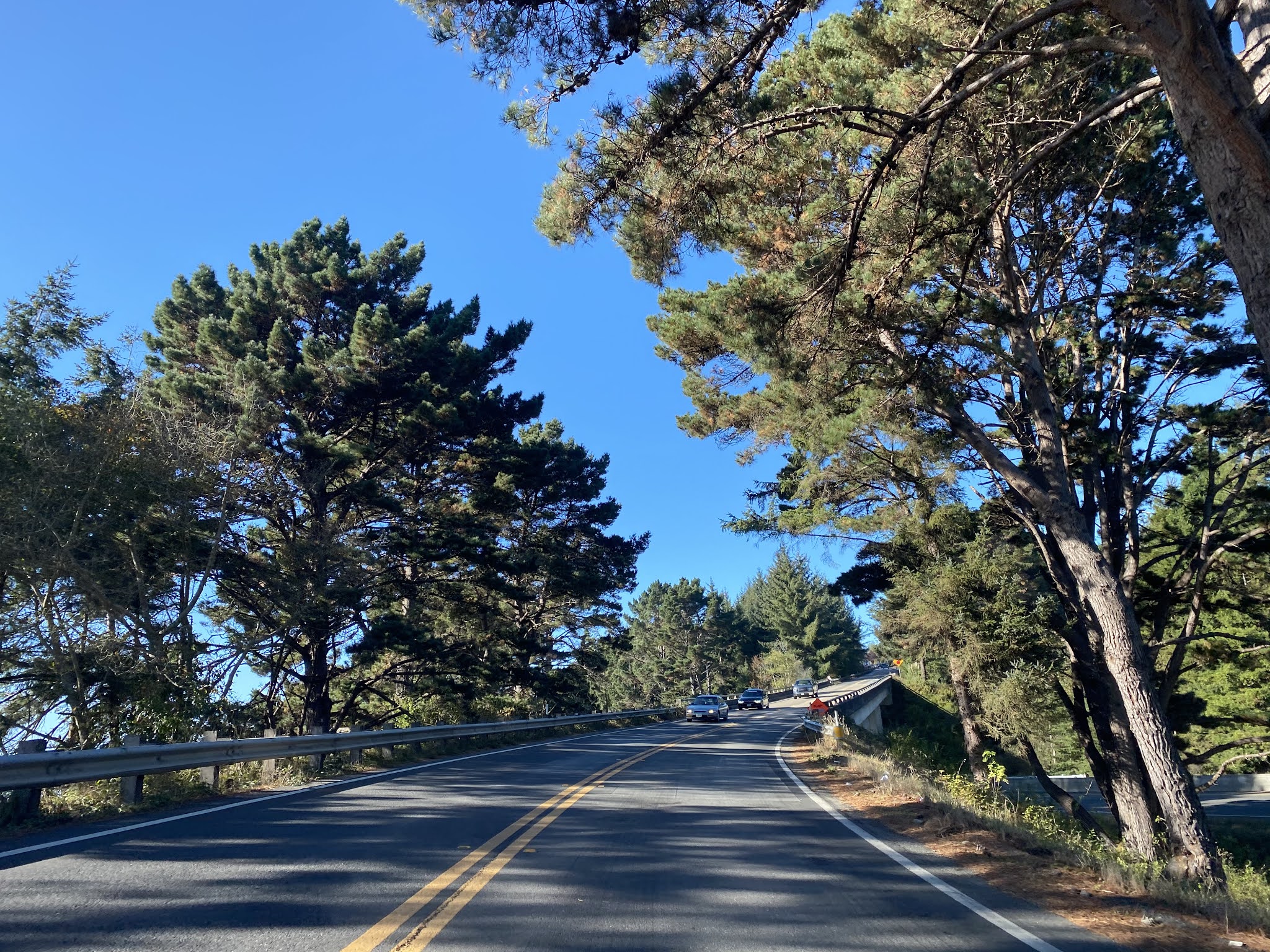
CA 200 west continues on a largely direct line whereas the Mad River meanders away via a gooseneck.  Upon pulling away from the Mad River CA 200 opens onto a valley landscape.


At Post Mile HUM 1.293 CA 200 intersects Azalea Avenue which is the access point for Azalea State Reserve.


CA 200 west again meets the Mad River and climbs to a bluff along the north bank.


CA 200 west terminates at the modern US 101 expressway and an at-grade intersection with US 101 Business on Central Avenue.


Part 3; a drive on California State Route 200 eastbound

From US 101 southbound CA 200 begins from Exit 718 at North Bank Road.  CA 200 eastbound begins at the end of the southbound ramp on the US 101 Business Route.


CA 200 eastbound makes a left hand turn at the US 101 northbound ramp at Postmile HUM R0.42 onto North Bank Road.

Azalea State Preserve is signed as 1 mile away on CA 200 east.  CA 299 is signed as 2 miles away on CA 200 east. 

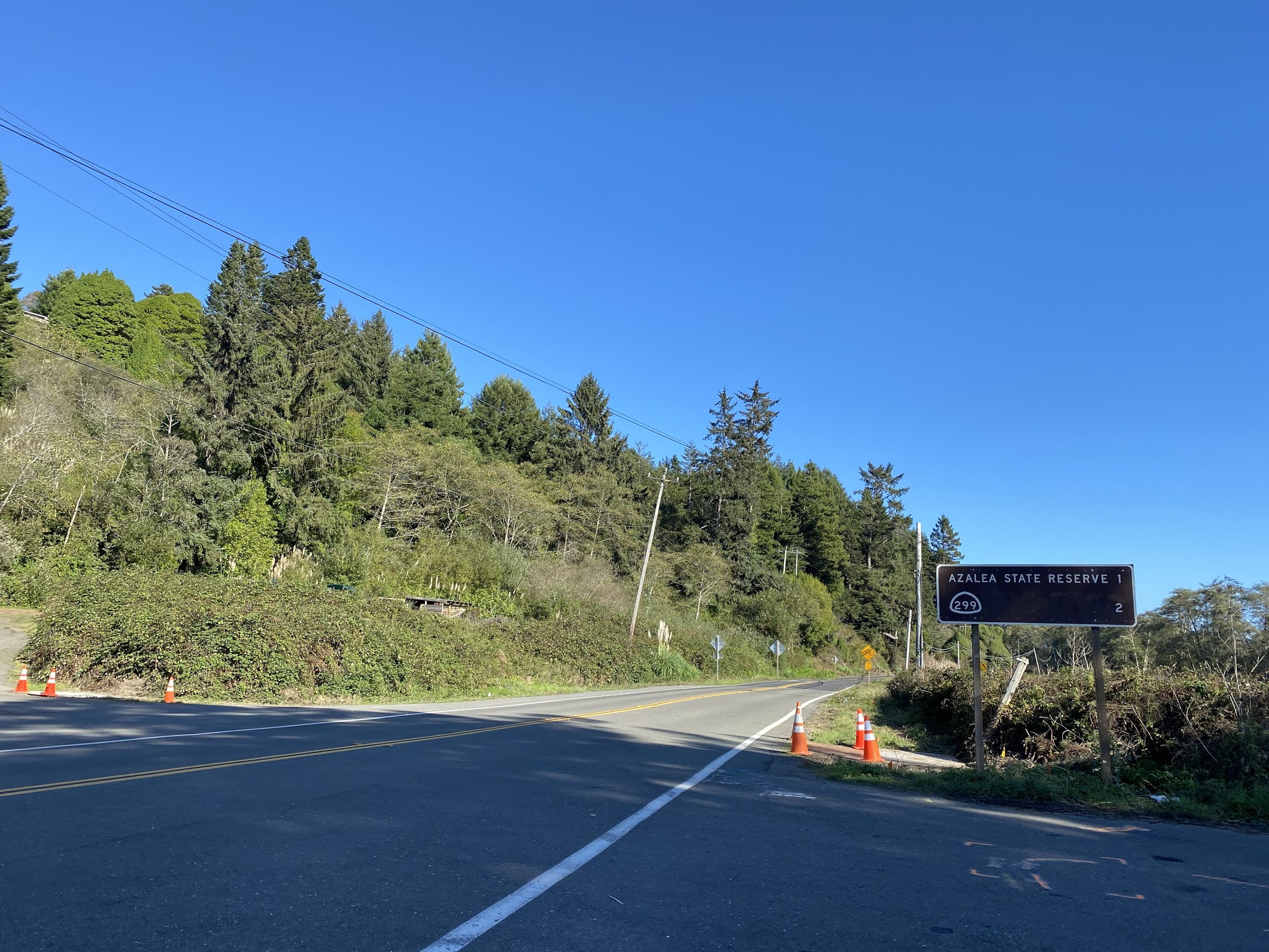
At Postmile HUM 1.289 CA 200 east intersects Azalea Avenue which is signed as access to the Azalea State Reserve. 


CA 200 eastbound follows North Bank Road to a terminus at CA 299.


Comments

Doug-O said…
I am puzzled by the label 'Old Highway 200' that is evident on Google Maps for a road ~5 miles east of the route discussed here that appears to be an old alignment of the Trinity Highway. Why isn't it marked 'Old Highway 299?'

Popular posts from this blog

Did Caltrans just kill the G26 cutout US Route shields?

The US Route System was formally created by the American Association of State Highway Officials during November 1926.  Through the history of the system the only state to which has elected to maintain cutout US Route shields has been California.  The G26 series cutout US Route shields have become a favorite in the road enthusiast hobby and are generally considered to be much more visually pleasing than the standard Federal Highway Administration variant.  However, the G26 shield series appears to have been killed off on January 18, 2026, when Caltrans updated their Manual of Uniform Traffic Control Devices.  This blog will examine the history of the US Route shield specifications in California and what is happening with the 2026 changes.  The blog cover photo is facing towards the terminus of California State Route 136 and at a G26-2 specification US Route 395 shield.  In the background Mount Whitney can be seen in the Sierra Nevada range.   ...

Hawaii Route 50

Hawaii Route 50 is the longest Sign Route on the island of Kauai at 32.6 miles.  The entirety of Hawaii Route 50 is overlaid atop Kaumualii Highway from Lihue west to the Pacific Missile Range Facility at Barking Sands. Hawaii Route 50 is one of the original 1955-era State Highway designations on Kauai.  Much of the Kaumualii Highway corridor was constructed during the sugar plantation boom of the late Hawaiian Kingdom.  The first tee beam bridge in Hawaii would be constructed along the Kaumualii Highway in 1911 at the Hanapepe.  Much of this highway would be modernized to two-lane standards through the 1930s and 1940s. This page is part of the Gribblenation Hawaii Roads series.  A compellation of all Hawaii-related media from both Gribblenation and RoadwayWiz can be found by clicking  here .  Part 1; the history of Hawaii Route 50 and Kaumualii Highway Hawaii Route 50 is the longest highway on Kauai at 32.6 miles.  The highway begins at Rice Str...

Ghost Town Tuesday; Nichols, FL

A couple years ago I spent a lot of spare time exploring phosphate mining ghost towns in the Bone Valley of Polk County, Florida.  One ghost town in particular called Nichols on Polk County Route 676 west of Mulberry caught my eye due to a relative lack of documentation on ghosttowns.com. Nichols was created in 1905 during the early phosphate mining boom in the Bone Valley region.  For the time Nichols was unusual since it had company housing in the Nichols Mine site and private residences outside the gate.  Nichols is only about two miles west of Mulberry which probably made it a somewhat reasonable commute even by the wonky standards of the early 20th Century.  Most of the Bone Valley region was relatively remote which made commuting or homesteading impractical which is why there are so many ghost towns in the area.  The company housing section of Nichols was phased out and abandoned by 1950. The Nichols town site is largely abandoned and could "possibl...