US Route 30/Columbia River Highway; old US 30 on the Historic Columbia River Highway and modern US 30 from Astoria-Portland
This past September I visited Oregon and had a chance to drive a significant segment of US Route 30. Early in the trip I drove from the western terminus of US 30 in Astoria east to Portland. One of the last activities I did in Oregon before departing was driving part of Old US 30 on the Historic Columbia River Highway.

US Route 30 traverses Oregon east from US Route 101 in Astoria to the Idaho State Line. In total US 30 within Oregon carries 477.02 miles of the 3,073 miles which make up the highway. US 30 in Oregon is largely associated with the Historic Columbia River Highway.

Part 1; the history of the Columbia River Highway and US Route 20?
The Columbia River Gorge has been a major corridor of transportation all the way back to the days of the Oregon Trail. The Columbia River Gorge is the lowest mountain pass of the Cascade Range which made it attractive for immigrant wagon trains heading west to Willamette Valley. The Oregon Trail was laid out from 1811 through 1840 by fur trappers. Early travel on the Oregon Trail was primitive and wagon trains had traverse the Columbia River Gorge from The Dalles westward towards modern day Troutdale. Early wagon trains typically floated their wagons down the Columbia River which was considered to be extremely hazardous. Travel on the Oregon Trail began much safer upon the opening of the Barlow Toll Road in 1846. Even still, many immigrant trains opted to still float their wagons from The Dalles through the Columbia River Gorge.
Travel by land in the Columbia River Gorge became viable when the The Dalles & Sandy Wagon Road was funded by the State of Oregon in 1872. The Dalles & Sandy Wagon Road was completed by 1876 and offered much safer passage through the Columbia River Gorge. By1882 much of The Dalles & Sandy Wagon Road was razed for the construction of a rail line by the Oregon Railway & Navigation Company. The era of late 19th Century Travel in the Columbia River Gorge is well documented on beaverstateroads.net.
Orphane Historic Columbia River Highway Segment near Shellrock Mountain\
During the early 20th Century it became apparent that with the emergency of the Automobile that new road was needed in the Columbia River Gorge. With the railroad inhabiting the much more desirable water level route previously used by much of The Dalles & Sandy Wagon Road a new highway would need to be built uphill on less suitable terrain. Multnomah County began constructing a roadway but ran into difficulties near Shellrock Mountain. Prison labor was used at the behest of the Oregon Governor in 1912 to prove that a highway could be built.
What would become the Columbia River Highway was largely designed by engineer Samuel C. Lancaster. By 1913 the Oregon State Highway Commission was formed and work on the Columbia River Highway began in September. By June 27th, 1922 a completion ceremony was held when the final portion of Columbia River Highway was paved near Rowena. The Columbia River Highway was constructed not only with the purpose of transportation in mind but also as a highly scenic Auto Touring corridor. The Columbia River Highway was assigned Highway Number 2 and stretched from Astoria east to Pendleton.
The Columbia River Highway was promoted by the Portland Chamber of Commerce in the below insert guide dated from 1915:


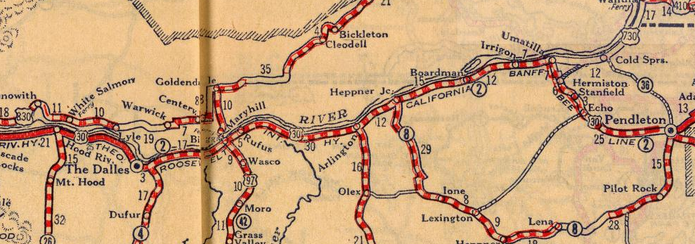
Segments of the Columbia River Highway carried numerous Auto Trail designations:
- The Grant Highway from Astoria east to Pendleton.
- The Theodore Roosevelt Highway from Portland east to Pendleton.
- The Old Oregon Trail from Astoria east to Pendleton.
- The California Banff "B" Line Highway from Biggs east to Pendleton.
The Columbia River Highway along with all the above Auto Trails can be seen on the 1925 Rand McNally Map of Oregon.


During the early phases of what would become the US Route System the Columbia River Highway was planned to become US Route 20. US 20 can be seen routed on the Columbia River Highway on the Report of Joint Board on Interstate Highways dated October 30th, 1925.

Ultimately on the final US Route System approved in November 1926 US Route 30 had been extended from Salt Lake City over the Columbia River Highway to Astoria. US 30 can be seen routed over the Columbia River Highway on the 1927 Rand McNally Map of Oregon.


In 1932 a major realignment of the Columbia River Highway in the Columbia River Gorge was proposed which would shift it a water level alignment. This realignment was completed in 1937 and the original Columbia River Highway in the Columbia River Gorge was retained as a scenic highway. In 1948 the Oneonta Tunnel was bypassed when the railroad grade was moved to landfill. The new alignment of US 30 on the Columbia River Highway in the Columbia River Gorge can be seen on the 1956 Shell Highway Map of Oregon.

The 1937 alignment of the Columbia River Highway would ultimately become part of I-84/US 30 in the Columbia River Gorge. I-84 in the western United States was meant to be designated as I-82 during the drafting phases of the Federal Aid Highway Act of 1956. Ultimately the suffixed designation of I-80N was chosen in 1958 in what I can assume was attempt not to duplicate I-84 on the east coast. By 1977 the AASHTO approved changing I-80N to I-84 which took until 1980 to actually occur completely. I-80N from Portland east through the Columbia River Gorge largely was complete by 1963 and required that a large segment of Historic Columbia River Highway be destroyed. I-80N in the Columbia River Gorge was fully brought up to Interstate Standards in 1968.
Today the Historic Columbia River Highway in the Columbia River Gorge is internally known as Highway Number 100 but is signed as Historic US 30. While much of the Historic Columbia River Highway in the Columbia River Gorge can still be driven many significant segments are completely abandoned or are part of State Trails.


The HCRH is signed as Historic US 30 which can be seen exiting the I-84/US 30 Freeway. Exit 18 directly accesses Crown Point Highway which is only a short distance from the HCRH.


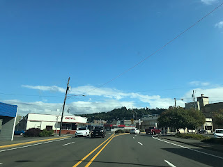
US 30 eastbound takes a left hand turn from 8th Street onto Commercial Street.

US 101 originally accessed the Astoria-Melger Ferry on 14th Street. The Astoria-Megler Ferry operated from 1921 until July 28th 1966 (the day before the Astoria-Megler Bridge opened). The Astoria-Megler Ferry was sold the Oregon Department of Transportation in June of 1946. Bridgehunter.com has numerous vintage photos of the Astoria-Megler Ferry operation and a roster of ferry boats.
USends.com has a detailed history of the US Routes endpoints in Astoria. US 101 northbound originally followed Bond Drive, 7th Street and Commercial Street to 14th Street (which can be seen on the 1939 topographical map of Astoria on historiaerials.com). US 101 was straightened onto a direct alignment to 14th Street likely at sometime in the 1940s. At some point likely in the 1950s US 101/US 26 split onto a one-way coupling on Marine Drive and Commercial Street.
The original western terminus of US 30 was located Marine Drive and 14th Street. The one-way split of US 101/US 26 meant that the eastern start of US 30 was moved to Commercial Street and 14th Street until the Astoria-Megler Ferry shuttered. Once the Astoria-Megler Bridge opened US 30 was extended west to US 101/US 26 at the foot of the bridge. Presently US 30 eastbound traverses downtown Astoria via Commercial Street and passes by 14th Street with little fanfare.


Both travel directions of US 30 converge at 16th Street and Marine Drive. US 30 eastbound merges onto Marine Drive east of downtown Astoria.


US 30 east merges onto Leif Erikson Drive on the outskirts of Astoria. The Goonies House can be seen from 37th Street (the turnoff is in the fourth photo below) south to Duane Street. My wife insisted on stopping, not much could be seen from the street.


US 30 east transition onto the modern Columbia River Highway upon leaving Astoria. Clatskanie is signed as 33 miles away whereas Portland is signed as 94 miles away.


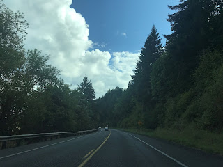
US 30 eastbound on the Columbia River Highway winds through the hilly terrain south of the Columbia River. US 30 eastbound passes by the community of Svensen which is located on Svensen Island Road.


US 30 eastbound on the Columbia River Highway continues traverse a hilly landscape to a turnoff for Bradwood and Clifton at Clifton Road.


US 30 eastbound begins to descend in elevation and approaches an overpass which accesses Taylorville Road. Taylorville Road directly accesses Taylorville and Wauna.


US 30 eastbound on the Columbia River Highway enters Westport. Access to the Wahkiakum Ferry is signed via Westport Ferry Road. The Wahkiakum County Ferry and is the last regularly scheduled automotive ferry over the Columbia River. The Wahkiakum County Ferry began operation in 1925 and became part of WA 409 in 1969.


Clatskanie is signed 9 miles east of Westport on US 30 whereas Portland is signed as 71 miles away.


US 30 eastbound on the Columbia River Highway enters Columbia County and meets OR 47 in Clatskaine.


Clatskanie is named after the Clatskanie River which passes through the community. Clatskanie incorporated as a City in 1891. US 30 eastbound passes through Clatskanie which is co-signed as part of the Lewis & Clark Trail near the eastern City Limit.


Rainier is signed 14 miles east of Clatskanie on the Columbia River Highway whereas Portland is signed as 60 miles away.

US 30 eastbound on the Columbia River Highway has a weigh station near Beaver Creek.


US 30 eastbound begins to descend downhill towards Rainier with Lewis & Clark Bridge within full view over the Columbia River. Access to the Lewis & Clark Bridge is provided by a fully controlled interchange.


The Lewis & Clark Bridge is maintained by WADOT and carries WA 433 over the Columbia River. The Lewis & Clark Bridge is a cantilever structure which opened to traffic as a private facility known as the Longview Bridge in 1930. The State of Washington purchased the Longview Bridge in 1947 and removed the tolls in 1965. The modern name of the Lewis & Clark Bridge was came in 1980, the structure is 8,288 feet in length.

St. Helens is signed as 20 miles away on the Columbia River Highway upon entering Rainier whereas Portland is signed as 48 miles away.


US 30 eastbound passes through downtown Rainier on the Columbia River Highway. Rainier was founded in 1851 and incorporated in 1881.


US 30 eastbound on the Columbia River Highway passes by another weigh station near the turn-off for Camp Wilkerson County Park at Canaan Road.


US 30 eastbound on the Columbia River Highway crosses a set of railroad tracks and begins to swing southward towards Portland following the Columbia River. US 30 eastbound passes through the communities of Deer Island and Columbia City before entering St. Helens. St. Helens is the Columbia County Seat and was founded in 1845 as Plymouth. St. Helens assumed it's modern name in 1850 and incorporated in 1889.


US 30 eastbound on the Columbia River Highway passes through the communities of; McNulty, Warren, and Scappoosee before entering a Safety Corridor at the Multnomah County Line.


Upon entering Multnomah County US 30 eastbound has a major junction with Cornelius Pass Road.


Portland is signed as 10 miles to the east on US 30 beyond Cornelius Pass Road upon entering Burlington.


US 30 eastbound on the Columbia River Highway passes by the Sauvie Island Bridge at Sauvie Island Road. The present Sauvie Island Bridge opened in 2008 and is a tied arch span. The original Sauvie Island Bridge was a Parker Truss span which opened in 1950.


East of the Sauvie Island Bridge US 30 enters the City of Portland and is signed on St. Helens Road.

US 30 eastbound splits into a bypass route via the St. Johns Bridge which is accessed by Bridge Street. Mainline US 30 eastbound continues under the St. Johns Bridge via St. Helens Road. The St. Johns Bridge crosses the Willamette River on a suspension span which is 400 in height and opened to traffic in 1931. The St. Johns Bridge 2,067 feet in length and was the first non-movable bridge over the Willamette River.


From US 30 eastbound on St. Helens Road near Doane Point the Burlington Northern Railroad Bridge 5.1 ("5.1 Bridge") can be seen. The 5.1 Bridge is owned by the BNSF Railway and opened over the Willamette River in 1908 as part of the Spokane, Portland & Seattle Railway. Interestingly the 5.1 Bridge was a swing-span design from 1908 to 1989 when it was converted to a vertical lift structure. The 5.1 Bridge spans 1,756 feet above the Willamette River.

US 30 eastbound transitions onto Yeon Avenue and merges onto I-405 northbound. My hotel was off the Sunset Highway so I followed I-405 southbound towards US 26.


US Route 30 traverses Oregon east from US Route 101 in Astoria to the Idaho State Line. In total US 30 within Oregon carries 477.02 miles of the 3,073 miles which make up the highway. US 30 in Oregon is largely associated with the Historic Columbia River Highway.

Part 1; the history of the Columbia River Highway and US Route 20?
The Columbia River Gorge has been a major corridor of transportation all the way back to the days of the Oregon Trail. The Columbia River Gorge is the lowest mountain pass of the Cascade Range which made it attractive for immigrant wagon trains heading west to Willamette Valley. The Oregon Trail was laid out from 1811 through 1840 by fur trappers. Early travel on the Oregon Trail was primitive and wagon trains had traverse the Columbia River Gorge from The Dalles westward towards modern day Troutdale. Early wagon trains typically floated their wagons down the Columbia River which was considered to be extremely hazardous. Travel on the Oregon Trail began much safer upon the opening of the Barlow Toll Road in 1846. Even still, many immigrant trains opted to still float their wagons from The Dalles through the Columbia River Gorge.
Travel by land in the Columbia River Gorge became viable when the The Dalles & Sandy Wagon Road was funded by the State of Oregon in 1872. The Dalles & Sandy Wagon Road was completed by 1876 and offered much safer passage through the Columbia River Gorge. By1882 much of The Dalles & Sandy Wagon Road was razed for the construction of a rail line by the Oregon Railway & Navigation Company. The era of late 19th Century Travel in the Columbia River Gorge is well documented on beaverstateroads.net.
Orphane Historic Columbia River Highway Segment near Shellrock Mountain\
During the early 20th Century it became apparent that with the emergency of the Automobile that new road was needed in the Columbia River Gorge. With the railroad inhabiting the much more desirable water level route previously used by much of The Dalles & Sandy Wagon Road a new highway would need to be built uphill on less suitable terrain. Multnomah County began constructing a roadway but ran into difficulties near Shellrock Mountain. Prison labor was used at the behest of the Oregon Governor in 1912 to prove that a highway could be built.
What would become the Columbia River Highway was largely designed by engineer Samuel C. Lancaster. By 1913 the Oregon State Highway Commission was formed and work on the Columbia River Highway began in September. By June 27th, 1922 a completion ceremony was held when the final portion of Columbia River Highway was paved near Rowena. The Columbia River Highway was constructed not only with the purpose of transportation in mind but also as a highly scenic Auto Touring corridor. The Columbia River Highway was assigned Highway Number 2 and stretched from Astoria east to Pendleton.
The Columbia River Highway was promoted by the Portland Chamber of Commerce in the below insert guide dated from 1915:


Segments of the Columbia River Highway carried numerous Auto Trail designations:
- The Grant Highway from Astoria east to Pendleton.
- The Theodore Roosevelt Highway from Portland east to Pendleton.
- The Old Oregon Trail from Astoria east to Pendleton.
- The California Banff "B" Line Highway from Biggs east to Pendleton.
The Columbia River Highway along with all the above Auto Trails can be seen on the 1925 Rand McNally Map of Oregon.


During the early phases of what would become the US Route System the Columbia River Highway was planned to become US Route 20. US 20 can be seen routed on the Columbia River Highway on the Report of Joint Board on Interstate Highways dated October 30th, 1925.
Ultimately on the final US Route System approved in November 1926 US Route 30 had been extended from Salt Lake City over the Columbia River Highway to Astoria. US 30 can be seen routed over the Columbia River Highway on the 1927 Rand McNally Map of Oregon.

In 1932 a major realignment of the Columbia River Highway in the Columbia River Gorge was proposed which would shift it a water level alignment. This realignment was completed in 1937 and the original Columbia River Highway in the Columbia River Gorge was retained as a scenic highway. In 1948 the Oneonta Tunnel was bypassed when the railroad grade was moved to landfill. The new alignment of US 30 on the Columbia River Highway in the Columbia River Gorge can be seen on the 1956 Shell Highway Map of Oregon.

The 1937 alignment of the Columbia River Highway would ultimately become part of I-84/US 30 in the Columbia River Gorge. I-84 in the western United States was meant to be designated as I-82 during the drafting phases of the Federal Aid Highway Act of 1956. Ultimately the suffixed designation of I-80N was chosen in 1958 in what I can assume was attempt not to duplicate I-84 on the east coast. By 1977 the AASHTO approved changing I-80N to I-84 which took until 1980 to actually occur completely. I-80N from Portland east through the Columbia River Gorge largely was complete by 1963 and required that a large segment of Historic Columbia River Highway be destroyed. I-80N in the Columbia River Gorge was fully brought up to Interstate Standards in 1968.
Today the Historic Columbia River Highway in the Columbia River Gorge is internally known as Highway Number 100 but is signed as Historic US 30. While much of the Historic Columbia River Highway in the Columbia River Gorge can still be driven many significant segments are completely abandoned or are part of State Trails.

Part 2; a drive on the Historic Columbia River Highway in the Columbia River Gorge
I began my drive on the Historic Columbia River Highway ("HCRH") at the tail of my Oregon trip in the late afternoon. My approach to the HCRH was via I-84/US 30 eastbound where I pulled off the modern freeway after crossing the Sandy River via Exit 18. Exit 18 is signed as access to Lewis & Clark State Recreation Site.


The HCRH is signed as Historic US 30 which can be seen exiting the I-84/US 30 Freeway. Exit 18 directly accesses Crown Point Highway which is only a short distance from the HCRH.

The the connecting Crown Point Highway crosses under a railroad bridge at the Lewis & Clark State Recreation Site.


Crown Point Highway connects to the HCRH at the 1912 Troutdale Bridge. The 1912 Troutdale Bridge is a Pratt Truss design which spans the Sandy River and is 363.9 feet long.


The HCRH east of the Sandy River is co-signed as Historic US 30 along with occasional Historic Columbia River Highway shields.


The HCRH eastbound follows the bank of the Sandy River to an intersection with the 1914 Stark Street Bridge.


Springdale, the Vista House, and Multnomah Falls are signed as destinations on the HCRH east of Stark Street.


The HCRH eastbound passes through Springdale and Corbett. Springdale was named for the numerous springs located in the area. The western parts of Springdale were apparently known as "Gage" until circa 1903. Corbett was settled in the 1880s by Senator Corbett and the community assumed his name by 1895.


From Corbett the HCRH eastbound is signed as 3 miles from Crown Point/Vista House and 11 miles from Multnomah Falls.

East of Corbett the HCRH crosses by the Portland Women's Forum Scenic Viewpoint.


The HCRH splits left at Larch Mountain Road and the signature white barriers begin to appear.


The Columbia River Gorge can be spied below the eastbound HCRH.


The HCRH eastbound approaches Crown Point and the Vista House.


Crown Point is located 733 feet above the Columbia River and overlooks the Columbia River Gorge. Crown Point was designated as National Natural Landmark in 1971.


The HCRH wraps around the Vista House at Crown Point. The Vista House was completed in 1918 and was recently restored in 2000. The Vista House was designed by Edgar Lazarus and was under construction for two years.

A plaque dedicated to Samuel Lancaster adorns the entrance to the Vista House.

The ground floor has a plaque describing the history of the construction of the Vista House.


From the roof of the Vista House the Columbia River Gorge is easily observed.


The basement of the Vista House has numerous plaques on the history of the Columbia River Highway.


The best views of the Columbia River Gorge at the Vista House are located on the sidewalk along the HCRH.


East of the Vista House the HCRH winds above the Columbia River Gorge passing through the community of Latourell before crossing the Latourell Creek Bridge. The Latourell Creek Bridge was completed in 1914 and features a concrete arch design. Latourell Creek Bridge crosses Latourell Falls which are part of Guy W. Talbot State Park. Latourell was established in 1876 and once had a river level rail siding.


The HCRH eastbound continues through Shepperd's Dell and crosses the Shepperd's Dell Bridge over Young Creek. The Shepperd's Dell Bridge was completed in 1914 and is also an arch concrete design.


I continued east on the HCRH to the Bridal View State Scenic Viewpoint.


Bridal Viel Fall is located at the end of a small trail from a parking area off the HCRH.


The HCRH eastbound continues over Bridal Viel Creek on the namesake Bridal Viel Creek. The Bridal Viel Creek Bridge was opened in 1914 and features a somewhat unique Girder design.


I continued east on the HCRH towards Angel's Rest Trailhead. I turned around towards Portland via Bridal Viel Road towards I-84/US 30 westbound due to Multnomah Falls being closed due to heavy holiday crowding.


Part 3; a drive on US 30/Columbia River Highway from US 101 in Astoria to I-405 in Portland
Early in my Oregon trip I headed out to Cannon Beach by way of US 26 west on the Sunset Highway from Portland. Not wanting to backtrack to Portland east on US 26 I decided to head north on US 101 to Astoria and follow US 30 instead. After returning to Oregon after crossing the Astoria-Megler Bridge I turned east on US 30 towards Portland. From the start of US 30 in Astoria the highway crosses the country and ends in Atlantic City, NJ at a distance of 3,073 miles away.

Astoria is the County Seat of Clatsop County and is the oldest American
settlement west of the Rocky Mountains having been founded in 1811.
Astoria was incorporated as a City in 1876 and grew to a peak population
of about 14,000 residents by the 1920 due to it's fortunate location at
the mouth of the Columbia River. Astoria is a common movie and TV
backdrop but is mostly known for being the setting of The Goonies.
US 30 eastbound crosses under the Astoria-Megler Bridge via Marine Drive and enters downtown Astoria. US 30 splits onto a one-way alignment in downtown Astoria via 8th Street.


US 101 originally accessed the Astoria-Melger Ferry on 14th Street. The Astoria-Megler Ferry operated from 1921 until July 28th 1966 (the day before the Astoria-Megler Bridge opened). The Astoria-Megler Ferry was sold the Oregon Department of Transportation in June of 1946. Bridgehunter.com has numerous vintage photos of the Astoria-Megler Ferry operation and a roster of ferry boats.
USends.com has a detailed history of the US Routes endpoints in Astoria. US 101 northbound originally followed Bond Drive, 7th Street and Commercial Street to 14th Street (which can be seen on the 1939 topographical map of Astoria on historiaerials.com). US 101 was straightened onto a direct alignment to 14th Street likely at sometime in the 1940s. At some point likely in the 1950s US 101/US 26 split onto a one-way coupling on Marine Drive and Commercial Street.
The original western terminus of US 30 was located Marine Drive and 14th Street. The one-way split of US 101/US 26 meant that the eastern start of US 30 was moved to Commercial Street and 14th Street until the Astoria-Megler Ferry shuttered. Once the Astoria-Megler Bridge opened US 30 was extended west to US 101/US 26 at the foot of the bridge. Presently US 30 eastbound traverses downtown Astoria via Commercial Street and passes by 14th Street with little fanfare.


Both travel directions of US 30 converge at 16th Street and Marine Drive. US 30 eastbound merges onto Marine Drive east of downtown Astoria.


US 30 east merges onto Leif Erikson Drive on the outskirts of Astoria. The Goonies House can be seen from 37th Street (the turnoff is in the fourth photo below) south to Duane Street. My wife insisted on stopping, not much could be seen from the street.


US 30 east transition onto the modern Columbia River Highway upon leaving Astoria. Clatskanie is signed as 33 miles away whereas Portland is signed as 94 miles away.


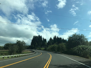
US 30 eastbound on the Columbia River Highway winds through the hilly terrain south of the Columbia River. US 30 eastbound passes by the community of Svensen which is located on Svensen Island Road.


US 30 eastbound on the Columbia River Highway continues traverse a hilly landscape to a turnoff for Bradwood and Clifton at Clifton Road.


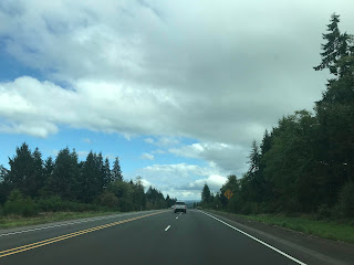
US 30 eastbound begins to descend in elevation and approaches an overpass which accesses Taylorville Road. Taylorville Road directly accesses Taylorville and Wauna.


US 30 eastbound on the Columbia River Highway enters Westport. Access to the Wahkiakum Ferry is signed via Westport Ferry Road. The Wahkiakum County Ferry and is the last regularly scheduled automotive ferry over the Columbia River. The Wahkiakum County Ferry began operation in 1925 and became part of WA 409 in 1969.


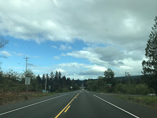
Clatskanie is signed 9 miles east of Westport on US 30 whereas Portland is signed as 71 miles away.


US 30 eastbound on the Columbia River Highway enters Columbia County and meets OR 47 in Clatskaine.


Clatskanie is named after the Clatskanie River which passes through the community. Clatskanie incorporated as a City in 1891. US 30 eastbound passes through Clatskanie which is co-signed as part of the Lewis & Clark Trail near the eastern City Limit.


Rainier is signed 14 miles east of Clatskanie on the Columbia River Highway whereas Portland is signed as 60 miles away.

US 30 eastbound on the Columbia River Highway has a weigh station near Beaver Creek.


US 30 eastbound begins to descend downhill towards Rainier with Lewis & Clark Bridge within full view over the Columbia River. Access to the Lewis & Clark Bridge is provided by a fully controlled interchange.


The Lewis & Clark Bridge is maintained by WADOT and carries WA 433 over the Columbia River. The Lewis & Clark Bridge is a cantilever structure which opened to traffic as a private facility known as the Longview Bridge in 1930. The State of Washington purchased the Longview Bridge in 1947 and removed the tolls in 1965. The modern name of the Lewis & Clark Bridge was came in 1980, the structure is 8,288 feet in length.

St. Helens is signed as 20 miles away on the Columbia River Highway upon entering Rainier whereas Portland is signed as 48 miles away.


US 30 eastbound passes through downtown Rainier on the Columbia River Highway. Rainier was founded in 1851 and incorporated in 1881.


US 30 eastbound on the Columbia River Highway passes by another weigh station near the turn-off for Camp Wilkerson County Park at Canaan Road.


US 30 eastbound on the Columbia River Highway crosses a set of railroad tracks and begins to swing southward towards Portland following the Columbia River. US 30 eastbound passes through the communities of Deer Island and Columbia City before entering St. Helens. St. Helens is the Columbia County Seat and was founded in 1845 as Plymouth. St. Helens assumed it's modern name in 1850 and incorporated in 1889.


US 30 eastbound on the Columbia River Highway passes through the communities of; McNulty, Warren, and Scappoosee before entering a Safety Corridor at the Multnomah County Line.


Upon entering Multnomah County US 30 eastbound has a major junction with Cornelius Pass Road.


Portland is signed as 10 miles to the east on US 30 beyond Cornelius Pass Road upon entering Burlington.


US 30 eastbound on the Columbia River Highway passes by the Sauvie Island Bridge at Sauvie Island Road. The present Sauvie Island Bridge opened in 2008 and is a tied arch span. The original Sauvie Island Bridge was a Parker Truss span which opened in 1950.


East of the Sauvie Island Bridge US 30 enters the City of Portland and is signed on St. Helens Road.

US 30 eastbound splits into a bypass route via the St. Johns Bridge which is accessed by Bridge Street. Mainline US 30 eastbound continues under the St. Johns Bridge via St. Helens Road. The St. Johns Bridge crosses the Willamette River on a suspension span which is 400 in height and opened to traffic in 1931. The St. Johns Bridge 2,067 feet in length and was the first non-movable bridge over the Willamette River.


From US 30 eastbound on St. Helens Road near Doane Point the Burlington Northern Railroad Bridge 5.1 ("5.1 Bridge") can be seen. The 5.1 Bridge is owned by the BNSF Railway and opened over the Willamette River in 1908 as part of the Spokane, Portland & Seattle Railway. Interestingly the 5.1 Bridge was a swing-span design from 1908 to 1989 when it was converted to a vertical lift structure. The 5.1 Bridge spans 1,756 feet above the Willamette River.

US 30 eastbound transitions onto Yeon Avenue and merges onto I-405 northbound. My hotel was off the Sunset Highway so I followed I-405 southbound towards US 26.


Comments