
(Editor's Note: While there's some slow time in the few week's before
we have a new addition to the family, I'm trying to catch up on blog
entries that I wanted to post or started but never completed. This is
another one of those entries.)
Day 2 of the Florida Trip was the haul from Tampa to Key West. It was more interesting than the ride from Raleigh to Tampa and a lot more photos this time as well. For the photo proof, you can head to flickr.
Route: I-275, I-75, FL 951, US 41, FL 991, US 1.
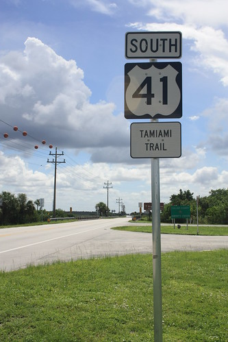
We decided to take US 41, the Tamiami Trail, instead of I-75/Alligator Alley and it was actually a pretty nice ride. Even if this poorly made US highway shield was up along the route.
Just east of where US 41 meets FL 29 is the Ochopee Post Office. One of a series of Post Offices that claim to be the country's or world's smallest post office.
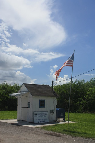
Now I have been to the "World's Smallest Mailing Office" in Silver Lake, WV. Unlike Silver Lake, Ochopee is still a functioning Post Office. It's a former irrigation shed that was pressed into service in 1953 after a fire destroyed the Ochopee General Store, which housed the Post Office. It was closed when we went through.
We turned onto FL 997 and I was amazed at the number of Avacado stands and tropical plant nurseries there were along the entire route. It was certainly something I wasn't used to seeing.
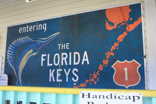
For roadgeeks, finding a fast-disappearing colored US Route Shield is an accomplishment. I wasn't expecting to find one, but when we stopped at the Florida Keys Visitor Center in Key Largo. They preserved one.
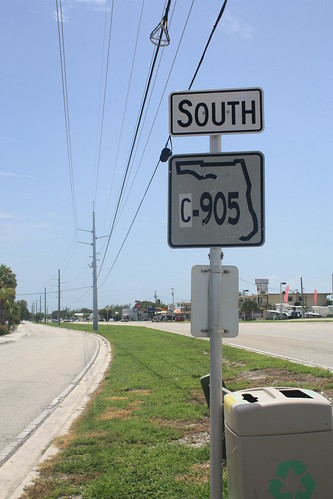
We also saw an I think rare Monroe County C-905 marker.
We also stopped at the Florida Keys Memorial, honoring those that died in the 1935 Labor Day Hurricane, in Islamorada.
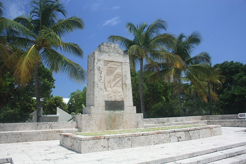
The 1935 Labor Day Hurricane is one of the most powerful hurricanes to ever hit the United States. The Category 5 Hurricane killed over 400 people. Many of which were WPA workers and their families.
We also stopped at the Seven Mile Bridge.
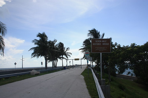
The newer structure, built in 1982, replaced a rail bridge constructed in 1912 for Henry Flagler's Overseas Railroad. When the 1935 Labor Day Hurricane destroyed much of the railroad, the federal government took over and converted the rail bridge to a highway bridge. Fortunately, there's a good bit of the original span still standing and is used as a walking and bike trail today.
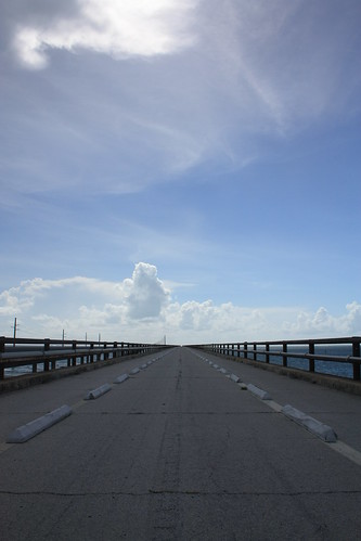
I can't imagine how anyone could drive on that narrow of a highway for nearly 50 years!
With that it was onto Key West...and Part 3 of the trip "Exploring Key West" next to come.
Day 2 of the Florida Trip was the haul from Tampa to Key West. It was more interesting than the ride from Raleigh to Tampa and a lot more photos this time as well. For the photo proof, you can head to flickr.
Route: I-275, I-75, FL 951, US 41, FL 991, US 1.
We decided to take US 41, the Tamiami Trail, instead of I-75/Alligator Alley and it was actually a pretty nice ride. Even if this poorly made US highway shield was up along the route.
Just east of where US 41 meets FL 29 is the Ochopee Post Office. One of a series of Post Offices that claim to be the country's or world's smallest post office.
Now I have been to the "World's Smallest Mailing Office" in Silver Lake, WV. Unlike Silver Lake, Ochopee is still a functioning Post Office. It's a former irrigation shed that was pressed into service in 1953 after a fire destroyed the Ochopee General Store, which housed the Post Office. It was closed when we went through.
We turned onto FL 997 and I was amazed at the number of Avacado stands and tropical plant nurseries there were along the entire route. It was certainly something I wasn't used to seeing.
For roadgeeks, finding a fast-disappearing colored US Route Shield is an accomplishment. I wasn't expecting to find one, but when we stopped at the Florida Keys Visitor Center in Key Largo. They preserved one.
We also saw an I think rare Monroe County C-905 marker.
We also stopped at the Florida Keys Memorial, honoring those that died in the 1935 Labor Day Hurricane, in Islamorada.
The 1935 Labor Day Hurricane is one of the most powerful hurricanes to ever hit the United States. The Category 5 Hurricane killed over 400 people. Many of which were WPA workers and their families.
We also stopped at the Seven Mile Bridge.
The newer structure, built in 1982, replaced a rail bridge constructed in 1912 for Henry Flagler's Overseas Railroad. When the 1935 Labor Day Hurricane destroyed much of the railroad, the federal government took over and converted the rail bridge to a highway bridge. Fortunately, there's a good bit of the original span still standing and is used as a walking and bike trail today.
I can't imagine how anyone could drive on that narrow of a highway for nearly 50 years!
With that it was onto Key West...and Part 3 of the trip "Exploring Key West" next to come.
Comments