
Let's take a break from the Catching Up posts and how about a blog entry from a trip taken this year!
Yesterday, Joe Babyak and I took a brief trip exploring Eastern Wake County. We also got into Nash and Franklin Counties. And this trip proved once again that sometimes there's a lot you can find on a roadtrip just in your back yard.
For the entire trip set on flickr, head here.
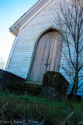
Our first stop was an abandoned country church off of Mial Plantation Road which is a few miles nearby. I have taken photos of this church before, but now that I have Lightroom 4 - I decided to play around with various editing settings.
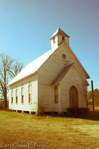
I am not sure the name or denomination of this old country church. There is an old family cemetery behind it belonging to the Auton Family, and all of the grave sites date to early 20th century.
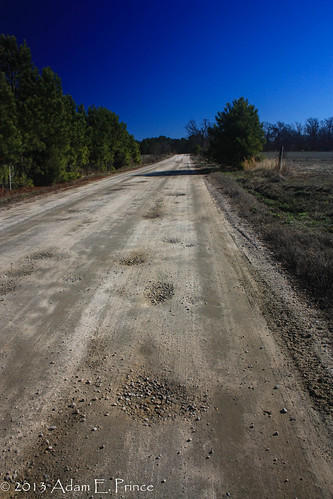
What's also interesting about the area surrounding the church is that it is one of the rare rural dirt roads still left in Wake County.
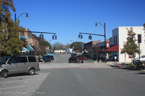
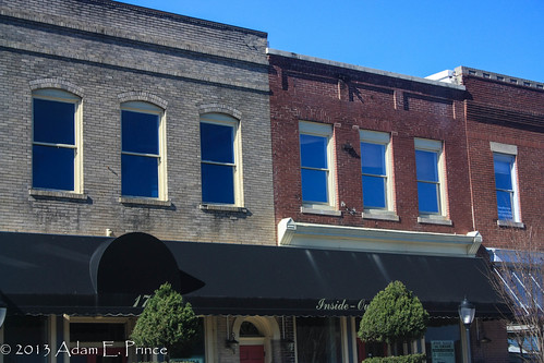
We then worked our way back onto Business US 64 and did a brief photo walk through the town of Wendell.
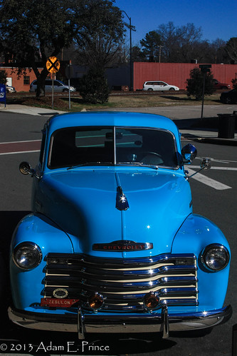
Saw a great classic Chevy Truck.
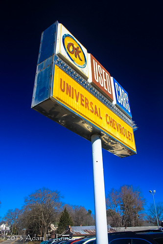
And a decently old OK Used Cars sign for Universal Chevrolet.
Outside of town along Business US 64, we came along a Blue Star Memorial Highway marker. This marker was recently restored by the local American Legion and Garden Club. It is amazing to me how much that blue just pops out on the sign when you look at it close up.
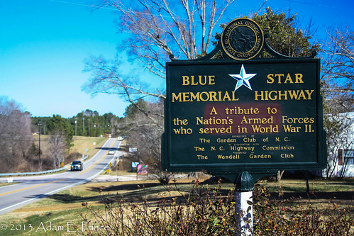
Blue Star Memorial Highways and the accompanying markers began shortly after World War II by the National Council of Garden Clubs. US 64 in North Carolina is a Blue Star Memorial Highway. Since then, the program includes Memorial By-Ways and Memorials. A Blue Star Memorial Marker is located in our town of Knightdale.
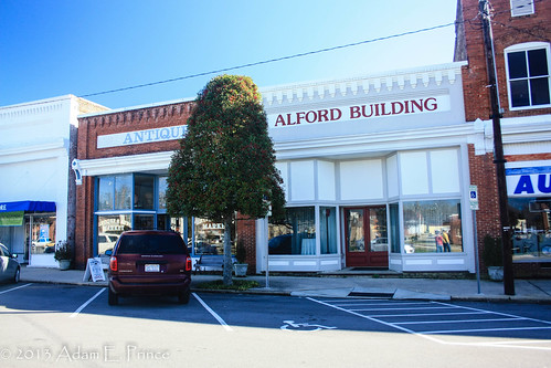
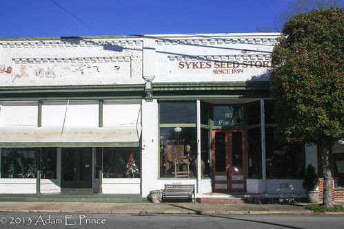
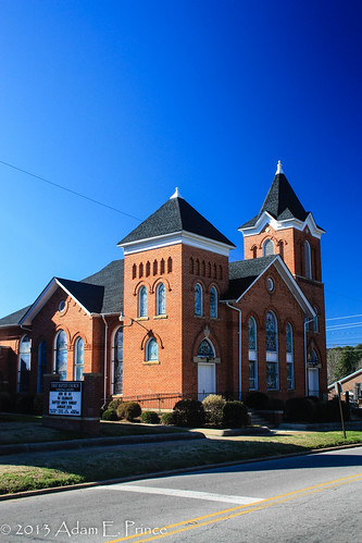
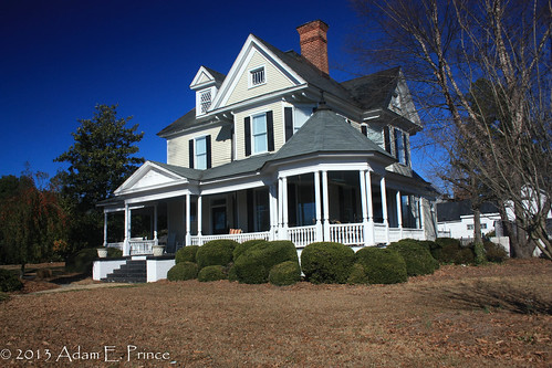
After stopping for lunch in Zebulon, the next town to be explored was Spring Hope. Located on US 64 Alternate in Nash County. Spring Hope is a rather pleasant small town with some great old commercial buildings, churches and homes.
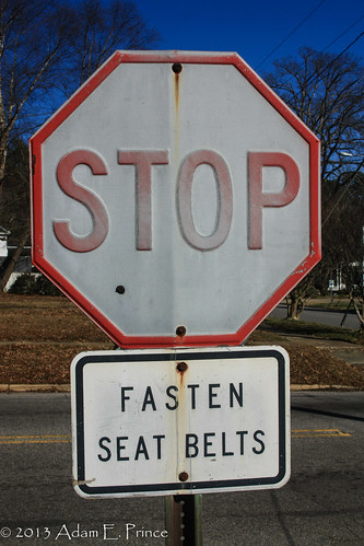
And it never seems to fail, that inside a rural small town post office parking lot, you'll find an old embossed STOP sign.
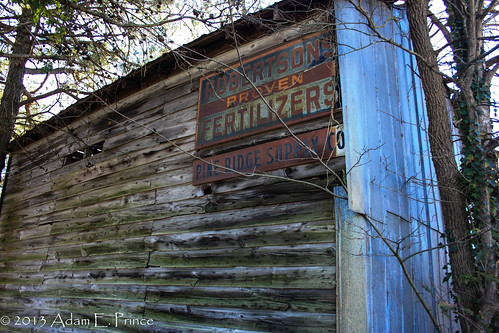
From Spring Hope we continued on US 64 Alternate as it transitioned into an un-numbered old alignment, "Old US 64". In Franklin County, we came across this old Robertson Fertilizers sign.
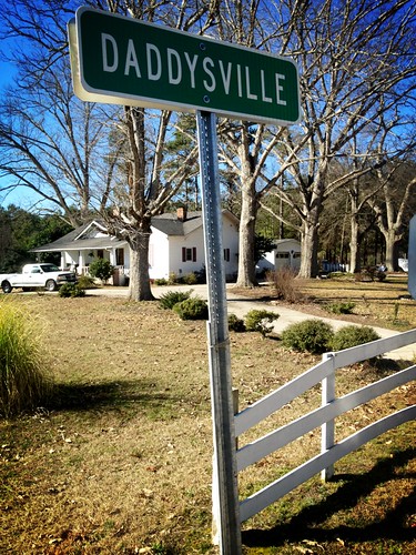
And came across a rather uniquely named community....Who's Your.......Daddysville?
We didn't have time to walk through Zebulon....but we'll save it for our next local photo trip - "From Bunn to Dunn". If you are from this part of North Carolina, you'll understand the reference.
Yesterday, Joe Babyak and I took a brief trip exploring Eastern Wake County. We also got into Nash and Franklin Counties. And this trip proved once again that sometimes there's a lot you can find on a roadtrip just in your back yard.
For the entire trip set on flickr, head here.
Our first stop was an abandoned country church off of Mial Plantation Road which is a few miles nearby. I have taken photos of this church before, but now that I have Lightroom 4 - I decided to play around with various editing settings.
I am not sure the name or denomination of this old country church. There is an old family cemetery behind it belonging to the Auton Family, and all of the grave sites date to early 20th century.
What's also interesting about the area surrounding the church is that it is one of the rare rural dirt roads still left in Wake County.
We then worked our way back onto Business US 64 and did a brief photo walk through the town of Wendell.
Saw a great classic Chevy Truck.
And a decently old OK Used Cars sign for Universal Chevrolet.
Outside of town along Business US 64, we came along a Blue Star Memorial Highway marker. This marker was recently restored by the local American Legion and Garden Club. It is amazing to me how much that blue just pops out on the sign when you look at it close up.
Blue Star Memorial Highways and the accompanying markers began shortly after World War II by the National Council of Garden Clubs. US 64 in North Carolina is a Blue Star Memorial Highway. Since then, the program includes Memorial By-Ways and Memorials. A Blue Star Memorial Marker is located in our town of Knightdale.
After stopping for lunch in Zebulon, the next town to be explored was Spring Hope. Located on US 64 Alternate in Nash County. Spring Hope is a rather pleasant small town with some great old commercial buildings, churches and homes.
And it never seems to fail, that inside a rural small town post office parking lot, you'll find an old embossed STOP sign.
From Spring Hope we continued on US 64 Alternate as it transitioned into an un-numbered old alignment, "Old US 64". In Franklin County, we came across this old Robertson Fertilizers sign.
And came across a rather uniquely named community....Who's Your.......Daddysville?
We didn't have time to walk through Zebulon....but we'll save it for our next local photo trip - "From Bunn to Dunn". If you are from this part of North Carolina, you'll understand the reference.
Comments
Thanks for triggering the memories.
Preston D. Parsons, Jr.
Burlington, NC