
The ultimate destination of the New England Road Trip was Acadia National Park. We arrived at Acadia at about 1 pm along with our travel companion for the trip - known as fog. Though the fog stayed with us for most of our time on Mount Desert Island - the time spend there was awesome. And it is somewhere I certainly hope to visit again and spend more time.
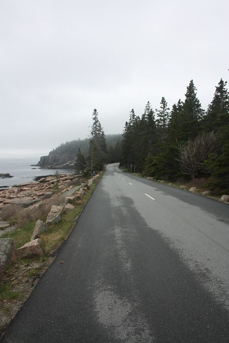
As you can see the fog was with us for most of our time at Acadia.
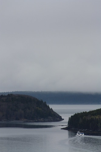
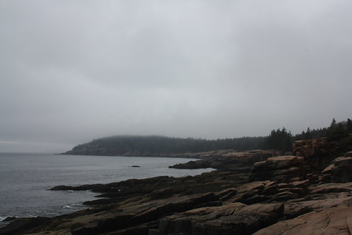
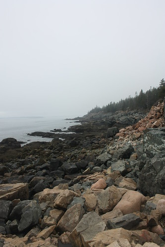
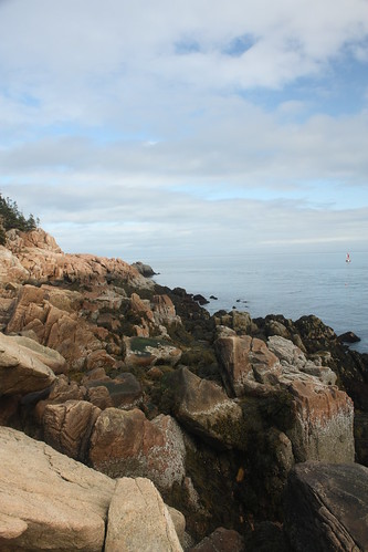
We weren't able to do the entire loop road or get to Cadillac Mountain. However, what we did see was some of the signature rugged coastline that Acadia and the Maine Coast is famous for. The flickr set for the Acadia Loop Road is here.
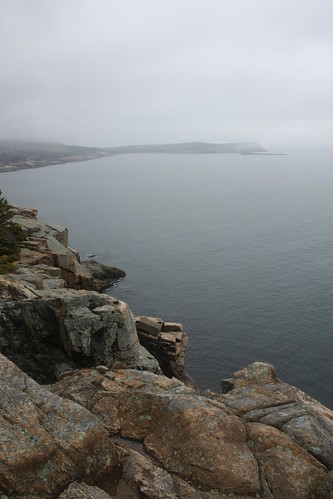
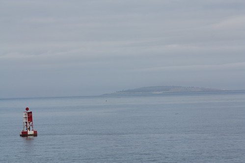
One of the first stops on the Park Loop road is an overlook of Frenchman Bay. The Porcupine Islands and the town of Bar Harbor are two of the main features of Frenchman Bay.
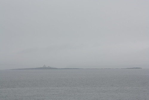
Just prior to the park's main entrance station - there is a small offshoot road that leads to a scenic view of Egg Rock and allows you a chance to explore the rocky coastline.
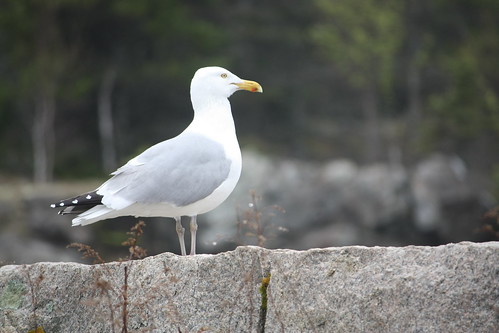
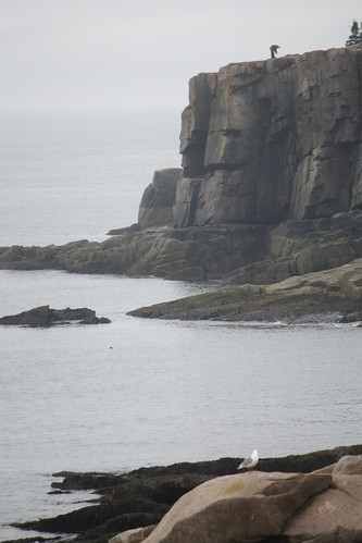
You also can share your time with a feather friend or two.
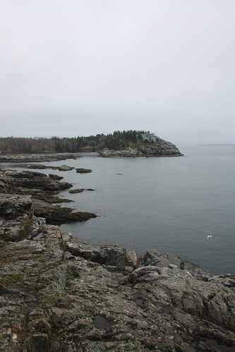
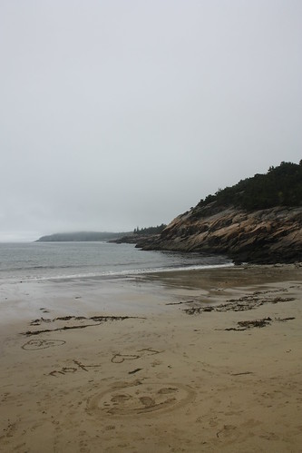
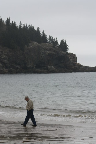
Sand Beach on warm sunny afternoon's is a very popular spot. It's not as much on a chilly foggy day'; however, the character of this little cove really comes through.
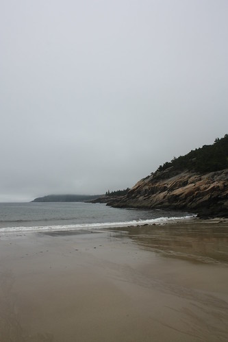
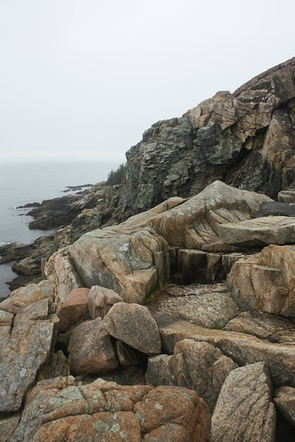
From Sand Beach to Otter Point - the opportunities to stop and take photos and explore the coastline are endless.
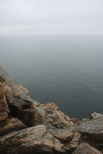
Otter Cliff - at 110 feet above the Atlantic Ocean - is one of the most impressive - or frightening - spots in all of Acadia National Park.
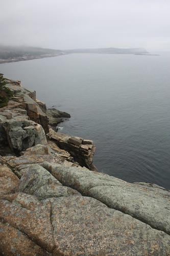
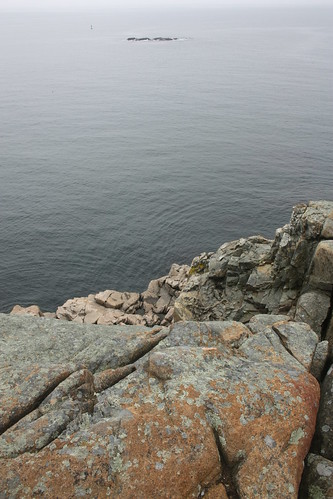
As you can see it's a long way down!
After Otter Point, the loop road continues to run along the coastline at a more gentle slope.
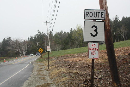
Just beyond the Wildwood Stables, we headed off the loop road and back on to Maine 3 to head Bass Harbor Head Lighthouse which is one of the most popular spots on Mount Desert Island. Once we got on ME 3, we came across this rather interesting highway shield.
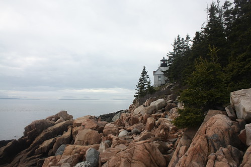
Bass Harbor Head Lighthouse is the only lighthouse that is physically located on Mount Desert Island. It has been in operation since 1858 and is listed on the National Register of Historic Places. The lightkeeper's home is the residence of the commander of the local US Coast Guard Unit.
My set of photos from Bass Harbor is located here.
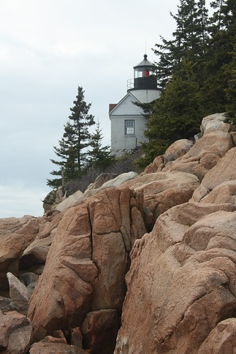
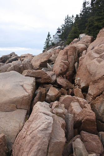
The best vantage point of the light, cliffs and waters around it is to take any of the trails to the left or the right of the lighthouse. Be very careful on the cliffs though. There are not any railing or other pathways on the cliffs.
Fortunately, the fog started to lift as we were there.
Bass Harbor Head Lighthouse is also the key feature in a modern version of the classic WPA style posters that Rand Doug Enterprises has made for Acadia National Park. Now, that I have visited the park I will certainly be buying one to add to my collection. (I need to blog about that some day).
Acadia and Mount Desert Island was a great visit. I only wish we had more time to explore more of the park and Bar Harbor. Cadillac Mountain and biking the numerous carriage roads within the park are still on the to do list. Hopefully, I will get to do that next time. But even if it is only for a half day to explore and drive around the park, it is certainly worth it.
As you can see the fog was with us for most of our time at Acadia.
We weren't able to do the entire loop road or get to Cadillac Mountain. However, what we did see was some of the signature rugged coastline that Acadia and the Maine Coast is famous for. The flickr set for the Acadia Loop Road is here.
One of the first stops on the Park Loop road is an overlook of Frenchman Bay. The Porcupine Islands and the town of Bar Harbor are two of the main features of Frenchman Bay.
Just prior to the park's main entrance station - there is a small offshoot road that leads to a scenic view of Egg Rock and allows you a chance to explore the rocky coastline.
You also can share your time with a feather friend or two.
Sand Beach on warm sunny afternoon's is a very popular spot. It's not as much on a chilly foggy day'; however, the character of this little cove really comes through.
From Sand Beach to Otter Point - the opportunities to stop and take photos and explore the coastline are endless.
Otter Cliff - at 110 feet above the Atlantic Ocean - is one of the most impressive - or frightening - spots in all of Acadia National Park.
As you can see it's a long way down!
After Otter Point, the loop road continues to run along the coastline at a more gentle slope.
Just beyond the Wildwood Stables, we headed off the loop road and back on to Maine 3 to head Bass Harbor Head Lighthouse which is one of the most popular spots on Mount Desert Island. Once we got on ME 3, we came across this rather interesting highway shield.
Bass Harbor Head Lighthouse is the only lighthouse that is physically located on Mount Desert Island. It has been in operation since 1858 and is listed on the National Register of Historic Places. The lightkeeper's home is the residence of the commander of the local US Coast Guard Unit.
My set of photos from Bass Harbor is located here.
The best vantage point of the light, cliffs and waters around it is to take any of the trails to the left or the right of the lighthouse. Be very careful on the cliffs though. There are not any railing or other pathways on the cliffs.
Fortunately, the fog started to lift as we were there.
Bass Harbor Head Lighthouse is also the key feature in a modern version of the classic WPA style posters that Rand Doug Enterprises has made for Acadia National Park. Now, that I have visited the park I will certainly be buying one to add to my collection. (I need to blog about that some day).
Acadia and Mount Desert Island was a great visit. I only wish we had more time to explore more of the park and Bar Harbor. Cadillac Mountain and biking the numerous carriage roads within the park are still on the to do list. Hopefully, I will get to do that next time. But even if it is only for a half day to explore and drive around the park, it is certainly worth it.

Comments