
Road Trip to Triangle Expressway

Last weekend I took by first return to NC road trip to southern Durham and Wake Counties to take my first trip on the Triangle Parkway section of NCTA's Triangle Expressway and to view progress in completing the rest of the toll road to the west and south.

Triangle Parkway
Since Adam has posted photos from the Parkway section, I'll only post a few that are most interesting to me. First, what I never thought I'd see on a NC highway sign:
Toll banners, with other projects underway, there will be more of these. I like the way the bridges are designed...
Brick face on the sides and the roadway number or name carved into the concrete. Upon leaving the parkway, there appears a sign that is temporary:
Since in a few month the toll road will not end. Given this is on the offramp from the Parkway, does this mean NC 540 South starts on the ramp, while NC 540 South still exists on the mainline?

Western Wake Portion of Triangle Expressway (NC 540)
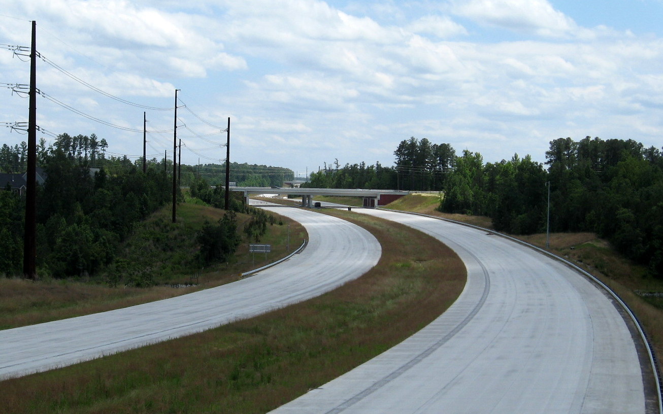
Looks like they've saved a place for the future toll banner here--
The unopened portion of the road looks close to completion, and is almost ready for the next Triangle Expressway Run in August. The view from McCrimmon Parkway to the south--
The final layer of cement is down, there are guardrails and signs up, the only thing that appears missing are lane markers. This is a view looking backward towards the NC 55 exit--
If one looks closely enough, one can see the new overhead signage for the NC 55 exit in the distance. The next bridge carrying Carpenter Fire Station Road over the TriEx is open:
There is still some road work going on here. A view back toward McCrimmon shows exit signs in place:
Along with power distribution lines taking advantage of the new corridor. The view to the south looks toward the first new interchange exit sign and Green Hope School Road:
There is some work still going on toward the center of the picture. A closer view of the text in the sign above is below from just before the Green Hope School Road Bridge--
This is standard design for single exit signage, guess a simple ground mounted sign was not seen as good enough. The number for the exit is 62. 

Here's a similar sign for the NC 55 Exit on North NC 540:

A view looking further south toward the Green Level West interchange area shows work being done on testing the VMS signs:
A closer view of this interchange (and the US 64 interchange signage further in the distance) will have to wait until the next road trip. Here's closeup on the Green Hope School Road Bridge where the above photo was taken:
On the way back I spotted new sign assemblies for Exit 66 that have not been put up lying in the NC 540 median at NC 55-
These should be put up soon, the existing signs I guess could not be easily modified to have exit only tabs attached. 

From back on the open portion of the TriEx --
Showing a new VMS and new North NC 540 sign. And signage approaching the Triangle Parkway with more Toll tabs--
And finally heading under the Kit Creek Parkway Bridge and onto Toll NC 147 North--
The TriEx opening is still planned for August, I hope to get more photos before then.

Comments

Popular posts from this blog

Dillon Road

Dillon Road is a 34.2-mile highway located in northern Coachella Valley of Riverside County, California.  Dillon Road begins at Avenue 48 on the outskirts of Indio and ends to the west at California State Route 62 near San Gorgonio Pass.  Dillon Road was developed the 1930s as a construction road for the Colorado River Aqueduct.  Dillon Road serves as a northern bypass to much of the development of Coachella Valley.  Dillon Road is known for it's frequent dips and spectacular views of San Gorgonio Pass.   Part 1; the history of Dillon Road Dillon Road was constructed as a haul road for the Colorado River Aqueduct through Coachella Valley.  The Colorado River Aqueduct spans 242 miles from Parker Dam on the Colorado River west to Lake Mathews near Corona.  Construction of the Colorado River Aqueduct began during January 1933 near Thousand Palms and was made functional on January 7, 1939.  West of Berdoo Canyon Road the alignment of Dillon Road is largely concurrent with the Colorado

Tehachapi-Willow Springs Road

Tehachapi-Willow Springs Road is an approximately 21-mile highway located in southeast Kern County.  Tehachapi-Willow Springs Road begins at Tehachapi Boulevard (former US Route 466) in Tehachapi and crosses the Tehachapi Mountains via the 4,820-foot-high Oak Creek Pass.  Tehachapi-Willow Springs Road enters Antelope Valley of the wider Mojave Desert and passes by the historic stage station of Willow Springs to a southern terminus at Rosamond Boulevard.  Tehachapi-Willow Springs Road has historic ties to the Havilah-Los Angeles Road and Stockton-Los Angeles Road due to the once reliable presence of water at Willow Springs. Part 1; the history of Tehachapi-Willow Springs Road Oak Creek Pass and Willow Springs were known to the local tribes of the Tehachapi Mountains for generations.  The first documented European crossing of Oak Creek Pass was during 1776 as part of an expedition by Francisco Garces.  Oak Creek Pass is as used again by John C. Fremont during an 1844-1845 expedition to e

The 1928 Iowa Hill Road Bridge

The 1928 Iowa Hill Road Bridge is a derelict structure located in the Sierra Nevada Mountains of Placer County, California.  The 1928 Iowa Hill Road Bridge can be found between the communities of Colfax and Iowa Hill.  The 1928 Iowa Hill Road Bridge is a wire suspension structure which spans the North Fork American River.  The 1928 Iowa Hill Road Bridge was replaced by a modern span and converted to pedestrian use following floods during 1963.   Part 1; the history of the 1928 Iowa Hill Road Bridge During 1853 gold was discovered at what to become Iowa Hill.  The gold mining claims soon led to a small community known as Iowa City being established.   By 1854, Post Office Service began at the mines of Iowa City.  By 1856 gold production at Iowa City was estimated to be around $100,000.  Iowa City was burned in fires during 1857 and 1862 but the community was rebuilt with more modernized structures.   The location of Iowa City can be seen as "Iowa Hill" on the 1873 Bancroft