
Yesterday was the first official roadtrip with the new camera. Two weeks ago, I bought a Canon Rebel XSi. I'm enjoying it thoroughly so far!
Joe came up from Wilmington for this ride through the Northeastern Part of the state.
Route: I-540 - US 64, US 64 Business, US 264A, NC 33, US 17, NC 308, NC 11/42, NC 111, US 264, I-540.
For the entire flickr set over 80 photos: Go Here.
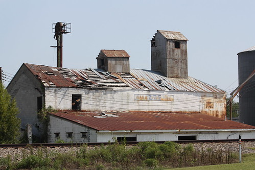
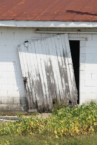
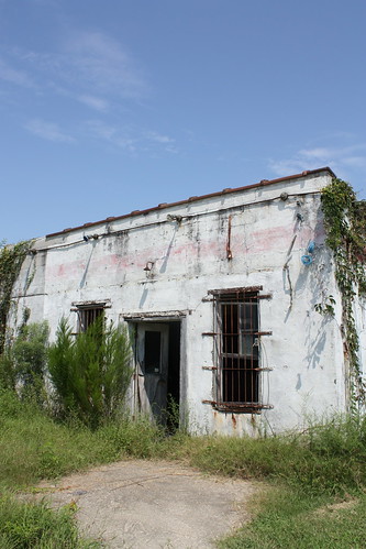
The first stop was a walk around Bailey, NC which the main part of town sits on the opposite side of the tracks from US 264A. There is a great old abandoned Feed Mill here.
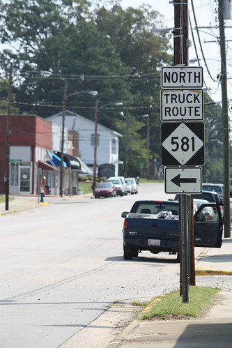
Bailey is home to a short NC 581 truck route because of a railroad underpass on NC 581 that is only 8'6" high.
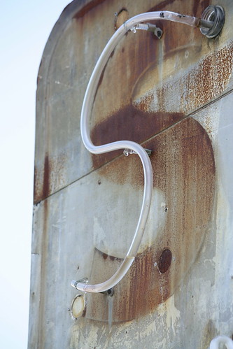
Outside of Wilson on US 264A - Was an unbelievable old gas station ' Save On Gas'. The station has most likely been abandoned for years. But fortunately, the old sign and some of the neon tubing is still there.
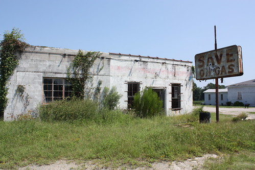
I'd love to see how that sign looked lit up at night.
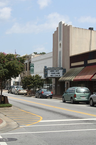
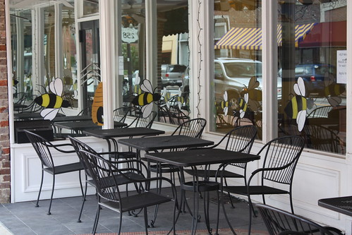
The next stop was the town of Farmville, and we walked around there a bit. US 264 had ran through Farmville years ago, but the town has been bypassed not once but twice. US 264A follows the first bypass to the south...while the US 264 freeway runs to the north. NC 121 now runs on part of the old alignment.

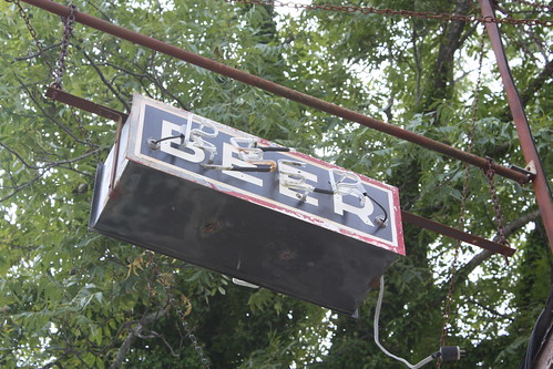
This was the second old neon 'BEER' sign found on the trip. There is another on US 264A in Bailey.
Downtown Farmville isn't a bad place.
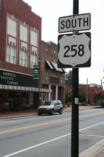
And unlike US 264, US 258 still runs through it.
Now on US 17 in Chocowinity, there is this rare sign for WITN-TV. WITN is an NBC affiliate and the sign outside its studios dates from the mid-late 1970s. This is the era when NBC used the stylized 'N' and abandoned the peacock all together.
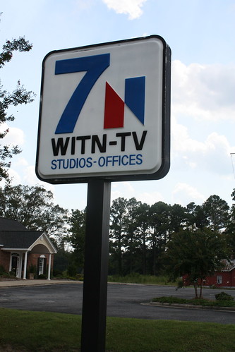
Never thought I'd see one of those again.
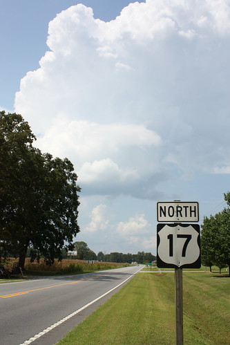
US 17 is two lanes north of Washington to Williamston - and offers a view like this in Old Ford.
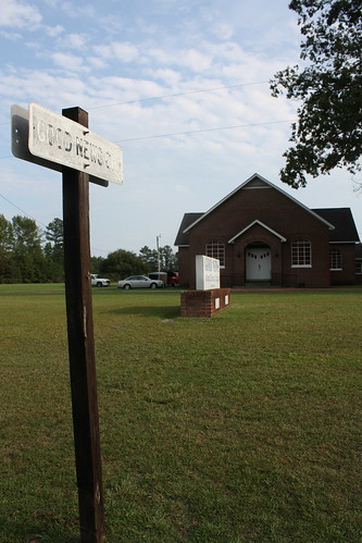
Finally, near the end of the trip, Joe spotted this 'sign' find. Another old black on white crossroads signs. This one is actually for a church. Good News Church.
A fun trip...and the camera got some good use and practice just in time for the Labor Day trip to Michigan.
Joe came up from Wilmington for this ride through the Northeastern Part of the state.
Route: I-540 - US 64, US 64 Business, US 264A, NC 33, US 17, NC 308, NC 11/42, NC 111, US 264, I-540.
For the entire flickr set over 80 photos: Go Here.
The first stop was a walk around Bailey, NC which the main part of town sits on the opposite side of the tracks from US 264A. There is a great old abandoned Feed Mill here.
Bailey is home to a short NC 581 truck route because of a railroad underpass on NC 581 that is only 8'6" high.
Outside of Wilson on US 264A - Was an unbelievable old gas station ' Save On Gas'. The station has most likely been abandoned for years. But fortunately, the old sign and some of the neon tubing is still there.
I'd love to see how that sign looked lit up at night.
The next stop was the town of Farmville, and we walked around there a bit. US 264 had ran through Farmville years ago, but the town has been bypassed not once but twice. US 264A follows the first bypass to the south...while the US 264 freeway runs to the north. NC 121 now runs on part of the old alignment.
This was the second old neon 'BEER' sign found on the trip. There is another on US 264A in Bailey.
Downtown Farmville isn't a bad place.
And unlike US 264, US 258 still runs through it.
Now on US 17 in Chocowinity, there is this rare sign for WITN-TV. WITN is an NBC affiliate and the sign outside its studios dates from the mid-late 1970s. This is the era when NBC used the stylized 'N' and abandoned the peacock all together.
Never thought I'd see one of those again.
US 17 is two lanes north of Washington to Williamston - and offers a view like this in Old Ford.
Finally, near the end of the trip, Joe spotted this 'sign' find. Another old black on white crossroads signs. This one is actually for a church. Good News Church.
A fun trip...and the camera got some good use and practice just in time for the Labor Day trip to Michigan.
Comments