
Fork in the Road - Dutchess County, New York


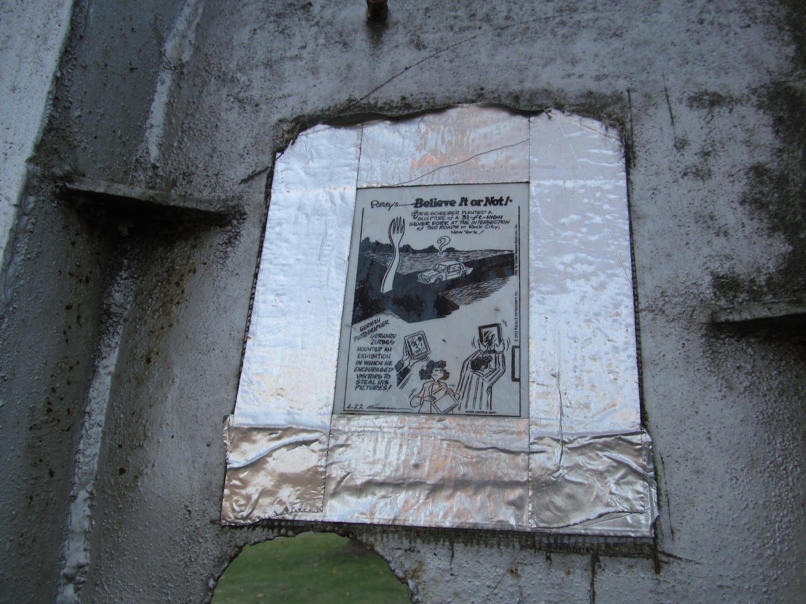
Around where Red Hook, Rhinebeck, Milan and Rock City meet in northern Dutchess County in New York State's Hudson Valley region is a fork in the road, both in the proverbial sense and the literal sense of the term. Located in the grassy plot of land at the junction of NY 199 and NY 308 stands a sculpture of a fork called "Fork in the Road". Erected by local artist Stephen Schreiber, Fork in the Road is one of a few punny sculptures that he has sculpted and has available for display in the immediate area. Prozac Capsule is another one of his sculptures, located right across the street from the Fork in the Road. Standing tall at 31 feet, the Fork in the Road is hard to miss (I've taken pictures of the Fork in the Road on a few occasions) and was featured in Ripley's Believe it or Not.


Sources and Links:
Hudson Valley Magazine - Silly Silverware
JFiveHomes Realty - A Fork in the Road
Roadside America - Fork in the Road, Prozac Capsule 

How to Get There:


Update Log:
January 3, 2018: Published original article at Unlocking New York.
August 21, 2021: Transferred article from Unlocking New York to Gribblenation.

Comments

Popular posts from this blog

Former US Route 50 and the Pioneer Route Lincoln Highway on Johnson's Pass Road

Johnson's Pass Road is one of the oldest highway corridors in California.  Johnson's Pass was part of the Lake Tahoe Wagon Road as it was completed during 1856 over the Sierra Nevada.  The pass would later be incorporated into the Pioneer Branch of the Lincoln Highway in 1913 and US Route 50 in 1926.  Johnson's Pass Road would be bypassed by a new alignment of US Route 50 over Echo Summit in 1938.  A replacement of the Meyers Grade east of Johnson's Pass would be opened to traffic in 1947.   Johnson's Pass Road remains accessible to traffic and is still signed by the Lincoln Highway Association.  Pictured as the blog cover is the view from the top of Johnson's Pass Road overlooking modern US Route 50 and Lake Tahoe.   Part 1; the history of Johnson's Pass Much of the history of what become the Lake Tahoe Wagon Road is discussed in the  September 1950 California Highways & Public Works  during its Centennial Edition.  The or...

Former US Route 50 and the South Lincoln Highway from Folsom east to Placerville

The corridor of Folsom of Sacramento County east to Placerville of El Dorado County has been a long established corridor of overland travel dating back to the California Gold Rush.  The Folsom-Placerville corridor was once part of the path of the Lake Tahoe Wagon Road which became the first California State Highway and later the South Lincoln Highway.  In time the South Lincoln Highway's surface alignment was inherited by US Route 50.  The Folsom-Placerville corridor also includes the communities of; Clarksville, Shingle Springs and El Dorado. Part 1; the history of the Lake Tahoe Wagon Road, South Lincoln Highway and US Route 50 through Folsom-Placerville Folsom is located on the American River/Lake Natoma of eastern Sacramento County.  That lands now occupied by the City of Folsom were part of Rancho Rio de los Americanos prior to the finding of gold at Sutter's Mill during 1848.  During the California Gold Rush the lands of Rancho Rio de los Americanos were p...

Abandoned US Route 40 in the Truckee River Canyon

Within the Truckee River Canyon in the Sierra Nevada range numerous abandoned portions of US Route 40 can be found alongside modern Interstate 80.   This segment of highway was opened during 1926 as a bypass of the Dog Valley Grade which carried the early North Lincoln Highway and Victory Highway. The corridor of the Truckee River Canyon State Highway would be assigned as US Route 40 when the US Route System was commissioned during November 1926. During 1958 the segment of Interstate 80 between Boca, California and the Nevada state line was complete. When Interstate 80 opened east of Boca numerous obsolete portions of US Route 40 were abandoned. Some of these abandoned segments have been incorporated into the Tahoe-Pyramid Trail.  Part 1; the history of US Route 40 in the Truckee River Canyon The Truckee River Canyon for centuries has been an established corridor of travel known to native tribes crossing the Sierra Nevada range.  The first documented wagon crossi...