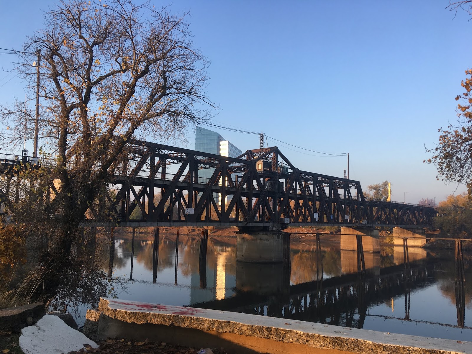
US Route 99 from downtown Sacramento north through Sacramento Valley to the City of Red Bluff was once host to a East/West split alignment of US Route 99. US Route 99 West was the original alignment of US Route 99 prior to 1928 and followed Legislative Route Number 7 over what had mostly been the Pacific Highway. Above the original Yolo Causeway can be seen as featured in the 1916 California Highway Bulletin just after it opened. The 1916 Yolo Causeway would later become part of US Route 99 West and US Route 40. Below US Route 99 West can be seen traversing north from Sacramento via Legislative Route Number 6 and 7 to the Red Bluff on the 1938 Division of Highways State Map.
This blog is part of the larger Gribblenation US Route 99 Page. For more information pertaining to the other various segments of US Route 99 and it's three-digit child routes check out the link the below.
Part 1; the history of the US Route 99 West corridor between West Sacramento and Red Bluff
The emergence of the automobile in the early 20th Century led to the 1909 First State Highway Bond Act which was approved by voters during 1910. The majority of the highways approved as part of the First State Highway Bond Act were largely well established routes of travel. In the case of Red Bluff it was along the path of what would become Legislative Route Number 3 ("LRN 3") and the north terminus of LRN 7. According to CAhighways.org the original definition of
LRN 3 was as follows:
"Sacramento to the Oregon Line."
According to CAhighways.org the original definition of
LRN 7 was as follows:
"Tehama Junction to Benicia."
Note; Tehama Junction was simplified to "Red Bluff" when LRN 7 was codified in 1935.
By 1913 the Pacific Highway was created as a major Auto Trail between San Diego and Vancouver, British Columbia. The Pacific Highway followed Main Street via LRN 3 into downtown Red Bluff. From downtown Red Bluff the Pacific Highway followed LRN 7 towards Woodland and Davis. A very early LRN 3 and LRN 7 through Red Bluff can be seen on the
1917 California State Automobile Association Map. Note; the 1917 California State Automobile Association Map shows LRN 7 ending in Tehama at LRN 3 which would account for it's original definition above.


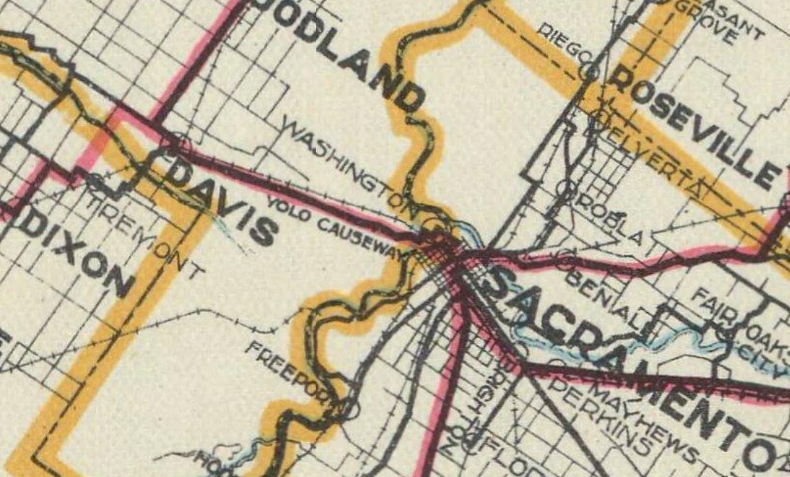
Within Sacramento early LRN 6 can be seen departing the City via the I Street Bridge to West Sacramento in error on the 1917 California State Automobile Association Map. The I Street Bridge opened to traffic over the Sacramento River in 1912 as a swing span carrying the Southern Pacific Railroad and highway traffic. The original definition of
LRN 6 from the 1909 First State Bond Act was Sacramento west to Woodland Junction. From West Sacramento (shown as Washington) LRN 6 can be seen traversing the Yolo Causeway to the City of Davis. Note; West Sacramento was originally known as Washington until the community received Post Office service in 1915.
The
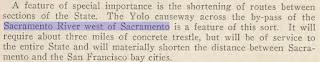
May 1913 California Highway Bulletin discusses the need for a structure over the Yolo Basin between Sacramento and Davis. A bridging structure is noted to be essential to the development of the State Highway System as there was no direct link by road from Sacramento and the San Francisco Bay Area.
The
May 1913 California Highway Bulletin references a upcoming bridge which was to be constructed over Stony Creek north of Orland as part of the Pacific Highway and LRN 7. The Stony Creek Bridge is stated to have a planned length of 1,200 feet and would feature a arch concrete design. The Stony Creek Bridge is stated to have an anticipated opening during December 1913.
The
July 1914 California Highway Bulletin describes the design of the upcoming Yolo Causeway as consisting of three miles of concrete trestles. LRN 6 from West Sacramento to Davis is described as having been fully designed and was put out for construction bid. Notably early plans for LRN 6 had it connect from the I Street Bridge to the upcoming Yolo Causeway.

Very early survey descriptions of LRN 3 and LRN 7 can be found on the
January 1915 Highway Bulletin. LRN 7 is described as having an end point at LRN 3 at Tehama Junction (Tehama).
The
July 1916 California Highway Bulletin features the completed Yolo Causeway (referred to as the Yolo Basin Trestle) between West Sacramento and Davis. The dedication ceremony celebrating the opening the Yolo Causeway took place from May 11th, 1916 to May 14th, 1916. The Yolo Basin is described as being a historically difficult area to traverse overland due to it being flooded six to eight months every year. Prior to the construction of the Yolo Causeway a primitive seasonal road known as "Tule Jake Road" could be utilized to traverse Yolo Basin by car between West Sacramento and Davis. Note; upon the completion of the Carquinez Bridge in 1927 the Lincoln Highway was realigned over the Yolo Causeway.
The Yolo Causeway article in the 1916 California Highway Bulletin shows LRN 6 was realigned from the I Street Bridge to the M Street Bridge in West Sacramento. This realignment would have eliminated a rail overpass from the alignment of LRN 6.
The
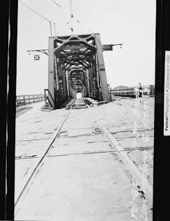
M Street Bridge was originally constructed as a railroad swing structure in 1911. The M Street Bridge was utilized by the Sacramento North Railway, Oakland Antioch & Eastern Railway and Northern Electric Railway. The construction of LRN 6 and the Yolo Causeway saw roadway lanes added to the M Street Bridge as part of the realignment of the highway. The photos below are hosted by bridgehunter.com and were taken when the M Street Bridge was being replaced by the Tower Bridge during 1934.


The
1918 Division of Highways Map shows LRN 7 extended to Red Bluff as LRN 3 is shown following the east bank of the Sacramento River north of Tehama on a new alignment.
The
1920 Clason Highway Map of California shows the Pacific Highway and National Park to Park Highway entering Red Bluff southbound. South of Red Bluff the Pacific Highway is shown on LRN 7 towards Davis whereas the National Park to Park Highway is shown following LRN 3 towards Sacramento. Note; the National Park to Park Highway was established as an Auto Trail in 1916.

The initial draft of the US Route System was approved by the Secretary of Agriculture during November of 1925. The US Route System within California was approved by California Highway Commission ("CHC") with no changes recommended by
January 1926. The initial alignment of US Route 99 ("US 99") was largely planned to follow the Pacific Highway through Sacramento Valley. US 99 is shown on a map published in the 1926 California Highways & Public Works following LRN 3 into Red Bluff, heading south towards Davis via LRN 7 and east via multiplex of US 40/LRN 6 to Sacramento.
Thusly US 99 appears on the 1925 Rand McNally Map of California as being routed from Red Bluff south on LRN 7 to Davis and US 40/LRN 6 to Sacramento.
The August 1925 California Highways & Public Works described a fire that destroyed the existing Sacramento Northern Railroad Subway on LRN 6 in West Sacramento. The article cites bids having been put out by the State to construct a new subway and eliminate a blind curve.
The
December 1925 California Highways & Public Works cites paving of LRN 7/Pacific Highway as recently completed in the City of Corning as part of a cooperative project with the State. The newly paved 1.5 mile segment through Corning was the last gap in unpaved highway on LRN 7 between Davis and Red Bluff.
The
March 1926 California Highway & Public Works cites the Sacramento Northern Railroad Subway on LRN 6 in West Sacramento as being completed. The new Subway structure is cited to still be in need of grading and paving. A new approach structure from the new subway to the M Street Bridge is cited to be forthcoming.
During November of 1926 the US Route System was approved by the AASHO. US 99 was approved as a single route from Red Bluff south to Davis. US 99 can be seen as a standalone route from Red Bluff south via LRN 7 to Woodland and via multiplex of US 40/LRN 6 to Sacramento on the
1927 National Map Company Sectional Map.
The February 1927 California Highways & Public Works features the recently completed M Street Bridge approach in West Sacramento along with the new alignment of US 99/US 40/LRN 6 through the 1926 Sacramento Northern Railroad Subway.
The January 1928 California Highways & Public Works describes US 99 as a single route heading south out of Red Bluff via LRN 7 towards Davis and via a multiplex of US 40/LRN 6 to Sacramento.
The AASHO data base has information pertaining to a request made by the California State Highway Engineer to have US 99 become a split route between Red Bluff south to Sacramento. In a letter dated June 13th, 1928 the rationale for splitting US 99 into an East/West Route was a two-to-one traffic ratio on LRN 3 on the east bank of the Sacramento River compared to LRN 7 on the west bank.
The proposed US 99W/US 99E split can be seen for the first time on this map (which was scanned upside down in the AASHO database).
The US 99 W/US 99E split from Red Bluff to Sacramento was approved by the AASHO on August 6th, 1928.
The first map to display US 99 as a split route south of Red Bluff towards Sacramento can be seen on the 1930 Division of Highways State Map.
The Yolo Causeway is stated to be in the process of expansion to four lane capacity via the addition of a timber trestle in the December 1932 California Highways & Public Works.
In 1935 the California Division of Highways produced detailed road maps for all the counties in the state. Through these maps the initial alignment of US 99W can be seen in detail.
The
1935 Division of Highways Map of Yolo County shows US 99W entering West Sacramento multiplexed with US 40 on LRN 6 over the M Street Bridge west from downtown Sacramento. US 99W/US 40 are shown traversing West Sacramento westward on Capitol Avenue towards the Yolo Causeway. US 99W/US 40 are shown following LRN 6 west on the Yolo Causeway towards what is now County Road 32A and the grade of Interstate 80 through Webster siding into Davis.

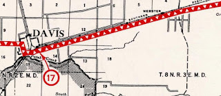
The 1935 Division of Highways Map of Yolo County shows US 99W/US 40 entering Davis on LRN 6 via Olive Drive. US 99W is shown splitting onto LRN 7 via Richards Boulevard over the Southern Pacific Railroad. US 99W/LRN 7 northbound is shown traversing Davis via; Richards Boulevard, 1st Street, B Street and Russell Boulevard. From Russel Boulevard US 99W/LRN 7 northbound is seen following the grade of the modern California State Route 113 ("CA 113") freeway and East Street to Main Street in Woodland. US 99W/LRN 7 in Woodland is shown following Main Street and modern CA 16/County Road 98.
The 1935 Division of Highways Map of Yolo County shows US 99W/LRN 7 north of Woodland following modern CA 16/County Road 98 to County Road 99W at Yolo. From Yolo US 99W/LRN 7 northbound followed County Road 99W through Zamora and Dunnigan to the Colusa County Line.
The 1935 Division of Highways Map of Colusa County shows US 99W/LRN 7 following Frontage Road north from Arbuckle through Genevra and Macy. US 99W/LRN 7 is shown passing through Williams via 7th Street.
The 1935 Division of Highways Map of Colusa County shows US 99W/LRN 7 following Old Highway 99W north of Williams through Cortena and Maxwell. From Maxwell US 99W/LRN 7 is shown following Old Highway 99W north through Delavan to the Glenn County Line.
The
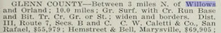
1935 Division of Highways Map of Glenn County shows US 99W/LRN 7 following Highway 99W through Norman and Logandale onward toward Willows. US 99W/LRN 7 is shown traversing Willows via Tehama Street northbound. US 99W/LRN 7 is shown following Highway 99W northbound through Lyman, Artois and Greenwood towards Orland. US 99W/LRN 7 is shown following 6th Street through Orland and Highway 99W to the Tehama County Line.
The
1935 Division Highways Map of Tehama County shows US 99W/LRN 7 northbound following Highway 99W into Corning. US 99W/LRN 7 is shown traversing downtown Corning via Solano Street and 3rd Street. North from Corning US 99W/LRN 7 is shown following State Highway 99W through Richfield, Proberta and Rawson to Main Street in Red Bluff. US 99W/LRN 7 is shown following Main Street through north Red Bluff to US 99E/LRN 3 at Antelope Boulevard.
The
March 1935 California Highways & Public Works announced US 99W/LRN 7 from Willows north to Orland had been put up for bid to grade and resurface.
The
January 1936 California Highways & Public Works covers the opening of the Tower Bridge on December 15th, 1935. The Tower Bridge was a direct replacement for the previous M Street Bridge which existed on the same location. During the process of construction of the Tower Bridge the M Street Bridge was removed and US 99W/US 40/LRN 6 crossed the Sacramento River via a temporary structure. Unlike the swing design of the M Street Bridge the design of the Tower Bridge features a vertical lift span.
The
January 1936 California Highways & Public Works announced US 99W/LRN 7 was slated to be repaved and surfaced over the course of the next 18 months in the Dunnigan-Arbuckle corridor.
The
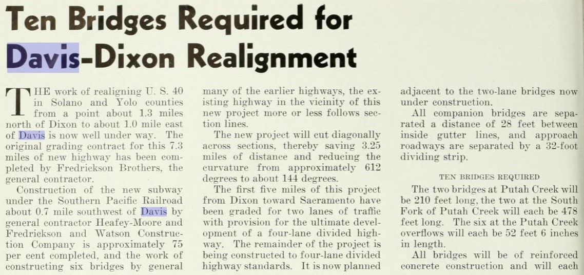
September 1940 California Highways & Public Works discusses the ongoing construction of an upgraded alignment of US 40/LRN 6 between Dixon and Davis. The project end is cited to extend through Davis and would include a new bypass of US 99W/US 40/LRN 6 off of Olive Drive.
The
February 1941 California Highways & Public Works describes the progress of the Dixon-Davis realignment of US 40/LRN 6. A map shows the upcoming bypass route of Davis which would serve as a future alignment of US 99W/US 40/LRN 6. An extension of the Dixon-Davis projected is cited to be a re-decking of the Yolo Causeway.
Further updates to the Davis-Dixon realignment of US 40/LRN 6 are featured in the
July 1941 California Highways & Public Works. The almost completed four lane segment of US 99W/US 40/LRN 6 east of Davis approaching the Yolo Causeway can be seen.
The
October 1942 California Highways & Public Works features the completed Dixon-Davis Cutoff alignment of US 40/LRN 6. The Dixon-Davis Cutoff was fully opened to traffic on September, 22nd 1942 which included the new bypass route of US 99W/US 40/LRN 6 around Davis. US 99W/LRN 7 branched from US 40/LRN 6 via what is now Pedrick Road. US 99W/LRN 7 followed Pedrick Road and Russell Boulevard towards the grade of the modern CA 113 freeway.
The
September/October 1949 California Highways & Public Works announced that US 99W/US 40/LRN 6 from the Tower Bridge west to the Yolo Causeway would be upgraded with additional grading and road structures.
The
March/April 1953 California Highways & Public Works features the construction of the West Sacramento Freeway. The West Sacramento Freeway was to serve as a limited access realignment of US 99W/US 40/LRN 6 off Capitol Avenue from the Tower Bridge west to the Yolo Causeway. The West Sacramento Freeway is cited to be planned to open during Fall of 1954.
The
July/August 1954 California Highways & Public Works cites the West Sacramento Freeway as opening on June 15th, 1954 in an article pertaining to the expansion of US 40. The article states the West Sacramento Freeway was designed with provisions to build an additional bridge over the Sacramento River so US 99W/US 40/LRN 6 would serve as a full bypass of downtown Sacramento. The article states that the US 99W and US 40 intersection in Davis was shifted to a new interchange configuration. The new interchange configuration utilized by US 99W/LRN 7 is where CA 113 presently transitions from Interstate 80 in Davis.
The new US 99W/LRN 7 and US 40/LRN 6 interchange in Davis can be seen for the first time on the
1955 Division of Highways Map. US 99W/LRN 7 was joined by US 40A from Woodland south to Davis beginning in 1954.
On June 29th, 1956 the Federal Highway Aid Act of 1956 was signed into law on the Federal Level. The Federal Highway Aid Act of 1956 was the genesis point of the Interstate Highway System which would in the coming decade sew the demise via of US 99W via replacement by Interstate 5. US 99W/US 40/LRN 6 from Sacramento west to Davis were slated to become part of the corridor of Interstate 80.
The planned route of Interstate 5 was generally defined by 1957 Legislative Chapter 26 as part of
LRN 238:
"to extend from a point on LRN 4 south of Bakersfield to a point on LRN 7 near Woodland, on a route along the westerly side of San Joaquin Valley to be selected by the California Highway Commission, which route may include all or portions of any existing state highway route or routes"
The planned alignment of Interstate 5/LRN 238 on the Westside Freeway can be seen for the first time on the
1958 Division of Highways Map. The Westside Freeway is shown to follow the general corridor of CA 16/CA 24/LRN 50 from Sacramento-Woodland which would serve to cutoff much of existing US 99W. The Westside Freeway from Wheeler Ridge north to Tracy was intended to carry the mainline of Interstate 5 and Interstate 5 East north towards Dunnigan. Interstate 5 East and Interstate 5 West were planned to consolidate near Dunnigan at LRN 90.
The
July/August 1958 California Highways & Public Works cites US 99W/LRN 7 as having been moved to a freeway bypass in Arbuckle during August 1957. The freeway bypass of Arbuckle was the first limited access freeway segment constructed in Sacramento Valley north of Davis. The same article cites a freeway alignment of US 99W/LRN 7 had been adopted from 2 miles south of Willows the the Tehama County Line.
The July/August 1959 California Highways & Public Works states a meeting was held on January 14th, 1959 regarding a potential new freeway alignment of US 99W/US 40/LRN 6 through Sacramento. The article cites this prospective new freeway would include an interchange with Interstate 5 East/LRN 238 and would include a new bridge over the Sacramento River.
The
November/December 1960 California Highways & Public Works announced the existing Yolo Causeway was to be replaced by a new freeway structure.

The
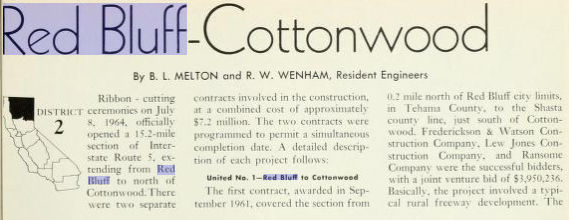
September/October 1961 California Highways & Public Works details the freeway conversion of substandard segments of US 40 between the Carquinez Bridge and Sacramento. The replacement Yolo Causeway project is detailed and the article goes to state that the replacement might be ready to be opened to traffic during 1962. The original Yolo Causeway is stated to have been fully expanded in 1933 to make room for an undivided four lane roadway. The new Yolo Causeway is stated to be two dual structures consisting of three lanes apiece providing a necessary expansion of US 99W/US 40/LRN 6.
The
October/November 1960 California Highways & Public Works details the upcoming Westside Freeway segment of Interstate 5 between Wheeler Ridge to Tracy and Interstate 5 East towards Dunnigan where it would consolidate with Interstate 5 West. The article goes onto state from the vicinity Woodland the planned route of Interstate 5 north was planned to follow US 99W to Red Bluff and US 99 to the Oregon State Line.
The
May/June 1962 California Highways & Public Works cites the new Yolo Causeway as being two thirds complete and likely to open in early 1963.
The
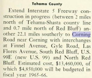
November/December 1963 California Highways & Public Works cites the US 99W/Interstate 5/LRN 7 freeway bypass of Orland as being budgeted for the 1964-65 Fiscal Year. The bypass of Orland is cited to begin near Artois and extend to the Tehama County Line. An extension of CA 32 west from Orland to the new freeway is cited to be budgeted to for the 1965-66 Fiscal Year.
The
November/December 1963 California Highways & Public Works notes US 99E/LRN 3 south of Red Bluff was selected as the future mainline corridor of US 99. US 99W/Interstate 5/LRN 7 south of Red Bluff bypassing Corning is cited to be budgeted for freeway conversion during the 1965-66 Fiscal Year.
The
November/December 1963 California Highways & Public Works cites the new Yolo Causeway as having been completed during October 1963.
The
November/December 1963 California Highways & Public Works updates the progress of Westside Freeway. In the article header the East/West split of Interstate 5 is shown to be eliminated in favor of a single corridor. Interstate 5 is stated to be planned to follow the entire Westside Freeway and much of Interstate 5 West was slated to be come Interstate 580. Interstate 5 is stated to follow the corridor of US 99W north of Woodland to Red Bluff.
On New Year 1964 the California State Highway Renumbering took effect. The California State Highway Renumbering sought to eliminate all the Legislative Route Number designations in favor field signage, renumber certain highways to avoid duplication with the Interstates, eliminate suffixed routes and trim US Routes that did not cross the State Line. The 1
964 Division of Highways Map depicts the numerous effects of the 1964 Renumbering to the corridor of US 99W.
Within Sacramento the planned route of US 99W/US 40/Interstate 80 was assigned as Route 80. The existing corridor of US 99W/US 40 in Sacramento and from the Tower Bridge towards the West Sacramento Freeway is shown also assigned as Route 80. The existing corridor of CA 24 north from Sacramento on the Jibboom Street Bridge is shown reassigned as Route 99. Planned Interstate 5 on what was LRN 238 is shown to be reassigned as Route 5.
US 99W/US 40A from Davis north to Woodland is shown reassigned legislatively as Route 113. From Woodland north to Red Bluff US 99W is shown legislatively reassigned as Route 5.


The
November/December 1965 California Highways & Public Works cites the Interstate 5 freeway in Arbuckle was budgeted to be extended 5.5 miles south and 8 miles north during the 1966-67 Fiscal Year.
The
November/December 1966 California Highways & Public Works cites numerous projects to construct segments of Interstate 5 from Sacramento northward towards Woodland as being budgeted for the 1967-68 Fiscal Year. The Interstate 80 freeway through downtown Sacramento between Alhambra Boulevard and 5th Street is noted to be nearing completion.
The
November/December 1966 California Highways & Public Works cites the freeway expansion of Interstate 5 on former US 99W south from Arbuckle to Interstate 505 as having been budgeted for the 1968-69 Fiscal Year.

1967 Legislative Chapter 1350 defined
CA 275 as:
"Route 80 near West Acres Road west of Sacramento to the junction of Capitol Avenue and Ninth Street in Sacramento."
Essentially the definition of CA 275 consisted of the segment of former US 99W/US 40 from Interstate 80 east over the Tower Bridge towards the State Capitol. This alignment of CA 275 can be seen on the
1967 Division of Highways State Map.
The
1967 Division of Highways State Map shows CA 113 signed over former US 99W/US 40A between Davis north to Woodland. The planned route of Interstate 5 north from Sacramento north to Woodland appears following the general corridor of CA 16. The planned realignment of Interstate 5 north from Woodland to Willows appears next to the former corridor of US 99W. Interstate 5 north from Willows to Red Bluff is shown as complete.


The California Highways & Public Works publication ended in 1967. Interstate 5 on the
1969 Division of Highways Map is shown as completed from Willows south towards Interstate 505 near Dunnigan. Interstate 80 is shown completed through Sacramento along with CA 275 appearing as a signed highway over former US 99W/US 40 on a portion of the West Sacramento Freeway to the Tower Bridge. Interstate 5 is shown to be constructed north from Sacramento towards the Sacramento River.

Bridge stamps on the Interstate 5/CA 113 interchanges in Woodland indicate they were completed in 1973. The completion of the Interstate 5 bypass Woodland also marked the end of construction of the Westside Freeway. The completion of the Westside Freeway saw only a segment of CA 113 from Woodland south to Davis along with CA 275 over the Tower Bridge and Capitol Mall as the only remaining surface segments of US 99W still in service as part of the State Highway System. The completed Westside Freeway appears on the
1975 Caltrans State Map.
Former US 99W on CA 113 from Davis north towards County Road 29 was upgraded to freeway standards by 1976 (as indicated on bridge year stamps). This segment of the CA 113 freeway first appears on the
1977 Caltrans State Map.
1981 Legislative Chapter 292 saw US 50 extended over what had been former US 99W/US 40 on the West Sacramento Freeway west of CA 275 towards new alignment of Interstate 80 near the Yolo Causeway. Interstate 80 was shifted from its original alignment in downtown Sacramento to what had been Interstate 880 during 1981. The legislative changes to US 50 and Interstate 80 appear for the first time on the
1982 Caltrans State Map.

The remainder of CA 113 north from County Road 27 north to the existing Interstate 5/CA 113 interchange in Woodland display structure build years of 1990. With the completion of the CA 113 freeway between Woodland and Davis the only active remaining active former surface segment of US 99W in service was CA 275 from the Tower Bridge eastward on Capitol Mall.
CA 275 was deleted from the State Highway System by 1996 Legislative Chapter 1154. Former US 99W/US 40 on the West Sacramento Freeway from the Tower Bridge to US 50 was converted to Tower Bridge Gateway and relinquished to the City of West Sacramento. Former US 99W/US 40 on Capitol Mall east from the Tower Bridge to 9th Street was relinquished to the City of Sacramento. An agreement to relinquish the Tower Bridge could never be reached. Subsequently CA 275 was reactivated via 2010 Legislative Chapter 421 which solely consisted of the Tower Bridge. The Tower Bridge is the last segment of former US 99W that remains an active part of the State Highway System.
Part 2; former Legislative Route Number 6 at the I Street Bridge
The I Street Bridge as stated in Part 1 was completed in 1911 over the Sacramento River. The I Street Bridge is a swing span design which features a total length of 400 feet. The top deck of the I Street Bridge carries automotive traffic whereas the bottom carries rail traffic. Early LRN 6, CA 16 and CA 24 all utilized the I Street Bridge at differing times. The Southern Pacific Railroad constructed the underpass used by the Sacramento River Bike Trail circa 1913-1914.
Road traffic is slated to be moved off the I Street Bridge to a new structure which will be located to the north at Railyards Boulevard. The Jibboom Street Viaduct and I Street Viaduct are slated to be demolished as part of the new bridge project. Construction on the Railyards Boulevard Bridge is slated to take place from 2023-2026.
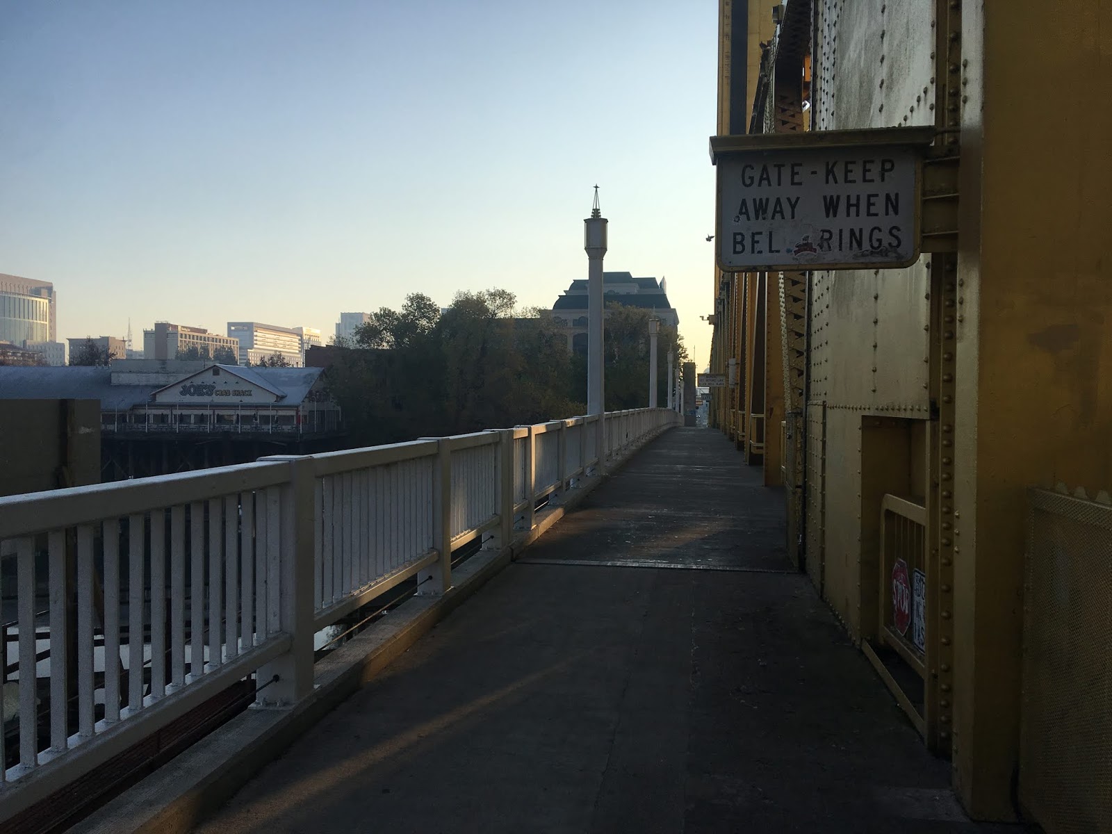
Part 3; former US Route 99 West/US Route 40 over the Tower Bridge
As stated Part 1 the Tower Bridge was completed in 1935 and replaced the M Street Bridge as the new alignment of US 99W/US 40 over the Sacramento River. The Tower Bridge and CA 275 are 737 feet in length and carry four lanes of traffic over the Sacramento River. The Tower Bridge is a vertical lift design that has a 100 foot clearance above the high water mark of the Sacramento River.
Crossing Capitol Mall at the eastern foot of the Tower Bridge offers an impressive view of the road deck to the west and the State Capitol ten streets to the east.
Heading west along the eastbound lanes of the Tower Bridge offers a view south on Sacramento River towards US 50. There is various signs on the Tower Bridge alerting pedestrian traffic to get off the lift span when the bell from the control station rings.
Looking east towards the Tower Bridge it is hard to envision it as the eastern terminus of the West Sacramento Freeway.
The westbound lanes of the Tower Bridge offer a northward view of the I Street Bridge.
On the south side of the Tower Bridge along the Sacramento River Bike Trail there are several historical placards detailing the history of the structure. There is a historical placard regarding the 1911 M Street Bridge
From the south side of the Tower Bridge a sign stating the operating hours for the control bridge can be observed. The Tower Bridge lift span is surprisingly operated by only two 100hp electric motors.
Part 4; modern US Route 50 east of Interstate 80 to Tower Bridge Gateway and the remaining active segment of former US Route 99 West/US Route 40 on the West Sacramento Freeway
Modern US 50 from Interstate 80 east to CA 99/CA 51 is designated as part of FHWA Interstate 305. Upon crossing the modern Yolo Causeway Interstate 80 intersects US 50/Interstate 305 at Exit 81.
US 50/Interstate 305 from Interstate 80 east to Exit 3/Tower Bridge Gateway was part of former US 99W/US 40 on the West Sacramento Freeway. As US 50/I-305 eastbound begins traffic is notified that Ocean City, Maryland is 3,073 miles away.
US 50/I-305 east Exit 1 accesses Harbor Boulevard.
US 50/I-305 east Exit 3 accesses Jefferson Boulevard (former CA 84) which in turn is signed as access to downtown Sacramento via Tower Bridge Gateway (former US 99W/US 40). A Interstate 80 Business Loop shield can be found approaching Exit 3.
Part 5; former US Route 99 West on Road 98 in Woodland
The modern western segment CA 16 eastbound enters Woodland as Main Street. Modern CA 16 eastbound in Woodland makes a left hand turn onto former US 99W onto Road 98. Road 98 presently co-signed as CA 16 and Yolo County Road E7.
Oddly former US 99W on Road 98 is also includes Interstate 5 Business signage.
CA 16 east, Yolo County Route E7 north, and I-5 Business all follow Road 98 northward a terminus at Interstate 5 located at Postmile YOL R43.42. Prior to the construction of the Westside Freeway US 99W would have crossed the grade of modern Interstate 5 to County Road 99W at Yolo siding.
Part 6; former US Route 99 West on 5th Street in Arbuckle
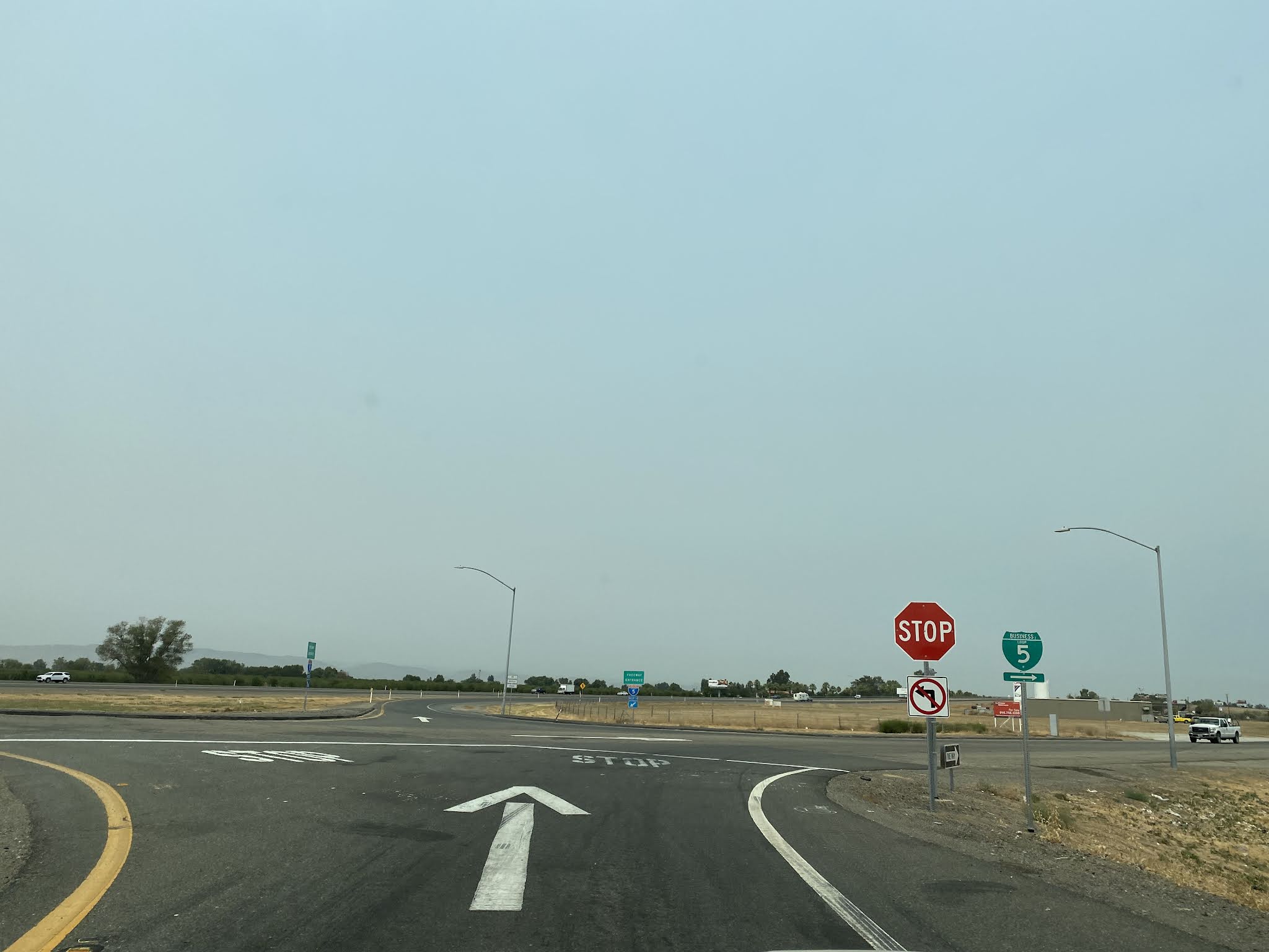
On Interstate 5 northbound in Colusa County former US 99W can be accessed in the community of Arbuckle via Exit 566 to 5th Street.
Signage on former US 99W on 5th Street directs traffic through downtown Arbuckle back towards Interstate 5.
The International Order of Odd Fellows building from former US 99W on 5th Street in Arbuckle.
Arbuckle was plotted in 1875 as a siding of the Southern Pacific Railroad and takes it's name in honor of Tacitus Ryland Arbuckle. The Arbuckle Train Deport was constructed during June of 1876 and saw it's first train arrive the following July. The Arbuckle Train Depot is the only surviving train station left in Colusa County. In spite of it's poor state of repair the Arbuckle Train Depot can still be found off of former US 99W at 5th Street and Hall Street.
An older structure on former US 99W on 5th Street in Arbuckle.
Former US 99W on 5th Street continues north out of downtown Arbuckle where a ramp can be used to return to Interstate 5.
Part 7; former US Route 99 West through Williams and Maxwell
Interstate 5 Exit 575 in central Colusa County can be used to access former US 99W by way of Husted Road. Interstate 5 Business signage directs traffic to turn right onto Husted Road and left on former US 99W on Frontage Road.
Former US 99W crosses under Interstate 5 onto 7th Street in the City of Williams. Approaching downtown Williams Historic US Route 99 West signage can be found on 7th Street.
As former US 99W on 7th Street continues through downtown Williams it intersects former CA 20 at E Street.
The Williams Arch (
public domain photo sourced from Wikipedia) can be found on E Street approaching 6th Street.
Williams was plotted out as a Southern Pacific Railroad siding known as "Central" in 1874. When the community received Post Office service in 1876 it assumed the name of Williams in honor W.H. Williams who plotted the town site. Williams incorporated as a City during May 1920.
North of E Street the course of former US 99W on 7th Street departs downtown Williams and intersects modern CA 20.
From Williams former US 99W continues northbound for approximately 9 miles to the community of Maxwell. Former US 99W north of Williams is signed as Interstate 5 Business.
Maxwell was plotted out as a Southern Pacific Railroad siding and was first reported in Weekly Colusa Sunday during March 1877. The Weekly Colusa Sunday reported initially the community name was plotted out as "Occident." When Occident was given Post Office service in April 1877 it was assigned as "Maxwell." The Southern Pacific Railroad would later formally change the community name to Maxwell in 1878 to match it's Post Office designation. From downtown Maxwell Maxwell-Colusa Road can be used eastbound to return to Interstate 5.
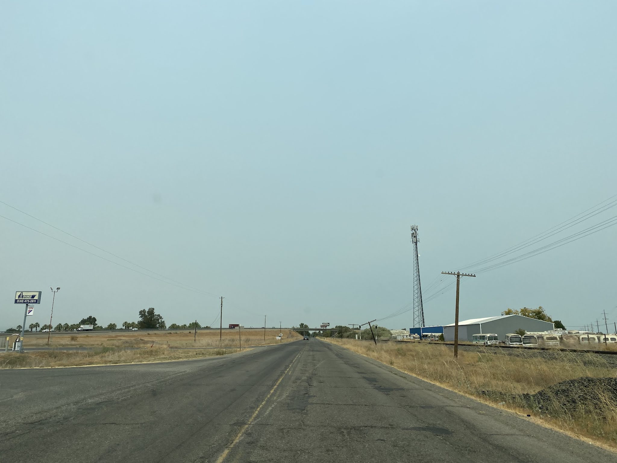
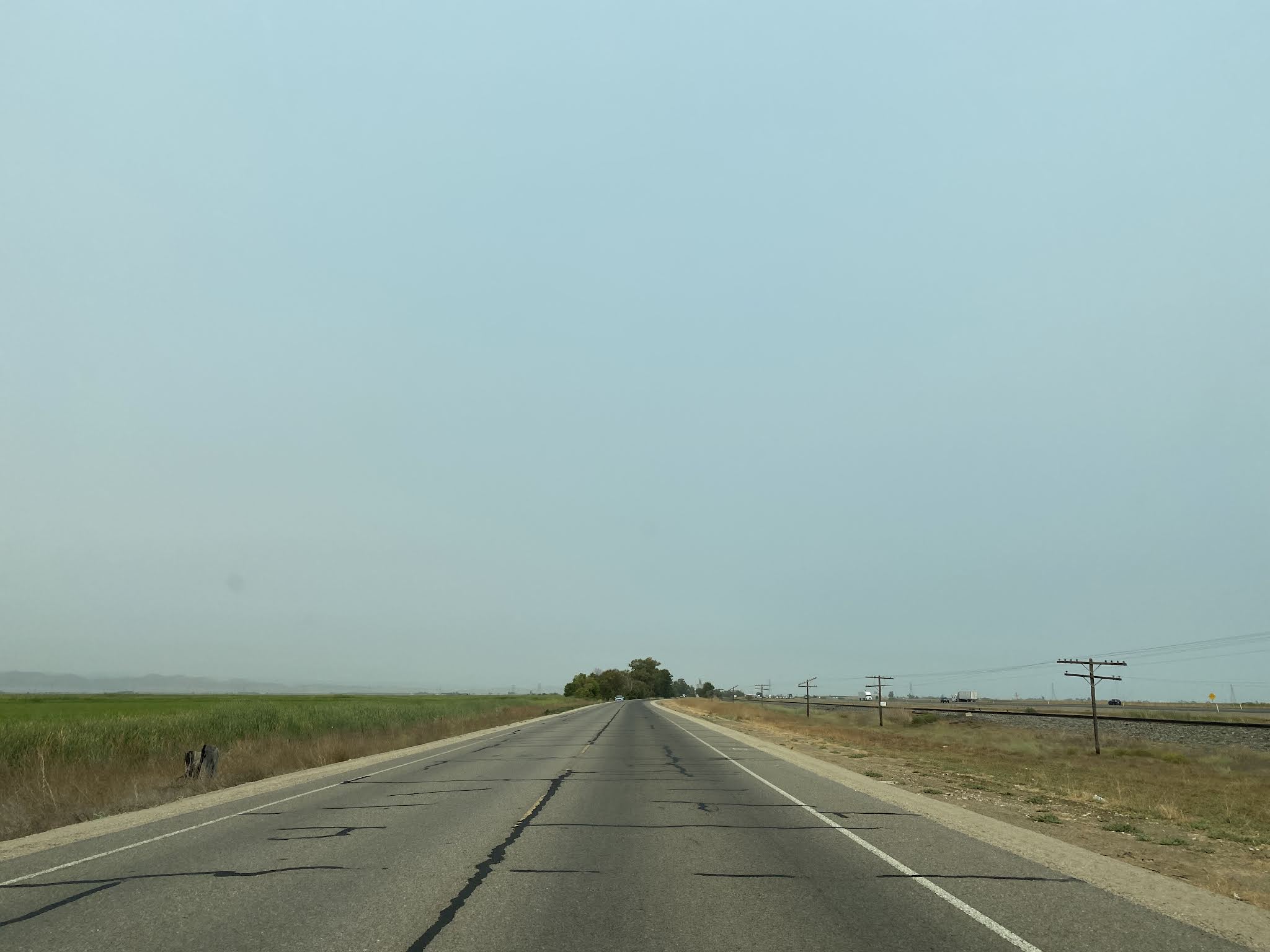
Part 8; former US Route 99 West through Willows, Bluegum, Artois and Orland
Within Glenn County former US 99W in Willows can be accessed from Interstate 5 northbound Exit 601 onto Road 57. Interstate 5 Business signage directs traffic to use a right hand turn onto Road 57 and left hand turn onto former US 99W.
Former US 99W heads northbound into the Willows City Limit and transitions on Tehama Street. The City of Williams is the present Glenn County Seat. Willows is one of the few communities on the corridor of former US 99W that doesn't have it's origins directly tied to the Southern Pacific Railroad. The Willows Post Office opened for service as "Willow" during 1862. During January 1886 Willow incorporated as a City and was selected as the Glenn County Seat in 1891 when it split from Colusa County. Willow took it's present name of "Willows" beginning in 1918.
Former US 99W on Tehama Street approaches downtown Willows and intersects CA 162 at Biggs-Willows Road.
North of CA 162 former US 99W follows Tehama Street and departs the City of Willows.
Approaching the Bluegum Motel an older alignment of US 99W can be seen to the west of Highway 99W.
Former US 99W departing Bluegum crosses a bridge over Willow Creek dated to 1933.
From the Bluegum Motel former US 99W continues northward into the community of Artois. Artois was founded in 1877 as a Southern Pacific Railroad siding known as "Germantown." The community name changed to "Artois" in 1918 in honor of the three Battles of Artois which occurred in World War I.
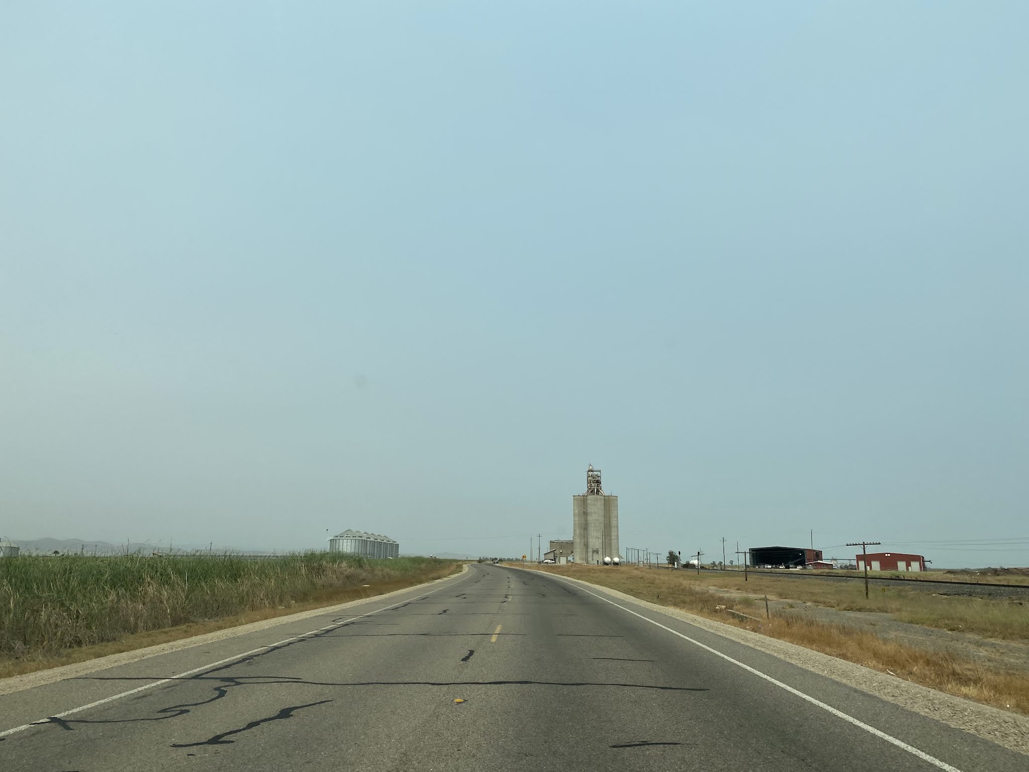
From Artois former US 99W continues north approximately 9 miles east of Interstate 5 into the City of Orland. A Historic US Route 99 West sign can be spied underneath the "Orland City Limits" sign.. Former US 99W transitions onto 6th Street upon entering the City of Orland.
Former US 99W follows 6th Street in Orland and intersects CA 32 at Walker Street.
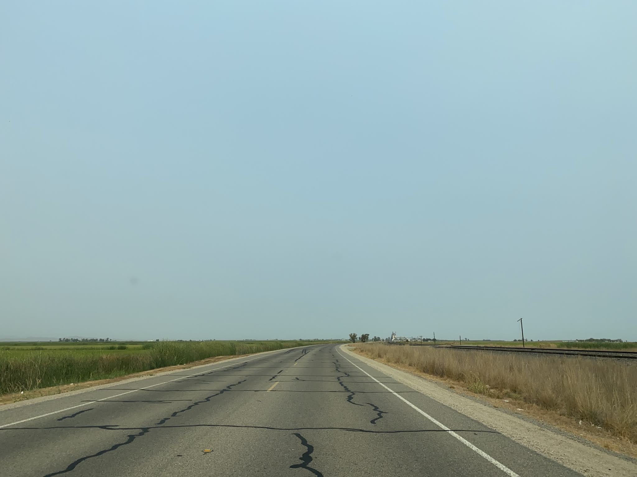
Former US 99W north of CA 32 follows 6th Street to the Orland City Limit at the Orland Arch. The Orland Arch was constructed during the summer of 1926 and is one of the few recognizable structures which would have been part of the single corridor US 99 in Sacramento Valley pre-1928. Orland was plotted out in 1878 as a Southern Pacific Railroad siding immediately south of Stony Creek. Orland would incorporate as a City during November of 1909.
North of Orland former US 99W crosses the
1936 Orland Hambright Creek Bridge and the
1913 Stony Creek Bridge. The Stony Creek Bridge was rehabilitated in 1952 according to bridgehunter.com which is why the structure appears somewhat modern from the road surface. Upon crossing the Stony Creek Bridge access back to Interstate 5 can be found at County Road 7.
Part 9; former US Route 99 West through Corning and Proberta onward to Red Bluff
Interstate 5 northbound Exit 628 in Tehama County accesses former US 99W south of the City of Corning.
Approaching South Avenue former US 99W northbound enters the City of Corning.
Amusingly US 99 is posted at the Love's located a former US 99W and South Avenue. I didn't know (sarcasm) US 58 went to California much less over Tehachapi Pass.
Former US 99W continues northbound into downtown Corning and would have turned right onto Solano Street. The Olive Pit located at the northeast corner of former US 99W and Solano Street has a been a fixture in the City of Corning since 1967. Corning itself was plotted as a Southern Pacific Railroad siding in 1882 and took it's name from railroad official John Corning. Corning would incorporate as a City during August 1907.
Former US 99W on Solano Street jogs east to 3rd Street. Since 1967 Solano Street has been part of Tehama County Route A9.
Departing downtown Corning via 3rd Street a Historic US Route 99 shield can be observed.
Former US 99W continues approximately 8 miles north of Corning and intersects Tehama County Route A11 at Gyle Road.
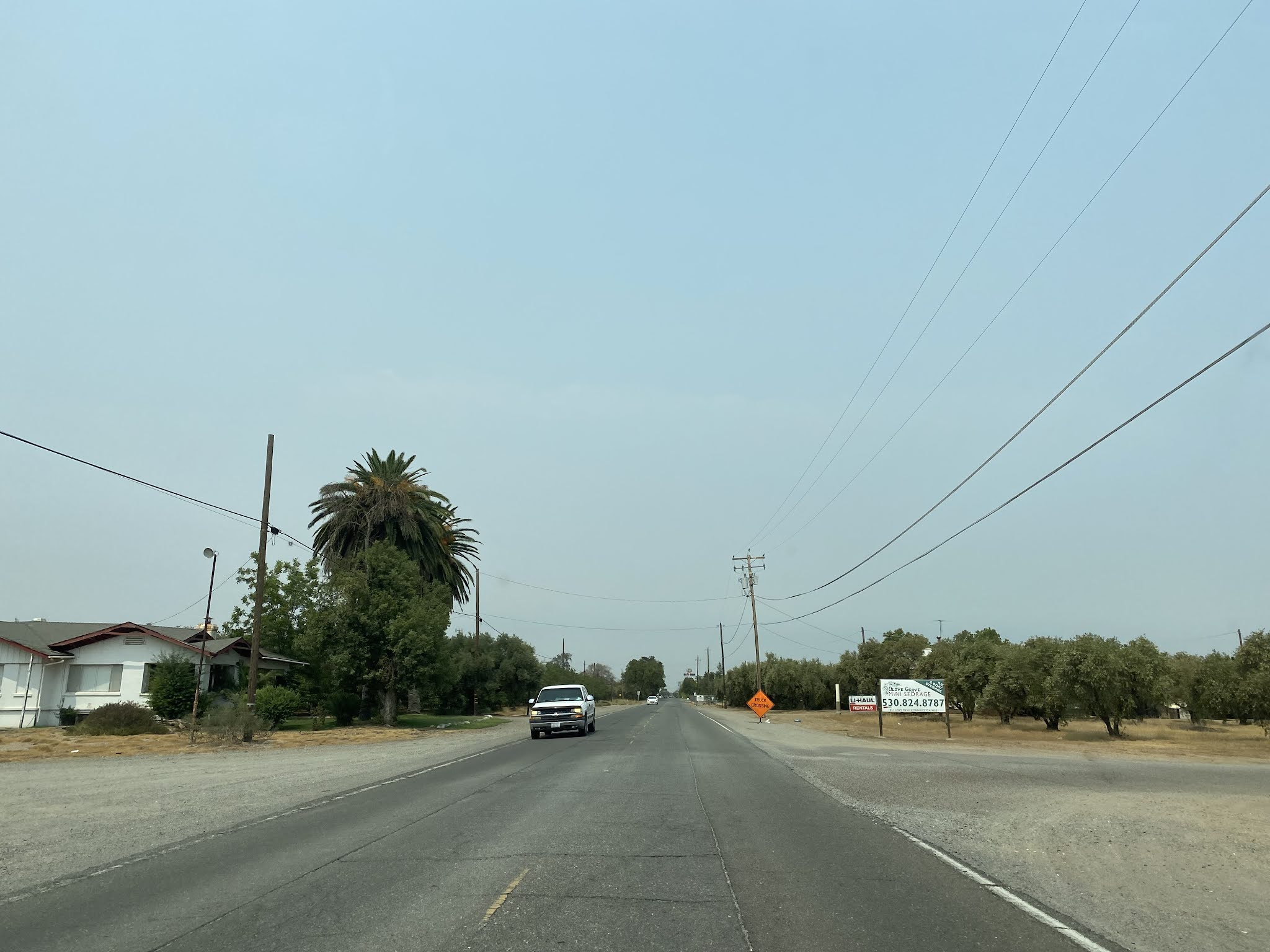
Former US 99W continues northward into the community of Proberta and picks up Tehama County Route A8 at San Benito Avenue. Proberta was plotted out in 1886 as a Southern Pacific Railroad siding and takes it's name from founder Edward Proberta.
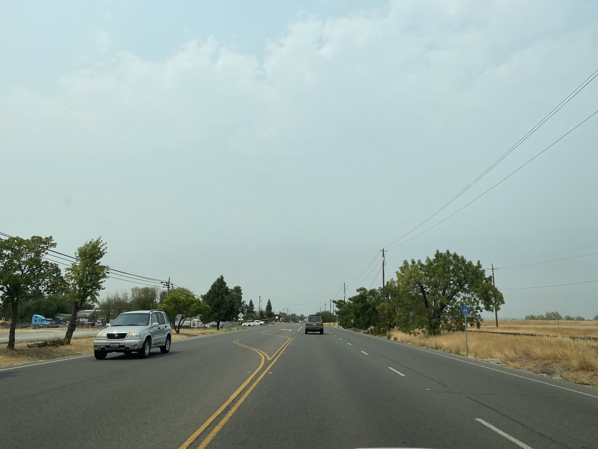
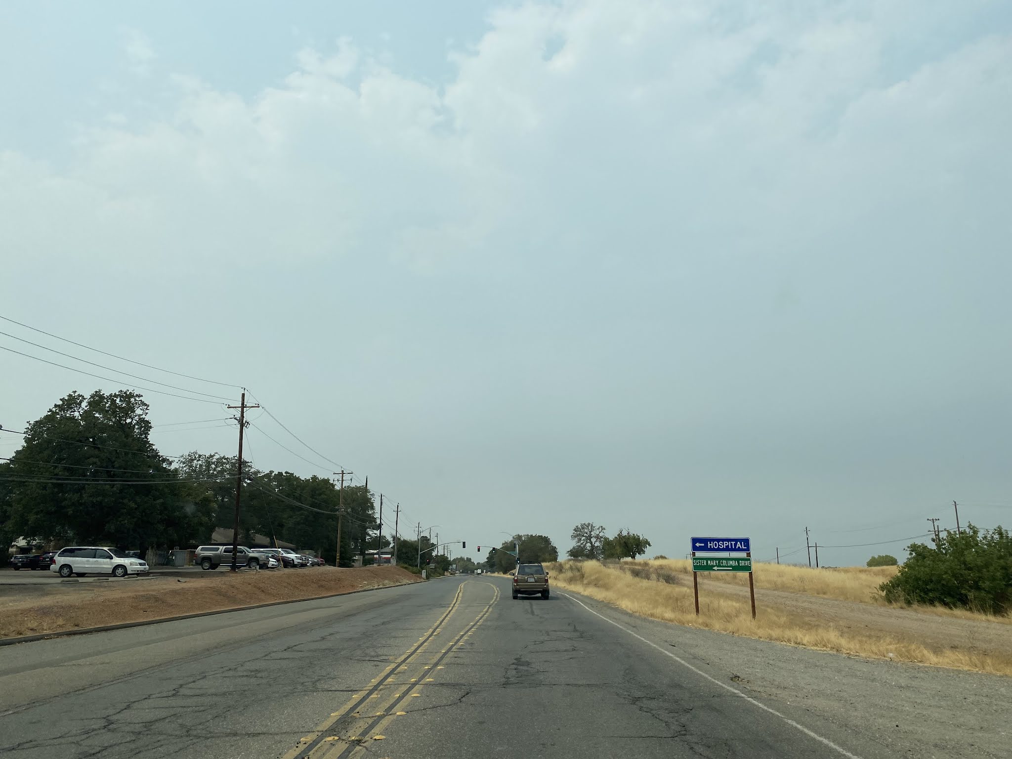
Former US 99W is carried north of Proberta all the way to Red Bluff as part of Tehama County Route A8. Tehama County Route A8 was plotted in 1967 and connects Los Molinos to Red Bluff via an alternate corridor to CA 99. Tehama County Route A8 follows former US 99W into Red Bluff on Main Street all the way to Antelope Boulevard (modern CA 36) where it would have consolidated with US 99E. Upon entering the City of Red Bluff former US 99W crosses over Interstate 5 and transitions to Main Street.
Further Reading
Continuing north on US Route 99 into Red Bluff?
Continuing south on US Route 99 to Sacramento?


Comments