Sierra Vista Scenic Byway Part 3; Sierra National Forest Route 81 and failed plans for the Minaret Summit Highway
Following completing the 18 miles of the Sierra Vista Scenic Byway on Forest Route 7/Baysore Road northeast from Forest Route 10 I turned south onto Forest Route 81/Minarets Road. Part 3 of the Sierra Vista Scenic Byway covers Sierra National Forest Route 81/Forest Road 4S81 on Minarets Road southward 50 plus miles mostly along the San Joaquin River Canyon to North Fork. This particular segment of the Sierra Vista Scenic Byway is interesting for several reasons; it largely is aligned along the San Joaquin River Canyon, has the best vistas along the entire Sierra Vista Scenic Byway and in a historical context likely would have been incorporated into the Minaret Summit Highway had it been built.

As noted above Part 2 of the Sierra Vista Scenic Byway covers the segment of the route aligned on Forest Route 7 which is signed on Forest Road 5S07/Beasore Road.
Sierra Vista Scenic Byway Part 2; a bumpy ride on Sierra National Forest Route 7
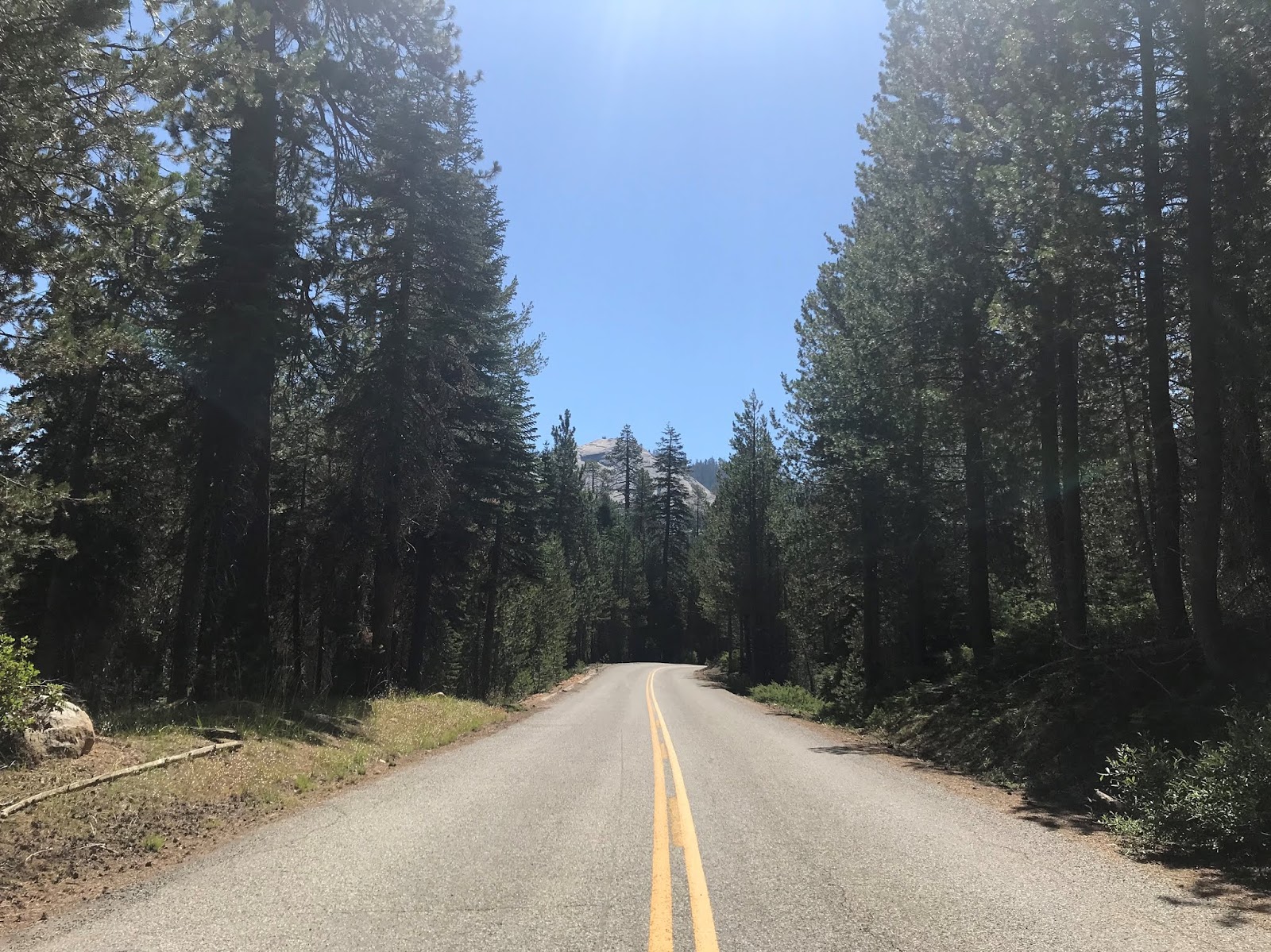
As noted in Part 2 the alignment of the Sierra Vista Scenic Byway on Forest Route 7/5S07 terminates at Forest Route 10/4S81. From the east terminus of Forest Route 7/5S07 the route of the Sierra Vista Scenic Byway turns south on Forest Route 81/4S81. North Fork is signed as being 51 miles due south along Forest Route 81/4S81 from the terminus of Forest Route 7/5S07. Oddly there is no Forest Route 81 reassurance shield at the east terminus of Forest Route 7.


The first major locale on Forest Route 81/4S81 south is the McCreary Trailhead.


South of the McCreary Trailhead on Forest Route 81/4S81 the peak of Piyua Dome comes into view followed by the namesake Trailhead. Piyua Dome is located 7,798 feet above sea level.


The first Forest Route 81 shield appears south of the Piyua Dome Trailhead.


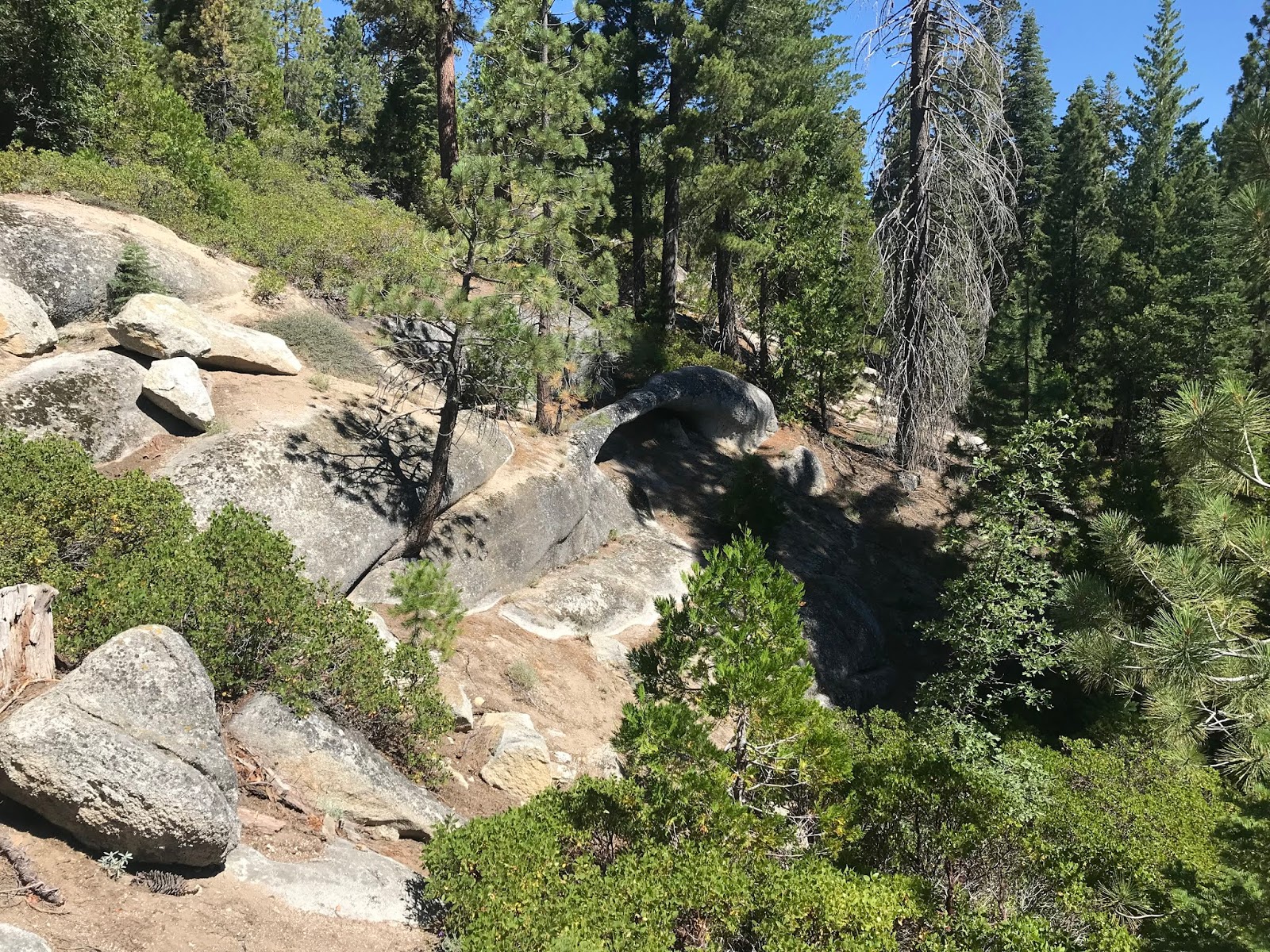
South of Piyau Dome there is a trailhead access to Arch Rock.


The Arch Rock Trail is short but overlooks the San Joaquin River Canyon to the east.

The Arch Rock Trail ends at an observation deck overlooking the namesake granite Arch Rock. Arch Rocks are formed by water eroding through a rock formation and are somewhat rare to see carved from granite. The Arch Rock is shown on the informational placard as being 46.6 miles from North Fork.


From the Arch Rock Trail the route of Forest Route 81 south opens into wide vistas of the San Joaquin River Canyon and Jackass Dome.


Forest Road 6S19 connects to Forest Route 81/Forest Road 4S81 and provides access to the Hell's Half Acre Trailhead. The Hell's Half Acre Trail accesses the Ansel Adams Wilderness and the San Joaquin River to the east.

From Forest Road 6S19 the alignment of Forest Route 81/4S81 opens up into a direct line of sight view of Jackass Rock.

Jackass Rock is located at approximately 7,000 feet above sea level. Forest Route 81/4S81 passes by Jackass Rock and it crosses a bridge over Jackass Creek. From the side Forest Route 81/4S81 much of the San Joaquin River Canyon and Jackass Rock can be seen in a wide vista.


At Forest Road 6S58 there is access to the Jackass Rock Organization Camp from Forest Route 81/4S81.

Forest Route 81/4S81 south begins to close in on the western segment of the San Joaquin River Canyon as it crosses West Fork Jackass Creek.


As noted in Part 1 and Part 2 there is still many cattle drives through Sierra National Forest. That being the case I still found it odd to find a small assortment of cows grazing in Forest Route 81/4S81.

Forest Route 81/4S81 meets Grizzly Road/6S01 which is signed as access to Lower Chiquito Campground 4 miles to the west and Beasore Meadows (on Forest Route 7) 14 miles to the west. From the junction with Grizzly Road/6S01 the alignment of Forest Route 81/4S81 is signed as being 9 miles from the Mammoth Pool.


South of Grizzly Road there is a Forest Service Station located on Forest Route 81/4S81.


Little Jackass Campound is accessible from Forest Road 6S22.

At Mammoth Pool Road/6S25 there is access from Forest Route 81/4S81 to the Mammoth Pool Reservoir. From Mammoth Pool Road the route of Forest Route 81/4S81 is signed as being 38 miles from North Fork.


Just south of Mammoth Pool Road there is a shoulder on Forest Route 81/4S81 where Shuteye Ridge can be viewed.


Forest Route 81/4S81 south crosses over Chiquito Creek on a modern bridge structure.


Forest Route 81/4S81 south of Chiquito Creek intersects Soda Springs Cutoff Road/6S71. Soda Springs Cutoff Road directly accesses the paved section of Grizzly Road which is why Beasore Meadows is used as a control destination.


Forest Route 81/4S81 south of Soda Springs Cutoff Road crosses by the Soda Springs Campground and crosses West Fork Chiquito Creek.


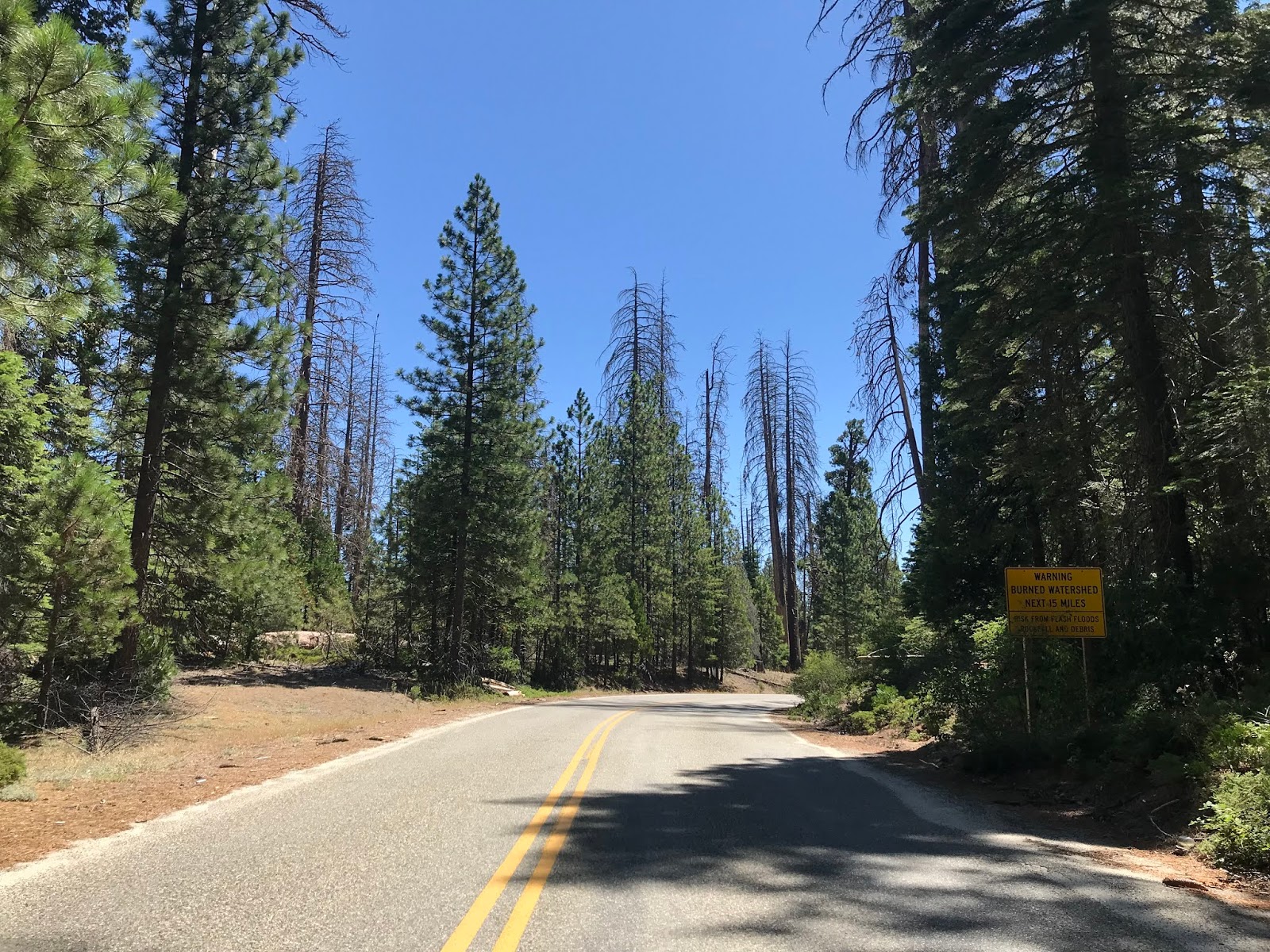
Beyond West Fork Chiquito Creek traffic on Forest Route 81/4S81 south is advised that there is a burn area over the next 15 miles.


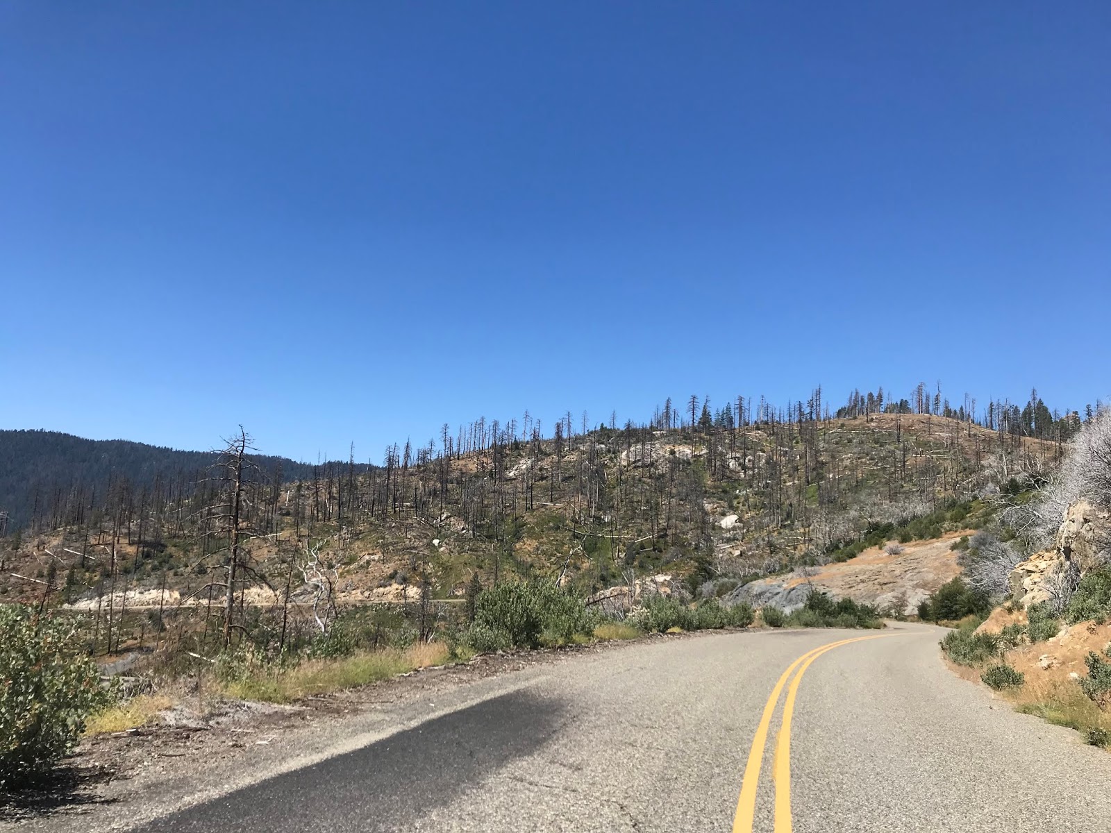
The burn area on Forest Route 81/4S81 south really clears out the tree growth which makes it readily apparent that the roadway lies above the San Joaquin River Canyon. I encountered a stray heavy-duty trucker in this portion of Forest Route 81/4S81 right before the Mile High Vista.


The Mile High Vista lies at approximately 5,300 feet above sea level and overlooks the Mammoth Pool, San Joaquin River Canyon and Minarets Sub-Range of the Sierra Nevada Mountains. The Mammoth Pool Reservoir below has a normal elevation of 3,330 feet above sea level which contrasts significantly with the 13,157 Mount Ritter off in the distance to the north. Mammoth Mountain near the community of Mammoth Lakes is also easily observable to the northeast at 11,033 feet above sea level.


The Mammoth Pool opened in 1959 upon the completion of the Mammoth Pool Dam. Mammoth Pool Dam is an earthen fill structure which is 411 feet in height. Mammoth Pool Dam is part of the Big Creek Hydroelectric Project and is operated by Southern California Edison.

Interest in a reservoir at the site of Mammoth Pool Dam dates to the early phases of what became the Big Creek Project. In the 1880s the course of the San Joaquin River was surveyed by engineer John S. Eastwood for potential sites for reservoirs and hydroelectric power plants. In 1900 the Mammoth Power Company began planning the early phases of the Big Creek Project which saw potential for a reservoir at the present location of Mammoth Pool Dam. Mammoth Pool Dam is located at a natural choke point along the San Joaquin River between two granite spires. Ultimately the site of Mammoth Pool Dam was not chosen due to the massive scale of the project in favor of Huntington Lake on Big Creek. Much of the history of the Big Creek Project can be found on my blog below regarding California State Route 168.
Tale of CA 168 West and the failed Piute Pass Highway
Work on Mammoth Pool Dam began with the building of a roadway towards the construction site during the 1950s. This road to the site of Mammoth Pool Dam was an extension of the existing road between North Fork and Ross Creek which was noted as being present on the 1935 Division of Highways Map in Part 1 of this blog series. This roadway would come to be known as "Minarets Road" which is presently Forest Route 81/4S81. Work on the main abutment of Mammoth Pool Dam began in October 1958 and took about a year to complete. On the 1956 Shell Highway Map of California the route of Minarets Road can be seen connecting to the future site of Mammoth Pool Dam and Soda Springs Road.
1956 Shell California Highway Map
The Mammoth Pool is surprisingly close to the eastern flank of the Sierras at only about 20 miles "as-the-crow-flies" to the City of Mammoth Lakes. The Middle Fork San Joaquin River itself is very accessible from the 9,265 Minaret Summit via CA 203 and Minaret Summit Road into Devil's Postpile National Monument. Minaret Summit is located in Inyo National Forest and interestingly is located in far northeast Madera County. This close proximity of Minaret Summit to the western flank of the Sierras via the San Joaquin River has led to repeated interest in a Trans-Sierra Highway.

Interest in a Tran-Sierra Highway in the proximity of Minaret Summit was born out of mining claims of the early 20th Century near the community of Mammoth. Minaret Summit is located near Devil's Postpile National Monument on the Middle Fork San Joaquin River which originally was within the boundary of Yosemite National Park. By 1905 the boundary of Yosemite National Park was scaled back due to gold claims being struck near Minaret Summit and Devil's Postpile. Proposals to build a reservoir along the Middle Fork San Joaquin River would have flooded over Devil's Postpile which spurred the creation of the namesake National Monument in 1911. Despite the protections afforded by Devil's Postpile National Monument the lands east of it's boundaries remained open to development.


A Trans-Sierra Highway via Minaret Summit and the San Joaquin River was one of many that was proposed in the early 20th Century. The Central Sierra Nevada Mountains had several Trans-Sierra Highways which were proposed but ultimately failed for numerous reasons:
- The Piute Pass Highway was born out of interests spurred by the Roosevelt Highway to build a Trans-Sierra Highway over Piute Pass. This proposal was spurred by the continued development of the Big Creek Project and Kaiser Pass Road. Much of this project became what is now CA 168 but a crossing of the Sierras via Piute Pass was blocked by General Grant National Park being reorganized and expanded into Kings Canyon National Park in 1940.
Tale of CA 168 West and the failed Piute Pass Highway
- The Kings Canyon Highway was pursued in the early State Highway era from Hume Lake eastward through Kings Canyon. The Kings Canyon Highway likely would have connected to Owens Valley by way of Onion Valley Road. This road is now CA 180 and was also blocked by the creation of Kings Canyon National park in 1940.
CA 180 east of Fresno to Cedar Grove (Kings Canyon Highway)
- The Lone Pine to Porterville High Sierra Road was a locally born proposal to build a Trans-Sierra Highway via the Kern River Fault. The early parts of this project were actually built on both sides of the Sierras with the western segment becoming Signed County Route J37 on Balch Park Road. Ultimately this project was picked up by the state as part of CA 190 and currently is the only active un-built Trans-Sierra Highway which still legislatively exists.
Signed County Route J37; the last Signed County Route and Lone Pine-Porterville High Sierra Road
CA 190; a Trans-Sierra Highway that could have been
In 1931 a wilderness area was declared west of Devil's Postpile National Monument but a five mile gap to the east was left open to highway development. Interest in developing a highway from Minaret Summit waned until the Mammoth Pool Dam Project began building Minarets Road through Sierra National Forest. According to the National Park Service the Bureau of Public Roads and Forest Service released a report in 1957 which stated that a "Minaret Summit Highway" was feasible.
Devil's Postpile National Monument on the Trans-Sierra Highway
Interestingly the above article seems to suggest that the Forest Service was interested in building a Trans-Sierra Minaret Summit Highway. This would not seem to be out of the scope of possibility given Sequoia National Forest ultimately constructed Sherman Pass Road as a Trans-Sierra Highway during the 1970s.
Trans-Sierra Highway; Sherman Pass Road and Signed County Route J41
The National Park Service article above goes on to state that there was strong opposition out of Mammoth towards the Minaret Summit Highway following the report released by the Forest Service and Bureau of Public Roads. At some point in what appears to be the 1960s the California Division of Highways appears to have picked up interest in Minaret Summit Highway. In 1966 the California Division of Highways concluded while the route of the Minaret Summit Highway was possible it would require expansive bridge work and would also have the highest snow removal costs of any State Highway in California. The Division of Highways apparently also raised concerns about the impact a highway would have on the columns of Devil's Postpile National Monument. Nonetheless it seems that CA 203 was realigned from Old Mammoth towards Minaret Summit in anticipation of a Minaret Summit Highway between 1967 and 1969.
CA 203; the road that could have been a Trans-Sierra Highway
In April of 1970 the California Environmental Quality Improvement Act became effective. In December of 1970 the Federal Environmental Protection Agency was created. In what wasn't likely a coincidence a March 1971 Environmental Impact Study concluded the Minaret Summit Highway would have adverse affects on Devil's Postpile National Monument and surrounding area. This reported was followed by the chair of the Council on Environmental Quality petitioning the Federal Highway Administration to abandoned interest in the Minaret Summit Highway in May of 1971. During a 1972 visit to the Middle Fork San Joaquin River then California Governor Ronald Reagan announced that President Richard Nixon opposed the Minaret Summit Highway. It likely wasn't a coincidence that a study initiated by Governor Reagan in 1972 led to the Division of Highways being consolidated into Caltrans.
The Minaret Summit Highway was dealt another major blow when the Ansel Adams Wilderness Area was expanded in 1984 by the California Wilderness Act. The 1984 legislation expanded the original 1964 definition of the Minarets Wilderness eastward over the planned route of the Minaret Summit Highway. The present boundaries of the Ansel Adams Wilderness is 231,533 acres which consists of segments of Sierra National Forest and Inyo National Forest.
Returning to the present Sierra Vista Scenic Byway the route of Forest Route 81/4S81 south the is aligned above the rim of the San Joaquin River from the Mile High Vista.


South of Mile Highway Vista Forest Route 81/4S81 intersects Forest Road 7S42 and crosses by the Rock Creek Campground.


Forest Route 81/4S81 continues south and crosses over Fish Creek near the Fish Creek Campground.


From Fish Creek Campground Forest Route 81/4S81 is signed as 18 miles from North Fork.


Forest Route 81/4S81 crosses over Ross Creek which is located at 4,320 feet above sea level. As noted above the 1935 Division of Highways Map in Part 1 showed the road to North Fork beginning here.


Clearwater Station is located directly south of Ross Creek.

South of Clearwater Station along Forest Route 81/4S81 there is a small hiking trail to Jesse Ross's cabin. The Ross Cabin was originally located closer to the namesake Ross Creek and was built in the 1860s. The Ross Cabin was originally located in what was an apple orchard which remained active well into the 20th Century on private lands. The private land holders donated Ross Cabin in 1990 which led to it being restored and moved to it's present location.


South of Ross Cabin the route of Forest Route 81/4S81 passes by Power House Road/Forest Road 8S03 which accesses Mammoth Power House #8 and the San Joaquin River.


From Power House Road the alignment of Forest Route 81/4S81 begins to swing west towards North Fork and briefly enters Kinsman Flat Wildlife Area.

Forest Route 81/4S41 begins to open up as the elevation declines approaching North Fork. At 3,700 feet above sea level there is an overlook of Redinger Lake. Redinger Lake is part of the Big Creek Project and is formed by the 250 foot high Redinger Dam on the San Joaquin River. Redinger Dam is a concrete structure which was completed in 1951.


West of Redinger Lake Vista the route of Sierra Vista Scenic Byway and Forest Route 81/4S81 terminates at the boundary of Sierra National Forest. The roadway continues west to Road 225/Italian Bar Road as Minarets Road.


From the south terminus of the Minarets Road I made a detour on Road 225/Italian Bar to the Geographic Center of California located in the Redinger Lake Recreation Area.


I returned to the junction of Road 225/Minarets Road and followed it west into North Fork to Road 274/Bass Lake Road.


From North Fork traffic returning to Fresno can take Road 200/North Fork Road to CA 41 or Road 222/Powerhouse Road to CA 168.
North Fork Road/Road 200
Powerhouse Road/Road 222

As noted above Part 2 of the Sierra Vista Scenic Byway covers the segment of the route aligned on Forest Route 7 which is signed on Forest Road 5S07/Beasore Road.
Sierra Vista Scenic Byway Part 2; a bumpy ride on Sierra National Forest Route 7
As noted in Part 2 the alignment of the Sierra Vista Scenic Byway on Forest Route 7/5S07 terminates at Forest Route 10/4S81. From the east terminus of Forest Route 7/5S07 the route of the Sierra Vista Scenic Byway turns south on Forest Route 81/4S81. North Fork is signed as being 51 miles due south along Forest Route 81/4S81 from the terminus of Forest Route 7/5S07. Oddly there is no Forest Route 81 reassurance shield at the east terminus of Forest Route 7.


The first major locale on Forest Route 81/4S81 south is the McCreary Trailhead.


South of the McCreary Trailhead on Forest Route 81/4S81 the peak of Piyua Dome comes into view followed by the namesake Trailhead. Piyua Dome is located 7,798 feet above sea level.

The first Forest Route 81 shield appears south of the Piyua Dome Trailhead.


South of Piyau Dome there is a trailhead access to Arch Rock.


The Arch Rock Trail is short but overlooks the San Joaquin River Canyon to the east.

The Arch Rock Trail ends at an observation deck overlooking the namesake granite Arch Rock. Arch Rocks are formed by water eroding through a rock formation and are somewhat rare to see carved from granite. The Arch Rock is shown on the informational placard as being 46.6 miles from North Fork.


From the Arch Rock Trail the route of Forest Route 81 south opens into wide vistas of the San Joaquin River Canyon and Jackass Dome.


Forest Road 6S19 connects to Forest Route 81/Forest Road 4S81 and provides access to the Hell's Half Acre Trailhead. The Hell's Half Acre Trail accesses the Ansel Adams Wilderness and the San Joaquin River to the east.

From Forest Road 6S19 the alignment of Forest Route 81/4S81 opens up into a direct line of sight view of Jackass Rock.

Jackass Rock is located at approximately 7,000 feet above sea level. Forest Route 81/4S81 passes by Jackass Rock and it crosses a bridge over Jackass Creek. From the side Forest Route 81/4S81 much of the San Joaquin River Canyon and Jackass Rock can be seen in a wide vista.


At Forest Road 6S58 there is access to the Jackass Rock Organization Camp from Forest Route 81/4S81.

Forest Route 81/4S81 south begins to close in on the western segment of the San Joaquin River Canyon as it crosses West Fork Jackass Creek.


As noted in Part 1 and Part 2 there is still many cattle drives through Sierra National Forest. That being the case I still found it odd to find a small assortment of cows grazing in Forest Route 81/4S81.

Forest Route 81/4S81 meets Grizzly Road/6S01 which is signed as access to Lower Chiquito Campground 4 miles to the west and Beasore Meadows (on Forest Route 7) 14 miles to the west. From the junction with Grizzly Road/6S01 the alignment of Forest Route 81/4S81 is signed as being 9 miles from the Mammoth Pool.


South of Grizzly Road there is a Forest Service Station located on Forest Route 81/4S81.


Little Jackass Campound is accessible from Forest Road 6S22.

At Mammoth Pool Road/6S25 there is access from Forest Route 81/4S81 to the Mammoth Pool Reservoir. From Mammoth Pool Road the route of Forest Route 81/4S81 is signed as being 38 miles from North Fork.


Just south of Mammoth Pool Road there is a shoulder on Forest Route 81/4S81 where Shuteye Ridge can be viewed.


Forest Route 81/4S81 south crosses over Chiquito Creek on a modern bridge structure.


Forest Route 81/4S81 south of Chiquito Creek intersects Soda Springs Cutoff Road/6S71. Soda Springs Cutoff Road directly accesses the paved section of Grizzly Road which is why Beasore Meadows is used as a control destination.


Forest Route 81/4S81 south of Soda Springs Cutoff Road crosses by the Soda Springs Campground and crosses West Fork Chiquito Creek.


Beyond West Fork Chiquito Creek traffic on Forest Route 81/4S81 south is advised that there is a burn area over the next 15 miles.


The burn area on Forest Route 81/4S81 south really clears out the tree growth which makes it readily apparent that the roadway lies above the San Joaquin River Canyon. I encountered a stray heavy-duty trucker in this portion of Forest Route 81/4S81 right before the Mile High Vista.


The Mile High Vista lies at approximately 5,300 feet above sea level and overlooks the Mammoth Pool, San Joaquin River Canyon and Minarets Sub-Range of the Sierra Nevada Mountains. The Mammoth Pool Reservoir below has a normal elevation of 3,330 feet above sea level which contrasts significantly with the 13,157 Mount Ritter off in the distance to the north. Mammoth Mountain near the community of Mammoth Lakes is also easily observable to the northeast at 11,033 feet above sea level.


The Mammoth Pool opened in 1959 upon the completion of the Mammoth Pool Dam. Mammoth Pool Dam is an earthen fill structure which is 411 feet in height. Mammoth Pool Dam is part of the Big Creek Hydroelectric Project and is operated by Southern California Edison.

Interest in a reservoir at the site of Mammoth Pool Dam dates to the early phases of what became the Big Creek Project. In the 1880s the course of the San Joaquin River was surveyed by engineer John S. Eastwood for potential sites for reservoirs and hydroelectric power plants. In 1900 the Mammoth Power Company began planning the early phases of the Big Creek Project which saw potential for a reservoir at the present location of Mammoth Pool Dam. Mammoth Pool Dam is located at a natural choke point along the San Joaquin River between two granite spires. Ultimately the site of Mammoth Pool Dam was not chosen due to the massive scale of the project in favor of Huntington Lake on Big Creek. Much of the history of the Big Creek Project can be found on my blog below regarding California State Route 168.
Tale of CA 168 West and the failed Piute Pass Highway
Work on Mammoth Pool Dam began with the building of a roadway towards the construction site during the 1950s. This road to the site of Mammoth Pool Dam was an extension of the existing road between North Fork and Ross Creek which was noted as being present on the 1935 Division of Highways Map in Part 1 of this blog series. This roadway would come to be known as "Minarets Road" which is presently Forest Route 81/4S81. Work on the main abutment of Mammoth Pool Dam began in October 1958 and took about a year to complete. On the 1956 Shell Highway Map of California the route of Minarets Road can be seen connecting to the future site of Mammoth Pool Dam and Soda Springs Road.
1956 Shell California Highway Map
The Mammoth Pool is surprisingly close to the eastern flank of the Sierras at only about 20 miles "as-the-crow-flies" to the City of Mammoth Lakes. The Middle Fork San Joaquin River itself is very accessible from the 9,265 Minaret Summit via CA 203 and Minaret Summit Road into Devil's Postpile National Monument. Minaret Summit is located in Inyo National Forest and interestingly is located in far northeast Madera County. This close proximity of Minaret Summit to the western flank of the Sierras via the San Joaquin River has led to repeated interest in a Trans-Sierra Highway.

Interest in a Tran-Sierra Highway in the proximity of Minaret Summit was born out of mining claims of the early 20th Century near the community of Mammoth. Minaret Summit is located near Devil's Postpile National Monument on the Middle Fork San Joaquin River which originally was within the boundary of Yosemite National Park. By 1905 the boundary of Yosemite National Park was scaled back due to gold claims being struck near Minaret Summit and Devil's Postpile. Proposals to build a reservoir along the Middle Fork San Joaquin River would have flooded over Devil's Postpile which spurred the creation of the namesake National Monument in 1911. Despite the protections afforded by Devil's Postpile National Monument the lands east of it's boundaries remained open to development.


A Trans-Sierra Highway via Minaret Summit and the San Joaquin River was one of many that was proposed in the early 20th Century. The Central Sierra Nevada Mountains had several Trans-Sierra Highways which were proposed but ultimately failed for numerous reasons:
- The Piute Pass Highway was born out of interests spurred by the Roosevelt Highway to build a Trans-Sierra Highway over Piute Pass. This proposal was spurred by the continued development of the Big Creek Project and Kaiser Pass Road. Much of this project became what is now CA 168 but a crossing of the Sierras via Piute Pass was blocked by General Grant National Park being reorganized and expanded into Kings Canyon National Park in 1940.
Tale of CA 168 West and the failed Piute Pass Highway
- The Kings Canyon Highway was pursued in the early State Highway era from Hume Lake eastward through Kings Canyon. The Kings Canyon Highway likely would have connected to Owens Valley by way of Onion Valley Road. This road is now CA 180 and was also blocked by the creation of Kings Canyon National park in 1940.
CA 180 east of Fresno to Cedar Grove (Kings Canyon Highway)
- The Lone Pine to Porterville High Sierra Road was a locally born proposal to build a Trans-Sierra Highway via the Kern River Fault. The early parts of this project were actually built on both sides of the Sierras with the western segment becoming Signed County Route J37 on Balch Park Road. Ultimately this project was picked up by the state as part of CA 190 and currently is the only active un-built Trans-Sierra Highway which still legislatively exists.
Signed County Route J37; the last Signed County Route and Lone Pine-Porterville High Sierra Road
CA 190; a Trans-Sierra Highway that could have been
In 1931 a wilderness area was declared west of Devil's Postpile National Monument but a five mile gap to the east was left open to highway development. Interest in developing a highway from Minaret Summit waned until the Mammoth Pool Dam Project began building Minarets Road through Sierra National Forest. According to the National Park Service the Bureau of Public Roads and Forest Service released a report in 1957 which stated that a "Minaret Summit Highway" was feasible.
Devil's Postpile National Monument on the Trans-Sierra Highway
Interestingly the above article seems to suggest that the Forest Service was interested in building a Trans-Sierra Minaret Summit Highway. This would not seem to be out of the scope of possibility given Sequoia National Forest ultimately constructed Sherman Pass Road as a Trans-Sierra Highway during the 1970s.
Trans-Sierra Highway; Sherman Pass Road and Signed County Route J41
The National Park Service article above goes on to state that there was strong opposition out of Mammoth towards the Minaret Summit Highway following the report released by the Forest Service and Bureau of Public Roads. At some point in what appears to be the 1960s the California Division of Highways appears to have picked up interest in Minaret Summit Highway. In 1966 the California Division of Highways concluded while the route of the Minaret Summit Highway was possible it would require expansive bridge work and would also have the highest snow removal costs of any State Highway in California. The Division of Highways apparently also raised concerns about the impact a highway would have on the columns of Devil's Postpile National Monument. Nonetheless it seems that CA 203 was realigned from Old Mammoth towards Minaret Summit in anticipation of a Minaret Summit Highway between 1967 and 1969.
CA 203; the road that could have been a Trans-Sierra Highway
In April of 1970 the California Environmental Quality Improvement Act became effective. In December of 1970 the Federal Environmental Protection Agency was created. In what wasn't likely a coincidence a March 1971 Environmental Impact Study concluded the Minaret Summit Highway would have adverse affects on Devil's Postpile National Monument and surrounding area. This reported was followed by the chair of the Council on Environmental Quality petitioning the Federal Highway Administration to abandoned interest in the Minaret Summit Highway in May of 1971. During a 1972 visit to the Middle Fork San Joaquin River then California Governor Ronald Reagan announced that President Richard Nixon opposed the Minaret Summit Highway. It likely wasn't a coincidence that a study initiated by Governor Reagan in 1972 led to the Division of Highways being consolidated into Caltrans.
The Minaret Summit Highway was dealt another major blow when the Ansel Adams Wilderness Area was expanded in 1984 by the California Wilderness Act. The 1984 legislation expanded the original 1964 definition of the Minarets Wilderness eastward over the planned route of the Minaret Summit Highway. The present boundaries of the Ansel Adams Wilderness is 231,533 acres which consists of segments of Sierra National Forest and Inyo National Forest.
Returning to the present Sierra Vista Scenic Byway the route of Forest Route 81/4S81 south the is aligned above the rim of the San Joaquin River from the Mile High Vista.


South of Mile Highway Vista Forest Route 81/4S81 intersects Forest Road 7S42 and crosses by the Rock Creek Campground.


Forest Route 81/4S81 continues south and crosses over Fish Creek near the Fish Creek Campground.


From Fish Creek Campground Forest Route 81/4S81 is signed as 18 miles from North Fork.


Forest Route 81/4S81 crosses over Ross Creek which is located at 4,320 feet above sea level. As noted above the 1935 Division of Highways Map in Part 1 showed the road to North Fork beginning here.


Clearwater Station is located directly south of Ross Creek.

South of Clearwater Station along Forest Route 81/4S81 there is a small hiking trail to Jesse Ross's cabin. The Ross Cabin was originally located closer to the namesake Ross Creek and was built in the 1860s. The Ross Cabin was originally located in what was an apple orchard which remained active well into the 20th Century on private lands. The private land holders donated Ross Cabin in 1990 which led to it being restored and moved to it's present location.


South of Ross Cabin the route of Forest Route 81/4S81 passes by Power House Road/Forest Road 8S03 which accesses Mammoth Power House #8 and the San Joaquin River.


From Power House Road the alignment of Forest Route 81/4S81 begins to swing west towards North Fork and briefly enters Kinsman Flat Wildlife Area.

Forest Route 81/4S41 begins to open up as the elevation declines approaching North Fork. At 3,700 feet above sea level there is an overlook of Redinger Lake. Redinger Lake is part of the Big Creek Project and is formed by the 250 foot high Redinger Dam on the San Joaquin River. Redinger Dam is a concrete structure which was completed in 1951.


West of Redinger Lake Vista the route of Sierra Vista Scenic Byway and Forest Route 81/4S81 terminates at the boundary of Sierra National Forest. The roadway continues west to Road 225/Italian Bar Road as Minarets Road.


From the south terminus of the Minarets Road I made a detour on Road 225/Italian Bar to the Geographic Center of California located in the Redinger Lake Recreation Area.


I returned to the junction of Road 225/Minarets Road and followed it west into North Fork to Road 274/Bass Lake Road.


From North Fork traffic returning to Fresno can take Road 200/North Fork Road to CA 41 or Road 222/Powerhouse Road to CA 168.
North Fork Road/Road 200
Powerhouse Road/Road 222
Comments