Part 2 of the Sierra Vista Scenic Byway series continues from where Part 1 left off; the terminus of Forest Route 10 on Beasore Loop Road at Forest Route 7 on Beasore Road.

As noted above Part 1 of the Sierra Vista Scenic Byway covers the segment of the route aligned on Forest Route 10 which is signed on Forest Road 6S10/Sky Ranch Road and 6S10X/Beasore Loop Road.
Sierra Vista Scenic Byway Part 1; Sierra National Forest Route 10
As noted in Part 1 the alignment of the Sierra Vista Scenic Byway on Forest Route 10 intersects Forest Route 7 on Beasore Road at Cold Springs Summit. Cold Springs Summit is the highest location on the Sierra Vista Scenic Byway located at 7,308 feet above sea level. The Sierra Vista Scenic Byway makes a left turn onto Forest Route 7 on Beasore Road. Forest Route 7 is designated as Forest Road 5S07 and carries the alignment of the Sierra Vista Scenic Byway 18 miles northeast to Forest Route 81.


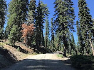
From Forest Route 10 the alignment of Forest Route 7/5S07 eastbound is initially aligned on very well maintained asphalt. Forest Route 7/5S07 east quickly enters the community of Beasore Meadows which is the location of Jone's Store.


Jones Store is a cash-only general goods facility that is one of the few places on the Sierra Vista Scenic Byway which services travelers. Jones Store was opened in 1936 by Tom Jones as Beasore Road was being completed and was known initially as Western Front Store. The Western Front Store primarily served the ranchers driving cattle along Beasore Road. The present Jones Store opened in the same location as the Western Front Store in 1954 and still serves ranchers driving cattle to this day. Jones Store also has a balcony area where Beasore Meadows can be viewed.


East of Jones Store Forest Route 7 east has a significant junction with Grizzly Road which is signed on Forest Road 6S01. Grizzly Road/6S01 serves as a cut-off road which more or less is a more direct connection to the Mammoth Pool Reservoir 21 miles to the east.


Northeast of Grizzly Road the alignment of Forest Route 7 passes through the privately held Far Meadow before returning to Sierra National Forest held lands.


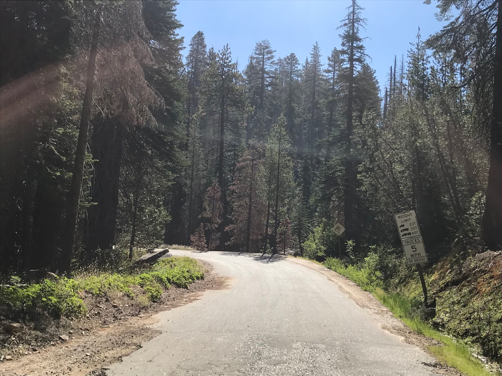
Forest Route 7/5S04 continues through lands of Sierra National Forest before briefly passes through a privately held parcel along Mugler Creek. At Globe Rock Road/Forest Road 5S04 traffic on Forest Route 7/5S04 is advised the highway narrows.


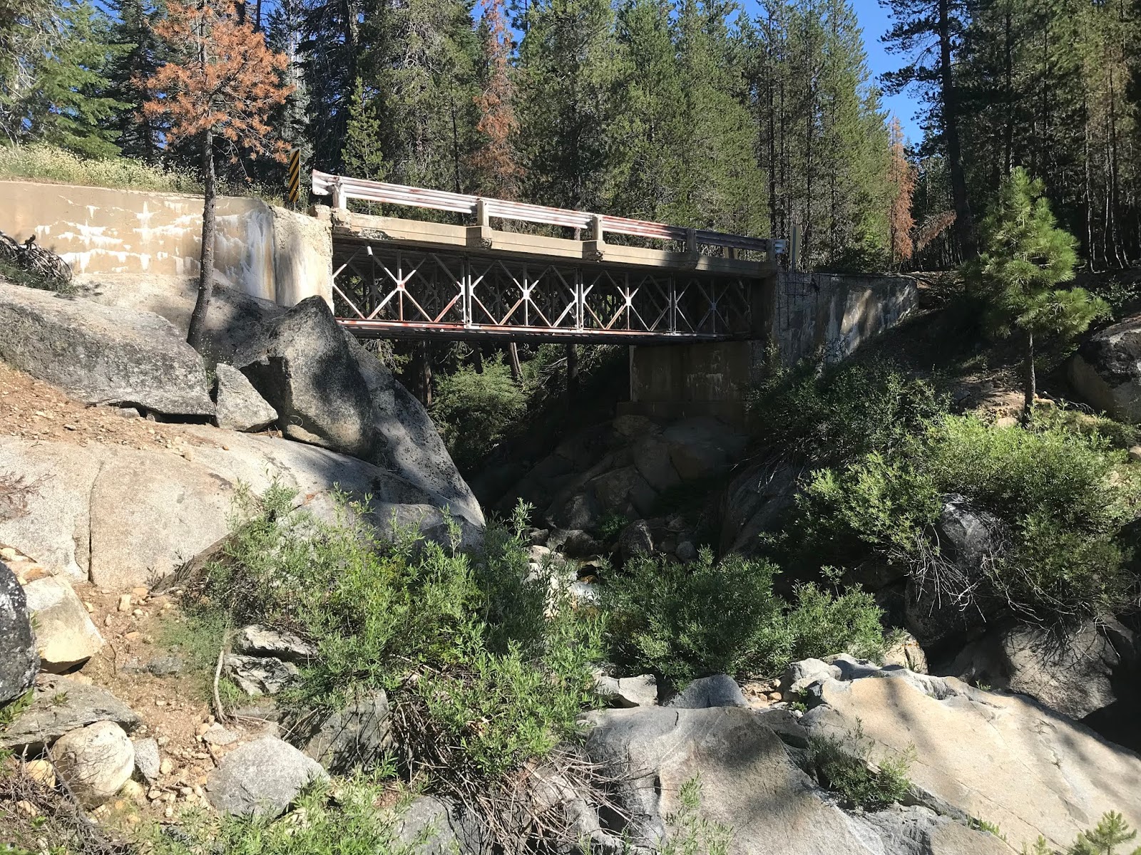
Forest Route 7/5S07 is initially aligned east of Globe Rock Road on a single lane of asphalt to the 1952 Upper Chiquito Creek Bridge. The Upper Chiquito Creek Bridge traverses the namesake Chiquito Creek on a very narrow alignment which has strict truck restrictions mandating 5 MPH speeds. Despite the unique design the Upper Chiquito Creek Bridge is slated to be replaced and construction was supposed to begin in July of 2019. I'm not sure why the Upper Chiquito Creek Bridge project is delayed but it is supposed to last 180 days when it begins and will require a detour of the Sierra Vista Scenic Byway onto Grizzly Road.


East of the Upper Chiquito Creek Bridge the alignment of Forest Route 7/5S07 drops to severely decayed asphalt top layered with dirt. This segment of Forest Route 7/5S07 is the bumpiest part of the Sierra Vista Scenic Byway but doesn't pose any clearance problems for cars.


Forest Route 7/5S04 alternates from segments of remaining asphalt and dirt as it winds along the boundary of the Ansel Adams Wilderness. Forest Route 7/5S04 briefly returns to a two-lane paved roadway approaching the Portuguese Creek Overlook.


The Portuguese Creek Overlook provides a vista of the granite domes of Shuteye Ridge to the south. The drop in the terrain towards the San Joaquin River can be seen faintly off in the distance.


From the Portuguese Creek Overlook the alignment of Forest Route 7/5S07 drops back to a broken asphalt/dirt combination before meeting Forest Road 5S88. Forest Road 5S88 provides access to some privately held parcels Jackass Meadow.


Forest Route 7/5S07 briefly becomes a two-lane paved road again approaching the Jackass Meadow Vista.


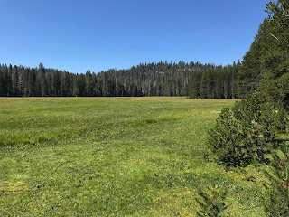
A short boarded trail from Forest Route 7/5S07 provides access to the overlook of Jackass Meadow. Jackass Meadow is one of the largest of it's kind in the Central Sierras and often is seen with a full bloom of flowers. On clearer days the Minarets Sub-Range of the Sierras can be seen to the east.


East of the Jackass Meadows Vista there is access along Forest Route 7/5S07 to the Jackass Lakes Trailhead.


Forest Route 7/5S07 meets Forest Road 5S05 east of the Jackass Lakes Trailhead. Access to the Fernandez Trailhead lies just east of Forest Road 5S05.


Forest Route 7/5S07 east continues to the Norris Creek Bridge which is located at 7,100 feet above sea level. I didn't find a date for the Norris Creek Bridge but the structure is interesting as it is completely comprised of a wooden frame.


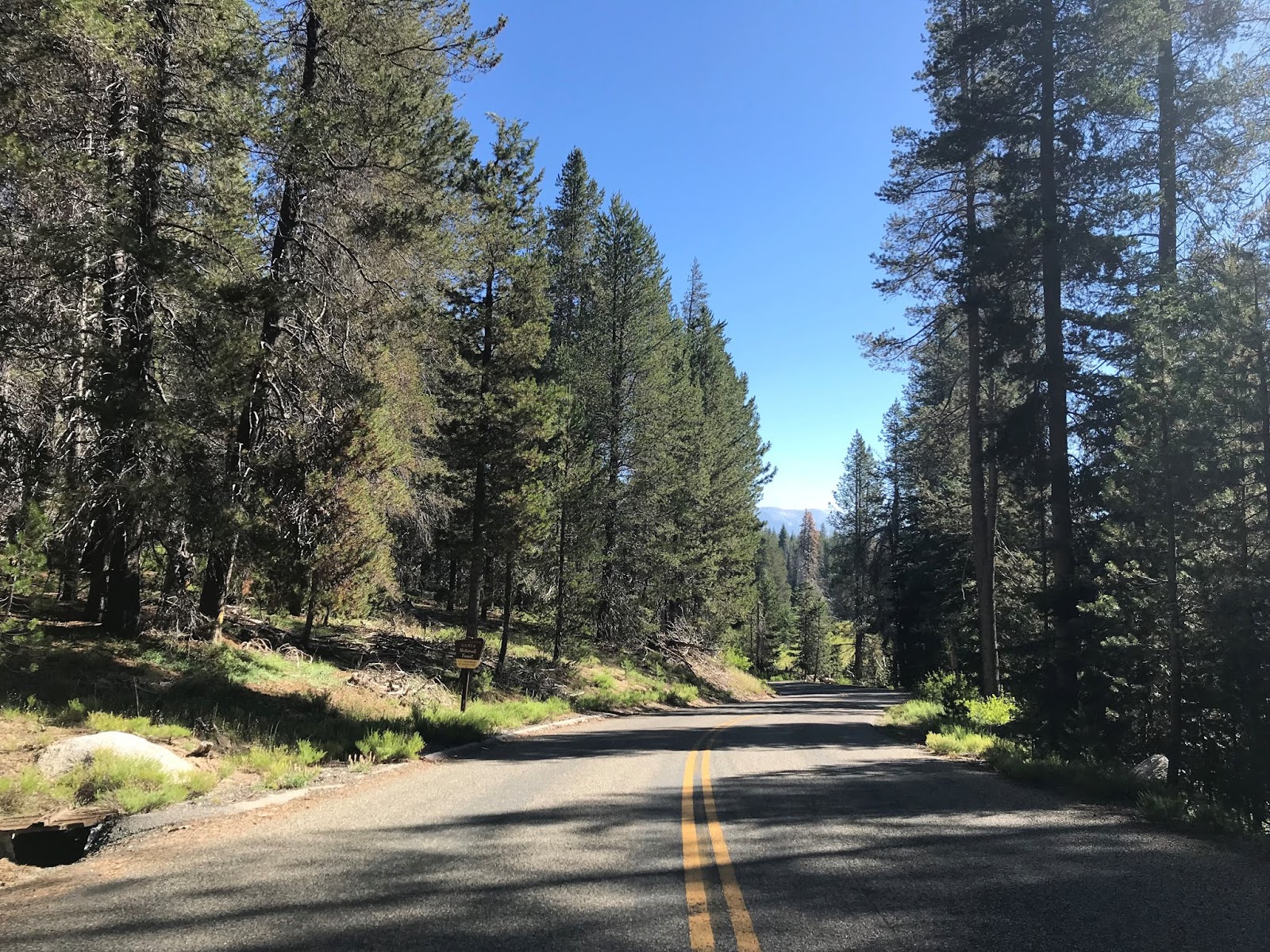
East of the Norris Creek Bridge Forest Route 7/5S07 resumes being fully paved and terminates at Forest Route 81/4S81.


The Sierra Vista Scenic Byway turns south on Forest Route 81/4S81. Forest Route 81/4S81 is also known as Minarets Road and is signed as being 51 miles from North Fork.

Part 3 of the Sierra Vista Scenic Byway series covers alignment of Forest Route 81 southward to North Fork.
Sierra Vista Scenic Byway Part 3; Sierra National Forest Route 81 and the failed plans for the Minaret Summit Highway

As noted above Part 1 of the Sierra Vista Scenic Byway covers the segment of the route aligned on Forest Route 10 which is signed on Forest Road 6S10/Sky Ranch Road and 6S10X/Beasore Loop Road.
Sierra Vista Scenic Byway Part 1; Sierra National Forest Route 10
As noted in Part 1 the alignment of the Sierra Vista Scenic Byway on Forest Route 10 intersects Forest Route 7 on Beasore Road at Cold Springs Summit. Cold Springs Summit is the highest location on the Sierra Vista Scenic Byway located at 7,308 feet above sea level. The Sierra Vista Scenic Byway makes a left turn onto Forest Route 7 on Beasore Road. Forest Route 7 is designated as Forest Road 5S07 and carries the alignment of the Sierra Vista Scenic Byway 18 miles northeast to Forest Route 81.


From Forest Route 10 the alignment of Forest Route 7/5S07 eastbound is initially aligned on very well maintained asphalt. Forest Route 7/5S07 east quickly enters the community of Beasore Meadows which is the location of Jone's Store.


Jones Store is a cash-only general goods facility that is one of the few places on the Sierra Vista Scenic Byway which services travelers. Jones Store was opened in 1936 by Tom Jones as Beasore Road was being completed and was known initially as Western Front Store. The Western Front Store primarily served the ranchers driving cattle along Beasore Road. The present Jones Store opened in the same location as the Western Front Store in 1954 and still serves ranchers driving cattle to this day. Jones Store also has a balcony area where Beasore Meadows can be viewed.


East of Jones Store Forest Route 7 east has a significant junction with Grizzly Road which is signed on Forest Road 6S01. Grizzly Road/6S01 serves as a cut-off road which more or less is a more direct connection to the Mammoth Pool Reservoir 21 miles to the east.


Northeast of Grizzly Road the alignment of Forest Route 7 passes through the privately held Far Meadow before returning to Sierra National Forest held lands.


Forest Route 7/5S04 continues through lands of Sierra National Forest before briefly passes through a privately held parcel along Mugler Creek. At Globe Rock Road/Forest Road 5S04 traffic on Forest Route 7/5S04 is advised the highway narrows.


Forest Route 7/5S07 is initially aligned east of Globe Rock Road on a single lane of asphalt to the 1952 Upper Chiquito Creek Bridge. The Upper Chiquito Creek Bridge traverses the namesake Chiquito Creek on a very narrow alignment which has strict truck restrictions mandating 5 MPH speeds. Despite the unique design the Upper Chiquito Creek Bridge is slated to be replaced and construction was supposed to begin in July of 2019. I'm not sure why the Upper Chiquito Creek Bridge project is delayed but it is supposed to last 180 days when it begins and will require a detour of the Sierra Vista Scenic Byway onto Grizzly Road.


East of the Upper Chiquito Creek Bridge the alignment of Forest Route 7/5S07 drops to severely decayed asphalt top layered with dirt. This segment of Forest Route 7/5S07 is the bumpiest part of the Sierra Vista Scenic Byway but doesn't pose any clearance problems for cars.


Forest Route 7/5S04 alternates from segments of remaining asphalt and dirt as it winds along the boundary of the Ansel Adams Wilderness. Forest Route 7/5S04 briefly returns to a two-lane paved roadway approaching the Portuguese Creek Overlook.


The Portuguese Creek Overlook provides a vista of the granite domes of Shuteye Ridge to the south. The drop in the terrain towards the San Joaquin River can be seen faintly off in the distance.


From the Portuguese Creek Overlook the alignment of Forest Route 7/5S07 drops back to a broken asphalt/dirt combination before meeting Forest Road 5S88. Forest Road 5S88 provides access to some privately held parcels Jackass Meadow.


Forest Route 7/5S07 briefly becomes a two-lane paved road again approaching the Jackass Meadow Vista.


A short boarded trail from Forest Route 7/5S07 provides access to the overlook of Jackass Meadow. Jackass Meadow is one of the largest of it's kind in the Central Sierras and often is seen with a full bloom of flowers. On clearer days the Minarets Sub-Range of the Sierras can be seen to the east.


East of the Jackass Meadows Vista there is access along Forest Route 7/5S07 to the Jackass Lakes Trailhead.


Forest Route 7/5S07 meets Forest Road 5S05 east of the Jackass Lakes Trailhead. Access to the Fernandez Trailhead lies just east of Forest Road 5S05.


Forest Route 7/5S07 east continues to the Norris Creek Bridge which is located at 7,100 feet above sea level. I didn't find a date for the Norris Creek Bridge but the structure is interesting as it is completely comprised of a wooden frame.


East of the Norris Creek Bridge Forest Route 7/5S07 resumes being fully paved and terminates at Forest Route 81/4S81.


The Sierra Vista Scenic Byway turns south on Forest Route 81/4S81. Forest Route 81/4S81 is also known as Minarets Road and is signed as being 51 miles from North Fork.

Part 3 of the Sierra Vista Scenic Byway series covers alignment of Forest Route 81 southward to North Fork.
Sierra Vista Scenic Byway Part 3; Sierra National Forest Route 81 and the failed plans for the Minaret Summit Highway
Comments